Coffle End

Settlement in Bedfordshire

England

Coffle End

Bridge at Sharnbrook This bridge on Park Lane takes the road under the Midland Main Line.
Bridge at Sharnbrook Credit: Bob Walters

Coffle End is a small village located in the county of Bedfordshire, England. Situated approximately 5 miles northwest of the town of Bedford, Coffle End is nestled amidst picturesque countryside and offers a tranquil and idyllic setting for its residents.

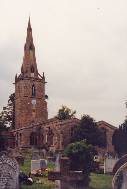
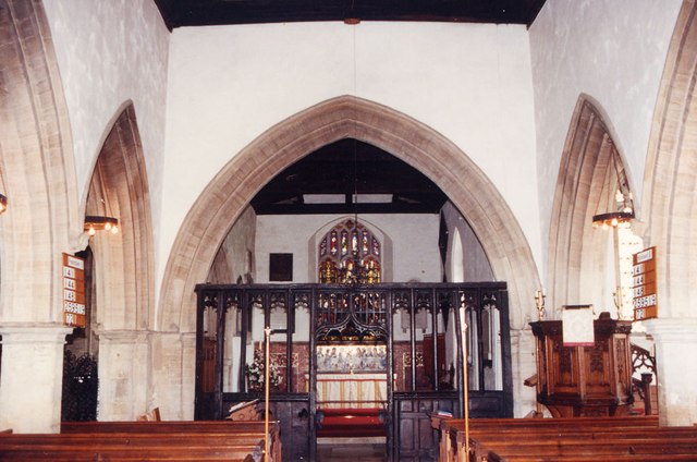
The village is home to a close-knit community, with a population of around 300 people. The charming village center features a handful of traditional cottages and houses, giving it a quintessential English village feel. The local church, St. Mary's, is a prominent landmark and serves as a focal point for community activities and events.

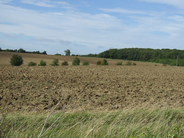
Coffle End benefits from its rural location, with an abundance of green spaces and scenic walking routes in the surrounding area. The nearby countryside offers opportunities for outdoor activities such as hiking, cycling, and horse riding, making it an attractive destination for nature enthusiasts.

Although primarily a residential area, Coffle End is conveniently located near larger towns and cities. Bedford provides a range of amenities including shops, supermarkets, schools, and healthcare facilities, all within easy reach for residents of Coffle End.

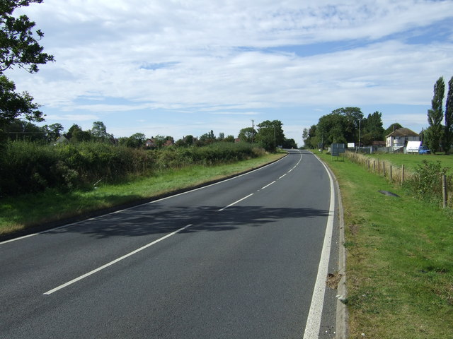
The village enjoys good transport links, with regular bus services connecting it to nearby towns and villages. The A6 road is also easily accessible, providing convenient connections to major road networks, making commuting to nearby cities such as Milton Keynes and Northampton relatively straightforward.

In conclusion, Coffle End offers a peaceful and picturesque retreat for its residents, with a strong sense of community and access to both rural and urban amenities nearby.

If you have any feedback on the listing, please let us know in the comments section below.

Coffle End Images

Images are sourced within 2km of 52.224795/-0.53426305 or Grid Reference TL0059. Thanks to Geograph Open Source API. All images are credited.

Bridge at Sharnbrook This bridge on Park Lane takes the road under the Midland Main Line.
Bridge at Sharnbrook
This bridge on Park Lane takes the road under the Midland Main Line.
Wind turbine under construction near Souldrop: aerial 2014
Felmersham Causeway This ford is created when the Ouse is in flood.
Felmersham Causeway
This ford is created when the Ouse is in flood.
Farmland towards Temple Wood
Minor road towards the A6 The A6 is one of the main historic north south roads in England. At 299 miles long it is the fourth longest road in the country. It currently runs from Luton in Bedfordshire to Carlisle in Cumbria, although it formerly started at a junction with the A1 at Barnet.
Wikipedia: <span class="nowrap"><a title="http://en.wikipedia.org/wiki/A6_road_(England)" rel="nofollow ugc noopener" href="http://en.wikipedia.org/wiki/A6_road_(England)">Link</a><img style="margin-left:2px;" alt="External link" title="External link - shift click to open in new window" src="https://s1.geograph.org.uk/img/external.png" width="10" height="10"/></span> 
See also <span class="nowrap"><a title="http://www.sabre-roads.org.uk/wiki/index.php?title=A6" rel="nofollow ugc noopener" href="http://www.sabre-roads.org.uk/wiki/index.php?title=A6">Link</a><img style="margin-left:2px;" alt="External link" title="External link - shift click to open in new window" src="https://s1.geograph.org.uk/img/external.png" width="10" height="10"/></span> for more route detail.
Minor road towards the A6
The A6 is one of the main historic north south roads in England. At 299 miles long it is the fourth longest road in the country. It currently runs from Luton in Bedfordshire to Carlisle in Cumbria, although it formerly started at a junction with the A1 at Barnet. Wikipedia: LinkExternal link See also LinkExternal link for more route detail.
Farmland towards kennels
A6 towards Rushden The A6 is one of the main historic north south roads in England. At 299 miles long it is the fourth longest road in the country. It currently runs from Luton in Bedfordshire to Carlisle in Cumbria, although it formerly started at a junction with the A1 at Barnet.
Wikipedia: <span class="nowrap"><a title="http://en.wikipedia.org/wiki/A6_road_(England)" rel="nofollow ugc noopener" href="http://en.wikipedia.org/wiki/A6_road_(England)">Link</a><img style="margin-left:2px;" alt="External link" title="External link - shift click to open in new window" src="https://s1.geograph.org.uk/img/external.png" width="10" height="10"/></span> 
See also <span class="nowrap"><a title="http://www.sabre-roads.org.uk/wiki/index.php?title=A6" rel="nofollow ugc noopener" href="http://www.sabre-roads.org.uk/wiki/index.php?title=A6">Link</a><img style="margin-left:2px;" alt="External link" title="External link - shift click to open in new window" src="https://s1.geograph.org.uk/img/external.png" width="10" height="10"/></span> for more route detail.
A6 towards Rushden
The A6 is one of the main historic north south roads in England. At 299 miles long it is the fourth longest road in the country. It currently runs from Luton in Bedfordshire to Carlisle in Cumbria, although it formerly started at a junction with the A1 at Barnet. Wikipedia: LinkExternal link See also LinkExternal link for more route detail.
In Deadmans Spinney
In Deadmans Spinney
Farmland towards Greenacres
St Peter, Sharnbrook
St Peter, Sharnbrook - East end
Entrance to Sharnbrook
St Mary's church, Felmersham The church was originally built in C13. There were some alterations in C15 and restoration was carried out in C19.
St Mary's church, Felmersham
The church was originally built in C13. There were some alterations in C15 and restoration was carried out in C19.
Looking east up the River Great Ouse from the Felmersham Bridge
Sharnbrook
Sharnbrook
St Mary, Felmersham - south-east elevation The church dates from c1220-1240. It is an elegant building and in places has the proportions if not the size of a cathedral. How such a church came to be built in this remote part of north Bedfordshire needs explanation.
St Mary, Felmersham - south-east elevation
The church dates from c1220-1240. It is an elegant building and in places has the proportions if not the size of a cathedral. How such a church came to be built in this remote part of north Bedfordshire needs explanation.
St Mary, Felmersham - west crossing arch Four massive but delicate arches like this support the central tower of the church.
St Mary, Felmersham - west crossing arch
Four massive but delicate arches like this support the central tower of the church.
Lake at Felmersham Gravel Pits
Show me another place!

Coffle End is located at Grid Ref: TL0059 (Lat: 52.224795, Lng: -0.53426305)

Unitary Authority: Bedford

Police Authority: Bedfordshire

What 3 Words

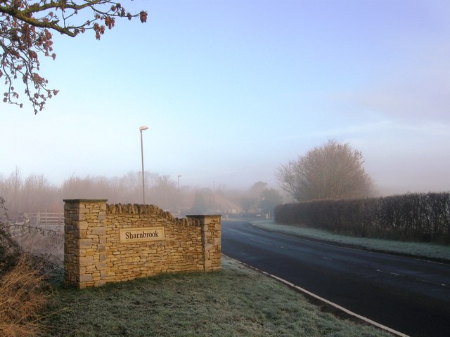
///overjoyed.gown.flooding. Near Sharnbrook, Bedfordshire

Related Wikis

Sharnbrook railway station

Sharnbrook railway station was opened in 1857 by the Midland Railway to serve the village of Sharnbrook in Bedfordshire, England. It was on the Midland...

Church of St Peter, Sharnbrook

Church of St Peter is a Grade I listed church in Sharnbrook, Bedfordshire, England. It became a listed building on 13 July 1964. The parish church is...

Sharnbrook

Sharnbrook is a village and civil parish located in the Borough of Bedford in Bedfordshire, England, situated around 7 miles (11 km) north-west of Bedford...

Felmersham

Felmersham is a small village and civil parish in the Borough of Bedford in Bedfordshire, England, on the River Great Ouse, about 7 miles (11 km) north...

Nearby Amenities

Located within 500m of 52.224795,-0.53426305
Railway: switch
Lat/Long: 52.2246751/-0.530824
Coffle End
Place: locality
Source: OS 1:25k
Lat/Long: 52.2224016/-0.5310064
Pub
Fordham Arms
Addr City: Sharnbrook
Addr Country: GB
Addr Postcode: MK44 1PX
Addr Street: Templars Way
Brewery: various
Fhrs Authority: Bedford
Fhrs Id: 965856
Fhrs Local Authority Id: 125876
Food: yes
Outdoor Seating: yes
Lat/Long: 52.2246832/-0.5348124
Recycling
Recycling Clothes: yes
Recycling Glass Bottles: yes
Recycling Shoes: yes
Lat/Long: 52.2249748/-0.5342671
Railway: switch
Lat/Long: 52.225649/-0.5317118
Telephone
Booth: KX100
Covered: booth
Lat/Long: 52.2245749/-0.5345091
Waste Basket
Source: local_knowledge
Lat/Long: 52.2244774/-0.5353923
Railway: switch
Lat/Long: 52.2238598/-0.5303466
Railway: switch
Lat/Long: 52.224284/-0.5304443
Railway: switch
Lat/Long: 52.2242632/-0.5306106
Railway: switch
Lat/Long: 52.2247486/-0.5310198
Sharnbrook
Historic Railway: station
Railway: site
Wikidata: Q7489939
Wikipedia: en:Sharnbrook railway station
Lat/Long: 52.225603/-0.5318533
Railway: switch
Lat/Long: 52.2260295/-0.5320939
Railway: switch
Lat/Long: 52.2269762/-0.533144
Railway: switch
Lat/Long: 52.226804/-0.5330744
Railway: switch
Lat/Long: 52.2271937/-0.533533
Railway: switch
Lat/Long: 52.2274982/-0.5339661
Tartan Fish
Office: government
Lat/Long: 52.2251391/-0.5413294
Bus Stop
Bench: yes
Bus: yes
Covered: yes
Public Transport: platform
Shelter: yes
Lat/Long: 52.2251021/-0.5337079
Bus Stop
Bench: yes
Bus: yes
Covered: yes
Public Transport: platform
Shelter: yes
Lat/Long: 52.2246462/-0.5343503
Post Box
Brand: Royal Mail
Brand Wikidata: Q638098
Brand Wikipedia: en:Royal Mail
Collection Times: Mo-Fr 09:00; Sa 07:00
Operator: Royal Mail
Operator Wikidata: Q638098
Post Box Type: lamp
Ref: MK44 79D
Royal Cypher: EIIR
Royal Cypher Wikidata: Q33102113
Source: survey
Survey Date: 2016-04-30
Lat/Long: 52.2243907/-0.534534
Hill Farm Shop
Addr City: Sharnbrook
Addr Country: GB
Addr Postcode: MK44 1NP
Addr Street: Mill Road
Fhrs Authority: Bedford
Fhrs Id: 109757
Fhrs Local Authority Id: 39714
Shop: farm
Lat/Long: 52.2235324/-0.52736
Cock & Pullet
Operator: Cock & Pullet
Shop: animal_feeds
Lat/Long: 52.2277823/-0.5359464
Defibrillator
Defibrillator Location: outside Sharnbrook Surgery
Emergency: defibrillator
Indoor: no
Lat/Long: 52.2244768/-0.5343538
Railway: switch
Lat/Long: 52.2273807/-0.5335733
Power: pole
Lat/Long: 52.2250523/-0.5280157
Power: pole
Lat/Long: 52.2253942/-0.5293861
Power: pole
Lat/Long: 52.2256612/-0.5304329
Power: pole
Lat/Long: 52.2259524/-0.531526
Power: pole
Lat/Long: 52.2258877/-0.5324076
Power: pole
Lat/Long: 52.2259808/-0.5334379
Power: pole
Lat/Long: 52.2260738/-0.5344484
Power: pole
Lat/Long: 52.2261709/-0.5354952
Power: pole
Lat/Long: 52.22627/-0.5366311
Power: pole
Lat/Long: 52.226357/-0.5376449
Power: pole
Lat/Long: 52.2264521/-0.5386653
Power: pole
Lat/Long: 52.2265633/-0.5398045
Power: pole
Lat/Long: 52.2266402/-0.5408414
Power: pole
Lat/Long: 52.226203/-0.5285764
Power: pole
Lat/Long: 52.2262896/-0.5291747
Power: pole
Lat/Long: 52.2272148/-0.528606
Addr Country: GB
Addr Housenumber: 45
Addr Street: Mill Road
Lat/Long: 52.2224851/-0.530494
The data included in this document is from www.openstreetmap.org. The data is made available under ODbL.

Have you been to Coffle End?

Leave your review of Coffle End below (or comments, questions and feedback).