Deadman's Spinney

Wood, Forest in Bedfordshire

England

Deadman's Spinney

Bridge at Sharnbrook This bridge on Park Lane takes the road under the Midland Main Line.
Bridge at Sharnbrook Credit: Bob Walters

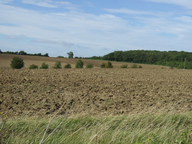
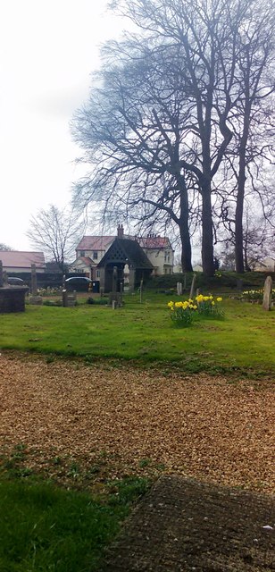
Deadman's Spinney is a small woodland located in Bedfordshire, England. Situated near the village of Deadman's Cross, the spinney covers an area of approximately 10 acres. It is a popular destination for nature enthusiasts, walkers, and those seeking a tranquil environment.

The spinney is characterized by dense vegetation and a variety of tree species, including oak, beech, and birch. The canopy of the woodland provides shade and creates a cool and peaceful atmosphere, making it an ideal retreat during hot summer days. The forest floor is covered in a thick carpet of moss and fallen leaves, adding to the natural beauty of the area.

Wildlife thrives within Deadman's Spinney, with the woodland providing a habitat for a diverse range of species. Visitors may encounter woodland creatures such as squirrels, rabbits, and various species of birds, including woodpeckers and owls. The spinney is also home to a variety of plant life, including bluebells, wild garlic, and ferns, which adorn the forest floor in spring and summer.

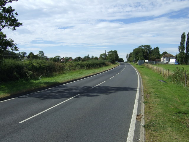
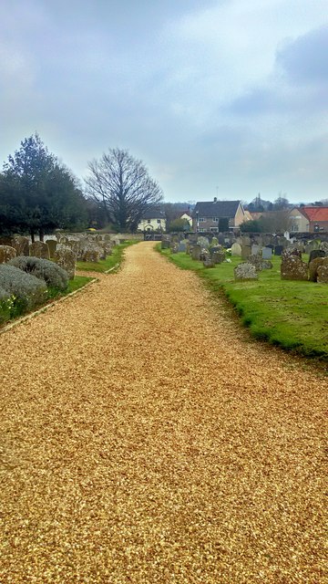
Several footpaths and trails wind their way through Deadman's Spinney, offering visitors the opportunity to explore and discover its hidden gems. These paths provide a peaceful and picturesque setting for leisurely walks or more vigorous hikes. Interpretative signs and information boards are scattered throughout the spinney, providing educational insights into the local flora and fauna.

Deadman's Spinney is a cherished natural space in Bedfordshire, offering visitors a chance to immerse themselves in the beauty of nature and experience a sense of tranquility and serenity.

If you have any feedback on the listing, please let us know in the comments section below.

Deadman's Spinney Images

Images are sourced within 2km of 52.228243/-0.5237977 or Grid Reference TL0059. Thanks to Geograph Open Source API. All images are credited.

Bridge at Sharnbrook This bridge on Park Lane takes the road under the Midland Main Line.
Bridge at Sharnbrook
This bridge on Park Lane takes the road under the Midland Main Line.
Farmland near Bourne End
Road towards Bourne End and the A6 The A6 is one of the main historic north south roads in England. At 299 miles long it is the fourth longest road in the country. It currently runs from Luton in Bedfordshire to Carlisle in Cumbria, although it formerly started at a junction with the A1 at Barnet.
Wikipedia: <span class="nowrap"><a title="http://en.wikipedia.org/wiki/A6_road_(England)" rel="nofollow ugc noopener" href="http://en.wikipedia.org/wiki/A6_road_(England)">Link</a><img style="margin-left:2px;" alt="External link" title="External link - shift click to open in new window" src="https://s1.geograph.org.uk/img/external.png" width="10" height="10"/></span> 
See also <span class="nowrap"><a title="http://www.sabre-roads.org.uk/wiki/index.php?title=A6" rel="nofollow ugc noopener" href="http://www.sabre-roads.org.uk/wiki/index.php?title=A6">Link</a><img style="margin-left:2px;" alt="External link" title="External link - shift click to open in new window" src="https://s1.geograph.org.uk/img/external.png" width="10" height="10"/></span> for more route detail.
Road towards Bourne End and the A6
The A6 is one of the main historic north south roads in England. At 299 miles long it is the fourth longest road in the country. It currently runs from Luton in Bedfordshire to Carlisle in Cumbria, although it formerly started at a junction with the A1 at Barnet. Wikipedia: LinkExternal link See also LinkExternal link for more route detail.
Farmland towards Temple Wood
Minor road towards the A6 The A6 is one of the main historic north south roads in England. At 299 miles long it is the fourth longest road in the country. It currently runs from Luton in Bedfordshire to Carlisle in Cumbria, although it formerly started at a junction with the A1 at Barnet.
Wikipedia: <span class="nowrap"><a title="http://en.wikipedia.org/wiki/A6_road_(England)" rel="nofollow ugc noopener" href="http://en.wikipedia.org/wiki/A6_road_(England)">Link</a><img style="margin-left:2px;" alt="External link" title="External link - shift click to open in new window" src="https://s1.geograph.org.uk/img/external.png" width="10" height="10"/></span> 
See also <span class="nowrap"><a title="http://www.sabre-roads.org.uk/wiki/index.php?title=A6" rel="nofollow ugc noopener" href="http://www.sabre-roads.org.uk/wiki/index.php?title=A6">Link</a><img style="margin-left:2px;" alt="External link" title="External link - shift click to open in new window" src="https://s1.geograph.org.uk/img/external.png" width="10" height="10"/></span> for more route detail.
Minor road towards the A6
The A6 is one of the main historic north south roads in England. At 299 miles long it is the fourth longest road in the country. It currently runs from Luton in Bedfordshire to Carlisle in Cumbria, although it formerly started at a junction with the A1 at Barnet. Wikipedia: LinkExternal link See also LinkExternal link for more route detail.
Farmland towards kennels
A6 towards Rushden The A6 is one of the main historic north south roads in England. At 299 miles long it is the fourth longest road in the country. It currently runs from Luton in Bedfordshire to Carlisle in Cumbria, although it formerly started at a junction with the A1 at Barnet.
Wikipedia: <span class="nowrap"><a title="http://en.wikipedia.org/wiki/A6_road_(England)" rel="nofollow ugc noopener" href="http://en.wikipedia.org/wiki/A6_road_(England)">Link</a><img style="margin-left:2px;" alt="External link" title="External link - shift click to open in new window" src="https://s1.geograph.org.uk/img/external.png" width="10" height="10"/></span> 
See also <span class="nowrap"><a title="http://www.sabre-roads.org.uk/wiki/index.php?title=A6" rel="nofollow ugc noopener" href="http://www.sabre-roads.org.uk/wiki/index.php?title=A6">Link</a><img style="margin-left:2px;" alt="External link" title="External link - shift click to open in new window" src="https://s1.geograph.org.uk/img/external.png" width="10" height="10"/></span> for more route detail.
A6 towards Rushden
The A6 is one of the main historic north south roads in England. At 299 miles long it is the fourth longest road in the country. It currently runs from Luton in Bedfordshire to Carlisle in Cumbria, although it formerly started at a junction with the A1 at Barnet. Wikipedia: LinkExternal link See also LinkExternal link for more route detail.
In Deadmans Spinney
In Deadmans Spinney
Farmland towards Greenacres
St Peter, Sharnbrook
St Peter, Sharnbrook - East end
Sharnbrook
Sharnbrook
Lake at Felmersham Gravel Pits
Gate of St. Peter’s Church Sharnbrook
St. Peter’s Churchyard Sharnbrook
St. Peter’s Church Sharnbrook
Stained Glass in Porch of St. Peter’s Church Sharnbrook The window is a thank you to the people of Sharnbrook from the children of London and is dated Sept 1939
Stained Glass in Porch of St. Peter’s Church Sharnbrook
The window is a thank you to the people of Sharnbrook from the children of London and is dated Sept 1939
Footbridge at Felmersham Gravel Pits
Show me another place!

Deadman's Spinney is located at Grid Ref: TL0059 (Lat: 52.228243, Lng: -0.5237977)

Unitary Authority: Bedford

Police Authority: Bedfordshire

What 3 Words

///evolving.seagull.claw. Near Sharnbrook, Bedfordshire

Related Wikis

Sharnbrook railway station

Sharnbrook railway station was opened in 1857 by the Midland Railway to serve the village of Sharnbrook in Bedfordshire, England. It was on the Midland...

Sharnbrook

Sharnbrook is a village and civil parish located in the Borough of Bedford in Bedfordshire, England, situated around 7 miles (11 km) north-west of Bedford...

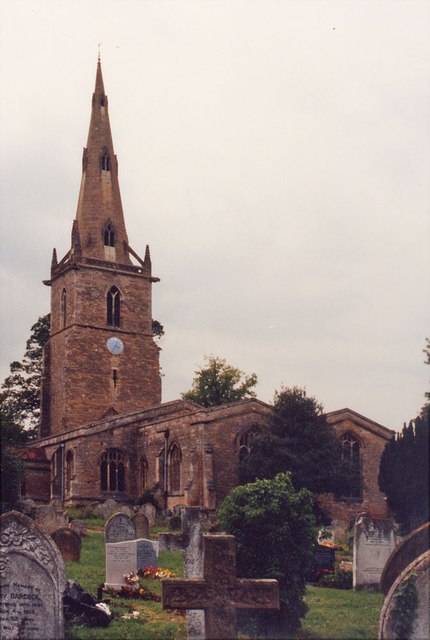
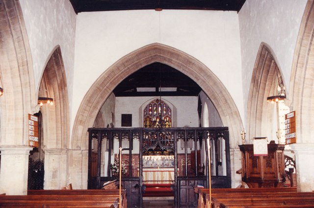
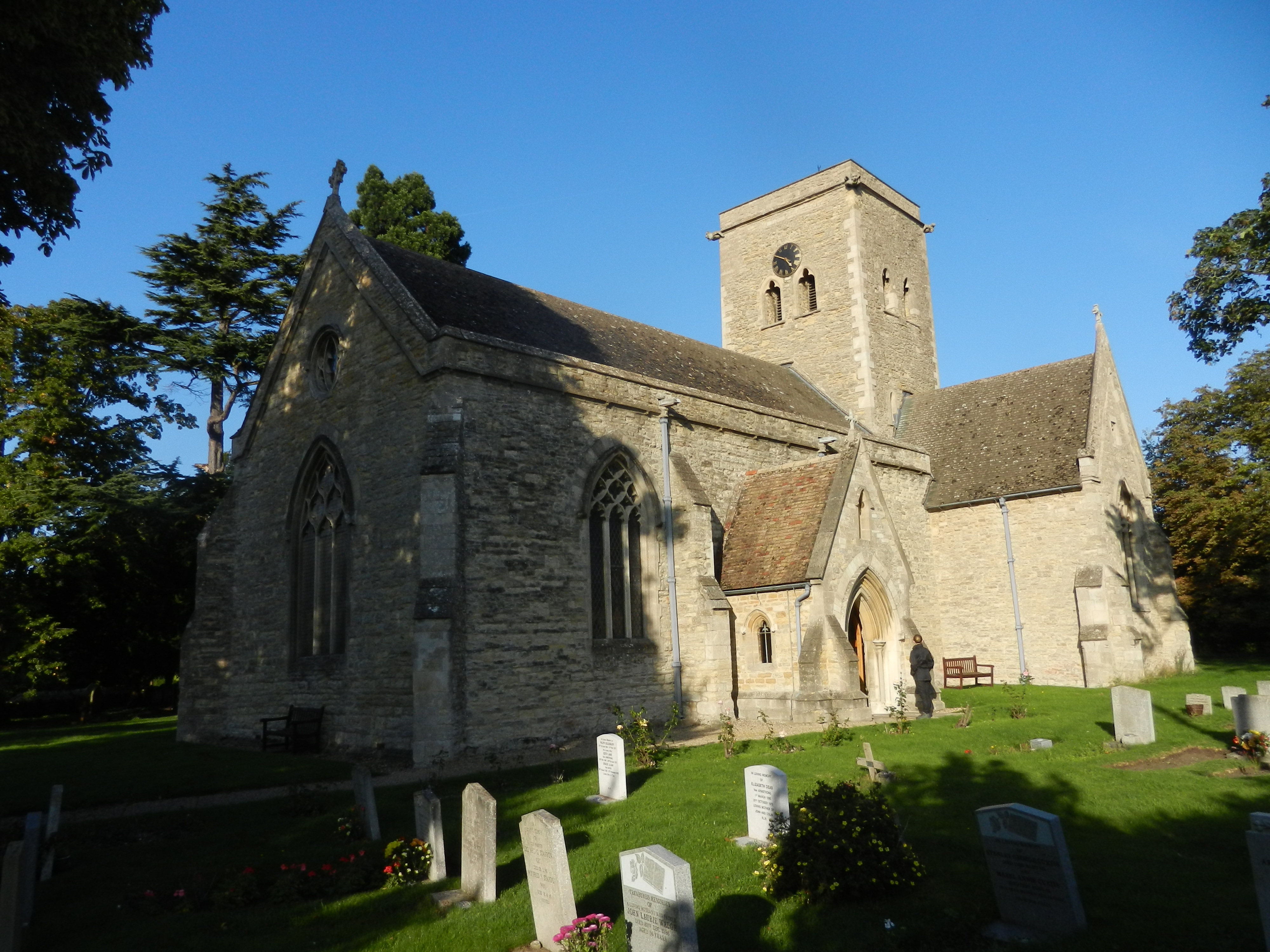
Church of St Peter, Sharnbrook

Church of St Peter is a Grade I listed church in Sharnbrook, Bedfordshire, England. It became a listed building on 13 July 1964. The parish church is...

Souldrop

Souldrop is a village and former civil parish, now in the parish of Knotting and Souldrop, in the Bedford district, in the ceremonial county of Bedfordshire...

Radwell Manor Railway

The Radwell Manor Railway was a 10+1⁄4 in (260 mm) gauge miniature railway situated in the village of Radwell, near Felmersham, in North Bedfordshire,...

Bletsoe

Bletsoe is a village and civil parish in Bedfordshire, England. It is on the A6, and about eight miles north of Bedford. The village has a small park,...

Bletsoe Castle

Bletsoe Castle was a late medieval fortified manor house in the village of Bletsoe, Bedfordshire, England. == Details == Bletsoe Castle was created by...

Felmersham

Felmersham is a small village and civil parish in the Borough of Bedford in Bedfordshire, England, on the River Great Ouse, about 7 miles (11 km) north...

Nearby Amenities

Located within 500m of 52.228243,-0.5237977
Power: pole
Lat/Long: 52.232459/-0.523217
Power: pole
Lat/Long: 52.2267565/-0.5176317
Power: pole
Lat/Long: 52.2240571/-0.5240432
Power: pole
Lat/Long: 52.2243908/-0.5253377
Power: pole
Lat/Long: 52.2247206/-0.5266552
Power: pole
Lat/Long: 52.2250523/-0.5280157
Power: pole
Lat/Long: 52.2253942/-0.5293861
Power: pole
Lat/Long: 52.226203/-0.5285764
Power: pole
Lat/Long: 52.2262896/-0.5291747
Power: pole
Lat/Long: 52.2290141/-0.5274633
Power: pole
Lat/Long: 52.2272148/-0.528606
Power: pole
Lat/Long: 52.228125/-0.5280274
Traffic Calming: island
Lat/Long: 52.2312476/-0.527914
Give Way
Direction: forward
Lat/Long: 52.2312698/-0.5278946
Traffic Calming: island
Lat/Long: 52.2312399/-0.5275943
The data included in this document is from www.openstreetmap.org. The data is made available under ODbL.

Have you been to Deadman's Spinney?

Leave your review of Deadman's Spinney below (or comments, questions and feedback).