Cobbler's Corner

Settlement in Worcestershire Malvern Hills

England

Cobbler's Corner

Sheep grazing, Broadwas On a bank above the A44.
Sheep grazing, Broadwas Credit: JThomas

Cobbler's Corner is a charming village located in the picturesque county of Worcestershire, England. Situated amidst rolling hills and lush green countryside, this idyllic settlement offers a peaceful retreat from the hustle and bustle of city life. The village is known for its quaint, traditional architecture, with many of the buildings dating back centuries.

Nestled within the village is a charming cobblestone square, after which the village is named. Cobbler's Corner is a hub of activity, with a range of local businesses and shops lining the square. One of the most prominent features of the village is the historic cobbler's shop, which has been in operation for over a century and continues to provide expert shoe repair services to locals and visitors alike.

The village also boasts a welcoming community atmosphere, with friendly residents who take pride in their surroundings. The village green is a popular gathering spot for locals, where village fairs and events are held throughout the year. Visitors to Cobbler's Corner can expect to be greeted with warm hospitality and an abundance of local knowledge.

Surrounded by natural beauty, Cobbler's Corner offers ample opportunities for outdoor activities. The nearby Worcestershire Hills provide stunning hiking trails and panoramic views of the countryside. Additionally, the village is a short drive away from several historic landmarks, including the iconic Worcester Cathedral and the historic market town of Malvern.

In summary, Cobbler's Corner is a delightful village in Worcestershire, offering a peaceful and quaint experience for visitors. With its historic architecture, friendly community, and proximity to natural beauty, it is a perfect destination for those seeking a charming English countryside retreat.

If you have any feedback on the listing, please let us know in the comments section below.

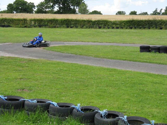
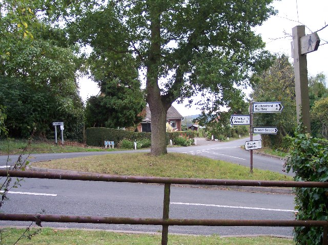
Cobbler's Corner Images

Images are sourced within 2km of 52.210122/-2.3320317 or Grid Reference SO7756. Thanks to Geograph Open Source API. All images are credited.

Sheep grazing, Broadwas On a bank above the A44.
Sheep grazing, Broadwas
On a bank above the A44.
A44, Broadwas Towards Worcester.
A44, Broadwas
Towards Worcester.
Crop field and woodland, Broadwas Off the A44.
Crop field and woodland, Broadwas
Off the A44.
A44 towards Worcester
A fishing pond at Cobhouse Farm
Swans at Cobhouse Farm fishing ponds
Sluice gate on stream near Cobhouse Farm
Sheep with lambs in a field near Newhouse Farm
Pond near Newhouse Farm
Pond at Cobhouse Farm
Trees near Cobhouse Farm, Wichenford
B4204 near Cobhouse Farm
Footpath exit from Cob House Countryside Park
Swan on a pond with Cobhouse Farm behind
Tree by a stile near Cobhouse Farm
Distance sheep in a field by Newhouse Farm
Old Milestone by the B4204, west of Kenswick Manor, Kenswick Parish Stone post (original plate lost) by the B4204, in parish of Kenswick (Malvern Hills District), West of Kenswick Manor, by the road, on South side of road. Worcester Cross iron plate (re-plated), erected by the Worcester turnpike trust in the 19th century. 

Inscription reads:-
TO
WORCESTER
CROSS
5
MILES 

Milestone Society National ID: WO_TBWO14
Old Milestone by the B4204, west of Kenswick Manor, Kenswick Parish
Stone post (original plate lost) by the B4204, in parish of Kenswick (Malvern Hills District), West of Kenswick Manor, by the road, on South side of road. Worcester Cross iron plate (re-plated), erected by the Worcester turnpike trust in the 19th century. Inscription reads:- TO WORCESTER CROSS 5 MILES Milestone Society National ID: WO_TBWO14
Karting at Moat House Farm A Geographer fails miserably to hit the racing line. Again.
Karting at Moat House Farm
A Geographer fails miserably to hit the racing line. Again.
Show me another place!

Cobbler's Corner is located at Grid Ref: SO7756 (Lat: 52.210122, Lng: -2.3320317)

Administrative County: Worcestershire

District: Malvern Hills

Police Authority: West Merica

What 3 Words

///annual.yappy.fetches. Near Lower Broadheath, Worcestershire

Related Wikis

Broadwas

Broadwas, or Broadwas-on-Teme, is a village and civil parish (with Cotheridge) in the Malvern Hills district of Worcestershire, England. According to...

Cotheridge

Cotheridge is a village and civil parish in the district of Malvern Hills in the county of Worcestershire, England. It is 4 miles (6 km) west of the...

Kenswick, Worcestershire

Kenswick is a village and civil parish (with Wichenford) in the Malvern Hills District in the county of Worcestershire, England. == External links... ==

Doddenham

Doddenham is a hamlet and civil parish (with Knightwick) in the Malvern Hills district in the county of Worcestershire, England. Doddenham was in the...

Nearby Amenities

Located within 500m of 52.210122,-2.3320317
Bus Stop
Cobbler's Corner
Bus: yes
Naptan AtcoCode: 2000G652001
Naptan Bearing: NW
Naptan CommonName: Cobbler's Corner
Naptan Indicator: Adj
Naptan Landmark: The laurels
Naptan NaptanCode: wocdptjm
Naptan Street: Cobbler's Lane
Naptan Verified: no
Public Transport: platform
Source: naptan_import
Lat/Long: 52.2104429/-2.3324389
Power: tower
Lat/Long: 52.206503/-2.3331078
Power: tower
Lat/Long: 52.2079227/-2.329299
Power: tower
Lat/Long: 52.2091737/-2.3259187
Power: pole
Lat/Long: 52.2099636/-2.3252902
Power: pole
Lat/Long: 52.2073962/-2.3264999
Power: pole
Lat/Long: 52.2091058/-2.3256879
Power: pole
Lat/Long: 52.2082707/-2.3260922
Post Box
Collection Times: Mo-Fr 17:00; Sa 08:45
Post Box Type: lamp
Ref: WR6 408
Royal Cypher: EIIR
Royal Cypher Wikidata: Q33102113
Lat/Long: 52.210604/-2.3324934
Location Transition: yes
Power: pole
Lat/Long: 52.2072451/-2.3333274
Power: pole
Lat/Long: 52.2077571/-2.3331074
Power: pole
Lat/Long: 52.2085329/-2.3326796
Power: pole
Lat/Long: 52.2100203/-2.3318663
Power: pole
Lat/Long: 52.2092577/-2.3322934
Power: pole
Lat/Long: 52.2103688/-2.3316691
Cobblers Green
Power: pole
Transformer: distribution
Voltage Primary: 11000
Lat/Long: 52.2106893/-2.3319467
Power: pole
Lat/Long: 52.2117/-2.3316403
Power: pole
Lat/Long: 52.2126467/-2.331427
Power: pole
Lat/Long: 52.213323/-2.3312473
Power: pole
Lat/Long: 52.2140436/-2.3307404
The data included in this document is from www.openstreetmap.org. The data is made available under ODbL.

Have you been to Cobbler's Corner?

Leave your review of Cobbler's Corner below (or comments, questions and feedback).