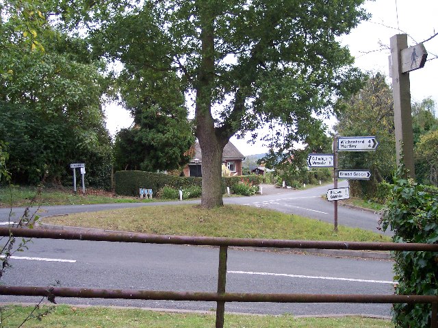
Broad Green

Settlement in Worcestershire Malvern Hills

England

Broad Green

Houses, Doddenham
Houses, Doddenham Credit: JThomas

Broad Green is a small village located in the county of Worcestershire, England. Situated approximately 4 miles east of the town of Pershore, it falls within the Wychavon district. With a population of around 300 people, it offers a tight-knit and close community atmosphere.

The village is known for its picturesque countryside surroundings, with rolling hills and green pastures creating a tranquil and serene environment. Broad Green is encompassed by farmland, providing residents with beautiful views and opportunities for outdoor activities such as walking and cycling.

The village itself is characterized by a mix of traditional and modern architecture. There are a number of well-maintained period cottages and houses, blending seamlessly with newer properties. The village church, St. James the Great, is a prominent feature, dating back to the 12th century and offering a glimpse into the area's rich history.

Amenities in Broad Green are limited, with no shops or pubs within the immediate vicinity. However, the village benefits from its close proximity to Pershore, where residents can access a wider range of facilities including supermarkets, schools, and healthcare services.

Transport links in Broad Green are relatively convenient, with regular bus services connecting the village to Pershore and surrounding areas. The nearby Pershore railway station provides further transportation options, with direct trains to Worcester, Birmingham, and beyond.

Overall, Broad Green offers a peaceful and idyllic countryside lifestyle, making it an attractive place to reside for those seeking a rural retreat within easy reach of larger towns and cities.

If you have any feedback on the listing, please let us know in the comments section below.

Broad Green Images

Images are sourced within 2km of 52.202166/-2.335782 or Grid Reference SO7756. Thanks to Geograph Open Source API. All images are credited.

Houses, Doddenham
Houses, Doddenham
Band in the A44, Doddenham Towards Worcester.
Band in the A44, Doddenham
Towards Worcester.
Footpath off the A44 south of Doddenham
Orchard near the River Teme
A44 towards Worcester
The Royal Oak, Broadwas On the A44.
The Royal Oak, Broadwas
On the A44.
Sign for the Royal Oak, Broadwas
Sheep grazing, Broadwas On a bank above the A44.
Sheep grazing, Broadwas
On a bank above the A44.
A44, Broadwas Towards Worcester.
A44, Broadwas
Towards Worcester.
Crop field and woodland, Broadwas Off the A44.
Crop field and woodland, Broadwas
Off the A44.
A44 towards Worcester
Grassland near the River Teme
Footpath towards Broadwas Begins as a track off the A44.
Footpath towards Broadwas
Begins as a track off the A44.
Approaching a bend on the A44 towards Worcester
Footpath through crop field Towards Cotheridge.
Footpath through crop field
Towards Cotheridge.
A44 towards Worcester
Grassland, Cotheridge Off the A44.
Grassland, Cotheridge
Off the A44.
A44, Cotheridge Towards Worcester.
A44, Cotheridge
Towards Worcester.
Show me another place!

Broad Green is located at Grid Ref: SO7756 (Lat: 52.202166, Lng: -2.335782)

Administrative County: Worcestershire

District: Malvern Hills

Police Authority: West Mercia

What 3 Words

///socket.glossed.supple. Near Lower Broadheath, Worcestershire

Related Wikis

Broadwas

Broadwas, or Broadwas-on-Teme, is a village and civil parish (with Cotheridge) in the Malvern Hills district of Worcestershire, England. According to...

Cotheridge

Cotheridge is a village and civil parish in the district of Malvern Hills in the county of Worcestershire, England. It is 4 miles (6 km) west of the...

Cotheridge Court

Cotheridge Court is a Grade II* listed ancient manor house situated in the south-western part of Cotheridge, in the county of Worcestershire, England,...

St Leonard's Church, Cotheridge

St. Leonard's Church is a small, 12th-century church located in the scattered village of Cotheridge in Worcestershire. It stands not far from the manor...

Nearby Amenities

Located within 500m of 52.202166,-2.335782
Barrier: stile
Foot: yes
Material: wood
Step Count: 1
Stile: stepover
Lat/Long: 52.2028086/-2.333656
Barrier: stile
Foot: yes
Lat/Long: 52.2041374/-2.3315394
Barrier: stile
Foot: yes
Lat/Long: 52.2047164/-2.3301606
Power: tower
Lat/Long: 52.2039184/-2.3400256
Power: tower
Lat/Long: 52.2051875/-2.3366115
Broad Green
Place: hamlet
Lat/Long: 52.2021658/-2.3379127
Post Box
Collection Times: Mo-Fr 17:00; Sa 08:00
Post Box Type: lamp
Ref: WR6 243
Royal Cypher: EIIR
Royal Cypher Wikidata: Q33102113
Lat/Long: 52.2017579/-2.3387278
Board Type: nature
Information: board
Tourism: information
Lat/Long: 52.2017711/-2.3387125
Barrier: stile
Foot: yes
Material: wood
Step Count: 1
Stile: stepover
Lat/Long: 52.202599/-2.3386023
Barrier: stile
Foot: yes
Material: wood
Step Count: 1
Stile: stepover
Lat/Long: 52.2031678/-2.3408187
Power: pole
Lat/Long: 52.2035008/-2.3396417
Power: pole
Lat/Long: 52.2035034/-2.3359901
Power: pole
Lat/Long: 52.203509/-2.3379564
Power: pole
Lat/Long: 52.2035133/-2.3410245
Broad Green South
Power: pole
Transformer: distribution
Voltage Primary: 11000
Lat/Long: 52.2009569/-2.3388254
Ridgeacre Farm
Power: pole
Transformer: distribution
Voltage Primary: 11000
Lat/Long: 52.2035284/-2.3326247
Power: pole
Lat/Long: 52.202052/-2.3346738
Power: pole
Lat/Long: 52.2038643/-2.3329263
Power: pole
Lat/Long: 52.2014101/-2.3358955
Power: pole
Lat/Long: 52.2035044/-2.334549
Power: pole
Lat/Long: 52.2041975/-2.3314914
Broad Green
Power: pole
Transformer: distribution
Voltage Primary: 11000
Lat/Long: 52.2011164/-2.3364645
Power: pole
Lat/Long: 52.2027079/-2.3334332
Power: pole
Lat/Long: 52.2029389/-2.3331141
Power: pole
Lat/Long: 52.2002874/-2.3383347
Broad Green
Man Made: survey_point
Ref: S3822
Tpuk Ref: TP1644
Lat/Long: 52.1988646/-2.3401122
The Moat House
Power: pole
Transformer: distribution
Voltage Primary: 11000
Lat/Long: 52.1996983/-2.3310449
Power: pole
Lat/Long: 52.2023763/-2.3326059
Power: pole
Lat/Long: 52.2012796/-2.3316807
Power: pole
Lat/Long: 52.200531/-2.3313668
Power: pole
Lat/Long: 52.1994723/-2.3403159
Power: pole
Lat/Long: 52.1998759/-2.3393087
Broad Green Pumping Station
Power: pole
Transformer: distribution
Voltage Primary: 11000
Lat/Long: 52.2027551/-2.3382036
Power: pole
Lat/Long: 52.2028743/-2.3374486
Power: pole
Lat/Long: 52.2028431/-2.3369457
Forest Farm
Power: pole
Transformer: distribution
Voltage Primary: 11000
Lat/Long: 52.2028143/-2.3364522
Power: pole
Lat/Long: 52.2030445/-2.3356046
Power: pole
Lat/Long: 52.202885/-2.3344646
Power: pole
Lat/Long: 52.2028012/-2.3339456
Power: pole
Lat/Long: 52.2005647/-2.3377021
Power: pole
Lat/Long: 52.2043677/-2.3328982
Power: pole
Lat/Long: 52.2049981/-2.3330538
Location Transition: yes
Power: pole
Lat/Long: 52.2056646/-2.3332603
The data included in this document is from www.openstreetmap.org. The data is made available under ODbL.

Have you been to Broad Green?

Leave your review of Broad Green below (or comments, questions and feedback).