Clarendon

Settlement in Kent Dover

England

Clarendon

Shakespeare Cliff
Shakespeare Cliff Credit: N Chadwick

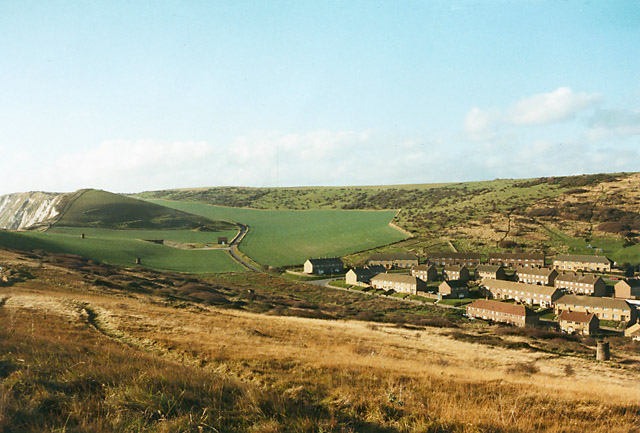
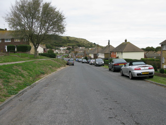
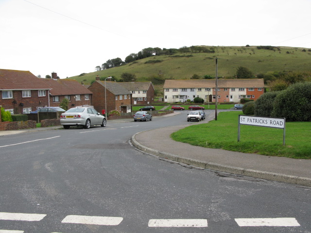
Clarendon is a small village located in the county of Kent, England. Situated in the southeastern part of the country, it is nestled between the towns of Canterbury and Ashford. With a population of around 500 residents, Clarendon is known for its tranquil and picturesque surroundings.

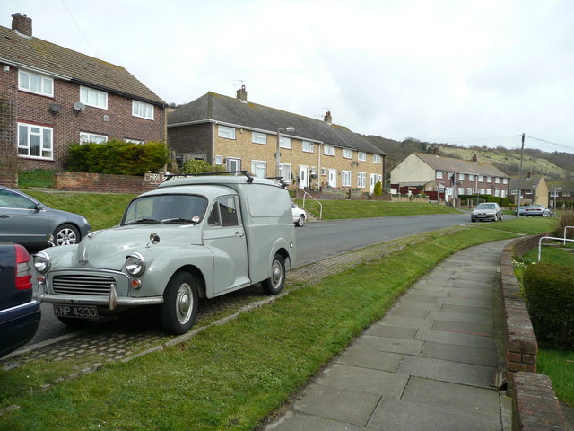
The village is characterized by its charming, traditional English cottages, many of which date back several centuries. The architecture reflects the rich history of the area, with some houses featuring exposed timber frames and thatched roofs. The village center is centered around a quaint village green, providing a gathering place for locals and a tranquil spot for visitors.

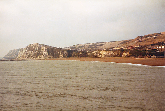
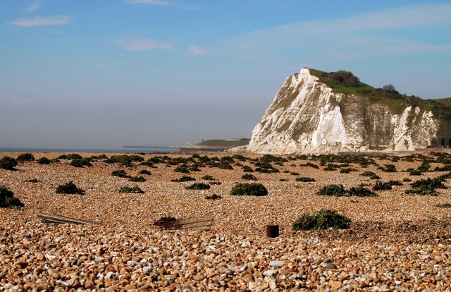
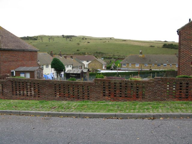
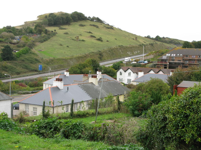
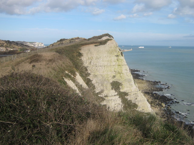
Clarendon is surrounded by beautiful countryside and rolling hills, making it a popular destination for nature lovers and hikers. The area boasts several walking and cycling trails, offering breathtaking views of the surrounding landscape. The nearby Clarendon Woods provide a peaceful retreat for those seeking solitude and a chance to explore the diverse flora and fauna.

Despite its small size, Clarendon has a strong sense of community. The village hosts regular events and activities, ranging from fairs and festivals to local markets and sporting events. The village pub, The Clarendon Arms, is a popular meeting spot for residents and visitors alike, offering a warm and friendly atmosphere.

Overall, Clarendon offers a peaceful and idyllic escape from the hustle and bustle of city life, with its beautiful surroundings and close-knit community. It is a place where residents and visitors can appreciate the natural beauty and rich history of the Kent countryside.

If you have any feedback on the listing, please let us know in the comments section below.
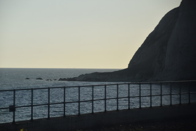
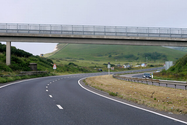
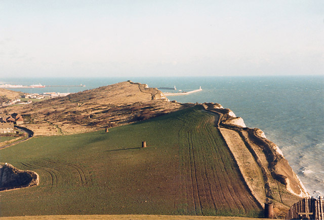
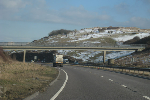
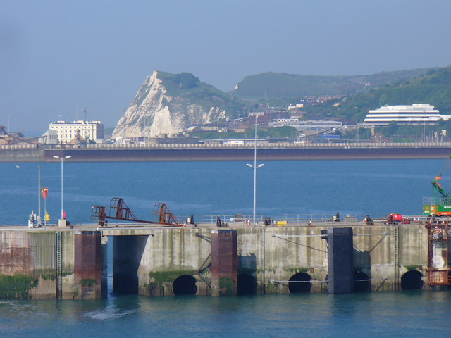
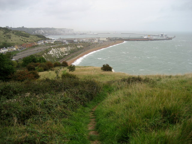
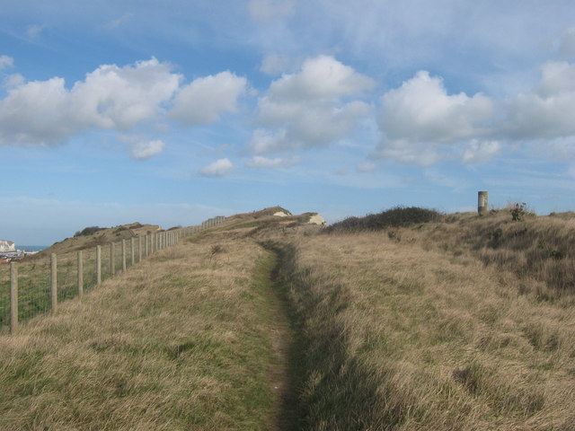
Clarendon Images

Images are sourced within 2km of 51.124036/1.2998289 or Grid Reference TR3141. Thanks to Geograph Open Source API. All images are credited.

Shakespeare Cliff
Shakespeare Cliff
Footbridge over the A20 near Shakespeare Cliff The A20 runs from the London Borough of Lewisham to Dover, Kent. It runs through the major towns of Maidstone, Ashford and Folkestone, terminating at the port of Dover.
Footbridge over the A20 near Shakespeare Cliff
The A20 runs from the London Borough of Lewisham to Dover, Kent. It runs through the major towns of Maidstone, Ashford and Folkestone, terminating at the port of Dover.
In the Channel Tunnel A typical view of a Eurotunnel Shuttle heading for France.
In the Channel Tunnel
A typical view of a Eurotunnel Shuttle heading for France.
Cliff top showing Shakespeare Railway Tunnel, Dover Looking along the course of the railway tunnel from Long Down towards the port of Dover. The six "chimneys" are the tops of air vents for the tunnel. The cliff top path is part of the North Downs and Saxon Shore Ways.
Cliff top showing Shakespeare Railway Tunnel, Dover
Looking along the course of the railway tunnel from Long Down towards the port of Dover. The six "chimneys" are the tops of air vents for the tunnel. The cliff top path is part of the North Downs and Saxon Shore Ways.
Aycliff, Dover This is the western edge of Dover, before the A20 was made into a dual carriageway and rerouted through here. There was just a single-track road through an unspoilt valley running parallel to the coastline. In the middle left of the green field is the entrance to a tunnel, dug in 1973 for channel tunnel works then, and providing vehicular access to the railway depot at the foot of Shakespeare Cliff. This access was later used in the 1980s for building the Channel Tunnel, see <a href="https://www.geograph.org.uk/photo/1632798">TR2939 : Channel Tunnel construction depot</a>.
Aycliff, Dover
This is the western edge of Dover, before the A20 was made into a dual carriageway and rerouted through here. There was just a single-track road through an unspoilt valley running parallel to the coastline. In the middle left of the green field is the entrance to a tunnel, dug in 1973 for channel tunnel works then, and providing vehicular access to the railway depot at the foot of Shakespeare Cliff. This access was later used in the 1980s for building the Channel Tunnel, see TR2939 : Channel Tunnel construction depot.
Shakespeare cliff and Aycliff, Dover Before the A20 was rerouted here. Seen from Admiralty Pier.
Shakespeare cliff and Aycliff, Dover
Before the A20 was rerouted here. Seen from Admiralty Pier.
Shakespeare Cliff, Dover Shakespeare Cliff is described in King Lear, Act1V, Scene 1 and the assonance of Matthew Arnold's poem "Dover Beach" can be felt at this spot.
Shakespeare Cliff, Dover
Shakespeare Cliff is described in King Lear, Act1V, Scene 1 and the assonance of Matthew Arnold's poem "Dover Beach" can be felt at this spot.
St David's Avenue - view east Including a 1966 Morris Minor van!
St David's Avenue - view east
Including a 1966 Morris Minor van!
View NE along St David's Avenue
View seaward from St David's Avenue The A20 runs through the gap between the houses and the cliff.
View seaward from St David's Avenue
The A20 runs through the gap between the houses and the cliff.
St Patrick's Road off St David's Avenue
Shakespeare Cliff and the A20 from St David's Avenue
Footbridge over A20 Shakespeare Cliff to the rear.
Footbridge over A20
Shakespeare Cliff to the rear.
Shakespeare Cliff, Dover Seen from a ferry in Dover's Eastern Docks. Through the base of the chalk cliff is a tunnel carrying the Dover-Folkestone railway line. Farther below the same cliff is the Channel Tunnel connecting Folkestone (Cheriton) with Calais (Coquelles).
Shakespeare Cliff, Dover
Seen from a ferry in Dover's Eastern Docks. Through the base of the chalk cliff is a tunnel carrying the Dover-Folkestone railway line. Farther below the same cliff is the Channel Tunnel connecting Folkestone (Cheriton) with Calais (Coquelles).
The Costa Magica in Dover Docks The Costa Magica is an Italian Cruise Liner. Her tonnange is 102,587 T. She was built in 2004; is 809ft long & 118ft in the beam. She has 17 decks, can carry 2672 passengers and has a maximum speed of 22 knots.
The Costa Magica in Dover Docks
The Costa Magica is an Italian Cruise Liner. Her tonnange is 102,587 T. She was built in 2004; is 809ft long & 118ft in the beam. She has 17 decks, can carry 2672 passengers and has a maximum speed of 22 knots.
Descending over Shakespeare Cliff Following the North Downs Way towards Dover.
Descending over Shakespeare Cliff
Following the North Downs Way towards Dover.
North Downs Way beside a trig point on Shakespeare Cliff The long distance path leads along a cliff top path towards Dover.
North Downs Way beside a trig point on Shakespeare Cliff
The long distance path leads along a cliff top path towards Dover.
Shakespeare Cliff As seen from the trig point on the cliffs. See <a href="https://www.geograph.org.uk/photo/2290599">TR3039 : North Downs Way beside a trig point on Shakespeare Cliff</a>.
The port of Dover is just around the corner and ferries from France carry many lorries and passengers to Britain.
Shakespeare Cliff
As seen from the trig point on the cliffs. See TR3039 : North Downs Way beside a trig point on Shakespeare Cliff. The port of Dover is just around the corner and ferries from France carry many lorries and passengers to Britain.
Show me another place!

Clarendon is located at Grid Ref: TR3141 (Lat: 51.124036, Lng: 1.2998289)

Administrative County: Kent

District: Dover

Police Authority: Kent

What 3 Words

///depths.unwound.tripling. Near Dover, Kent

Nearby Locations

Clarendon Dover

Related Wikis

Dover Priory railway station

Dover Priory railway station is the southern terminus of the South Eastern Main Line in England, and is the main station serving the town of Dover, Kent...
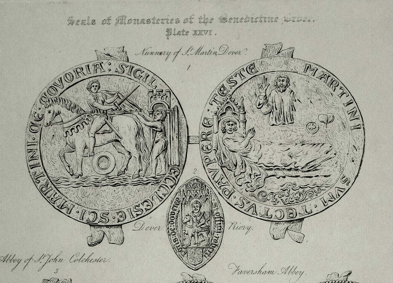
Dover Priory

The Priory of St. Mary the Virgin and St. Martin of the New Work, or Newark, commonly called Dover Priory, was a priory at Dover in southeast England....

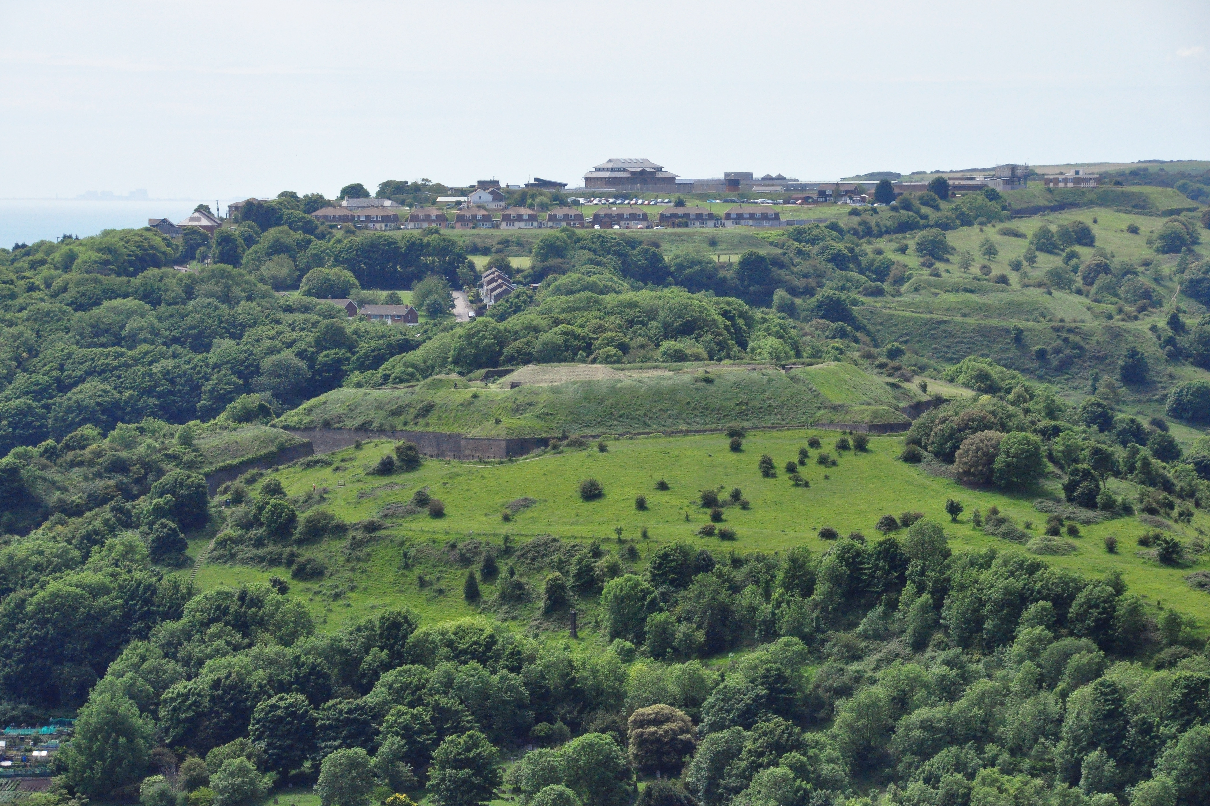
Dover Western Heights

The Western Heights of Dover are one of the most impressive fortifications in Britain. They comprise a series of forts, strong points and ditches, designed...

Dover College

Dover College is an independent day and boarding school in the English public school tradition located in Dover in south east England. It was founded in...

Related Videos

Nature’s Masterpiece #travel #outdoors #britishcoast #hiking #nature #reels

Samphire Hoe: Where land and sea collide, offering breathtaking views and a haven for nature enthusiasts.

Hiking the White Cliffs of Dover | Part 1 of 2 | 4K Walking Tour

Hi! I'm Robert, a photographer who started taking long walks to lose weight. I started recording these walks, and they became ...

Dover | Whitfield woods to Waldershare and back walking tour! | I found a fairy garden!

Are you visiting Dover? Do you like picturesque walks and trails? Then why not do this fantastic walking route! The full circular ...

North Downs Way Part 1- Dover to Hollingbourne (via Canterbury)

This is the first part of my three part journey along the North Downs Way in southern England. I travel alone wild camping as I go.

Nearby Amenities

Located within 500m of 51.124036,1.2998289
Mini Roundabout
Elms Vale Junction
Direction: clockwise
Source Name: naptan_import
Lat/Long: 51.1233002/1.2957559
Traffic Calming: cushion
Lat/Long: 51.1246478/1.2931441
Traffic Calming: cushion
Lat/Long: 51.1278313/1.2962673
Traffic Calming: cushion
Lat/Long: 51.1278505/1.2977582
Railway: switch
Lat/Long: 51.1246835/1.3054492
Traffic Calming: table
Lat/Long: 51.125806/1.3054833
Traffic Calming: cushion
Lat/Long: 51.1282162/1.3006918
Crossing
Crossing: traffic_signals
Crossing Ref: pelican
Lat/Long: 51.1252964/1.3058106
Bus Stop
Malvern Road
Bus: yes
Local Ref: adj
Naptan AtcoCode: 240097283
Naptan Bearing: W
Naptan BusStopType: MKD
Naptan CommonName: Malvern Road
Naptan Indicator: adj
Naptan Landmark: Malvern Road
Naptan NaptanCode: kntgpapd
Naptan PlusbusZoneRef: DOVERP
Naptan RevisionNumber: 5
Naptan Status: act
Naptan Street: Folkestone Road
Naptan Verified: no
Public Transport: platform
Ref: kntgpapd
Source: naptan_import
Source Date: 2018-02-20
Lat/Long: 51.1248702/1.3041194
Bus Stop
Boar's Head
Bus: yes
Naptan AtcoCode: 240097554
Naptan Bearing: S
Naptan CommonName: Boar's Head
Naptan Indicator: opp
Naptan Landmark: Boar's Head
Naptan NaptanCode: kntjmjmt
Naptan PlusbusZoneRef: DOVERP
Naptan Street: Eaton Road
Naptan Verified: no
Public Transport: platform
Source: naptan_import
Lat/Long: 51.1252832/1.2933132
Bus Stop
Boar's Head
Bus: yes
Naptan AtcoCode: 240097556
Naptan Bearing: N
Naptan CommonName: Boar's Head
Naptan Indicator: adj
Naptan Landmark: Boar's Head
Naptan NaptanCode: kntjmjmp
Naptan PlusbusZoneRef: DOVERP
Naptan Street: Eaton Road
Naptan Verified: no
Public Transport: platform
Source: naptan_import
Lat/Long: 51.1253256/1.2930875
The Malvern
Disused Highway: bus_stop
Disused Public Transport: platform
Local Ref: adj
Naptan AtcoCode: 240098270
Naptan Bearing: SW
Naptan BusStopType: MKD
Naptan CommonName: The Malvern
Naptan Indicator: adj
Naptan Landmark: The Malvern PH
Naptan NaptanCode: kntgmtpd
Naptan PlusbusZoneRef: DOVERP
Naptan RevisionNumber: 3
Naptan Status: del
Naptan Street: Clarendon Road
Naptan Verified: no
Ref: kntgmtpd
Source: naptan_import
Source Date: 2011-02-24
Lat/Long: 51.1237545/1.30454
Bus Stop
Clarendon Place
Bus: yes
Local Ref: SW-bound
Naptan AtcoCode: 240098272
Naptan Bearing: SW
Naptan BusStopType: MKD
Naptan CommonName: Clarendon Place
Naptan Indicator: SW-bound
Naptan NaptanCode: kntgmtma
Naptan PlusbusZoneRef: DOVERP
Naptan RevisionNumber: 2
Naptan Status: act
Naptan Street: Clarendon Place
Naptan Verified: no
Public Transport: platform
Ref: kntgmtma
Source: naptan_import
Source Date: 2013-10-15
Lat/Long: 51.1229302/1.3024229
Westbury House
Disused Highway: bus_stop
Disused Public Transport: platform
Local Ref: opp
Naptan AtcoCode: 240098555
Naptan Bearing: SW
Naptan BusStopType: MKD
Naptan CommonName: Westbury House
Naptan Indicator: opp
Naptan Landmark: Westbury House
Naptan NaptanCode: kntgmtjw
Naptan PlusbusZoneRef: DOVERP
Naptan RevisionNumber: 3
Naptan Status: del
Naptan Street: Clarendon Place
Naptan Verified: no
Ref: kntgmtjw
Source: naptan_import
Source Date: 2016-12-14
Lat/Long: 51.1219523/1.299336
Bus Stop
Clarendon Street
Bus: yes
Local Ref: opp
Naptan AtcoCode: 240098557
Naptan Bearing: N
Naptan BusStopType: MKD
Naptan CommonName: Clarendon Street
Naptan Indicator: opp
Naptan Landmark: Clarendon Street
Naptan NaptanCode: kntgmtpm
Naptan PlusbusZoneRef: DOVERP
Naptan RevisionNumber: 1
Naptan Status: act
Naptan Street: Belgrave Road
Naptan Verified: no
Public Transport: platform
Ref: kntgmtpm
Source: naptan_import
Source Date: 2011-02-24
Lat/Long: 51.1223906/1.2985961
Bus Stop
Goschen Road
Bus: yes
Naptan AtcoCode: 240098569
Naptan Bearing: E
Naptan CommonName: Goschen Road
Naptan Indicator: adj
Naptan NaptanCode: kntgmtwd
Naptan PlusbusZoneRef: DOVERP
Naptan Street: Astor Avenue
Naptan Verified: no
Public Transport: platform
Source: naptan_import
Lat/Long: 51.1278963/1.2973018
Bus Stop
Goschen Road
Bus: yes
Flag: no
Naptan AtcoCode: 240098571
Naptan Bearing: W
Naptan BusStopType: CUS
Naptan CommonName: Goschen Road
Naptan Indicator: opp
Naptan NaptanCode: kntgmtwm
Naptan PlusbusZoneRef: DOVERP
Naptan Street: Astor Avenue
Naptan Verified: no
Public Transport: platform
Source: naptan_import
Lat/Long: 51.1277515/1.2973344
Clarendon Road
Disused Highway: bus_stop
Disused Public Transport: platform
Local Ref: S-bound
Naptan AtcoCode: 240098583
Naptan Bearing: S
Naptan BusStopType: MKD
Naptan CommonName: Clarendon Road
Naptan Indicator: S-bound
Naptan Landmark: Folkestone Road
Naptan NaptanCode: kntgmwaw
Naptan PlusbusZoneRef: DOVERP
Naptan RevisionNumber: 6
Naptan Status: del
Naptan Street: Clarendon Road
Naptan Verified: no
Ref: kntgmwaw
Source: naptan_import
Source Date: 2015-01-19
Lat/Long: 51.1248126/1.3052017
Bus Stop
Elms Vale Junction
Bus: yes
Local Ref: adj
Naptan AtcoCode: 2400A030590A
Naptan Bearing: NE
Naptan BusStopType: MKD
Naptan CommonName: Elms Vale Junction
Naptan Indicator: adj
Naptan Landmark: Old Tram Shelter
Naptan NaptanCode: kntdjatd
Naptan PlusbusZoneRef: DOVERP
Naptan RevisionNumber: 3
Naptan Status: act
Naptan Street: Folkestone Road
Naptan Verified: no
Public Transport: platform
Ref: kntdjatd
Source: naptan_import
Source Date: 2018-08-07
Lat/Long: 51.1231843/1.2953371
Bus Stop
Belgrave Road
Bus: yes
Local Ref: opp
Naptan AtcoCode: 2400A030600A
Naptan Bearing: E
Naptan BusStopType: MKD
Naptan CommonName: Belgrave Road
Naptan Indicator: opp
Naptan Landmark: Belgrave Road
Naptan NaptanCode: kntdjatg
Naptan PlusbusZoneRef: DOVERP
Naptan RevisionNumber: 2
Naptan Status: act
Naptan Street: Folkestone Road
Naptan Verified: no
Public Transport: platform
Ref: kntdjatg
Source: naptan_import
Source Date: 2012-05-14
Lat/Long: 51.1238647/1.2980013
Bus Stop
Winchelsea Road
Bus: yes
Local Ref: adj
Naptan AtcoCode: 2400A030610A
Naptan Bearing: E
Naptan BusStopType: MKD
Naptan CommonName: Winchelsea Road
Naptan Indicator: adj
Naptan Landmark: Winchelsea Road
Naptan NaptanCode: kntdjatj
Naptan PlusbusZoneRef: DOVERP
Naptan RevisionNumber: 2
Naptan Status: act
Naptan Street: Folkestone Road
Naptan Verified: no
Public Transport: platform
Ref: kntdjatj
Source: naptan_import
Source Date: 2018-02-20
Lat/Long: 51.1242218/1.3003281
Bus Stop
Malvern Road
Bus: yes
Local Ref: opp
Naptan AtcoCode: 2400A030620A
Naptan Bearing: E
Naptan BusStopType: MKD
Naptan CommonName: Malvern Road
Naptan Crossing: Malvern Road
Naptan Indicator: opp
Naptan Landmark: St John's Road
Naptan NaptanCode: kntdjatm
Naptan PlusbusZoneRef: DOVERP
Naptan RevisionNumber: 5
Naptan Status: act
Naptan Street: Folkestone Road
Naptan Verified: no
Public Transport: platform
Ref: kntdjatm
Source: naptan_import
Source Date: 2015-01-19
Lat/Long: 51.1249125/1.3035793
Bus Stop
Dover Priory Railway Station
Bench: yes
Bin: yes
Bus: yes
Local Ref: O
Naptan AtcoCode: 2400A030630A
Naptan Bearing: E
Naptan BusStopType: MKD
Naptan CommonName: Dover Priory Railway Station
Naptan Indicator: Stop O
Naptan Landmark: Dover Priory Railway Station
Naptan NaptanCode: kntdjatp
Naptan PlusbusZoneRef: DOVERP
Naptan RevisionNumber: 7
Naptan ShortCommonName: Priory Station O
Naptan Status: act
Naptan Street: Folkestone Road
Naptan Verified: no
Public Transport: platform
Ref: kntdjatp
Shelter: yes
Short Name: Priory Station
Source: naptan_import
Source Date: 2018-02-20
Lat/Long: 51.125545/1.3063404
Bus Stop
Winchelsea Road
Bus: yes
Local Ref: opp
Naptan AtcoCode: 2400A030640A
Naptan Bearing: W
Naptan BusStopType: MKD
Naptan CommonName: Winchelsea Road
Naptan Indicator: opp
Naptan Landmark: Winchelsea Road
Naptan NaptanCode: kntdjatw
Naptan PlusbusZoneRef: DOVERP
Naptan RevisionNumber: 2
Naptan Status: act
Naptan Street: Folkestone Road
Naptan Verified: no
Public Transport: platform
Ref: kntdjatw
Source: naptan_import
Source Date: 2007-02-27
Lat/Long: 51.1240141/1.2999078
Bus Stop
Elms Vale Junction
Bus: yes
Local Ref: opp
Naptan AtcoCode: 2400A030650A
Naptan Bearing: SW
Naptan BusStopType: MKD
Naptan CommonName: Elms Vale Junction
Naptan Indicator: opp
Naptan Landmark: Old Tram Shelter
Naptan NaptanCode: kntdjawa
Naptan PlusbusZoneRef: DOVERP
Naptan RevisionNumber: 2
Naptan Status: act
Naptan Street: Folkestone Road
Naptan Verified: no
Public Transport: platform
Ref: kntdjawa
Source: naptan_import
Source Date: 2007-02-27
Lat/Long: 51.12348/1.2967948
Bus Stop
Vale View Road
Bus: yes
Local Ref: opp
Naptan AtcoCode: 2400A030660A
Naptan Bearing: W
Naptan BusStopType: MKD
Naptan CommonName: Vale View Road
Naptan Indicator: opp
Naptan Landmark: Old Tram Shelter
Naptan NaptanCode: kntdjawd
Naptan PlusbusZoneRef: DOVERP
Naptan RevisionNumber: 5
Naptan Status: act
Naptan Street: Elms Vale Road
Naptan Verified: no
Public Transport: platform
Ref: kntdjawd
Source: naptan_import
Source Date: 2018-08-07
Lat/Long: 51.1233393/1.2947102
Bus Stop
Vale View Road
Bus: yes
Local Ref: adj
Naptan AtcoCode: 2400A030730A
Naptan Bearing: E
Naptan BusStopType: MKD
Naptan CommonName: Vale View Road
Naptan Indicator: adj
Naptan Landmark: Old Tram Shelter
Naptan NaptanCode: kntdjdag
Naptan PlusbusZoneRef: DOVERP
Naptan RevisionNumber: 5
Naptan Status: act
Naptan Street: Elms Vale Road
Naptan Verified: no
Public Transport: platform
Ref: kntdjdag
Source: naptan_import
Source Date: 2018-08-07
Lat/Long: 51.1234149/1.2954208
Bus Stop
Dover Priory Railway Station
Bus: yes
Local Ref: o/s
Naptan AtcoCode: 2400A060290R
Naptan Bearing: N
Naptan BusStopType: MKD
Naptan CommonName: Dover Priory Railway Station
Naptan Indicator: o/s
Naptan Landmark: Dover Priory Railway Station
Naptan NaptanCode: kntgawdm
Naptan PlusbusZoneRef: DOVERP
Naptan RevisionNumber: 7
Naptan ShortCommonName: Priory Station
Naptan Status: act
Naptan Street: Station Approach Road
Naptan Verified: no
Public Transport: platform
Ref: kntgawdm
Short Name: Priory Station
Source: naptan_import
Source Date: 2018-02-20
Lat/Long: 51.1264561/1.304976
Taxi
Dover Priory Rail Station
Naptan AtcoCode: 2400A060300R
Naptan CommonName: Dover Priory Rail Station
Naptan Indicator: taxi rank
Naptan Landmark: Rail Station
Naptan PlusbusZoneRef: DOVERP
Naptan RevisionNumber: 4
Naptan Status: act
Naptan Street: Priory Station Approach Road
Naptan Verified: no
Source: naptan_import
Source Date: 2013-11-28
Lat/Long: 51.1254844/1.3056213
Parking
Lat/Long: 51.1260302/1.3055898
Telephone
Booth: KX100
Covered: booth
Lat/Long: 51.1256756/1.3053961
Post Box
Collection Plate: CP1D
Collection Times: Mo-Fr 09:00; Sa 07:00
Description: This postbox is inside the ticket gates and on the platform.
Operator: Royal Mail
Operator Wikidata: Q638098
Post Box Design: type_b
Post Box Type: pillar
Ref: CT17 28D
Royal Cypher: GR
Royal Cypher Wikidata: Q33102273
Source: survey
Survey Date: 2022-12-19
Lat/Long: 51.125934/1.3050749
Bicycle Parking
Bicycle Parking: stands
Capacity: 12
Covered: yes
Cyclestreets Id: 26822
Source: survey
Lat/Long: 51.1260923/1.304998
Bicycle Parking
Bicycle Parking: front_wheel
Capacity: 10
Covered: yes
Cyclestreets Id: 26821
Source: survey
Lat/Long: 51.1262056/1.3049515
Bicycle Parking
Bicycle Parking: front_wheel
Capacity: 6
Covered: yes
Cyclestreets Id: 26820
Source: survey
Lat/Long: 51.126298/1.3049075
Post Box
Collection Times: Mo-Fr 09:00; Sa 07:00
Operator: Royal Mail
Operator Type: private
Operator Wikidata: Q638098
Post Box Design: type_b
Post Box Type: pillar
Ref: CT17 14
Royal Cypher: GR
Royal Cypher Wikidata: Q33102273
Lat/Long: 51.1249877/1.3038432
Barrier: lift_gate
Lat/Long: 51.1255216/1.3036981
Railway: switch
Lat/Long: 51.1273217/1.3043356
Railway: buffer_stop
Lat/Long: 51.1251503/1.3048094
Railway: crossing
Lat/Long: 51.1267479/1.3043071
Dover Priory
Local Ref: 3
Public Transport: stop_position
Railway: stop
Train: yes
Lat/Long: 51.1261587/1.3046706
Railway: buffer_stop
Lat/Long: 51.125165/1.3048715
Railway: switch
Lat/Long: 51.1269225/1.3043225
Post Box
Collection Times: Mo-Fr 09:00; Sa 07:00
Operator: Royal Mail
Operator Wikidata: Q638098
Post Box Mounting: wall
Post Box Type: lamp
Ref: CT17 60
Royal Cypher: EIIR
Royal Cypher Wikidata: Q33102113
Lat/Long: 51.1222358/1.2986682
Post Box
Collection Times: Mo-Fr 16:15; Sa 11:30
Operator: Royal Mail
Operator Wikidata: Q638098
Post Box Mounting: brick_pillar
Post Box Type: wall
Ref: CT17 46
Royal Cypher: EVIIR
Royal Cypher Wikidata: Q33102324
Lat/Long: 51.1237994/1.2928826
Post Box
Collection Times: Mo-Fr 09:00; Sa 07:00
Operator: Royal Mail
Operator Type: private
Operator Wikidata: Q638098
Post Box Mounting: metal_post
Post Box Type: lamp
Ref: CT17 3
Royal Cypher: EIIR
Royal Cypher Wikidata: Q33102113
Lat/Long: 51.1240888/1.2997524
Post Box
Collection Times: Mo-Fr 16:30; Sa 13:00
Operator: Royal Mail
Operator Wikidata: Q638098
Post Box Mounting: brick_pillar
Post Box Type: wall
Ref: CT17 84
Royal Cypher: EIIR
Royal Cypher Wikidata: Q33102113
Lat/Long: 51.1233698/1.2962316
Bicycle Parking
Bicycle Parking: stands
Capacity: 16
Covered: no
Cyclestreets Id: 25793
Lat/Long: 51.1255847/1.3053713
Clarendon
Place: suburb
Source: OS_OpenData_StreetView
Lat/Long: 51.1232016/1.2993594
Crossing
Crossing: traffic_signals
Crossing Ref: pelican
Traffic Calming: table
Lat/Long: 51.1280213/1.299743
Traffic Calming: cushion
Lat/Long: 51.1278891/1.298749
Traffic Calming: cushion
Lat/Long: 51.1278663/1.2976254
Crossing
Crossing: uncontrolled
Crossing Ref: zebra
Lat/Long: 51.1278572/1.2970958
Traffic Calming: cushion
Lat/Long: 51.1240055/1.2931052
Railway: switch
Lat/Long: 51.1251468/1.3052637
Dover Priory
Local Ref: 1
Public Transport: stop_position
Railway: stop
Train: yes
Lat/Long: 51.1254139/1.3052051
Railway: switch
Lat/Long: 51.1247978/1.305453
Elms Vale Garage
Phone: +44 1304 201077
Shop: car_repair
Lat/Long: 51.1236107/1.2928173
Genryukan Aikido
Addr Housename: Clarenden and Westbury Community Centre
Addr Postcode: CT17 9RA
Addr Street: Belgrave Road
Building: school
Designation: Aikido
Leisure: sports_centre
Lat/Long: 51.1222938/1.2986293
Cafe
Buffers Sandwich shop
Addr City: Dover
Addr County: Kent
Addr Housenumber: 13A
Addr Postcode: CT17 9SA
Addr Street: Priory Gate Road
Cuisine: local
Fhrs Id: 430030
Internet Access: no
Opening Hours: Mo-Fr 06:00-14:30; Sa 07:00-14:00
Smoking: no
Source Addr: FHRS Open Data
Wheelchair: no
Lat/Long: 51.1256795/1.3061877
Clare House
Addr City: Dover
Addr Housenumber: 167
Addr Postcode: CT17 9SJ
Addr Street: Folkestone Road
Fhrs Id: 254314
Source Addr: FHRS Open Data
Tourism: guest_house
Lat/Long: 51.1239242/1.2997263
Fast Food
Golden Grill Fish Bar
Addr City: Dover
Addr Housenumber: 125
Addr Postcode: CT17 9SG
Addr Street: Folkestone Road
Fhrs Id: 254180
Source Addr: FHRS Open Data
Lat/Long: 51.1246664/1.302901
Pharmacy
Grace Chemist
Healthcare: pharmacy
Lat/Long: 51.1246387/1.3028092
Longfield
Addr City: Dover
Addr Housenumber: 203
Addr Postcode: CT17 9SL
Addr Street: Folkestone Road
Fhrs Id: 254526
Source Addr: FHRS Open Data
Tourism: guest_house
Lat/Long: 51.123674/1.2978965
Telephone
Booth: KX100
Covered: booth
Lat/Long: 51.1237121/1.2982105
Sandown
Addr City: Dover
Addr Housenumber: 229
Addr Postcode: CT17 9SL
Addr Street: Folkestone Road
Fhrs Id: 254742
Source Addr: FHRS Open Data
Tourism: guest_house
Lat/Long: 51.1234273/1.2966586
W&G Hall
Shop: convenience
Lat/Long: 51.1246182/1.3026986
Parking
West Bank
Access: customers
Capacity: 4
Parking: surface
Lat/Long: 51.1219484/1.2947552
West Bank
Tourism: guest_house
Lat/Long: 51.1232548/1.2960014
Pharmacy
White Cliffs
Addr City: Dover
Addr Country: GB
Addr County: Kent
Addr Housenumber: 139-141
Addr Postcode: CT17 9SG
Addr Street: Folkestone Road
Fhrs Id: 782284
Healthcare: pharmacy
Source Addr: FHRS Open Data
Lat/Long: 51.124414/1.3017686
Railway: switch
Lat/Long: 51.1247751/1.3054142
Railway: railway_crossing
Lat/Long: 51.1249502/1.3053708
Railway: switch
Lat/Long: 51.1251582/1.3053121
Entrance: main
Naptan AtcoCode: 2400DOVERP0
Naptan CommonName: Dover Priory Rail Station
Naptan Indicator: entrance
Naptan Landmark: Station Entrance
Naptan RevisionNumber: 4
Naptan Status: act
Naptan Street: Priory Station Approach Road
Source: naptan_import
Source Date: 2013-11-28
Lat/Long: 51.1259622/1.3052933
St Albans Guest House, Dover
Addr City: Dover
Addr County: Kent
Addr Housenumber: 71
Addr Postcode: CT17 9RZ
Addr Street: Folkestone Road
Fhrs Id: 254191
Internet Access: wlan
Internet Access Fee: no
Rooms: 6
Smoking: no
Source Addr: FHRS Open Data
Tourism: guest_house
Lat/Long: 51.1253396/1.3058259
Doctors
White Cliff's Medical Centre
Healthcare: doctor
Lat/Long: 51.1242648/1.301884
Cafe
Pumpkin
Brand: Pumpkin
Brand Wikidata: Q27825961
Cuisine: coffee_shop
Takeaway: yes
Lat/Long: 51.125753/1.3052427
Generator Method: photovoltaic
Generator Output Electricity: yes
Generator Source: solar
Generator Type: solar_photovoltaic_panel
Location: roof
Power: generator
Lat/Long: 51.1225865/1.2935141
Dover Priory
Addr Postcode: CT17 9SB
Naptan AtcoCode: 9100DOVERP
Network: National Rail
Network Website: https://www.nationalrail.co.uk/stations/dvp/
Network Wikidata: Q26334
Operator: Southeastern
Operator Website: https://www.southeasternrailway.co.uk/travel-information/more-travel-help/station-information/stations/dover-priory
Operator Wikidata: Q108888230
Public Transport: station
Railway: station
Ref Crs: DVP
Source: survey
Toilets Wheelchair: yes
Train: yes
Uic Ref: 7000004
Wheelchair: limited
Wikidata: Q2666521
Wikipedia: en:Dover Priory railway station
Lat/Long: 51.1259357/1.3048692
Dover Priory
Local Ref: 2
Public Transport: stop_position
Railway: stop
Train: yes
Lat/Long: 51.1259518/1.3049334
Generator Output Electricity: yes
Generator Source: solar
Generator Type: solar_photovoltaic_panel
Location: roof
Power: generator
Lat/Long: 51.1241303/1.2929106
Generator Output Electricity: yes
Generator Source: solar
Generator Type: solar_photovoltaic_panel
Location: roof
Power: generator
Lat/Long: 51.1241252/1.2929615
Generator Output Electricity: yes
Generator Source: solar
Generator Type: solar_photovoltaic_panel
Location: roof
Power: generator
Lat/Long: 51.1232885/1.2941524
Generator Output Electricity: yes
Generator Source: solar
Generator Type: solar_photovoltaic_panel
Location: roof
Power: generator
Lat/Long: 51.1216648/1.2977023
Generator Output Electricity: yes
Generator Source: solar
Generator Type: solar_photovoltaic_panel
Location: roof
Power: generator
Lat/Long: 51.1216934/1.2977104
Generator Output Electricity: yes
Generator Source: solar
Generator Type: solar_photovoltaic_panel
Location: roof
Power: generator
Lat/Long: 51.1217279/1.2976742
Generator Output Electricity: yes
Generator Source: solar
Generator Type: solar_photovoltaic_panel
Location: roof
Power: generator
Lat/Long: 51.121717/1.2978297
Generator Output Electricity: yes
Generator Source: solar
Generator Type: solar_photovoltaic_panel
Location: roof
Power: generator
Lat/Long: 51.1220057/1.2946433
Generator Output Electricity: yes
Generator Source: solar
Generator Type: solar_photovoltaic_panel
Location: roof
Power: generator
Lat/Long: 51.1217027/1.2938815
Generator Output Electricity: yes
Generator Source: solar
Generator Type: solar_photovoltaic_panel
Location: roof
Power: generator
Lat/Long: 51.1273809/1.3029474
Generator Output Electricity: yes
Generator Source: solar
Generator Type: solar_photovoltaic_panel
Location: roof
Power: generator
Lat/Long: 51.1233677/1.3011751
Generator Output Electricity: yes
Generator Source: solar
Generator Type: solar_photovoltaic_panel
Location: roof
Power: generator
Lat/Long: 51.1233626/1.3039479
Generator Output Electricity: yes
Generator Source: solar
Generator Type: solar_photovoltaic_panel
Location: roof
Power: generator
Lat/Long: 51.1233929/1.3039345
Bus Stop
Westbury Road
Bus: yes
Local Ref: adj
Naptan AtcoCode: 2400107342
Naptan Bearing: N
Naptan BusStopType: MKD
Naptan CommonName: Westbury Road
Naptan Indicator: adj
Naptan Landmark: Westbury Road
Naptan NaptanCode: kntjwgpd
Naptan RevisionNumber: 0
Naptan Status: act
Naptan Street: Belgrave Road
Naptan Verified: no
Public Transport: platform
Ref: kntjwgpd
Source: naptan_import
Source Date: 2015-07-22
Lat/Long: 51.121662/1.2989163
Bus Stop
Dover Priory Railway Station
Bus: yes
Local Ref: S
Naptan AtcoCode: 2400A060580A
Naptan Bearing: W
Naptan BusStopType: MKD
Naptan CommonName: Dover Priory Railway Station
Naptan Indicator: Stop S
Naptan Landmark: Dover Priory Railway Station
Naptan NaptanCode: kntjatgp
Naptan RevisionNumber: 4
Naptan ShortCommonName: Priory Station S
Naptan Status: act
Naptan Street: Folkestone Road
Naptan Verified: no
Public Transport: platform
Ref: kntjatgp
Short Name: Priory Station
Source: naptan_import
Source Date: 2018-02-20
Lat/Long: 51.1252927/1.3060365
Shelter
Disused Railway: tram_stop
Note: NaPTAN lists nearby bus stops with "Landmark=Old Tram Shelter"
Shelter Type: public_transport
Source: naptan_import
Lat/Long: 51.1232885/1.2954748
Railway: crossing
Lat/Long: 51.1266331/1.3042526
Railway: crossing
Lat/Long: 51.1267497/1.3042776
Railway: crossing
Lat/Long: 51.12675/1.3043821
Railway: crossing
Lat/Long: 51.1269102/1.3044054
Railway: buffer_stop
Lat/Long: 51.125259/1.3050288
Railway: switch
Railway Switch: double_slip
Lat/Long: 51.1270089/1.304328
Railway: buffer_stop
Lat/Long: 51.1274171/1.3042536
Railway: switch
Lat/Long: 51.1275094/1.3042933
Railway: switch
Lat/Long: 51.125065/1.3052273
Generator Method: photovoltaic
Generator Output Electricity: yes
Generator Source: solar
Generator Type: solar_photovoltaic_panel
Location: roof
Power: generator
Lat/Long: 51.1224434/1.2968883
Generator Method: photovoltaic
Generator Output Electricity: yes
Generator Source: solar
Generator Type: solar_photovoltaic_panel
Location: roof
Power: generator
Lat/Long: 51.1238811/1.3026389
Generator Method: photovoltaic
Generator Output Electricity: yes
Generator Source: solar
Generator Type: solar_photovoltaic_panel
Location: roof
Power: generator
Lat/Long: 51.1236993/1.3046506
Telephone
Booth: KX100
Covered: booth
Lat/Long: 51.1256724/1.3053765
The data included in this document is from www.openstreetmap.org. The data is made available under ODbL.

Have you been to Clarendon?

Leave your review of Clarendon below (or comments, questions and feedback).