Dover
Settlement in Kent Dover
England
Dover

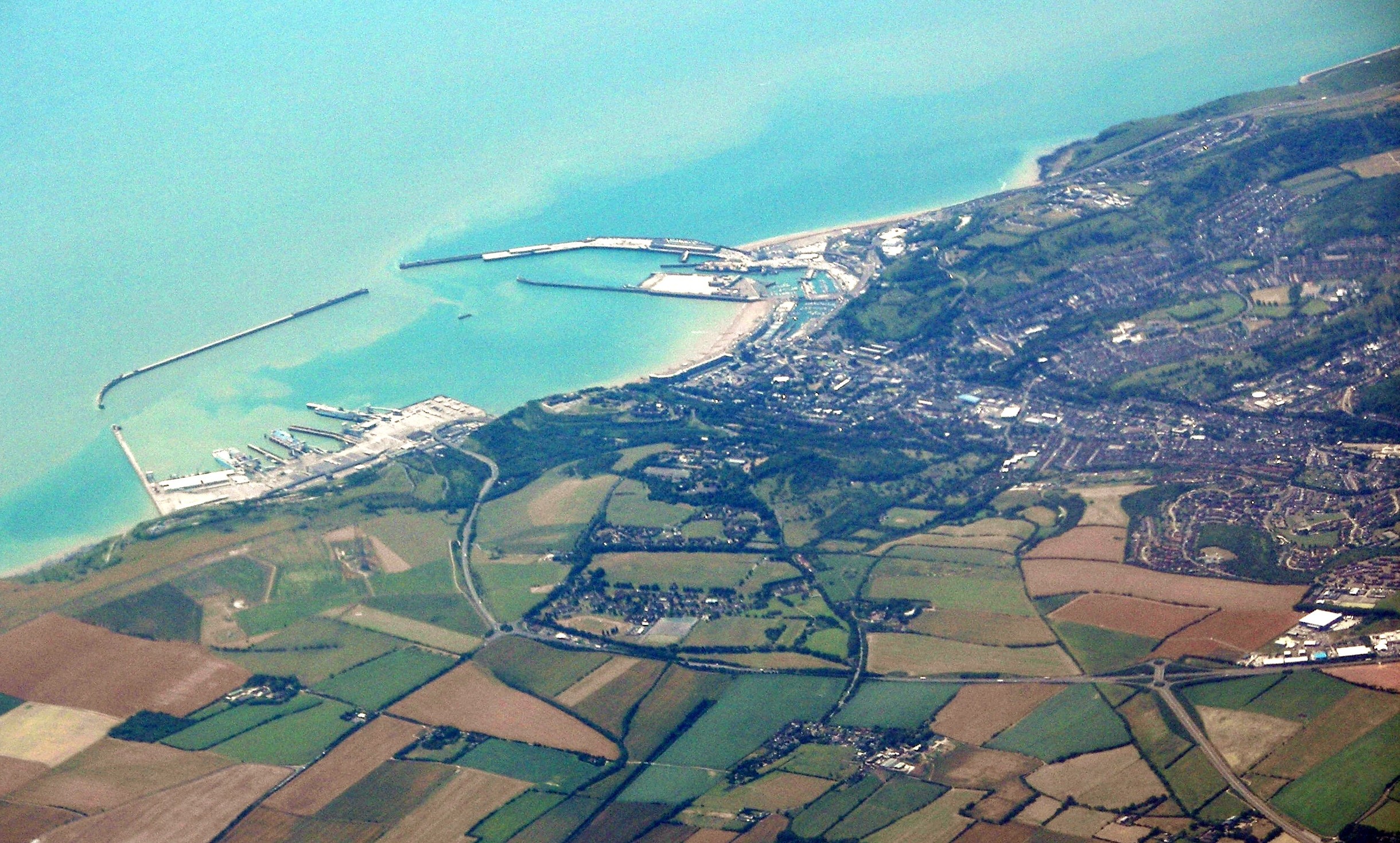
Dover is a historic town located in the county of Kent, in southeastern England. Situated on the English Channel, Dover is known for its iconic white cliffs, which have become a symbol of the country. The town has a population of around 31,000 people and is a significant port, serving as a gateway between England and continental Europe.
With a rich history dating back to Roman times, Dover is home to several historical landmarks. The most famous of these is Dover Castle, a medieval fortress that has stood proudly on the cliffs for over nine centuries. The castle offers stunning views of the town and the English Channel and attracts thousands of tourists each year.
Apart from its historical significance, Dover is also a bustling town with a variety of amenities and attractions. The town center is a vibrant hub of shops, restaurants, and entertainment venues, catering to both locals and visitors. The Dover Museum is a popular destination, showcasing the town's history and heritage.
As a major port, Dover has a thriving maritime industry. The Port of Dover is one of the busiest passenger ports in Europe, serving as a crucial link between the United Kingdom and mainland Europe. Ferries and cruise ships regularly transport passengers to and from destinations such as Calais, Dunkirk, and Boulogne.
In addition to its maritime connections, Dover is well-connected by road and rail. The town is a vital transport hub, with the A2 and A20 roads passing through, providing access to London and beyond. Dover Priory railway station offers regular services to London and other major cities.
Overall, Dover is a town steeped in history and natural beauty, offering a mix of cultural attractions and modern amenities. From its famous cliffs to its bustling port, it continues to be an important destination for visitors and a thriving community for its residents.
If you have any feedback on the listing, please let us know in the comments section below.
Dover Images
Images are sourced within 2km of 51.128138/1.3084269 or Grid Reference TR3141. Thanks to Geograph Open Source API. All images are credited.


Dover is located at Grid Ref: TR3141 (Lat: 51.128138, Lng: 1.3084269)
Administrative County: Kent
District: Dover
Police Authority: Kent
What 3 Words
///prefer.pint.uses. Near Dover, Kent
Related Wikis
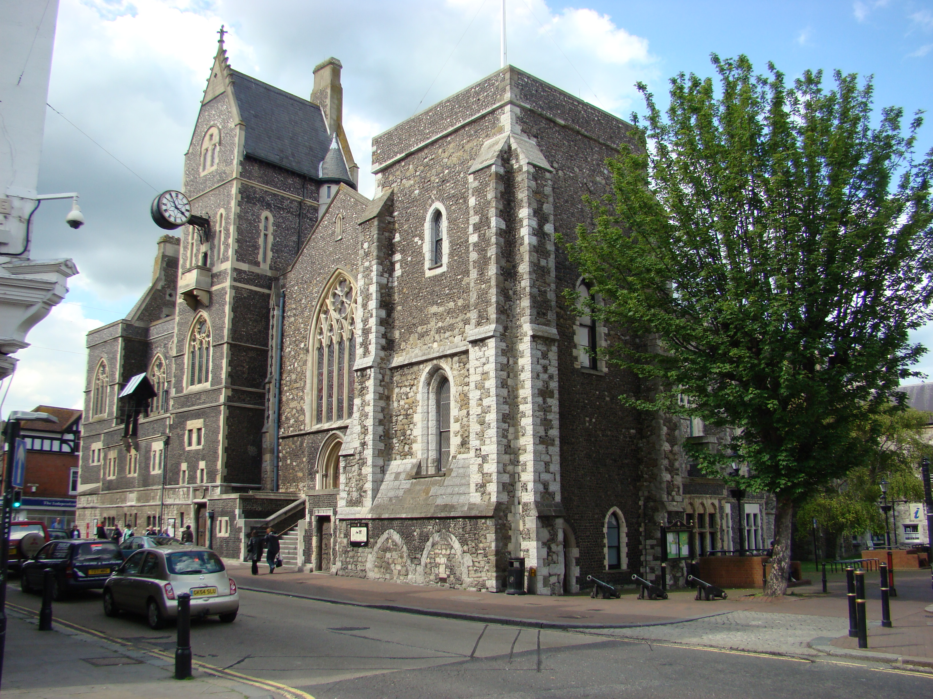
Maison Dieu, Dover
The Hospital of St Mary, Domus Dei, or Maison Dieu (Latin/Norman French – house of God), is a medieval building in Dover, England which forms the oldest...
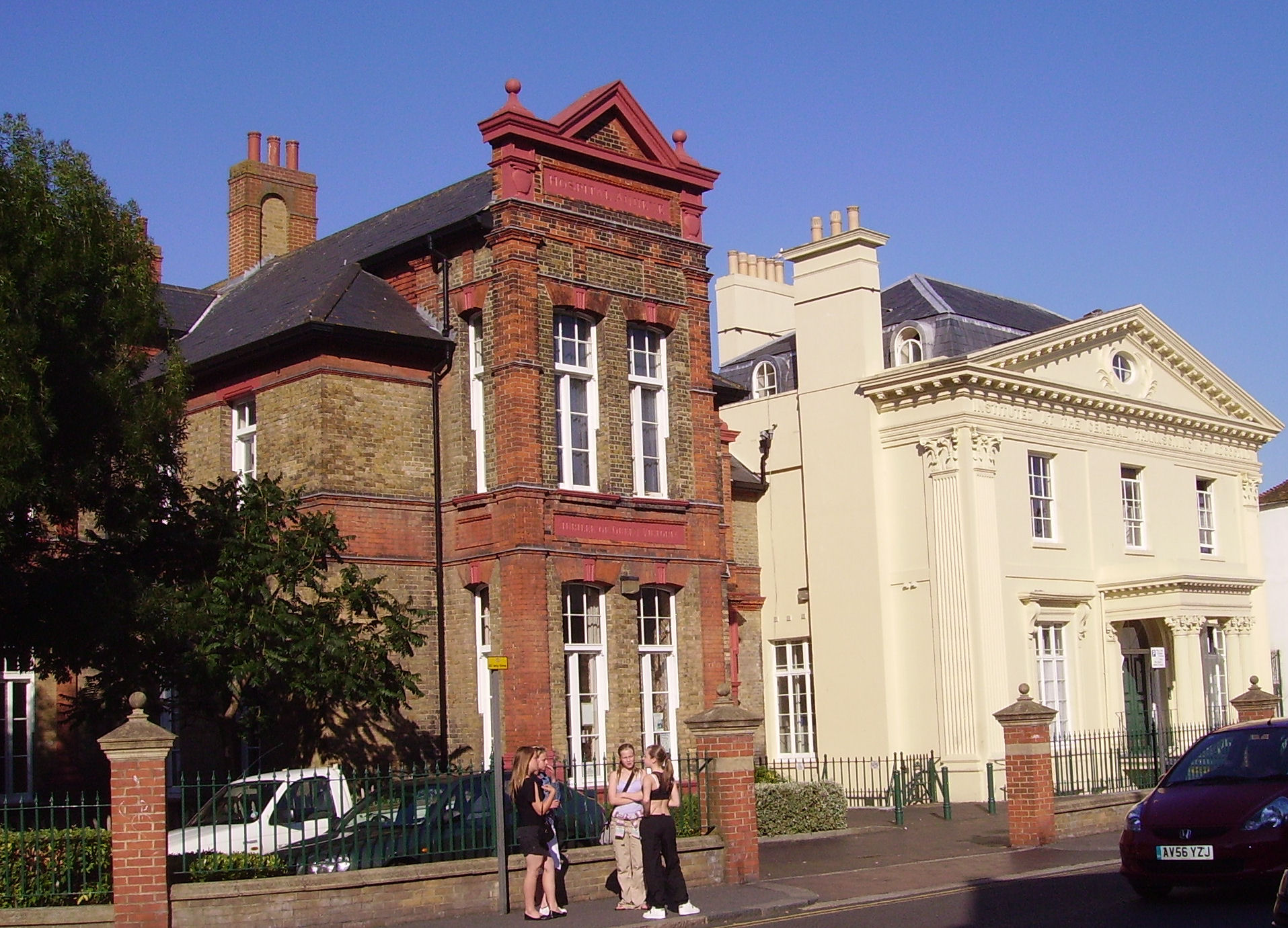
Royal Victoria Hospital, Dover
The Royal Victoria Hospital was a health facility in the High Street in Dover, Kent, England. The original hospital is a Grade II listed building. ��2...
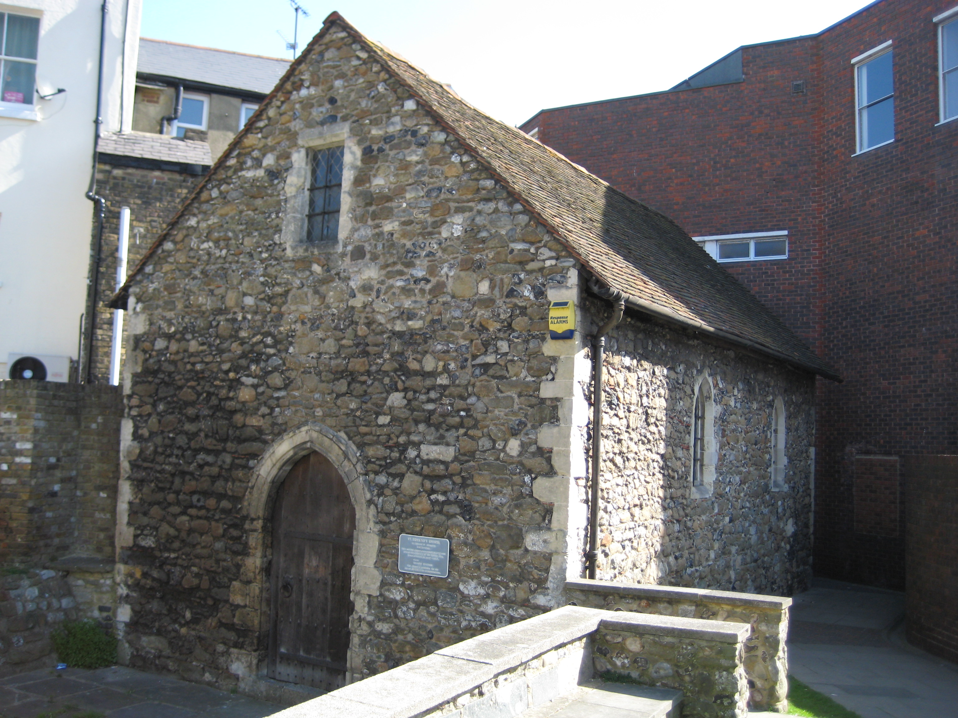
St Edmund's Chapel
St Edmund's Chapel is a church in Dover, England, dedicated to St Edmund. It was completed in 1262 as a wayside chapel or chapel of rest for the cemetery...
Dover
Dover ( DOH-vər) is a town and major ferry port in Kent, South East England. It faces France across the Strait of Dover, the narrowest part of the English...
Nearby Amenities
Located within 500m of 51.128138,1.3084269Have you been to Dover?
Leave your review of Dover below (or comments, questions and feedback).