Church End

Settlement in Bedfordshire

England

Church End

B5704 London Road at turning for Potsgrove The B5704 heads north towards Woburn.
B5704 London Road at turning for Potsgrove Credit: Robin Webster

Church End is a small village located in the county of Bedfordshire, England. Situated approximately 12 miles north of Bedford, it forms part of the civil parish of Northill. Despite its modest size, Church End possesses a rich history and a close-knit community.

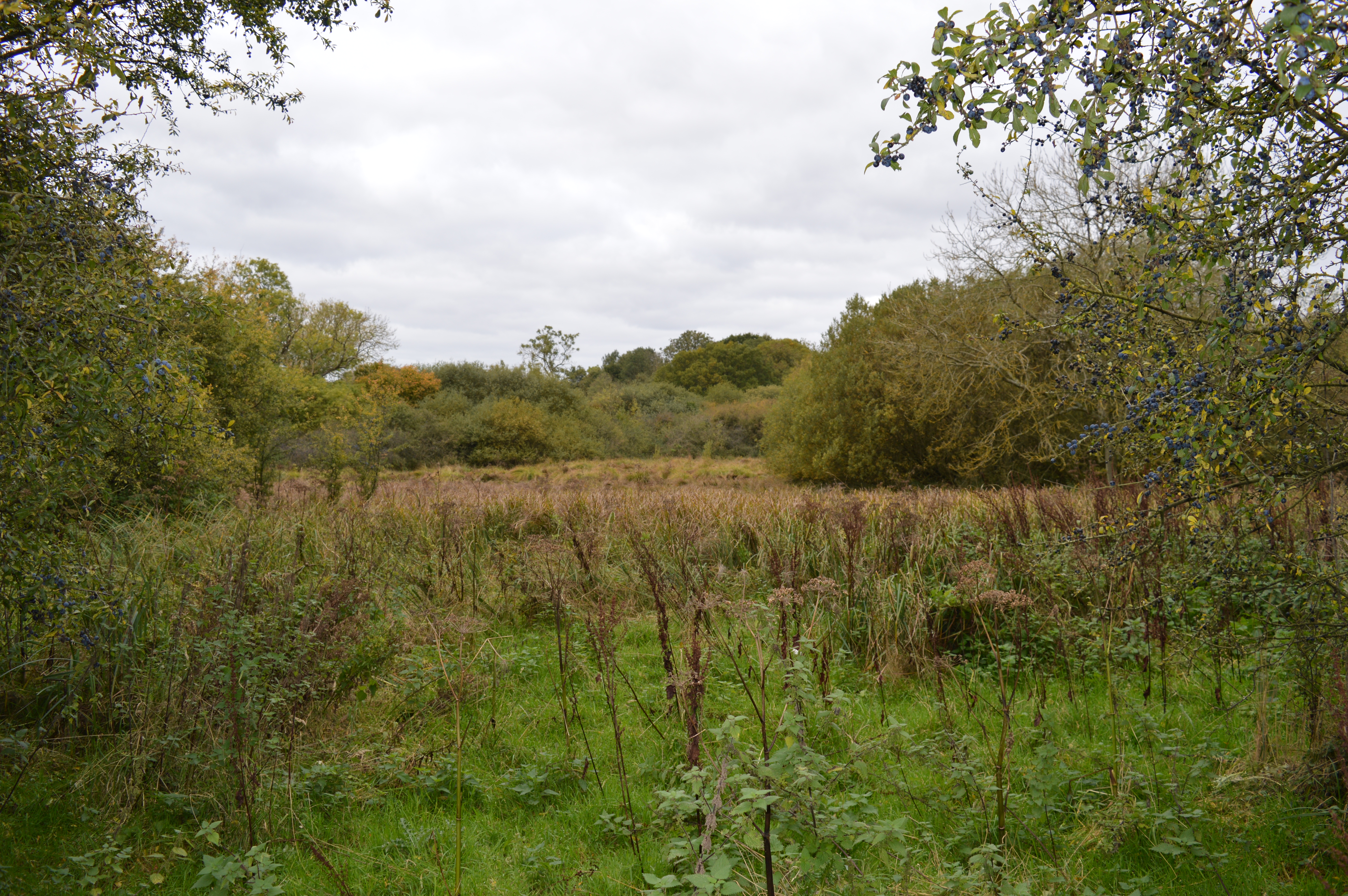
The village is renowned for its picturesque surroundings, boasting beautiful countryside views with rolling hills and lush green fields. It is often described as a tranquil and idyllic location, attracting visitors looking to escape the hustle and bustle of city life.

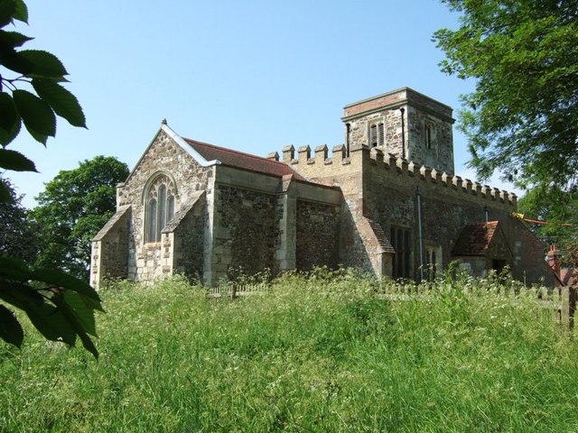
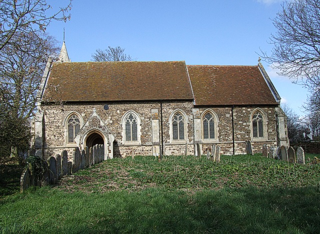
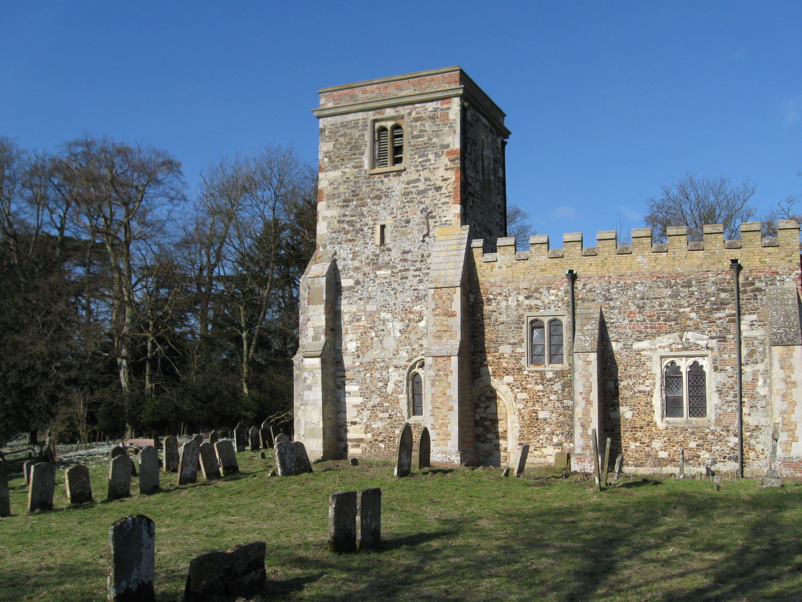
The heart of Church End is its historic church, St. Mary's, which dates back to the 12th century. This Norman church features stunning architecture and intricate stained glass windows, making it a significant landmark in the area. The church is still an active place of worship and holds regular services, adding to the village's sense of community and tradition.

Although Church End primarily consists of residential properties and farmland, there are a few amenities available to residents and visitors. These include a village hall, a primary school, and a pub, providing essential services and social gathering spaces.

In terms of transportation, Church End is well-connected to nearby towns and cities. The A1 road runs just east of the village, offering convenient access to major routes, and the nearest train station is located in nearby Sandy, providing regular connections to London and other parts of the country.

Overall, Church End, Bedfordshire is a charming and peaceful village, cherished for its natural beauty, historical significance, and close-knit community spirit.

If you have any feedback on the listing, please let us know in the comments section below.

Church End Images

Images are sourced within 2km of 51.967159/-0.5879244 or Grid Reference SP9730. Thanks to Geograph Open Source API. All images are credited.

B5704 London Road at turning for Potsgrove The B5704 heads north towards Woburn.
B5704 London Road at turning for Potsgrove
The B5704 heads north towards Woburn.
B5704 London Road towards Woburn
Chinese Dairy and Pond On the Woburn Abbey Estate, a folly dairy
Chinese Dairy and Pond
On the Woburn Abbey Estate, a folly dairy
Woburn Park - View to the Abbey Looking across a stretch of Woburn Park to the Abbey. Hidden in a dip is Basin Pond. Deer and wildfowl dot the intervening land.
Woburn Park - View to the Abbey
Looking across a stretch of Woburn Park to the Abbey. Hidden in a dip is Basin Pond. Deer and wildfowl dot the intervening land.
Farmland, Milton Bryan A footpath through wheat to the north-east of the village.
Farmland, Milton Bryan
A footpath through wheat to the north-east of the village.
Farmland, Toddington Oats to the north-west of Happy Land Farm.
Farmland, Toddington
Oats to the north-west of Happy Land Farm.
Farmland, Potsgrove A bridleway through oats climbs towards the B5704.
Farmland, Potsgrove
A bridleway through oats climbs towards the B5704.
Woburn Abbey and Estate
Milton Wood This view of Milton Wood was taken from the Eastern edge of Fourteen Acre Spinney on the road from Eversholt to Milton Bryan.
Milton Wood
This view of Milton Wood was taken from the Eastern edge of Fourteen Acre Spinney on the road from Eversholt to Milton Bryan.
St. Peter, Milton Bryan Rather an unusual church this one. It is almost square with parts of wildly different ages and construction style - and it has a tower made of such closely keened pale stone that it looks like concrete. It is set in a garden-like churchyard. Definitely a one-off. I originally accidentally added a T to Bryan making it Bryant - curiously I now discover that that is an alternative disused name for the village. More info here - <span class="nowrap"><a title="http://www.bedfordshire.gov.uk/communityandliving/archivesandrecordoffice/communityarchives/miltonbryan/miltonbryanchurch.aspx" rel="nofollow ugc noopener" href="http://www.bedfordshire.gov.uk/communityandliving/archivesandrecordoffice/communityarchives/miltonbryan/miltonbryanchurch.aspx">Link</a><img style="margin-left:2px;" alt="External link" title="External link - shift click to open in new window" src="https://s1.geograph.org.uk/img/external.png" width="10" height="10"/></span> and <span class="nowrap"><a title="http://www.british-history.ac.uk/report.asp?compid=42456" rel="nofollow ugc noopener" href="http://www.british-history.ac.uk/report.asp?compid=42456">Link</a><img style="margin-left:2px;" alt="External link" title="External link - shift click to open in new window" src="https://s1.geograph.org.uk/img/external.png" width="10" height="10"/></span>
St. Peter, Milton Bryan
Rather an unusual church this one. It is almost square with parts of wildly different ages and construction style - and it has a tower made of such closely keened pale stone that it looks like concrete. It is set in a garden-like churchyard. Definitely a one-off. I originally accidentally added a T to Bryan making it Bryant - curiously I now discover that that is an alternative disused name for the village. More info here - LinkExternal link and LinkExternal link
St. Peter's church, Milton Bryan - Western end A close up of the Western end of St. Peter's church, Milton Bryan showing some of the mix of architectural styles and periods. This is a very odd-looking church. More info. here <span class="nowrap"><a title="http://www.british-history.ac.uk/report.asp?compid=42456#s3" rel="nofollow ugc noopener" href="http://www.british-history.ac.uk/report.asp?compid=42456#s3">Link</a><img style="margin-left:2px;" alt="External link" title="External link - shift click to open in new window" src="https://s1.geograph.org.uk/img/external.png" width="10" height="10"/></span>
St. Peter's church, Milton Bryan - Western end
A close up of the Western end of St. Peter's church, Milton Bryan showing some of the mix of architectural styles and periods. This is a very odd-looking church. More info. here LinkExternal link
Ford Spinney Taken from the A4012 near Battlesden
Ford Spinney
Taken from the A4012 near Battlesden
St. Peter, Milton Bryan - The Tower Taken from near the gateway into this unusual church's churchyard.
St. Peter, Milton Bryan - The Tower
Taken from near the gateway into this unusual church's churchyard.
Fields near Battlesden Looking across fields to the church and manor at Battlesden (which are in the adjacent square, see <a href="https://www.geograph.org.uk/photo/183068">SP9529 : St Peter and All Saints, Battlesden</a>). I think the crop is wheat, but as it has not yet produced its ears I'm by no means certain.
Fields near Battlesden
Looking across fields to the church and manor at Battlesden (which are in the adjacent square, see SP9529 : St Peter and All Saints, Battlesden). I think the crop is wheat, but as it has not yet produced its ears I'm by no means certain.
Lane to Battlesden This is the lane to Battlesden having left the main A4012 and travelled a few hundred yards. There is a footpath off to the right (North) at this point which leads towards Milton Bryan.
Lane to Battlesden
This is the lane to Battlesden having left the main A4012 and travelled a few hundred yards. There is a footpath off to the right (North) at this point which leads towards Milton Bryan.
Milton Lodge Most of the lodgehouses around here are to the enormous Woburn Abbey estate, but this one near Milton Bryan is an exception. This lodge marks the start of Battlesden Avenue which leads (after about a mile) to Battlesden House next to Battlesden Church. There is some information about this manor house here <span class="nowrap"><a title="http://www.british-history.ac.uk/report.asp?compid=42445" rel="nofollow ugc noopener" href="http://www.british-history.ac.uk/report.asp?compid=42445">Link</a><img style="margin-left:2px;" alt="External link" title="External link - shift click to open in new window" src="https://s1.geograph.org.uk/img/external.png" width="10" height="10"/></span>
Milton Lodge
Most of the lodgehouses around here are to the enormous Woburn Abbey estate, but this one near Milton Bryan is an exception. This lodge marks the start of Battlesden Avenue which leads (after about a mile) to Battlesden House next to Battlesden Church. There is some information about this manor house here LinkExternal link
Milton Lodge near Milton Bryan A closer view of the lodge in <a href="https://www.geograph.org.uk/photo/183076">SP9630 : Milton Lodge</a>
Most of the lodgehouses around here are to the enormous Woburn Abbey estate, but this one near Milton Bryan is an exception. This lodge marks the start of Battlesden Avenue which leads (after about a mile) to Battlesden House next to Battlesden Church. There is some information about this manor house here <span class="nowrap"><a title="http://www.british-history.ac.uk/report.asp?compid=42445" rel="nofollow ugc noopener" href="http://www.british-history.ac.uk/report.asp?compid=42445">Link</a><img style="margin-left:2px;" alt="External link" title="External link - shift click to open in new window" src="https://s1.geograph.org.uk/img/external.png" width="10" height="10"/></span>
Milton Lodge near Milton Bryan
A closer view of the lodge in SP9630 : Milton Lodge Most of the lodgehouses around here are to the enormous Woburn Abbey estate, but this one near Milton Bryan is an exception. This lodge marks the start of Battlesden Avenue which leads (after about a mile) to Battlesden House next to Battlesden Church. There is some information about this manor house here LinkExternal link
Wheat Field near Milton Bryan A field of wheat looking ready for harvest. This field is to the south of Park Road which links Milton Bryan to Toddington. Just a few yards of the road cut the NE corner of the square, this field is to the southwest of that point.
Wheat Field near Milton Bryan
A field of wheat looking ready for harvest. This field is to the south of Park Road which links Milton Bryan to Toddington. Just a few yards of the road cut the NE corner of the square, this field is to the southwest of that point.
Show me another place!

Church End is located at Grid Ref: SP9730 (Lat: 51.967159, Lng: -0.5879244)

Unitary Authority: Central Bedfordshire

Police Authority: Bedfordshire

What 3 Words

///handy.relegate.ombudsman. Near Milton Bryan, Bedfordshire

Related Wikis

Church of St Peter, Milton Bryan

Church of St Peter is a Grade I listed church in Milton Bryan, Bedfordshire, England. It became a listed building on 23 January 1961. == History == St...

Milton Bryan

Milton Bryan is a village and civil parish located in Central Bedfordshire (the spelling Milton Bryant was previously common and is still recognised by...

Woburn Abbey

Woburn Abbey (), occupying the east of the village of Woburn, Bedfordshire, England, is a country house, the family seat of the Duke of Bedford. Although...

Church of St Peter & All Saints, Battlesden

Church of St Peter & All Saints is a Grade I listed church in Battlesden, Bedfordshire, England. It became a listed building on 23 January 1961. ��2...

Tebworth Marsh

Tebworth Marsh is a 5.6-hectare biological Site of Special Scientific Interest north of Tebworth in Bedfordshire. It was notified under Section 28 of the...

St Mary's Church, Potsgrove

St Mary's Church is a redundant Anglican church in the village of Potsgrove, Bedfordshire. England. It is recorded in the National Heritage List for England...

Battlesden

Battlesden is a hamlet and civil parish in the Central Bedfordshire district of Bedfordshire, England. It is just north of the A5, between Dunstable...

Froxfield, Bedfordshire

Froxfield is a small hamlet in Bedfordshire, England. == References == The geographic coordinates are from the Ordnance Survey.

Nearby Amenities

Located within 500m of 51.967159,-0.5879244
Milton Bryan
Place: village
Source: npe
Wikidata: Q1521738
Lat/Long: 51.9646586/-0.5873164
Post Box
Collection Times: Mo-Fr 16:00; Sa 08:45
Operator: Royal Mail
Post Box Type: wall
Ref: MK17 26
Royal Cypher: VR
Royal Cypher Wikidata: Q33102356
Source: survey
Lat/Long: 51.9668757/-0.5881756
Bench
Backrest: yes
Lat/Long: 51.9673415/-0.5884139
Barrier: kissing_gate
Bicycle: no
Foot: designated
Horse: no
Material: metal
Motor Vehicle: no
Lat/Long: 51.9636826/-0.5872934
The data included in this document is from www.openstreetmap.org. The data is made available under ODbL.

Have you been to Church End?

Leave your review of Church End below (or comments, questions and feedback).