Church End

Settlement in Bedfordshire

England

Church End

Leighton Buzzard: Clipstone Viewed looking north from the bridge over Clipstone Brook towards Clipstone.
Leighton Buzzard: Clipstone Credit: Nigel Cox

Church End is a small village located in the county of Bedfordshire, England. Situated approximately 3 miles to the west of the town of Bedford, it is a predominantly rural area surrounded by beautiful countryside. The village is known for its peaceful and idyllic setting, offering residents a tranquil and close-knit community.

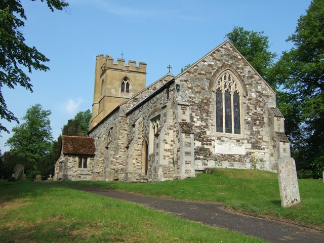
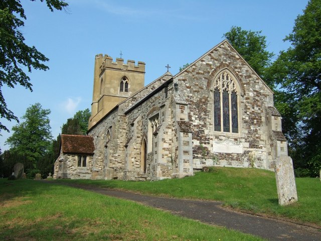
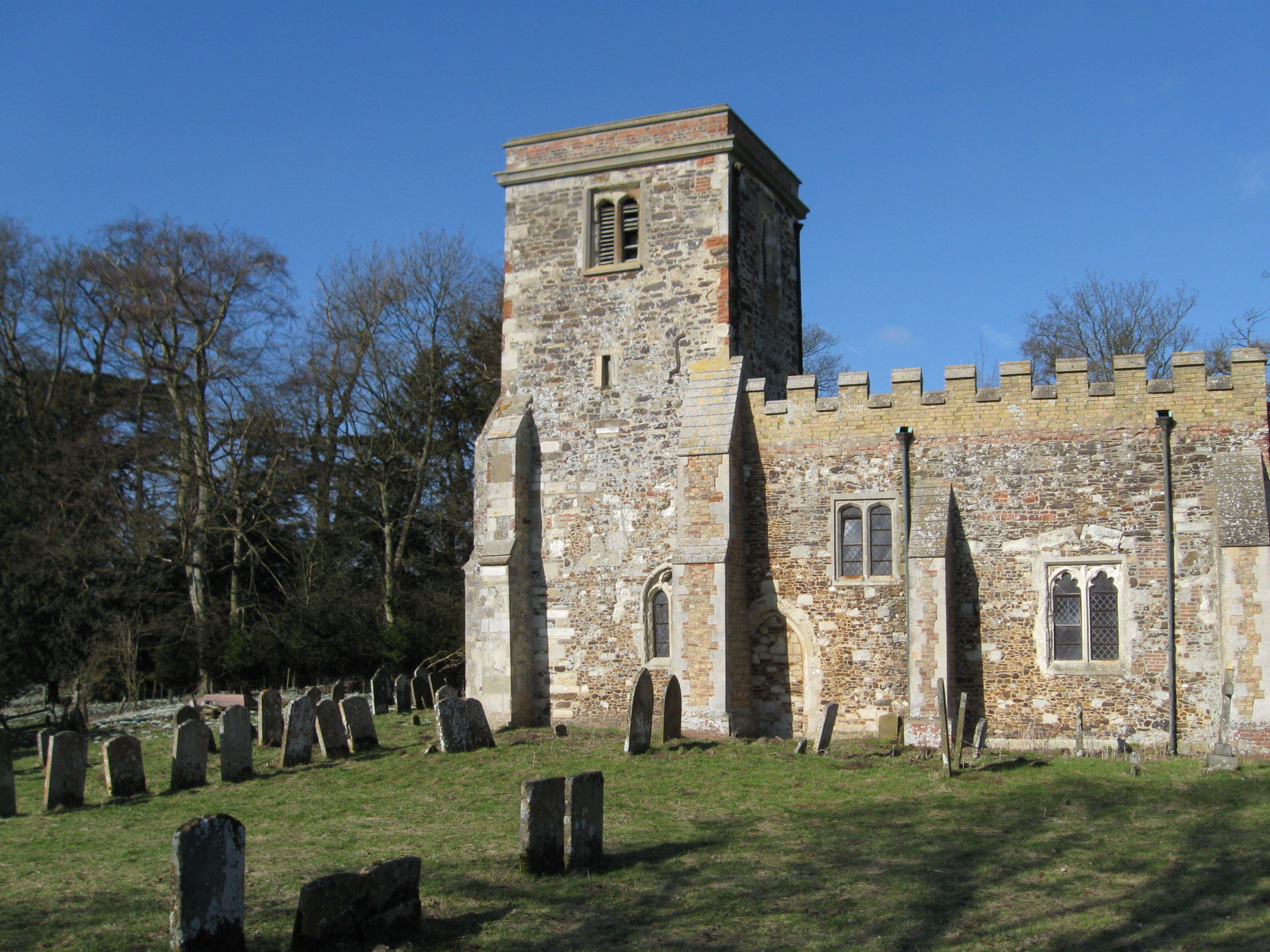
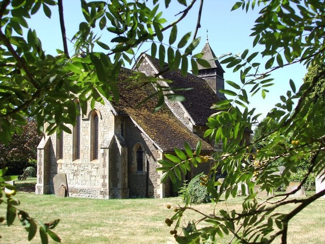
The heart of Church End is its historic church, St. Mary's Church, which dates back to the 12th century. This picturesque church is a prominent landmark in the village and adds to its charm and character. The churchyard is well-maintained and provides a peaceful place for reflection.

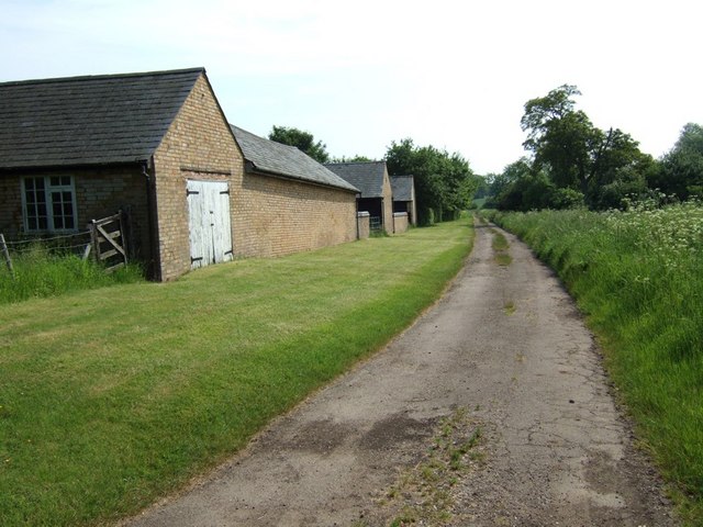
The village itself consists of a mix of traditional thatched cottages, Georgian houses, and more modern residences. The architecture in Church End reflects its rich history, with some buildings dating back several centuries. The village also boasts a well-preserved traditional pub, The Red Lion, which serves as a focal point for social gatherings and events.

Despite its small size, Church End offers a range of amenities for its residents. These include a primary school, a village hall, and a small convenience store. The village is well-connected to the nearby town of Bedford, with regular bus services and road links.

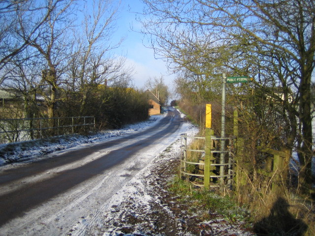
Church End's location in the Bedfordshire countryside provides ample opportunities for outdoor activities such as walking, cycling, and horse riding. The surrounding fields and woodlands offer stunning views and a chance to enjoy the natural beauty of the area.

Overall, Church End is a charming and peaceful village that offers residents a close-knit community, a rich history, and a beautiful natural environment.

If you have any feedback on the listing, please let us know in the comments section below.

Church End Images

Images are sourced within 2km of 51.932849/-0.59630338 or Grid Reference SP9626. Thanks to Geograph Open Source API. All images are credited.

Leighton Buzzard: Clipstone Viewed looking north from the bridge over Clipstone Brook towards Clipstone.
Leighton Buzzard: Clipstone
Viewed looking north from the bridge over Clipstone Brook towards Clipstone.
Hill Farm Sheep These sheep belong to Hill Farm which can be seen in the background. The lane abruptly ends just after this point with a private road continuing to the farm and a track leading to Battlesden.
Hill Farm Sheep
These sheep belong to Hill Farm which can be seen in the background. The lane abruptly ends just after this point with a private road continuing to the farm and a track leading to Battlesden.
Manor Avenue, Hockliffe Just short of the traffic lights where the A4012 staggers across the A5 Watling Street, this no-through-road leads to a few houses.
Manor Avenue, Hockliffe
Just short of the traffic lights where the A4012 staggers across the A5 Watling Street, this no-through-road leads to a few houses.
Lane to Hill Farm, Battlesden This lane leads off the Hockliffe Road near Watergate Lodge and goes to Hill Farm (see <a href="https://www.geograph.org.uk/photo/171948">SP9728 : Hill Farm Sheep</a>). As a track it continues to Battlesden.
Lane to Hill Farm, Battlesden
This lane leads off the Hockliffe Road near Watergate Lodge and goes to Hill Farm (see SP9728 : Hill Farm Sheep). As a track it continues to Battlesden.
St. Nicholas, Church End, Hockliffe Church End is a lovely quiet backwater of Hockliffe. Most of the village sprawls along the very busy A5 Watling Street, but this part of the village seems miles from hectic activity.
St. Nicholas, Church End, Hockliffe
Church End is a lovely quiet backwater of Hockliffe. Most of the village sprawls along the very busy A5 Watling Street, but this part of the village seems miles from hectic activity.
Hockliffe Grange Peeping over the trees which surround it, this is about the best view you can get of Hockliffe Grange, taken from the lane that approaches it from the church.
Hockliffe Grange
Peeping over the trees which surround it, this is about the best view you can get of Hockliffe Grange, taken from the lane that approaches it from the church.
Gates to Hockliffe Rectory Rather wonderfully overgrown gates and fencing to The Rectory, Church End, Hockliffe. This is almost opposite the church but in the adjacent square.
Gates to Hockliffe Rectory
Rather wonderfully overgrown gates and fencing to The Rectory, Church End, Hockliffe. This is almost opposite the church but in the adjacent square.
Ground Farm, Hockliffe The road from the church out to this farm gradually deteriorates until it becomes a muddy track with grass in the middle. It then improves a little just before you reach this farm. The area the farm is in is called "Hockliffe Grounds" hence the name of the farm.
Ground Farm, Hockliffe
The road from the church out to this farm gradually deteriorates until it becomes a muddy track with grass in the middle. It then improves a little just before you reach this farm. The area the farm is in is called "Hockliffe Grounds" hence the name of the farm.
Animal Farm Farm animals wander about and cluster round a tree in farmland leading up to Hill Farm near Hockliffe. There were also some wild Canada Geese nearby.
Animal Farm
Farm animals wander about and cluster round a tree in farmland leading up to Hill Farm near Hockliffe. There were also some wild Canada Geese nearby.
Centre Farm, Battlesden These buildings belong to Centre Farm in Battlesden. The track continues to Hill Farm (see <a href="https://www.geograph.org.uk/photo/171948">SP9728 : Hill Farm Sheep</a>) and according to my old 1:50000 is marked as a yellow (drivable) lane - but having seen the other end of it I think it would be a little cruel to an ordinary saloon car !
Centre Farm, Battlesden
These buildings belong to Centre Farm in Battlesden. The track continues to Hill Farm (see SP9728 : Hill Farm Sheep) and according to my old 1:50000 is marked as a yellow (drivable) lane - but having seen the other end of it I think it would be a little cruel to an ordinary saloon car !
Battlesden Taken at the hairpin (see map) in Battlesden where the main drivable lane doubles back to get to Battlesden church. In addition to this lane and the track next to <a href="https://www.geograph.org.uk/photo/183064">SP9628 : Centre Farm, Battlesden</a> there is a more direct footpath here to Hill Farm and a bridleway which heads towards Hockliffe. There are very few properties in this parish which is a very quiet little oasis. It has a church which I think means that it is a village, but there are many hamlets bigger than this !
Battlesden
Taken at the hairpin (see map) in Battlesden where the main drivable lane doubles back to get to Battlesden church. In addition to this lane and the track next to SP9628 : Centre Farm, Battlesden there is a more direct footpath here to Hill Farm and a bridleway which heads towards Hockliffe. There are very few properties in this parish which is a very quiet little oasis. It has a church which I think means that it is a village, but there are many hamlets bigger than this !
Church End, Hockliffe As it says on the sign. The eponymous church is <a href="https://www.geograph.org.uk/photo/182708">SP9626 : St. Nicholas, Church End, Hockliffe</a>
Church End, Hockliffe
As it says on the sign. The eponymous church is SP9626 : St. Nicholas, Church End, Hockliffe
Church Lane, Church End, Hockliffe This is the view back roughly southwards down Church Lane from near the lane junction at Church End. Note: The map shows this lane as Goose Green, but I'm pretty sure its street nameplate said Church Lane.
Church Lane, Church End, Hockliffe
This is the view back roughly southwards down Church Lane from near the lane junction at Church End. Note: The map shows this lane as Goose Green, but I'm pretty sure its street nameplate said Church Lane.
Steps & churchyard Steps illuminated with dappled light lead into the churchyard of <a href="https://www.geograph.org.uk/photo/182708">SP9626 : St. Nicholas, Church End, Hockliffe</a>
Steps & churchyard
Steps illuminated with dappled light lead into the churchyard of SP9626 : St. Nicholas, Church End, Hockliffe
Hockliffe Grounds Looking back down the track to Grounds Farm, Hockliffe. Just beyond this bend was a quite deep, very muddy puddle straddling the whole track.
Hockliffe Grounds
Looking back down the track to Grounds Farm, Hockliffe. Just beyond this bend was a quite deep, very muddy puddle straddling the whole track.
Hill Farm, Hockliffe Looking along the long straight track to the farm. This track is effectively a continuation of Woodcock Lane (also known as Little Lane).
Hill Farm, Hockliffe
Looking along the long straight track to the farm. This track is effectively a continuation of Woodcock Lane (also known as Little Lane).
Track to Grange Farm, Hockliffe This track leads to Grange Farm, Hockliffe. It strikes off at 90º from a 90º bend in the main lane, therefore effectively being a straight continuation of one limb of that lane.
Track to Grange Farm, Hockliffe
This track leads to Grange Farm, Hockliffe. It strikes off at 90º from a 90º bend in the main lane, therefore effectively being a straight continuation of one limb of that lane.
Battlesden - Looking South Looking south from the hairpin bend in Battlesden. This track services the two or three properties to the right. Footpaths/Bridleways lead off to the South and South-East.
Battlesden - Looking South
Looking south from the hairpin bend in Battlesden. This track services the two or three properties to the right. Footpaths/Bridleways lead off to the South and South-East.
Show me another place!

Church End is located at Grid Ref: SP9626 (Lat: 51.932849, Lng: -0.59630338)

Unitary Authority: Central Bedfordshire

Police Authority: Bedfordshire

What 3 Words

///brambles.staked.catch. Near Hockliffe, Bedfordshire

Related Wikis

Hockliffe

Hockliffe is a village and civil parish in Bedfordshire on the crossroads of the A5 road which lies upon the course of the Roman road known as Watling...

Battlesden

Battlesden is a hamlet and civil parish in the Central Bedfordshire district of Bedfordshire, England. It is just north of the A5, between Dunstable...

Clipstone, Bedfordshire

Clipstone is a small hamlet in Bedfordshire, England. It lies within the parish of Eggington that borders with Leighton Buzzard, Heath and Reach and Hockliffe...

Eggington

Egginton – or Eggington as it is now known – is a village and civil parish in the Central Bedfordshire district of Bedfordshire, England, about three miles...

Nearby Amenities

Located within 500m of 51.932849,-0.59630338
Turning Circle
Turning Circle: hammer
Lat/Long: 51.9349455/-0.5926596
Post Box
Brand: Royal Mail
Brand Wikidata: Q638098
Brand Wikipedia: en:Royal Mail
Collection Times: Mo-Fr 16:45; Sa 09:00
Operator: Royal Mail
Operator Wikidata: Q638098
Ref: LU7 21
Source: survey
Lat/Long: 51.9333177/-0.5955557
Place: farm
Lat/Long: 51.9289757/-0.5968909
Speed Camera
Enforcement: average_speed
Maxspeed: 30 mph
Lat/Long: 51.9338053/-0.5905556
The data included in this document is from www.openstreetmap.org. The data is made available under ODbL.

Have you been to Church End?

Leave your review of Church End below (or comments, questions and feedback).