Cuckoopit Spinney

Wood, Forest in Bedfordshire

England

Cuckoopit Spinney

B5704 London Road towards Woburn
B5704 London Road towards Woburn Credit: Robin Webster

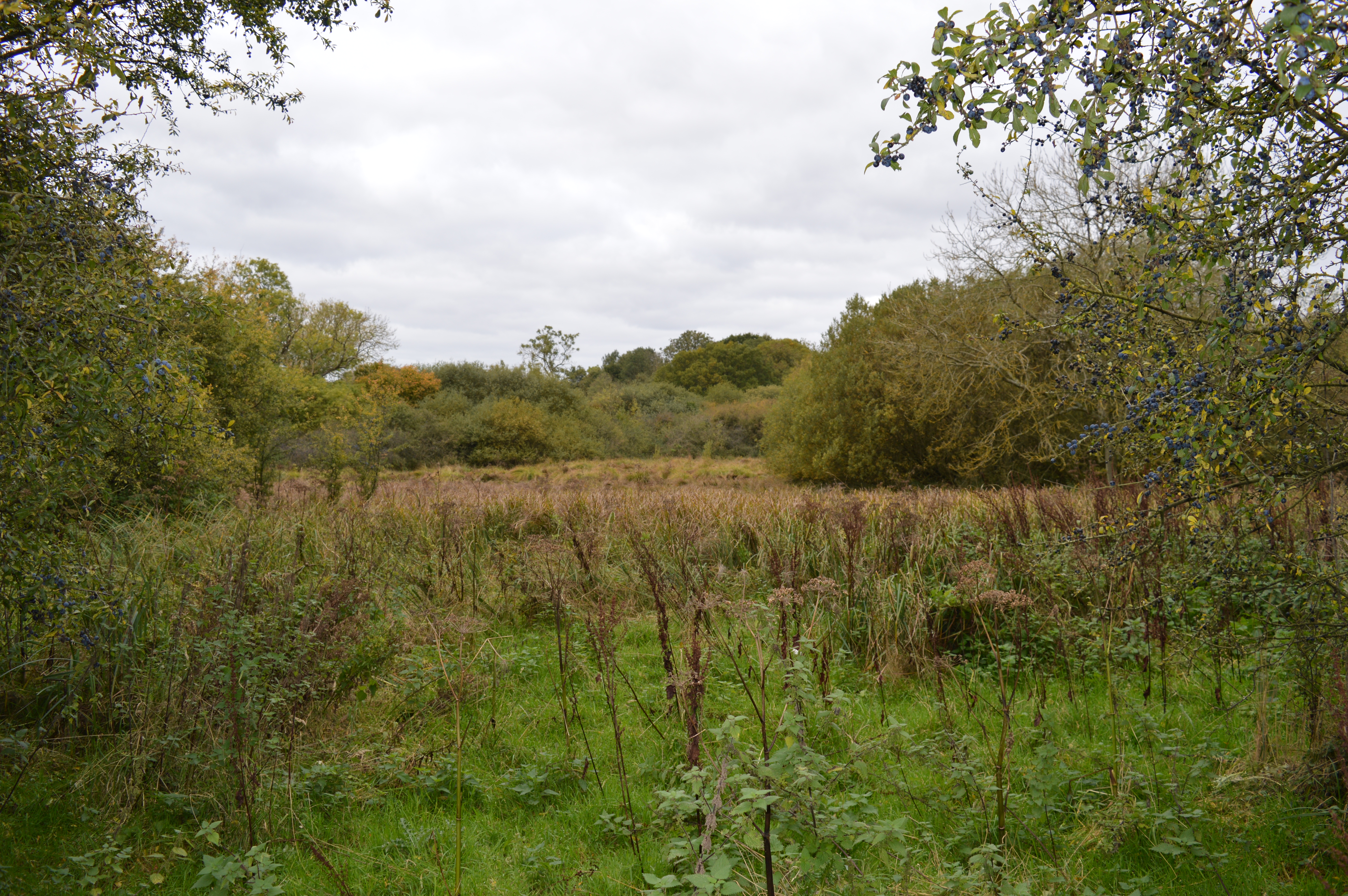
Cuckoopit Spinney is a small woodland located in Bedfordshire, England. It covers an area of approximately 10 acres and is known for its rich biodiversity and natural beauty. The spinney is situated on a gentle slope, with a mix of deciduous and coniferous trees providing a varied and dense canopy. The dominant tree species include oak, beech, and pine, which create a diverse habitat for a wide range of flora and fauna.

The forest floor is covered with a thick layer of leaf litter, providing a natural compost and supporting the growth of various wildflowers, ferns, and mosses. Bluebells, primroses, and wood anemones are common springtime species that add vibrant colors to the woodland.

The spinney is home to a variety of birds, including woodpeckers, nuthatches, and thrushes, which can often be heard and spotted among the trees. Mammals such as foxes, badgers, and squirrels also inhabit the area, making it an ideal spot for wildlife enthusiasts and photographers.

Cuckoopit Spinney is a popular destination for nature lovers and walkers, who can explore the network of paths that wind through the woodland. The tranquil atmosphere and secluded setting make it an excellent place for relaxation and contemplation.

Efforts have been made to preserve the natural integrity of Cuckoopit Spinney, with regular maintenance and conservation initiatives being carried out to protect its unique ecosystem. Overall, Cuckoopit Spinney offers a peaceful retreat for visitors to immerse themselves in the beauty of nature and enjoy the sights and sounds of a typical English woodland.

If you have any feedback on the listing, please let us know in the comments section below.

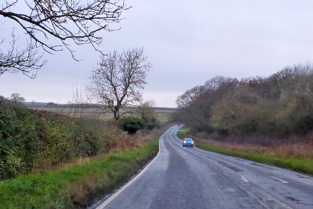
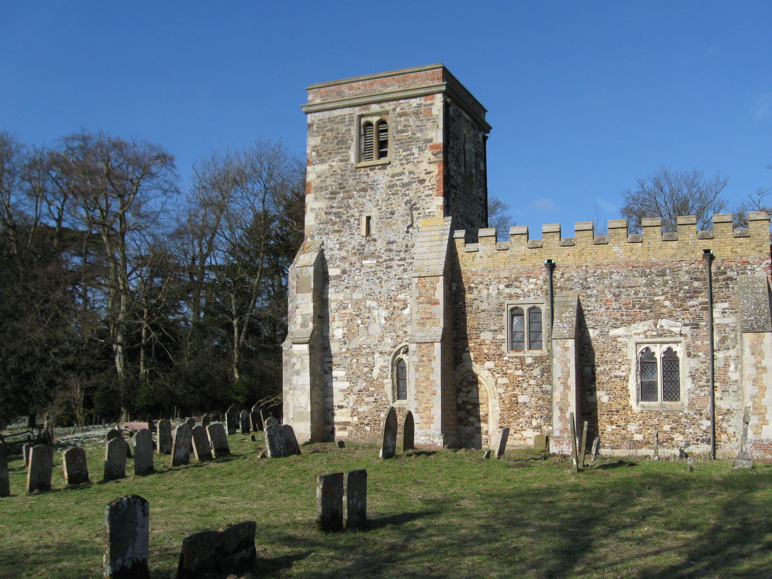
Cuckoopit Spinney Images

Images are sourced within 2km of 51.96633/-0.57811041 or Grid Reference SP9730. Thanks to Geograph Open Source API. All images are credited.

B5704 London Road towards Woburn
Farmland, Milton Bryan A footpath through wheat to the north-east of the village.
Farmland, Milton Bryan
A footpath through wheat to the north-east of the village.
Farmland, Toddington Oats to the north-west of Happy Land Farm.
Farmland, Toddington
Oats to the north-west of Happy Land Farm.
St. John the Baptist, Eversholt One of the many chocolate-brown churches in this part of Bedfordshire. The blue shape in the foreground is not an apparition of the Holy Grail, but more prosaically lens glare !
More information about Eversholt and its church here <span class="nowrap"><a title="http://www.british-history.ac.uk/report.asp?compid=42449" rel="nofollow ugc noopener" href="http://www.british-history.ac.uk/report.asp?compid=42449">Link</a><img style="margin-left:2px;" alt="External link" title="External link - shift click to open in new window" src="https://s1.geograph.org.uk/img/external.png" width="10" height="10"/></span>
St. John the Baptist, Eversholt
One of the many chocolate-brown churches in this part of Bedfordshire. The blue shape in the foreground is not an apparition of the Holy Grail, but more prosaically lens glare ! More information about Eversholt and its church here LinkExternal link
St John the Baptist - Tower & Porch Eversholt is quite a straggly village, the church here is (unsurprisingly) at Church End but near to Brook End. Another part of the village is called Witts End - which I've been at many times! 
More information about Eversholt and its church here <span class="nowrap"><a title="http://www.british-history.ac.uk/report.asp?compid=42449" rel="nofollow ugc noopener" href="http://www.british-history.ac.uk/report.asp?compid=42449">Link</a><img style="margin-left:2px;" alt="External link" title="External link - shift click to open in new window" src="https://s1.geograph.org.uk/img/external.png" width="10" height="10"/></span>
St John the Baptist - Tower & Porch
Eversholt is quite a straggly village, the church here is (unsurprisingly) at Church End but near to Brook End. Another part of the village is called Witts End - which I've been at many times! More information about Eversholt and its church here LinkExternal link
The Green Man, Eversholt A solid looking pub directly opposite the church in Eversholt. Apparently it dates from 1835 
Own website - <span class="nowrap"><a title="http://www.greenmaneversholt.com/Home.html" rel="nofollow ugc noopener" href="http://www.greenmaneversholt.com/Home.html">Link</a><img style="margin-left:2px;" alt="External link" title="External link - shift click to open in new window" src="https://s1.geograph.org.uk/img/external.png" width="10" height="10"/></span>
The Green Man, Eversholt
A solid looking pub directly opposite the church in Eversholt. Apparently it dates from 1835 Own website - LinkExternal link
Milton Wood This view of Milton Wood was taken from the Eastern edge of Fourteen Acre Spinney on the road from Eversholt to Milton Bryan.
Milton Wood
This view of Milton Wood was taken from the Eastern edge of Fourteen Acre Spinney on the road from Eversholt to Milton Bryan.
St. Peter, Milton Bryan Rather an unusual church this one. It is almost square with parts of wildly different ages and construction style - and it has a tower made of such closely keened pale stone that it looks like concrete. It is set in a garden-like churchyard. Definitely a one-off. I originally accidentally added a T to Bryan making it Bryant - curiously I now discover that that is an alternative disused name for the village. More info here - <span class="nowrap"><a title="http://www.bedfordshire.gov.uk/communityandliving/archivesandrecordoffice/communityarchives/miltonbryan/miltonbryanchurch.aspx" rel="nofollow ugc noopener" href="http://www.bedfordshire.gov.uk/communityandliving/archivesandrecordoffice/communityarchives/miltonbryan/miltonbryanchurch.aspx">Link</a><img style="margin-left:2px;" alt="External link" title="External link - shift click to open in new window" src="https://s1.geograph.org.uk/img/external.png" width="10" height="10"/></span> and <span class="nowrap"><a title="http://www.british-history.ac.uk/report.asp?compid=42456" rel="nofollow ugc noopener" href="http://www.british-history.ac.uk/report.asp?compid=42456">Link</a><img style="margin-left:2px;" alt="External link" title="External link - shift click to open in new window" src="https://s1.geograph.org.uk/img/external.png" width="10" height="10"/></span>
St. Peter, Milton Bryan
Rather an unusual church this one. It is almost square with parts of wildly different ages and construction style - and it has a tower made of such closely keened pale stone that it looks like concrete. It is set in a garden-like churchyard. Definitely a one-off. I originally accidentally added a T to Bryan making it Bryant - curiously I now discover that that is an alternative disused name for the village. More info here - LinkExternal link and LinkExternal link
St. Peter's church, Milton Bryan - Western end A close up of the Western end of St. Peter's church, Milton Bryan showing some of the mix of architectural styles and periods. This is a very odd-looking church. More info. here <span class="nowrap"><a title="http://www.british-history.ac.uk/report.asp?compid=42456#s3" rel="nofollow ugc noopener" href="http://www.british-history.ac.uk/report.asp?compid=42456#s3">Link</a><img style="margin-left:2px;" alt="External link" title="External link - shift click to open in new window" src="https://s1.geograph.org.uk/img/external.png" width="10" height="10"/></span>
St. Peter's church, Milton Bryan - Western end
A close up of the Western end of St. Peter's church, Milton Bryan showing some of the mix of architectural styles and periods. This is a very odd-looking church. More info. here LinkExternal link
Ford Spinney Taken from the A4012 near Battlesden
Ford Spinney
Taken from the A4012 near Battlesden
War Memorial, Eversholt In the churchyard of St.John the Baptist, Eversholt is this quite unusual war memorial topped by an angel (St. Michael perhaps) rather than the more usual cross.
War Memorial, Eversholt
In the churchyard of St.John the Baptist, Eversholt is this quite unusual war memorial topped by an angel (St. Michael perhaps) rather than the more usual cross.
View towards Tyrell's End Taken next to St. John the Baptist's church in Eversholt looking down the lane towards Tyrell's End.
View towards Tyrell's End
Taken next to St. John the Baptist's church in Eversholt looking down the lane towards Tyrell's End.
St. Peter, Milton Bryan - The Tower Taken from near the gateway into this unusual church's churchyard.
St. Peter, Milton Bryan - The Tower
Taken from near the gateway into this unusual church's churchyard.
Lane to Battlesden This is the lane to Battlesden having left the main A4012 and travelled a few hundred yards. There is a footpath off to the right (North) at this point which leads towards Milton Bryan.
Lane to Battlesden
This is the lane to Battlesden having left the main A4012 and travelled a few hundred yards. There is a footpath off to the right (North) at this point which leads towards Milton Bryan.
Milton Lodge Most of the lodgehouses around here are to the enormous Woburn Abbey estate, but this one near Milton Bryan is an exception. This lodge marks the start of Battlesden Avenue which leads (after about a mile) to Battlesden House next to Battlesden Church. There is some information about this manor house here <span class="nowrap"><a title="http://www.british-history.ac.uk/report.asp?compid=42445" rel="nofollow ugc noopener" href="http://www.british-history.ac.uk/report.asp?compid=42445">Link</a><img style="margin-left:2px;" alt="External link" title="External link - shift click to open in new window" src="https://s1.geograph.org.uk/img/external.png" width="10" height="10"/></span>
Milton Lodge
Most of the lodgehouses around here are to the enormous Woburn Abbey estate, but this one near Milton Bryan is an exception. This lodge marks the start of Battlesden Avenue which leads (after about a mile) to Battlesden House next to Battlesden Church. There is some information about this manor house here LinkExternal link
Milton Lodge near Milton Bryan A closer view of the lodge in <a href="https://www.geograph.org.uk/photo/183076">SP9630 : Milton Lodge</a>
Most of the lodgehouses around here are to the enormous Woburn Abbey estate, but this one near Milton Bryan is an exception. This lodge marks the start of Battlesden Avenue which leads (after about a mile) to Battlesden House next to Battlesden Church. There is some information about this manor house here <span class="nowrap"><a title="http://www.british-history.ac.uk/report.asp?compid=42445" rel="nofollow ugc noopener" href="http://www.british-history.ac.uk/report.asp?compid=42445">Link</a><img style="margin-left:2px;" alt="External link" title="External link - shift click to open in new window" src="https://s1.geograph.org.uk/img/external.png" width="10" height="10"/></span>
Milton Lodge near Milton Bryan
A closer view of the lodge in SP9630 : Milton Lodge Most of the lodgehouses around here are to the enormous Woburn Abbey estate, but this one near Milton Bryan is an exception. This lodge marks the start of Battlesden Avenue which leads (after about a mile) to Battlesden House next to Battlesden Church. There is some information about this manor house here LinkExternal link
Eversholt Millennium Pond "This pond was created by Eversholt 2000 and the people of Eversholt to mark the millennium. It was opened June 3rd 2002 by the Marquess and Marchioness of Tavistock" - so says the plaque on the gate.
A very tranquil and beautiful spot - and a very good way to mark the millennium, providing a habitat for wildlife.
There is a close-up of the <a href="https://www.geograph.org.uk/photo/183085">SP9832 : Purple Iris</a> here.
Eversholt Millennium Pond
"This pond was created by Eversholt 2000 and the people of Eversholt to mark the millennium. It was opened June 3rd 2002 by the Marquess and Marchioness of Tavistock" - so says the plaque on the gate. A very tranquil and beautiful spot - and a very good way to mark the millennium, providing a habitat for wildlife. There is a close-up of the SP9832 : Purple Iris here.
Purple Iris A close up of the Purple Iris seen in <a href="https://www.geograph.org.uk/photo/183084">SP9832 : Eversholt Millennium Pond</a>
Purple Iris
A close up of the Purple Iris seen in SP9832 : Eversholt Millennium Pond
Show me another place!

Cuckoopit Spinney is located at Grid Ref: SP9730 (Lat: 51.96633, Lng: -0.57811041)

Unitary Authority: Central Bedfordshire

Police Authority: Bedfordshire

What 3 Words

///helps.obligated.hems. Near Milton Bryan, Bedfordshire

Related Wikis

Church of St Peter, Milton Bryan

Church of St Peter is a Grade I listed church in Milton Bryan, Bedfordshire, England. It became a listed building on 23 January 1961. == History == St...

Milton Bryan

Milton Bryan is a village and civil parish located in Central Bedfordshire (the spelling Milton Bryant was previously common and is still recognised by...

Tebworth Marsh

Tebworth Marsh is a 5.6-hectare biological Site of Special Scientific Interest north of Tebworth in Bedfordshire. It was notified under Section 28 of the...

Woburn Abbey

Woburn Abbey (), occupying the east of the village of Woburn, Bedfordshire, England, is a country house, the family seat of the Duke of Bedford. Although...

Battlesden

Battlesden is a hamlet and civil parish in the Central Bedfordshire district of Bedfordshire, England. It is just north of the A5, between Dunstable...

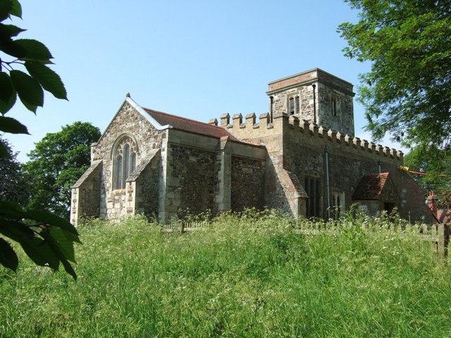
Church of St Peter & All Saints, Battlesden

Church of St Peter & All Saints is a Grade I listed church in Battlesden, Bedfordshire, England. It became a listed building on 23 January 1961. ��2...

Froxfield, Bedfordshire

Froxfield is a small hamlet in Bedfordshire, England. == References == The geographic coordinates are from the Ordnance Survey.

Toddington Manor, Bedfordshire

Toddington Manor is a Tudor country house in the English county of Bedfordshire, near the village of Toddington and is a Grade II listed building with...

Nearby Amenities

Located within 500m of 51.96633,-0.57811041
The data included in this document is from www.openstreetmap.org. The data is made available under ODbL.

Have you been to Cuckoopit Spinney?

Leave your review of Cuckoopit Spinney below (or comments, questions and feedback).