Bromesberrow Heath

Settlement in Gloucestershire Forest of Dean

England

Bromesberrow Heath

Wild daffodils by the M50 These Narcissus pseudonarcissus clothe the slopes surrounding the Highways Authority depot at Junction 2 of the M50.
Wild daffodils by the M50 Credit: Jonathan Billinger

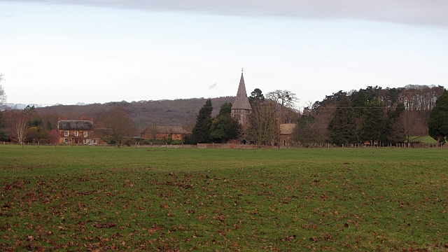
Bromesberrow Heath is a small rural village located in the county of Gloucestershire, England. Situated in the western part of the county, it lies approximately 9 miles southeast of Ledbury and 15 miles northwest of Gloucester. The village is nestled amidst the picturesque landscape of the rolling countryside, boasting scenic views and a tranquil atmosphere.

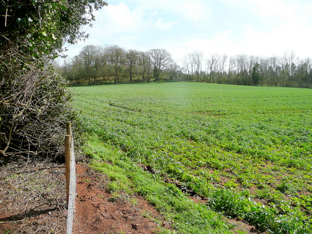
Bromesberrow Heath is known for its rich agricultural heritage, with vast stretches of farmland surrounding the village. The fertile soil and favorable climate make it an ideal location for farming, particularly sheep rearing and arable cultivation. The agriculture sector plays a significant role in the local economy, contributing to the village's sense of rural charm.

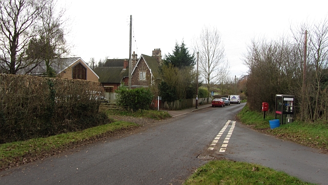
The village itself is small, with a close-knit community of residents. There are several traditional stone cottages and houses, giving the area a quaint and timeless feel. While it lacks many amenities, such as shops and schools, the village benefits from its proximity to nearby towns and villages, providing essential services and facilities.

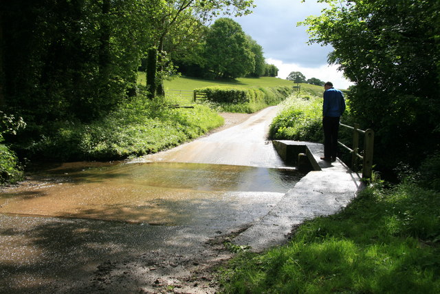
Bromesberrow Heath offers ample opportunities for outdoor activities and exploration. The surrounding countryside is crisscrossed with footpaths and bridleways, making it a haven for walkers, hikers, and horse riders. The area is also home to diverse wildlife, including various bird species, making it a popular spot for birdwatching enthusiasts.

Overall, Bromesberrow Heath is an idyllic village that embodies the charm and tranquility of rural Gloucestershire. With its beautiful landscapes, close community, and opportunities for outdoor pursuits, it offers a peaceful retreat from the hustle and bustle of urban life.

If you have any feedback on the listing, please let us know in the comments section below.

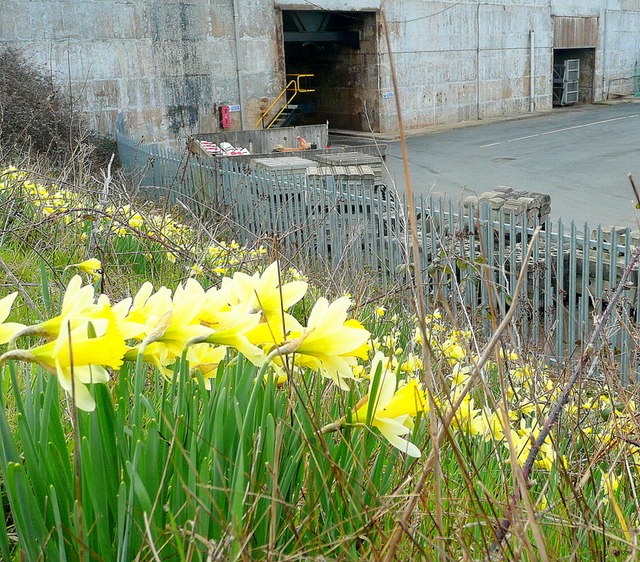
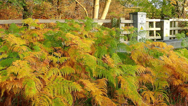
Bromesberrow Heath Images

Images are sourced within 2km of 51.99542/-2.387315 or Grid Reference SO7333. Thanks to Geograph Open Source API. All images are credited.

Wild daffodils by the M50 These Narcissus pseudonarcissus clothe the slopes surrounding the Highways Authority depot at Junction 2 of the M50.
Wild daffodils by the M50
These Narcissus pseudonarcissus clothe the slopes surrounding the Highways Authority depot at Junction 2 of the M50.
Bridleway to Ever Hill Coppice Deeply indented green lane popular with dog-walkers.
Bridleway to Ever Hill Coppice
Deeply indented green lane popular with dog-walkers.
Ryton Coppice View from the bridleway east of Ryton.
Ryton Coppice
View from the bridleway east of Ryton.
Wild daffodils by the M50 On this last day of March 2011, the flowers are starting to senesce.
Wild daffodils by the M50
On this last day of March 2011, the flowers are starting to senesce.
Ford on the minor road from Eastnor to Bromsberrow
Bracken by the M50 Whilst waiting in a traffic queue I noticed this little slice of autumn out of my passenger side window!
Bracken by the M50
Whilst waiting in a traffic queue I noticed this little slice of autumn out of my passenger side window!
A big grass field, Bromesberrow Looking towards the limestone hills at Ledbury, beyond Bromesberrow Court and church.
A big grass field, Bromesberrow
Looking towards the limestone hills at Ledbury, beyond Bromesberrow Court and church.
School, Bromesberrow Village primary school and telephone box seen from the green.
School, Bromesberrow
Village primary school and telephone box seen from the green.
Polytunnel hoops The frames for fruit tunnels are exposed during the winter.
Polytunnel hoops
The frames for fruit tunnels are exposed during the winter.
Ford near Clencher's Mill
Single track lane near Bromesberrow
Memorial to Marie Every spring this floral tribute by the M50 reminds me of the tragic and as yet (2012) unsolved murder of Marie Wilks in June 1988; see <span class="nowrap"><a title="http://www.bbc.co.uk/herefordandworcester/content/articles/2008/05/14/m50_marie_wilks_timeline_feature.shtml" rel="nofollow ugc noopener" href="http://www.bbc.co.uk/herefordandworcester/content/articles/2008/05/14/m50_marie_wilks_timeline_feature.shtml">Link</a><img style="margin-left:2px;" alt="External link" title="External link - shift click to open in new window" src="https://s1.geograph.org.uk/img/external.png" width="10" height="10"/></span>
Memorial to Marie
Every spring this floral tribute by the M50 reminds me of the tragic and as yet (2012) unsolved murder of Marie Wilks in June 1988; see LinkExternal link
Cows in Field near Smallends Farm
Oast at Smallends Farm Unconverted Oast House, with "Herefordshire style" cowl.
Oast at Smallends Farm
Unconverted Oast House, with "Herefordshire style" cowl.
Oast at Smallends Farm Single square kiln oast house. Unusually narrow kiln.
Oast at Smallends Farm
Single square kiln oast house. Unusually narrow kiln.
Lane Junction near Broom's Green
Haffield, Donnington A two-storey stuccoed villa with what is described as a Greek Doric portico but looks more like a loggia. By Robert Smirke, 1817-18, for William Gordon (the left-hand block is c1840). Grade II listed.
Haffield, Donnington
A two-storey stuccoed villa with what is described as a Greek Doric portico but looks more like a loggia. By Robert Smirke, 1817-18, for William Gordon (the left-hand block is c1840). Grade II listed.
Ford on the Glynch Brook at Pepper Mill This ford on the Glynch Brook is found just off  Clencher's Mill Lane leading out from Bromsberrow. The byway is not suitable for vehicles with a low ground clearance. There is a second ford on the border with Herefordshire further up the lane at:
<a title="https://www.geograph.org.uk/photo/753558" href="https://www.geograph.org.uk/photo/753558">Link</a>
Ford on the Glynch Brook at Pepper Mill
This ford on the Glynch Brook is found just off Clencher's Mill Lane leading out from Bromsberrow. The byway is not suitable for vehicles with a low ground clearance. There is a second ford on the border with Herefordshire further up the lane at: Link
Show me another place!

Bromesberrow Heath is located at Grid Ref: SO7333 (Lat: 51.99542, Lng: -2.387315)

Administrative County: Gloucestershire

District: Forest of Dean

Police Authority: Gloucestershire

What 3 Words

///gravitate.developer.aimed. Near Donnington, Herefordshire

Related Wikis

Three Counties (Gloucestershire, Herefordshire and Worcestershire)

The Three Counties of England are traditionally the three agrarian counties of Gloucestershire, Herefordshire and Worcestershire.Including towns and cities...

Bromsberrow

Bromsberrow (or Bromesberrow) is part of the Forest of Dean district. The village is close to the meeting point between Gloucestershire, Herefordshire...

Redmarley D'Abitot

Redmarley D'Abitot is a civil parish and village in the Forest of Dean district, Gloucestershire, South West England. In addition to the village of Redmarley...

Ketford Bank

Ketford Bank (grid reference SO723308) is a 0.69-hectare (1.7-acre) nature reserve in Gloucestershire.The site is owned and managed by the Gloucestershire...

Nearby Amenities

Located within 500m of 51.99542,-2.387315
Telephone
Defibrillator
Booth: K6
Covered: booth
Defibrillator Location: inside old red phone box, Bromesberrow Heath
Emergency: defibrillator
Man Made: telephone_box
Ref: CHT-13-928
Lat/Long: 51.9950386/-2.3900487
Bus Stop
Bromesberrow Heath Post Office
Naptan AtcoCode: 1600GL791
Naptan Bearing: W
Naptan CommonName: Bromesberrow Heath Post Office
Naptan Indicator: Opp
Naptan NaptanCode: gloamwpa
Naptan Street: Beech Ln
Naptan Verified: no
Source: naptan_import
Lat/Long: 51.9951309/-2.3898602
Bus Stop
Bromesberrow Heath Post Office
Naptan AtcoCode: 1600GL792
Naptan Bearing: E
Naptan CommonName: Bromesberrow Heath Post Office
Naptan NaptanCode: gloamwpt
Naptan Street: Beech Ln
Naptan Verified: no
Source: naptan_import
Lat/Long: 51.9952396/-2.3896281
Bus Stop
Sandfields
Naptan AtcoCode: 1600GLA36650
Naptan Bearing: SW
Naptan CommonName: Sandfields
Naptan NaptanCode: glogmgtg
Naptan Street: Sandfields
Naptan Verified: no
Source: naptan_import
Lat/Long: 51.994489/-2.3854706
Post Box
Collection Times: Mo-Fr 15:00; Sa 08:30
Description: Outside Bromsberrow Heath Post Office
Five roads meet here./Dyke House Lane / (unnamed roads)
Fixme: mass-upload; needs manual review
Post Box Type: lamp
Ref: HR8 647
Lat/Long: 51.995239/-2.390107
Phone
Check Date: 2022-01-08
Emergency: phone
Source: survey
Lat/Long: 51.9937428/-2.3856864
Phone
Check Date: 2022-01-08
Emergency: phone
Source: survey
Lat/Long: 51.9934976/-2.3856675
Power: pole
Lat/Long: 51.9964908/-2.3811479
Freedom Goat Farm
Power: pole
Transformer: distribution
Voltage Primary: 11000
Lat/Long: 51.9931768/-2.3883154
Power: pole
Lat/Long: 51.9936163/-2.39121
Post Office
Bromsberrow Heath Post Office
Addr Country: GB
Addr Postcode: HR8 1PG
Brand: Post Office
Brand Wikidata: Q1783168
Contact Website: https://www.postoffice.co.uk/branch-finder/2964716/bromsberrow-heath
Ref Pol Id: 129501
Lat/Long: 51.9934441/-2.3920399
Cafe
Addr City: Bromsberrow Heath
Addr Housename: Bromsberrow Heath Business Park
Addr Postcode: HR8 1PG
Outdoor Seating: yes
Phone: +44 1531 650744
Website: https://www.theshopatbromsberrow.co.uk
Lat/Long: 51.993411/-2.3920546
Power: pole
Lat/Long: 51.9932396/-2.3871835
Bromesberrow Heath West
Power: pole
Transformer: distribution
Voltage Primary: 11000
Lat/Long: 51.9949737/-2.3926619
Power: pole
Lat/Long: 51.9943734/-2.3928966
Power: pole
Lat/Long: 51.9937202/-2.3939453
Power: pole
Lat/Long: 51.993688/-2.3931158
Heath Farm
Power: pole
Transformer: distribution
Voltage Primary: 11000
Lat/Long: 51.9936455/-2.3922414
Power: pole
Lat/Long: 51.9934378/-2.3814281
Power: pole
Lat/Long: 51.9938325/-2.3824145
Power: pole
Lat/Long: 51.9935435/-2.383765
Power: pole
Lat/Long: 51.9934691/-2.3843953
Power: pole
Lat/Long: 51.9933841/-2.3852375
Bromesberrow Heath Council Houses
Power: pole
Transformer: distribution
Voltage Primary: 11000
Lat/Long: 51.9939768/-2.3856103
Power: pole
Lat/Long: 51.9932955/-2.3862551
Power: pole
Lat/Long: 51.9935377/-2.3892608
Bromesberrow Heath
Power: pole
Transformer: distribution
Voltage Primary: 11000
Lat/Long: 51.9935864/-2.3904745
Power: pole
Lat/Long: 51.9941632/-2.3829918
Power: pole
Lat/Long: 51.9936946/-2.3830254
Power: pole
Lat/Long: 51.9943961/-2.3829751
Power: pole
Lat/Long: 51.9946145/-2.3837093
Bromesberrow Heath East
Power: pole
Transformer: distribution
Voltage Primary: 11000
Lat/Long: 51.9950249/-2.38371
Power: pole
Lat/Long: 51.9954675/-2.3837838
Location Transition: yes
Power: pole
Lat/Long: 51.9961487/-2.382735
Bromsberrow Pumping Station
Power: transformer
Transformer: distribution
Voltage Primary: 11000
Lat/Long: 51.9967986/-2.3828839
Bromsberrow Heath North
Location Transition: yes
Power: pole
Transformer: distribution
Voltage Primary: 11000
Lat/Long: 51.9954584/-2.3875201
Location Transition: yes
Power: pole
Lat/Long: 51.9970187/-2.3848955
Power: pole
Lat/Long: 51.9972214/-2.3858484
Location Transition: yes
Power: pole
Lat/Long: 51.9974259/-2.3867845
Power: pole
Lat/Long: 51.9979183/-2.3876877
Grove House
Power: pole
Transformer: distribution
Voltage Primary: 11000
Lat/Long: 51.9983262/-2.3884247
Power: pole
Lat/Long: 51.9987448/-2.3891824
Power: pole
Lat/Long: 51.9992336/-2.3900621
The data included in this document is from www.openstreetmap.org. The data is made available under ODbL.

Have you been to Bromesberrow Heath?

Leave your review of Bromesberrow Heath below (or comments, questions and feedback).