Bitterne Manor

Settlement in Hampshire

England

Bitterne Manor

Travelodge Southampton On the A33, The Avenue, Southampton.
Travelodge Southampton Credit: Ian S

Bitterne Manor is a residential area located in the city of Southampton, Hampshire, England. Situated on the eastern bank of the River Itchen, it is approximately 3 miles northeast of Southampton city centre. Bitterne Manor is bordered by the neighborhoods of Bitterne, Thornhill, and Midanbury.

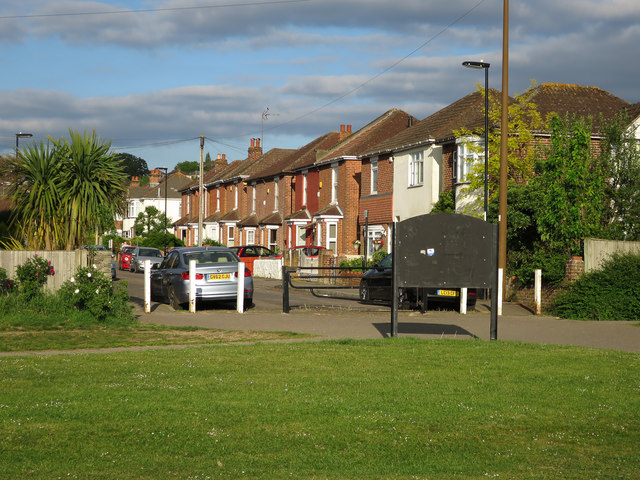
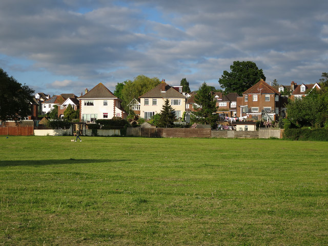
The area is predominantly residential, consisting of a mix of housing types including detached and semi-detached houses, terraced properties, and apartment buildings. Bitterne Manor is known for its quiet and leafy streets, making it an attractive place to live for families and professionals seeking a peaceful environment.

Bitterne Manor benefits from a range of amenities, including shopping facilities at Bitterne Village, which is within walking distance. The village offers a variety of shops, supermarkets, cafes, and restaurants, catering to the daily needs of residents. The area is also well-served by public transportation, with regular bus services connecting it to Southampton city centre and other surrounding areas.

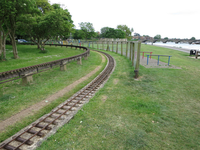
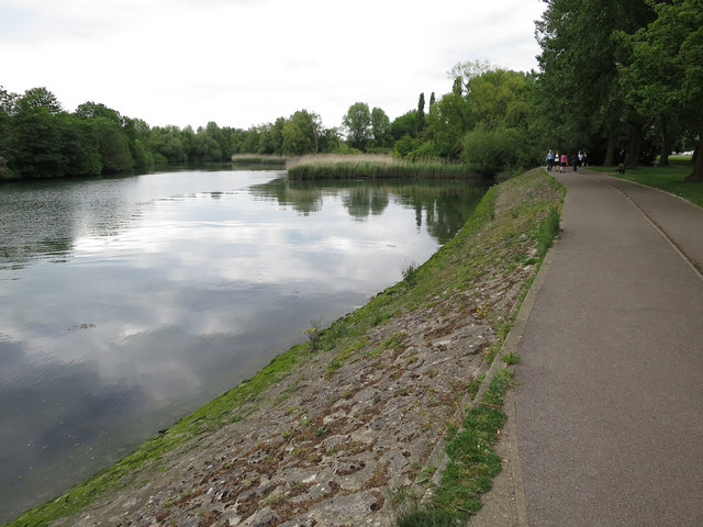
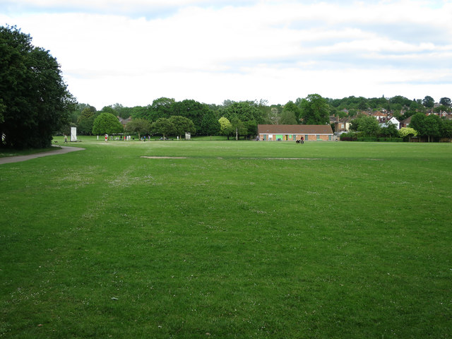
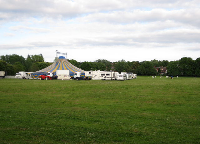
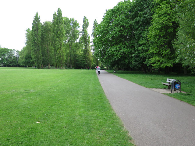
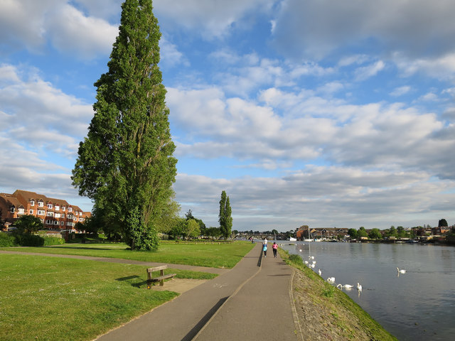
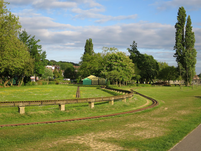
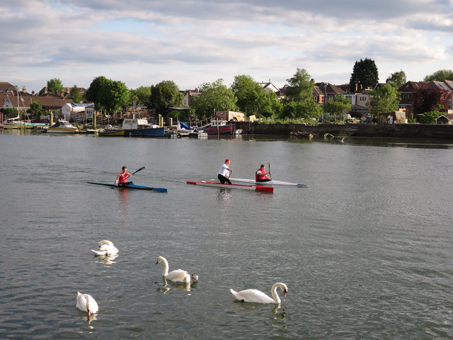
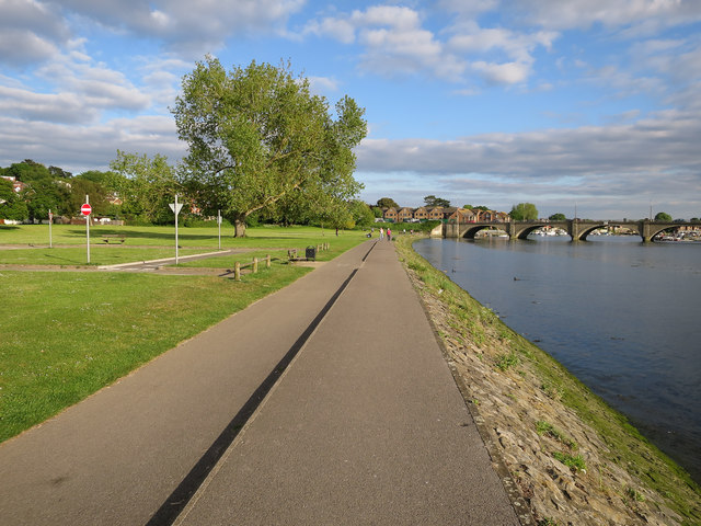
Bitterne Manor is surrounded by green spaces, with the nearby Itchen Valley Country Park providing opportunities for outdoor activities such as walking, cycling, and picnicking. The area is also close to the River Itchen, offering beautiful riverside walks and scenic views.

Overall, Bitterne Manor offers a peaceful and convenient residential location, combining suburban tranquility with easy access to amenities and natural landscapes.

If you have any feedback on the listing, please let us know in the comments section below.

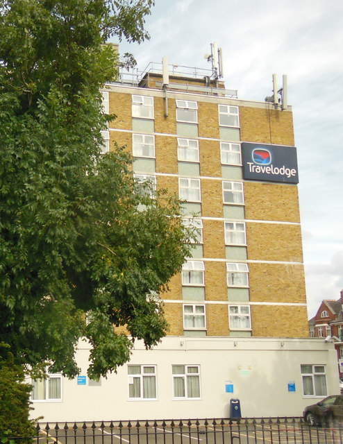
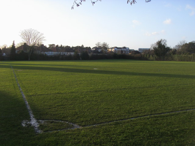
Bitterne Manor Images

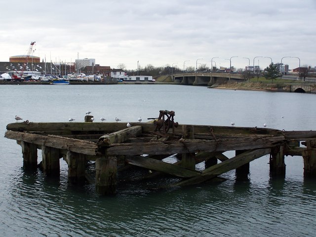
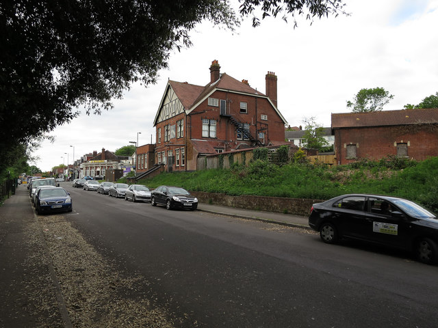
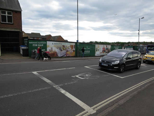
Images are sourced within 2km of 50.917216/-1.379417 or Grid Reference SU4313. Thanks to Geograph Open Source API. All images are credited.

Travelodge Southampton On the A33, The Avenue, Southampton.
Travelodge Southampton
On the A33, The Avenue, Southampton.
Bitterne Sports Ground Bitterne Sports Ground by Wynter Road
Bitterne Sports Ground
Bitterne Sports Ground by Wynter Road
Construction on site of Meridian Studios
Construction on the site of Meridian Studios
Decayed wooden structure in the River Itchen at Northam
Bitterne Park Hotel, Whitworth Crescent
Retirement Apartments for sale Not built yet, but for sale. See <a href="https://www.geograph.org.uk/photo/415173">SU4314 : Derelict building near Cobden Bridge, Southampton</a>.
Retirement Apartments for sale
Miniature railway, Bitterne Park
Path and cyclepath by the Itchen
Riverside Park Playing fields by the Itchen.
Riverside Park
Playing fields by the Itchen.
Circus in Riverside Park
Riverside Park
Riverside Park
Path by the Itchen
Path by the Itchen
River View Road By the Itchen.
River View Road
By the Itchen.
Miniature Railway by the Itchen
Canoeist and kayakers on the Itchen Impressive work in a racing canoe.
Canoeist and kayakers on the Itchen
Impressive work in a racing canoe.
Path by the Itchen Looking towards Cobden Bridge, past the cycle training road layout.
Path by the Itchen
Looking towards Cobden Bridge, past the cycle training road layout.
Bitterne Park
Bitterne Park
Show me another place!

Bitterne Manor is located at Grid Ref: SU4313 (Lat: 50.917216, Lng: -1.379417)

Unitary Authority: Southampton

Police Authority: Hampshire

What 3 Words

///claims.worked.rocket. Near Southampton, Hampshire

Nearby Locations

Bitterne Manor St Denys

Related Wikis

Bitterne railway station

Bitterne railway station is located in eastern Southampton, England. It is on the main Southampton to Portsmouth coastal line, and serves the suburbs of...

Bitterne Manor

Bitterne Manor is a suburb of Southampton surrounding the manor house of the same name. It is located on the eastern bank of the River Itchen, across Cobden...

Clausentum

Clausentum was a small town in the Roman province of Britannia. The site is believed to be located in Bitterne Manor, which is now a suburb of Southampton...

Northam Bridge

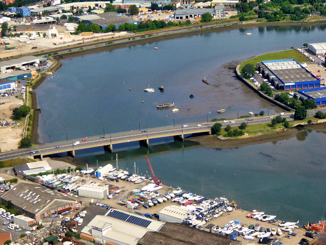
The Northam Bridge is a road bridge across the River Itchen in Southampton, England, linking the suburbs of Northam and Bitterne Manor. The current bridge...

Nearby Amenities

Located within 500m of 50.917216,-1.379417
Source: PGS
Lat/Long: 50.9127825/-1.3800694
Source: PGS
Lat/Long: 50.9133974/-1.3809736
Source: PGS
Lat/Long: 50.9211907/-1.3803848
Source: PGS
Lat/Long: 50.9211828/-1.3777574
Source: PGS
Lat/Long: 50.9205327/-1.3791
Source: PGS
Lat/Long: 50.9199945/-1.3810462
Source: PGS
Lat/Long: 50.9184753/-1.385298
Source: PGS
Lat/Long: 50.9185551/-1.3853453
Source: PGS
Lat/Long: 50.915884/-1.3860786
Source: PGS
Lat/Long: 50.9156152/-1.3853696
Source: PGS
Lat/Long: 50.9151569/-1.3790153
Source: PGS
Lat/Long: 50.9148198/-1.3776998
Traffic Signals
Traffic Signals: signal
Traffic Signals Direction: forward
Lat/Long: 50.9159599/-1.3849037
Princes Wharf
Place: locality
Lat/Long: 50.9132895/-1.3820266
Kemps Quay Marina
Leisure: marina
Seamark Harbour Category: marina
Seamark Type: harbour
Lat/Long: 50.9145617/-1.3778693
Bus Stop
Bus: yes
Public Transport: platform
Lat/Long: 50.9183328/-1.3738164
Bus Stop
Rampart Road
Bus: yes
Naptan AtcoCode: 1980HA120419
Naptan Bearing: E
Naptan CommonName: Rampart Road
Naptan NaptanCode: sohdptg
Naptan Street: Bitterne Road West
Naptan Verified: no
Public Transport: platform
Lat/Long: 50.9180991/-1.3791771
Traffic Signals
Traffic Signals: signal
Traffic Signals Direction: forward
Lat/Long: 50.9175081/-1.3751895
Post Box
Brand: Royal Mail
Brand Wikidata: Q638098
Brand Wikipedia: en:Royal Mail
Collection Plate: CP1D
Collection Times: Mo-Fr 09:00; Sa 07:00
Last Checked: 2021-03-24
Operator: Royal Mail
Operator Wikidata: Q638098
Post Box Type: pillar
Ref: SO18 127D
Royal Cypher: EIIR
Royal Cypher Wikidata: Q33102113
Source: Bing;local_knowledge
Lat/Long: 50.9176079/-1.3756393
Traffic Signals
Traffic Signals: signal
Traffic Signals Direction: forward
Lat/Long: 50.9176173/-1.3737198
Speed Camera
Direction: 50
Maxspeed: 30 mph
Lat/Long: 50.9156326/-1.3851174
Crossing
Crossing: unmarked
Crossing Markings: no
Tactile Paving: no
Lat/Long: 50.9180001/-1.3764858
Crossing
Button Operated: yes
Crossing: traffic_signals
Crossing Island: no
Crossing Markings: dots
Tactile Paving: yes
Lat/Long: 50.9159427/-1.3847171
Traffic Signals
Traffic Signals: signal
Traffic Signals Direction: forward
Lat/Long: 50.9181861/-1.3797001
Rampart Road
Bus: yes
Public Transport: stop_position
Lat/Long: 50.9179737/-1.3802363
Traffic Signals
Traffic Signals: signal
Traffic Signals Direction: forward
Lat/Long: 50.9161941/-1.3844656
Quayside Road
Bus: yes
Public Transport: stop_position
Lat/Long: 50.9167716/-1.3838663
Quayside Road
Bus: yes
Public Transport: stop_position
Lat/Long: 50.9173814/-1.3833781
Traffic Signals
Traffic Signals: signal
Traffic Signals Direction: forward
Lat/Long: 50.9177953/-1.3754274
Traffic Signals
Traffic Signals: signal
Traffic Signals Direction: backward
Lat/Long: 50.9178385/-1.3751579
Traffic Signals
Traffic Signals: signal
Traffic Signals Direction: forward
Lat/Long: 50.9177256/-1.3753608
Cobbett Road
Bus: yes
Public Transport: stop_position
Lat/Long: 50.917643/-1.3745979
Give Way
Direction: forward
Lat/Long: 50.9183844/-1.3747973
Car Wash
Lat/Long: 50.9179782/-1.3741826
Recycling
Name Signed: no
Opening Hours: 24/7
Recycling Batteries: no
Recycling Books: no
Recycling Cans: no
Recycling Cardboard: yes
Recycling Cartons: no
Recycling Clothes: yes
Recycling Electrical Appliances: no
Recycling Glass: no
Recycling Glass Bottles: yes
Recycling Green Waste: no
Recycling Magazines: yes
Recycling Newspaper: yes
Recycling Paper: yes
Recycling Paper Packaging: yes
Recycling Plastic: no
Recycling Plastic Bottles: no
Recycling Plastic Packaging: no
Recycling Scrap Metal: no
Recycling Small Appliances: no
Recycling Waste: no
Recycling Wood: no
Recycling Type: centre
Lat/Long: 50.9178298/-1.3755385
Post Box
Brand: Royal Mail
Brand Wikidata: Q638098
Brand Wikipedia: en:Royal Mail
Operator: Royal Mail
Operator Wikidata: Q638098
Lat/Long: 50.9171008/-1.3793699
Bench
Lat/Long: 50.918729/-1.3836386
Bench
Lat/Long: 50.9186647/-1.3838586
Traffic Signals
Traffic Signals: signal
Traffic Signals Direction: forward
Lat/Long: 50.9175954/-1.3749749
Leisure: slipway
Lat/Long: 50.9135652/-1.3831363
Premier
Addr City: Southampton
Addr Housenumber: 6
Addr Postcode: SO19 4DD
Addr Street: Athelstan Road
Brand: Premier
Brand Wikidata: Q7240340
Brand Wikipedia: en:Premier Stores
Shop: convenience
Website: https://www.premier-stores.co.uk/our-stores/bitterne-convenience-store
Lat/Long: 50.9173591/-1.3753098
Bus Stop
Quayside Road
Bench: yes
Bin: yes
Bus: yes
Lit: yes
Naptan AtcoCode: 1980HA120417
Naptan Bearing: SW
Naptan CommonName: Quayside Road
Naptan NaptanCode: sohdpam
Naptan Street: Bitterne Road
Naptan Verified: no
Public Transport: platform
Shelter: yes
Tactile Paving: no
Lat/Long: 50.91673/-1.3838174
Traffic Signals
Traffic Signals: signal
Traffic Signals Direction: forward
Lat/Long: 50.9174573/-1.3736919
Bus Stop
Quayside Road
Bench: yes
Bin: yes
Bus: yes
Naptan AtcoCode: 1980HA120416
Naptan Bearing: NE
Naptan CommonName: Quayside Road
Naptan NaptanCode: sohdpat
Naptan Street: Bitterne Road West
Naptan Verified: no
Public Transport: platform
Shelter: yes
Tactile Paving: no
Lat/Long: 50.9174459/-1.3834154
Traffic Signals
Traffic Signals: signal
Traffic Signals Direction: forward
Lat/Long: 50.9175603/-1.3739526
Traffic Signals
Traffic Signals: signal
Traffic Signals Direction: backward
Lat/Long: 50.917904/-1.379625
Crossing
Crossing: traffic_signals
Tactile Paving: yes
Lat/Long: 50.9179891/-1.3798141
Traffic Signals
Traffic Signals: signal
Traffic Signals Direction: forward
Lat/Long: 50.9180017/-1.3794819
Traffic Signals
Traffic Signals: signal
Traffic Signals Direction: forward
Lat/Long: 50.9180595/-1.3799099
Vending Machine
Check Date: 2023-07-12
Payment Credit Cards: yes
Payment Debit Cards: yes
Vending: public_transport_tickets
Lat/Long: 50.9180947/-1.3767576
Traffic Signals
Traffic Signals: signal
Traffic Signals Direction: backward
Lat/Long: 50.9162092/-1.3848488
Seamark Light Category: vertical
Seamark Light Character: F
Seamark Light Colour: red
Seamark Light Multiple: 2
Seamark Light Range: 2
Seamark Type: light_minor
Lat/Long: 50.9133703/-1.3810183
Seamark Beacon Lateral Category: port
Seamark Beacon Lateral Colour: red
Seamark Beacon Lateral Shape: stake
Seamark Topmark Colour: red
Seamark Topmark Shape: cylinder
Seamark Type: beacon_lateral
Lat/Long: 50.9199316/-1.3849024
Crane Type: boat_lift
Man Made: crane
Lat/Long: 50.9148034/-1.3776379
Community Centre
Bitterne Manor Community Centre
Lat/Long: 50.9184054/-1.3828909
Bar
Marina Bar
Lat/Long: 50.9158667/-1.3782511
Shop: car
Lat/Long: 50.9179055/-1.3747208
Atm
Lat/Long: 50.9182435/-1.3785749
Car Wash
Lat/Long: 50.9183455/-1.378862
Compressed Air
Lat/Long: 50.9182101/-1.3790263
Give Way
Direction: backward
Lat/Long: 50.9183204/-1.3750104
Rigfone Electrics Ltd
Craft: electrician
Lat/Long: 50.9181705/-1.3795015
PhilSpace self-storage
Shop: storage_rental
Lat/Long: 50.9182364/-1.3795048
Bitterne Building Contractors
Addr City: Southampton
Addr Housenumber: 8
Addr Postcode: SO19 4DD
Addr Street: Athelstan Road
Office: yes
Lat/Long: 50.917304/-1.3752816
Crystal Clear - designs and signs
Check Date: 2023-07-12
Craft: signmaker
Lat/Long: 50.9174725/-1.3753658
Cutting Edge Projects Ltd
Check Date: 2023-07-12
Office: yes
Lat/Long: 50.917511/-1.3753897
Fast Food
Pizza Roma
Lat/Long: 50.9176162/-1.3760699
Fast Food
Prestige Spice
Cuisine: indian
Lat/Long: 50.9174737/-1.3748002
Custom Covers Ltd
Office: yes
Lat/Long: 50.9163991/-1.3780774
Office: yes
Lat/Long: 50.9167204/-1.3783188
Office: yes
Lat/Long: 50.9163636/-1.3788338
Kinleys Garage
Shop: car_repair
Lat/Long: 50.9163839/-1.3783322
Southern Glass Services
Craft: glaziery
Lat/Long: 50.9163805/-1.3786004
Bitterne
Naptan AtcoCode: 9100BITERNE
Network: National Rail
Network Website: https://www.nationalrail.co.uk/stations/bte/
Network Wikidata: Q26334
Public Transport: station
Railway: station
Ref Crs: BTE
Train: yes
Wikidata: Q4919061
Wikipedia: en:Bitterne railway station
Lat/Long: 50.9181488/-1.3769392
Crossing
Crossing: uncontrolled
Crossing Island: no
Crossing Markings: zebra
Tactile Paving: yes
Lat/Long: 50.9184961/-1.3749534
Give Way
Direction: forward
Lat/Long: 50.9179114/-1.3753107
Rampart Road
Bus: yes
Public Transport: stop_position
Lat/Long: 50.9180322/-1.3792177
Spar
Addr City: Bitterne, Southampton
Addr Housenumber: 123
Addr Postcode: SO18 1AR
Addr Street: Bitterne Road West
Brand: Spar
Brand Wikidata: Q610492
Brand Wikipedia: en:Spar (retailer)
Pay Point: yes
Phone: +44 2380 224730
Shop: convenience
Source: receipt from visit
Toilets: no
Website: https://www.spar.co.uk/store-locator/afb26082-spar-platinum-retail-manor-service-station
Lat/Long: 50.9182213/-1.3787226
Seamark Type: wreck
Seamark Wreck Category: dangerous
Seamark Wreck Water Level: awash
Lat/Long: 50.9146469/-1.3847575
Seamark Type: wreck
Seamark Wreck Category: hull_showing
Lat/Long: 50.9158543/-1.3843015
Seamark Type: wreck
Seamark Wreck Category: hull_showing
Lat/Long: 50.9162669/-1.3839796
Seamark Type: wreck
Seamark Wreck Category: hull_showing
Lat/Long: 50.9161485/-1.3832501
Seamark Type: wreck
Seamark Wreck Category: hull_showing
Lat/Long: 50.9156209/-1.3817507
Seamark Type: wreck
Seamark Wreck Category: hull_showing
Lat/Long: 50.9157672/-1.3821034
Bus Stop
Rampart Road
Bench: no
Bin: yes
Bus: yes
Naptan AtcoCode: 1980HA120418
Naptan Bearing: W
Naptan CommonName: Rampart Road
Naptan NaptanCode: sohdpjt
Naptan Street: Bitterne Road West
Naptan Verified: no
Public Transport: platform
Shelter: no
Tactile Paving: no
Lat/Long: 50.9179191/-1.3803665
Bus Stop
Bullar Road
Bench: no
Bin: yes
Bus: yes
Lit: yes
Naptan AtcoCode: 1980HA120420
Naptan Bearing: W
Naptan CommonName: Bullar Road
Naptan NaptanCode: sohdtgj
Naptan Street: Bitterne Road West
Naptan Verified: no
Public Transport: platform
Shelter: yes
Tactile Paving: no
Lat/Long: 50.9176469/-1.3759088
Bullar Road
Bus: yes
Public Transport: stop_position
Lat/Long: 50.9177165/-1.3758352
Bus Stop
Cobbett Road
Bench: no
Bin: no
Bus: yes
Lit: yes
Naptan AtcoCode: 1980SNA90865
Naptan Bearing: E
Naptan CommonName: Cobbett Road
Naptan NaptanCode: sohmawa
Naptan Street: Bitterne Road West
Naptan Verified: no
Public Transport: platform
Shelter: no
Tactile Paving: no
Lat/Long: 50.9176732/-1.3744592
Crossing
Button Operated: yes
Crossing: traffic_signals
Crossing Island: no
Crossing Markings: dots
Tactile Paving: yes
Lat/Long: 50.916/-1.3848635
Bus Stop
Bench: yes
Bus: yes
Public Transport: platform
Shelter: yes
Lat/Long: 50.9183558/-1.3740222
Bus: yes
Public Transport: stop_position
Lat/Long: 50.9182886/-1.3740025
Crossing
Lat/Long: 50.9159506/-1.3735366
Crossing
Lat/Long: 50.9181385/-1.3796924
Crossing
Crossing: traffic_signals
Tactile Paving: yes
Lat/Long: 50.9180634/-1.379829
Crossing
Crossing: unmarked
Crossing Island: no
Crossing Markings: no
Lat/Long: 50.9179419/-1.3796359
Bitterne Manor
Place: suburb
Lat/Long: 50.9174842/-1.3836231
The data included in this document is from www.openstreetmap.org. The data is made available under ODbL.

Have you been to Bitterne Manor?

Leave your review of Bitterne Manor below (or comments, questions and feedback).