Ashleyhay

Settlement in Derbyshire Amber Valley

England

Ashleyhay

Jebb's Lane crosses the Ecclesbourne Valley Railway
Jebb's Lane crosses the Ecclesbourne Valley Railway Credit: Tim Glover

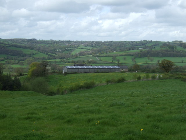
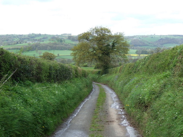
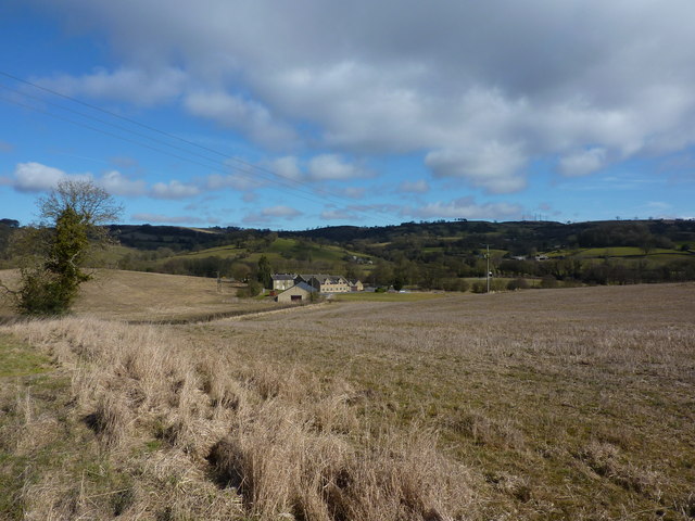
Ashleyhay is a small village located in the county of Derbyshire, England. Situated in the Amber Valley district, it lies about 5 miles northwest of Belper and 8 miles south of Matlock. The village is nestled in the picturesque Peak District National Park, offering residents and visitors stunning views of the surrounding countryside.

Ashleyhay is known for its rural charm and tranquility, making it an ideal destination for those seeking a peaceful getaway. The village is characterized by its quaint stone cottages and traditional architecture, which contribute to its idyllic atmosphere. The local community is close-knit and friendly, with a population of around 200 residents.

Despite its small size, Ashleyhay is home to a few notable landmarks and attractions. One such attraction is the Ashleyhay Garden, a beautiful private garden that opens to the public during specific times of the year. Visitors can explore the well-manicured lawns, vibrant flowerbeds, and intricate hedges that make up this delightful garden.

For those interested in outdoor activities, Ashleyhay offers easy access to the Peak District, a renowned national park known for its hiking trails, cycling routes, and breathtaking landscapes. The area is also dotted with charming villages, historic sites, and traditional country pubs, providing ample opportunities for exploration and relaxation.

In terms of amenities, Ashleyhay has limited facilities, with no shops or pubs within the village itself. However, the nearby towns of Belper and Matlock offer a range of services, including shops, restaurants, and recreational facilities.

Overall, Ashleyhay is a quiet and picturesque village in Derbyshire, offering residents and visitors a peaceful retreat amidst the beauty of the Peak District National Park.

If you have any feedback on the listing, please let us know in the comments section below.
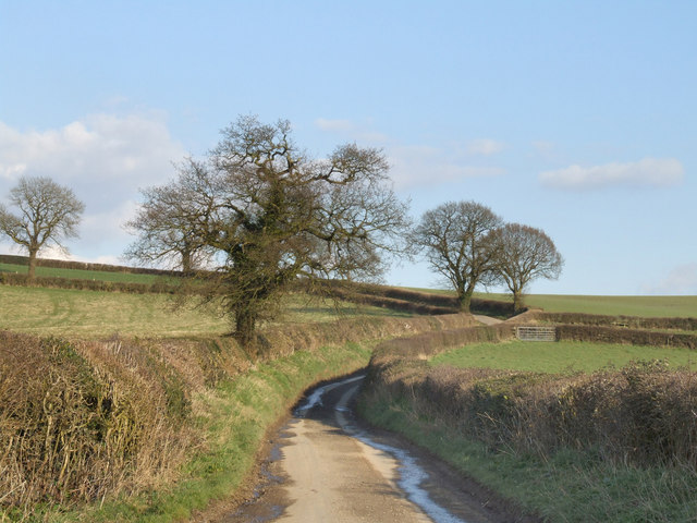
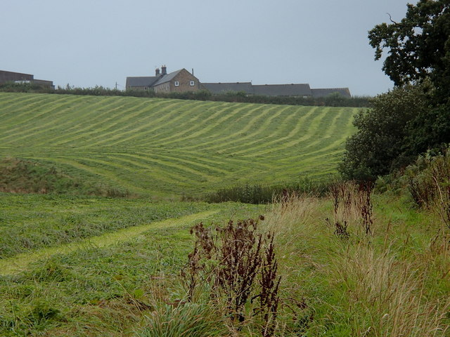
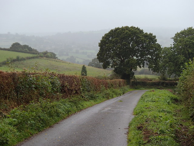
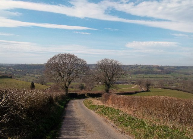
Ashleyhay Images

Images are sourced within 2km of 53.057475/-1.5631838 or Grid Reference SK2951. Thanks to Geograph Open Source API. All images are credited.

Jebb's Lane crosses the Ecclesbourne Valley Railway
The Ecclesbourne Way below Manifold Farm Heading towards Hilltop.
The Ecclesbourne Way below Manifold Farm
Heading towards Hilltop.
Diesel locomotive 31206 at a foot crossing on the Ecclesbourne Valley Railway 31206 pulling a train during the Diesel Locomotive Weekend in 2017.
Diesel locomotive 31206 at a foot crossing on the Ecclesbourne Valley Railway
31206 pulling a train during the Diesel Locomotive Weekend in 2017.
Jebb's Lane crossing the Ecclesbourne
Alton Mill Farm
Alton Mill Farm
Manifold Farm Looking across the hedge that separates Jebb lane from the fields of Manifold Farm.
Manifold Farm
Looking across the hedge that separates Jebb lane from the fields of Manifold Farm.
Near Wirksworth. A picture of one of the many narrow country lanes in this vicinity.
Near Wirksworth.
A picture of one of the many narrow country lanes in this vicinity.
Railway line. A view looking South towards Idridgehay along the Derby to Wirksworth railway line.
Railway line.
A view looking South towards Idridgehay along the Derby to Wirksworth railway line.
Hob Lane, leading to Kirk Ireton
Fields towards Manifold Farm Rows of recently cut grass.  Hoping in vain for drying weather.
Fields towards Manifold Farm
Rows of recently cut grass. Hoping in vain for drying weather.
Jebb's Lane The narrow country lane heads downhill, passing Manifold Farm lower down.
Jebb's Lane
The narrow country lane heads downhill, passing Manifold Farm lower down.
Valley farmland around Alport Mill Farm The farmhouse is on the grid line.  The valley sides rise up to Alport Height top left (above 300m / 1,000 ft).
Valley farmland around Alport Mill Farm
The farmhouse is on the grid line. The valley sides rise up to Alport Height top left (above 300m / 1,000 ft).
Jebb's Lane The start of the lane heading east from the B5023 just north of Idridgehay.
Jebb's Lane
The start of the lane heading east from the B5023 just north of Idridgehay.
Field south of Hob Lane
Hob Lane
Hob Lane
Jebb's Lane Looking west across the Ecclesbourne Valley and beyond towards Kirk Ireton.
Jebb's Lane
Looking west across the Ecclesbourne Valley and beyond towards Kirk Ireton.
Grazing towards Manifold Farm
Downhill on Jebb's Lane
Show me another place!

Ashleyhay is located at Grid Ref: SK2951 (Lat: 53.057475, Lng: -1.5631838)

Administrative County: Derbyshire

District: Amber Valley

Police Authority: Derbyshire

What 3 Words

///themes.recently.reseller. Near Wirksworth, Derbyshire

Related Wikis

Alderwasley Hall Sixth Form Centre

Alderwasley Hall Sixth Form is an independent special needs Sixth Form Centre located one mile south of Wirksworth in Derbyshire it is part of Alderwasley...

Ashleyhay

Ashleyhay (Old English Enclosure at the ash-tree wood or clearing ) is a village and civil parish in the Amber Valley district of Derbyshire, England,...

Alport Height

Alport Height is a hill near Wirksworth in Derbyshire. It is a popular picnic site, since it has extensive views to the South, and is the first hill over...

Duffield Frith

Duffield Frith was, in medieval times, an area of Derbyshire in England, part of that bestowed upon Henry de Ferrers (or Ferrars) by King William, controlled...

Haarlem Mill

Haarlem Mill, on the River Ecclesbourne in Wirksworth, Derbyshire, was an early cotton mill. Built by Richard Arkwright, it was the first cotton mill in...

Breamfield

Breamfield is a hamlet in Derbyshire, England. It is located 1 mile south-east of Wirksworth.

Derby Road Ground

Derby Road Ground is a cricket ground in Wirksworth, Derbyshire. The first recorded match on the ground was in 1866, when Wirksworth played an All-England...

Shottle

Shottle is a village approximately 3 miles (4.8 km) south of the market town of Wirksworth in Derbyshire. The population of the civil parish (Shottle and...

Nearby Amenities

Located within 500m of 53.057475,-1.5631838
Passing Place
Lat/Long: 53.0600986/-1.5649057
Ele: 172.0000000
Lat/Long: 53.061927/-1.5624984
Ele: 160.0000000
Lat/Long: 53.0613838/-1.5636269
Ele: 156.0000000
Lat/Long: 53.061145/-1.5645533
Ele: 146.0000000
Ford: stepping_stones
Lat/Long: 53.0611968/-1.5659846
Ele: 147.0000000
Lat/Long: 53.0611269/-1.5656112
Ele: 158.0000000
Lat/Long: 53.0612887/-1.5638733
Ele: 159.0000000
Lat/Long: 53.0537462/-1.5621677
Ele: 149
Lat/Long: 53.0536919/-1.5610855
Barrier: stile
Ele: 150.0000000
Material: stone
Steps: 1
Stile: stepover
Lat/Long: 53.0537033/-1.5611144
Ele: 149.0000000
Lat/Long: 53.0536507/-1.5608703
Ele: 149.0000000
Lat/Long: 53.0536665/-1.5609403
Ele: 149
Lat/Long: 53.0536773/-1.5610138
Barrier: stile
Stile: stepover
Lat/Long: 53.0619507/-1.5624639
Description: Ashleyhay Alton and Idridgehay Parish Council
Ele: 153.0000000
Information: board
Tourism: information
Lat/Long: 53.0610902/-1.566446
Barrier: stile
Ele: 195.0000000
Material: wood
Source: survey;bing;gps
Steps: 2
Stile: stepover
Lat/Long: 53.0599374/-1.5622762
Barrier: stile
Ele: 211.0000000
Steps: 1
Stile: stepover
Lat/Long: 53.059859/-1.5601358
Barrier: stile
Ele: 215.0000000
Stile: squeezer
Lat/Long: 53.0598688/-1.5594668
Barrier: stile
Ele: 233.0000000
Material: stone
Source: survey;gps
Stile: squeezer
Lat/Long: 53.0598524/-1.5580391
Ele: 246.0000000
Lat/Long: 53.0578698/-1.5573642
Ele: 244.0000000
Lat/Long: 53.0570164/-1.5571165
Ele: 235.0000000
Lat/Long: 53.05959/-1.5579534
Ele: 243.0000000
Lat/Long: 53.0589086/-1.5575985
Barrier: stile
Ele: 244.0000000
Material: stone
Source: survey;gps
Stile: squeezer
Lat/Long: 53.0581999/-1.557479
Barrier: stile
Ele: 251.0000000
Steps: 1
Stile: stepover
Lat/Long: 53.0563084/-1.5563585
Barrier: stile
Ele: 251.0000000
Steps: 2
Stile: wall
Lat/Long: 53.0560734/-1.5561644
Barrier: stile
Stile: squeezer
Lat/Long: 53.0608173/-1.5681543
Barrier: stile
Material: stone
Source: survey;gps
Stile: stepover
Lat/Long: 53.0613542/-1.5663346
Ford: stepping_stones
Lat/Long: 53.0613409/-1.5663482
Prow Ref: Ashleyhay FP 6
Lat/Long: 53.0537559/-1.5617345
Barrier: entrance
Source: survey;gps
Lat/Long: 53.0595786/-1.5579459
Barrier: stile
Source: survey;gps
Stile: squeezer
Lat/Long: 53.0612577/-1.5662855
Post Box
Operator: Royal Mail
Post Box Type: lamp
Ref: DE4 714
Royal Cypher: EIIR
Royal Cypher Wikidata: Q33102113
Lat/Long: 53.0609732/-1.5669143
Barrier: stile
Material: stone
Source: survey;gps
Stile: stepover
Lat/Long: 53.0610235/-1.5661105
The data included in this document is from www.openstreetmap.org. The data is made available under ODbL.

Have you been to Ashleyhay?

Leave your review of Ashleyhay below (or comments, questions and feedback).