Beighton Hill

Hill, Mountain in Derbyshire Amber Valley

England

Beighton Hill

Jebb's Lane crosses the Ecclesbourne Valley Railway
Jebb's Lane crosses the Ecclesbourne Valley Railway Credit: Tim Glover

Beighton Hill is a prominent natural landmark located in Derbyshire, England. Standing at an elevation of approximately 100 meters (328 feet), it is classified as a hill rather than a mountain due to its moderate height. The hill is situated in the southeastern part of the county, close to the village of Beighton and approximately 9 miles from the city of Sheffield.

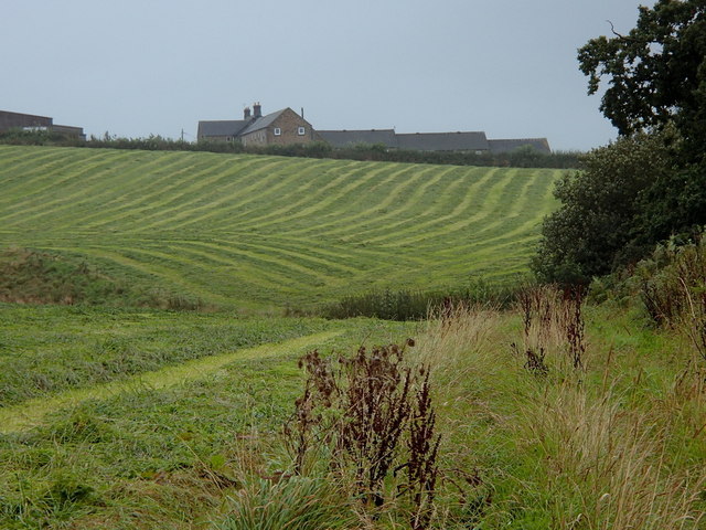
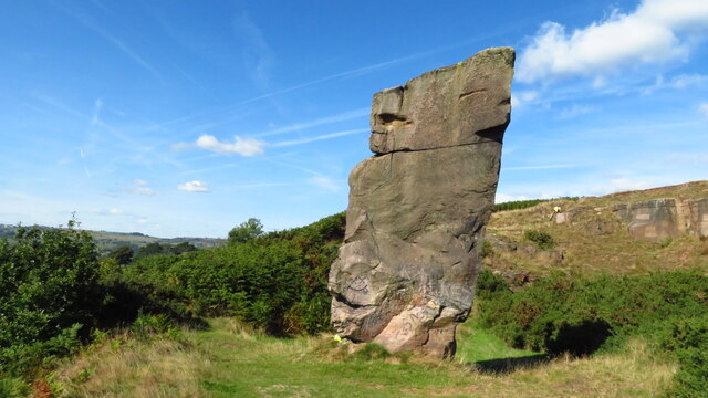
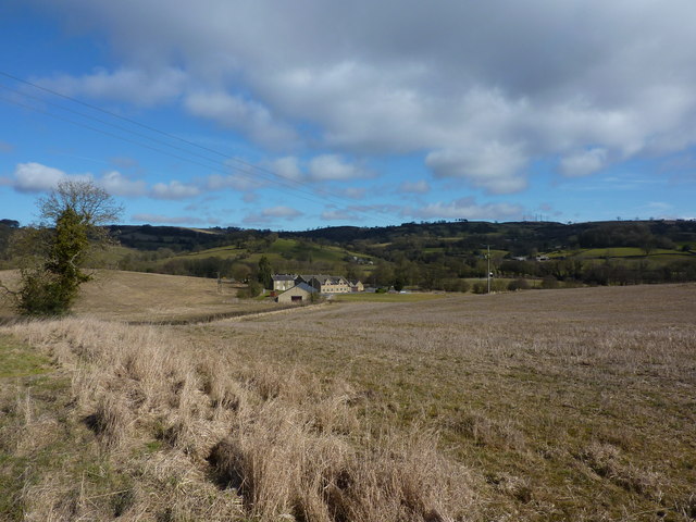
Beighton Hill is known for its picturesque beauty and offers stunning panoramic views of the surrounding countryside. It is covered with lush green vegetation, including grasses, shrubs, and scattered trees, creating a serene and tranquil atmosphere. The slopes of the hill are gentle, making it accessible for walkers and hikers of various fitness levels.

At the summit of Beighton Hill, visitors can enjoy breathtaking vistas that stretch as far as the eye can see. On clear days, one can spot landmarks such as the nearby Rother Valley Country Park, the Derbyshire Dales, and even the Peak District National Park in the distance. The hill's strategic location allows for uninterrupted views and makes it a popular spot for photographers and nature enthusiasts.

Beighton Hill is also home to diverse wildlife, including various bird species, rabbits, and other small mammals. The area is protected as a nature reserve, ensuring the preservation of its natural habitat and biodiversity.

Overall, Beighton Hill offers a delightful and serene escape from the bustling city life, providing visitors with an opportunity to connect with nature and enjoy the beauty of the Derbyshire countryside.

If you have any feedback on the listing, please let us know in the comments section below.

Beighton Hill Images

Images are sourced within 2km of 53.060321/-1.5671241 or Grid Reference SK2951. Thanks to Geograph Open Source API. All images are credited.

Jebb's Lane crosses the Ecclesbourne Valley Railway
The Ecclesbourne Way below Manifold Farm Heading towards Hilltop.
The Ecclesbourne Way below Manifold Farm
Heading towards Hilltop.
Diesel locomotive 31206 at a foot crossing on the Ecclesbourne Valley Railway 31206 pulling a train during the Diesel Locomotive Weekend in 2017.
Diesel locomotive 31206 at a foot crossing on the Ecclesbourne Valley Railway
31206 pulling a train during the Diesel Locomotive Weekend in 2017.
Jebb's Lane crossing the Ecclesbourne
Alton Mill Farm
Alton Mill Farm
Manifold Farm Looking across the hedge that separates Jebb lane from the fields of Manifold Farm.
Manifold Farm
Looking across the hedge that separates Jebb lane from the fields of Manifold Farm.
Railway line. A view looking South towards Idridgehay along the Derby to Wirksworth railway line.
Railway line.
A view looking South towards Idridgehay along the Derby to Wirksworth railway line.
Hob Lane, leading to Kirk Ireton
Fields towards Manifold Farm Rows of recently cut grass.  Hoping in vain for drying weather.
Fields towards Manifold Farm
Rows of recently cut grass. Hoping in vain for drying weather.
Valley farmland around Alport Mill Farm The farmhouse is on the grid line.  The valley sides rise up to Alport Height top left (above 300m / 1,000 ft).
Valley farmland around Alport Mill Farm
The farmhouse is on the grid line. The valley sides rise up to Alport Height top left (above 300m / 1,000 ft).
Jebb's Lane The start of the lane heading east from the B5023 just north of Idridgehay.
Jebb's Lane
The start of the lane heading east from the B5023 just north of Idridgehay.
Ecclesbourne Valley Railway  Heading north towards Wirksworth.
Ecclesbourne Valley Railway
Heading north towards Wirksworth.
Jebb's Lane Heading west towards the B5023.
Jebb's Lane
Heading west towards the B5023.
Trees along the River Ecclesbourne Looking west from the railway.
Trees along the River Ecclesbourne
Looking west from the railway.
Alport Height rock tower
Abandoned cottage near Alport Height
Houses on Bournebrooke Avenue, Wirksworth This looks like a former council estate. The house on the extreme right has been extended and this allowed me to place the aerial image. Seen from the Ecclesbourne Valley Railway
Houses on Bournebrooke Avenue, Wirksworth
This looks like a former council estate. The house on the extreme right has been extended and this allowed me to place the aerial image. Seen from the Ecclesbourne Valley Railway
Breasley Pillows, Water Lane, Wirksworth Seen from the Ecclesbourne Valley Railway. There is a larger more modern block behind that is marked on the aerial photograph as Breasley Pillows and I am assuming this older set of mill buildings is part of the same complex.
Breasley Pillows, Water Lane, Wirksworth
Seen from the Ecclesbourne Valley Railway. There is a larger more modern block behind that is marked on the aerial photograph as Breasley Pillows and I am assuming this older set of mill buildings is part of the same complex.
Show me another place!

Beighton Hill is located at Grid Ref: SK2951 (Lat: 53.060321, Lng: -1.5671241)

Administrative County: Derbyshire

District: Amber Valley

Police Authority: Derbyshire

What 3 Words

///cats.notebook.spurted. Near Wirksworth, Derbyshire

Related Wikis

Nearby Amenities

Located within 500m of 53.060321,-1.5671241
Passing Place
Lat/Long: 53.0600986/-1.5649057
Ele: 172.0000000
Lat/Long: 53.061927/-1.5624984
Ele: 160.0000000
Lat/Long: 53.0613838/-1.5636269
Ele: 156.0000000
Lat/Long: 53.061145/-1.5645533
Ele: 146.0000000
Ford: stepping_stones
Lat/Long: 53.0611968/-1.5659846
Ele: 155.0000000
Lat/Long: 53.0617696/-1.565891
Ele: 147.0000000
Lat/Long: 53.0611269/-1.5656112
Ele: 158.0000000
Lat/Long: 53.0612887/-1.5638733
Barrier: stile
Stile: stepover
Lat/Long: 53.0619507/-1.5624639
Description: Ashleyhay Alton and Idridgehay Parish Council
Ele: 153.0000000
Information: board
Tourism: information
Lat/Long: 53.0610902/-1.566446
Barrier: stile
Ele: 129.0000000
Steps: 0
Stile: stepover
Lat/Long: 53.0619737/-1.5712229
Ele: 128.0000000
Lat/Long: 53.0619576/-1.5712188
Ele: 127.0000000
Lat/Long: 53.061942/-1.571182
Barrier: stile
Ele: 195.0000000
Material: wood
Source: survey;bing;gps
Steps: 2
Stile: stepover
Lat/Long: 53.0599374/-1.5622762
Barrier: stile
Ele: 211.0000000
Steps: 1
Stile: stepover
Lat/Long: 53.059859/-1.5601358
Barrier: stile
Stile: squeezer
Lat/Long: 53.0608173/-1.5681543
Barrier: stile
Stile: squeezer
Lat/Long: 53.060992/-1.5739379
Barrier: stile
Material: stone
Source: survey;gps
Stile: stepover
Lat/Long: 53.0613542/-1.5663346
Barrier: stile
Material: stone
Steps: 1
Stile: stepover
Lat/Long: 53.0623601/-1.5662707
Barrier: stile
Material: wood
Steps: 2
Stile: stepover
Lat/Long: 53.0632545/-1.5660922
Ford: stepping_stones
Lat/Long: 53.0613409/-1.5663482
Barrier: stile
Material: stone
Source: survey;gps
Steps: 1
Stile: squeezer
Lat/Long: 53.0643652/-1.5659678
Barrier: stile
Stile: squeezer
Lat/Long: 53.0646009/-1.5655791
Barrier: stile
Source: survey;gps
Stile: squeezer
Lat/Long: 53.0612577/-1.5662855
Post Box
Operator: Royal Mail
Post Box Type: lamp
Ref: DE4 714
Royal Cypher: EIIR
Royal Cypher Wikidata: Q33102113
Lat/Long: 53.0609732/-1.5669143
Bus Stop
Callow Park
Naptan AtcoCode: 1000DWDR3561
Naptan NaptanCode: dbsdmpdj
Public Transport: platform
Shelter: yes
Tactile Paving: no
Lat/Long: 53.0620072/-1.5738807
Bus Stop
Callow Park
Bench: yes
Public Transport: platform
Shelter: yes
Tactile Paving: no
Lat/Long: 53.0620322/-1.5740121
Barrier: stile
Material: stone
Source: survey;gps
Stile: stepover
Lat/Long: 53.0610235/-1.5661105
The data included in this document is from www.openstreetmap.org. The data is made available under ODbL.

Have you been to Beighton Hill?

Leave your review of Beighton Hill below (or comments, questions and feedback).