Ashland

Settlement in Buckinghamshire

England

Ashland

Bridge 91 (Grand Union Canal) Underneath bridge 91 on the Grand Union Canal on this peaceful afternoon
Bridge 91 (Grand Union Canal) Credit: Ryan Griffiths

Ashland is a small village located in the county of Buckinghamshire, England. It is situated approximately 4 miles southeast of Milton Keynes and lies close to the border with Bedfordshire. The village is surrounded by beautiful countryside, offering residents and visitors a peaceful and picturesque setting.

With a population of around 400 people, Ashland is a close-knit community where neighbors know each other well. The village primarily consists of traditional stone cottages and a few modern houses, giving it a charming and rustic atmosphere.

One of the notable features of Ashland is its close proximity to the ancient woodland of Salcey Forest. This forest is a popular attraction for nature enthusiasts, offering various walking trails, cycling routes, and birdwatching opportunities.

Although Ashland is a small village, it benefits from its proximity to Milton Keynes, which provides residents with easy access to a range of amenities and services. The city offers a wide range of shopping centers, restaurants, entertainment venues, and recreational facilities.

For those seeking a more rural lifestyle, Ashland provides a peaceful retreat while still being within reach of urban conveniences. The village has a strong sense of community, with various social events and gatherings organized throughout the year.

Overall, Ashland is a tranquil and scenic village that offers a balance between rural living and proximity to larger towns. Its charming architecture, natural surroundings, and friendly community make it an attractive place to live or visit.

If you have any feedback on the listing, please let us know in the comments section below.
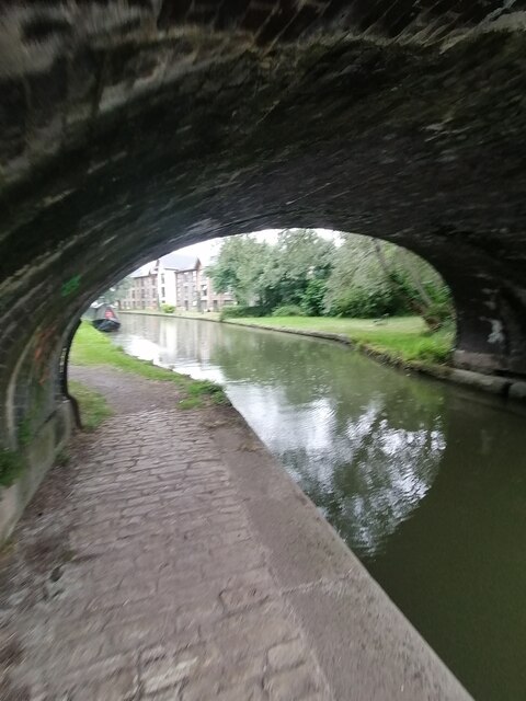
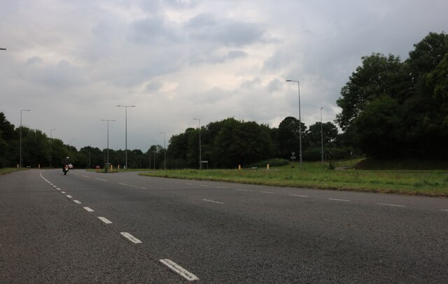
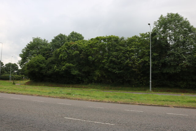
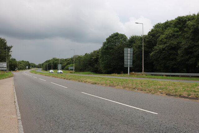
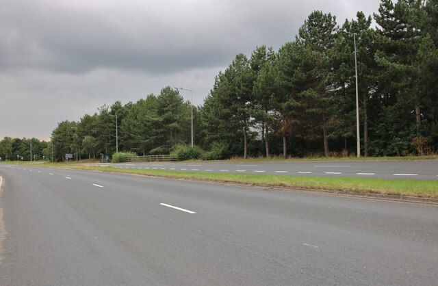
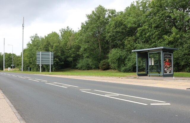
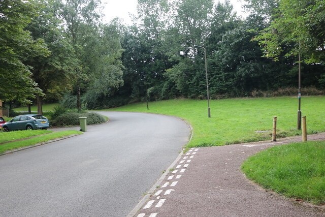
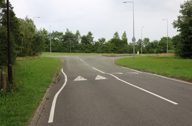
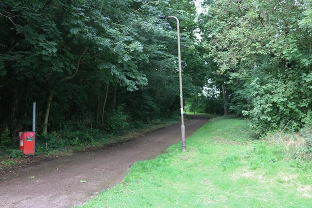
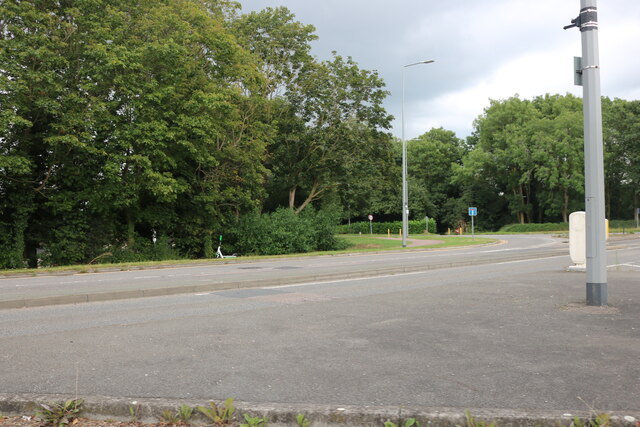
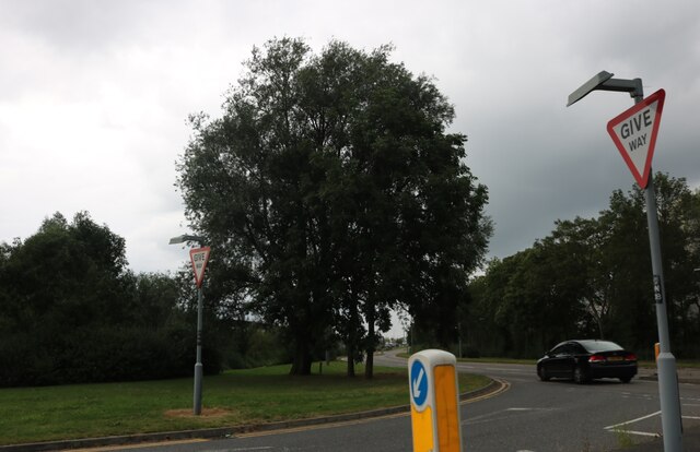
Ashland Images

Images are sourced within 2km of 52.015454/-0.73202328 or Grid Reference SP8735. Thanks to Geograph Open Source API. All images are credited.

Bridge 91 (Grand Union Canal) Underneath bridge 91 on the Grand Union Canal on this peaceful afternoon
Bridge 91 (Grand Union Canal)
Underneath bridge 91 on the Grand Union Canal on this peaceful afternoon
Bridge 93 (Grand Union Canal) A view from bridge 93 on the Grand Union Canal on this peaceful afternoon
Bridge 93 (Grand Union Canal)
A view from bridge 93 on the Grand Union Canal on this peaceful afternoon
Perrys Citroen on Watling Street, Fenny Stratford
Watling Street, Fenny Stratford
Bridge 87 (Grand Union Canal) Underneath Bridge 87 on the Grand Union Canal at Woughton on the Green
Bridge 87 (Grand Union Canal)
Underneath Bridge 87 on the Grand Union Canal at Woughton on the Green
Bridge 88 (Grand Union Canal) Underneath Bridge 88 on the Grand Union Canal at Peartree Bridge
Bridge 88 (Grand Union Canal)
Underneath Bridge 88 on the Grand Union Canal at Peartree Bridge
Bridge 89 (Grand Union Canal) Underneath Bridge 89 on the Grand Union Canal at Peartree Bridge
Bridge 89 (Grand Union Canal)
Underneath Bridge 89 on the Grand Union Canal at Peartree Bridge
Bridge 90 (Grand Union Canal) Underneath Bridge 90 on the Grand Union Canal at Woughton on the Green
Bridge 90 (Grand Union Canal)
Underneath Bridge 90 on the Grand Union Canal at Woughton on the Green
Marlborough Street, Milton Keynes
Woodland by Marlborough Street, Milton Keynes
Groveway, Milton Keynes
Saxon Street, Milton Keynes
Robins Hill, Coffee Hall
Robins Hill at the junction of Saxon Street
Path by Saxon Street, Coffee Hall
Saxon Street, Milton Keynes
Business entrance on Saxon Street, Milton Keynes
Show me another place!

Ashland is located at Grid Ref: SP8735 (Lat: 52.015454, Lng: -0.73202328)

Unitary Authority: Milton Keynes

Police Authority: Thames Valley

What 3 Words

///assist.ally.wake. Near Simpson, Buckinghamshire

Nearby Locations

Ashland

Related Wikis

Stadium MK

Stadium MK is a football ground in the Denbigh district of Bletchley in Milton Keynes, Buckinghamshire, England. Designed by Populous and opened in 2007...

Marshall Arena

The Marshall Arena (formerly known as Arena MK, also Milton Keynes Arena) is a multi-purpose indoor arena in Milton Keynes, Buckinghamshire, England, located...

The Redway School, Milton Keynes

The Redway School is an all-age (2–19) state special school for children and young people who experience severe learning difficulties, serving the children...

Simpson and Ashland

Simpson and Ashland is a civil parish in the south of Milton Keynes in Buckinghamshire, England. The parish comprises the village of Simpson and the districts...

Related Videos

Getaway Group Travel at Leisure & Tourism Show 2023

A short interview with Getaway Group Travel at the Travel and Tourism Show held at MK Dons in October 2023. Edited by ...

39. More Aggravation As I Travel Along The Grand Union Canal On A Beautiful Winters Day To Fenny....

39. More Aggravation As I Travel Along The Grand Union Canal On A Beautiful Winters Day To Fenny Stratford! You Can Buy Me ...

Milton Keynes Walking Route/ Caldecotte Lake

Milton Keynes has numeorus walking and biking routes. Living here made a spoilt for choice.

Nearby Amenities

Located within 500m of 52.015454,-0.73202328
Motorway Junction
Redmoor Roundabout
Lat/Long: 52.0121391/-0.7329918
Turning Circle
Lat/Long: 52.0177501/-0.7271369
Turning Circle
Lat/Long: 52.0168469/-0.7302706
Turning Circle
Lat/Long: 52.0164926/-0.7315211
Mini Roundabout
Direction: clockwise
Lat/Long: 52.0175426/-0.7359958
Turning Circle
Turning Circle: hammer
Lat/Long: 52.0177114/-0.7344306
Turning Circle
Turning Circle: hammer
Lat/Long: 52.0168108/-0.7334187
Post Box
Brand: Royal Mail
Brand Wikidata: Q638098
Brand Wikipedia: en:Royal Mail
Collection Times: Mo-Fr 09:00; Sa 07:00
Drive Through: no
Operator: Royal Mail
Operator Wikidata: Q638098
Post Box Type: pillar
Ref: MK6 333
Royal Cypher: EIIR
Royal Cypher Wikidata: Q33102113
Source: survey
Lat/Long: 52.0174392/-0.7357488
Traffic Calming: hump
Lat/Long: 52.0172651/-0.7383152
Turning Circle
Turning Circle: hammer
Lat/Long: 52.017057/-0.7374191
Turning Circle
Turning Circle: hammer
Lat/Long: 52.0191318/-0.7362219
Turning Circle
Turning Circle: hammer
Lat/Long: 52.0167047/-0.7380102
Post Box
Ref: MK6 320
Lat/Long: 52.0189313/-0.729909
Bus Stop
Ashland Roundabout South
Bus: yes
Naptan AtcoCode: 049000005069
Naptan Bearing: N
Naptan CommonName: Ashland Roundabout South
Naptan Indicator: North
Naptan Landmark: Groveway H9
Naptan NaptanCode: mltagatg
Naptan Street: Saxon Street V7
Naptan Verified: no
Public Transport: platform
Shelter: yes
Source: naptan_import
Lat/Long: 52.0152965/-0.7320818
Bus Stop
Ashland Roundabout South
Bus: yes
Naptan AtcoCode: 049000005098
Naptan Bearing: S
Naptan CommonName: Ashland Roundabout South
Naptan Indicator: South
Naptan Landmark: Groveway H9
Naptan NaptanCode: mltagatj
Naptan Street: Saxon Street V7
Naptan Verified: no
Public Transport: platform
Shelter: yes
Source: naptan_import
Lat/Long: 52.0146316/-0.7316581
Bus Stop
Redmoor Roundabout East
Bus: yes
Naptan AtcoCode: 049004945238
Naptan Bearing: E
Naptan CommonName: Redmoor Roundabout East
Naptan Indicator: North Eastbound
Naptan Landmark: N
Naptan NaptanCode: mltdwt
Naptan PlusbusZoneRef: MKNSCEN
Naptan Street: Groveway H9
Naptan Verified: no
Public Transport: platform
Source: naptan_import
Lat/Long: 52.013846/-0.7376747
Bus Stop
Redmoor Roundabout East
Bus: yes
Naptan AtcoCode: 049004945239
Naptan Bearing: W
Naptan CommonName: Redmoor Roundabout East
Naptan Indicator: South Westbound
Naptan Landmark: N
Naptan NaptanCode: mltgad
Naptan PlusbusZoneRef: MKNSCEN
Naptan Street: Groveway H9
Naptan Verified: no
Public Transport: platform
Source: naptan_import
Lat/Long: 52.0142385/-0.7365416
Bus Stop
Dodkin
Bus: yes
Naptan AtcoCode: 049004995263
Naptan Bearing: SE
Naptan CommonName: Dodkin
Naptan Indicator: 200m N of Barnfield Drive
Naptan Landmark: Moorland County First School
Naptan NaptanCode: mltgjad
Naptan PlusbusZoneRef: MKNSCEN
Naptan Street: Saxon Street V7
Naptan Verified: no
Public Transport: platform
Source: naptan_import
Lat/Long: 52.0194267/-0.7348797
Bus Stop
Dodkin
Bus: yes
Naptan AtcoCode: 049004995268
Naptan Bearing: NW
Naptan CommonName: Dodkin
Naptan Indicator: 10m NW od Dodkin
Naptan Landmark: N
Naptan NaptanCode: mltgjag
Naptan PlusbusZoneRef: MKNSCEN
Naptan Street: Saxon Street V7
Naptan Verified: no
Public Transport: platform
Source: naptan_import
Lat/Long: 52.019348/-0.735086
Bus Stop
Ashland Roundabout North
Bus: yes
Naptan AtcoCode: 049005005264
Naptan Bearing: SE
Naptan CommonName: Ashland Roundabout North
Naptan Indicator: South Eastbound
Naptan Landmark: N
Naptan NaptanCode: mltgjaj
Naptan PlusbusZoneRef: MKNSCEN
Naptan Street: Saxon Street V7
Naptan Verified: no
Public Transport: platform
Shelter: yes
Source: naptan_import
Lat/Long: 52.0168606/-0.7325076
Bus Stop
Ashland Roundabout North
Bus: yes
Naptan AtcoCode: 049005005267
Naptan Bearing: NW
Naptan CommonName: Ashland Roundabout North
Naptan Indicator: North Westbound
Naptan Landmark: Groveway H9
Naptan NaptanCode: mltgjam
Naptan PlusbusZoneRef: MKNSCEN
Naptan Street: Saxon Street V7
Naptan Verified: no
Public Transport: platform
Shelter: yes
Source: naptan_import
Lat/Long: 52.0168362/-0.7327133
Bus Stop
Ashland Roundabout East
Bus: yes
Naptan AtcoCode: 049005005284
Naptan Bearing: W
Naptan CommonName: Ashland Roundabout East
Naptan Indicator: Westbound
Naptan Landmark: Greyhound Stadium
Naptan NaptanCode: mltgag
Naptan Street: Groveway H9
Naptan Verified: no
Public Transport: platform
Source: naptan_import
Lat/Long: 52.015902/-0.7306949
Bus Stop
Ashland Roundabout East
Bus: yes
Naptan AtcoCode: 049005005285
Naptan Bearing: E
Naptan CommonName: Ashland Roundabout East
Naptan Indicator: Eastbound
Naptan Landmark: Greyhound Stadium
Naptan NaptanCode: mltgaj
Naptan Street: Groveway H9
Naptan Verified: no
Public Transport: platform
Shelter: yes
Source: naptan_import
Lat/Long: 52.0161462/-0.7308337
Bus Stop
Simpson Roundabout West
Bus: yes
Naptan AtcoCode: 049005055226
Naptan Bearing: SW
Naptan CommonName: Simpson Roundabout West
Naptan Indicator: Westbound
Naptan Landmark: N
Naptan NaptanCode: mltgam
Naptan Street: Groveway H9
Naptan Verified: no
Public Transport: platform
Source: naptan_import
Lat/Long: 52.0167556/-0.7256431
Turning Circle
Lat/Long: 52.0172012/-0.7290825
Turning Circle
Lat/Long: 52.0175445/-0.7278333
Ashland
Place: neighbourhood
Source: Local knowledge
Lat/Long: 52.0151126/-0.727301
Source: bing
Traffic Calming: hump
Lat/Long: 52.0161601/-0.739184
Source: bing
Traffic Calming: bump
Lat/Long: 52.0157204/-0.73851
Source: bing
Traffic Calming: hump
Lat/Long: 52.0151453/-0.7375927
Mini Roundabout
Direction: clockwise
Lat/Long: 52.0110264/-0.7324599
Turning Circle
Turning Circle: square
Lat/Long: 52.0184457/-0.7322331
Turning Circle
Turning Circle: square
Lat/Long: 52.0186907/-0.7294449
Motorway Junction
Lat/Long: 52.016575/-0.7267653
Turning Circle
Turning Circle: square
Lat/Long: 52.0173863/-0.7284627
Turning Circle
Turning Circle: square
Lat/Long: 52.0179857/-0.7318823
Tourism: information
Type: board
Lat/Long: 52.0127555/-0.7288822
Post Box
Brand: Royal Mail
Brand Wikidata: Q638098
Brand Wikipedia: en:Royal Mail
Collection Times: Mo-Fr 17:45; Sa 12:30
Operator: Royal Mail
Operator Wikidata: Q638098
Post Box Type: lamp
Ref: MK6 577
Royal Cypher: EIIR
Royal Cypher Wikidata: Q33102113
Source: survey
Lat/Long: 52.0154547/-0.7260102
Turning Circle
Turning Circle: square
Lat/Long: 52.0191056/-0.7297475
Budgens
Addr City: Milton Keynes
Addr Country: GB
Addr Postcode: MK6 4LP
Addr Street: Dodkin
Addr Suburb: Beanhill
Brand: Budgens
Brand Wikidata: Q4985016
Brand Wikipedia: en:Budgens
Fhrs Authority: Milton Keynes
Fhrs Id: 199254
Fhrs Local Authority Id: 69354
Shop: convenience
Lat/Long: 52.0178216/-0.7359338
Fast Food
Ocean Fish and Pizza
Addr City: Milton Keynes
Addr Country: GB
Addr Postcode: MK6 4LP
Addr Street: Dodkin
Addr Suburb: Beanhill
Fhrs Authority: Milton Keynes
Fhrs Id: 135911
Fhrs Local Authority Id: 69834
Lat/Long: 52.0179058/-0.7357943
Fast Food
Breadline Co-Operative
Addr City: Milton Keynes
Addr Country: GB
Addr Postcode: MK6 4LP
Addr Street: Dodkin
Addr Suburb: Beanhill
Fhrs Authority: Milton Keynes
Fhrs Id: 92681
Fhrs Local Authority Id: 26223
Lat/Long: 52.0179602/-0.7356924
Community Centre
Moorlands Family Centre
Addr City: Milton Keynes
Addr Country: GB
Addr Postcode: MK6 4LP
Addr Street: Dodkin
Addr Suburb: Beanhill
Fhrs Authority: Milton Keynes
Fhrs Id: 128985
Fhrs Local Authority Id: 59303
Lat/Long: 52.0180873/-0.7354993
Premier Store Ashland
Addr City: Milton Keynes
Addr Country: GB
Addr Housenumber: 10
Addr Postcode: MK6 4AT
Addr Street: Yearlstone Square
Addr Suburb: Ashland
Fhrs Authority: Milton Keynes
Fhrs Id: 957464
Fhrs Local Authority Id: 87905
Shop: convenience
Lat/Long: 52.0151243/-0.7275492
Barnardo's
Brand: Barnardo's
Brand Wikidata: Q2884670
Shop: charity
Lat/Long: 52.0150649/-0.7272354
Fast Food
Fried Chicken
Addr City: Milton Keynes
Addr Country: GB
Addr Housenumber: 26
Addr Postcode: MK6 4AT
Addr Street: Yearlstone Square
Addr Suburb: Ashland
Lat/Long: 52.0152101/-0.7269537
Fast Food
The Frying Dutchman
Addr City: Milton Keynes
Addr Country: GB
Addr Housenumber: 28
Addr Postcode: MK6 4AT
Addr Street: Yearlstone Square
Addr Suburb: Ashland
Fhrs Authority: Milton Keynes
Fhrs Id: 1044430
Fhrs Local Authority Id: 89718
Lat/Long: 52.0152597/-0.7268518
Entrance: yes
Lat/Long: 52.0120276/-0.7279763
Entrance: yes
Lat/Long: 52.0119999/-0.7279672
Give Way
Direction: forward
Lat/Long: 52.0146103/-0.7359637
Crossing
Crossing: unmarked
Crossing Island: no
Crossing Markings: no
Tactile Paving: yes
Lat/Long: 52.0136387/-0.7370495
Barrier: cycle_barrier
Cycle Barrier: double
Lat/Long: 52.0135636/-0.7371444
Barrier: cycle_barrier
Cycle Barrier: double
Lat/Long: 52.0136838/-0.7370073
Give Way
Direction: forward
Lat/Long: 52.0179408/-0.7331695
Give Way
Direction: forward
Lat/Long: 52.0184617/-0.7342811
Crossing
Crossing: unmarked
Crossing Island: yes
Crossing Markings: no
Tactile Paving: yes
Lat/Long: 52.0144896/-0.7355076
Give Way
Direction: forward
Lat/Long: 52.0178577/-0.7332375
Give Way
Direction: forward
Lat/Long: 52.0186264/-0.7341188
Give Way
Direction: forward
Lat/Long: 52.0163565/-0.7276714
Traffic Calming: table
Lat/Long: 52.0152753/-0.7276049
Traffic Calming: table
Lat/Long: 52.0155613/-0.7273064
Traffic Calming: table
Lat/Long: 52.0151882/-0.7270599
Traffic Calming: table
Lat/Long: 52.0154142/-0.7268852
Give Way
Direction: forward
Lat/Long: 52.0147365/-0.7358906
Motorway Junction
Lat/Long: 52.0151204/-0.7349093
Give Way
Direction: forward
Lat/Long: 52.0146059/-0.7356195
Crossing
Crossing: unmarked
Crossing Island: yes
Crossing Markings: no
Tactile Paving: yes
Lat/Long: 52.0144541/-0.7355862
Parking Entrance
Lat/Long: 52.0134689/-0.7364074
Parking Entrance
Lat/Long: 52.0138172/-0.7361286
Parking Entrance
Lat/Long: 52.0134969/-0.7360153
Give Way
Direction: forward
Lat/Long: 52.0136133/-0.7374866
Give Way
Direction: forward
Lat/Long: 52.0137503/-0.7350215
Turning Circle
Lat/Long: 52.0193563/-0.7339144
Give Way
Direction: forward
Lat/Long: 52.0180931/-0.7369421
Direction: 135
Generator Method: photovoltaic
Generator Output Electricity: yes
Generator Solar Modules: 3
Generator Source: solar
Generator Type: solar_photovoltaic_panel
Location: roof
Power: generator
Lat/Long: 52.016181/-0.7252633
Direction: 135
Generator Method: photovoltaic
Generator Output Electricity: yes
Generator Solar Modules: 3
Generator Source: solar
Generator Type: solar_photovoltaic_panel
Location: roof
Power: generator
Lat/Long: 52.0161514/-0.7253277
Direction: 125
Generator Method: photovoltaic
Generator Output Electricity: yes
Generator Solar Modules: 3
Generator Source: solar
Generator Type: solar_photovoltaic_panel
Location: roof
Power: generator
Lat/Long: 52.01611/-0.7253828
Direction: 125
Generator Method: photovoltaic
Generator Output Electricity: yes
Generator Solar Modules: 3
Generator Source: solar
Generator Type: solar_photovoltaic_panel
Location: roof
Power: generator
Lat/Long: 52.0160764/-0.7254215
Direction: 115
Generator Method: photovoltaic
Generator Output Electricity: yes
Generator Solar Modules: 3
Generator Source: solar
Generator Type: solar_photovoltaic_panel
Location: roof
Power: generator
Lat/Long: 52.0160313/-0.7254625
Direction: 115
Generator Method: photovoltaic
Generator Output Electricity: yes
Generator Solar Modules: 3
Generator Source: solar
Generator Type: solar_photovoltaic_panel
Location: roof
Power: generator
Lat/Long: 52.0159899/-0.7254906
Direction: 105
Generator Method: photovoltaic
Generator Output Electricity: yes
Generator Solar Modules: 3
Generator Source: solar
Generator Type: solar_photovoltaic_panel
Location: roof
Power: generator
Lat/Long: 52.0159376/-0.7255147
Direction: 105
Generator Method: photovoltaic
Generator Output Electricity: yes
Generator Solar Modules: 3
Generator Source: solar
Generator Type: solar_photovoltaic_panel
Location: roof
Power: generator
Lat/Long: 52.0158983/-0.7255328
Direction: 110
Generator Method: photovoltaic
Generator Output Electricity: yes
Generator Solar Modules: 3
Generator Source: solar
Generator Type: solar_photovoltaic_panel
Location: roof
Power: generator
Lat/Long: 52.0152662/-0.7251438
Direction: 125
Generator Method: photovoltaic
Generator Output Electricity: yes
Generator Solar Modules: 3
Generator Source: solar
Generator Type: solar_photovoltaic_panel
Location: roof
Power: generator
Lat/Long: 52.0153046/-0.7251095
Direction: 125
Generator Method: photovoltaic
Generator Output Electricity: yes
Generator Solar Modules: 3
Generator Source: solar
Generator Type: solar_photovoltaic_panel
Location: roof
Power: generator
Lat/Long: 52.015342/-0.7250885
Direction: 135
Generator Method: photovoltaic
Generator Output Electricity: yes
Generator Solar Modules: 3
Generator Source: solar
Generator Type: solar_photovoltaic_panel
Location: roof
Power: generator
Lat/Long: 52.0153851/-0.7250185
Direction: 135
Generator Method: photovoltaic
Generator Output Electricity: yes
Generator Solar Modules: 3
Generator Source: solar
Generator Type: solar_photovoltaic_panel
Location: roof
Power: generator
Lat/Long: 52.0154204/-0.7249793
Direction: 160
Generator Method: photovoltaic
Generator Output Electricity: yes
Generator Solar Modules: 180
Generator Source: solar
Generator Type: solar_photovoltaic_panel
Location: roof
Power: generator
Lat/Long: 52.0113385/-0.7344394
Generator Method: photovoltaic
Generator Output Electricity: yes
Generator Solar Modules: 16
Generator Source: solar
Generator Type: solar_photovoltaic_panel
Location: roof
Power: generator
Tilted: no
Lat/Long: 52.0184002/-0.7278298
Traffic Calming: hump
Lat/Long: 52.0188642/-0.730262
Traffic Calming: hump
Lat/Long: 52.0184888/-0.7315736
Traffic Calming: hump
Lat/Long: 52.0181652/-0.7327178
Turning Circle
Turning Circle: knuckle
Lat/Long: 52.0172017/-0.734003
Traffic Calming: hump
Lat/Long: 52.0170309/-0.7352373
Traffic Calming: hump
Lat/Long: 52.0182777/-0.7347428
Traffic Calming: hump
Lat/Long: 52.0178029/-0.7364389
Generator Method: photovoltaic
Generator Output Electricity: yes
Generator Solar Modules: 32
Generator Source: solar
Generator Type: solar_photovoltaic_panel
Location: roof
Power: generator
Tilted: no
Lat/Long: 52.0182085/-0.7363173
Turning Circle
Turning Circle: square
Lat/Long: 52.0143586/-0.7381116
Turning Circle
Turning Circle: square
Lat/Long: 52.0158268/-0.7370126
Direction: 245
Generator Method: photovoltaic
Generator Output Electricity: yes
Generator Solar Modules: 12
Generator Source: solar
Generator Type: solar_photovoltaic_panel
Location: roof
Power: generator
Lat/Long: 52.0190871/-0.7323277
Crossing
Crossing: unmarked
Crossing Island: no
Crossing Markings: no
Tactile Paving: yes
Lat/Long: 52.0131419/-0.7350088
Crossing
Crossing: unmarked
Crossing Island: no
Crossing Markings: no
Tactile Paving: yes
Lat/Long: 52.0134543/-0.7350754
Crossing
Crossing: unmarked
Crossing Island: no
Crossing Markings: no
Tactile Paving: yes
Lat/Long: 52.0137661/-0.7351376
The data included in this document is from www.openstreetmap.org. The data is made available under ODbL.

Have you been to Ashland?

Leave your review of Ashland below (or comments, questions and feedback).