Ashbrooke

Settlement in Durham

England

Ashbrooke

"Shadows in another light" Dating from 1998, one of the sculptures forming part of the St Peter's Riverside Sculpture Project. The base is actually the original base of a riverside crane. Sometimes alternatively known as "The Iron Tree". To the east, the supposed shadow of the original crane is picked out in the paving slabs along the riverside path. The University of Sunderland Library can be seen in the distance.
"Shadows in another light" Credit: Oliver Dixon

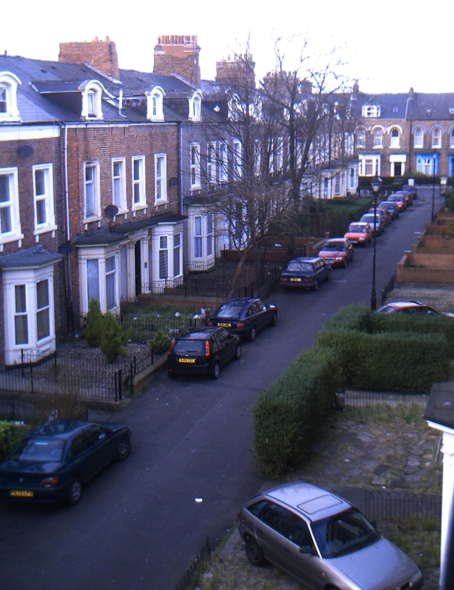
Ashbrooke is a residential area located in the city of Durham, England. Situated approximately one mile to the northwest of the city center, Ashbrooke is known for its affluent and prestigious status. The neighborhood is characterized by its grand Victorian and Edwardian houses, tree-lined streets, and well-maintained gardens.

Ashbrooke is home to a diverse community, including professionals, academics, and families. The area offers a tranquil and peaceful atmosphere, attracting residents seeking a balance between city living and a more suburban lifestyle. The proximity to the city center allows for easy access to amenities, including shops, restaurants, and cultural attractions.

One of the notable features of Ashbrooke is its close proximity to the University of Sunderland's city campus, making it an appealing location for students and academics. The area also benefits from its location near several green spaces, such as Backhouse Park and Mowbray Park, providing residents with opportunities for leisurely activities and outdoor recreation.

Transportation in Ashbrooke is well-served, with frequent bus services connecting the neighborhood to the city center and surrounding areas. The A690 road runs adjacent to Ashbrooke, providing convenient access to major road networks.

Overall, Ashbrooke offers an attractive and desirable place to live in Durham, combining the charm of historic architecture with modern amenities and a peaceful environment.

If you have any feedback on the listing, please let us know in the comments section below.
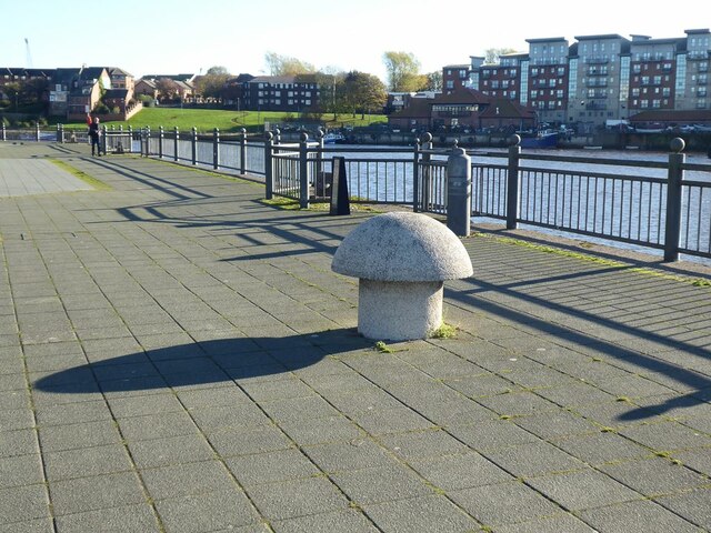
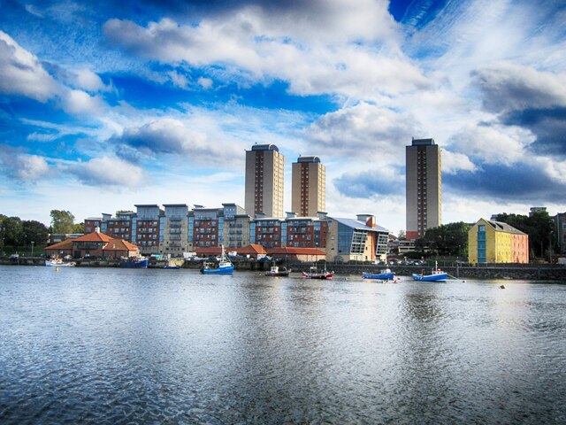
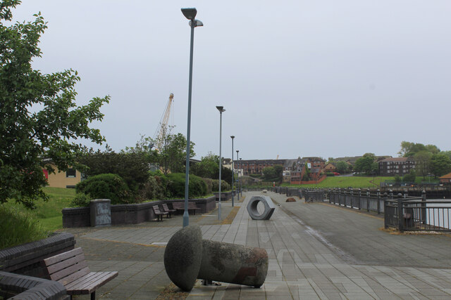
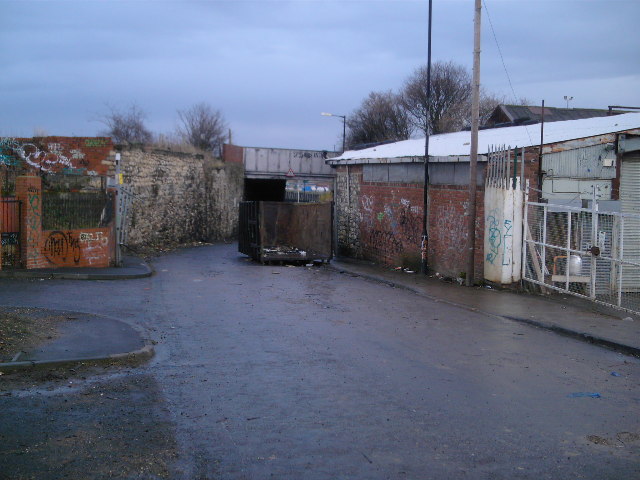
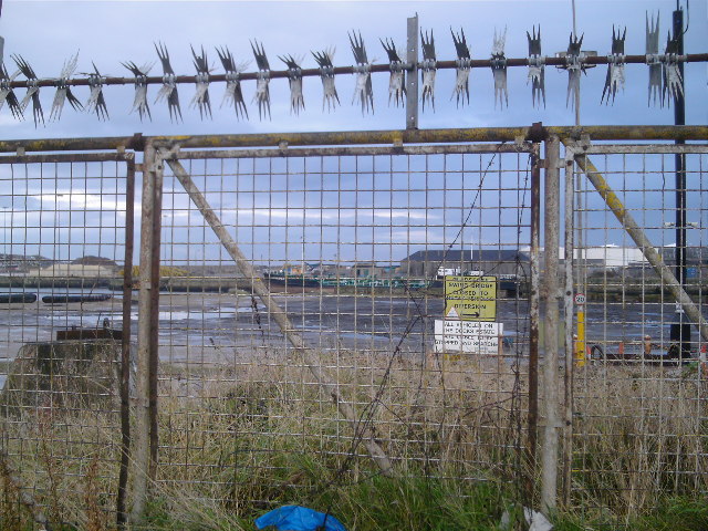
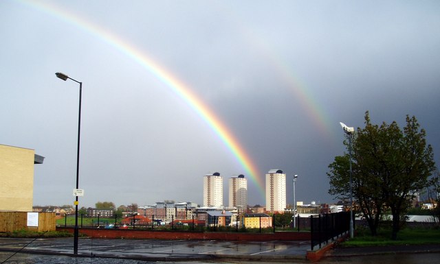
Ashbrooke Images

Images are sourced within 2km of 54.895325/-1.3889905 or Grid Reference NZ3955. Thanks to Geograph Open Source API. All images are credited.

"Shadows in another light" Dating from 1998, one of the sculptures forming part of the St Peter's Riverside Sculpture Project. The base is actually the original base of a riverside crane. Sometimes alternatively known as "The Iron Tree". To the east, the supposed shadow of the original crane is picked out in the paving slabs along the riverside path. The University of Sunderland Library can be seen in the distance.
"Shadows in another light"
Dating from 1998, one of the sculptures forming part of the St Peter's Riverside Sculpture Project. The base is actually the original base of a riverside crane. Sometimes alternatively known as "The Iron Tree". To the east, the supposed shadow of the original crane is picked out in the paving slabs along the riverside path. The University of Sunderland Library can be seen in the distance.
"Shadows in another light" Dating from 1998, one of the sculptures forming part of the St Peter's Riverside Sculpture Project. The base is actually the original base of a riverside crane. Sometimes alternatively known as "The Iron Tree". To the east, the supposed shadow of the original crane is picked out in the paving slabs along the riverside path.
"Shadows in another light"
Dating from 1998, one of the sculptures forming part of the St Peter's Riverside Sculpture Project. The base is actually the original base of a riverside crane. Sometimes alternatively known as "The Iron Tree". To the east, the supposed shadow of the original crane is picked out in the paving slabs along the riverside path.
Shadow on St Peter's Riverside path The supposed shadow of a crane is picked out in the paving slabs along the riverside path. The University of Sunderland Library can be seen in the distance. See also <a href="https://www.geograph.org.uk/photo/7333203">NZ4057 : "Shadows in another light"</a>.
Shadow on St Peter's Riverside path
The supposed shadow of a crane is picked out in the paving slabs along the riverside path. The University of Sunderland Library can be seen in the distance. See also NZ4057 : "Shadows in another light".
Sculpture and "shadow" on St Peter's Riverside The supposed shadow of a crane (originally standing on the concrete base of the sculpture) is picked out in the paving slabs along the riverside path. A concrete "rivet" can also be seen, commemorating the days of shipbuilding.  See also <a href="https://www.geograph.org.uk/photo/7333203">NZ4057 : "Shadows in another light"</a>.
Sculpture and "shadow" on St Peter's Riverside
The supposed shadow of a crane (originally standing on the concrete base of the sculpture) is picked out in the paving slabs along the riverside path. A concrete "rivet" can also be seen, commemorating the days of shipbuilding. See also NZ4057 : "Shadows in another light".
Shadow beside St Peter's Riverside The actual shadow of the "Shadows in another light" sculpture. See also <a href="https://www.geograph.org.uk/photo/7333246">NZ4057 : Sculpture and "shadow" on St Peter's Riverside</a>.
Shadow beside St Peter's Riverside
The actual shadow of the "Shadows in another light" sculpture. See also NZ4057 : Sculpture and "shadow" on St Peter's Riverside.
Telescope on St Peter's Riverside The plinth bears the inscription:
"Look up and see behind you. A shadow can raise a memory that nothing can erase."
This refers to the sculpture seen in <a href="https://www.geograph.org.uk/photo/7333208">NZ4057 : "Shadows in another light"</a> and the supposed shadow of a crane seen in <a href="https://www.geograph.org.uk/photo/7333239">NZ4057 : Shadow on St Peter's Riverside path</a>.
Telescope on St Peter's Riverside
The plinth bears the inscription: "Look up and see behind you. A shadow can raise a memory that nothing can erase." This refers to the sculpture seen in NZ4057 : "Shadows in another light" and the supposed shadow of a crane seen in NZ4057 : Shadow on St Peter's Riverside path.
Rivet and nut Two artefacts commemorating the shipbuilding tradition of the locality; part of the St Peter's Riverside Sculpture Project.
Rivet and nut
Two artefacts commemorating the shipbuilding tradition of the locality; part of the St Peter's Riverside Sculpture Project.
Giant nut on St Peter's Riverside Artefact commemorating the shipbuilding tradition of the locality; part of the St Peter's Riverside Sculpture Project. A giant rivet and the "Shadows in another light" sculpture can be seen in the middle distance.
Giant nut on St Peter's Riverside
Artefact commemorating the shipbuilding tradition of the locality; part of the St Peter's Riverside Sculpture Project. A giant rivet and the "Shadows in another light" sculpture can be seen in the middle distance.
St Peter's Riverside Artefacts commemorating the shipbuilding tradition of the locality; part of the St Peter's Riverside Sculpture Project.
St Peter's Riverside
Artefacts commemorating the shipbuilding tradition of the locality; part of the St Peter's Riverside Sculpture Project.
Sunderland Fish Quay Sunderland fish quay area
Sunderland Fish Quay
Sunderland fish quay area
Weardale Way beside Sunderland Harbour Giant rivets and nuts are passed by - a nod to the shipbuilding industry
Weardale Way beside Sunderland Harbour
Giant rivets and nuts are passed by - a nod to the shipbuilding industry
Extension Road This is Extension Road leading to Hendon Docks.
Extension Road
This is Extension Road leading to Hendon Docks.
Extension Street Railway Bridge Further into NZ4056.
Extension Street Railway Bridge
Further into NZ4056.
The Parade Frivolously titled street in this industrial wasteland, Note stray horses behind quaint, old, tumbledown wall.
The Parade
Frivolously titled street in this industrial wasteland, Note stray horses behind quaint, old, tumbledown wall.
Henry Street East More uneasy industrial menace.
Henry Street East
More uneasy industrial menace.
More Industrial Estate Unkempt light industrial area.
More Industrial Estate
Unkempt light industrial area.
More 4056 Guess what, more industrial decrepitude.
More 4056
Guess what, more industrial decrepitude.
Rainbows over Sunderland, 8th May 2005.
Show me another place!

Ashbrooke is located at Grid Ref: NZ3955 (Lat: 54.895325, Lng: -1.3889905)

Unitary Authority: Sunderland

Police Authority: Northumbria

What 3 Words

///cloud.extra.badly. Near Sunderland, Tyne & Wear

Nearby Locations

Ashbrooke Hillview

Related Wikis

Ashbrooke

Ashbrooke is a residential area of Sunderland, North East England directly south and south-west of the city centre. Ashbrooke developed through the Victorian...

St Aidan's Catholic Academy

St Aidan's Catholic Academy (formerly St Aidan's Catholic School) is a Roman Catholic boys' secondary school and sixth form with academy status, situated...

Thornhill Academy

Thornhill Academy, (formerly known as Thornhill School) is a co-educational secondary school located in Sunderland, Tyne and Wear, England.It was a community...

St Anthony's Girls' Catholic Academy

St Anthony's Girls' Catholic Academy (formerly St Anthony's Girls' Catholic School) is a secondary school and sixth form located in Sunderland, Tyne and...

Stockton Road United Reformed Church

Stockton Road United Reformed Church (formerly St George's with Trinity and St James Church (abbreviated to St George's)) is a United Reformed church in...

Sunderland High School

Sunderland High School was a mixed private day school located in Sunderland, Tyne and Wear, England. Founded in 1883 as the oldest girls' senior school...

Sunderland Synagogue

The Sunderland Synagogue is a former synagogue building in Sunderland, England. The synagogue, on Ryhope Road, was designed by architect Marcus Kenneth...

Palatine Lodge No. 97

Palatine Lodge No. 97 is a Craft Masonic Lodge in Freemasonry under the jurisdiction of the United Grand Lodge of England. The Lodge meets at Wearside...

Related Videos

Walking city centre of Sunderland with Wearmouth Bridge - #wearmouth Bridge #sunderland #uk

Walking around the city centre of Sunderland, north east England. Donate for a cup of coffee at the link below ...

LIVING IN UK #5 |MINI VACATION| 2 cities in 1 week| Road trips+ Meeting family members | MonnyLagos

Hiii beautiful people☺️ Happy Sunday I took some time out to rest and visit some family members and tried to do a little bit of a ...

Top 10 Places to Visit in Sunderland, Tyne and Wear | England - English

SunderlandPlaces #PlacesInSunderland #SunderlandVisitPlaces #Sunderland Sunderland is a port city and the administrative ...

Nearby Amenities

Located within 500m of 54.895325,-1.3889905
Ashbrooke
Place: suburb
Wikidata: Q4804639
Lat/Long: 54.8980257/-1.3861703
Post Box
Ref: SR2 165
Lat/Long: 54.8967535/-1.3963957
Telephone
Lat/Long: 54.8982528/-1.3884903
Ashbrooke Store
Addr City: Sunderland
Addr Housenumber: 1
Addr Postcode: SR2 7HP
Addr Street: Tunstall Vale
Fhrs Id: 651918
Shop: convenience
Source Addr: FHRS Open Data
Lat/Long: 54.8964895/-1.3859846
Post Box
Ref: SR2 59
Lat/Long: 54.8968904/-1.3850502
Telephone
Booth: KX300
Covered: booth
Lat/Long: 54.8960321/-1.3841899
Post Box
Ref: SR2 23
Lat/Long: 54.8995714/-1.3870958
Bus Stop
QUEEN ALEXANDRA ROAD-TUNSTALL ROAD-E/B
Bus: yes
Local Ref: E
Naptan AtcoCode: 410000024451
Naptan Bearing: E
Naptan CommonName: QUEEN ALEXANDRA ROAD-TUNSTALL ROAD-E/B
Naptan Indicator: E
Naptan Landmark: OUTSIDE ST TIMOTHY'S CHURCH
Naptan NaptanCode: twrdwpjm
Naptan PlusbusZoneRef: SNDRLND
Naptan Street: QUEEN ALEXANDRA ROAD
Naptan Verified: no
Public Transport: platform
Source: naptan_import
Lat/Long: 54.8920864/-1.389411
Bus Stop
QUEEN ALEXANDRA ROAD-ASHBROOKE ROAD-S/B
Bus: yes
Local Ref: N
Naptan AtcoCode: 410000024452
Naptan Bearing: N
Naptan CommonName: QUEEN ALEXANDRA ROAD-ASHBROOKE ROAD-S/B
Naptan Indicator: N
Naptan Landmark: OPPOSITE THE ROSEDENE PUBLIC HOUSE
Naptan NaptanCode: twrdwpjp
Naptan PlusbusZoneRef: SNDRLND
Naptan Street: QUEEN ALEXANDRA ROAD
Naptan Verified: no
Public Transport: platform
Source: naptan_import
Lat/Long: 54.8916668/-1.387115
Bus Stop
QUEEN ALEXANDRA ROAD-LINDEN ROAD-N/B
Bus: yes
Local Ref: N
Naptan AtcoCode: 410000024457
Naptan Bearing: N
Naptan CommonName: QUEEN ALEXANDRA ROAD-LINDEN ROAD-N/B
Naptan Indicator: N
Naptan Landmark: OUTSIDE THE ROSEDENE PUBLIC HOUSE
Naptan NaptanCode: twrdwpmg
Naptan PlusbusZoneRef: SNDRLND
Naptan Street: QUEEN ALEXANDRA ROAD
Naptan Verified: no
Public Transport: platform
Source: naptan_import
Lat/Long: 54.8913336/-1.38763
Bus Stop
QUEEN ALEXANDRA ROAD-FAIRHOLME ROAD-W/B
Bus: yes
Local Ref: W
Naptan AtcoCode: 410000024458
Naptan Bearing: W
Naptan CommonName: QUEEN ALEXANDRA ROAD-FAIRHOLME ROAD-W/B
Naptan Indicator: W
Naptan Landmark: 45M WEST OF FAIRHOLME ROAD JUNCTION
Naptan NaptanCode: twrdwpmj
Naptan PlusbusZoneRef: SNDRLND
Naptan Street: QUEEN ALEXANDRA ROAD
Naptan Verified: no
Public Transport: platform
Source: naptan_import
Lat/Long: 54.89229/-1.3931124
Bus Stop
QUEEN ALEXANDRA ROAD-NEWLANDS AVENUE-W/B
Local Ref: W
Naptan AtcoCode: 410000024459
Naptan Bearing: W
Naptan CommonName: QUEEN ALEXANDRA ROAD-NEWLANDS AVENUE-W/B
Naptan Indicator: W
Naptan Landmark: OUTSIDE JUNCTION NEWLANDS AVENUE
Naptan NaptanCode: twrdwpmp
Naptan PlusbusZoneRef: SNDRLND
Naptan Street: QUEEN ALEXANDRA ROAD
Naptan Verified: no
Source: naptan_import
Lat/Long: 54.8923394/-1.3947647
Bus Stop
Thornholme Road - School (S/B)
Bus: yes
Local Ref: SW
Naptan AtcoCode: 410000024468
Naptan Bearing: SW
Naptan CommonName: THORNHOLME ROAD-SCHOOL-S/B
Naptan Indicator: SW
Naptan Landmark: OUTSIDE THORNHILL PARK SCHOOL THORNHOLME UNIT
Naptan NaptanCode: twrdwptm
Naptan PlusbusZoneRef: SNDRLND
Naptan Street: THORNHOLME ROAD
Naptan Verified: no
Public Transport: platform
Source: naptan_import
Lat/Long: 54.8989605/-1.3904616
Bus Stop
THORNHOLME ROAD-BERESFORD PARK-S/B
Bus: yes
Local Ref: SW
Naptan AtcoCode: 410000024469
Naptan Bearing: SW
Naptan CommonName: THORNHOLME ROAD-BERESFORD PARK-S/B
Naptan Indicator: SW
Naptan Landmark: OUTSIDE THORNHILL PARK SCHOOL
Naptan NaptanCode: twrdwptp
Naptan PlusbusZoneRef: SNDRLND
Naptan Street: THORNHOLME ROAD
Naptan Verified: no
Public Transport: platform
Source: naptan_import
Lat/Long: 54.898197/-1.3923287
Bus Stop
THORNHOLME ROAD-BEECHWOOD TERRACE-N/B
Bus: yes
Local Ref: E
Naptan AtcoCode: 410000024474
Naptan Bearing: E
Naptan CommonName: THORNHOLME ROAD-BEECHWOOD TERRACE-N/B
Naptan Indicator: E
Naptan Landmark: OPPOSITE THORNHILL SCHOOL
Naptan NaptanCode: twrdwpwj
Naptan PlusbusZoneRef: SNDRLND
Naptan Street: THORNHOLME ROAD
Naptan Verified: no
Public Transport: platform
Source: naptan_import
Lat/Long: 54.8978434/-1.3935036
Bus Stop
Thornholme Road - School (N/B)
Bus: yes
Local Ref: E
Naptan AtcoCode: 410000024475
Naptan Bearing: E
Naptan CommonName: THORNHOLME ROAD-SCHOOL-N/B
Naptan Indicator: E
Naptan Landmark: OPPOSITE THORNHILL PARK SCHOOL THORNHOLME UNIT
Naptan NaptanCode: twrdwpwm
Naptan PlusbusZoneRef: SNDRLND
Naptan Street: THORNHOLME ROAD
Naptan Verified: no
Public Transport: platform
Source: naptan_import
Lat/Long: 54.8992161/-1.3901851
Bus Stop
TUNSTALL ROAD-THORNHILL PARK-S/B
Bus: yes
Local Ref: S
Naptan AtcoCode: 410000024285
Naptan Bearing: S
Naptan CommonName: TUNSTALL ROAD-THORNHILL PARK-S/B
Naptan Indicator: S
Naptan Landmark: OPPOSITE THORNHILL PARK JUNCTION
Naptan NaptanCode: twrdwjgm
Naptan PlusbusZoneRef: SNDRLND
Naptan Street: TUNSTALL ROAD
Naptan Verified: no
Public Transport: platform
Source: naptan_import
Lat/Long: 54.8985894/-1.3883381
Bus Stop
ASHBROOKE
Bus: yes
Local Ref: S
Naptan AtcoCode: 410000024286
Naptan Bearing: S
Naptan CommonName: ASHBROOKE
Naptan Indicator: S
Naptan Landmark: OUTSIDE TUNSTALL VALE JUNCTION
Naptan NaptanCode: twrdwjgp
Naptan PlusbusZoneRef: SNDRLND
Naptan Street: TUNSTALL ROAD
Naptan Verified: no
Public Transport: platform
Source: naptan_import
Lat/Long: 54.8960858/-1.3888677
Bus Stop
TUNSTALL ROAD-BELLE VUE ROAD-S/B
Bus: yes
Local Ref: S
Naptan AtcoCode: 410000024287
Naptan Bearing: S
Naptan CommonName: TUNSTALL ROAD-BELLE VUE ROAD-S/B
Naptan Indicator: S
Naptan Landmark: OUTSIDE ST AIDANS RC SCHOOL
Naptan NaptanCode: twrdwjgt
Naptan PlusbusZoneRef: SNDRLND
Naptan Street: TUNSTALL ROAD
Naptan Verified: no
Public Transport: platform
Source: naptan_import
Lat/Long: 54.8940115/-1.3891954
Bus Stop
THORNHOLME ROAD-ASHWOOD TERRACE-S/B
Bus: yes
Local Ref: SW
Naptan AtcoCode: 410000024928
Naptan Bearing: SW
Naptan CommonName: THORNHOLME ROAD-ASHWOOD TERRACE-S/B
Naptan Indicator: SW
Naptan Landmark: OUTSIDE THORNHILL SCHOOL
Naptan NaptanCode: twrgagmd
Naptan PlusbusZoneRef: SNDRLND
Naptan Street: THORNHOLME ROAD
Naptan Verified: no
Public Transport: platform
Source: naptan_import
Lat/Long: 54.8974433/-1.3943516
Bus Stop
BELVEDERE ROAD-AZALEA TERRACE-W/B
Bus: yes
Local Ref: W
Naptan AtcoCode: 410000024948
Naptan Bearing: W
Naptan CommonName: BELVEDERE ROAD-AZALEA TERRACE-W/B
Naptan Indicator: W
Naptan Landmark: EAST OF JUNCTION OF AZALEA TERRACE
Naptan NaptanCode: twrgwmgj
Naptan PlusbusZoneRef: SNDRLND
Naptan Street: BELVEDERE ROAD
Naptan Verified: no
Public Transport: platform
Source: naptan_import
Lat/Long: 54.8995349/-1.3867259
Bus Stop
TUNSTALL ROAD-QUEEN ALEXANDRA ROAD-S/B
Local Ref: S
Naptan AtcoCode: 410000024288
Naptan Bearing: S
Naptan CommonName: TUNSTALL ROAD-QUEEN ALEXANDRA ROAD-S/B
Naptan Indicator: S
Naptan Landmark: 60M SOUTH OF QUEEN ALEXANDRA ROAD ROUNDABOUT
Naptan NaptanCode: twrdwjgw
Naptan PlusbusZoneRef: SNDRLND
Naptan Street: TUNSTALL ROAD
Naptan Verified: no
Source: naptan_import
Lat/Long: 54.8916098/-1.3906403
Bus Stop
TUNSTALL ROAD-TUNSTALL PARK-N/B
Bus: yes
Local Ref: N
Naptan AtcoCode: 410000024291
Naptan Bearing: N
Naptan CommonName: TUNSTALL ROAD-TUNSTALL PARK-N/B
Naptan Indicator: N
Naptan Landmark: OPPOSITE ST AIDANS RC SCHOOL
Naptan NaptanCode: twrdwjmg
Naptan PlusbusZoneRef: SNDRLND
Naptan Street: TUNSTALL ROAD
Naptan Verified: no
Public Transport: platform
Source: naptan_import
Lat/Long: 54.8928115/-1.3900399
Bus Stop
TUNSTALL ROAD-HOLMLANDS PARK SOUTH-N/B
Bus: yes
Local Ref: N
Naptan AtcoCode: 410000024292
Naptan Bearing: N
Naptan CommonName: TUNSTALL ROAD-HOLMLANDS PARK SOUTH-N/B
Naptan Indicator: N
Naptan Landmark: OPPOSITE ASHBROOKE BOWLING GREENS
Naptan NaptanCode: twrdwjmj
Naptan PlusbusZoneRef: SNDRLND
Naptan Street: TUNSTALL ROAD
Naptan Verified: no
Public Transport: platform
Source: naptan_import
Lat/Long: 54.8946232/-1.3893109
Bus Stop
ASHBROOKE
Bus: yes
Local Ref: N
Naptan AtcoCode: 410000024293
Naptan Bearing: N
Naptan CommonName: ASHBROOKE
Naptan Indicator: N
Naptan Landmark: OUTSIDE NO.9 BROOKESIDE TERRACE
Naptan NaptanCode: twrdwjmp
Naptan PlusbusZoneRef: SNDRLND
Naptan Street: TUNSTALL ROAD
Naptan Verified: no
Public Transport: platform
Source: naptan_import
Lat/Long: 54.8965265/-1.388939
Bus Stop
TUNSTALL ROAD-THORNHILL GARDENS-N/B
Bus: yes
Local Ref: N
Naptan AtcoCode: 410000024294
Naptan Bearing: N
Naptan CommonName: TUNSTALL ROAD-THORNHILL GARDENS-N/B
Naptan Indicator: N
Naptan Landmark: OPPOSITE NO.4 VALEBROOKE
Naptan NaptanCode: twrdwjmt
Naptan PlusbusZoneRef: SNDRLND
Naptan Street: TUNSTALL ROAD
Naptan Verified: no
Public Transport: platform
Source: naptan_import
Lat/Long: 54.8978909/-1.3886221
Bus Stop
ASHBROOKE
Bus: yes
Local Ref: SE
Naptan AtcoCode: 410000060202
Naptan Bearing: SE
Naptan CommonName: ASHBROOKE
Naptan Indicator: SE
Naptan Landmark: OUTSIDE NO 17 AZALEA AVENUE
Naptan NaptanCode: twrgpwaj
Naptan PlusbusZoneRef: SNDRLND
Naptan Street: AZALEA AVENUE
Naptan Verified: no
Public Transport: platform
Source: naptan_import
Lat/Long: 54.8979758/-1.3858608
Post Office
Tunstall Vale Post Office
Addr City: Sunderland
Addr Country: GB
Addr Housename: Wilsons Convenience Store
Addr Housenumber: 128
Addr Postcode: SR2 9AB
Addr Street: Queen Alexandra Road
Opening Hours: Mo-Sa 06:00-20:00
Ref Pol Id: 131926
Lat/Long: 54.892445/-1.3907812
Barrier: wall
Fixme: Check type of barrier by survey
Source: Bing
Lat/Long: 54.8940135/-1.3908001
Barrier: bollard
Lat/Long: 54.8969988/-1.390574
Barrier: bollard
Lat/Long: 54.8970103/-1.3905445
Barrier: bollard
Lat/Long: 54.8969886/-1.3906266
Barrier: lift_gate
Lat/Long: 54.8952739/-1.3881795
Brookside Lodge
Building: house
Lat/Long: 54.8965989/-1.3892164
Crossing
Lat/Long: 54.8976785/-1.393825
The data included in this document is from www.openstreetmap.org. The data is made available under ODbL.

Have you been to Ashbrooke?

Leave your review of Ashbrooke below (or comments, questions and feedback).