Alverton

Settlement in Cornwall

England

Alverton

Newlyn harbour from Fore Street
Newlyn harbour from Fore Street Credit: David Gearing

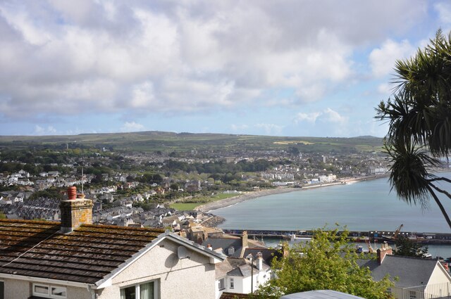
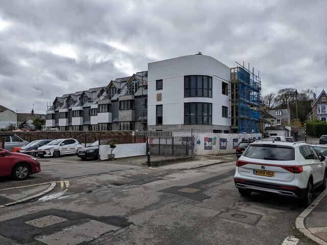
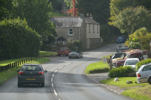
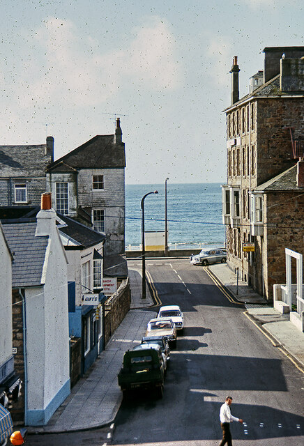
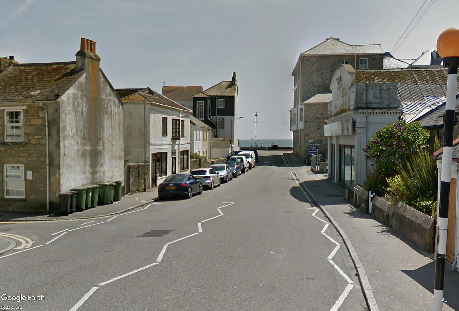
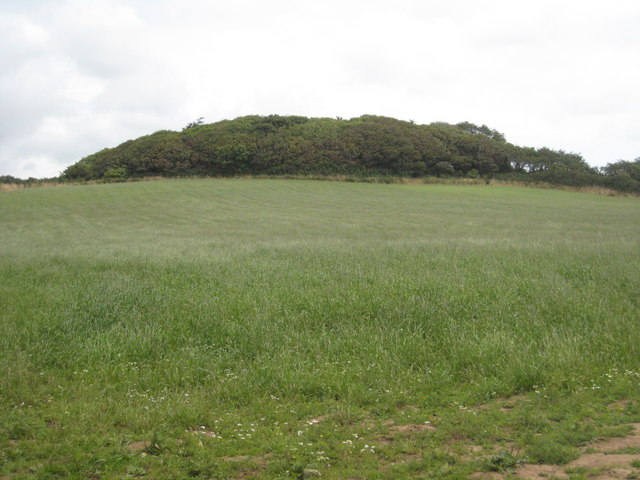
Alverton is a picturesque village located in the county of Cornwall, England. Situated just a mile away from the bustling town of Penzance, Alverton offers a serene and tranquil atmosphere to its residents and visitors. The village is nestled amidst lush green fields, rolling hills, and stunning coastal views, making it a popular destination for nature enthusiasts and hikers.

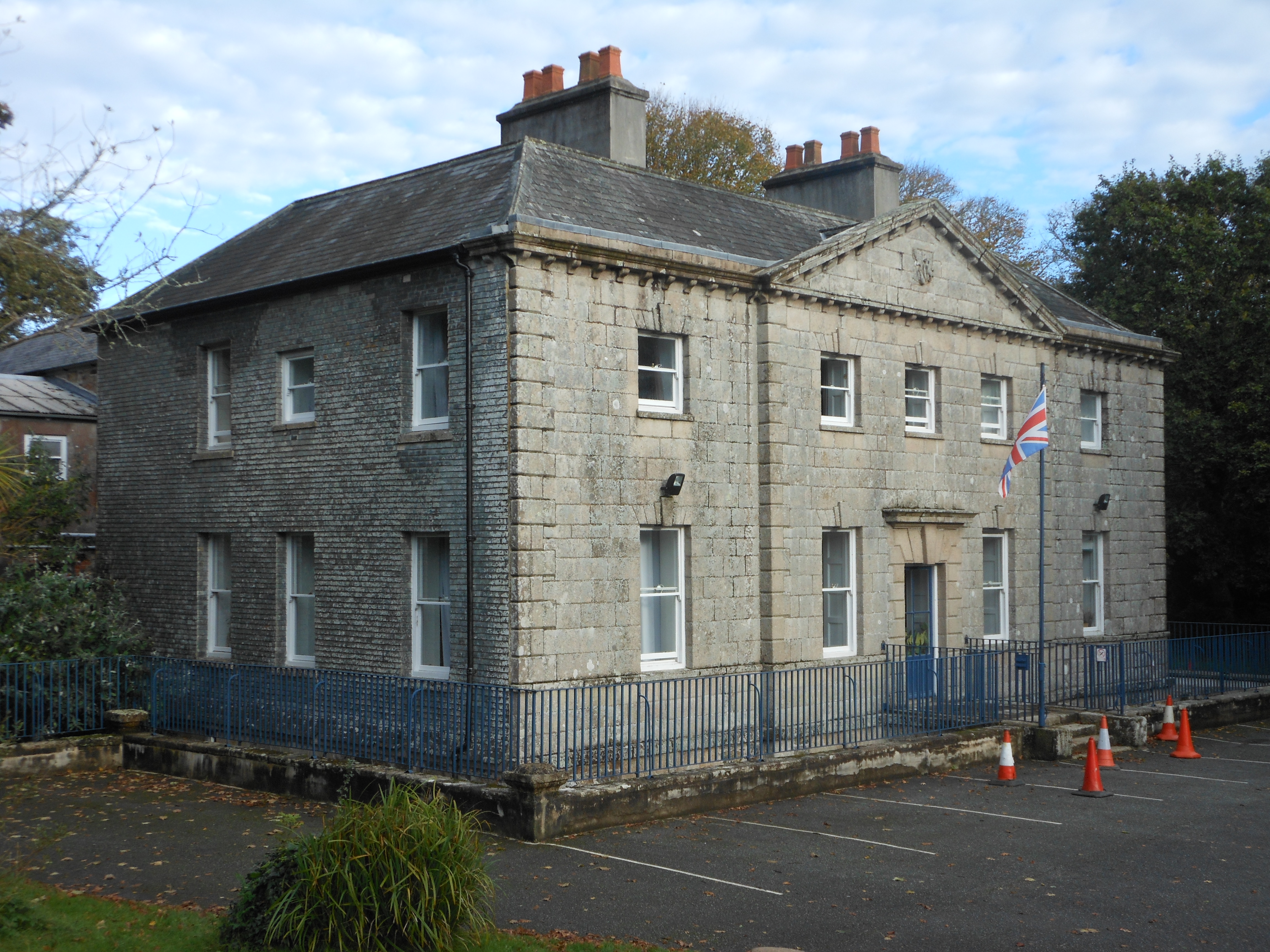
Alverton is blessed with a rich history, dating back to medieval times. The main focal point of the village is the historic Alverton Manor, a Grade II listed building that has been converted into a luxury hotel. The manor's stunning architecture and beautiful gardens attract tourists from far and wide.

The village boasts a tight-knit community with a range of amenities for its residents. There is a local primary school, a village hall, and a charming local pub that serves traditional Cornish cuisine. The village also has a small convenience store, catering to the daily needs of its inhabitants.

Alverton is perfectly situated for exploring the surrounding areas of Cornwall. Just a short drive away, visitors can discover the picturesque coastal villages of Mousehole and St. Ives, renowned for their quaint charm and artistic communities. The famous landmark of St. Michael's Mount is also a stone's throw away, offering stunning views and a glimpse into Cornwall's history.

Overall, Alverton is a hidden gem in Cornwall, offering a blend of natural beauty, history, and a close-knit community, making it a delightful place to visit or call home.

If you have any feedback on the listing, please let us know in the comments section below.

Alverton Images

Images are sourced within 2km of 50.115139/-5.5520492 or Grid Reference SW4629. Thanks to Geograph Open Source API. All images are credited.

Newlyn harbour from Fore Street
The Newlyn Fishermen Memorial
Royal National Mission to Deep Sea Fishermen, Newlyn
Coastal views
Coastal views
View towards Newlyn Tidal Observatory from Tolcarne FBM
Newlyn Harbour A view of Newlyn Harbour taken from behind the RNLI station and looking southeast with the Mary Williams Pier on the left and the South Pier in the background.
Newlyn Harbour
A view of Newlyn Harbour taken from behind the RNLI station and looking southeast with the Mary Williams Pier on the left and the South Pier in the background.
Newlyn Harbour View of Newlyn Harbour, taken looking south from the Mary Williams Pier.
Newlyn Harbour
View of Newlyn Harbour, taken looking south from the Mary Williams Pier.
Street in Tolcarne
Street in Tolcarne
Looking across towards Penzance A view from Chywoone Hill across Newlyn towards Penzance.  Newlyn Harbour North  Quay crosses the bay from left to right.
Looking across towards Penzance
A view from Chywoone Hill across Newlyn towards Penzance. Newlyn Harbour North Quay crosses the bay from left to right.
Looking in to Mennaye Field
The gates to Penzance football club ground
Sponsored by Jewsons
Where once a garage stood Apartments have replaced the old garage. See: <a title="https://www.geograph.org.uk/photo/5749923" href="https://www.geograph.org.uk/photo/5749923">Link</a>
Where once a garage stood
Apartments have replaced the old garage. See: Link
Buryas Bridge : A30 Looking along the A30.
Buryas Bridge : A30
Looking along the A30.
Newlyn : A30 Looking along the A30.
Newlyn : A30
Looking along the A30.
Fish pond in Morrab Gardens
Morrab Road, Penzance c.1970 From the upstairs window of the former Marine Park Hotel. Streetview image Sep 2021: <span class="nowrap"><a title="https://media.geograph.org.uk/files/7eabe3a1649ffa2b3ff8c02ebfd5659f/Morrab_Rd_Penzance_Sep_2021-original.jpg" rel="nofollow ugc noopener" href="https://media.geograph.org.uk/files/7eabe3a1649ffa2b3ff8c02ebfd5659f/Morrab_Rd_Penzance_Sep_2021-original.jpg">Link</a><img style="margin-left:2px;" alt="External link" title="External link - shift click to open in new window" src="https://s1.geograph.org.uk/img/external.png" width="10" height="10"/></span>

<a href="https://www.geograph.org.uk/photo/7416705">SW4729 : Marine Park Hotel, Morab Road, Penzance c.1970</a>
Morrab Road, Penzance c.1970
From the upstairs window of the former Marine Park Hotel. Streetview image Sep 2021: LinkExternal link SW4729 : Marine Park Hotel, Morab Road, Penzance c.1970
Penzance : Road A road heading out from Penzance.
Penzance : Road
A road heading out from Penzance.
Show me another place!

Alverton is located at Grid Ref: SW4629 (Lat: 50.115139, Lng: -5.5520492)

Unitary Authority: Cornwall

Police Authority: Devon and Cornwall

What 3 Words

///stews.bagpipes.picked. Near Penzance, Cornwall

Related Wikis

Castle Horneck

Castle Horneck is a Grade II* listed building, and refurbished Georgian mansion to the west of the Cornish town of Penzance. It is currently owned by the...
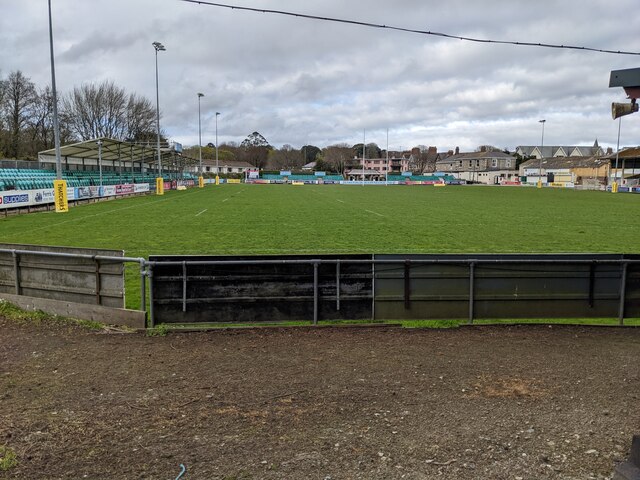
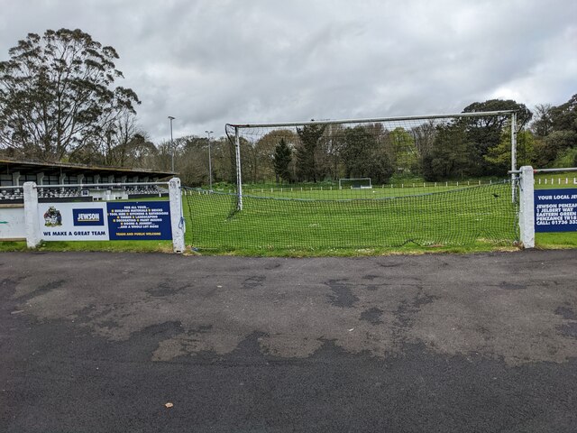
Mennaye Field

The Mennaye Field is a sports stadium located in Penzance, Cornwall, UK. The ground was provided by the Borough of Penzance for the Penzance and Newlyn...
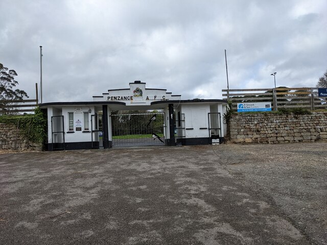
Penzance A.F.C.

Penzance Association Football Club is a Charter Standard Football Club based in Penzance, Cornwall in the United Kingdom. They were established in 1888...

Penlee House

Penlee House is a museum and art gallery located in the town of Penzance in Cornwall, and is home to a great many paintings by members of the Newlyn School...

Penzance School of Art

Penzance School of Art is an art school in Penzance, Cornwall, England, housed in a purpose-built Grade II listed building opened in 1881. == History... ==

Wherrytown

Wherrytown is a small settlement in west Cornwall, United Kingdom, on the east side of the Laregan River, between Newlyn and Penzance. It was formerly...

Lesingey Round

Lesingey Round is a ringfort, a smaller type of hillfort, about 1 mile (1.6 km) west of Penzance, in Cornwall, England. It is a scheduled monument.A 'round...

St John's Hall, Penzance

St John's Hall, formerly known as the Public Buildings, Penzance, is a municipal building in Alverton Street, Penzance, Cornwall, England. The structure...

Nearby Amenities

Located within 500m of 50.115139,-5.5520492
Bus Stop
Alexandra Rd
Bus: yes
Naptan AtcoCode: 0800COD40030
Naptan Bearing: SE
Naptan CommonName: Alexandra Rd
Naptan Crossing: Alverton Road
Naptan Indicator: Opp
Naptan NaptanCode: coradtgw
Naptan PlusbusZoneRef: PENZNCE
Naptan Street: Alexandra Road
Naptan Verified: no
Public Transport: platform
Shelter: no
Source: naptan_import
Lat/Long: 50.116646/-5.5459622
Bus Stop
Alexandra Rd
Bus: yes
Naptan AtcoCode: 0800COD40031
Naptan Bearing: NW
Naptan CommonName: Alexandra Rd
Naptan Crossing: Alverton Road
Naptan NaptanCode: coradtgt
Naptan PlusbusZoneRef: PENZNCE
Naptan Street: Alexandra Road
Naptan Verified: no
Public Transport: platform
Shelter: no
Source: naptan_import
Lat/Long: 50.1165785/-5.5461111
Bus Stop
YMCA
Bus: yes
Naptan AtcoCode: 0800COD40126
Naptan Bearing: W
Naptan CommonName: YMCA
Naptan Crossing: Orchard Court
Naptan NaptanCode: coradtdw
Naptan PlusbusZoneRef: PENZNCE
Naptan Street: Alverton Road
Naptan Verified: no
Public Transport: platform
Shelter: no
Source: naptan_import
Lat/Long: 50.1168171/-5.5477239
Bus Stop
YMCA
Bus: yes
Naptan AtcoCode: 0800COD40127
Naptan Bearing: E
Naptan CommonName: YMCA
Naptan Crossing: Orchard Court
Naptan Indicator: Opp
Naptan NaptanCode: coradtdg
Naptan PlusbusZoneRef: PENZNCE
Naptan Street: Alverton Road
Naptan Verified: no
Public Transport: platform
Shelter: no
Source: naptan_import
Lat/Long: 50.1168599/-5.5483846
Bus Stop
Alverton
Bus: yes
Naptan AtcoCode: 0800COD40128
Naptan Bearing: NE
Naptan CommonName: Alverton
Naptan Crossing: Penpons Close
Naptan NaptanCode: coradpmg
Naptan PlusbusZoneRef: PENZNCE
Naptan Street: Alverton Road
Naptan Verified: no
Public Transport: platform
Shelter: yes
Source: naptan_import
Lat/Long: 50.1157857/-5.5517331
Bus Stop
Landsdowne Road
Bus: yes
Naptan AtcoCode: 0800COD40129
Naptan Bearing: S
Naptan CommonName: Landsdowne Road
Naptan NaptanCode: coradpjt
Naptan PlusbusZoneRef: PENZNCE
Naptan Street: Alverton Road
Naptan Verified: no
Public Transport: platform
Source: naptan_import
Lat/Long: 50.1151736/-5.5520376
Bus Stop
Rope Walk
Bus: yes
Naptan AtcoCode: 0800COD40130
Naptan Bearing: S
Naptan CommonName: Rope Walk
Naptan NaptanCode: coradpaw
Naptan PlusbusZoneRef: PENZNCE
Naptan Street: Pine Road
Naptan Verified: no
Public Transport: platform
Shelter: yes
Source: naptan_import
Lat/Long: 50.1137749/-5.5542285
Bus Stop
Rope Walk
Bus: yes
Naptan AtcoCode: 0800COD40131
Naptan Bearing: W
Naptan CommonName: Rope Walk
Naptan Crossing: The Ropewalk
Naptan NaptanCode: coradpdg
Naptan PlusbusZoneRef: PENZNCE
Naptan Street: Pine Road
Naptan Verified: no
Public Transport: platform
Shelter: no
Source: naptan_import
Lat/Long: 50.1137373/-5.5539879
Bus Stop
Croft Rd
Bus: yes
Naptan AtcoCode: 0800COD40132
Naptan Bearing: NW
Naptan CommonName: Croft Rd
Naptan NaptanCode: coradpmd
Naptan PlusbusZoneRef: PENZNCE
Naptan Street: The Ropewalk
Naptan Verified: no
Public Transport: platform
Source: naptan_import
Lat/Long: 50.1134855/-5.5516327
Bus Stop
Rope Walk
Bus: yes
Naptan AtcoCode: 0800COD40133
Naptan Bearing: S
Naptan CommonName: Rope Walk
Naptan Crossing: Croft Road
Naptan NaptanCode: coradpmp
Naptan PlusbusZoneRef: PENZNCE
Naptan Street: The Ropewalk
Naptan Verified: no
Public Transport: platform
Source: naptan_import
Lat/Long: 50.1133171/-5.5512565
Bus Stop
Creeping Lane
Bus: yes
Naptan AtcoCode: 0800COD40135
Naptan Bearing: SE
Naptan CommonName: Creeping Lane
Naptan Crossing: Creeping Lane
Naptan NaptanCode: coradptp
Naptan PlusbusZoneRef: PENZNCE
Naptan Street: Lidden Road
Naptan Verified: no
Public Transport: platform
Source: naptan_import
Lat/Long: 50.1108687/-5.5504176
Bus Stop
The Steps
Bus: yes
Naptan AtcoCode: 0800COD40166
Naptan Bearing: NW
Naptan CommonName: The Steps
Naptan Crossing: Trenoweth Road
Naptan NaptanCode: coradpdj
Naptan PlusbusZoneRef: PENZNCE
Naptan Street: Lansdowne Road
Naptan Verified: no
Public Transport: platform
Source: naptan_import
Lat/Long: 50.115778/-5.5540412
Bus Stop
Number 40
Bus: yes
Naptan AtcoCode: 0800COD40167
Naptan Bearing: SE
Naptan CommonName: Number 40
Naptan Crossing: Lansdowne Road
Naptan NaptanCode: coradpdp
Naptan PlusbusZoneRef: PENZNCE
Naptan Street: Cardinnis Road
Naptan Verified: no
Public Transport: platform
Source: naptan_import
Lat/Long: 50.1171595/-5.5538778
Bus Stop
Trenoweth Road
Bus: yes
Naptan AtcoCode: 0800COD40168
Naptan Bearing: W
Naptan CommonName: Trenoweth Road
Naptan Crossing: Lansdowne Road
Naptan NaptanCode: coradpdw
Naptan PlusbusZoneRef: PENZNCE
Naptan Street: Trenoweth Road
Naptan Verified: no
Public Transport: platform
Source: naptan_import
Lat/Long: 50.1163067/-5.5535207
Bus Stop
Landsdown Place
Bus: yes
Naptan AtcoCode: 0800COD40169
Naptan Bearing: E
Naptan CommonName: Landsdown Place
Naptan NaptanCode: coradpjd
Naptan PlusbusZoneRef: PENZNCE
Naptan Street: Lansdowne Road
Naptan Verified: no
Public Transport: platform
Source: naptan_import
Lat/Long: 50.1153031/-5.5525089
Bus Stop
Castle Horneck Youth Hostel
Bus: yes
Naptan AtcoCode: 0800COD40316
Naptan Bearing: W
Naptan CommonName: Castle Horneck Youth Hostel
Naptan NaptanCode: coradpda
Naptan PlusbusZoneRef: PENZNCE
Naptan Street: Castle Horneck Road
Naptan Verified: no
Public Transport: platform
Shelter: no
Source: naptan_import
Lat/Long: 50.1180247/-5.5544176
Pub
Pirate Inn
Addr City: Penzance
Addr Country: GB
Addr Postcode: TR18 4PS
Addr Street: Alverton Road
Fhrs Id: 1149490
Lat/Long: 50.1162016/-5.550837
YMCA Hostel
Source: Local Knowledge
Tourism: hostel
Lat/Long: 50.1166767/-5.5480351
Post Box
Collection Times: Mo-Fr 09:00; Sa 07:00
Operator: Royal Mail
Operator Wikidata: Q638098
Post Box Type: lamp
Ref: TR18 102D
Royal Cypher: EIIR
Royal Cypher Wikidata: Q33102113
Source: survey
Survey Date: 2015-10-01
Lat/Long: 50.1120874/-5.5513978
Post Box
Collection Times: Mo-Fr 17:15; Sa 11:30
Operator: Royal Mail
Operator Wikidata: Q638098
Post Box Type: pillar
Ref: TR18 53
Royal Cypher: EIIR
Royal Cypher Wikidata: Q33102113
Source: survey
Survey Date: 2015-10-01
Lat/Long: 50.1151266/-5.5518322
Post Box
Collection Times: Mo-Fr 09:00; Sa 07:00
Operator: Royal Mail
Operator Wikidata: Q638098
Post Box Type: lamp
Ref: TR18 54D
Royal Cypher: EIIR
Royal Cypher Wikidata: Q33102113
Source: survey
Survey Date: 2015-10-01
Lat/Long: 50.1160239/-5.5541746
Post Box
Collection Times: Mo-Fr 09:00; Sa 07:00
Operator: Royal Mail
Operator Wikidata: Q638098
Post Box Type: wall
Ref: TR18 125D
Royal Cypher: GR
Royal Cypher Wikidata: Q33102273
Source: survey
Survey Date: 2015-10-01
Lat/Long: 50.1168815/-5.549388
Man Made: tower
Lat/Long: 50.1122475/-5.5542832
Crossing
Crossing: unmarked
Lat/Long: 50.1138009/-5.5573609
Barrier: cycle_barrier
Lat/Long: 50.1139963/-5.5545991
Barrier: cycle_barrier
Lat/Long: 50.114216/-5.5565847
Swing Gate Type: single
Lat/Long: 50.1135141/-5.5572148
Bench
Backrest: yes
Material: wood
Seats: 5
Lat/Long: 50.1170258/-5.5464394
Mini Roundabout
Lat/Long: 50.1169768/-5.5463443
Generator Method: photovoltaic
Generator Output Electricity: yes
Generator Source: solar
Generator Type: solar_photovoltaic_panel
Location: roof
Power: generator
Lat/Long: 50.115862/-5.5530775
Generator Method: photovoltaic
Generator Output Electricity: yes
Generator Source: solar
Generator Type: solar_photovoltaic_panel
Location: roof
Power: generator
Lat/Long: 50.1160065/-5.5533243
Generator Method: photovoltaic
Generator Output Electricity: yes
Generator Source: solar
Generator Type: solar_photovoltaic_panel
Location: roof
Power: generator
Lat/Long: 50.1164846/-5.5544615
Generator Method: photovoltaic
Generator Output Electricity: yes
Generator Source: solar
Generator Type: solar_photovoltaic_panel
Location: roof
Power: generator
Lat/Long: 50.1162421/-5.5529273
Generator Method: photovoltaic
Generator Output Electricity: yes
Generator Source: solar
Generator Type: solar_photovoltaic_panel
Location: roof
Power: generator
Lat/Long: 50.1164829/-5.5527878
Generator Method: photovoltaic
Generator Output Electricity: yes
Generator Source: solar
Generator Type: solar_photovoltaic_panel
Location: roof
Power: generator
Lat/Long: 50.1161337/-5.5514869
Generator Method: photovoltaic
Generator Output Electricity: yes
Generator Source: solar
Generator Type: solar_photovoltaic_panel
Location: roof
Power: generator
Lat/Long: 50.1161011/-5.5514279
Generator Method: photovoltaic
Generator Output Electricity: yes
Generator Source: solar
Generator Type: solar_photovoltaic_panel
Location: roof
Power: generator
Lat/Long: 50.1145875/-5.5530534
Generator Method: photovoltaic
Generator Output Electricity: yes
Generator Source: solar
Generator Type: solar_photovoltaic_panel
Location: roof
Power: generator
Lat/Long: 50.1169197/-5.5546868
Generator Method: photovoltaic
Generator Output Electricity: yes
Generator Source: solar
Generator Type: solar_photovoltaic_panel
Location: roof
Power: generator
Lat/Long: 50.1169318/-5.5547217
Generator Method: photovoltaic
Generator Output Electricity: yes
Generator Source: solar
Generator Type: solar_photovoltaic_panel
Location: roof
Power: generator
Lat/Long: 50.1179379/-5.5515567
Generator Method: photovoltaic
Generator Output Electricity: yes
Generator Source: solar
Generator Type: solar_photovoltaic_panel
Location: roof
Power: generator
Lat/Long: 50.1185485/-5.552187
Generator Method: photovoltaic
Generator Output Electricity: yes
Generator Source: solar
Generator Type: solar_photovoltaic_panel
Location: roof
Power: generator
Lat/Long: 50.1191389/-5.5499557
Generator Method: photovoltaic
Generator Output Electricity: yes
Generator Source: solar
Generator Type: solar_photovoltaic_panel
Location: roof
Power: generator
Lat/Long: 50.1191407/-5.5518869
Generator Method: photovoltaic
Generator Output Electricity: yes
Generator Source: solar
Generator Type: solar_photovoltaic_panel
Location: roof
Power: generator
Lat/Long: 50.1178491/-5.5487889
Direction: SE
Generator Method: photovoltaic
Generator Output Electricity: small_installation
Generator Source: solar
Generator Type: solar_photovoltaic_panel
Location: roof
Power: generator
Source: bing
Lat/Long: 50.1150505/-5.5450661
Direction: S
Generator Method: photovoltaic
Generator Output Electricity: small_installation
Generator Source: solar
Generator Type: solar_photovoltaic_panel
Location: roof
Power: generator
Source: bing
Lat/Long: 50.1153463/-5.546473
Direction: SE
Generator Method: photovoltaic
Generator Output Electricity: small_installation
Generator Source: solar
Generator Type: solar_photovoltaic_panel
Location: roof
Power: generator
Source: bing
Lat/Long: 50.1144218/-5.5469759
Direction: E
Generator Method: photovoltaic
Generator Output Electricity: small_installation
Generator Source: solar
Generator Type: solar_photovoltaic_panel
Location: roof
Power: generator
Source: bing
Lat/Long: 50.1126562/-5.5513157
Direction: W
Generator Method: photovoltaic
Generator Output Electricity: small_installation
Generator Source: solar
Generator Type: solar_photovoltaic_panel
Location: roof
Power: generator
Source: bing
Lat/Long: 50.1126631/-5.5514056
Direction: S
Generator Method: photovoltaic
Generator Output Electricity: small_installation
Generator Source: solar
Generator Type: solar_photovoltaic_panel
Location: roof
Power: generator
Source: bing
Lat/Long: 50.1124975/-5.5509637
Direction: E
Generator Method: photovoltaic
Generator Output Electricity: small_installation
Generator Source: solar
Generator Type: solar_photovoltaic_panel
Location: roof
Power: generator
Source: bing
Lat/Long: 50.1125272/-5.5509147
Direction: S
Generator Method: photovoltaic
Generator Output Electricity: small_installation
Generator Source: solar
Generator Type: solar_photovoltaic_panel
Location: roof
Power: generator
Source: bing
Lat/Long: 50.1120637/-5.5510354
Direction: S
Generator Method: photovoltaic
Generator Output Electricity: small_installation
Generator Source: solar
Generator Type: solar_photovoltaic_panel
Location: roof
Power: generator
Source: bing
Lat/Long: 50.1108312/-5.5523148
Direction: S
Generator Method: photovoltaic
Generator Output Electricity: small_installation
Generator Source: solar
Generator Type: solar_photovoltaic_panel
Location: roof
Power: generator
Source: bing
Lat/Long: 50.1123036/-5.5525965
Direction: S
Generator Method: photovoltaic
Generator Output Electricity: small_installation
Generator Source: solar
Generator Type: solar_photovoltaic_panel
Location: roof
Power: generator
Source: bing
Lat/Long: 50.112025/-5.5523255
Direction: E
Generator Method: photovoltaic
Generator Output Electricity: small_installation
Generator Source: solar
Generator Type: solar_photovoltaic_panel
Location: roof
Power: generator
Source: bing
Lat/Long: 50.1117085/-5.5526501
Direction: W
Generator Method: photovoltaic
Generator Output Electricity: small_installation
Generator Source: solar
Generator Type: solar_photovoltaic_panel
Location: roof
Power: generator
Source: bing
Lat/Long: 50.1115906/-5.5523591
Direction: W
Generator Method: photovoltaic
Generator Output Electricity: small_installation
Generator Source: solar
Generator Type: solar_photovoltaic_panel
Location: roof
Power: generator
Source: bing
Lat/Long: 50.1116964/-5.5526984
Direction: W
Generator Method: photovoltaic
Generator Output Electricity: small_installation
Generator Source: solar
Generator Type: solar_photovoltaic_panel
Location: roof
Power: generator
Source: bing
Lat/Long: 50.1116689/-5.5528955
Direction: S
Generator Method: photovoltaic
Generator Output Electricity: small_installation
Generator Source: solar
Generator Type: solar_photovoltaic_panel
Location: roof
Power: generator
Source: bing
Lat/Long: 50.1118959/-5.5483237
Direction: SE
Generator Method: photovoltaic
Generator Output Electricity: small_installation
Generator Source: solar
Generator Type: solar_photovoltaic_panel
Location: roof
Power: generator
Source: bing
Lat/Long: 50.1143552/-5.5484806
Premier Alverton Stores
Brand: Premier
Brand Wikidata: Q7240340
Shop: convenience
Website: https://www.premier-stores.co.uk/our-stores/alverton-stores
Lat/Long: 50.1151569/-5.5516423
Fast Food
buzz's fish and chips
Lat/Long: 50.1150363/-5.5518279
Polgood Vineyard & Orchard
Addr City: Penzance
Addr Housename: Polgoon Farm
Addr Postcode: TR20 8TE
Addr Street: Rosehill
Craft: brewery
Email: tours@polgoon.com
Phone: +44 1736 333 946
Product: cider
Website: https://www.polgoon.com/
Lat/Long: 50.1187407/-5.5536631
Location Transition: yes
Power: pole
Lat/Long: 50.1161753/-5.5566976
Power: pole
Transformer: distribution
Lat/Long: 50.116349/-5.5573359
Power: pole
Lat/Long: 50.116564/-5.558103
Crossing
Crossing: unmarked
Lat/Long: 50.1139072/-5.5567397
Crossing
Crossing: unmarked
Lat/Long: 50.1139827/-5.5566988
Crossing
Crossing: unmarked
Lat/Long: 50.1137679/-5.5572546
The data included in this document is from www.openstreetmap.org. The data is made available under ODbL.

Have you been to Alverton?

Leave your review of Alverton below (or comments, questions and feedback).