Wherry Town

Settlement in Cornwall

England

Wherry Town

Newlyn harbour from Fore Street
Newlyn harbour from Fore Street Credit: David Gearing

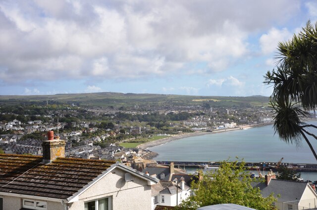
Wherry Town is a small coastal village situated in the county of Cornwall, England. It is located on the western outskirts of the town of Penzance and overlooks the picturesque Mount's Bay. Wherry Town is well-known for its stunning views of St. Michael's Mount, a small tidal island crowned by a medieval castle.

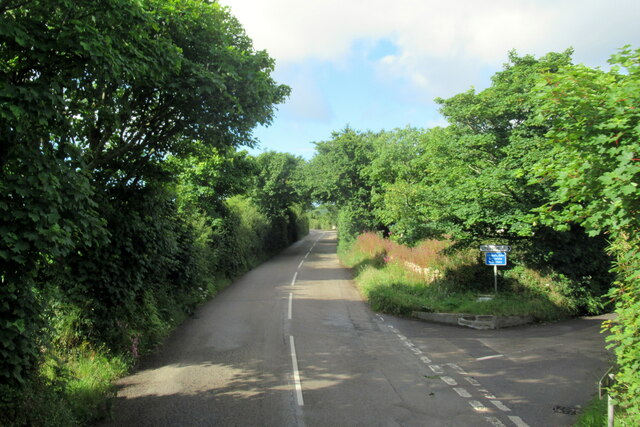
The village is primarily residential, with a mix of traditional Cornish cottages and modern houses. It enjoys a peaceful and laid-back atmosphere, making it a popular destination for those seeking tranquility away from the hustle and bustle of larger towns. The community is tight-knit and friendly, with a strong sense of local pride.

Wherry Town benefits from its proximity to the coast, offering residents and visitors alike the opportunity to enjoy a range of recreational activities. The area's sandy beaches are perfect for sunbathing, swimming, and beachcombing, while the clear blue waters provide an ideal environment for water sports such as surfing, kayaking, and sailing.

For those interested in history and culture, Wherry Town is within walking distance of Penzance's town center, where one can explore historic landmarks like the Penzance Promenade and the Penlee House Gallery and Museum. The village also hosts a variety of events throughout the year, including local fairs, art exhibitions, and traditional Cornish festivals.

In summary, Wherry Town offers a peaceful coastal retreat with breathtaking views, a friendly community, and access to a range of recreational activities. It is an idyllic destination for nature lovers, history enthusiasts, and those seeking a slower pace of life.

If you have any feedback on the listing, please let us know in the comments section below.
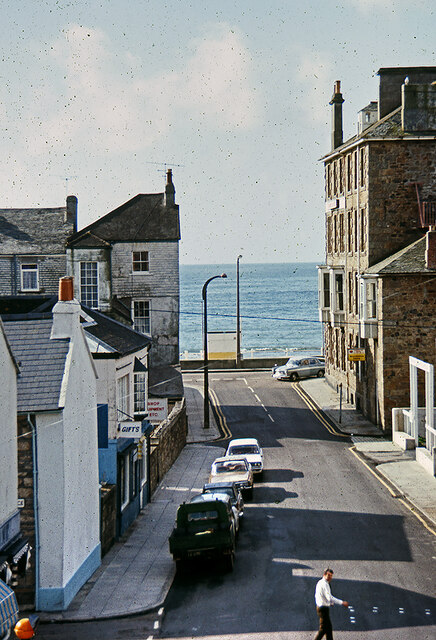
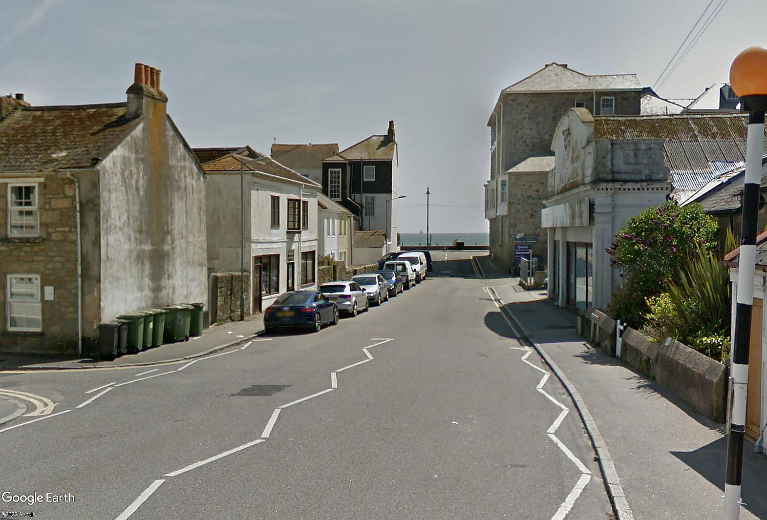
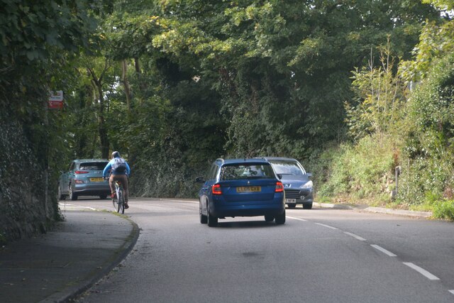
Wherry Town Images

Images are sourced within 2km of 50.111399/-5.54293 or Grid Reference SW4629. Thanks to Geograph Open Source API. All images are credited.

Newlyn harbour from Fore Street
The Newlyn Fishermen Memorial
Royal National Mission to Deep Sea Fishermen, Newlyn
Coastal views
Coastal views
View towards Newlyn Tidal Observatory from Tolcarne FBM
Newlyn Harbour A view of Newlyn Harbour taken from behind the RNLI station and looking southeast with the Mary Williams Pier on the left and the South Pier in the background.
Newlyn Harbour
A view of Newlyn Harbour taken from behind the RNLI station and looking southeast with the Mary Williams Pier on the left and the South Pier in the background.
Newlyn Harbour View of Newlyn Harbour, taken looking south from the Mary Williams Pier.
Newlyn Harbour
View of Newlyn Harbour, taken looking south from the Mary Williams Pier.
Street in Tolcarne
Street in Tolcarne
Looking across towards Penzance A view from Chywoone Hill across Newlyn towards Penzance.  Newlyn Harbour North  Quay crosses the bay from left to right.
Looking across towards Penzance
A view from Chywoone Hill across Newlyn towards Penzance. Newlyn Harbour North Quay crosses the bay from left to right.
The B3315 at turning for Chyenhal
Looking in to Mennaye Field
The gates to Penzance football club ground
Sponsored by Jewsons
Where once a garage stood Apartments have replaced the old garage. See: <a title="https://www.geograph.org.uk/photo/5749923" href="https://www.geograph.org.uk/photo/5749923">Link</a>
Where once a garage stood
Apartments have replaced the old garage. See: Link
Newlyn : A30 Looking along the A30.
Newlyn : A30
Looking along the A30.
Fish pond in Morrab Gardens
Morrab Road, Penzance c.1970 From the upstairs window of the former Marine Park Hotel. Streetview image Sep 2021: <span class="nowrap"><a title="https://media.geograph.org.uk/files/7eabe3a1649ffa2b3ff8c02ebfd5659f/Morrab_Rd_Penzance_Sep_2021-original.jpg" rel="nofollow ugc noopener" href="https://media.geograph.org.uk/files/7eabe3a1649ffa2b3ff8c02ebfd5659f/Morrab_Rd_Penzance_Sep_2021-original.jpg">Link</a><img style="margin-left:2px;" alt="External link" title="External link - shift click to open in new window" src="https://s1.geograph.org.uk/img/external.png" width="10" height="10"/></span>

<a href="https://www.geograph.org.uk/photo/7416705">SW4729 : Marine Park Hotel, Morab Road, Penzance c.1970</a>
Morrab Road, Penzance c.1970
From the upstairs window of the former Marine Park Hotel. Streetview image Sep 2021: LinkExternal link SW4729 : Marine Park Hotel, Morab Road, Penzance c.1970
Penzance : Road A road heading out from Penzance.
Penzance : Road
A road heading out from Penzance.
Show me another place!

Wherry Town is located at Grid Ref: SW4629 (Lat: 50.111399, Lng: -5.54293)

Unitary Authority: Cornwall

Police Authority: Devon and Cornwall

What 3 Words

///interview.carrots.homelands. Near Penzance, Cornwall

Related Wikis

Wherrytown

Wherrytown is a small settlement in west Cornwall, United Kingdom, on the east side of the Laregan River, between Newlyn and Penzance. It was formerly...
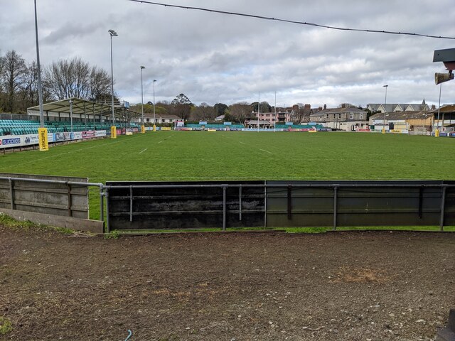
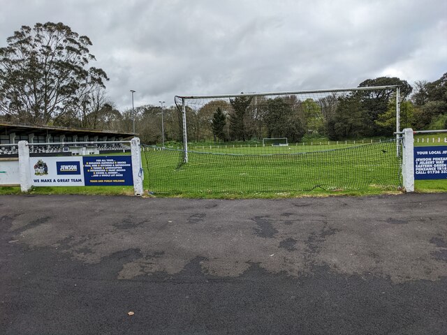
Mennaye Field

The Mennaye Field is a sports stadium located in Penzance, Cornwall, UK. The ground was provided by the Borough of Penzance for the Penzance and Newlyn...
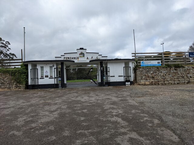
Penzance A.F.C.

Penzance Association Football Club is a Charter Standard Football Club based in Penzance, Cornwall in the United Kingdom. They were established in 1888...

Penlee House

Penlee House is a museum and art gallery located in the town of Penzance in Cornwall, and is home to a great many paintings by members of the Newlyn School...
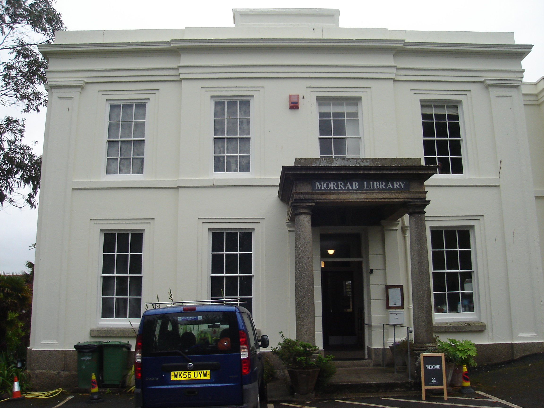
Morrab Library

The Morrab Library is an independent library based in Penzance, Cornwall in the UK. The library, situated in Morrab House within Morrab Gardens, was founded...
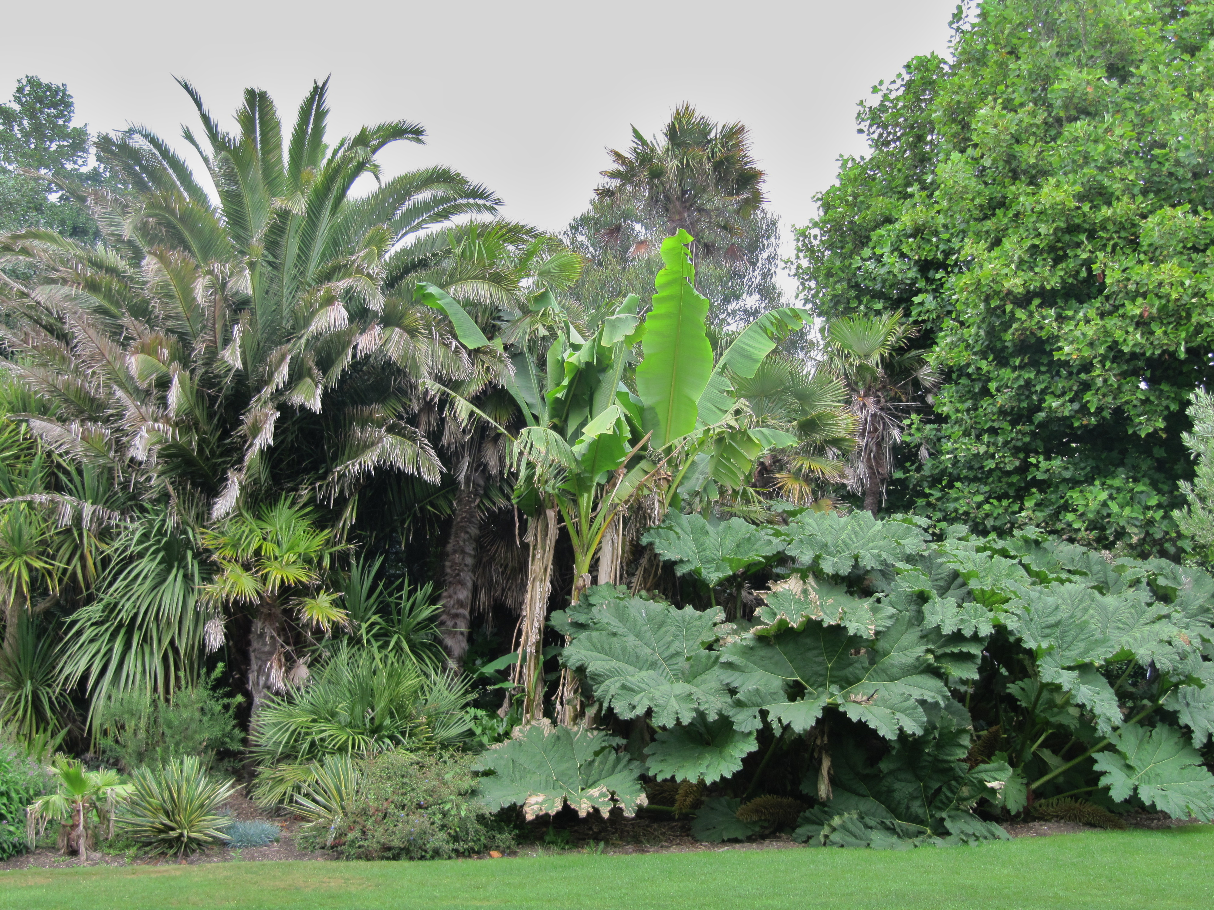
Morrab Gardens

Morrab Gardens are a municipal garden covering 1.2 ha (3.0 acres) to the south of Penzance town centre, Cornwall. It is known for its Mediterranean and...

Penzance School of Art

Penzance School of Art is an art school in Penzance, Cornwall, England, housed in a purpose-built Grade II listed building opened in 1881. == History... ==

Penwith Hundred

Penwith Hundred was one of ten ancient administrative hundreds of the county of Cornwall, England, UK. The ancient hundred of Penwith was larger than the...

Nearby Amenities

Located within 500m of 50.111399,-5.54293
Source: PGS
Lat/Long: 50.1082614/-5.5473205
Source: PGS
Lat/Long: 50.1085305/-5.5469225
Source: PGS
Lat/Long: 50.1088409/-5.5465797
Source: PGS
Lat/Long: 50.1091524/-5.5462568
Source: PGS
Lat/Long: 50.1096489/-5.545623
Source: PGS
Lat/Long: 50.1099669/-5.5451243
Source: PGS
Lat/Long: 50.1101951/-5.5447121
Source: PGS
Lat/Long: 50.1103982/-5.5443182
Source: PGS
Lat/Long: 50.1107311/-5.5435088
Source: PGS
Lat/Long: 50.1108137/-5.5434246
Source: PGS
Lat/Long: 50.1108185/-5.5433298
Source: PGS
Lat/Long: 50.111484/-5.5420536
Source: PGS
Lat/Long: 50.1121125/-5.5408218
Source: PGS
Lat/Long: 50.1123862/-5.5403431
Source: PGS
Lat/Long: 50.1127139/-5.5397796
Source: PGS
Lat/Long: 50.1131358/-5.5389959
Source: PGS
Lat/Long: 50.113139/-5.5389583
Source: PGS
Lat/Long: 50.1133262/-5.5385933
Source: PGS
Lat/Long: 50.1137311/-5.5377846
Source: PGS
Lat/Long: 50.1138923/-5.5374388
Crossing
Crossing: traffic_signals
Crossing Island: no
Crossing Ref: pelican
Tactile Paving: yes
Lat/Long: 50.1137813/-5.5382329
Bus Stop
Chynance
Bus: yes
Naptan AtcoCode: 0800COD40033
Naptan Bearing: SE
Naptan CommonName: Chynance
Naptan Crossing: Alexandra Place
Naptan Indicator: Opp
Naptan NaptanCode: coradtmg
Naptan PlusbusZoneRef: PENZNCE
Naptan Street: Alexandra Road
Naptan Verified: no
Public Transport: platform
Shelter: no
Source: naptan_import
Lat/Long: 50.1142521/-5.5433367
Bus Stop
Chynance
Bus: yes
Naptan AtcoCode: 0800COD40035
Naptan Bearing: W
Naptan CommonName: Chynance
Naptan Crossing: Alexandra Road
Naptan NaptanCode: coradtma
Naptan PlusbusZoneRef: PENZNCE
Naptan Street: Rosevale
Naptan Verified: no
Public Transport: platform
Shelter: no
Source: naptan_import
Lat/Long: 50.1142274/-5.5435587
Bus Stop
Alexandra Inn
Bench: no
Bin: no
Bus: yes
Lit: yes
Naptan AtcoCode: 0800COD40036
Naptan Bearing: SE
Naptan CommonName: Alexandra Inn
Naptan NaptanCode: coradtpt
Naptan PlusbusZoneRef: PENZNCE
Naptan Street: Alexandra Road
Naptan Verified: no
Public Transport: platform
Shelter: yes
Source: naptan_import
Tactile Paving: no
Lat/Long: 50.1131175/-5.5413081
Bus Stop
Alexandra Inn
Bench: no
Bin: no
Bus: yes
Lit: yes
Naptan AtcoCode: 0800COD40037
Naptan Bearing: NW
Naptan CommonName: Alexandra Inn
Naptan NaptanCode: coradtpm
Naptan PlusbusZoneRef: PENZNCE
Naptan Street: Alexandra Road
Naptan Verified: no
Public Transport: platform
Shelter: yes
Source: naptan_import
Tactile Paving: no
Lat/Long: 50.1130414/-5.5414424
Bus Stop
Lidl
Bench: no
Bin: no
Bus: yes
Naptan AtcoCode: 0800COD40038
Naptan Bearing: SW
Naptan CommonName: Lidl
Naptan Crossing: Lariggan Road
Naptan Indicator: Opp
Naptan NaptanCode: coradtmt
Naptan PlusbusZoneRef: PENZNCE
Naptan ShortCommonName: Wherry Town
Naptan Street: Western Promenade Road
Naptan Verified: no
Public Transport: platform
Shelter: no
Source: naptan_import
Survey Date: 2022-05-07
Lat/Long: 50.1113752/-5.5433037
Bus Stop
Lidl
Bench: no
Bus: yes
Naptan AtcoCode: 0800COD40039
Naptan Bearing: NE
Naptan CommonName: Lidl
Naptan Crossing: Lariggan Road
Naptan NaptanCode: coradtmp
Naptan PlusbusZoneRef: PENZNCE
Naptan ShortCommonName: Wherry Town
Naptan Street: Western Promenade Road
Naptan Verified: no
Public Transport: platform
Shelter: yes
Source: naptan_import
Lat/Long: 50.1117391/-5.5428432
Bus Stop
Bottom of Lidden Road
Bench: no
Bus: yes
Naptan AtcoCode: 0800COD40138
Naptan Bearing: NW
Naptan CommonName: Bottom of Lidden Road
Naptan Crossing: Donnington Road
Naptan NaptanCode: coradtdj
Naptan PlusbusZoneRef: PENZNCE
Naptan Street: Lidden Road
Naptan Verified: no
Public Transport: platform
Shelter: no
Source: naptan_import
Tactile Paving: no
Lat/Long: 50.1099974/-5.547723
Bench
Backrest: yes
Lat/Long: 50.1134266/-5.5387686
Bench
Backrest: yes
Lat/Long: 50.1130274/-5.5395042
Bench
Backrest: no
Lat/Long: 50.112891/-5.5397574
Bench
Backrest: yes
Lat/Long: 50.1135355/-5.5385115
Cafe
Sophia's Cafe
Addr City: Penzance
Addr Country: GB
Addr Place: Promenade
Addr Postcode: TR18 4HG
Check Date: 2023-08-09
Contact Phone: +441736 333363
Contact Website: http://www.sophiaspenzance.co.uk/
Fhrs Id: 583116
Lat/Long: 50.1137093/-5.5389116
Bench
Backrest: yes
Lat/Long: 50.1137812/-5.5379534
Litter Bin
Lat/Long: 50.1136919/-5.5381651
Bench
Lat/Long: 50.1136823/-5.5382478
Barrier: break
Note: break in wall, no gate
Lat/Long: 50.1135872/-5.5385482
Queens Hotel
Addr City: Penzance
Addr Country: GB
Addr Housename: Queens Hotel
Addr Place: Promenade
Addr Postcode: TR18 4HG
Tourism: hotel
Lat/Long: 50.1139828/-5.5379473
Restaurant
Gino's Spaghetti House
Addr City: Penzance
Addr Country: GB
Addr Housename: Ginos Spaghetti House
Addr Place: Promenade
Addr Postcode: TR18 4HG
Check Date: 2023-08-09
Cuisine: italian
Fhrs Id: 465894
Lat/Long: 50.1140894/-5.5376553
Bench
Backrest: yes
Lat/Long: 50.1139284/-5.5375671
Bench
Backrest: yes
Lat/Long: 50.1138582/-5.537737
Bench
Backrest: no
Shelter: yes
Lat/Long: 50.11271/-5.5400822
Restaurant
Thai Moon
Addr City: Penzance
Addr Country: GB
Addr Housenumber: 2
Addr Postcode: TR18 4LY
Addr Street: Alexandra Road
Check Date: 2023-08-09
Cuisine: thai
Fhrs Id: 402662
Source Addr: FHRS Open Data
Lat/Long: 50.1126626/-5.5412321
Crossing
Crossing: zebra
Crossing Island: yes
Tactile Paving: yes
Lat/Long: 50.1128142/-5.5409226
Toilets
Changing Table: yes
Check Date: 2022-05-07
Fee: no
Lat/Long: 50.1110893/-5.5434518
Recycling
Location: overground
Recycling Type: container
Lat/Long: 50.1116154/-5.5424257
Fuel
Texaco
Brand: Texaco
Brand Wikidata: Q775060
Brand Wikipedia: en:Texaco
Compressed Air: yes
Source: survey
Lat/Long: 50.111705/-5.5430907
Noexit: yes
Lat/Long: 50.1153482/-5.5428658
Traffic Signals
Crossing: traffic_signals
Crossing Ref: pelican
Source: survey
Lat/Long: 50.1141233/-5.5432168
Chiverton House
Tourism: guest_house
Wikidata: Q111888671
Lat/Long: 50.1139801/-5.5415431
Post Box
Collection Times: Mo-Fr 09:00; Sa 07:00
Operator: Royal Mail
Operator Wikidata: Q638098
Post Box Type: pillar
Ref: TR18 98D
Royal Cypher: VR
Royal Cypher Wikidata: Q33102356
Source: survey
Survey Date: 2015-09-28
Lat/Long: 50.1148547/-5.5403902
Wherrytown
Is In Town: Penzance
Name Kw: Trehweri
Place: suburb
Source: survey
Wikidata: Q7993516
Lat/Long: 50.112072/-5.5422357
Give Way
Direction: backward
Lat/Long: 50.1111663/-5.5446389
Post Box
Collection Times: Mo-Fr 09:00; Sa 07:00
Operator: Royal Mail
Operator Wikidata: Q638098
Post Box Type: pillar
Ref: TR18 56D
Royal Cypher: GR
Royal Cypher Wikidata: Q33102273
Source: survey
Survey Date: 2015-10-01
Lat/Long: 50.1103375/-5.5483855
Post Box
Collection Times: Mo-Fr 16:30; Sa 11:30
Operator: Royal Mail
Operator Wikidata: Q638098
Ref: TR18 55
Royal Cypher: GVIR
Royal Cypher Wikidata: Q33102169
Source: knowledge;bing
Lat/Long: 50.1114658/-5.5449201
Post Box
Check Date: 2022-05-07
Collection Times: Mo-Fr 16:30; Sa 11:30
Operator: Royal Mail
Operator Wikidata: Q638098
Post Box Type: pillar
Ref: TR18 1
Royal Cypher: GVIR
Royal Cypher Wikidata: Q33102169
Source: survey
Lat/Long: 50.1132373/-5.5414395
Post Box
Collection Times: Mo-Fr 16:15; Sa 11:30
Fixme: inn navy the nearwrong location
Operator: Royal Mail
Operator Wikidata: Q638098
Post Box Type: pillar
Ref: TR18 66
Royal Cypher: EIIR
Royal Cypher Wikidata: Q33102113
Source: survey
Survey Date: 2022-05-07
Lat/Long: 50.1141213/-5.5373946
Post Box
Collection Times: Mo-Fr 09:00; Sa 07:00
Operator: Royal Mail
Operator Wikidata: Q638098
Post Box Type: lamp
Ref: TR18 140D
Royal Cypher: EIIR
Royal Cypher Wikidata: Q33102113
Source: survey
Survey Date: 2015-09-28
Lat/Long: 50.1152899/-5.5444841
Beachfield Hotel
Addr City: Penzance
Addr Country: GB
Addr Postcode: TR18 4NW
Addr Street: Western Promenade Road
Contact Email: reception@beachfield.co.uk
Contact Phone: +44 1736 362067
Contact Website: https://www.beachfield.co.uk/
Fhrs Id: 573990
Tourism: hotel
Lat/Long: 50.1125781/-5.5411322
Bench
Lat/Long: 50.1089378/-5.5470362
Bench
Lat/Long: 50.1093837/-5.5464689
Bench
Lat/Long: 50.1098077/-5.5459338
Bench
Backrest: yes
Lat/Long: 50.1107486/-5.544185
Cafe
Fraser's
Addr City: Penzance
Addr Country: GB
Addr Postcode: TR18 4HH
Addr Street: Marine Terrace
Check Date: 2023-08-09
Cuisine: fish_and_chips
Fhrs Id: 900509
Source Addr: FHRS Open Data
Lat/Long: 50.1136355/-5.5391587
Building: roof
Lat/Long: 50.1127079/-5.5401883
Penmorvah
Tourism: guest_house
Lat/Long: 50.1131841/-5.5415299
Penzance Backpackers
Phone: +411736363836
Tourism: hostel
Website: http://www.pzbackpack.com
Lat/Long: 50.1152/-5.54467
West Cornwall Angling
Check Date: 2023-08-09
Shop: outdoor
Lat/Long: 50.1127981/-5.5411837
Tin Coast Design
Shop: houseware
Lat/Long: 50.1128471/-5.5412628
Pub
Alexandra Inn
Addr City: Penzance
Addr Postcode: TR18 4LY
Addr Street: Alexandra Road
Check Date: 2023-08-09
Fhrs Id: 658791
Opening Hours: Mo-We 15:00+; Th-Su 12:00+
Source Addr: FHRS Open Data
Lat/Long: 50.1129125/-5.5413714
Restaurant
Scarlett's Kitchen
Opening Hours: Mo-We off; Th-Su 12:00-19:46
Lat/Long: 50.1129306/-5.5413727
Grand Casino Launderette
Opening Hours: Mo-Su 7:30-21:00
Shop: laundry
Lat/Long: 50.1136667/-5.5394912
Treventon Guest House
Addr City: Penzance
Addr Housename: Treventon Guest House
Addr Postcode: TR18 4NE
Addr Street: Alexandra Place
Guest House: guest_house
Internet Access: yes
Internet Access Fee: no
Operator: Treventon
Rooms: 6
Tourism: guest_house
Website: https://treventon.co.uk
Lat/Long: 50.1137693/-5.5425484
Direction: SE
Generator Method: photovoltaic
Generator Output Electricity: small_installation
Generator Source: solar
Generator Type: solar_photovoltaic_panel
Location: roof
Power: generator
Source: bing
Lat/Long: 50.1148871/-5.5449414
Direction: SE
Generator Method: photovoltaic
Generator Output Electricity: small_installation
Generator Source: solar
Generator Type: solar_photovoltaic_panel
Location: roof
Power: generator
Source: bing
Lat/Long: 50.1150505/-5.5450661
Direction: SE
Generator Method: photovoltaic
Generator Output Electricity: small_installation
Generator Source: solar
Generator Type: solar_photovoltaic_panel
Location: roof
Power: generator
Source: bing
Lat/Long: 50.1144218/-5.5469759
Direction: SE
Generator Method: photovoltaic
Generator Output Electricity: small_installation
Generator Source: solar
Generator Type: solar_photovoltaic_panel
Location: roof
Power: generator
Source: bing
Lat/Long: 50.1098817/-5.5486268
Direction: SE
Generator Method: photovoltaic
Generator Output Electricity: small_installation
Generator Source: solar
Generator Type: solar_photovoltaic_panel
Location: roof
Power: generator
Source: bing
Lat/Long: 50.1102584/-5.5493456
Direction: S
Generator Method: photovoltaic
Generator Output Electricity: small_installation
Generator Source: solar
Generator Type: solar_photovoltaic_panel
Location: roof
Power: generator
Source: bing
Lat/Long: 50.1118959/-5.5483237
Direction: SE
Generator Method: photovoltaic
Generator Output Electricity: small_installation
Generator Source: solar
Generator Type: solar_photovoltaic_panel
Location: roof
Power: generator
Source: bing
Lat/Long: 50.1123793/-5.5464435
Direction: S
Generator Method: photovoltaic
Generator Output Electricity: small_installation
Generator Source: solar
Generator Type: solar_photovoltaic_panel
Location: roof
Power: generator
Source: bing
Lat/Long: 50.1120972/-5.546658
Direction: S
Generator Method: photovoltaic
Generator Output Electricity: small_installation
Generator Source: solar
Generator Type: solar_photovoltaic_panel
Location: roof
Power: generator
Source: bing
Lat/Long: 50.1145912/-5.538429
WW2 Light Anti-Aircraft Battery (site of)
Building: bunker
Bunker Type: gun_emplacement
Military: bunker
Note: Exact location within park yet to be historically ratified.
Lat/Long: 50.1093177/-5.5468601
WW2 Anti-Aircraft Gun Battery (site of)
Building: bunker
Bunker Type: gun_emplacement
Military: bunker
Lat/Long: 50.11216/-5.5413057
WW2 Light Anti-Aircraft Battery (site of)
Building: bunker
Bunker Type: gun_emplacement
Military: bunker
Lat/Long: 50.1124833/-5.5444445
Bicycle Parking
Access: yes
Bicycle Parking: stands
Capacity: 40
Covered: yes
Fee: no
Lat/Long: 50.1115103/-5.5424568
Life Ring
Emergency: life_ring
Survey Date: 2022-05-07
Lat/Long: 50.1137218/-5.5379372
Waste Basket
Survey Date: 2022-05-07
Lat/Long: 50.1134176/-5.5389983
Bench
Survey Date: 2022-05-07
Lat/Long: 50.1100133/-5.5456264
Life Ring
Emergency: life_ring
Survey Date: 2022-05-07
Lat/Long: 50.1089949/-5.547002
Waste Basket
Survey Date: 2022-05-07
Lat/Long: 50.1139956/-5.5374645
Telephone
Booth: KX100
Survey Date: 2022-05-07
Lat/Long: 50.1134803/-5.5393097
Waste Basket
Survey Date: 2022-05-07
Lat/Long: 50.1108471/-5.5441326
Recycling
Recycling Type: container
Survey Date: 2022-05-07
Lat/Long: 50.1108526/-5.5441277
Life Ring
Emergency: life_ring
Survey Date: 2022-05-07
Lat/Long: 50.1099284/-5.5457576
Waste Basket
Survey Date: 2022-05-07
Lat/Long: 50.1133586/-5.5395718
Life Ring
Emergency: life_ring
Survey Date: 2022-05-07
Lat/Long: 50.1118948/-5.5414068
Fire Hydrant
Emergency: fire_hydrant
Survey Date: 2022-05-07
Lat/Long: 50.1106851/-5.5457942
Bench
Survey Date: 2022-05-07
Lat/Long: 50.1111007/-5.5454145
Atm
Survey Date: 2022-05-07
Lat/Long: 50.1118013/-5.5429748
Bicycle Parking
Survey Date: 2022-05-07
Lat/Long: 50.1128906/-5.5407669
Bench
Survey Date: 2022-05-07
Lat/Long: 50.110997/-5.5455509
Waste Basket
Survey Date: 2022-05-07
Lat/Long: 50.1113807/-5.5444123
Bench
Survey Date: 2022-05-07
Lat/Long: 50.1109679/-5.5455831
Bicycle Parking
Bicycle Parking: stands
Survey Date: 2022-05-07
Lat/Long: 50.1113837/-5.5443078
Life Ring
Emergency: life_ring
Survey Date: 2022-05-07
Lat/Long: 50.1117095/-5.5441864
Life Ring
Emergency: life_ring
Survey Date: 2022-05-07
Lat/Long: 50.1121845/-5.5448489
Bicycle Parking
Bicycle Parking: stands
Capacity: 12
Covered: no
Survey Date: 2022-05-07
Lat/Long: 50.112088/-5.5423751
Fire Hydrant
Emergency: fire_hydrant
Fire Hydrant Position: sidewalk
Fire Hydrant Type: underground
Survey Date: 2022-05-07
Lat/Long: 50.1123873/-5.5411267
Fire Hydrant
Emergency: fire_hydrant
Survey Date: 2022-05-07
Lat/Long: 50.11474/-5.5383351
Waste Basket
Survey Date: 2022-05-07
Lat/Long: 50.1128821/-5.540917
Toilets
Survey Date: 2022-05-07
Lat/Long: 50.113217/-5.5407801
Fire Hydrant
Emergency: fire_hydrant
Fire Hydrant Diameter: 6"
Fire Hydrant Position: sidewalk
Fire Hydrant Type: underground
Survey Date: 2022-05-07
Lat/Long: 50.113191/-5.5398971
Waste Basket
Survey Date: 2022-05-07
Lat/Long: 50.1132598/-5.539763
Fire Hydrant
Emergency: fire_hydrant
Survey Date: 2022-05-07
Lat/Long: 50.1139909/-5.538888
Noexit: yes
Lat/Long: 50.1133505/-5.5426594
Give Way
Direction: forward
Lat/Long: 50.1113517/-5.5446133
Fast Food
EZPZ Food Trailer
Addr City: Penzance
Addr Street: Western Promenade Road
Check Date: 2023-09-02
Cuisine: regional
Currency GBP: yes
Currency XBT: yes
Description: Easy peasy Street food on the prom. Fresh local produce, served by the sea
Payment Lightning: yes
Payment Lightning Contactless: no
Payment Onchain: yes
Website: https://www.instagram.com/ezpzontheprom/
Lat/Long: 50.1129615/-5.5396913
The data included in this document is from www.openstreetmap.org. The data is made available under ODbL.

Have you been to Wherry Town?

Leave your review of Wherry Town below (or comments, questions and feedback).