Àird Mhìghe

Settlement in Inverness-shire

Scotland

Àird Mhìghe

Ruin at Ardvey Abandoned and derelict, in spite of being relatively modern.
Ruin at Ardvey Credit: Richard Dorrell

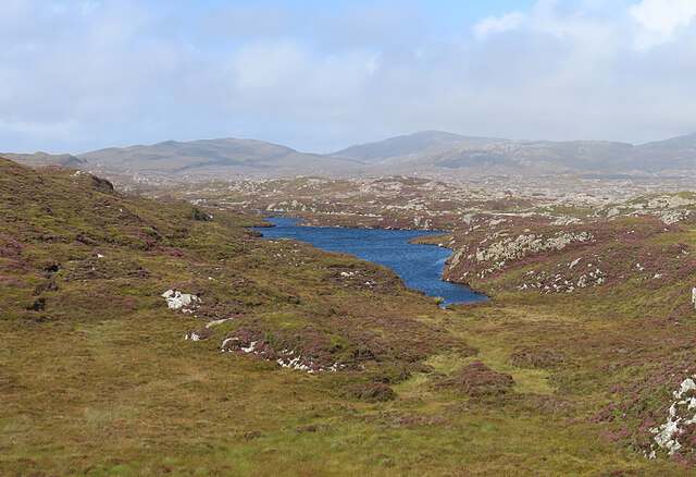
Àird Mhìghe, also known as Aird, is a small township located in the historic county of Inverness-shire, Scotland. Situated approximately 7 miles northwest of the town of Fort William, Àird Mhìghe sits on the western shore of Loch Eil, offering stunning views of the surrounding mountainous landscape.

The township is primarily residential, with a population of around 500 residents. It is characterized by its charming traditional Highland architecture, featuring stone houses and cottages that blend harmoniously with the natural environment. The area is known for its tranquility and close-knit community, making it an ideal place for those seeking a peaceful and scenic retreat.

The economy of Àird Mhìghe is largely based on tourism and agriculture. The township's proximity to the popular tourist destinations of Fort William and the Scottish Highlands provides ample opportunities for visitors to explore the region's natural wonders, including Ben Nevis, the highest mountain in the British Isles. Fishing and outdoor activities, such as hiking, cycling, and boating, are also popular among both locals and tourists.

Despite its rural location, Àird Mhìghe benefits from good transport links. The A830 road, also known as the Road to the Isles, connects the township to Fort William and Mallaig, providing convenient access to major transport hubs and amenities.

Overall, Àird Mhìghe offers a picturesque and peaceful setting for residents and visitors alike, combining the beauty of the Scottish Highlands with a strong sense of community.

If you have any feedback on the listing, please let us know in the comments section below.

Àird Mhìghe Images

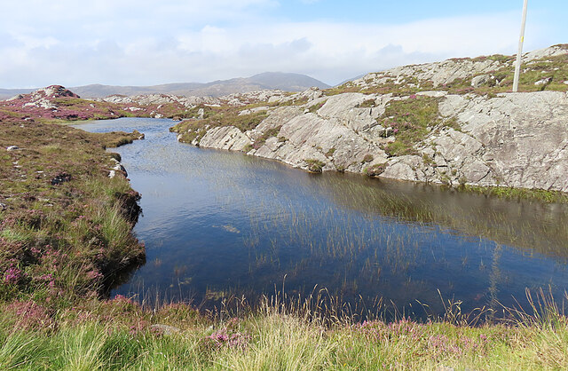
Images are sourced within 2km of 57.776211/-6.9133723 or Grid Reference NG0886. Thanks to Geograph Open Source API. All images are credited.

Ruin at Ardvey Abandoned and derelict, in spite of being relatively modern.
Ruin at Ardvey
Abandoned and derelict, in spite of being relatively modern.
Loch Fhionnsabhaigh The blue pay-to-view telescope is probably there to enable seal-watchers to get a closer view - though as the seals were today basking on rocks just a few yards from the shore, the scope was barely necessary.
See also: <a href="https://www.geograph.org.uk/photo/7033022">NG0887 : Common seals in Loch Fhionnsabhaigh</a>.
Loch Fhionnsabhaigh
The blue pay-to-view telescope is probably there to enable seal-watchers to get a closer view - though as the seals were today basking on rocks just a few yards from the shore, the scope was barely necessary. See also: NG0887 : Common seals in Loch Fhionnsabhaigh.
Common seals in Loch Fhionnsabhaigh A slightly zoomed-in image, taken from the shore of the loch.
Common seals in Loch Fhionnsabhaigh
A slightly zoomed-in image, taken from the shore of the loch.
The road approaching Fionnsabhagh from the south
Fish Farm Pier at Loch Huamabhat
Desolate inland Harris Geocaching is a type of global treasure hunt of people looking for caches, or hidden stashes of objects. Geocaching may also be described as a series of hide-and-seek games, where hiders provide online clues for seekers. Seekers use global positioning system (GPS) devices to find hidden caches
Desolate inland Harris
Geocaching is a type of global treasure hunt of people looking for caches, or hidden stashes of objects. Geocaching may also be described as a series of hide-and-seek games, where hiders provide online clues for seekers. Seekers use global positioning system (GPS) devices to find hidden caches
Loch an Luig One of the hundreds of small lochs among the gneiss of eastern Harris.
Loch an Luig
One of the hundreds of small lochs among the gneiss of eastern Harris.
Loch Sgùrr The road is right on the brink of this small lochan.
Loch Sgùrr
The road is right on the brink of this small lochan.
Fionnsabhaigh Finsbay is one of the scattered villages on the east side of Harris, settled by people evicted from the fertile machair land on the west during the Highand Clearances.
Fionnsabhaigh
Finsbay is one of the scattered villages on the east side of Harris, settled by people evicted from the fertile machair land on the west during the Highand Clearances.
Finsbay One of a handful of small settlements in Eastern Harris.
Finsbay
One of a handful of small settlements in Eastern Harris.
Sea Inlet at Ardvey Marked on the map as a tidal pond, this is connected to the sea on the right, beyond the narrowest part. It is, unfortunately, difficult to photograph anything in this area without including the necessary evil of power lines.
Sea Inlet at Ardvey
Marked on the map as a tidal pond, this is connected to the sea on the right, beyond the narrowest part. It is, unfortunately, difficult to photograph anything in this area without including the necessary evil of power lines.
Tidal Inlet at Aird Mhighe The inlet is in this square but the house is in the next square.
Tidal Inlet at Aird Mhighe
The inlet is in this square but the house is in the next square.
Loch Fhionnsabhaigh One of the larger sea-lochs on the east coast of Harris.
Loch Fhionnsabhaigh
One of the larger sea-lochs on the east coast of Harris.
Loch Holmasaig A small lochan, one of dozens alongside the Bays road.
Loch Holmasaig
A small lochan, one of dozens alongside the Bays road.
Loch Huamabhat One of the larger lochans in the wilderness of East Harris.
Loch Huamabhat
One of the larger lochans in the wilderness of East Harris.
Fishing Station? It's not immediately obvious what the reason for the large raft and jetties is.
Fishing Station?
It's not immediately obvious what the reason for the large raft and jetties is.
Cnoc and Lochan Topography The Lewisian gneiss typically produces topography with knolls or rocks interspersed with hollows that are occupied by small lochs. In geography and geology this is described as Cnoc and lochan topography.
Cnoc and Lochan Topography
The Lewisian gneiss typically produces topography with knolls or rocks interspersed with hollows that are occupied by small lochs. In geography and geology this is described as Cnoc and lochan topography.
Loch Buaile Cairistiona Mhurchaidh This rather cumbersome name for a very small loch means something like 'loch of Christina Murdoch's cattle fold'.
Loch Buaile Cairistiona Mhurchaidh
This rather cumbersome name for a very small loch means something like 'loch of Christina Murdoch's cattle fold'.
Show me another place!

Àird Mhìghe is located at Grid Ref: NG0886 (Lat: 57.776211, Lng: -6.9133723)

Unitary Authority: Na h-Eileanan an Iar

Police Authority: Highlands and Islands

Also known as: Ardvey

What 3 Words

///version.ourselves.pepper. Near Leverburgh, Na h-Eileanan Siar

Related Wikis

Borsham

Borsham (Scottish Gaelic: Boirseam) is a village in the 'Bays' area of Harris in the Outer Hebrides, Scotland. Borsham is within the parish of Harris....

Lingarabay

Lingarabay (also Lingerabay or Lingerbay; Scottish Gaelic: Lingreabhagh) is a small coastal settlement on Harris, in the Outer Hebrides of Scotland. It...

Harris Superquarry

The Harris Super Quarry was a super quarry at Lingerbay, Harris, Scotland proposed by Redland Aggregates in 1991. The plan was to surface mine aggregate...

Roineabhal

Roineabhal is a hill in Harris, in the Western Isles of Scotland. The granite on the summit plateau of the mountain is anorthosite, and is similar in composition...

St Clement's Church, Rodel

St Clement's Church (Scottish Gaelic: Tùr Chliamhainn, meaning Clement's Tower) is a late fifteenth-century or early sixteenth-century church in Rodel...

Rodel

Rodel (Scottish Gaelic: Roghadal) is a village on the south-eastern coast of Harris, an island in the Scottish Outer Hebrides. Rodel is situated in the...

Leverburgh

Leverburgh (Scottish Gaelic: An t-Òb [ən̪ˠ ˈt̪ɔːp]) is the second largest village, after Tarbert, in Harris in the Outer Hebrides of Scotland. Leverburgh...

Outer Hebrides

The Outer Hebrides ( HEB-rid-eez) or Western Isles (Scottish Gaelic: na h-Eileanan Siar [nə ˈhelanən ˈʃiəɾ] , na h-Eileanan an Iar [nə ˈhelanən əɲ ˈiəɾ...

Nearby Amenities

Located within 500m of 57.776211,-6.9133723
Passing Place
Lat/Long: 57.7789359/-6.9177404
Passing Place
Lat/Long: 57.7796486/-6.9167145
Passing Place
Lat/Long: 57.7741085/-6.9204904
Passing Place
Lat/Long: 57.7726131/-6.9156195
Turning Circle
Lat/Long: 57.7759857/-6.9127336
Telephone
Booth: K6
Covered: booth
Operator: BT
Phone: +44 1859 530231
Source: survey
Lat/Long: 57.7771464/-6.9213911
Àird Mhighe Fhionnsbhaigh
Alt Name En: Ardvay
Alt Name Gd: Àird Mhighe;Àird Mhighe Fhionnasbhaigh
Name En: Ardvey
Name Gd: Àird Mhighe Fhionnsbhaigh
Place: hamlet
Lat/Long: 57.7789157/-6.9197909
Passing Place
Lat/Long: 57.7803527/-6.9156485
Bus Stop
Ardvey Rd End
Bus: yes
Naptan AtcoCode: 6010731649
Naptan Bearing: W
Naptan CommonName: Ardvey Rd End
Naptan Indicator: at
Naptan NaptanCode: 94723625
Naptan Street: Golden Road
Naptan Verified: no
Public Transport: platform
Shelter: yes
Lat/Long: 57.7785044/-6.9194377
Material: wood
Power: pole
Lat/Long: 57.7802214/-6.9161411
Material: wood
Power: pole
Lat/Long: 57.7771594/-6.914214
Material: wood
Power: pole
Lat/Long: 57.7767847/-6.9138975
Material: wood
Power: pole
Lat/Long: 57.7764944/-6.9133182
Material: wood
Power: pole
Lat/Long: 57.7763213/-6.9127844
Material: wood
Power: pole
Lat/Long: 57.7761511/-6.9122453
Material: wood
Power: pole
Lat/Long: 57.7776128/-6.9151689
Material: wood
Power: pole
Lat/Long: 57.7776857/-6.9156571
Material: wood
Power: pole
Lat/Long: 57.7780662/-6.9160996
Material: wood
Power: pole
Lat/Long: 57.7785352/-6.917084
Material: wood
Power: pole
Lat/Long: 57.7770552/-6.9144431
Material: wood
Power: pole
Lat/Long: 57.7741953/-6.9204945
Material: wood
Power: pole
Lat/Long: 57.7741367/-6.9197811
Material: wood
Power: pole
Lat/Long: 57.7740151/-6.9193694
Material: wood
Power: pole
Lat/Long: 57.7738449/-6.918794
Material: wood
Power: pole
Lat/Long: 57.7737297/-6.9183703
Material: wood
Power: pole
Lat/Long: 57.7735767/-6.917862
Material: wood
Power: pole
Lat/Long: 57.7732957/-6.9174959
Material: wood
Power: pole
Lat/Long: 57.7731225/-6.9172693
Material: wood
Power: pole
Lat/Long: 57.7797727/-6.9168322
Material: wood
Power: pole
Lat/Long: 57.7800466/-6.9153677
Material: wood
Power: pole
Lat/Long: 57.7802647/-6.9158465
Passing Place
Lat/Long: 57.777013/-6.9214042
Passing Place
Lat/Long: 57.7729951/-6.9169384
Passing Place
Lat/Long: 57.7718883/-6.9147028
Power: pole
Lat/Long: 57.7791775/-6.9178033
Power: pole
Lat/Long: 57.7796077/-6.9182748
Material: wood
Power: pole
Lat/Long: 57.777225/-6.9215623
Booth: K6
Man Made: telephone_box
Lat/Long: 57.7799659/-6.915299
Passing Place
Lat/Long: 57.7785604/-6.9163927
The data included in this document is from www.openstreetmap.org. The data is made available under ODbL.

Have you been to Àird Mhìghe?

Leave your review of Àird Mhìghe below (or comments, questions and feedback).