Àird Cumhang

Settlement in Inverness-shire

Scotland

Àird Cumhang

Mystery harbour, Benbecula This loch is named as Oban Crothintin on the larger scale OS maps. The inlet shown in the photo has been built up on the southern side as if to make some sort of landing stage. The mystery is that, although it is tidal, the burn leading from the loch to the sea is very narrow, barely wide enough to get a rowing boat through at high spring tides. If a boat required sheltered moorings, the bay on the other side of the road offers that in abundance with a much easier passage to the open water.
Mystery harbour, Benbecula Credit: AlastairG

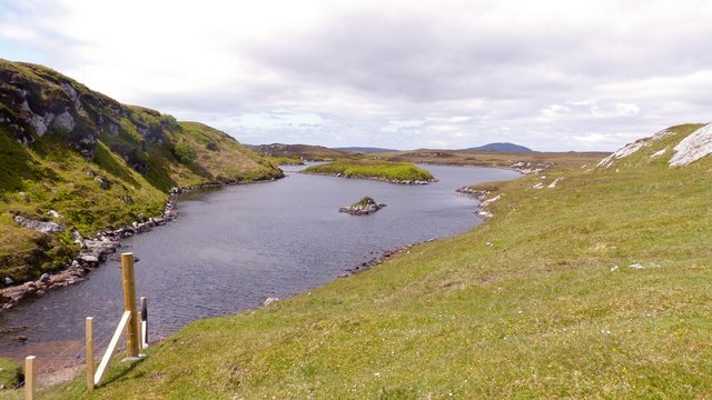
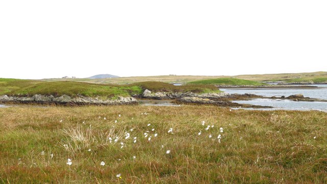
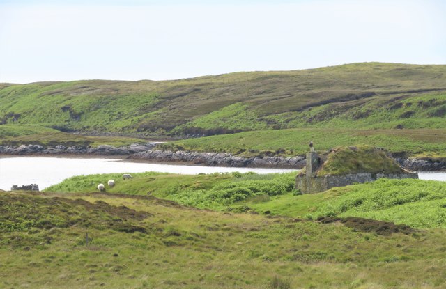
Àird Cumhang is a small hamlet located in Inverness-shire, Scotland. Situated on the north-west coast of the country, this picturesque village is known for its stunning views of the surrounding countryside and the nearby Loch Ewe. The area is rich in natural beauty, with rolling hills, lush green fields, and rugged coastline.

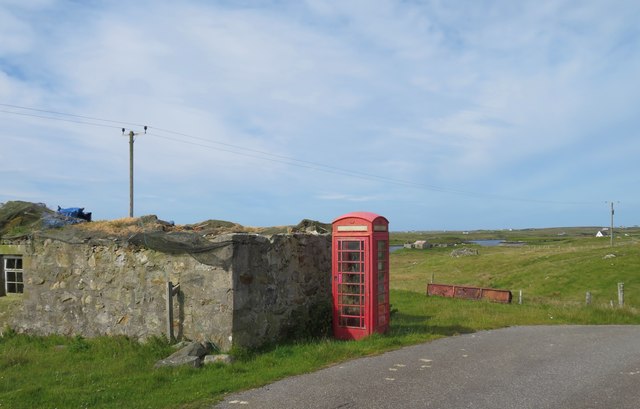
The village itself is made up of a cluster of traditional stone buildings, including a few small shops, a church, and a local pub. The population of Àird Cumhang is relatively small, with most residents working in agriculture or tourism.

Visitors to Àird Cumhang can enjoy a range of outdoor activities, including hiking, fishing, and birdwatching. The nearby Loch Ewe is a popular spot for water sports such as kayaking and sailing, while the surrounding hills offer excellent opportunities for walking and wildlife spotting.

Overall, Àird Cumhang is a charming and peaceful village, perfect for those looking to escape the hustle and bustle of city life and immerse themselves in the natural beauty of the Scottish countryside.

If you have any feedback on the listing, please let us know in the comments section below.
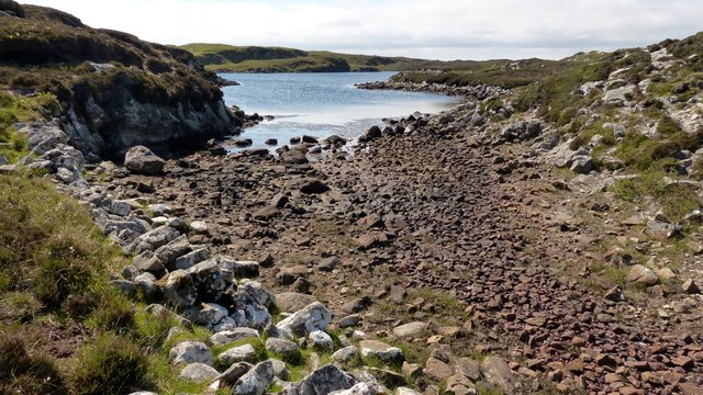
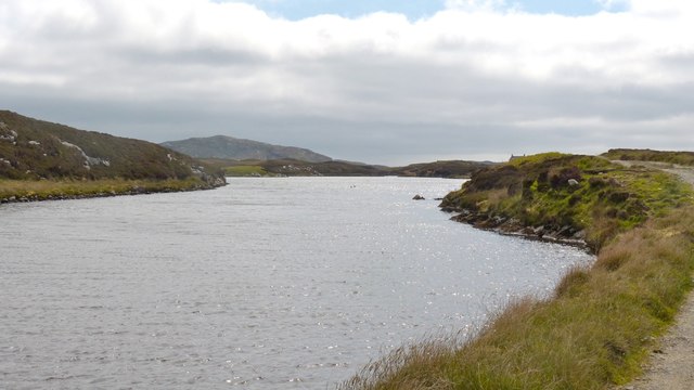
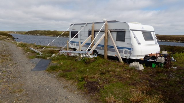
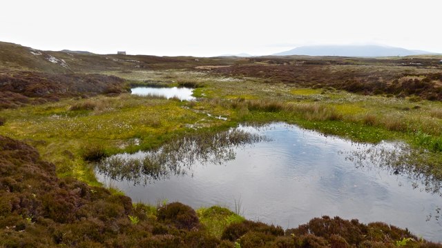
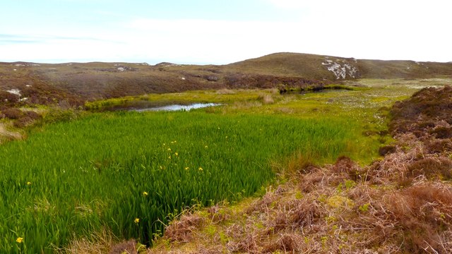
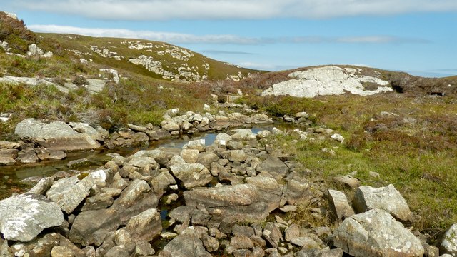
Àird Cumhang Images

Images are sourced within 2km of 57.410422/-7.2554362 or Grid Reference NF8447. Thanks to Geograph Open Source API. All images are credited.
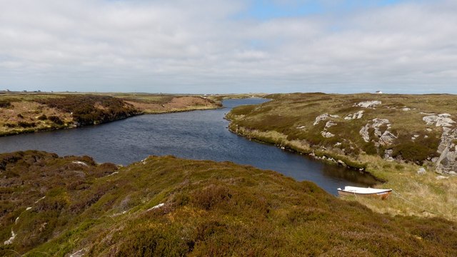
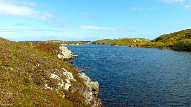
Mystery harbour, Benbecula This loch is named as Oban Crothintin on the larger scale OS maps. The inlet shown in the photo has been built up on the southern side as if to make some sort of landing stage. The mystery is that, although it is tidal, the burn leading from the loch to the sea is very narrow, barely wide enough to get a rowing boat through at high spring tides. If a boat required sheltered moorings, the bay on the other side of the road offers that in abundance with a much easier passage to the open water.
Mystery harbour, Benbecula
This loch is named as Oban Crothintin on the larger scale OS maps. The inlet shown in the photo has been built up on the southern side as if to make some sort of landing stage. The mystery is that, although it is tidal, the burn leading from the loch to the sea is very narrow, barely wide enough to get a rowing boat through at high spring tides. If a boat required sheltered moorings, the bay on the other side of the road offers that in abundance with a much easier passage to the open water.
New track on Benbecula Neither the OS maps nor Google Earth show this track  alongside Loch an Droma bho Dheas. It seems to have been constructed to gain access to a building which looked to be in the process of renovation.
New track on Benbecula
Neither the OS maps nor Google Earth show this track alongside Loch an Droma bho Dheas. It seems to have been constructed to gain access to a building which looked to be in the process of renovation.
Loch an Droma bho Deas This is the continuation of the track shown in <a href="https://www.geograph.org.uk/photo/5018122">NF8447 : New track on Benbecula</a>  The chimneys of the house under restoration can just be seen on the skyline on the right at the end on the loch.
Loch an Droma bho Deas
This is the continuation of the track shown in NF8447 : New track on Benbecula The chimneys of the house under restoration can just be seen on the skyline on the right at the end on the loch.
Extreme weather precautions on Benbecula This belt and braces job speaks volumes about the anticipated wind conditions on Benbecula ....and, yes, the other side is just the same.  The loch is loch an Droma bho Deas.
Extreme weather precautions on Benbecula
This belt and braces job speaks volumes about the anticipated wind conditions on Benbecula ....and, yes, the other side is just the same. The loch is loch an Droma bho Deas.
Loch an Droma bho Deas, Benbecula The colour of the water is misleading. Unlike nearby lochs, this one has a fringe of unpleasant filamentous algae and the water itself is quite turbid.  This reason for this could be the presence of a large number of geese and swans with their resultant deposits.  This would be made worse by the lack of meaningful rain for about two months. A pity as it's in a lovely setting.
Loch an Droma bho Deas, Benbecula
The colour of the water is misleading. Unlike nearby lochs, this one has a fringe of unpleasant filamentous algae and the water itself is quite turbid. This reason for this could be the presence of a large number of geese and swans with their resultant deposits. This would be made worse by the lack of meaningful rain for about two months. A pity as it's in a lovely setting.
Dying loch, Benbecula This loch is near the end of its life. What was once open water has gone through a series of changes, each of which alters the habitat, allowing other plant types to become established. As the submerged plants die each year, for example, their remains accumulate, making the water shallower allowing emergent species e.g. bogbean to grow. These changes are known as a hydrosere and will eventually result in a flat area which will support the climax community for the area, often woodland.
Dying loch, Benbecula
This loch is near the end of its life. What was once open water has gone through a series of changes, each of which alters the habitat, allowing other plant types to become established. As the submerged plants die each year, for example, their remains accumulate, making the water shallower allowing emergent species e.g. bogbean to grow. These changes are known as a hydrosere and will eventually result in a flat area which will support the climax community for the area, often woodland.
Dying loch, Benbecula This shows the next stage of succession after that shown in <a href="https://www.geograph.org.uk/photo/5018170">NF8447 : Dying loch, Benbecula</a> The flag iris bases would certainly allow someone to walk across what had been open water. The time taken for these changes to occur can vary greatly. In some circumstances, the habitat can reach this stage in as little as twenty years.
Dying loch, Benbecula
This shows the next stage of succession after that shown in NF8447 : Dying loch, Benbecula The flag iris bases would certainly allow someone to walk across what had been open water. The time taken for these changes to occur can vary greatly. In some circumstances, the habitat can reach this stage in as little as twenty years.
Drainage burn, Loch Langabhat For such a large body of water, almost two and a half miles long, the exit burn is very small. When this photo was taken, it was no more than eighteen inches wide. The presence of an old sluice suggests that the levels had been managed in the past.
Drainage burn, Loch Langabhat
For such a large body of water, almost two and a half miles long, the exit burn is very small. When this photo was taken, it was no more than eighteen inches wide. The presence of an old sluice suggests that the levels had been managed in the past.
Loch Langabhat, Benbecula One of the many long narrow lochs in the area, Langabhat is thirty yards wide in places although it is over two miles long.
Loch Langabhat, Benbecula
One of the many long narrow lochs in the area, Langabhat is thirty yards wide in places although it is over two miles long.
Loch Langabhat, Benbecula The fence was clearly a very recent addition although there wasn't any sign of stock to keep in, or out.
Loch Langabhat, Benbecula
The fence was clearly a very recent addition although there wasn't any sign of stock to keep in, or out.
Causeway by Loch Chill Eireabhaigh Compare with this similar view in 2008 [<a title="https://www.geograph.org.uk/photo/855856" href="https://www.geograph.org.uk/photo/855856">Link</a>].
Causeway by Loch Chill Eireabhaigh
Compare with this similar view in 2008 [Link].
Cotton grass and tidal inlets Looking north from one of the tiny islets connected by causeways on the B891 towards Eilean Dubh Fo Thuath and the distant hill of Ruabhal.
Cotton grass and tidal inlets
Looking north from one of the tiny islets connected by causeways on the B891 towards Eilean Dubh Fo Thuath and the distant hill of Ruabhal.
The phone box is still standing Two contributors recorded this scene in 2007, but since then the roof of the old croft house has totally collapsed, but at least the telephone box is still standing, though probably rarely used except to shelter from horizontal rain.
The phone box is still standing
Two contributors recorded this scene in 2007, but since then the roof of the old croft house has totally collapsed, but at least the telephone box is still standing, though probably rarely used except to shelter from horizontal rain.
Old blackhouse at Aird Cumhang There are still many of these old turf roofed cottages on the Uists and Benbecula. Many are in a similar state to this one, but others, particularly those near roads and services have been restored as holiday cottages.
Old blackhouse at Aird Cumhang
There are still many of these old turf roofed cottages on the Uists and Benbecula. Many are in a similar state to this one, but others, particularly those near roads and services have been restored as holiday cottages.
Oban Uaine Small tidal inlet on the east side of Benbecula
Oban Uaine
Small tidal inlet on the east side of Benbecula
Oban nan Crothintin An odd name for what appears to be a small freshwater loch just inland from a sea inlet.
Oban nan Crothintin
An odd name for what appears to be a small freshwater loch just inland from a sea inlet.
A  maze of rocks and narrow channels Looking out into Loch a' Laip from one of several inlets that make up Oban Uaine.
A maze of rocks and narrow channels
Looking out into Loch a' Laip from one of several inlets that make up Oban Uaine.
Cattle grid on the road at Creagastrom The grid is presumably at a boundary between crofts.
Cattle grid on the road at Creagastrom
The grid is presumably at a boundary between crofts.
Show me another place!

Àird Cumhang is located at Grid Ref: NF8447 (Lat: 57.410422, Lng: -7.2554362)

Unitary Authority: Na h-Eileanan an Iar

Police Authority: Highlands and Islands

What 3 Words

///self.condition.repelled. Near Balivanich, Na h-Eileanan Siar

Related Wikis

Grimsay (South East Benbecula)

Grimsay, south east of Benbecula is a tidal island of the Outer Hebrides. It is connected to Benbecula by a causeway which carries the B891. In the 2001...

Eilean na Cille

Eilean na Cille, south east of Benbecula is an island of the Outer Hebrides connected to Grimsay (South) by a causeway which carries the B891. The road...

Eileanan Chearabhaigh

Eileanan Chearabhaigh is a collection of small uninhabited tidal islands off the south east coast of Benbecula in the Outer Hebrides of Scotland. The English...

Wiay, Outer Hebrides

Wiay (Scottish Gaelic: Bhuia or Fuidheigh) is an uninhabited island in the Outer Hebrides. It lies south-east of Benbecula and measures approximately...

Nearby Amenities

Located within 500m of 57.410422,-7.2554362
Passing Place
Lat/Long: 57.4103837/-7.2628967
Passing Place
Lat/Long: 57.4100347/-7.2567017
Passing Place
Lat/Long: 57.4105545/-7.2550836
Passing Place
Lat/Long: 57.410204/-7.2598132
Power: pole
Lat/Long: 57.4120186/-7.2477887
Power: pole
Lat/Long: 57.4117874/-7.2491848
Power: pole
Lat/Long: 57.4116214/-7.250137
Power: pole
Lat/Long: 57.4114248/-7.2513129
Power: pole
Lat/Long: 57.4110955/-7.2529038
Power: pole
Lat/Long: 57.4108783/-7.2538372
Power: pole
Lat/Long: 57.4106395/-7.2548825
Power: pole
Lat/Long: 57.4101199/-7.255679
Power: pole
Lat/Long: 57.4096425/-7.256453
Power: pole
Lat/Long: 57.409725/-7.2577387
Power: pole
Lat/Long: 57.4098107/-7.2589561
Power: pole
Lat/Long: 57.4099125/-7.2603989
Power: pole
Lat/Long: 57.4099984/-7.2615832
Power: pole
Lat/Long: 57.4101087/-7.2630807
Passing Place
Lat/Long: 57.4113598/-7.2546811
Passing Place
Lat/Long: 57.4116267/-7.251069
Passing Place
Lat/Long: 57.4117851/-7.249634
Barrier: cattle_grid
Lat/Long: 57.4103315/-7.2553163
Passing Place
Lat/Long: 57.4117887/-7.2543703
The data included in this document is from www.openstreetmap.org. The data is made available under ODbL.

Have you been to Àird Cumhang?

Leave your review of Àird Cumhang below (or comments, questions and feedback).