Aird Druim an Tolla

Coastal Feature, Headland, Point in Inverness-shire

Scotland

Aird Druim an Tolla

Track and sheep pen, Lingarabay A few nomadic sheep manage to survive here, among the heather and bedrock on the east coast of Harris.
Track and sheep pen, Lingarabay Credit: Richard Dorrell

Aird Druim an Tolla is a prominent coastal feature located in Inverness-shire, Scotland. It is a headland that extends out into the North Sea, forming a distinctive point along the rugged coastline. The name Aird Druim an Tolla translates to "The Point of the Ridge."

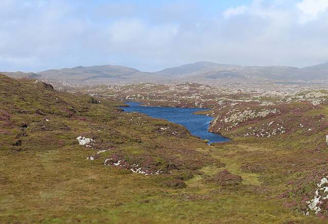
The headland is characterized by its dramatic cliffs, which rise steeply from the sea below. These cliffs are composed of ancient rock formations, showcasing layers of sedimentary rocks that have been shaped by years of erosion. The height of the cliffs offers breathtaking panoramic views of the surrounding coastline and the vast expanse of the North Sea.

Aird Druim an Tolla is of significant geological and ecological importance. The exposed rock formations provide an opportunity for geologists and researchers to study the region's geological history. The headland also serves as a nesting site for various seabird species, including guillemots and puffins, making it a popular destination for birdwatchers and nature enthusiasts.

Access to Aird Druim an Tolla is available through well-maintained footpaths that wind along the cliff tops. The paths provide a safe and enjoyable way to explore the headland while admiring its natural beauty. However, caution is advised as the cliffs can be hazardous, especially during inclement weather or high tides.

Overall, Aird Druim an Tolla is a captivating coastal feature that offers visitors a unique opportunity to immerse themselves in the stunning scenery and rich natural history of Inverness-shire's coastline.

If you have any feedback on the listing, please let us know in the comments section below.

Aird Druim an Tolla Images

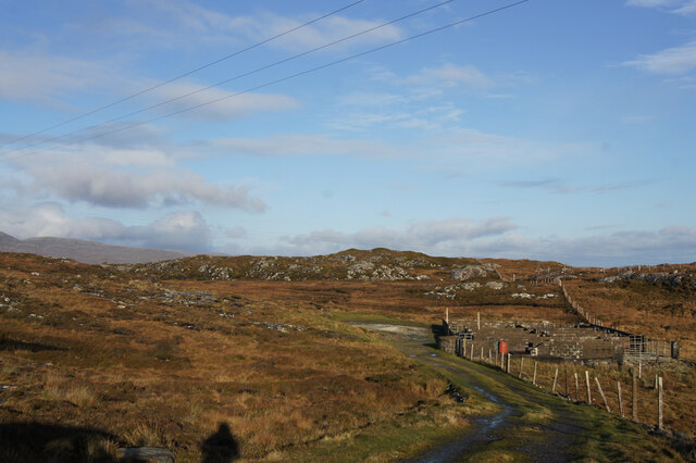
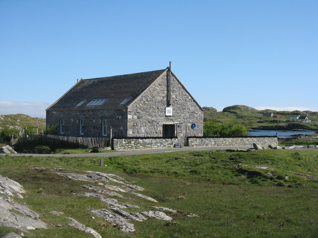
Images are sourced within 2km of 57.771559/-6.9096916 or Grid Reference NG0886. Thanks to Geograph Open Source API. All images are credited.

Track and sheep pen, Lingarabay A few nomadic sheep manage to survive here, among the heather and bedrock on the east coast of Harris.
Track and sheep pen, Lingarabay
A few nomadic sheep manage to survive here, among the heather and bedrock on the east coast of Harris.
Ruin at Ardvey Abandoned and derelict, in spite of being relatively modern.
Ruin at Ardvey
Abandoned and derelict, in spite of being relatively modern.
Loch Fhionnsabhaigh The blue pay-to-view telescope is probably there to enable seal-watchers to get a closer view - though as the seals were today basking on rocks just a few yards from the shore, the scope was barely necessary.
See also: <a href="https://www.geograph.org.uk/photo/7033022">NG0887 : Common seals in Loch Fhionnsabhaigh</a>.
Loch Fhionnsabhaigh
The blue pay-to-view telescope is probably there to enable seal-watchers to get a closer view - though as the seals were today basking on rocks just a few yards from the shore, the scope was barely necessary. See also: NG0887 : Common seals in Loch Fhionnsabhaigh.
Common seals in Loch Fhionnsabhaigh A slightly zoomed-in image, taken from the shore of the loch.
Common seals in Loch Fhionnsabhaigh
A slightly zoomed-in image, taken from the shore of the loch.
The road approaching Fionnsabhagh from the south
Fish Farm Pier at Loch Huamabhat
Desolate inland Harris Geocaching is a type of global treasure hunt of people looking for caches, or hidden stashes of objects. Geocaching may also be described as a series of hide-and-seek games, where hiders provide online clues for seekers. Seekers use global positioning system (GPS) devices to find hidden caches
Desolate inland Harris
Geocaching is a type of global treasure hunt of people looking for caches, or hidden stashes of objects. Geocaching may also be described as a series of hide-and-seek games, where hiders provide online clues for seekers. Seekers use global positioning system (GPS) devices to find hidden caches
Loch an Luig One of the hundreds of small lochs among the gneiss of eastern Harris.
Loch an Luig
One of the hundreds of small lochs among the gneiss of eastern Harris.
Loch Sgùrr The road is right on the brink of this small lochan.
Loch Sgùrr
The road is right on the brink of this small lochan.
Fionnsabhaigh Finsbay is one of the scattered villages on the east side of Harris, settled by people evicted from the fertile machair land on the west during the Highand Clearances.
Fionnsabhaigh
Finsbay is one of the scattered villages on the east side of Harris, settled by people evicted from the fertile machair land on the west during the Highand Clearances.
Finsbay One of a handful of small settlements in Eastern Harris.
Finsbay
One of a handful of small settlements in Eastern Harris.
Sea Inlet at Ardvey Marked on the map as a tidal pond, this is connected to the sea on the right, beyond the narrowest part. It is, unfortunately, difficult to photograph anything in this area without including the necessary evil of power lines.
Sea Inlet at Ardvey
Marked on the map as a tidal pond, this is connected to the sea on the right, beyond the narrowest part. It is, unfortunately, difficult to photograph anything in this area without including the necessary evil of power lines.
Tidal Inlet at Aird Mhighe The inlet is in this square but the house is in the next square.
Tidal Inlet at Aird Mhighe
The inlet is in this square but the house is in the next square.
Loch Fhionnsabhaigh One of the larger sea-lochs on the east coast of Harris.
Loch Fhionnsabhaigh
One of the larger sea-lochs on the east coast of Harris.
Loch Holmasaig A small lochan, one of dozens alongside the Bays road.
Loch Holmasaig
A small lochan, one of dozens alongside the Bays road.
Loch Huamabhat One of the larger lochans in the wilderness of East Harris.
Loch Huamabhat
One of the larger lochans in the wilderness of East Harris.
Fishing Station? It's not immediately obvious what the reason for the large raft and jetties is.
Fishing Station?
It's not immediately obvious what the reason for the large raft and jetties is.
Mission House Studio At Finsbay/Fionnsabhagh, looking in much better condition than it does on Google Street View imagery of 2009.
Mission House Studio
At Finsbay/Fionnsabhagh, looking in much better condition than it does on Google Street View imagery of 2009.
Show me another place!

Aird Druim an Tolla is located at Grid Ref: NG0886 (Lat: 57.771559, Lng: -6.9096916)

Unitary Authority: Na h-Eileanan an Iar

Police Authority: Highlands and Islands

What 3 Words

///torched.milky.escalated. Near Leverburgh, Na h-Eileanan Siar

Related Wikis

Borsham

Borsham (Scottish Gaelic: Boirseam) is a village in the 'Bays' area of Harris in the Outer Hebrides, Scotland. Borsham is within the parish of Harris....

Lingarabay

Lingarabay (also Lingerabay or Lingerbay; Scottish Gaelic: Lingreabhagh) is a small coastal settlement on Harris, in the Outer Hebrides of Scotland. It...

Harris Superquarry

The Harris Super Quarry was a super quarry at Lingerbay, Harris, Scotland proposed by Redland Aggregates in 1991. The plan was to surface mine aggregate...

Roineabhal

Roineabhal is a hill in Harris, in the Western Isles of Scotland. The granite on the summit plateau of the mountain is anorthosite, and is similar in composition...

Nearby Amenities

Located within 500m of 57.771559,-6.9096916
Passing Place
Lat/Long: 57.7726131/-6.9156195
Boirseam
Alt Name: Bòirseam
Name En: Borsham
Name Gd: Boirseam
Place: hamlet
Lat/Long: 57.7684094/-6.9126151
Turning Circle
Lat/Long: 57.7672811/-6.9108044
Material: wood
Power: pole
Lat/Long: 57.7731225/-6.9172693
Material: wood
Power: pole
Lat/Long: 57.769789/-6.9127095
Material: wood
Power: pole
Lat/Long: 57.7707717/-6.91154
Material: wood
Power: pole
Lat/Long: 57.7702496/-6.9122186
Material: wood
Power: pole
Lat/Long: 57.7705121/-6.9118632
Passing Place
Lat/Long: 57.7729951/-6.9169384
Passing Place
Lat/Long: 57.7718883/-6.9147028
Loch Fhionnsbhaigh
Natural: bay
Lat/Long: 57.7743066/-6.9033381
Aird Druim an Tolla
Natural: cape
Lat/Long: 57.7712513/-6.9071897
Power: pole
Lat/Long: 57.7688849/-6.912262
Power: pole
Lat/Long: 57.7685187/-6.9120032
Power: pole
Lat/Long: 57.7681653/-6.9117833
Power: pole
Lat/Long: 57.7679085/-6.9115794
Power: pole
Lat/Long: 57.7674629/-6.9112575
Power: pole
Lat/Long: 57.7693917/-6.9125086
Power: pole
Lat/Long: 57.7701813/-6.9135376
Power: pole
Lat/Long: 57.7705125/-6.9143851
Power: pole
Lat/Long: 57.7710203/-6.9156324
Power: pole
Lat/Long: 57.7714923/-6.9168273
The data included in this document is from www.openstreetmap.org. The data is made available under ODbL.

Have you been to Aird Druim an Tolla?

Leave your review of Aird Druim an Tolla below (or comments, questions and feedback).