Àird Mhithinis

Settlement in Inverness-shire

Scotland

Àird Mhithinis

Looking north from Ardmhor/Àird Mhòr
Looking north from Ardmhor/Àird Mhòr Credit: M J Richardson

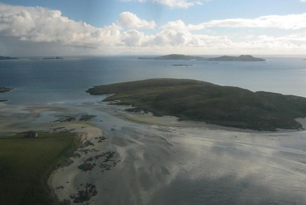
Àird Mhithinis, also known as Ardmillan, is a small rural settlement located in Inverness-shire, Scotland. Situated amidst stunning natural beauty, it lies on the eastern shore of Loch Eil, a sea loch that extends from the Firth of Lorne. The hamlet is part of the wider community of Corpach, which is about 6 miles southwest of Fort William.

Àird Mhithinis boasts a picturesque setting with panoramic views of the surrounding mountains and lochs. The area is renowned for its rugged landscapes, making it an ideal destination for outdoor enthusiasts. Hiking, cycling, and fishing are popular activities in this region, with ample opportunities to explore the nearby Ben Nevis, the highest peak in the British Isles.

With its remote location, Àird Mhithinis offers a tranquil and peaceful escape from the hustle and bustle of city life. The community primarily consists of residential properties, and the locals enjoy a close-knit and friendly atmosphere. While there are limited amenities within the hamlet itself, the nearby town of Fort William provides essential services such as shops, schools, and healthcare facilities.

Accessible by road, Àird Mhithinis offers easy connections to the wider Inverness-shire area and other major cities in Scotland. The hamlet also benefits from its proximity to the West Highland Railway Line, offering breathtaking scenic journeys for both residents and visitors.

Overall, Àird Mhithinis presents a serene and idyllic location for those seeking a peaceful retreat amidst the stunning Scottish Highlands.

If you have any feedback on the listing, please let us know in the comments section below.

Àird Mhithinis Images

Images are sourced within 2km of 57.003941/-7.4283874 or Grid Reference NF7003. Thanks to Geograph Open Source API. All images are credited.

Looking north from Ardmhor/Àird Mhòr
The road along Ardmhor/Àird Mhòr The road from the Eriskay-Barra ferry terminal.
The road along Ardmhor/Àird Mhòr
The road from the Eriskay-Barra ferry terminal.
Otters and salmon at Àird Mhòr/Ardmhor ferry terminal A sculpture by Iain Brady <span class="nowrap"><a title="http://www.iainbrady.com/" rel="nofollow ugc noopener" href="http://www.iainbrady.com/">Link</a><img style="margin-left:2px;" alt="External link" title="External link - shift click to open in new window" src="https://s1.geograph.org.uk/img/external.png" width="10" height="10"/></span> . Overlooking the harbour at the arrival/departure point for the ferry to Eriskay.
Otters and salmon at Àird Mhòr/Ardmhor ferry terminal
A sculpture by Iain Brady LinkExternal link . Overlooking the harbour at the arrival/departure point for the ferry to Eriskay.
Àird Mhòr/Ardmhor ferry terminal Departure/arrival point for the ferry to Eriskay from Barra.
Àird Mhòr/Ardmhor ferry terminal
Departure/arrival point for the ferry to Eriskay from Barra.
Harbour at Ardmhor/Àird Mhòr Looking across An Oitir Mhòr to Eriskay. The ferry for Eriskay leaves from here.
Harbour at Ardmhor/Àird Mhòr
Looking across An Oitir Mhòr to Eriskay. The ferry for Eriskay leaves from here.
Slipway and ferry terminal at Ardmhor Looking across to Eriskay on the left and Hellisay on the right.
Slipway and ferry terminal at Ardmhor
Looking across to Eriskay on the left and Hellisay on the right.
Harbour at Bayherivagh/Thiarabhagh At North Bay on Barra.
Harbour at Bayherivagh/Thiarabhagh
At North Bay on Barra.
Hornet ashore at Barra All I could find about this boat is that there are photos of a trawler that looks very similar, same name, same number, but different colour scheme, dating from 2009 and registered at Faversham, Kent. It may have relocated.
Hornet ashore at Barra
All I could find about this boat is that there are photos of a trawler that looks very similar, same name, same number, but different colour scheme, dating from 2009 and registered at Faversham, Kent. It may have relocated.
Church at Bayherivagh/Thiarabhagh The catholic church of St Barr.
Church at Bayherivagh/Thiarabhagh
The catholic church of St Barr.
Up, up, and away to Glasgow Loganair Twin Otter G-HIAL leaving Tràigh Mhòr, Barra. On the left is an orange airfield boundary marker, and the car in the distance is with the two cocklers on the beach.
Up, up, and away to Glasgow
Loganair Twin Otter G-HIAL leaving Tràigh Mhòr, Barra. On the left is an orange airfield boundary marker, and the car in the distance is with the two cocklers on the beach.
Loch Ob The north shore, near Bogach.
Loch Ob
The north shore, near Bogach.
Northbay House at Bogach At the head of Loch Ob.
Northbay House at Bogach
At the head of Loch Ob.
Heathbank Hotel At Bogach, near Northbay.
Heathbank Hotel
At Bogach, near Northbay.
House at Bruairnis/Bruarnish Boarded-up, but looking reasonably sound.
House at Bruairnis/Bruarnish
Boarded-up, but looking reasonably sound.
Electricity supply pole at Bruernish Supporting transformer and cables.
Electricity supply pole at Bruernish
Supporting transformer and cables.
Inlet of Bàgh Thiarabhagh With a rather fragile-looking jetty.
Inlet of Bàgh Thiarabhagh
With a rather fragile-looking jetty.
Looking out to Bàgh Thiarabhagh From the road at Heathbank Hotel, Thiarabhagh.
Looking out to Bàgh Thiarabhagh
From the road at Heathbank Hotel, Thiarabhagh.
Moored at Àird Mhòr The 'SY' boat registration is for Stornoway.
Moored at Àird Mhòr
The 'SY' boat registration is for Stornoway.
Show me another place!

Àird Mhithinis is located at Grid Ref: NF7003 (Lat: 57.003941, Lng: -7.4283874)

Unitary Authority: Na h-Eileanan an Iar

Police Authority: Highlands and Islands

What 3 Words

///perplexed.opposing.unleashed. Near CastleBay, Na h-Eileanan Siar

Related Wikis

Northbay

Northbay (Scottish Gaelic: Am Bàgh a Tuath) is a township and community in the north of Barra in the Outer Hebrides, off the west coast of Scotland. Northbay...

Ardveenish

Ardveenish (Scottish Gaelic: Àird Mhèanais) is a village on Barra in the Western Isles, Scotland. Ardveenish is also within the parish of Barra. ��2�...

Bogach

Bogach (Scottish Gaelic: A' Bhogach) is a village on the island of Barra in the Outer Hebrides, Scotland. Bogach is also within the parish of Barra, and...

Ardmore, Barra

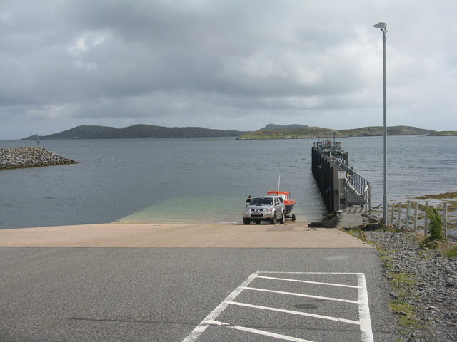
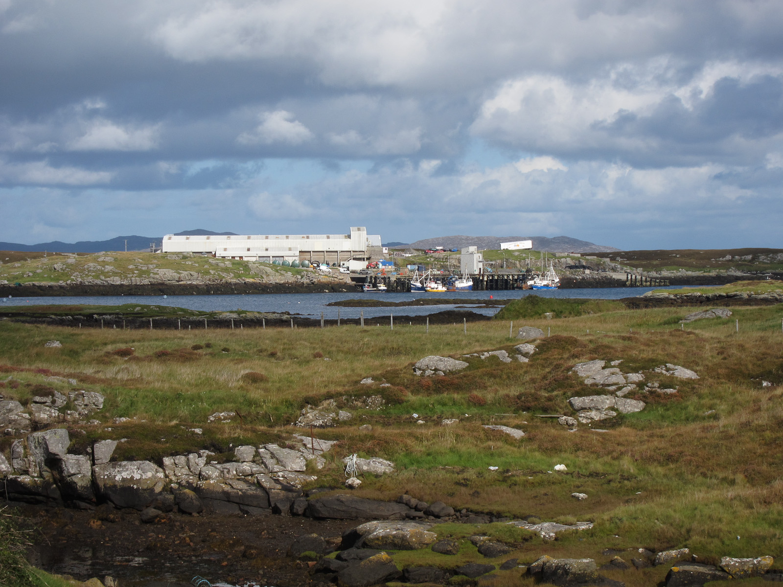
Ardmhor (Scottish Gaelic: Aird Mhòr) is a small village in the north east of the Isle of Barra in the Outer Hebrides, Scotland. In 2002 a small ferry port...
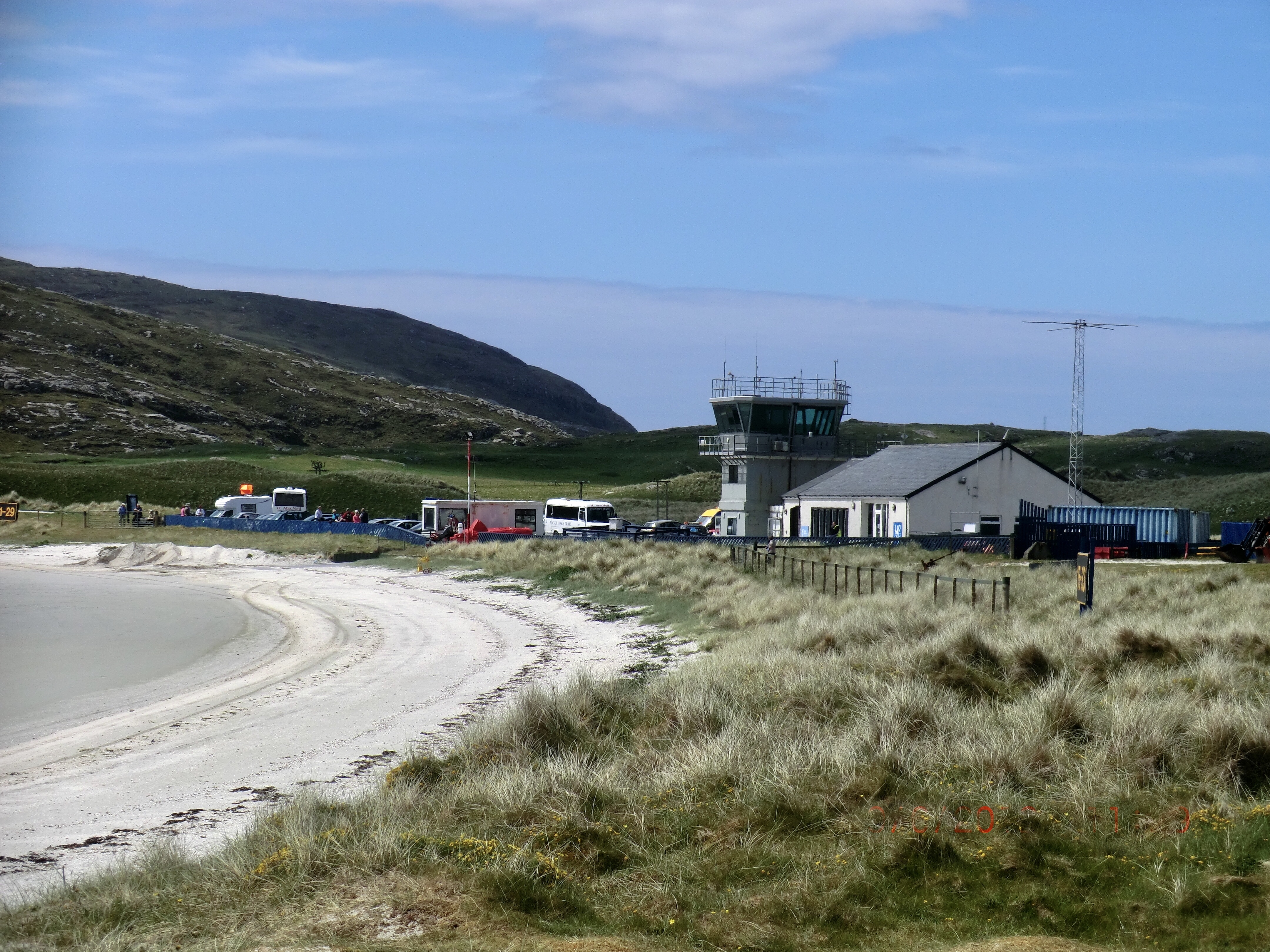
Barra Airport

Barra Airport (Scottish Gaelic: Port-adhair Bharraigh) (IATA: BRR, ICAO: EGPR) (also known as Barra Eoligarry Airport) is a short-runway airport (or STOLport...

Traigh Mhòr

The Tràigh Mhòr, in English 'Big Beach', is a large expanse of sand forming a magnificent white beach at the northern end of the island of Barra in the...

Orosay

Orosay (Scottish Gaelic: Orasaigh) is a small uninhabited tidal island in the Sound of Barra lying at the north end of Traigh Mhòr, the "big beach" on...

Barra

Barra (; Scottish Gaelic: Barraigh [ˈparˠaj] or Eilean Bharraigh [ˈelan ˈvarˠaj] ; Scots: Barra) is an island in the Outer Hebrides, Scotland, and the...

Nearby Amenities

Located within 500m of 57.003941,-7.4283874
Passing Place
Source: Bing
Lat/Long: 57.0082519/-7.4296334
Bus Stop
Northbay
Naptan AtcoCode: 6010731768
Naptan Bearing: S
Naptan CommonName: Northbay
Naptan Indicator: Junction
Naptan Landmark: Junction
Naptan NaptanCode: 94723258
Naptan Street: Junction
Naptan Verified: no
Source: naptan_import
Lat/Long: 57.0017926/-7.4306212
Bus Stop
Northbay
Bus: yes
Naptan AtcoCode: 6010731769
Naptan Bearing: W
Naptan CommonName: Northbay
Naptan Indicator: Village
Naptan Landmark: Village
Naptan NaptanCode: 94723256
Naptan Street: Village
Naptan Verified: no
Public Transport: platform
Shelter: yes
Source: naptan_import
Lat/Long: 57.0007773/-7.4258714
Turning Circle
Lat/Long: 57.0000661/-7.4247827
Turning Circle
Lat/Long: 57.000915/-7.4327282
Leisure: slipway
Lat/Long: 57.0014001/-7.4264336
Passing Place
Lat/Long: 57.0021136/-7.4351657
Passing Place
Lat/Long: 57.0071926/-7.4259335
Barrier: cattle_grid
Lat/Long: 57.002244/-7.4345191
Post Box
Note: RM list suggests different number
Operator: Royal Mail
Ref: HS9 16
Lat/Long: 57.0071738/-7.4286837
Bàgh a Tuath
Alt Name En: Bayherivagh
Alt Name Gd: Thiarabhagh
Name En: Northbay
Name Gd: Bàgh a Tuath
Place: village
Wikidata: Q7057698
Wikipedia: en:Northbay
Lat/Long: 57.0008295/-7.4256199
Statue of St Barr
Artwork Type: statue
Tourism: artwork
Lat/Long: 57.0021185/-7.4275768
Power: pole
Lat/Long: 57.0080008/-7.4302956
Power: pole
Lat/Long: 57.0074173/-7.43047
Power: pole
Lat/Long: 57.0067433/-7.4306712
Power: pole
Lat/Long: 57.0062438/-7.4308401
Power: pole
Lat/Long: 57.0055441/-7.4310574
Power: pole
Lat/Long: 57.0049022/-7.4312478
Power: pole
Lat/Long: 57.0042975/-7.4314436
Power: pole
Lat/Long: 57.0038162/-7.431504
Power: pole
Lat/Long: 57.0035029/-7.4315429
Power: pole
Lat/Long: 56.9998641/-7.4262884
Power: pole
Lat/Long: 57.0000861/-7.4274713
Power: pole
Lat/Long: 57.0003118/-7.4286447
Power: pole
Lat/Long: 57.0005383/-7.4298236
Power: pole
Lat/Long: 57.0007472/-7.430989
Power: pole
Lat/Long: 57.0009305/-7.4318661
Power: pole
Lat/Long: 57.0013819/-7.4318152
Power: pole
Lat/Long: 57.0017514/-7.4317735
Power: pole
Lat/Long: 57.0022109/-7.4317025
Power: pole
Lat/Long: 57.0026308/-7.4316528
Power: pole
Lat/Long: 57.0027849/-7.4316327
Power: pole
Lat/Long: 57.0028032/-7.4321195
Power: pole
Lat/Long: 57.0028149/-7.432538
Power: pole
Lat/Long: 57.0028529/-7.4336095
Power: pole
Lat/Long: 57.0028806/-7.4346448
Power: pole
Lat/Long: 57.0029259/-7.4359551
Power: pole
Lat/Long: 57.002514/-7.4335693
Power: pole
Lat/Long: 57.0028404/-7.4331026
Power: pole
Lat/Long: 57.0032231/-7.4327002
Power: pole
Lat/Long: 57.0040528/-7.4318084
Power: pole
Lat/Long: 57.0046327/-7.4317199
Power: pole
Lat/Long: 57.0053236/-7.4316287
Power: pole
Lat/Long: 57.0059341/-7.4315563
Power: pole
Lat/Long: 57.0065724/-7.4314624
Power: pole
Lat/Long: 57.0071201/-7.4313846
Power: pole
Lat/Long: 57.0078095/-7.4312854
Power: pole
Lat/Long: 57.0042255/-7.4256519
Power: pole
Lat/Long: 57.0045506/-7.4245275
Power: pole
Lat/Long: 57.0048723/-7.423345
Power: pole
Lat/Long: 57.004643/-7.4226051
Power: pole
Lat/Long: 57.0043719/-7.4217503
Power: pole
Lat/Long: 57.003943/-7.4203719
Tòrr Gormlaig
Place: locality
Lat/Long: 57.0032847/-7.422155
Power: pole
Lat/Long: 57.003775/-7.4237514
Power: pole
Lat/Long: 57.0038215/-7.4242846
Power: pole
Lat/Long: 57.0040237/-7.4249825
Power: pole
Lat/Long: 57.0040604/-7.4264809
Power: pole
Lat/Long: 57.003791/-7.4268552
Power: pole
Lat/Long: 57.0034842/-7.4272735
Power: pole
Lat/Long: 57.0035584/-7.4277167
Power: pole
Lat/Long: 57.0055505/-7.4239481
Power: pole
Lat/Long: 57.0061105/-7.424438
Power: pole
Lat/Long: 57.0066464/-7.4253016
Power: pole
Lat/Long: 57.0071144/-7.4260091
Power: pole
Lat/Long: 57.0077192/-7.4269466
Power: pole
Lat/Long: 57.0076376/-7.4279454
Power: pole
Lat/Long: 57.0075847/-7.4287373
Power: pole
Lat/Long: 57.0075122/-7.42962
Power: pole
Lat/Long: 57.0008461/-7.424608
Power: pole
Lat/Long: 57.0006531/-7.4246891
Power: pole
Lat/Long: 57.000203/-7.4249258
Power: pole
Lat/Long: 56.9999741/-7.4249384
Power: pole
Lat/Long: 57.000723/-7.4269546
Power: pole
Lat/Long: 57.0009443/-7.429862
Power: pole
Lat/Long: 57.0008919/-7.4290998
Power: pole
Lat/Long: 57.0008373/-7.4283849
Power: pole
Lat/Long: 57.0007839/-7.4275926
Power: pole
Lat/Long: 57.0006441/-7.425747
Power: pole
Lat/Long: 57.000439/-7.425171
Barrier: cattle_grid
Lat/Long: 57.0071465/-7.4278852
Barrier: cattle_grid
Lat/Long: 57.0037231/-7.4279226
Power: pole
Lat/Long: 57.0033063/-7.4294025
Power: pole
Lat/Long: 57.0033457/-7.4286502
Power: pole
Lat/Long: 57.0033618/-7.4306471
Passing Place
Lat/Long: 57.0071654/-7.4270835
Passing Place
Lat/Long: 57.0073311/-7.4242165
Passing Place
Lat/Long: 57.0071792/-7.4233132
Barrier: cattle_grid
Lat/Long: 56.9999752/-7.4247155
Power: pole
Lat/Long: 57.0006899/-7.4264484
Barrier: cattle_grid
Lat/Long: 57.0009614/-7.4254482
Charging Station
Access: yes
Capacity: 2
Fee: yes
Operator: ChargePlace Scotland
Operator Wikidata: Q105359316
Ref: 60472
Socket Chademo Output: 17 kW
Socket Type2 Output: 15 kW
Socket Type2 Combo Output: 17 kW
Website: https://chargeplacescotland.org/cpmap/chargepoint/2372965/
Lat/Long: 57.0011558/-7.4242867
Passing Place
Lat/Long: 57.0003269/-7.4263521
Passing Place
Lat/Long: 57.0009348/-7.4293385
Passing Place
Lat/Long: 57.000759/-7.4315264
Power: pole
Lat/Long: 57.0026846/-7.4349682
Power: pole
Lat/Long: 57.0026335/-7.4357112
The data included in this document is from www.openstreetmap.org. The data is made available under ODbL.

Have you been to Àird Mhithinis?

Leave your review of Àird Mhithinis below (or comments, questions and feedback).