Addingford

Settlement in Yorkshire

England

Addingford

The Sycamores, Horbury Off Daw Lane.
The Sycamores, Horbury Credit: Richard Vince

Addingford is a small village located in the county of Yorkshire, England. Situated approximately four miles east of Huddersfield, it falls under the local government district of Kirklees. With a population of around 700 residents, Addingford maintains a close-knit community atmosphere.

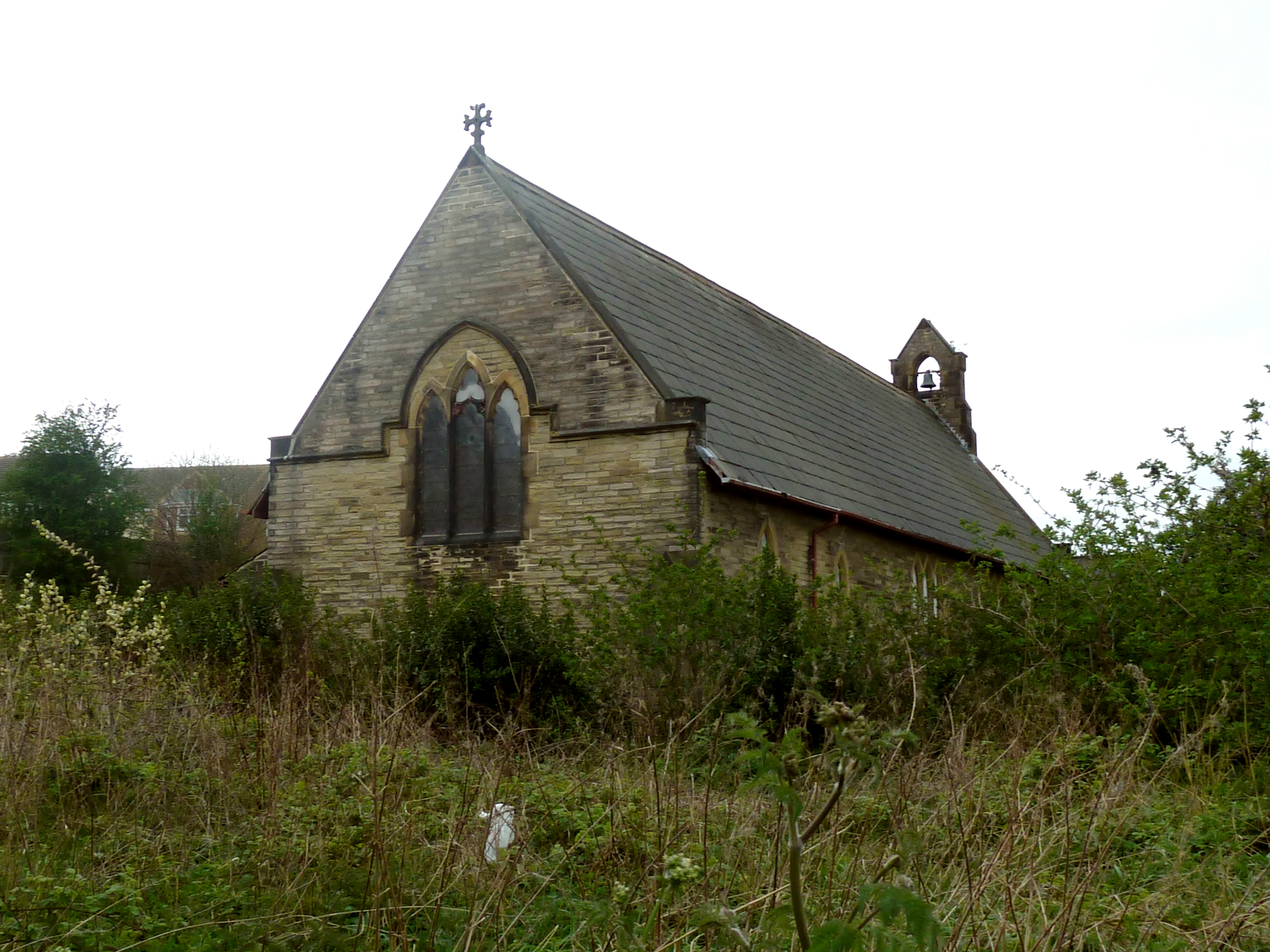
The village boasts a rich history, dating back to the Middle Ages. It was mentioned in the Domesday Book of 1086, where it was recorded as "Edulfingeforde," referring to a ford on the River Colne. Addingford's historical significance can be observed through the presence of several well-preserved buildings, including the All Hallows Church, which dates back to the 12th century.

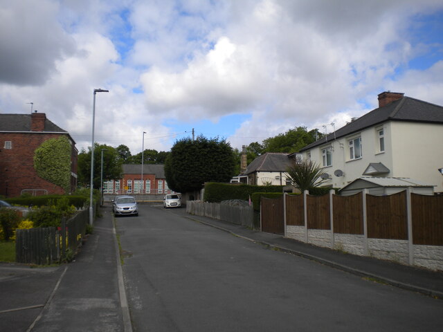
Addingford is surrounded by picturesque countryside, providing its residents with ample opportunities for outdoor activities such as hiking, walking, and cycling. The village is also home to several small businesses, including local shops, pubs, and cafes, which contribute to the village's economy and provide a sense of community.

While Addingford may be small in size, it benefits from its proximity to nearby towns and cities. The bustling town of Huddersfield is easily accessible, offering a wider range of amenities, shopping centers, and entertainment options.

Overall, Addingford, Yorkshire, is a charming village that combines its historical heritage with a tranquil countryside setting. With a strong sense of community and its convenient location, the village offers residents a peaceful yet well-connected place to call home.

If you have any feedback on the listing, please let us know in the comments section below.

Addingford Images

Images are sourced within 2km of 53.655506/-1.5594807 or Grid Reference SE2917. Thanks to Geograph Open Source API. All images are credited.

The Sycamores, Horbury Off Daw Lane.
The Sycamores, Horbury
Off Daw Lane.
Daw Lane, Horbury Seen from its east end, where it bifurcates into Green Lane and Millfield Road.
Daw Lane, Horbury
Seen from its east end, where it bifurcates into Green Lane and Millfield Road.
Ginnel off the Sycamores, Horbury Leading to Northfield Lane.
Ginnel off the Sycamores, Horbury
Leading to Northfield Lane.
West end of South Avenue, Horbury Looking towards the dead end where it doesn't quite meet Northfield Lane.
West end of South Avenue, Horbury
Looking towards the dead end where it doesn't quite meet Northfield Lane.
Access to subway under Northfield Lane, Horbury On the south side of Northfield Lane, opposite Horbury Primary Academy. Even from this distance, the subway did not smell good.
Access to subway under Northfield Lane, Horbury
On the south side of Northfield Lane, opposite Horbury Primary Academy. Even from this distance, the subway did not smell good.
East end of Cluntergate, Horbury Off Northfield Lane.
East end of Cluntergate, Horbury
Off Northfield Lane.
Water from the canal entering the River Calder A small weir releasing water from the Calder and Hebble Navigation into the River Calder.
Water from the canal entering the River Calder
A small weir releasing water from the Calder and Hebble Navigation into the River Calder.
Broad Cut Top Lock A lock along the Calder and Hebble Navigation.
Broad Cut Top Lock
A lock along the Calder and Hebble Navigation.
Railway bridge over the canal Looking along the Calder and Hebble Navigation towards a bridge carrying the Hallam lines over the canal.
Railway bridge over the canal
Looking along the Calder and Hebble Navigation towards a bridge carrying the Hallam lines over the canal.
Canal below Broad Cut Top Lock A section of the Calder and Hebble Navigation.
Canal below Broad Cut Top Lock
A section of the Calder and Hebble Navigation.
Train crossing the Calder and Hebble Navigation The train is the 1232 Leeds to Sheffield (2L65) consisting of 158868 and 150204.
Train crossing the Calder and Hebble Navigation
The train is the 1232 Leeds to Sheffield (2L65) consisting of 158868 and 150204.
Boats east of Waller Bridge Looking along the towpath beside the Calder and Hebble Navigation near Horbury.
Boats east of Waller Bridge
Looking along the towpath beside the Calder and Hebble Navigation near Horbury.
Boat east of Waller Bridge Looking along part of the Calder and Hebble Navigation.
Boat east of Waller Bridge
Looking along part of the Calder and Hebble Navigation.
Canal above Broad Cut Low Lock The Calder and Hebble Navigation rejoins the River Calder for a short section.
Canal above Broad Cut Low Lock
The Calder and Hebble Navigation rejoins the River Calder for a short section.
Broad Cut Low Lock Looking along the lock from the lower lock gates on the Calder and Hebble Navigation. Behind the canal enters the River Calder.
Broad Cut Low Lock
Looking along the lock from the lower lock gates on the Calder and Hebble Navigation. Behind the canal enters the River Calder.
Lock entering the River Calder Broad Cut Low Lock on the Calder and Hebble Navigation sees the canal rejoin the River Calder for a bit.
Lock entering the River Calder
Broad Cut Low Lock on the Calder and Hebble Navigation sees the canal rejoin the River Calder for a bit.
River Calder Bridge footpath Nestled between the running lines of the railway bridge is a small footpath.
River Calder Bridge footpath
Nestled between the running lines of the railway bridge is a small footpath.
Steps on the south side of the bridge River Calder Bridge is a rail bridge over the River Calder with a narrow footpath accessed by stairs at each end which include bike rails.
Steps on the south side of the bridge
River Calder Bridge is a rail bridge over the River Calder with a narrow footpath accessed by stairs at each end which include bike rails.
Show me another place!

Addingford is located at Grid Ref: SE2917 (Lat: 53.655506, Lng: -1.5594807)

Division: West Riding

Unitary Authority: Wakefield

Police Authority: West Yorkshire

What 3 Words

///polishing.farmland.snug. Near Horbury, West Yorkshire

Related Wikis

Horbury Town F.C.

Horbury Town Football Club is a football club based in Horbury, West Yorkshire, England. They play at the Slazengers Sports Complex. == History == The...

Horbury

Horbury is a town in the City of Wakefield in West Yorkshire, England. Historically in the West Riding of Yorkshire, it is situated north of the River...

Horbury Town Hall

Horbury Town Hall is a former municipal building in Westfield Road, Horbury, West Yorkshire, England. The structure, which is now used as business centre...

Horbury and Ossett railway station

Horbury and Ossett railway station formerly served the town of Horbury in West Yorkshire, England. It was located on the Manchester and Leeds Railway...

St Peter and St Leonard's Church, Horbury

St Peter and St Leonard's Church, Horbury is in Horbury, West Yorkshire, England. It is an active Church of England parish church and part of the Wakefield...

Horbury Millfield Road railway station

Horbury Millfield Road railway station served the village of Horbury, West Yorkshire, England from 1927 to 1961 on the Manchester and Leeds Railway....

Horbury Academy

Horbury Academy (formerly Horbury School) is a mixed secondary school located in Horbury in the City of Wakefield, West Yorkshire, England.The school...

Church of St John the Divine, Calder Grove

The Church of St John the Divine, designed by William Swinden Barber, was built as a mission church in 1892–1893 in the parish of St James, Chapelthorpe...

Related Videos

Family recreate summer holiday trip in their house and garden | SWNS

A family-of-six whose summer holiday abroad is in jeopardy because of coronavirus have shot a hilarious video - recreating the ...

GREENWAY - Ossett to Dewsbury Walk (Vlog #58)

A morning walk along the Greenway from Ossett town centre to Savile Town Wharf Marina in Dewsbury, West Yorkshire.

ASMR Walking In the Park In The Snow

Just me trying out my Willcell ice cleats for the first time, I bought them last year but never got round to using them. £10 from ...

A Solo Walk In A Beautiful Place In Summer

What another gorgeous morning! First solo walking video ive made in 3 years for this channel! Some of you know my mental ...

Nearby Amenities

Located within 500m of 53.655506,-1.5594807
Bus Stop
Highfield Road High Street
Bus: yes
Local Ref: 45022282
Naptan AtcoCode: 450022282
Naptan Bearing: SW
Naptan CommonName: Highfield Road High Street
Naptan Crossing: High Street
Naptan Indicator: Stop 45022282
Naptan Landmark: Junior School
Naptan PlusbusZoneRef: LEEDS
Naptan ShortCommonName: High Street Horbury
Naptan Street: Highfield Road
Naptan Verified: yes
Public Transport: platform
Ref: 45022282
Shelter: yes
Source: naptan_import
Lat/Long: 53.659626/-1.5585174
Barrier: motorcycle_barrier
Lat/Long: 53.654217/-1.560974
Barrier: motorcycle_barrier
Lat/Long: 53.6527486/-1.5638485
Barrier: cycle_barrier
Lat/Long: 53.6551404/-1.5626537
Barrier: cycle_barrier
Lat/Long: 53.6554746/-1.5624461
Barrier: stile
Lat/Long: 53.6566406/-1.5594251
Bus Stop
Highfield Road Horbury
Bus: yes
Local Ref: 45022281
Naptan AtcoCode: 450022281
Naptan Bearing: W
Naptan CommonName: Highfield Road Horbury
Naptan Crossing: Southfield Lane
Naptan Indicator: Stop 45022281
Naptan PlusbusZoneRef: LEEDS
Naptan ShortCommonName: Southfield Lane
Naptan Street: Quarry Hill
Naptan Verified: yes
Public Transport: platform
Ref: 45022281
Shelter: no
Source: naptan_import
Timetable: yes
Lat/Long: 53.6584332/-1.5614426
Bus Stop
Quarry Hill Southfield Lane
Bus: yes
Local Ref: 45022283
Naptan AtcoCode: 450022283
Naptan Bearing: E
Naptan CommonName: Quarry Hill Southfield Lane
Naptan Crossing: Southfield Lane
Naptan Indicator: Stop 45022283
Naptan PlusbusZoneRef: LEEDS
Naptan ShortCommonName: Southfield Lane
Naptan Street: Quarry Hill
Naptan Verified: yes
Public Transport: platform
Ref: 45022283
Source: naptan_import
Lat/Long: 53.658474/-1.5627738
Post Box
Operator: Royal Mail
Post Box Type: wall
Ref: WF4 46
Lat/Long: 53.6592646/-1.5591486
Noexit: yes
Lat/Long: 53.6561005/-1.5607954
Crossing: informal
Lat/Long: 53.6555499/-1.559559
Railway: switch
Lat/Long: 53.6575475/-1.5647303
Grit Bin
Lat/Long: 53.657852/-1.5626779
The Strands
Place: locality
Lat/Long: 53.6556737/-1.5670486
Post Box
Operator: Royal Mail
Post Box Type: lamp
Ref: WF4 176
Lat/Long: 53.6588785/-1.5553466
Cafe
Horbury Vintage Tea Rooms
Addr City: Wakefield
Addr Housenumber: 12
Addr Postcode: WF4 5LX
Addr Street: Highfield Road
Addr Suburb: Horbury
Lat/Long: 53.6594651/-1.5589549
Pub
Slazenger Sports & Social Club
Addr City: Wakefield
Addr Postcode: WF4 5BH
Addr Street: Addingford Lane
Addr Suburb: Horbury
Fhrs Id: 313724
Lat/Long: 53.6554349/-1.5573321
Horbury Station Junction
Railway: junction
Lat/Long: 53.6576193/-1.5648084
Horbury & Ossett Junction
Historic Railway: junction
Railway: site
Lat/Long: 53.6567486/-1.5620391
Power: pole
Lat/Long: 53.652801/-1.5650057
Power: pole
Lat/Long: 53.6524528/-1.5641102
The data included in this document is from www.openstreetmap.org. The data is made available under ODbL.

Have you been to Addingford?

Leave your review of Addingford below (or comments, questions and feedback).