Three Creeks

Island in Banffshire

Scotland

Three Creeks

Rock outcrop This outcrop is partly in Cullen Links and partly on the Cullen Sands.
Rock outcrop Credit: don cload

Three Creeks is a small island located in Banffshire, Scotland. Situated off the northeastern coast, it lies in the Moray Firth, near the mouth of the River Spey. The island is named after the three creeks that flow into the surrounding waters, creating a unique and picturesque landscape.

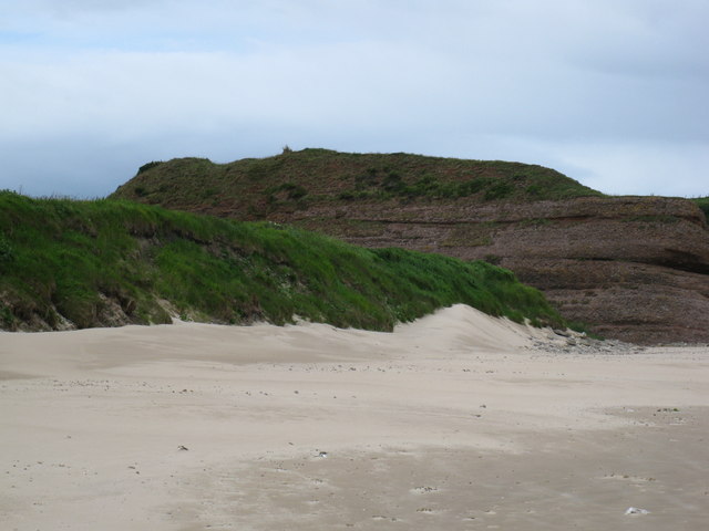
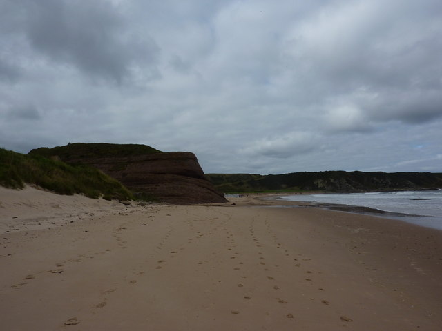
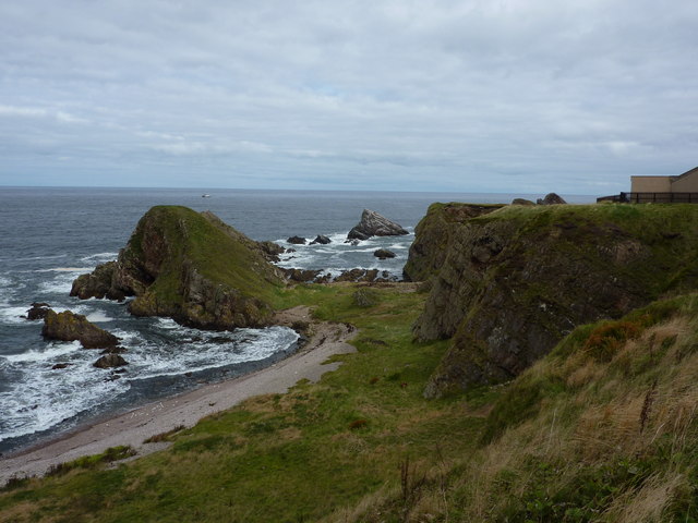
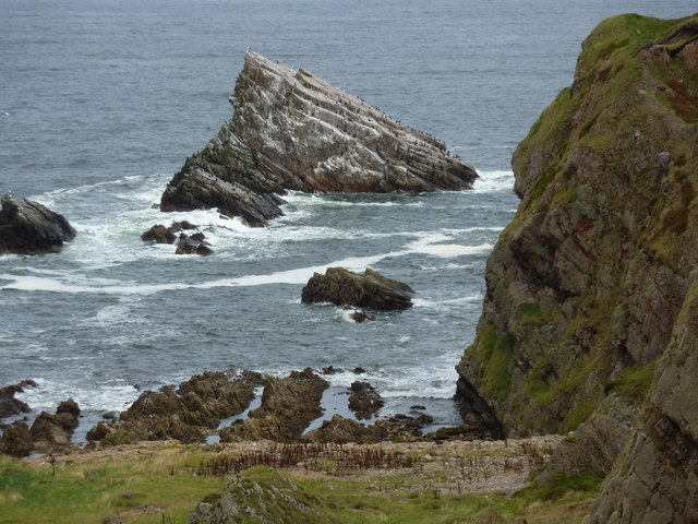
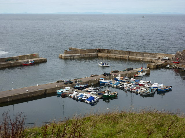
Covering an area of approximately 1 square kilometer, Three Creeks is a natural paradise with diverse flora and fauna. The island boasts a combination of sandy beaches, rocky cliffs, and lush greenery. It is home to a variety of bird species, including puffins, gulls, and cormorants, making it a popular spot for birdwatchers.

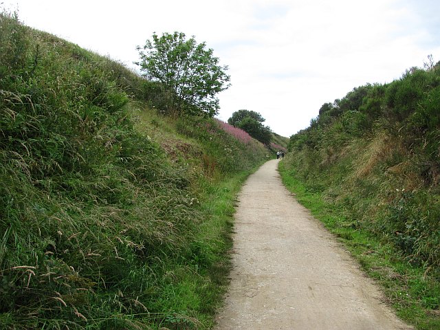
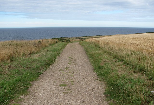
The island's terrain is mostly flat, with a few small hills providing panoramic views of the surrounding sea. Visitors can enjoy leisurely walks along the shoreline, exploring the rock pools and watching seals basking in the sun. The sandy beaches offer opportunities for sunbathing and picnicking.

Despite its small size, Three Creeks has a rich history. It was inhabited by early settlers who left behind remnants of ancient dwellings and burial sites. The island also played a role in the fishing industry, with fishermen using it as a base for their operations.

Access to Three Creeks is possible via boat or ferry services from nearby coastal towns. While there are no permanent residents on the island, it attracts tourists and nature enthusiasts throughout the year, seeking tranquility and natural beauty. Three Creeks offers a peaceful retreat, allowing visitors to reconnect with nature and experience the charm of Scotland's coastal wilderness.

If you have any feedback on the listing, please let us know in the comments section below.
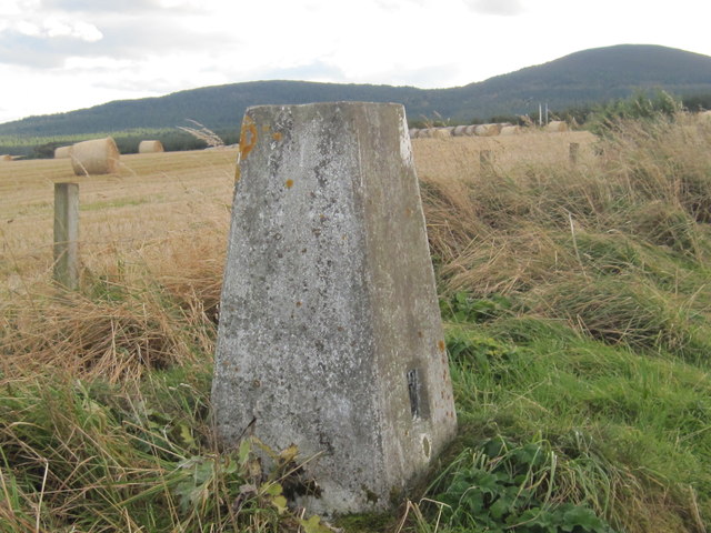
Three Creeks Images

Images are sourced within 2km of 57.705592/-2.8572654 or Grid Reference NJ4968. Thanks to Geograph Open Source API. All images are credited.

Rock outcrop This outcrop is partly in Cullen Links and partly on the Cullen Sands.
Rock outcrop
This outcrop is partly in Cullen Links and partly on the Cullen Sands.
Bow Fiddle Rock Famous rock feature at Portknockie.
Bow Fiddle Rock
Famous rock feature at Portknockie.
Portknockie Harbour
Portknockie Harbour
Bow Fiddle Rock
Bow Fiddle Rock
Reddish rock outcrop in Cullen Bay
Coast at Portknockie Triangular rock in the middle is Shitten Craig. The cat sitting on the fence in <a href="https://www.geograph.org.uk/photo/2620784">NJ4968 : Wee cat on fence</a> has cleared off.
Coast at Portknockie
Triangular rock in the middle is Shitten Craig. The cat sitting on the fence in NJ4968 : Wee cat on fence has cleared off.
Wee cat on fence By a chapel on the coast at Portknockie.
Wee cat on fence
By a chapel on the coast at Portknockie.
Cormorants and gulls on Shitten Craig Rocky coastline at Portknockie, Moray Firth.
Cormorants and gulls on Shitten Craig
Rocky coastline at Portknockie, Moray Firth.
Fishing boat leaving Portknockie harbour A few boats out at sea; the hills of Cromarty in the distance.
Fishing boat leaving Portknockie harbour
A few boats out at sea; the hills of Cromarty in the distance.
Youth Centre, Portknockie
New house, Church Street, Portknockie
Moray Coast Railway A cutting behind Cullen Links. The trackbed is now a path.
Moray Coast Railway
A cutting behind Cullen Links. The trackbed is now a path.
Moray Coast Railway The start of a section of trackbed which has been turned into a path to Cullen.
Moray Coast Railway
The start of a section of trackbed which has been turned into a path to Cullen.
Portknockie Harbour Fishing off the harbour wall at Portknockie.
Portknockie Harbour
Fishing off the harbour wall at Portknockie.
Coast path, Banffshire Well surfaced but not tarred section of the cycle route. It runs through a barley field by Tronach Head. A line on the horizon may be the haar, out at sea but ready to return.
Coast path, Banffshire
Well surfaced but not tarred section of the cycle route. It runs through a barley field by Tronach Head. A line on the horizon may be the haar, out at sea but ready to return.
Bow Fiddle Rock Bow Fiddle Rock is a classic example of a sea stack with a dramatic natural arch. It is named after its unusual shape which is supposed to resemble a violin bow, and it is the most visited tourist attraction in the village of Portknockie.
Bow Fiddle Rock
Bow Fiddle Rock is a classic example of a sea stack with a dramatic natural arch. It is named after its unusual shape which is supposed to resemble a violin bow, and it is the most visited tourist attraction in the village of Portknockie.
Triangulation Pillar S7179 at Portknockie
Ordnance Survey  Flush Bracket G4051 This can be found on a boundary wall at Cullen Bay Hotel.
For more detail see : <span class="nowrap"><a title="http://www.bench-marks.org.uk/bm16939" rel="nofollow ugc noopener" href="http://www.bench-marks.org.uk/bm16939">Link</a><img style="margin-left:2px;" alt="External link" title="External link - shift click to open in new window" src="https://s1.geograph.org.uk/img/external.png" width="10" height="10"/></span>
Ordnance Survey Flush Bracket G4051
This can be found on a boundary wall at Cullen Bay Hotel. For more detail see : LinkExternal link
Show me another place!

Three Creeks is located at Grid Ref: NJ4968 (Lat: 57.705592, Lng: -2.8572654)

Unitary Authority: Moray

Police Authority: North East

What 3 Words

///claw.singer.shell. Near Portknockie, Moray

Related Wikis

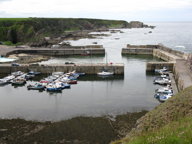
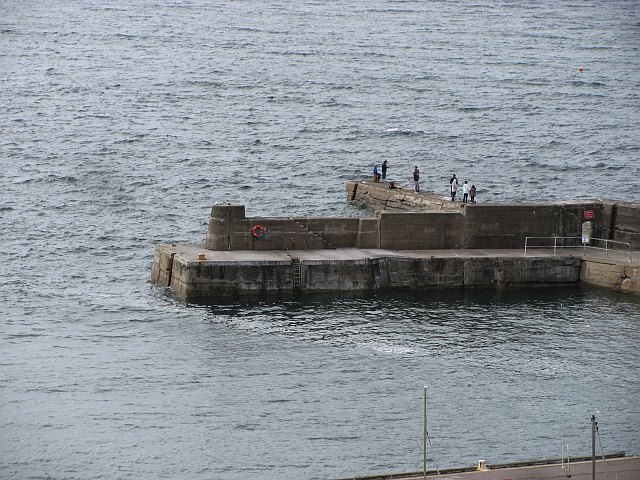
Green Castle, Portknockie

Green Castle is a naturally defended rocky outcrop in the village of Portknockie in Moray, Scotland, that was occupied successively by small promontory...
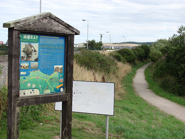
Portknockie

Portknockie (Scottish Gaelic: Port Chnocaidh, the hilly port) is a coastal village on the Moray Firth within Moray, Scotland. The village's name is written...
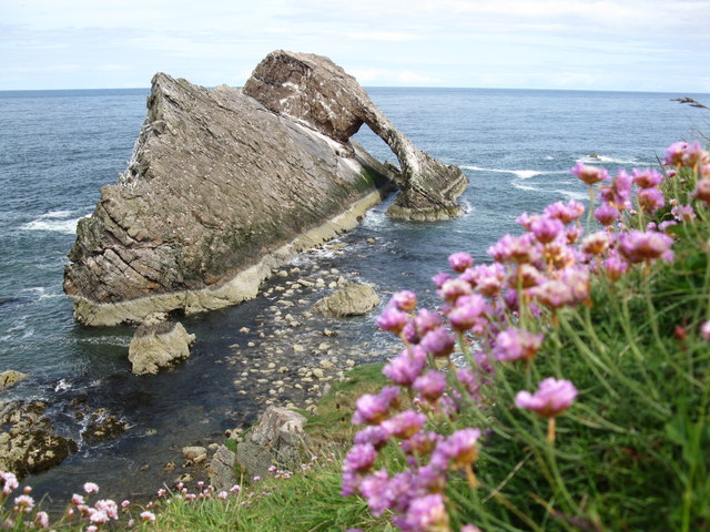
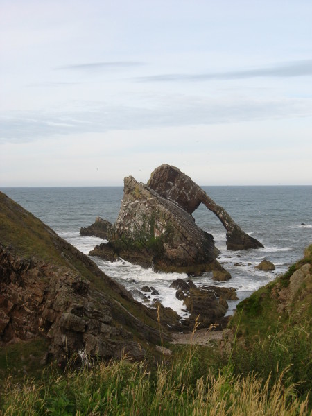
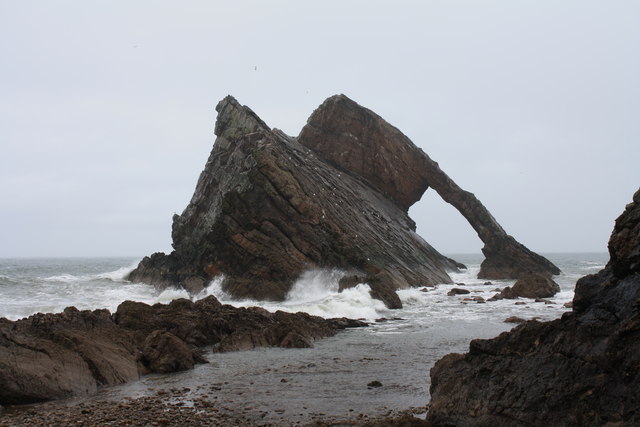
Bow Fiddle Rock

Bow Fiddle Rock is a natural sea arch near Portknockie on the north-eastern coast of Scotland. It is so called because it resembles the tip of a fiddle...

Portknockie railway station

Portknockie railway station was a railway station that served the small fishing village of Portknockie, close to Cullen in Moray. The railway station was...

Related Videos

Portnockie Scotland Walking Tour 4K 60fps, Mar 2024

Portnockie Scotland Walking Tour 4K 60fps, Mar 2024. Step into the charming embrace of Portnockie village in Scotland through ...

Sketching Scotland Project Origin & hiking // Scotland's Moray Coast Ep. 01

Episode 01 takes you along the first 10 mile section of the Moray Coast Trail, starting on the eastern edge of Cullen and walking to ...

BOW FIDDLE ROCK | SCOTLAND | DAY 2[TRAVEL BEEPS]

travelbeeps #bowfiddlerock #scotland #couplegoals #travelvlog #travel #familyvlog Bow Fiddle Rock is a natural sea arch near ...

Walking the Coast | Portknockie to Cullen

Last week we walked along the coast from Cullen to Portknockie - this week we're walking back from Portknockie to Cullen, but ...

Nearby Amenities

Located within 500m of 57.705592,-2.8572654
Portknockie
Name Gd: Port Chnocaidh
Place: village
Population: 1220
Source: npe
Wikidata: Q1011778
Wikipedia: en:Portknockie
Lat/Long: 57.7034964/-2.8581483
Post Box
Collection Times: Mo-Fr 09:00; Sa 07:00
Operator: Royal Mail
Post Box Mounting: pole
Post Box Type: lamp
Ref: AB56 97D
Royal Cypher: scottish_crown
Lat/Long: 57.702943/-2.8636862
Postal Code: AB56
Ref: AB56 101
Removed Amenity: post_box
Source: survey
Lat/Long: 57.704658/-2.8582588
Bow Fiddle Rock
Tourism: viewpoint
Lat/Long: 57.7055644/-2.8531964
Fast Food
Portknockie Fish & Chip Shop
Cuisine: fish_and_chips
Lat/Long: 57.7030635/-2.8579918
Pub
The Seafield Inn
Addr Postcode: AB56 4LH
Addr Street: Victoria Place
Fhrs Id: 19869
Source Addr: FHRS Open Data
Lat/Long: 57.7031254/-2.8584948
Post Box
Collection Times: Mo-Fr 16:00; Sa 11:45
Operator: Royal Mail
Royal Cypher: scottish_crown
Lat/Long: 57.7024139/-2.8584567
Bus Stop
Bus: yes
Naptan AtcoCode: 638050751
Naptan NaptanCode: 67923949
Public Transport: platform
Lat/Long: 57.7017544/-2.8566191
Fee: no
Natural: cave_entrance
Lat/Long: 57.7057655/-2.8532098
Bench
Lat/Long: 57.7046147/-2.857654
Artwork Type: mosaic
Tourism: artwork
Lat/Long: 57.7050767/-2.8597078
Bench
Lat/Long: 57.7040033/-2.8624509
Bench
Lat/Long: 57.7040043/-2.8625297
Bench
Lat/Long: 57.7040062/-2.8626085
Bench
Lat/Long: 57.7040186/-2.8626926
Bench
Lat/Long: 57.7040196/-2.8628216
Historic: memorial
Lat/Long: 57.7025243/-2.8574498
Post Office
Portknockie Post Office
Addr Postcode: AB56 4LN
Branch: Portknockie
Brand: Post Office
Brand Wikidata: Q1783168
Check Date: 2020-02-20
Contact Website: https://www.postoffice.co.uk/branch-finder/2708019/portknockie
Ref Pol Id: 10794
Lat/Long: 57.7023809/-2.8585394
SPAR
Brand Wikidata: Q610492
Shop: convenience
Website: https://www.spar.co.uk/store-locator/lan18070-spar-portnockie/
Lat/Long: 57.7023963/-2.8585354
Man Made: flagpole
Lat/Long: 57.7049695/-2.8602849
The data included in this document is from www.openstreetmap.org. The data is made available under ODbL.

Have you been to Three Creeks?

Leave your review of Three Creeks below (or comments, questions and feedback).