Eilean Carnaich

Island in Argyllshire

Scotland

Eilean Carnaich

Forestry at Lunga Looking north east from a small hill at NM791051.
Forestry at Lunga Credit: Patrick Mackie

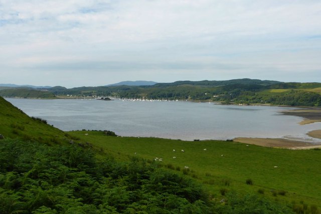
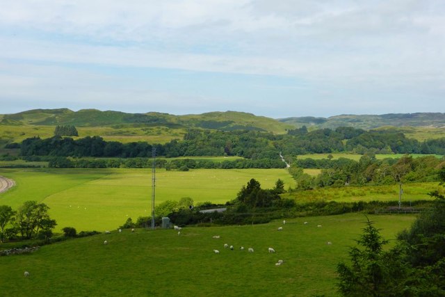
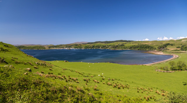
Eilean Carnaich is a small island located in Argyllshire, Scotland. It is situated in Loch Fyne, a long sea loch stretching from the Firth of Clyde to Inveraray. The island has a rich history and is known for its natural beauty.

Eilean Carnaich covers an area of approximately 15 acres and is predominantly covered in lush green vegetation. The island is uninhabited and remains largely untouched by human activity. It is accessible by boat and provides a peaceful retreat for nature lovers and those seeking tranquility.

The island boasts stunning views of the surrounding mountains and the crystal-clear waters of Loch Fyne. It is home to a diverse range of wildlife, including various species of birds, seals, and otters. Birdwatchers can spot a variety of seabirds nesting on the island's cliffs, while others can enjoy fishing in the surrounding waters.

Eilean Carnaich also has historical significance. Ruins of a castle dating back to the 16th century can be found on the island. The castle was once a stronghold of the Clan Campbell and played a role in the region's turbulent past. Exploring the remnants of the castle provides visitors with a glimpse into the island's intriguing history.

Overall, Eilean Carnaich offers a unique and picturesque experience for those who venture to this remote island. Its natural beauty, diverse wildlife, and historical remnants make it a captivating destination for nature enthusiasts and history buffs alike.

If you have any feedback on the listing, please let us know in the comments section below.

Eilean Carnaich Images

Images are sourced within 2km of 56.187403/-5.5235177 or Grid Reference NM8105. Thanks to Geograph Open Source API. All images are credited.
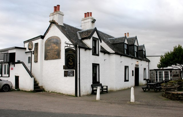
Forestry at Lunga Looking north east from a small hill at NM791051.
Forestry at Lunga
Looking north east from a small hill at NM791051.
Head of Loch Craignish A Sea loch.
Head of Loch Craignish
A Sea loch.
Bend on the A816 I thought take this view as everyone else has taken photos of the standing stone nearby.
Bend on the A816
I thought take this view as everyone else has taken photos of the standing stone nearby.
Loch Craignish View looking over the head of Loch Craignish.
Loch Craignish
View looking over the head of Loch Craignish.
Loch nah Ardlaraich, near Ardfern
A816 by Kintraw Standing Stone and Cairns
A816 north of Kintraw
A816 approaching Acharonich
The Galley Of Lorne Inn, Ardfern A Category C listed pub/hotel, dating from about 1800. It was previously called the Craignish Inn and also the Ardfern Inn.
The Galley Of Lorne Inn, Ardfern
A Category C listed pub/hotel, dating from about 1800. It was previously called the Craignish Inn and also the Ardfern Inn.
Sign for the Galley of Lorne Inn The inn [<a title="https://www.geograph.org.uk/photo/5963628" href="https://www.geograph.org.uk/photo/5963628">Link</a>] gets its name from the Galley of Lorne - the Symbol of Somerled, Lord of Lorne, King of the Western Isles, who pushed out the Vikings and set up the present Clan system.
Sign for the Galley of Lorne Inn
The inn [Link] gets its name from the Galley of Lorne - the Symbol of Somerled, Lord of Lorne, King of the Western Isles, who pushed out the Vikings and set up the present Clan system.
Craignish Parish Church Category B listed church [<span class="nowrap"><a title="http://portal.historicenvironment.scot/designation/LB4991" rel="nofollow ugc noopener" href="http://portal.historicenvironment.scot/designation/LB4991">Link</a><img style="margin-left:2px;" alt="External link" title="External link - shift click to open in new window" src="https://s1.geograph.org.uk/img/external.png" width="10" height="10"/></span>] dating from 1826 in Ardfern. The village's war memorial is in front of the church.
Craignish Parish Church
Category B listed church [LinkExternal link] dating from 1826 in Ardfern. The village's war memorial is in front of the church.
War Memorial, Craignish Parish Church, Ardfern IN
THE GREAT WAR
1914 - 1919
THEY DIED
FOR FREEDOM AND
FOR HONOUR

"MARIDH AN AINM-
SAN GU SIORUIDH"

For full transcription see [<span class="nowrap"><a title="https://canmore.org.uk/site/341320/ardfern-craignish-parish-church-war-memorial" rel="nofollow ugc noopener" href="https://canmore.org.uk/site/341320/ardfern-craignish-parish-church-war-memorial">Link</a><img style="margin-left:2px;" alt="External link" title="External link - shift click to open in new window" src="https://s1.geograph.org.uk/img/external.png" width="10" height="10"/></span>].
War Memorial, Craignish Parish Church, Ardfern
IN THE GREAT WAR 1914 - 1919 THEY DIED FOR FREEDOM AND FOR HONOUR "MARIDH AN AINM- SAN GU SIORUIDH" For full transcription see [LinkExternal link].
Craignish Parish Church Category B listed church [<span class="nowrap"><a title="http://portal.historicenvironment.scot/designation/LB4991" rel="nofollow ugc noopener" href="http://portal.historicenvironment.scot/designation/LB4991">Link</a><img style="margin-left:2px;" alt="External link" title="External link - shift click to open in new window" src="https://s1.geograph.org.uk/img/external.png" width="10" height="10"/></span>] dating from 1826 in Ardfern.
Craignish Parish Church
Category B listed church [LinkExternal link] dating from 1826 in Ardfern.
Houses beside the B8002, Ardfern Properties built within the last few years close to Craignish Parish Church.
Houses beside the B8002, Ardfern
Properties built within the last few years close to Craignish Parish Church.
Rough grazing near Hill Park
Old Milestone by the A816, Kintraw, Kilmartin parish Milestone by the A816, in parish of Kilmartin (Argyll & Bute District), North end of Loch Craignish, on verge.

Inscription once read:-
: (Ardrishaig / 14½) : : (Oban / 24½) :

Surveyed

Milestone Society National ID: AB_ONLG24
Old Milestone by the A816, Kintraw, Kilmartin parish
Milestone by the A816, in parish of Kilmartin (Argyll & Bute District), North end of Loch Craignish, on verge. Inscription once read:- : (Ardrishaig / 14½) : : (Oban / 24½) : Surveyed Milestone Society National ID: AB_ONLG24
Old Milestone by the A816, north of Barbreck Bridge Milestone by the A816, in parish of Ardnish (Argyll & Bute District), North of junction with the B8002, opposite telephone box and exchange, behind Armco barrier.

Inscription once read:-
: (ARDRISHAIG / 15½ / MILES) : : (OBAN / 23½ / MILES) :  

Surveyed

Milestone Society National ID: AB_ONLG23
Old Milestone by the A816, north of Barbreck Bridge
Milestone by the A816, in parish of Ardnish (Argyll & Bute District), North of junction with the B8002, opposite telephone box and exchange, behind Armco barrier. Inscription once read:- : (ARDRISHAIG / 15½ / MILES) : : (OBAN / 23½ / MILES) : Surveyed Milestone Society National ID: AB_ONLG23
Shore access at Barfad
Show me another place!

Eilean Carnaich is located at Grid Ref: NM8105 (Lat: 56.187403, Lng: -5.5235177)

Unitary Authority: Argyll and Bute

Police Authority: Argyll and West Dunbartonshire

What 3 Words

///eclipses.think.cookies. Near Lochgilphead, Argyll & Bute

Related Wikis

Ardfern

Ardfern (Scottish Gaelic: Aird Fheàrna, meaning "the head-land of alder-trees") is a village in Argyll and Bute, Scotland. It lies on the south coast of...

Craignish

Craignish (Scottish Gaelic, Creiginis) is a peninsula in Argyll, on the west coast of Scotland. It lies around 25 miles (40 km) south of Oban, and 10 miles...

Eilean Mhic Chrion

Eilean Mhic Chrion is a tidal island sheltering Ardfern in Loch Craignish, Scotland. Eilean Mhic Chrion is one of 43 tidal islands that can be walked to...

Dunan Aula

Dunan Aula, also known in Scottish Gaelic as Dùnan Amhlaidh, is the site of an exposed cist, located in the parish of Craignish, in Argyll and Bute, Scotland...

Nearby Amenities

Located within 500m of 56.187403,-5.5235177
Source: PGS
Lat/Long: 56.1846352/-5.5290852
Source: PGS
Lat/Long: 56.1850338/-5.5285654
Source: PGS
Lat/Long: 56.185323/-5.5280798
Source: PGS
Lat/Long: 56.1860839/-5.5276174
Source: PGS
Lat/Long: 56.1868096/-5.5272921
Source: PGS
Lat/Long: 56.1870818/-5.5270008
Source: PGS
Lat/Long: 56.1873384/-5.5266812
Source: PGS
Lat/Long: 56.1877195/-5.5262963
Source: PGS
Lat/Long: 56.1881012/-5.5257751
Source: PGS
Lat/Long: 56.188314/-5.5252451
Source: PGS
Lat/Long: 56.1883828/-5.5245157
Source: PGS
Lat/Long: 56.1882712/-5.5241238
Source: PGS
Lat/Long: 56.1881858/-5.5239327
Source: PGS
Lat/Long: 56.1880878/-5.523817
Source: PGS
Lat/Long: 56.1881616/-5.5236553
Source: PGS
Lat/Long: 56.1883543/-5.5231369
Source: PGS
Lat/Long: 56.1883978/-5.5228798
Source: PGS
Lat/Long: 56.1885206/-5.5222948
Source: PGS
Lat/Long: 56.1886067/-5.5219964
Source: PGS
Lat/Long: 56.188872/-5.5216511
Source: PGS
Lat/Long: 56.1891575/-5.5204844
Source: PGS
Lat/Long: 56.1892017/-5.5202246
Source: PGS
Lat/Long: 56.1893264/-5.5198648
Source: PGS
Lat/Long: 56.1894072/-5.5196539
Source: PGS
Lat/Long: 56.1894656/-5.5195015
Source: PGS
Lat/Long: 56.1894918/-5.5192248
Source: PGS
Lat/Long: 56.1894596/-5.5190254
Source: PGS
Lat/Long: 56.1894612/-5.5188841
Source: PGS
Lat/Long: 56.1895705/-5.5187215
Source: PGS
Lat/Long: 56.1895752/-5.5185504
Source: PGS
Lat/Long: 56.1896692/-5.5182807
Source: PGS
Lat/Long: 56.1898389/-5.5174683
Ardlarach
Place: locality
Source: OS-OpenData_StreetView
Lat/Long: 56.1904185/-5.5272383
Power: pole
Lat/Long: 56.1902569/-5.5214969
Power: pole
Lat/Long: 56.1903088/-5.5250671
Power: pole
Lat/Long: 56.190601/-5.524723
Power: pole
Lat/Long: 56.190826/-5.5258539
Power: pole
Lat/Long: 56.1909515/-5.5264691
Power: pole
Lat/Long: 56.1908031/-5.5269993
Power: pole
Lat/Long: 56.1903125/-5.5274241
Power: pole
Lat/Long: 56.189724/-5.5279778
Power: pole
Lat/Long: 56.1889921/-5.52859
Power: pole
Lat/Long: 56.1914486/-5.5268558
Power: pole
Lat/Long: 56.1882569/-5.5292198
Power: pole
Lat/Long: 56.1874614/-5.5298409
Power: pole
Lat/Long: 56.1867327/-5.5304414
Power: pole
Lat/Long: 56.1860647/-5.5309482
Power: pole
Lat/Long: 56.1903992/-5.5238518
Recycling
Recycling Type: container
Lat/Long: 56.1872457/-5.5276961
The data included in this document is from www.openstreetmap.org. The data is made available under ODbL.

Have you been to Eilean Carnaich?

Leave your review of Eilean Carnaich below (or comments, questions and feedback).