An Tudan

Island in Argyllshire

Scotland

An Tudan

Eilean Dubh Mor and Garbh Eileach from Lunga Garbh Eileach is the largest of the Garvellachs, which stretch away to the left in the Firth of Lorn. The Isle of Mull is in the distance, with Ben More (a favourite 'Final Munro') almost in the exact centre.
Eilean Dubh Mor and Garbh Eileach from Lunga Credit: Michael Earnshaw

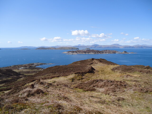
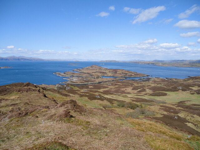
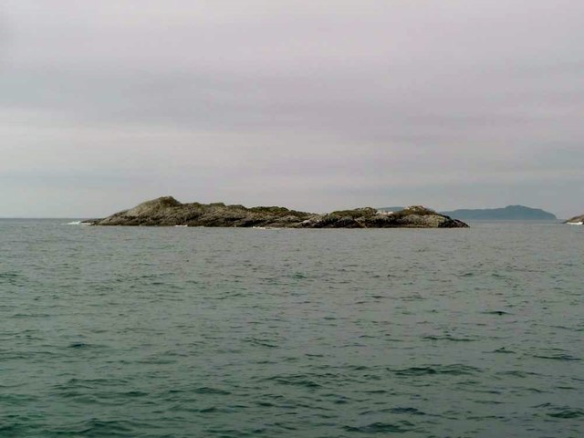
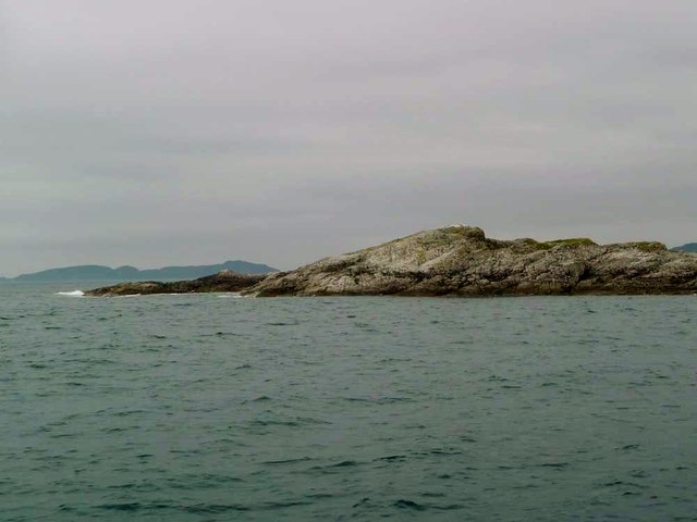
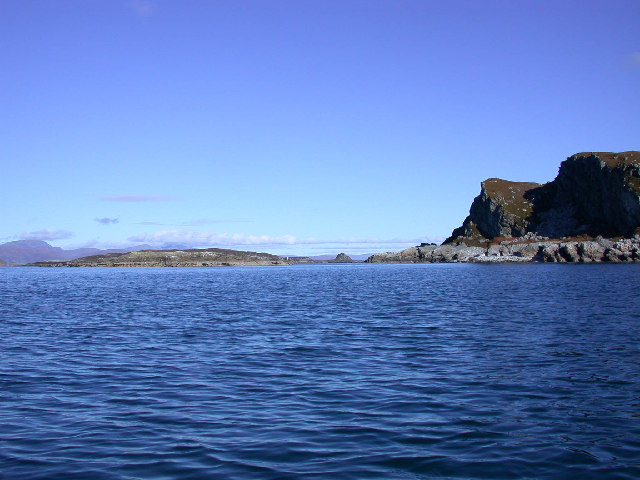
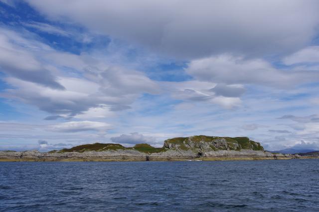
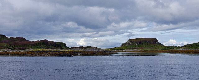
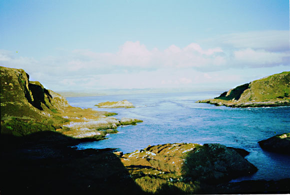
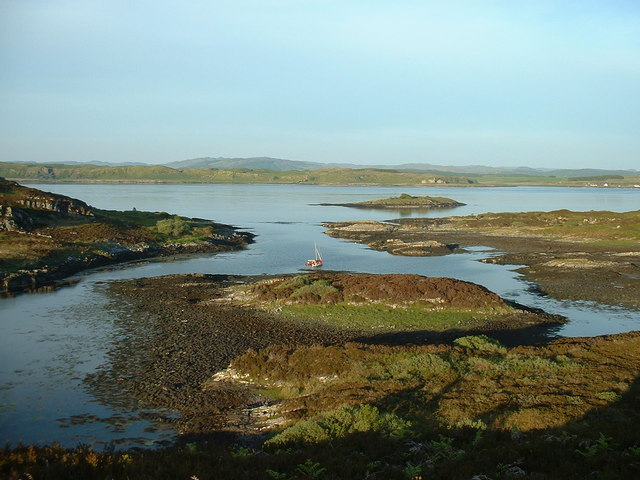
An Tudan is a small island located in Argyllshire, Scotland. It is situated in the Firth of Lorn, approximately 2 kilometers south of the Isle of Luing. The island covers an area of around 10 hectares and is mostly uninhabited.

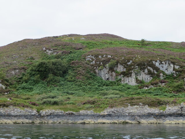
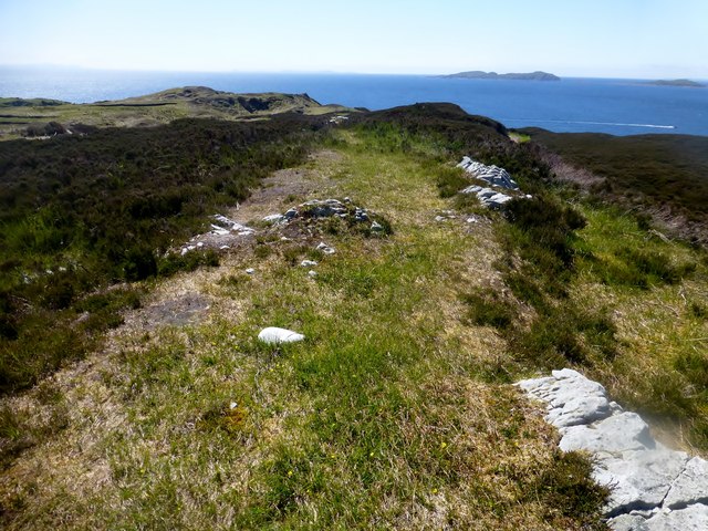
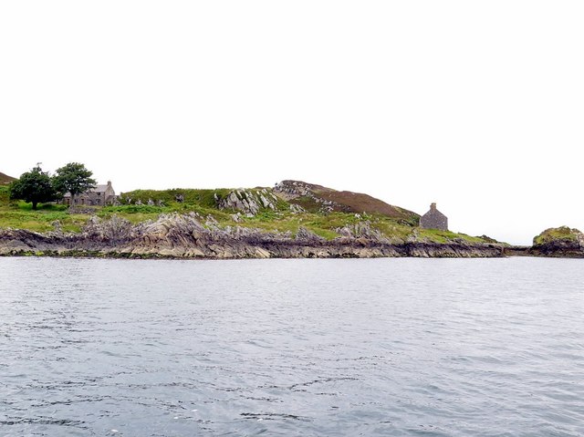
An Tudan is characterized by its rugged coastline and rocky terrain. It is primarily composed of granite and boasts stunning natural beauty, making it a popular destination for nature enthusiasts and birdwatchers. The island is home to a variety of bird species, including seabirds such as puffins, guillemots, and razorbills.

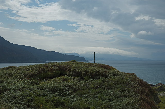
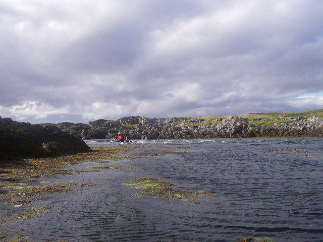
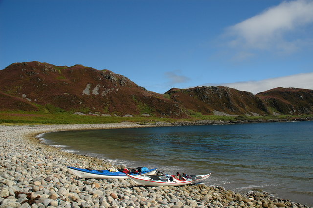
Access to An Tudan is mainly by boat, as there are no permanent ferry services to the island. However, during low tide, it is possible to reach the island on foot from the Isle of Luing, via a causeway known as "The Bridge over the Atlantic."

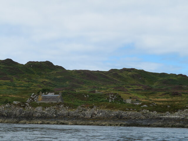
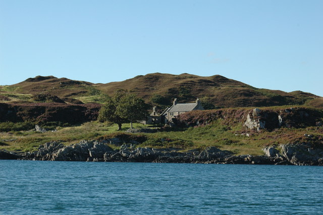
The island has a rich history, with remains of ancient settlements dating back to the Bronze Age. There are also traces of old fishing communities that once thrived on the island. Today, the ruins of these settlements can still be seen, adding to the island's historical significance.

Due to its remote and peaceful nature, An Tudan offers a tranquil escape from the hustle and bustle of daily life. Visitors can enjoy breathtaking views, take leisurely walks along the coastline, and immerse themselves in the island's natural wonders.

If you have any feedback on the listing, please let us know in the comments section below.

An Tudan Images

Images are sourced within 2km of 56.21548/-5.7198843 or Grid Reference NM6908. Thanks to Geograph Open Source API. All images are credited.

Eilean Dubh Mor and Garbh Eileach from Lunga Garbh Eileach is the largest of the Garvellachs, which stretch away to the left in the Firth of Lorn. The Isle of Mull is in the distance, with Ben More (a favourite 'Final Munro') almost in the exact centre.
Eilean Dubh Mor and Garbh Eileach from Lunga
Garbh Eileach is the largest of the Garvellachs, which stretch away to the left in the Firth of Lorn. The Isle of Mull is in the distance, with Ben More (a favourite 'Final Munro') almost in the exact centre.
Cottage on Lunga On the east coast of this Slate Island, in the Sound of Luing. There is also a larger house <a href="https://www.geograph.org.uk/photo/6932677">NM7108 : House on the Slate Island of Lunga</a>, obscured by the rock behind the cottage.
Cottage on Lunga
On the east coast of this Slate Island, in the Sound of Luing. There is also a larger house NM7108 : House on the Slate Island of Lunga, obscured by the rock behind the cottage.
House on the Slate Island of Lunga Seen from the Sound of Luing.
House on the Slate Island of Lunga
Seen from the Sound of Luing.
Barr Sligeig, on Lunga At 49 m, one of the higher points of Lunga; Bidein na h-Iolaire, at 100 m, is the highest. The rock would appear to be relatively soft - note the undercut at what would be the high tide mark?
Barr Sligeig, on Lunga
At 49 m, one of the higher points of Lunga; Bidein na h-Iolaire, at 100 m, is the highest. The rock would appear to be relatively soft - note the undercut at what would be the high tide mark?
Looking north from Lunga island summit In the foreground are two separate, but tidal islands, Eilean Iosal and Rubha Fiola. Further away can be seen Inch Island in the Firth of Lorn, and Seil to its right.
Looking north from Lunga island summit
In the foreground are two separate, but tidal islands, Eilean Iosal and Rubha Fiola. Further away can be seen Inch Island in the Firth of Lorn, and Seil to its right.
Liath Sgeir A skerry lying off the Black Isles.
Liath Sgeir
A skerry lying off the Black Isles.
Liath Sgeir A skerry lying off the Black Isles.
Liath Sgeir
A skerry lying off the Black Isles.
Northern tip of Guirasdeal Guirasdeal looking North to Lunga (right) and the black isle (left).
Northern tip of Guirasdeal
Guirasdeal looking North to Lunga (right) and the black isle (left).
Summit of Guirasdeal Summit of Guirasdeal, with Scarba and Jura in the distance.
Summit of Guirasdeal
Summit of Guirasdeal, with Scarba and Jura in the distance.
Guirasdeal from the SE At low water.
Guirasdeal from the SE
At low water.
Eilean Dubh Mòr Dropped off by Farsain Cruises from Craobh Haven, then Eilean Dubh Mòr before Dun a'Ghaill on a sunny day.
Name: Eilean Dubh Mòr
Hill number: 11529
Height: 54m / 177ft
Parent (Ma/M): none
Section: 20A: Jura, Scarba and Colonsay
County/UA: Argyll and Bute (UA)
Maritime Area: Scarba, Slate Islands & Firth of Lorn
Class: Tump (0-99m), SIB
Grid ref: NM695104 (est)
Drop: 54m
Col: Sea
Eilean Dubh Mòr
Dropped off by Farsain Cruises from Craobh Haven, then Eilean Dubh Mòr before Dun a'Ghaill on a sunny day. Name: Eilean Dubh Mòr Hill number: 11529 Height: 54m / 177ft Parent (Ma/M): none Section: 20A: Jura, Scarba and Colonsay County/UA: Argyll and Bute (UA) Maritime Area: Scarba, Slate Islands & Firth of Lorn Class: Tump (0-99m), SIB Grid ref: NM695104 (est) Drop: 54m Col: Sea
Houses on east coast of Lunga Lunga is one of the Slate Islands in the Firth of Lorn. The 'Grey Dog' tidal race, which runs in the sea channel to the south, Bealach a' Choin Ghlais, reaches 8 knots in full flood. The name 'Lunga' is derived from the Old Norse for 'Isle of the Longships', but almost all other place names are Gaelic in origin.
<span class="nowrap"><a title="https://en.wikipedia.org/wiki/Lunga_(Slate_Islands)" rel="nofollow ugc noopener" href="https://en.wikipedia.org/wiki/Lunga_(Slate_Islands)">Link</a><img style="margin-left:2px;" alt="External link" title="External link - shift click to open in new window" src="https://s1.geograph.org.uk/img/external.png" width="10" height="10"/></span>
Houses on east coast of Lunga
Lunga is one of the Slate Islands in the Firth of Lorn. The 'Grey Dog' tidal race, which runs in the sea channel to the south, Bealach a' Choin Ghlais, reaches 8 knots in full flood. The name 'Lunga' is derived from the Old Norse for 'Isle of the Longships', but almost all other place names are Gaelic in origin. LinkExternal link
North end of Lunga Looking west from the Sound of Luing through the narrow strait between Lunga (left) and Fiola Meadhonach (extreme right), to Fiola an Droma (centre right).
North end of Lunga
Looking west from the Sound of Luing through the narrow strait between Lunga (left) and Fiola Meadhonach (extreme right), to Fiola an Droma (centre right).
Bealach a' Choin Ghlais from Meall nan Caorach View Eastwards through the Bealach a' Choin Ghlais (Grey dogs View East through the Bealach a' Choin Ghlais (Grey dogs or little corryvreckan) from Lunga. Island to right is Scarba. Island in middle is Eilean a' Bhealaich.
Bealach a' Choin Ghlais from Meall nan Caorach
View Eastwards through the Bealach a' Choin Ghlais (Grey dogs View East through the Bealach a' Choin Ghlais (Grey dogs or little corryvreckan) from Lunga. Island to right is Scarba. Island in middle is Eilean a' Bhealaich.
Tidal channel between Eilean Iosa and Fiola an Droma Eilean Iosa and Fiola an Droma in the Sound of Luing
Tidal channel between Eilean Iosa and Fiola an Droma
Eilean Iosa and Fiola an Droma in the Sound of Luing
Camas a' Mhòr-Fhir, Lunga
Isle of Lunga
Isle of Lunga
Inlet at the North end of Lunga Taken from near the summit of Fiola an Droma.  Looking due East across the Sound of Luing to the island of Luing in the background.
Inlet at the North end of Lunga
Taken from near the summit of Fiola an Droma. Looking due East across the Sound of Luing to the island of Luing in the background.
Show me another place!

An Tudan is located at Grid Ref: NM6908 (Lat: 56.21548, Lng: -5.7198843)

Unitary Authority: Argyll and Bute

Police Authority: Argyll and West Dunbartonshire

What 3 Words

///wink.ejects.suspended. Near Lochbuie, Argyll & Bute

Related Wikis

Lunga, Firth of Lorn

Lunga is one of the Slate Islands in the Firth of Lorn in Argyll and Bute, Scotland. The "Grey Dog" tidal race, which runs in the sea channel to the south...

Scarba, Lunga and the Garvellachs National Scenic Area

Scarba, Lunga and the Garvellachs is the name of one of the 40 national scenic areas of Scotland. The designated area covers the islands of Scarba, Lunga...

Eilean Dubh Mòr

Eilean Dubh Mòr (Scottish Gaelic: big black island) is an uninhabited island in the Inner Hebrides of Scotland. It lies at the mouth of the Firth of Lorn...

Dùn Chonnuill

Dùn Chonnuill is a small island in the Garvellachs in the Firth of Lorn, Scotland. Dùn Chonnuill lies north east of Garbh Eileach, the largest of the archipelago...

Have you been to An Tudan?

Leave your review of An Tudan below (or comments, questions and feedback).