Sgeir na Mine

Island in Argyllshire

Scotland

Sgeir na Mine

Port an Eag-uillt, Scarba One of the few places to land on Scarba.
Port an Eag-uillt, Scarba Credit: M J Richardson

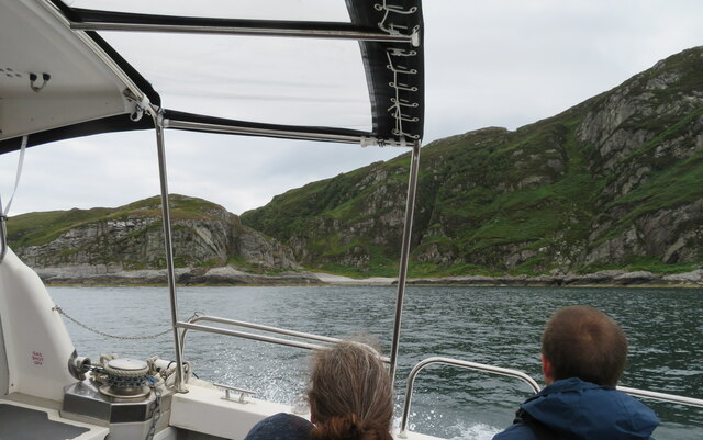
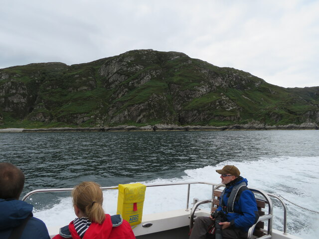
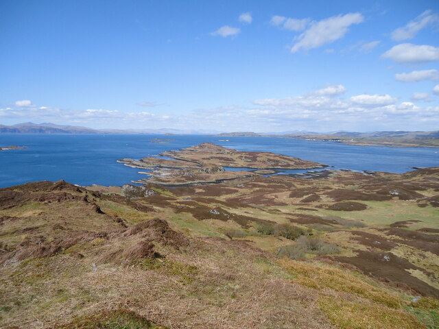
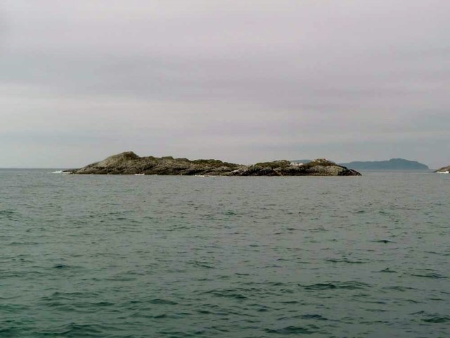
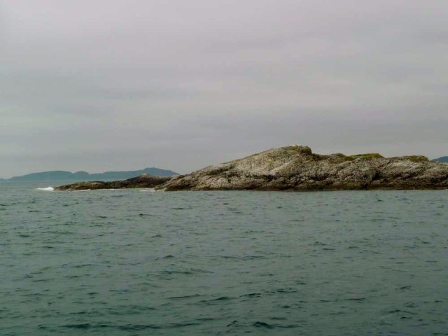
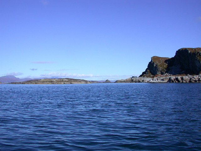
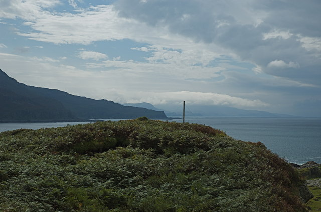
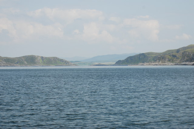
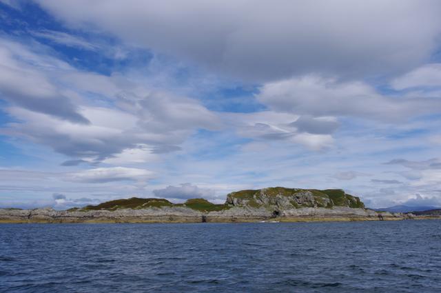
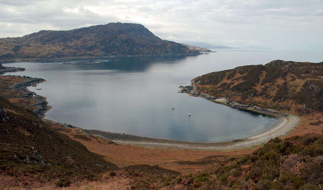
Sgeir na Mine is a small uninhabited island located off the west coast of Scotland in Argyllshire. It is situated in the Inner Hebrides, specifically in the Sound of Mull, approximately 2 kilometers northeast of the Isle of Mull.

The island is fairly small, with an area of approximately 1.5 hectares. It is rocky and rugged, with steep cliffs rising up to 15 meters in some areas. The island is predominantly composed of basalt, a volcanic rock, which gives it its distinctive dark appearance.

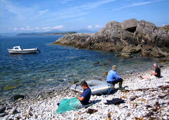
Sgeir na Mine is known for its rich wildlife and is an important breeding ground for seabirds. Species such as puffins, guillemots, and razorbills can be found nesting on the cliffs during the breeding season. The island is also home to a variety of other bird species, including gulls and shags.

Due to its remote location and lack of facilities, Sgeir na Mine is not accessible to the public. However, it can be viewed from boat tours that operate in the area, providing visitors with the opportunity to observe the diverse birdlife and enjoy the scenic beauty of the island.

Overall, Sgeir na Mine is a small but significant island in Argyllshire, renowned for its wildlife and natural beauty. Its rugged cliffs and rich birdlife make it a popular destination for nature enthusiasts and birdwatchers in the region.

If you have any feedback on the listing, please let us know in the comments section below.

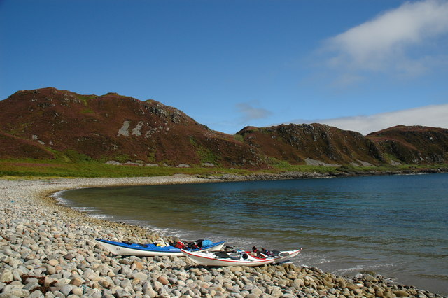
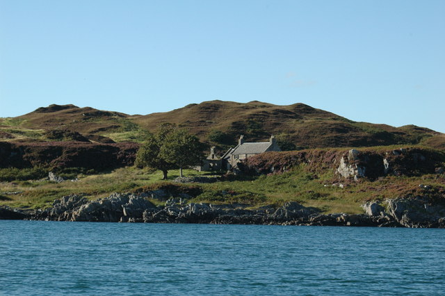
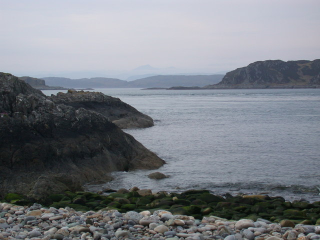
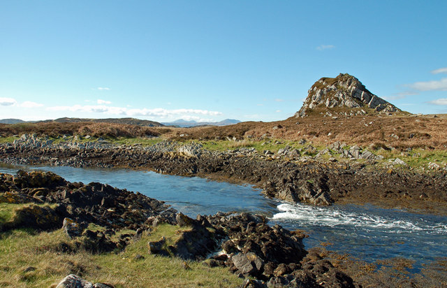
Sgeir na Mine Images

Images are sourced within 2km of 56.209129/-5.7226405 or Grid Reference NM6908. Thanks to Geograph Open Source API. All images are credited.

Port an Eag-uillt, Scarba One of the few places to land on Scarba.
Port an Eag-uillt, Scarba
One of the few places to land on Scarba.
The north coast of Scarba Port an Eag-Uillt is just visible on the left.
The north coast of Scarba
Port an Eag-Uillt is just visible on the left.
House on the Slate Island of Lunga Seen from the Sound of Luing.
House on the Slate Island of Lunga
Seen from the Sound of Luing.
Looking north from Lunga island summit In the foreground are two separate, but tidal islands, Eilean Iosal and Rubha Fiola. Further away can be seen Inch Island in the Firth of Lorn, and Seil to its right.
Looking north from Lunga island summit
In the foreground are two separate, but tidal islands, Eilean Iosal and Rubha Fiola. Further away can be seen Inch Island in the Firth of Lorn, and Seil to its right.
Liath Sgeir A skerry lying off the Black Isles.
Liath Sgeir
A skerry lying off the Black Isles.
Liath Sgeir A skerry lying off the Black Isles.
Liath Sgeir
A skerry lying off the Black Isles.
Northern tip of Guirasdeal Guirasdeal looking North to Lunga (right) and the black isle (left).
Northern tip of Guirasdeal
Guirasdeal looking North to Lunga (right) and the black isle (left).
Summit of Guirasdeal Summit of Guirasdeal, with Scarba and Jura in the distance.
Summit of Guirasdeal
Summit of Guirasdeal, with Scarba and Jura in the distance.
East towards the Grey Dogs Looking East towards the Grey Dogs - Scarba on the right, Lunga on the left.
East towards the Grey Dogs
Looking East towards the Grey Dogs - Scarba on the right, Lunga on the left.
Port an Eag-Uillt, Scarba Wonderful pebble beach on north coast of Scarba looking towards the Garvellachs and Mull.
Port an Eag-Uillt, Scarba
Wonderful pebble beach on north coast of Scarba looking towards the Garvellachs and Mull.
Guirasdeal from the SE At low water.
Guirasdeal from the SE
At low water.
Houses on east coast of Lunga Lunga is one of the Slate Islands in the Firth of Lorn. The 'Grey Dog' tidal race, which runs in the sea channel to the south, Bealach a' Choin Ghlais, reaches 8 knots in full flood. The name 'Lunga' is derived from the Old Norse for 'Isle of the Longships', but almost all other place names are Gaelic in origin.
<span class="nowrap"><a title="https://en.wikipedia.org/wiki/Lunga_(Slate_Islands)" rel="nofollow ugc noopener" href="https://en.wikipedia.org/wiki/Lunga_(Slate_Islands)">Link</a><img style="margin-left:2px;" alt="External link" title="External link - shift click to open in new window" src="https://s1.geograph.org.uk/img/external.png" width="10" height="10"/></span>
Houses on east coast of Lunga
Lunga is one of the Slate Islands in the Firth of Lorn. The 'Grey Dog' tidal race, which runs in the sea channel to the south, Bealach a' Choin Ghlais, reaches 8 knots in full flood. The name 'Lunga' is derived from the Old Norse for 'Isle of the Longships', but almost all other place names are Gaelic in origin. LinkExternal link
Bealach a' Choin Ghlais from Meall nan Caorach View Eastwards through the Bealach a' Choin Ghlais (Grey dogs View East through the Bealach a' Choin Ghlais (Grey dogs or little corryvreckan) from Lunga. Island to right is Scarba. Island in middle is Eilean a' Bhealaich.
Bealach a' Choin Ghlais from Meall nan Caorach
View Eastwards through the Bealach a' Choin Ghlais (Grey dogs View East through the Bealach a' Choin Ghlais (Grey dogs or little corryvreckan) from Lunga. Island to right is Scarba. Island in middle is Eilean a' Bhealaich.
Camas a' Mhòr-Fhir, Lunga
Isle of Lunga
Isle of Lunga
Port a' Bhan-uillt View across firth of Lorne to Mull in the distance.
Port a' Bhan-uillt
View across firth of Lorne to Mull in the distance.
Tidal Channel between Lunga and Fiola an Droma The narrow channels between Lunga and the neighbouring islands create quite striking tidal differences. Taken from the Lunga side.
Tidal Channel between Lunga and Fiola an Droma
The narrow channels between Lunga and the neighbouring islands create quite striking tidal differences. Taken from the Lunga side.
The anchorage at Camas a Mhor-Fhir, Lunga
Show me another place!

Sgeir na Mine is located at Grid Ref: NM6908 (Lat: 56.209129, Lng: -5.7226405)

Unitary Authority: Argyll and Bute

Police Authority: Argyll and West Dunbartonshire

What 3 Words

///prank.surviving.sulked. Near Lochbuie, Argyll & Bute

Related Wikis

Lunga, Firth of Lorn

Lunga is one of the Slate Islands in the Firth of Lorn in Argyll and Bute, Scotland. The "Grey Dog" tidal race, which runs in the sea channel to the south...

Scarba, Lunga and the Garvellachs National Scenic Area

Scarba, Lunga and the Garvellachs is the name of one of the 40 national scenic areas of Scotland. The designated area covers the islands of Scarba, Lunga...

Eilean Dubh Mòr

Eilean Dubh Mòr (Scottish Gaelic: big black island) is an uninhabited island in the Inner Hebrides of Scotland. It lies at the mouth of the Firth of Lorn...

Scarba

Scarba (Scottish Gaelic: Sgarba) is an island, in Argyll and Bute, Scotland, just north of the much larger island of Jura. The island has not been permanently...

Have you been to Sgeir na Mine?

Leave your review of Sgeir na Mine below (or comments, questions and feedback).