Rumach Uaine

Coastal Feature, Headland, Point in Argyllshire

Scotland

Rumach Uaine

Eilean Dubh Mor and Garbh Eileach from Lunga Garbh Eileach is the largest of the Garvellachs, which stretch away to the left in the Firth of Lorn. The Isle of Mull is in the distance, with Ben More (a favourite 'Final Munro') almost in the exact centre.
Eilean Dubh Mor and Garbh Eileach from Lunga Credit: Michael Earnshaw

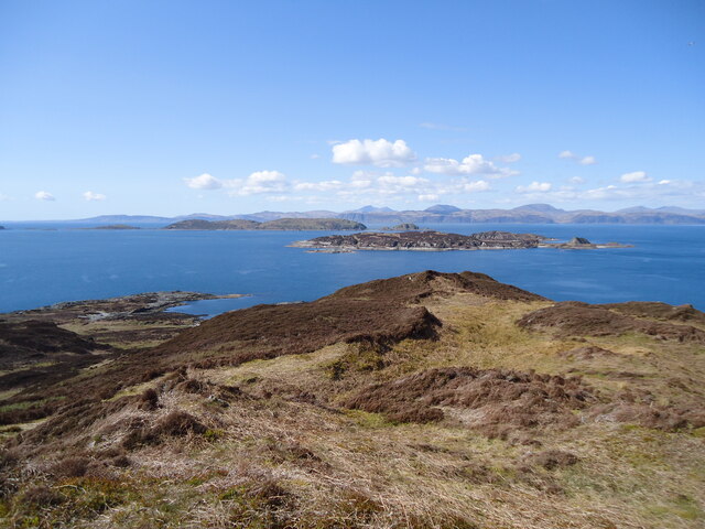
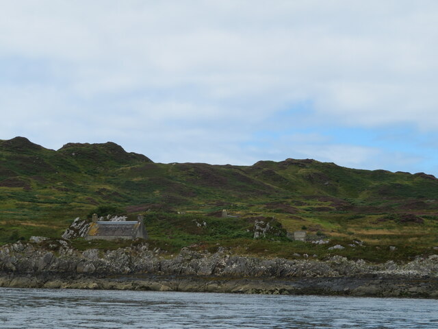
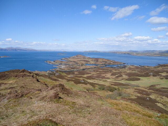
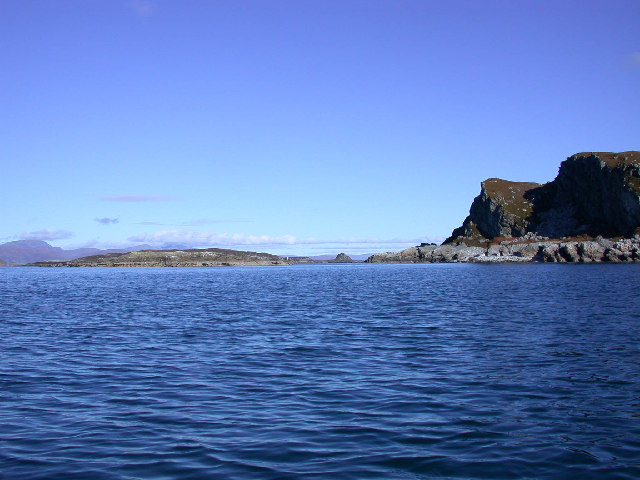
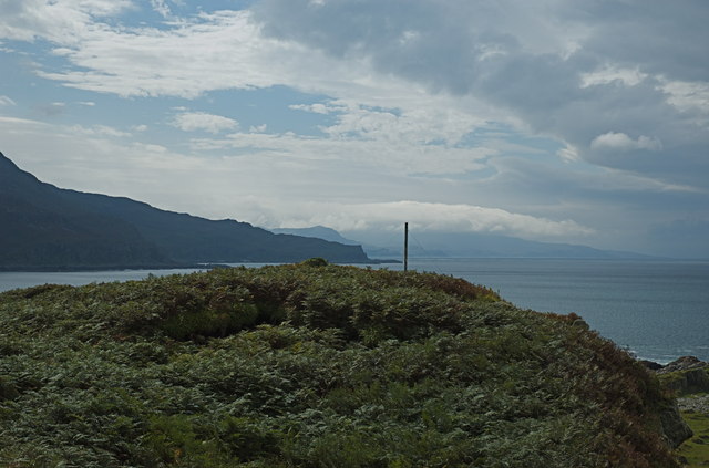
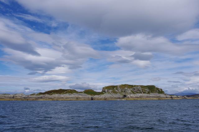
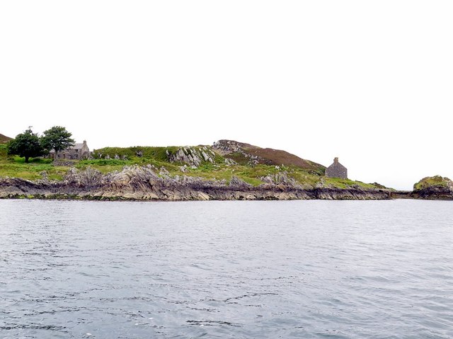
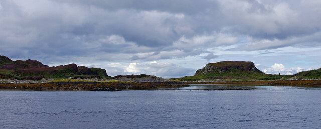
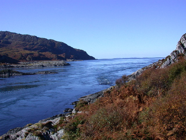
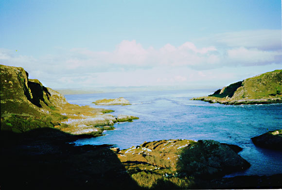
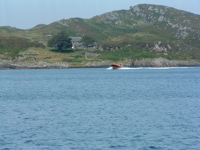
Rumach Uaine is a notable coastal feature located in Argyllshire, Scotland. Situated on the western coast, it is a prominent headland that extends into the Atlantic Ocean, forming a distinct point that attracts both locals and tourists.

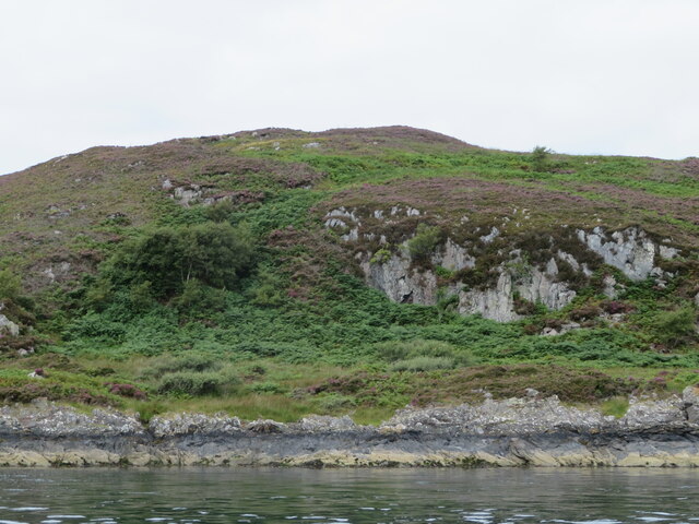
The name "Rumach Uaine" translates to "green point" in Gaelic, an apt description for this picturesque landscape. The headland is characterized by its rugged cliffs, which rise dramatically from the sea, offering breathtaking panoramic views of the surrounding area. These cliffs are composed of ancient rock formations, showcasing layers of sedimentary rock that provide valuable insights into the region's geological history.

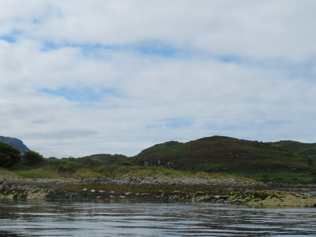
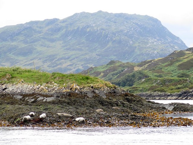
The headland is rich in flora and fauna, with a variety of plant species thriving in its grassy meadows and rocky crevices. Visitors can expect to encounter vibrant wildflowers, including heather and sea thrift, adding bursts of color to the landscape. The area is also home to numerous bird species, making it a popular spot for birdwatching enthusiasts.

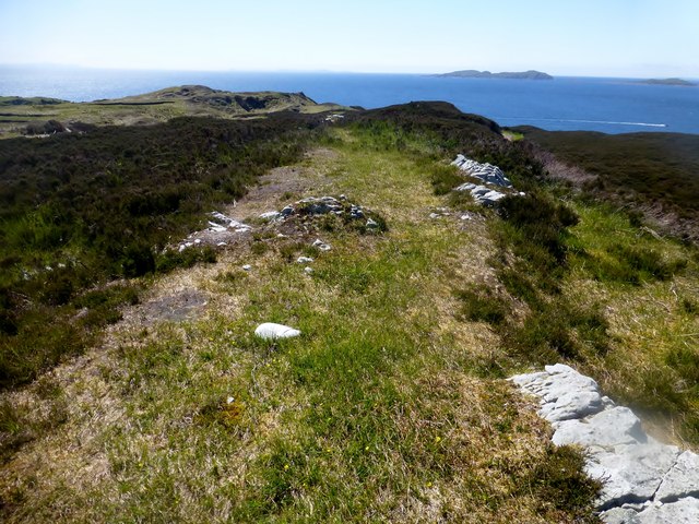
In addition to its natural beauty, Rumach Uaine also boasts a significant cultural heritage. The headland is dotted with archaeological remains, including ancient stone circles and burial sites, attesting to the presence of human activity in the area for centuries.

Access to Rumach Uaine is available via a well-maintained footpath that winds its way along the cliffs, providing a scenic route for hikers and nature lovers. The headland offers a peaceful and serene environment, allowing visitors to immerse themselves in the stunning coastal scenery and connect with nature.

If you have any feedback on the listing, please let us know in the comments section below.
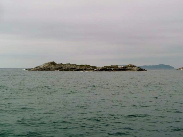
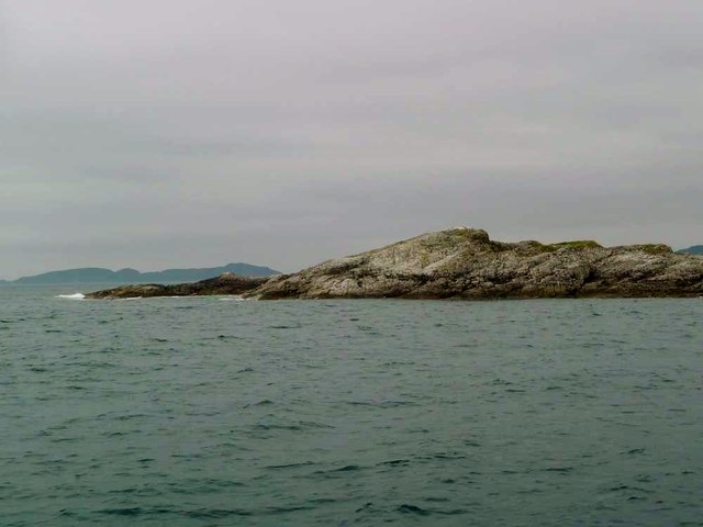
Rumach Uaine Images

Images are sourced within 2km of 56.213452/-5.713766 or Grid Reference NM6908. Thanks to Geograph Open Source API. All images are credited.

Eilean Dubh Mor and Garbh Eileach from Lunga Garbh Eileach is the largest of the Garvellachs, which stretch away to the left in the Firth of Lorn. The Isle of Mull is in the distance, with Ben More (a favourite 'Final Munro') almost in the exact centre.
Eilean Dubh Mor and Garbh Eileach from Lunga
Garbh Eileach is the largest of the Garvellachs, which stretch away to the left in the Firth of Lorn. The Isle of Mull is in the distance, with Ben More (a favourite 'Final Munro') almost in the exact centre.
Cottage on Lunga On the east coast of this Slate Island, in the Sound of Luing. There is also a larger house <a href="https://www.geograph.org.uk/photo/6932677">NM7108 : House on the Slate Island of Lunga</a>, obscured by the rock behind the cottage.
Cottage on Lunga
On the east coast of this Slate Island, in the Sound of Luing. There is also a larger house NM7108 : House on the Slate Island of Lunga, obscured by the rock behind the cottage.
House on the Slate Island of Lunga Seen from the Sound of Luing.
House on the Slate Island of Lunga
Seen from the Sound of Luing.
Seals on Eilean nan Ceann Both Atlantic Grey seals and Common seals were hauled out.
Seals on Eilean nan Ceann
Both Atlantic Grey seals and Common seals were hauled out.
Barr Sligeig, on Lunga At 49 m, one of the higher points of Lunga; Bidein na h-Iolaire, at 100 m, is the highest. The rock would appear to be relatively soft - note the undercut at what would be the high tide mark?
Barr Sligeig, on Lunga
At 49 m, one of the higher points of Lunga; Bidein na h-Iolaire, at 100 m, is the highest. The rock would appear to be relatively soft - note the undercut at what would be the high tide mark?
Looking north from Lunga island summit In the foreground are two separate, but tidal islands, Eilean Iosal and Rubha Fiola. Further away can be seen Inch Island in the Firth of Lorn, and Seil to its right.
Looking north from Lunga island summit
In the foreground are two separate, but tidal islands, Eilean Iosal and Rubha Fiola. Further away can be seen Inch Island in the Firth of Lorn, and Seil to its right.
Liath Sgeir A skerry lying off the Black Isles.
Liath Sgeir
A skerry lying off the Black Isles.
Liath Sgeir A skerry lying off the Black Isles.
Liath Sgeir
A skerry lying off the Black Isles.
Northern tip of Guirasdeal Guirasdeal looking North to Lunga (right) and the black isle (left).
Northern tip of Guirasdeal
Guirasdeal looking North to Lunga (right) and the black isle (left).
Summit of Guirasdeal Summit of Guirasdeal, with Scarba and Jura in the distance.
Summit of Guirasdeal
Summit of Guirasdeal, with Scarba and Jura in the distance.
Guirasdeal from the SE At low water.
Guirasdeal from the SE
At low water.
Eilean Dubh Mòr Dropped off by Farsain Cruises from Craobh Haven, then Eilean Dubh Mòr before Dun a'Ghaill on a sunny day.
Name: Eilean Dubh Mòr
Hill number: 11529
Height: 54m / 177ft
Parent (Ma/M): none
Section: 20A: Jura, Scarba and Colonsay
County/UA: Argyll and Bute (UA)
Maritime Area: Scarba, Slate Islands & Firth of Lorn
Class: Tump (0-99m), SIB
Grid ref: NM695104 (est)
Drop: 54m
Col: Sea
Eilean Dubh Mòr
Dropped off by Farsain Cruises from Craobh Haven, then Eilean Dubh Mòr before Dun a'Ghaill on a sunny day. Name: Eilean Dubh Mòr Hill number: 11529 Height: 54m / 177ft Parent (Ma/M): none Section: 20A: Jura, Scarba and Colonsay County/UA: Argyll and Bute (UA) Maritime Area: Scarba, Slate Islands & Firth of Lorn Class: Tump (0-99m), SIB Grid ref: NM695104 (est) Drop: 54m Col: Sea
Seals on Eilean nan Ceann and Lunga Eilean nan Ceann is a small rocky island situated in the sound of Luing a short distance east from the east end of 'Caolas na Bratham'. The island is in the parish of Jura and its name signifies, 'Island of the heads'.
<span class="nowrap"><a title="http://scotlandsplaces.gov.uk/digital-volumes/ordnance-survey-name-books/argyll-os-name-books-1868-1878/argyll-volume-66?display=transcription" rel="nofollow ugc noopener" href="http://scotlandsplaces.gov.uk/digital-volumes/ordnance-survey-name-books/argyll-os-name-books-1868-1878/argyll-volume-66?display=transcription">Link</a><img style="margin-left:2px;" alt="External link" title="External link - shift click to open in new window" src="https://s1.geograph.org.uk/img/external.png" width="10" height="10"/></span>
Seals on Eilean nan Ceann and Lunga
Eilean nan Ceann is a small rocky island situated in the sound of Luing a short distance east from the east end of 'Caolas na Bratham'. The island is in the parish of Jura and its name signifies, 'Island of the heads'. LinkExternal link
Houses on east coast of Lunga Lunga is one of the Slate Islands in the Firth of Lorn. The 'Grey Dog' tidal race, which runs in the sea channel to the south, Bealach a' Choin Ghlais, reaches 8 knots in full flood. The name 'Lunga' is derived from the Old Norse for 'Isle of the Longships', but almost all other place names are Gaelic in origin.
<span class="nowrap"><a title="https://en.wikipedia.org/wiki/Lunga_(Slate_Islands)" rel="nofollow ugc noopener" href="https://en.wikipedia.org/wiki/Lunga_(Slate_Islands)">Link</a><img style="margin-left:2px;" alt="External link" title="External link - shift click to open in new window" src="https://s1.geograph.org.uk/img/external.png" width="10" height="10"/></span>
Houses on east coast of Lunga
Lunga is one of the Slate Islands in the Firth of Lorn. The 'Grey Dog' tidal race, which runs in the sea channel to the south, Bealach a' Choin Ghlais, reaches 8 knots in full flood. The name 'Lunga' is derived from the Old Norse for 'Isle of the Longships', but almost all other place names are Gaelic in origin. LinkExternal link
North end of Lunga Looking west from the Sound of Luing through the narrow strait between Lunga (left) and Fiola Meadhonach (extreme right), to Fiola an Droma (centre right).
North end of Lunga
Looking west from the Sound of Luing through the narrow strait between Lunga (left) and Fiola Meadhonach (extreme right), to Fiola an Droma (centre right).
Bealach a' Choin Ghlais The Little Corryvreckan, or Grey dogs is the narrow tidal channel between the islands of Scarba and Lunga. The tide rips through here at 8 knots on Spring tides. View to the West, taken from Lunga and Scarba is on the left.
Bealach a' Choin Ghlais
The Little Corryvreckan, or Grey dogs is the narrow tidal channel between the islands of Scarba and Lunga. The tide rips through here at 8 knots on Spring tides. View to the West, taken from Lunga and Scarba is on the left.
Bealach a' Choin Ghlais from Meall nan Caorach View Eastwards through the Bealach a' Choin Ghlais (Grey dogs View East through the Bealach a' Choin Ghlais (Grey dogs or little corryvreckan) from Lunga. Island to right is Scarba. Island in middle is Eilean a' Bhealaich.
Bealach a' Choin Ghlais from Meall nan Caorach
View Eastwards through the Bealach a' Choin Ghlais (Grey dogs View East through the Bealach a' Choin Ghlais (Grey dogs or little corryvreckan) from Lunga. Island to right is Scarba. Island in middle is Eilean a' Bhealaich.
The Isle of Lunga House on the east side of Lunga, picture taken from small fast boat, similar to that in the shot,
The Isle of Lunga
House on the east side of Lunga, picture taken from small fast boat, similar to that in the shot,
Show me another place!

Rumach Uaine is located at Grid Ref: NM6908 (Lat: 56.213452, Lng: -5.713766)

Unitary Authority: Argyll and Bute

Police Authority: Argyll and West Dunbartonshire

What 3 Words

///wardrobe.toys.imperious. Near Lochbuie, Argyll & Bute

Related Wikis

Lunga, Firth of Lorn

Lunga is one of the Slate Islands in the Firth of Lorn in Argyll and Bute, Scotland. The "Grey Dog" tidal race, which runs in the sea channel to the south...

Scarba, Lunga and the Garvellachs National Scenic Area

Scarba, Lunga and the Garvellachs is the name of one of the 40 national scenic areas of Scotland. The designated area covers the islands of Scarba, Lunga...

Eilean Dubh Mòr

Eilean Dubh Mòr (Scottish Gaelic: big black island) is an uninhabited island in the Inner Hebrides of Scotland. It lies at the mouth of the Firth of Lorn...

Scarba

Scarba (Scottish Gaelic: Sgarba) is an island, in Argyll and Bute, Scotland, just north of the much larger island of Jura. The island has not been permanently...

Nearby Amenities

Located within 500m of 56.213452,-5.713766
Source: PGS
Lat/Long: 56.2097618/-5.7141758
The data included in this document is from www.openstreetmap.org. The data is made available under ODbL.

Have you been to Rumach Uaine?

Leave your review of Rumach Uaine below (or comments, questions and feedback).