Sgeir na Caora Duibhe

Island in Ross-shire

Scotland

Sgeir na Caora Duibhe

Caolas a Tuath A panoramic view down the length of the channel.
Caolas a Tuath Credit: Rob Burke

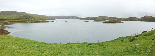
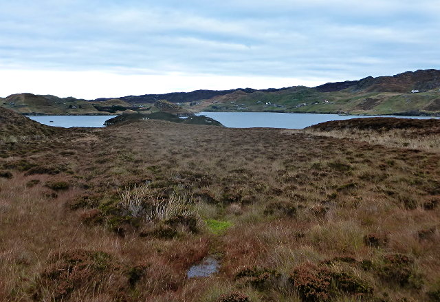
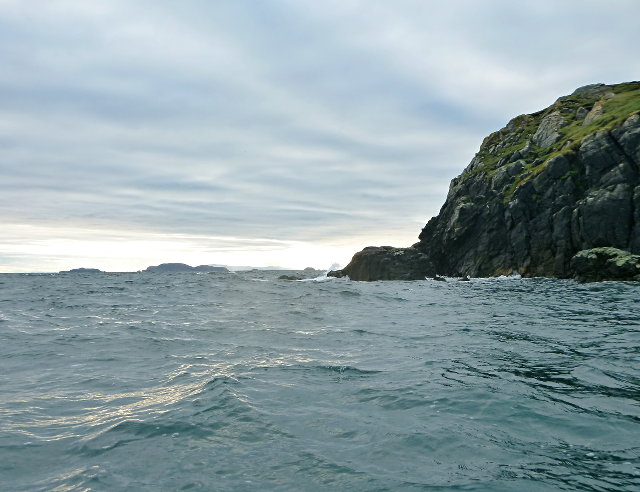
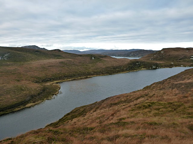
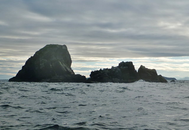
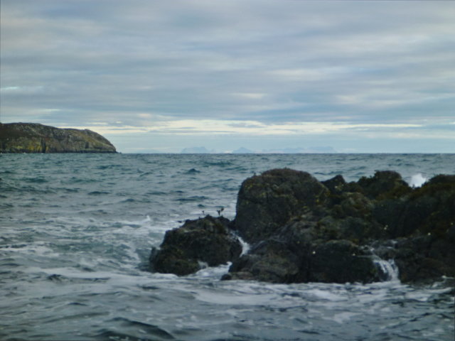
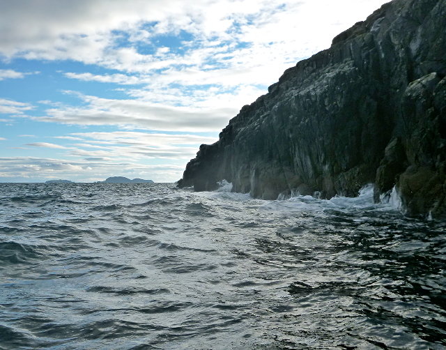
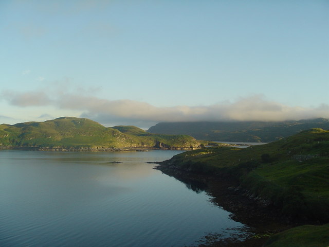
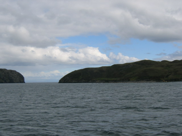
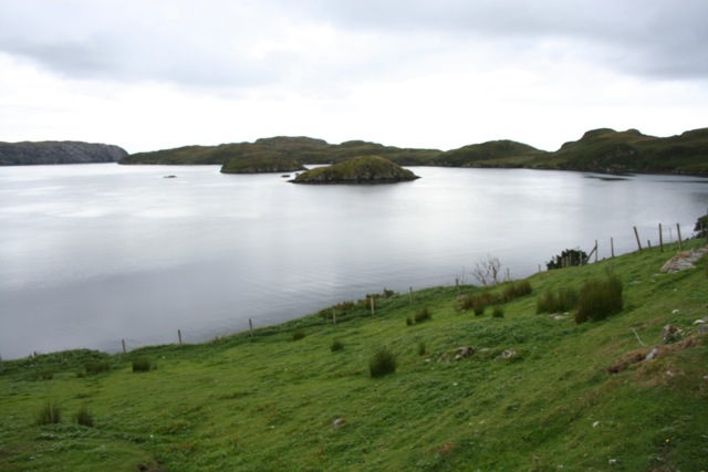
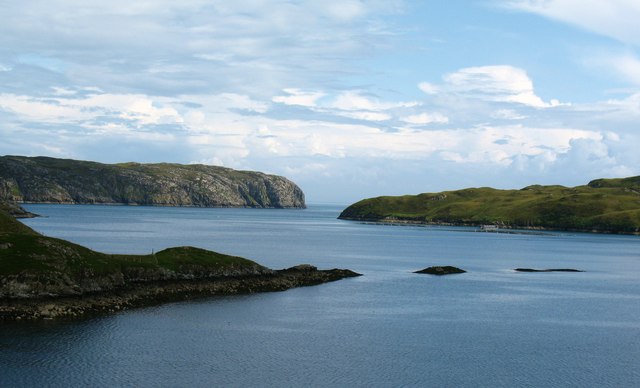
Sgeir na Caora Duibhe is a small uninhabited island located off the coast of Ross-shire in Scotland. The island is situated in the North Atlantic Ocean, near the village of Ullapool. Sgeir na Caora Duibhe is known for its rugged terrain and rocky shores, making it a popular destination for birdwatchers and nature enthusiasts.

The island is home to a variety of seabirds, including puffins, guillemots, and razorbills. Visitors to Sgeir na Caora Duibhe can also spot seals and dolphins in the surrounding waters. The island's remote location and lack of amenities make it a peaceful and secluded spot for those looking to escape the hustle and bustle of everyday life.

Access to Sgeir na Caora Duibhe is primarily by boat, with some tour operators offering trips to the island during the summer months. The island's rocky terrain can make landing difficult, so visitors should be prepared for a challenging landing. Despite its small size, Sgeir na Caora Duibhe offers a unique and tranquil experience for those willing to make the journey to explore its rugged beauty.

If you have any feedback on the listing, please let us know in the comments section below.

Sgeir na Caora Duibhe Images

Images are sourced within 2km of 57.997463/-6.4435963 or Grid Reference NB3709. Thanks to Geograph Open Source API. All images are credited.

Caolas a Tuath A panoramic view down the length of the channel.
Caolas a Tuath
A panoramic view down the length of the channel.
Eilean Liubhaird Eilean Liubhaird is a small island south of Lemreway - the village in the background of this view.
Eilean Liubhaird
Eilean Liubhaird is a small island south of Lemreway - the village in the background of this view.
Leac Reidh This is the eastern extremity of Eilean Liubhaird.
Leac Reidh
This is the eastern extremity of Eilean Liubhaird.
Loch na Buaile This is the largest body of fresh water on Eilean Liubhaird.
Loch na Buaile
This is the largest body of fresh water on Eilean Liubhaird.
Stac a' Bhàigh A small rocky islet just off Eilean Liubhaird.
Stac a' Bhàigh
A small rocky islet just off Eilean Liubhaird.
Skerry off Laimhrig Mhurchaidh A small rocky lump exposed by the tide, and temporary home to several seabirds.
Skerry off Laimhrig Mhurchaidh
A small rocky lump exposed by the tide, and temporary home to several seabirds.
Sloc Ailltinis Rough lands of the east of Parc.
Sloc Ailltinis
Rough lands of the east of Parc.
Rubh' Ailltinis The Lewis coast drops dramatically into the sea.
Rubh' Ailltinis
The Lewis coast drops dramatically into the sea.
Lemreway Island - Eilean Iubhaird A stunning view from the road end at Aird a' Chaolais looking across the sea loch to Eilean Iubhaird
Lemreway Island - Eilean Iubhaird
A stunning view from the road end at Aird a' Chaolais looking across the sea loch to Eilean Iubhaird
Eilean Liubhaird This Island in Loch Shell is so called after Prince Charles Edward Stuart. Edward's Island. Srianach Head prominent to left of frame.
Eilean Liubhaird
This Island in Loch Shell is so called after Prince Charles Edward Stuart. Edward's Island. Srianach Head prominent to left of frame.
Caolas a Tuath bay Leumrabhagh looking out to Eilean Liubhaird (Edward's Isle), past the islands of Sgeir Ghlas (Green Isle) and Sgeir Fraoich (Heather Isle) in Caolas a'Tuath (North Strait).
Caolas a Tuath bay
Leumrabhagh looking out to Eilean Liubhaird (Edward's Isle), past the islands of Sgeir Ghlas (Green Isle) and Sgeir Fraoich (Heather Isle) in Caolas a'Tuath (North Strait).
Lemreway - South Lochs Lemreway, South Lochs on the Isle of Lewis
Lemreway - South Lochs
Lemreway, South Lochs on the Isle of Lewis
Coastal scene at Leumrabhagh Looking out along the point of Rubha Gholl Shuil and across the channel of Caolas a Tuath to Eilean Liubhaird and the open sea.
Coastal scene at Leumrabhagh
Looking out along the point of Rubha Gholl Shuil and across the channel of Caolas a Tuath to Eilean Liubhaird and the open sea.
Show me another place!

Sgeir na Caora Duibhe is located at Grid Ref: NB3709 (Lat: 57.997463, Lng: -6.4435963)

Unitary Authority: Na h-Eileanan an Iar

Police Authority: Highlands and Islands

What 3 Words

///proofs.presides.pushed. Near Leurbost, Na h-Eileanan Siar

Related Wikis

Eilean Liubhaird

Eilean Liubhaird or Eilean Iubhard is an island in the Outer Hebrides, to the east of Lewis. == Geography and geology == The rock is "gneiss bedrock with...

Orinsay

Orinsay (Scottish Gaelic: Orasaigh) is a crofting village on the Isle of Lewis in the district of Pairc, in the Outer Hebrides, Scotland. The settlement...

Stiomrabhaig

Stiomrabhaig is an abandoned crofter's village on the Isle of Lewis in the Outer Hebrides. == History == The United Kingdom Census 1851 shows that the...

Gravir

Gravir (Scottish Gaelic: Grabhair), is a village on the shore of Loch Odhairn (a sea loch) in the Park district of the Isle of Lewis. Gravir is within...

Nearby Amenities

Located within 500m of 57.997463,-6.4435963
Created By: dmgroom_coastlines
Lat/Long: 57.99869/-6.43722
Created By: dmgroom_coastlines
Lat/Long: 57.99859/-6.43819
Created By: dmgroom_coastlines
Lat/Long: 57.99846/-6.43844
Created By: dmgroom_coastlines
Lat/Long: 57.99867/-6.44253
Created By: dmgroom_coastlines
Lat/Long: 57.99881/-6.443
Created By: dmgroom_coastlines
Lat/Long: 57.99994/-6.44823
The data included in this document is from www.openstreetmap.org. The data is made available under ODbL.

Have you been to Sgeir na Caora Duibhe?

Leave your review of Sgeir na Caora Duibhe below (or comments, questions and feedback).