Rubha na Caora Duibhe

Coastal Feature, Headland, Point in Ross-shire

Scotland

Rubha na Caora Duibhe

Caolas a Tuath A panoramic view down the length of the channel.
Caolas a Tuath Credit: Rob Burke

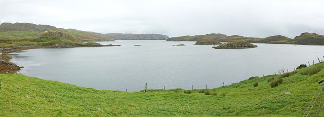
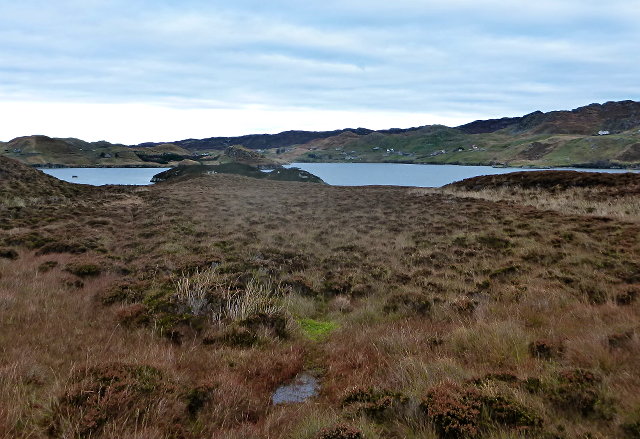
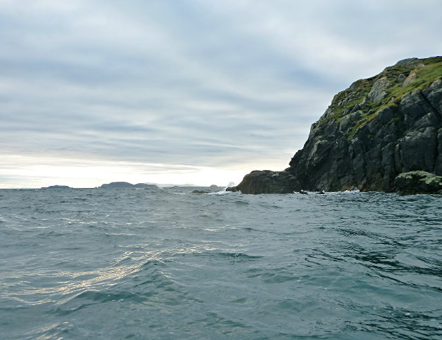
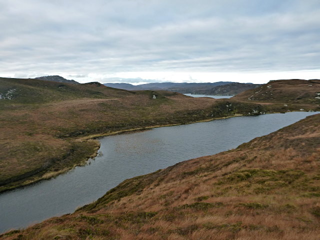
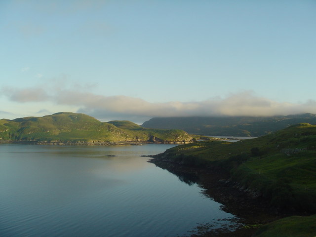
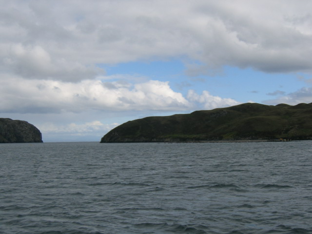
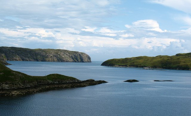
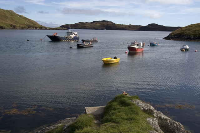
Rubha na Caora Duibhe, also known as Black Sheep Point, is a prominent headland located in Ross-shire, Scotland. Situated along the coast, it juts out into the North Atlantic Ocean, offering breathtaking panoramic views of the surrounding landscape.

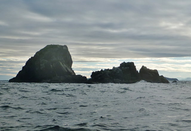
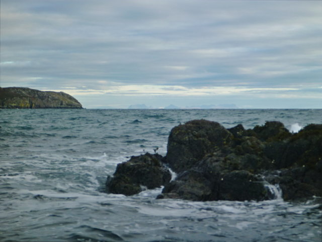
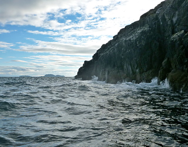
This coastal feature is characterized by its rugged cliffs, which rise dramatically from the sea to heights of around 100 meters. The cliffs are composed of ancient rock formations, displaying layers of sedimentary rock that provide valuable insight into the geological history of the area.

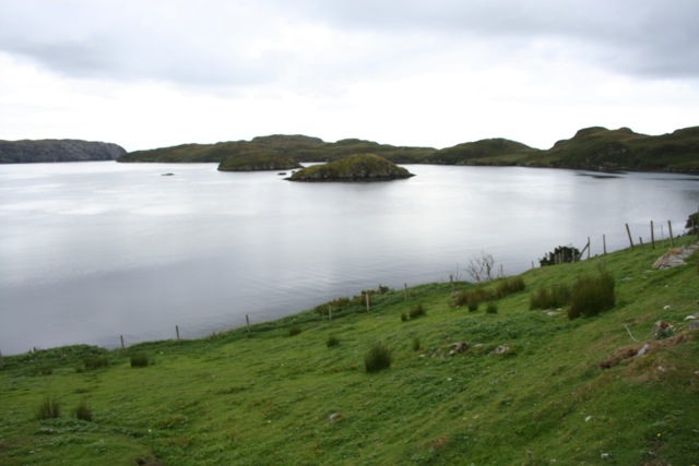
Rubha na Caora Duibhe is renowned for its abundant wildlife. The surrounding waters are home to various marine species, including seals and dolphins, making it a popular spot for wildlife enthusiasts. Birdwatchers are also drawn to the area, as it serves as a nesting site for a variety of seabirds, such as puffins, guillemots, and kittiwakes.

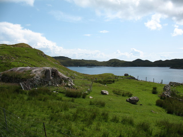
Access to Rubha na Caora Duibhe is relatively easy, with a well-maintained footpath leading visitors to the headland. Along the path, visitors can enjoy the diverse flora and fauna that thrive in this coastal habitat. The headland also offers opportunities for outdoor activities such as hiking, photography, and nature observation.

Due to its exposed location, Rubha na Caora Duibhe can experience strong winds and rough seas, adding to its wild and untamed beauty. It is a place where visitors can immerse themselves in the raw power of nature and appreciate the stunning coastal scenery that defines this part of Ross-shire.

If you have any feedback on the listing, please let us know in the comments section below.

Rubha na Caora Duibhe Images

Images are sourced within 2km of 57.998176/-6.4440574 or Grid Reference NB3709. Thanks to Geograph Open Source API. All images are credited.

Caolas a Tuath A panoramic view down the length of the channel.
Caolas a Tuath
A panoramic view down the length of the channel.
Eilean Liubhaird Eilean Liubhaird is a small island south of Lemreway - the village in the background of this view.
Eilean Liubhaird
Eilean Liubhaird is a small island south of Lemreway - the village in the background of this view.
Leac Reidh This is the eastern extremity of Eilean Liubhaird.
Leac Reidh
This is the eastern extremity of Eilean Liubhaird.
Loch na Buaile This is the largest body of fresh water on Eilean Liubhaird.
Loch na Buaile
This is the largest body of fresh water on Eilean Liubhaird.
Stac a' Bhàigh A small rocky islet just off Eilean Liubhaird.
Stac a' Bhàigh
A small rocky islet just off Eilean Liubhaird.
Skerry off Laimhrig Mhurchaidh A small rocky lump exposed by the tide, and temporary home to several seabirds.
Skerry off Laimhrig Mhurchaidh
A small rocky lump exposed by the tide, and temporary home to several seabirds.
Sloc Ailltinis Rough lands of the east of Parc.
Sloc Ailltinis
Rough lands of the east of Parc.
Rubh' Ailltinis The Lewis coast drops dramatically into the sea.
Rubh' Ailltinis
The Lewis coast drops dramatically into the sea.
Leumrabhagh A pretty port in a sheltered inlet of Loch Sealg.
Leumrabhagh
A pretty port in a sheltered inlet of Loch Sealg.
Lemreway Island - Eilean Iubhaird A stunning view from the road end at Aird a' Chaolais looking across the sea loch to Eilean Iubhaird
Lemreway Island - Eilean Iubhaird
A stunning view from the road end at Aird a' Chaolais looking across the sea loch to Eilean Iubhaird
Eilean Liubhaird This Island in Loch Shell is so called after Prince Charles Edward Stuart. Edward's Island. Srianach Head prominent to left of frame.
Eilean Liubhaird
This Island in Loch Shell is so called after Prince Charles Edward Stuart. Edward's Island. Srianach Head prominent to left of frame.
Caolas a Tuath bay Leumrabhagh looking out to Eilean Liubhaird (Edward's Isle), past the islands of Sgeir Ghlas (Green Isle) and Sgeir Fraoich (Heather Isle) in Caolas a'Tuath (North Strait).
Caolas a Tuath bay
Leumrabhagh looking out to Eilean Liubhaird (Edward's Isle), past the islands of Sgeir Ghlas (Green Isle) and Sgeir Fraoich (Heather Isle) in Caolas a'Tuath (North Strait).
Lemreway - South Lochs Lemreway, South Lochs on the Isle of Lewis
Lemreway - South Lochs
Lemreway, South Lochs on the Isle of Lewis
Leumrabhagh View towards the bay at Leumrabhagh. An old blackhouse is still in use as a store on the left of the photo. In the distance the island of Eilean Liubhaird shelters the bay from the Minch.
Leumrabhagh
View towards the bay at Leumrabhagh. An old blackhouse is still in use as a store on the left of the photo. In the distance the island of Eilean Liubhaird shelters the bay from the Minch.
Coastal scene at Leumrabhagh Looking out along the point of Rubha Gholl Shuil and across the channel of Caolas a Tuath to Eilean Liubhaird and the open sea.
Coastal scene at Leumrabhagh
Looking out along the point of Rubha Gholl Shuil and across the channel of Caolas a Tuath to Eilean Liubhaird and the open sea.
Jetty and harbour Lemreway Looking due south from the quay
Jetty and harbour Lemreway
Looking due south from the quay
Show me another place!

Rubha na Caora Duibhe is located at Grid Ref: NB3709 (Lat: 57.998176, Lng: -6.4440574)

Unitary Authority: Na h-Eileanan an Iar

Police Authority: Highlands and Islands

What 3 Words

///zipped.resolves.seasons. Near Leurbost, Na h-Eileanan Siar

Related Wikis

Eilean Liubhaird

Eilean Liubhaird or Eilean Iubhard is an island in the Outer Hebrides, to the east of Lewis. == Geography and geology == The rock is "gneiss bedrock with...

Orinsay

Orinsay (Scottish Gaelic: Orasaigh) is a crofting village on the Isle of Lewis in the district of Pairc, in the Outer Hebrides, Scotland. The settlement...

Stiomrabhaig

Stiomrabhaig is an abandoned crofter's village on the Isle of Lewis in the Outer Hebrides. == History == The United Kingdom Census 1851 shows that the...

Gravir

Gravir (Scottish Gaelic: Grabhair), is a village on the shore of Loch Odhairn (a sea loch) in the Park district of the Isle of Lewis. Gravir is within...

Nearby Amenities

Located within 500m of 57.998176,-6.4440574
Created By: dmgroom_coastlines
Lat/Long: 57.99869/-6.43722
Created By: dmgroom_coastlines
Lat/Long: 57.99859/-6.43819
Created By: dmgroom_coastlines
Lat/Long: 57.99846/-6.43844
Created By: dmgroom_coastlines
Lat/Long: 57.99867/-6.44253
Created By: dmgroom_coastlines
Lat/Long: 57.99881/-6.443
Created By: dmgroom_coastlines
Lat/Long: 57.99994/-6.44823
Puill Chriadha
Natural: bay
Lat/Long: 58.002137/-6.4480647
The data included in this document is from www.openstreetmap.org. The data is made available under ODbL.

Have you been to Rubha na Caora Duibhe?

Leave your review of Rubha na Caora Duibhe below (or comments, questions and feedback).