Dùnan

Coastal Feature, Headland, Point in Ross-shire

Scotland

Dùnan

Caolas a Tuath A panoramic view down the length of the channel.
Caolas a Tuath Credit: Rob Burke

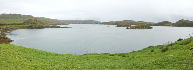
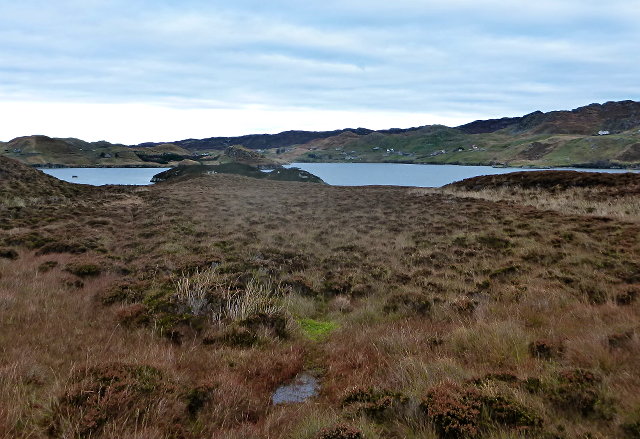
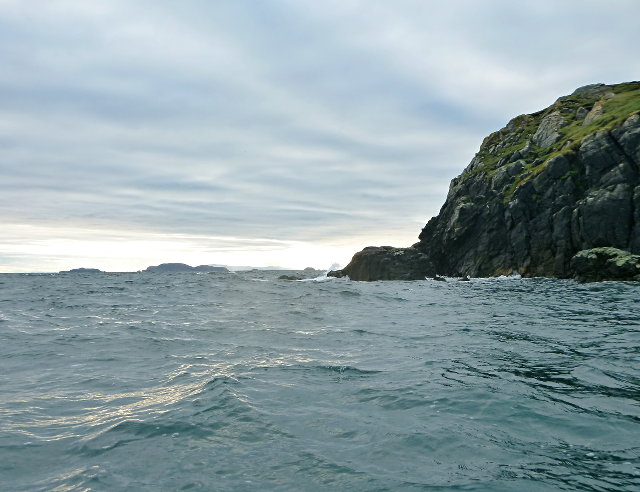
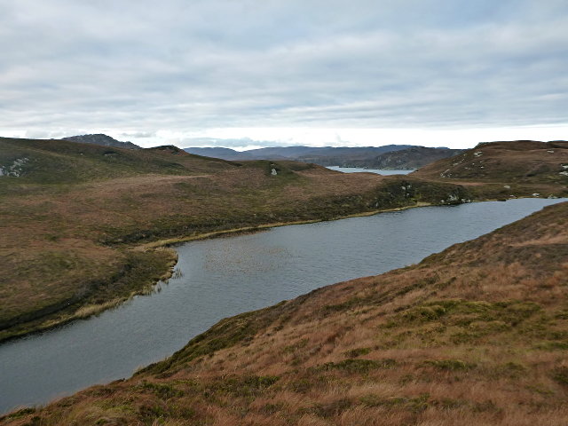
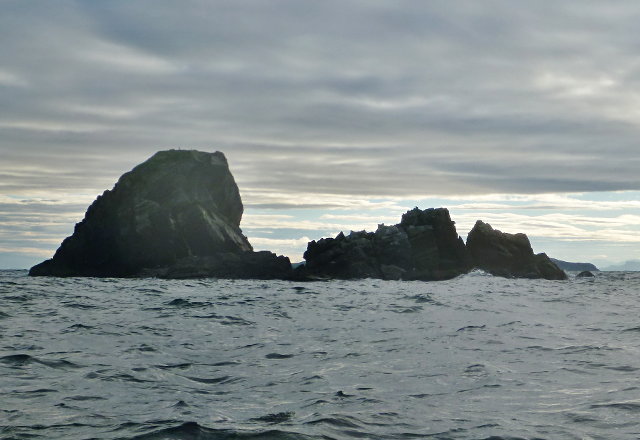
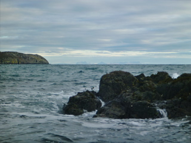
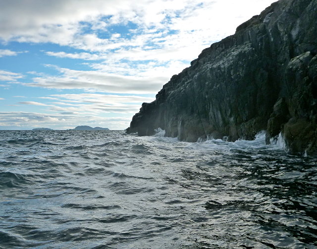
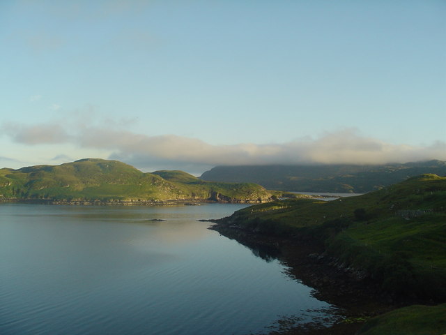
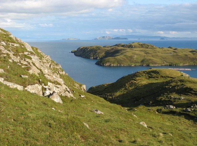
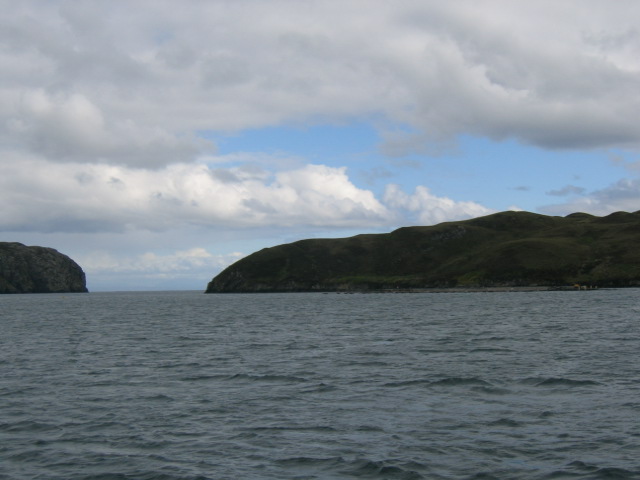
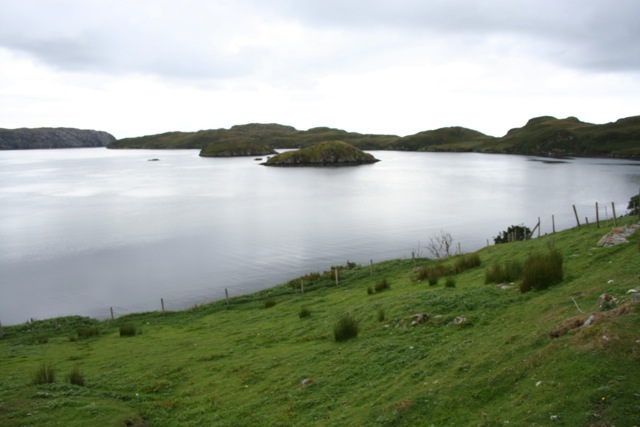
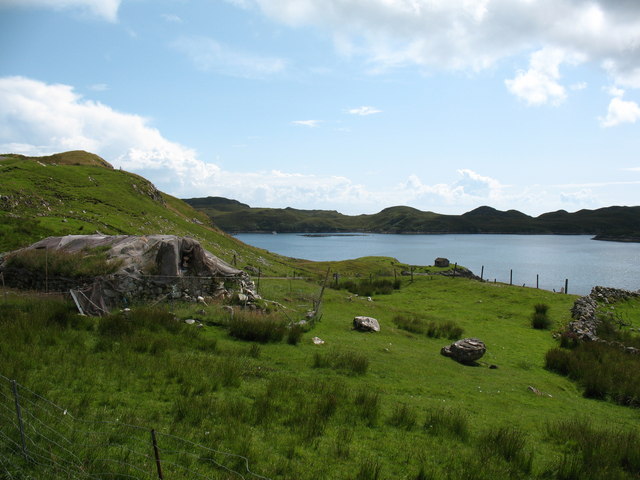
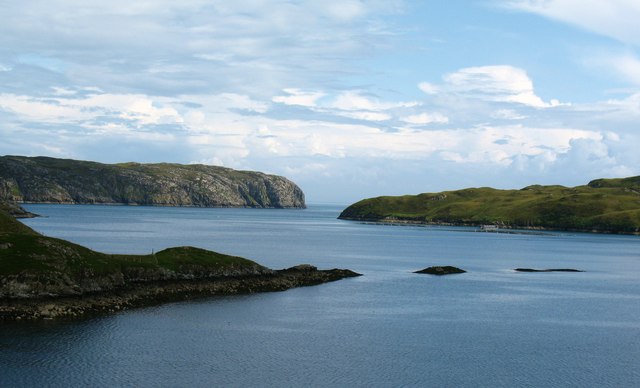
Dùnan is a prominent coastal feature located in Ross-shire, Scotland. It is classified as a headland or point, characterized by its elevated position and jutting out into the surrounding sea. Situated on the northern coast of the Scottish Highlands, Dùnan offers breathtaking views of the Atlantic Ocean and the surrounding rugged landscape.

The headland is formed by a combination of geological processes and erosion over millions of years. Its distinctive shape is a result of the constant battering of waves against the rocky cliffs, which has carved out its steep cliffs and jagged edges. The headland is composed of various types of rock formations, including sandstone and granite, which add to its unique character.

Dùnan is known for its rich biodiversity and is home to a variety of plant and animal species. The headland provides a habitat for seabird colonies, including gannets, fulmars, and kittiwakes, which nest on the cliffs. Visitors to Dùnan may also spot seals and dolphins swimming in the surrounding waters.

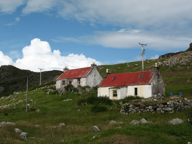
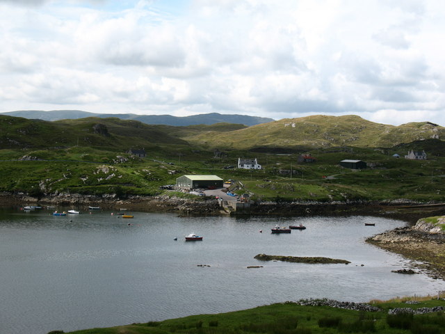
The headland is a popular destination for outdoor enthusiasts and nature lovers. It offers numerous walking trails and hiking routes, allowing visitors to explore the rugged coastline and enjoy the panoramic views. Dùnan is also a great spot for birdwatching and photography, with its dramatic scenery providing a stunning backdrop.

Overall, Dùnan in Ross-shire is a captivating coastal feature that showcases the beauty of Scotland's natural landscape. Its impressive cliffs, diverse wildlife, and panoramic views make it a must-visit destination for those seeking an authentic Scottish coastal experience.

If you have any feedback on the listing, please let us know in the comments section below.

Dùnan Images

Images are sourced within 2km of 57.997921/-6.4395032 or Grid Reference NB3709. Thanks to Geograph Open Source API. All images are credited.

Caolas a Tuath A panoramic view down the length of the channel.
Caolas a Tuath
A panoramic view down the length of the channel.
Eilean Liubhaird Eilean Liubhaird is a small island south of Lemreway - the village in the background of this view.
Eilean Liubhaird
Eilean Liubhaird is a small island south of Lemreway - the village in the background of this view.
Leac Reidh This is the eastern extremity of Eilean Liubhaird.
Leac Reidh
This is the eastern extremity of Eilean Liubhaird.
Loch na Buaile This is the largest body of fresh water on Eilean Liubhaird.
Loch na Buaile
This is the largest body of fresh water on Eilean Liubhaird.
Stac a' Bhàigh A small rocky islet just off Eilean Liubhaird.
Stac a' Bhàigh
A small rocky islet just off Eilean Liubhaird.
Skerry off Laimhrig Mhurchaidh A small rocky lump exposed by the tide, and temporary home to several seabirds.
Skerry off Laimhrig Mhurchaidh
A small rocky lump exposed by the tide, and temporary home to several seabirds.
Sloc Ailltinis Rough lands of the east of Parc.
Sloc Ailltinis
Rough lands of the east of Parc.
Rubh' Ailltinis The Lewis coast drops dramatically into the sea.
Rubh' Ailltinis
The Lewis coast drops dramatically into the sea.
Lemreway Island - Eilean Iubhaird A stunning view from the road end at Aird a' Chaolais looking across the sea loch to Eilean Iubhaird
Lemreway Island - Eilean Iubhaird
A stunning view from the road end at Aird a' Chaolais looking across the sea loch to Eilean Iubhaird
Evening near Leumrabhagh View from a small hill to the east of the village of Leumrabhagh.  A fish farm can be seen just in front of Eilean Liubhaird, and in the far distance the cliffs of the Shiant Islands catch the evening sun.
Evening near Leumrabhagh
View from a small hill to the east of the village of Leumrabhagh. A fish farm can be seen just in front of Eilean Liubhaird, and in the far distance the cliffs of the Shiant Islands catch the evening sun.
Northern Marsh Orchid (Dactylorhiza purpurella) Northern Marsh Orchids are commonly found in the Outer Hebrides, where the wet peaty conditions suit it.
Northern Marsh Orchid (Dactylorhiza purpurella)
Northern Marsh Orchids are commonly found in the Outer Hebrides, where the wet peaty conditions suit it.
Eilean Liubhaird This Island in Loch Shell is so called after Prince Charles Edward Stuart. Edward's Island. Srianach Head prominent to left of frame.
Eilean Liubhaird
This Island in Loch Shell is so called after Prince Charles Edward Stuart. Edward's Island. Srianach Head prominent to left of frame.
Caolas a Tuath bay Leumrabhagh looking out to Eilean Liubhaird (Edward's Isle), past the islands of Sgeir Ghlas (Green Isle) and Sgeir Fraoich (Heather Isle) in Caolas a'Tuath (North Strait).
Caolas a Tuath bay
Leumrabhagh looking out to Eilean Liubhaird (Edward's Isle), past the islands of Sgeir Ghlas (Green Isle) and Sgeir Fraoich (Heather Isle) in Caolas a'Tuath (North Strait).
Lemreway - South Lochs Lemreway, South Lochs on the Isle of Lewis
Lemreway - South Lochs
Lemreway, South Lochs on the Isle of Lewis
Leumrabhagh View towards the bay at Leumrabhagh. An old blackhouse is still in use as a store on the left of the photo. In the distance the island of Eilean Liubhaird shelters the bay from the Minch.
Leumrabhagh
View towards the bay at Leumrabhagh. An old blackhouse is still in use as a store on the left of the photo. In the distance the island of Eilean Liubhaird shelters the bay from the Minch.
Hillside cottages A pair of 'tin' roofed cottages on the hillside at Leumrabhagh. The view from them is stunning.
Hillside cottages
A pair of 'tin' roofed cottages on the hillside at Leumrabhagh. The view from them is stunning.
Harbour area at Leumrabhagh The natural sheltered harbour here is augmented by a small jetty on the far shore.
Harbour area at Leumrabhagh
The natural sheltered harbour here is augmented by a small jetty on the far shore.
Coastal scene at Leumrabhagh Looking out along the point of Rubha Gholl Shuil and across the channel of Caolas a Tuath to Eilean Liubhaird and the open sea.
Coastal scene at Leumrabhagh
Looking out along the point of Rubha Gholl Shuil and across the channel of Caolas a Tuath to Eilean Liubhaird and the open sea.
Show me another place!

Dùnan is located at Grid Ref: NB3709 (Lat: 57.997921, Lng: -6.4395032)

Unitary Authority: Na h-Eileanan an Iar

Police Authority: Highlands and Islands

What 3 Words

///perform.greed.frames. Near Leurbost, Na h-Eileanan Siar

Related Wikis

Eilean Liubhaird

Eilean Liubhaird or Eilean Iubhard is an island in the Outer Hebrides, to the east of Lewis. == Geography and geology == The rock is "gneiss bedrock with...

Orinsay

Orinsay (Scottish Gaelic: Orasaigh) is a crofting village on the Isle of Lewis in the district of Pairc, in the Outer Hebrides, Scotland. The settlement...

Stiomrabhaig

Stiomrabhaig is an abandoned crofter's village on the Isle of Lewis in the Outer Hebrides. == History == The United Kingdom Census 1851 shows that the...

Gravir

Gravir (Scottish Gaelic: Grabhair), is a village on the shore of Loch Odhairn (a sea loch) in the Park district of the Isle of Lewis. Gravir is within...

Nearby Amenities

Located within 500m of 57.997921,-6.4395032
Created By: dmgroom_coastlines
Lat/Long: 57.99869/-6.43722
Created By: dmgroom_coastlines
Lat/Long: 57.99859/-6.43819
Created By: dmgroom_coastlines
Lat/Long: 57.99846/-6.43844
Created By: dmgroom_coastlines
Lat/Long: 57.99867/-6.44253
Created By: dmgroom_coastlines
Lat/Long: 57.99881/-6.443
The data included in this document is from www.openstreetmap.org. The data is made available under ODbL.

Have you been to Dùnan?

Leave your review of Dùnan below (or comments, questions and feedback).