A' Chorr-sgeir

Island in Argyllshire

Scotland

A' Chorr-sgeir

Iona Golf Course On the western side of the island.
Iona Golf Course Credit: Andrew Abbott

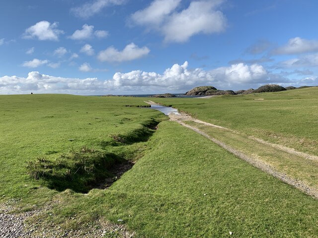
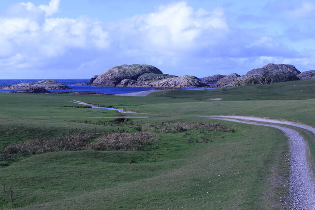
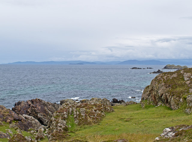
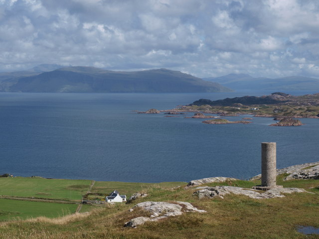
A' Chorr-sgeir is a small island located in Argyllshire, Scotland. It is situated in the Inner Hebrides, specifically in the Sound of Islay, between the islands of Islay and Jura. The island stretches for approximately 1.5 kilometers in length and covers an area of about 0.5 square kilometers.

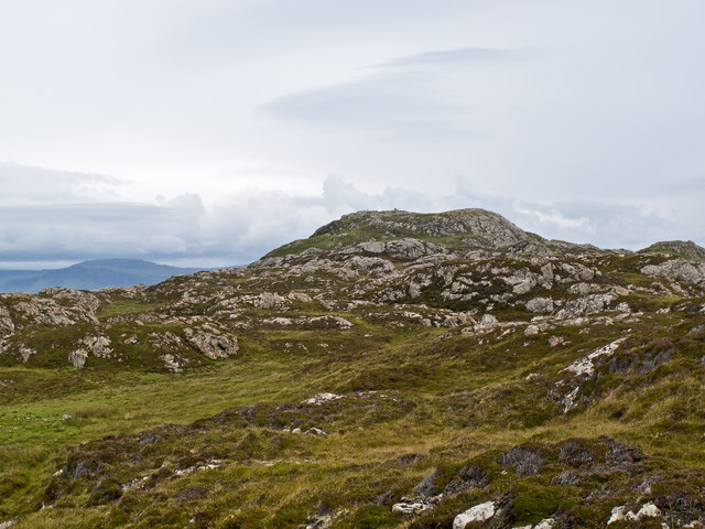
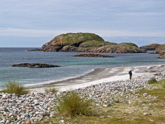
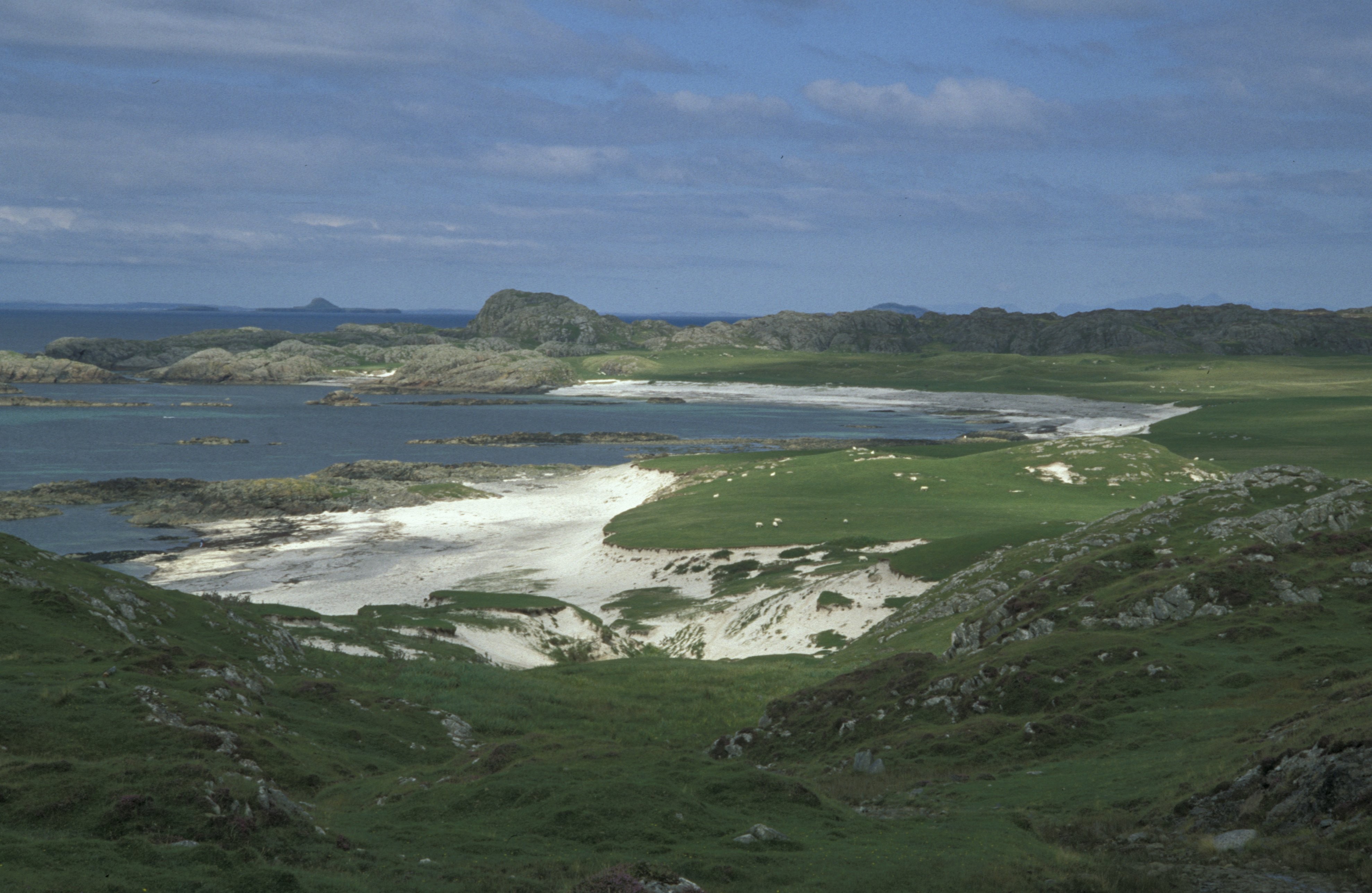
A' Chorr-sgeir is known for its rugged and rocky terrain, with steep cliffs and jagged coastlines. The island is uninhabited and lacks any significant vegetation, making it a haven for various seabird species. It is particularly renowned for being a nesting site for large colonies of seabirds, including guillemots, razorbills, and kittiwakes. These bird colonies create a lively atmosphere, with the constant sounds of their calls and the sight of their aerial acrobatics.

Due to its remote location and challenging access, A' Chorr-sgeir is not commonly visited by tourists. However, it can be observed from neighboring islands or during boat tours that explore the surrounding area. Its wild and untouched beauty, coupled with the abundance of birdlife, makes it a popular spot for nature enthusiasts and birdwatchers.

In addition to its natural beauty, A' Chorr-sgeir also holds historical significance. It is believed that the island was used as a hunting ground for Vikings during the early medieval period. Archaeological remains, such as stone structures and artefacts, have been discovered on the island, providing insight into its past.

Overall, A' Chorr-sgeir offers a unique and remote experience for those seeking to immerse themselves in the untouched beauty of Scotland's Inner Hebrides.

If you have any feedback on the listing, please let us know in the comments section below.

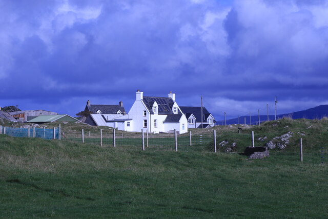
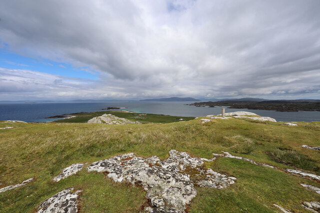
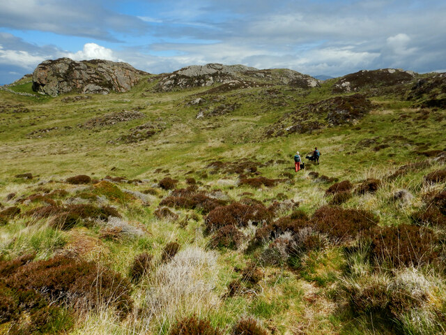
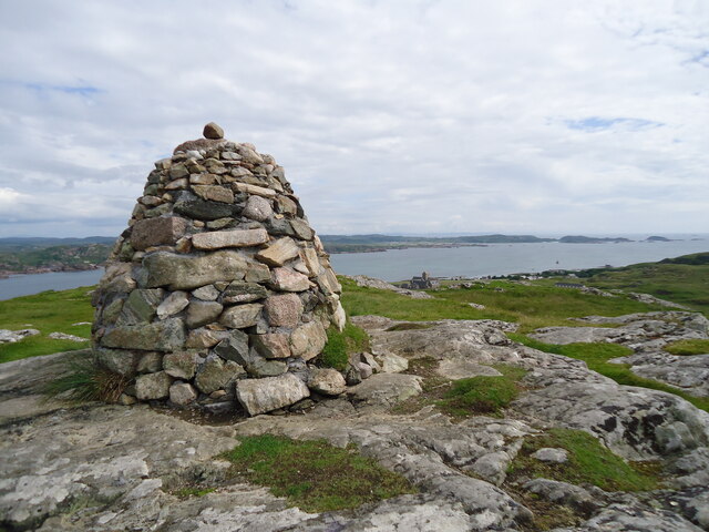
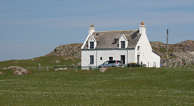
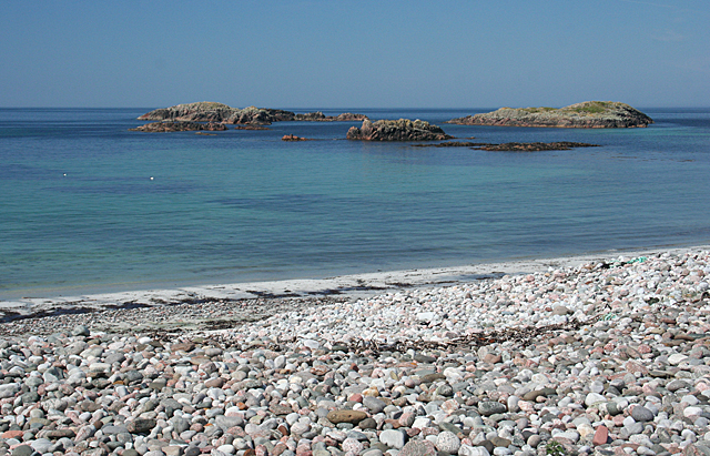
A' Chorr-sgeir Images

Images are sourced within 2km of 56.338967/-6.4286145 or Grid Reference NM2625. Thanks to Geograph Open Source API. All images are credited.

Iona Golf Course On the western side of the island.
Iona Golf Course
On the western side of the island.
Towards Iona Golf Course From Skerryvore.
Towards Iona Golf Course
From Skerryvore.
Gateway by Skerryvore Leading to Iona Golf Course.
Gateway by Skerryvore
Leading to Iona Golf Course.
Machair house On Iona
Machair house
On Iona
Clachancorrach House On Iona.
Clachancorrach House
On Iona.
From cairn to trig point on Dun I Dun I is a relatively easy ascent from the road north of the Abbey, but approaching from the interior, one feels as though one has climbed a much bigger and rougher hill than the 101m summit seen here. The cairn sits a little higher than the trig point to the NE and offers a super view over the tip of Iona to Staffa, the Treshnish Isles and the Wilderness coast of Mull.
From cairn to trig point on Dun I
Dun I is a relatively easy ascent from the road north of the Abbey, but approaching from the interior, one feels as though one has climbed a much bigger and rougher hill than the 101m summit seen here. The cairn sits a little higher than the trig point to the NE and offers a super view over the tip of Iona to Staffa, the Treshnish Isles and the Wilderness coast of Mull.
Cross country on the north of Iona The one fully land-locked grid square on Iona is rough terrain with various prehistoric defensible remains and lots of good viewpoints perched on rocky tors. Compared with the coast, it seems little frequented (and very boggy underfoot with various fences deflecting one from the obvious directions of travel). Frequent it we must, however, as this was my final square to complete coverage of my first inhabited island for geograph.
Cross country on the north of Iona
The one fully land-locked grid square on Iona is rough terrain with various prehistoric defensible remains and lots of good viewpoints perched on rocky tors. Compared with the coast, it seems little frequented (and very boggy underfoot with various fences deflecting one from the obvious directions of travel). Frequent it we must, however, as this was my final square to complete coverage of my first inhabited island for geograph.
Dun I, the summit of Iona Looking just east of south across Iona to Mull. Fionnphort (from where the ferries depart) is hidden by the large cairn, and the Abbey is just to its right. Further away the west end of the Ross of Mull is seen, with Erraid the fairly large island on the right and Eilean nam Muc <a href="https://www.geograph.org.uk/gridref/NM2819">NM2819</a> the smaller one near the edge of the photo.
Dun I, the summit of Iona
Looking just east of south across Iona to Mull. Fionnphort (from where the ferries depart) is hidden by the large cairn, and the Abbey is just to its right. Further away the west end of the Ross of Mull is seen, with Erraid the fairly large island on the right and Eilean nam Muc NM2819 the smaller one near the edge of the photo.
Iona coastline The north-west coastline of Iona, with rock of the Lewisian Gneiss type evident. This is one of Britain's oldest rocks, and was formed approximately 2,000 million years ago.
Iona coastline
The north-west coastline of Iona, with rock of the Lewisian Gneiss type evident. This is one of Britain's oldest rocks, and was formed approximately 2,000 million years ago.
North-west Iona The north-western area of Iona, viewed towards Dun I, the highest point on the island.
North-west Iona
The north-western area of Iona, viewed towards Dun I, the highest point on the island.
Iona coastline The western coastline of Iona near Camas Cuil an t-Saimh, with Eilean Didil visible in the distance.
Iona coastline
The western coastline of Iona near Camas Cuil an t-Saimh, with Eilean Didil visible in the distance.
Sheep-worrying, Iona Despite its small size, this canine fiend caused considerable distress to sheep on western Iona.
Sheep-worrying, Iona
Despite its small size, this canine fiend caused considerable distress to sheep on western Iona.
Trig Point Dun I Iona The Trig point at the top of Dun I, looking across the sound towards the Island of Mull.
Trig Point Dun I Iona
The Trig point at the top of Dun I, looking across the sound towards the Island of Mull.
Cairn Dun I Iona This is a close up view of the summit Cairn on Dun I Iona looking out towards Staffa and the Island of Mull.
Cairn Dun I Iona
This is a close up view of the summit Cairn on Dun I Iona looking out towards Staffa and the Island of Mull.
Dun I At a height of 101 metres Dun I is the highest point on the island of Iona. It is an easy climb and from the summit affords a spectacular view in all directions.
Dun I
At a height of 101 metres Dun I is the highest point on the island of Iona. It is an easy climb and from the summit affords a spectacular view in all directions.
Walking on Iona Visitors are not permitted to take their cars on to the Island, so the only way to get around is to walk or cycle. This is the route from the pier to the beaches on the west coast of the island.
Walking on Iona
Visitors are not permitted to take their cars on to the Island, so the only way to get around is to walk or cycle. This is the route from the pier to the beaches on the west coast of the island.
Cnoc nam Bradain If I believe the Gaelic dictionary, the name of this place means 'salmon knoll'. It is a typical Hebridean house, standing on the machair by the track across the island.
Cnoc nam Bradain
If I believe the Gaelic dictionary, the name of this place means 'salmon knoll'. It is a typical Hebridean house, standing on the machair by the track across the island.
Camas Cùil an t-Saimh This is the main beach on the west coast of Iona, and an easy one to get to. Its name apparently means either 'sorrel back beach' or 'bad smell back beach', according to the Gaelic dictionary, but there was no evidence for the latter today.
Camas Cùil an t-Saimh
This is the main beach on the west coast of Iona, and an easy one to get to. Its name apparently means either 'sorrel back beach' or 'bad smell back beach', according to the Gaelic dictionary, but there was no evidence for the latter today.
Show me another place!

A' Chorr-sgeir is located at Grid Ref: NM2625 (Lat: 56.338967, Lng: -6.4286145)

Unitary Authority: Argyll and Bute

Police Authority: Argyll and West Dunbartonshire

What 3 Words

///encrusted.explores.crowds. Near Fionnphort, Argyll & Bute

Related Wikis

Bay at the Back of the Ocean

The Bay at the Back of the Ocean (Scottish Gaelic: Camas Cuil an t-Saimh) is a wide, west facing bay on the island of Iona, Argyll and Bute, Scotland,...

Iona

Iona (; Scottish Gaelic: Ì Chaluim Chille [ˈiː ˈxal̪ˠɪm ˈçiʎə] , sometimes simply Ì) is a small island in the Inner Hebrides, off the Ross of Mull on the...

Iona Abbey

Iona Abbey is an abbey located on the island of Iona, just off the Isle of Mull on the West Coast of Scotland. It is one of the oldest Christian religious...

St Oran's Chapel

St Oran's Chapel (Odhráin/Orain/Odran) is a medieval chapel located on the island of Iona in the Inner Hebrides off the west coast of Scotland. Built in...

Bishop's House, Iona

Bishop's House is a retreat house for the Scottish Episcopal Church, located on the island of Iona, off the west coast of Scotland. == History == It was...

Sound of Iona

The Sound of Iona is a sound between the Inner Hebridean islands of Mull and Iona in western Scotland. It forms part of the Atlantic Ocean. The tidal...

Fionnphort

Fionnphort (English: , Scottish Gaelic: [ˈfjun̪ˠafɔrˠt̪]) is the principal port of the Ross of Mull, and the second largest settlement in the area (its...

Kintra

Kintra (Scottish Gaelic: Ceann na Tràgha), literally "country" in Scots is a settlement on the North-Western coast of the Ross of Mull, Scotland. The settlement...

Nearby Amenities

Located within 500m of 56.338967,-6.4286145
Created By: dmgroom_coastlines
Source: PGS
Lat/Long: 56.33474/-6.42953
The data included in this document is from www.openstreetmap.org. The data is made available under ODbL.

Have you been to A' Chorr-sgeir?

Leave your review of A' Chorr-sgeir below (or comments, questions and feedback).