Ceann an Uird
Island in Argyllshire
Scotland
Ceann an Uird

Ceann an Uird, located in Argyllshire, is a picturesque island situated off the west coast of Scotland. With a total area of approximately 5 square miles, it is renowned for its stunning natural beauty and tranquil atmosphere.
The island boasts a rugged coastline, characterized by towering cliffs and hidden coves. Visitors can enjoy breathtaking views of the surrounding sea and neighboring islands from various vantage points. Ceann an Uird is also home to a diverse range of wildlife, including seabirds, seals, and occasionally dolphins and whales.
The island's landscape is dominated by rolling hills and moorland, providing ample opportunities for outdoor activities such as hiking and birdwatching. There are several well-marked trails, allowing visitors to explore the island's scenic beauty at their own pace.
Ceann an Uird has a small population, with most residents involved in traditional industries such as fishing and agriculture. The island has a rich history, evident in the remains of ancient settlements and standing stones that can be found scattered across its landscape.
Although there are no hotels or large-scale tourist facilities on the island, visitors can find accommodation in nearby towns and villages on the mainland. The island offers a peaceful retreat for those seeking a break from the bustling city life, with its unspoiled nature and welcoming community.
Access to Ceann an Uird is primarily by boat or ferry, with regular services available from the mainland. It is advisable to check the ferry schedules before planning a visit to ensure a smooth and hassle-free journey.
If you have any feedback on the listing, please let us know in the comments section below.
Ceann an Uird Images
Images are sourced within 2km of 56.307317/-6.426045 or Grid Reference NM2621. Thanks to Geograph Open Source API. All images are credited.


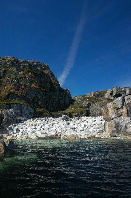
![Pebble maze, Port na Curaich Someone has spent a lot of time and effort to create a maze from pebbles at Columba's Bay. The design is similar to those seen in some cathedrals [Chartres?] and may have some religious significance. Nearby are some large piles of pebbles. It is said that in the past monks from the abbey created stone piles, the height and size relative to the magnitude of their sins. Either they must have sinned for a very long time, or someone has been carrying on the tradition.](https://s2.geograph.org.uk/geophotos/03/38/91/3389162_f46a7e1d.jpg)
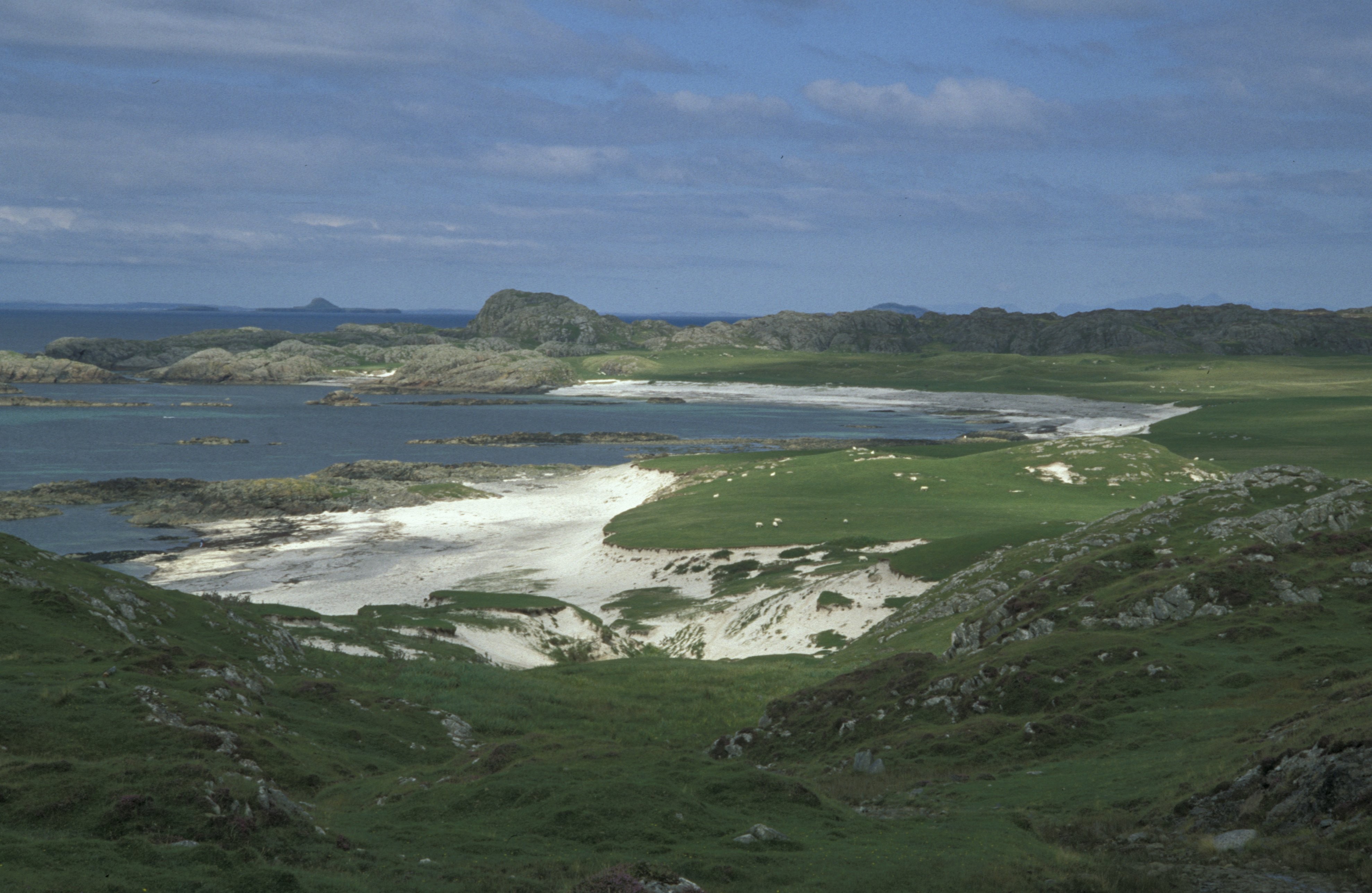
![Port na Curaich [Port of the Coracle] The pebble beach where St Columba is said to have landed at the southern end of Iona.](https://s1.geograph.org.uk/geophotos/03/38/91/3389169_07375fbe.jpg)


Ceann an Uird is located at Grid Ref: NM2621 (Lat: 56.307317, Lng: -6.426045)
Unitary Authority: Argyll and Bute
Police Authority: Argyll and West Dunbartonshire
What 3 Words
///inflates.squeaking.internal. Near Fionnphort, Argyll & Bute
Related Wikis
Bay at the Back of the Ocean
The Bay at the Back of the Ocean (Scottish Gaelic: Camas Cuil an t-Saimh) is a wide, west facing bay on the island of Iona, Argyll and Bute, Scotland,...

Iona
Iona (; Scottish Gaelic: Ì Chaluim Chille [ˈiː ˈxal̪ˠɪm ˈçiʎə] , sometimes simply Ì) is a small island in the Inner Hebrides, off the Ross of Mull on the...

Sound of Iona
The Sound of Iona is a sound between the Inner Hebridean islands of Mull and Iona in western Scotland. It forms part of the Atlantic Ocean. The tidal...

Bishop's House, Iona
Bishop's House is a retreat house for the Scottish Episcopal Church, located on the island of Iona, off the west coast of Scotland. == History == It was...

Iona Abbey
Iona Abbey is an abbey located on the island of Iona, just off the Isle of Mull on the West Coast of Scotland. It is one of the oldest Christian religious...

St Oran's Chapel
St Oran's Chapel (Odhráin/Orain/Odran) is a medieval chapel located on the island of Iona in the Inner Hebrides off the west coast of Scotland. Built in...

Erraid
Erraid (Scottish Gaelic: Eilean Earraid) is a tidal island approximately one mile (two kilometres) square located in the Inner Hebrides of Scotland. It...

Fionnphort
Fionnphort (English: , Scottish Gaelic: [ˈfjun̪ˠafɔrˠt̪]) is the principal port of the Ross of Mull, and the second largest settlement in the area (its...
Nearby Amenities
Located within 500m of 56.307317,-6.426045Have you been to Ceann an Uird?
Leave your review of Ceann an Uird below (or comments, questions and feedback).