Slochd Dùn Manamin

Sea, Estuary, Creek in Argyllshire

Scotland

Slochd Dùn Manamin

Iona Golf Course On the western side of the island.
Iona Golf Course Credit: Andrew Abbott

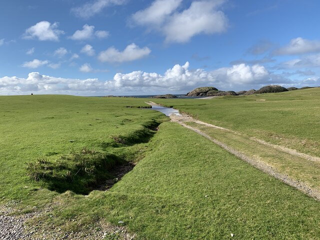
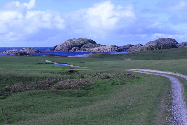
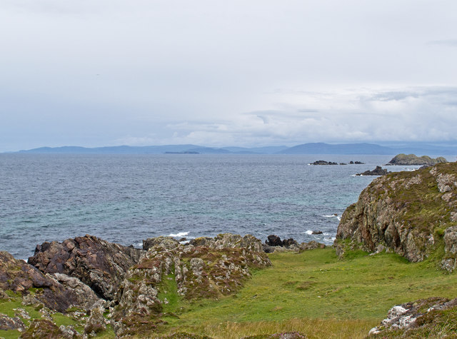
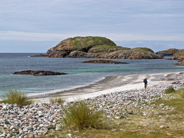
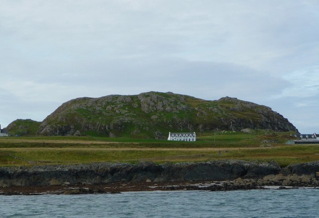
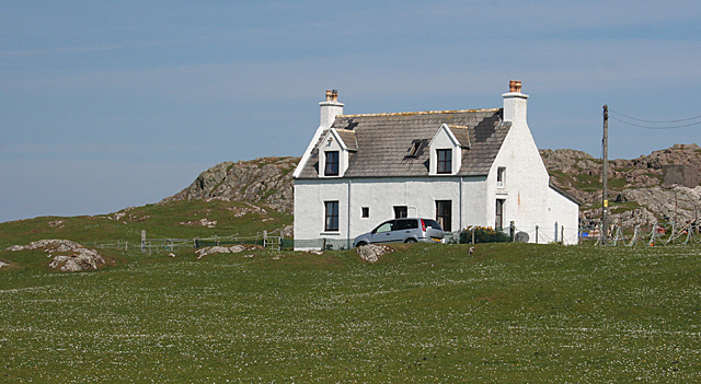
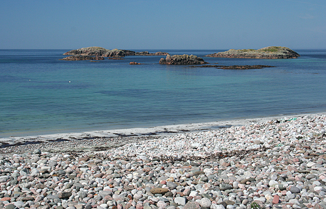
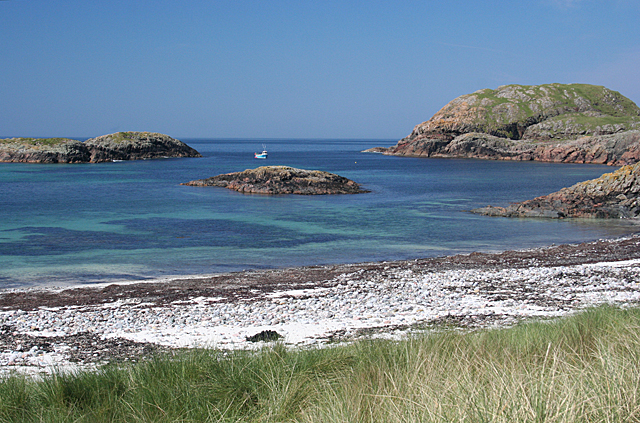
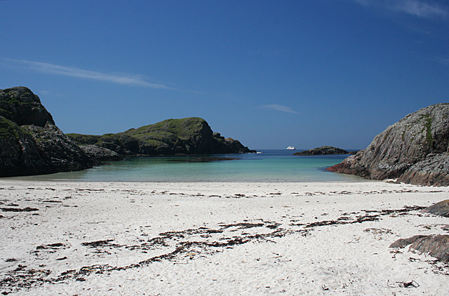
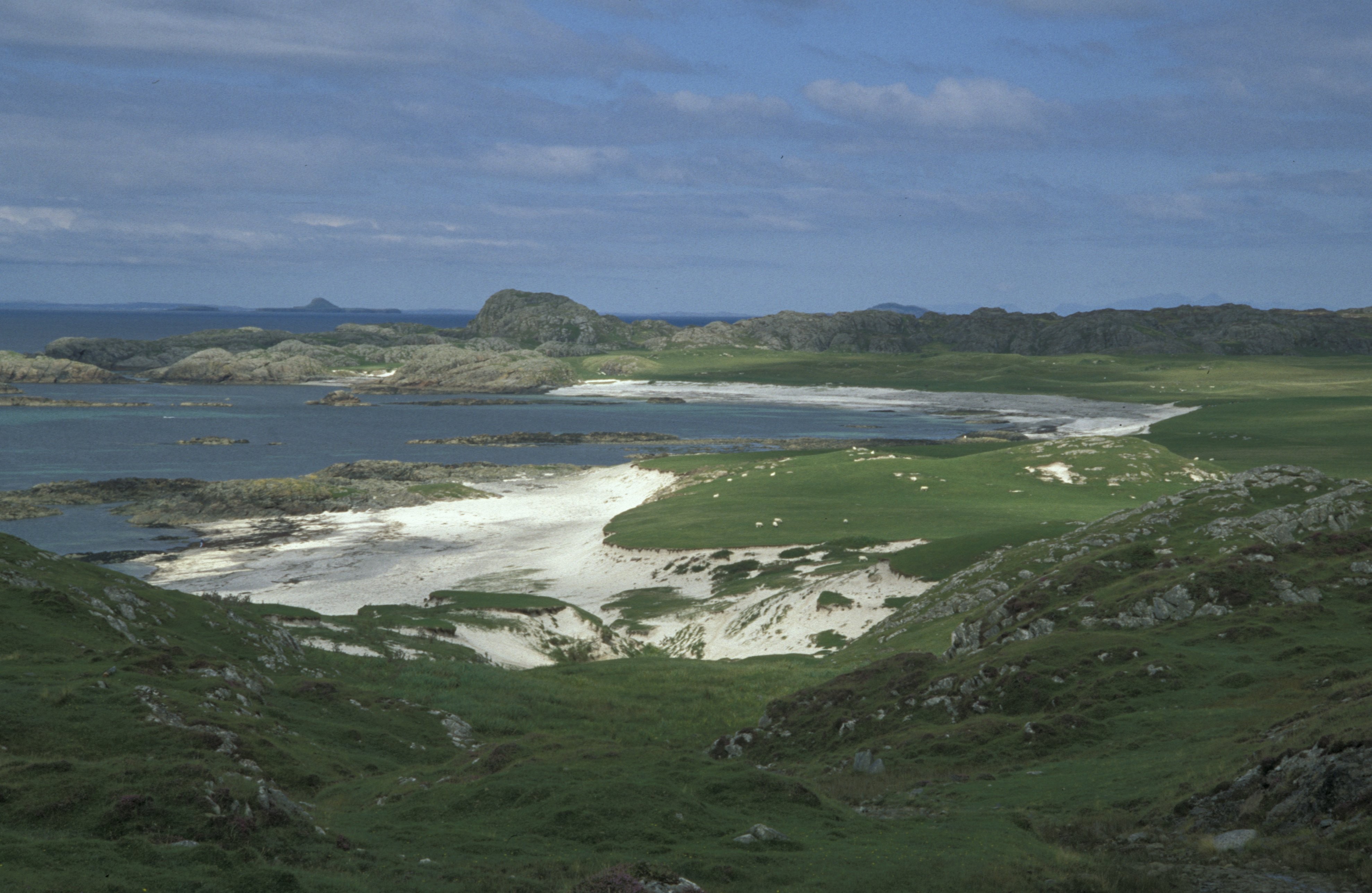
Slochd Dùn Manamin is a picturesque coastal area located in Argyllshire, Scotland. Situated on the west coast of Scotland, it offers stunning views of the sea, estuary, and creek, making it a popular destination for nature enthusiasts and photographers.

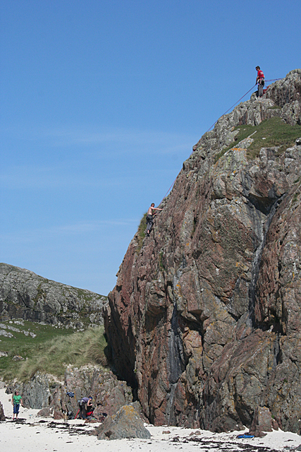
The area is characterized by its rugged coastline, with cliffs and rocky outcrops providing a dramatic backdrop to the crashing waves of the sea. The sea itself is a deep blue, contrasting beautifully with the surrounding green landscape. The estuary, formed by the convergence of the sea and a nearby river, is a haven for birdlife, with a variety of seabirds and waders often spotted here. The creek, a smaller waterway, meanders through the landscape, adding to the area's charm.

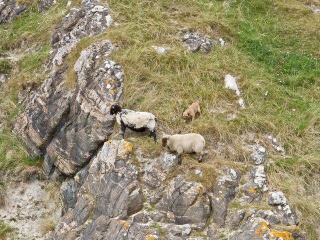
Slochd Dùn Manamin is known for its diverse wildlife. Seals can often be seen basking on the rocks, and if you're lucky, you may even spot dolphins or porpoises swimming in the sea. The area is also home to a range of bird species, including gannets, puffins, and oystercatchers, providing ample opportunities for birdwatching.

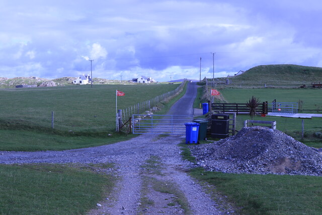
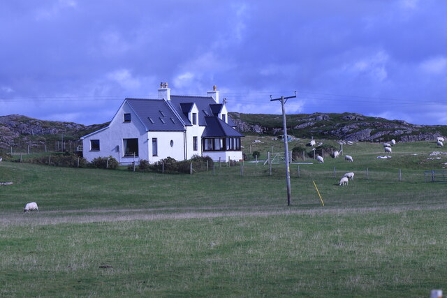
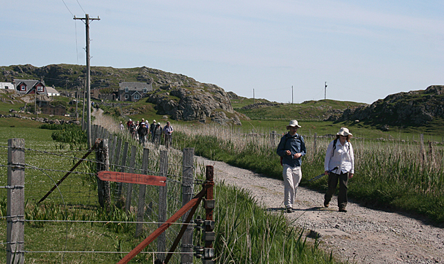
For those looking to explore the area, there are several walking trails that offer stunning views of the coastline and surrounding countryside. The nearby village of Argyllshire provides accommodation options and amenities for visitors, making it a convenient base for exploring Slochd Dùn Manamin and its natural beauty.

In summary, Slochd Dùn Manamin in Argyllshire is a breathtaking coastal area that offers a combination of sea, estuary, and creek landscapes. With its diverse wildlife and stunning views, it is a must-visit destination for anyone seeking a slice of Scotland's natural beauty.

If you have any feedback on the listing, please let us know in the comments section below.

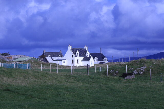
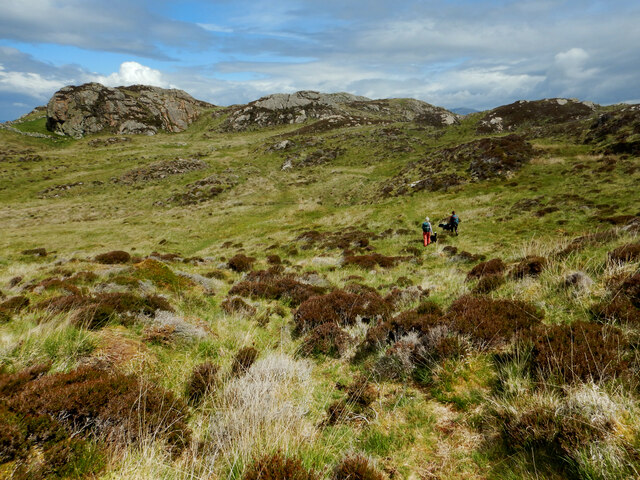
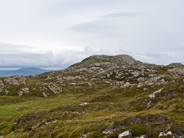
Slochd Dùn Manamin Images

Images are sourced within 2km of 56.338438/-6.4288284 or Grid Reference NM2625. Thanks to Geograph Open Source API. All images are credited.

Iona Golf Course On the western side of the island.
Iona Golf Course
On the western side of the island.
Towards Iona Golf Course From Skerryvore.
Towards Iona Golf Course
From Skerryvore.
Gateway by Skerryvore Leading to Iona Golf Course.
Gateway by Skerryvore
Leading to Iona Golf Course.
Machair house On Iona
Machair house
On Iona
Clachancorrach House On Iona.
Clachancorrach House
On Iona.
Cross country on the north of Iona The one fully land-locked grid square on Iona is rough terrain with various prehistoric defensible remains and lots of good viewpoints perched on rocky tors. Compared with the coast, it seems little frequented (and very boggy underfoot with various fences deflecting one from the obvious directions of travel). Frequent it we must, however, as this was my final square to complete coverage of my first inhabited island for geograph.
Cross country on the north of Iona
The one fully land-locked grid square on Iona is rough terrain with various prehistoric defensible remains and lots of good viewpoints perched on rocky tors. Compared with the coast, it seems little frequented (and very boggy underfoot with various fences deflecting one from the obvious directions of travel). Frequent it we must, however, as this was my final square to complete coverage of my first inhabited island for geograph.
Iona coastline The north-west coastline of Iona, with rock of the Lewisian Gneiss type evident. This is one of Britain's oldest rocks, and was formed approximately 2,000 million years ago.
Iona coastline
The north-west coastline of Iona, with rock of the Lewisian Gneiss type evident. This is one of Britain's oldest rocks, and was formed approximately 2,000 million years ago.
North-west Iona The north-western area of Iona, viewed towards Dun I, the highest point on the island.
North-west Iona
The north-western area of Iona, viewed towards Dun I, the highest point on the island.
Iona coastline The western coastline of Iona near Camas Cuil an t-Saimh, with Eilean Didil visible in the distance.
Iona coastline
The western coastline of Iona near Camas Cuil an t-Saimh, with Eilean Didil visible in the distance.
Sheep-worrying, Iona Despite its small size, this canine fiend caused considerable distress to sheep on western Iona.
Sheep-worrying, Iona
Despite its small size, this canine fiend caused considerable distress to sheep on western Iona.
Dun I At a height of 101 metres Dun I is the highest point on the island of Iona. It is an easy climb and from the summit affords a spectacular view in all directions.
Dun I
At a height of 101 metres Dun I is the highest point on the island of Iona. It is an easy climb and from the summit affords a spectacular view in all directions.
Walking on Iona Visitors are not permitted to take their cars on to the Island, so the only way to get around is to walk or cycle. This is the route from the pier to the beaches on the west coast of the island.
Walking on Iona
Visitors are not permitted to take their cars on to the Island, so the only way to get around is to walk or cycle. This is the route from the pier to the beaches on the west coast of the island.
Cnoc nam Bradain If I believe the Gaelic dictionary, the name of this place means 'salmon knoll'. It is a typical Hebridean house, standing on the machair by the track across the island.
Cnoc nam Bradain
If I believe the Gaelic dictionary, the name of this place means 'salmon knoll'. It is a typical Hebridean house, standing on the machair by the track across the island.
Camas Cùil an t-Saimh This is the main beach on the west coast of Iona, and an easy one to get to. Its name apparently means either 'sorrel back beach' or 'bad smell back beach', according to the Gaelic dictionary, but there was no evidence for the latter today.
Camas Cùil an t-Saimh
This is the main beach on the west coast of Iona, and an easy one to get to. Its name apparently means either 'sorrel back beach' or 'bad smell back beach', according to the Gaelic dictionary, but there was no evidence for the latter today.
Eilean nan Slat and Eilean Didil Eilean nan Slat is on the left and Eilean Didil is on the right. The rock in the middle of the bay is unnamed.
Eilean nan Slat and Eilean Didil
Eilean nan Slat is on the left and Eilean Didil is on the right. The rock in the middle of the bay is unnamed.
Bloody Cranesbill (Geranium sanguineum) Unmistakable because of its distinctive colour, this plant is usually found on lime, but here it is taking advantage of the shell sand of the machair.
Bloody Cranesbill (Geranium sanguineum)
Unmistakable because of its distinctive colour, this plant is usually found on lime, but here it is taking advantage of the shell sand of the machair.
Rock Climbing A party of students celebrate the end of their examinations by taking a few days and practise their rock-climbing skills at Port Bàn.
Rock Climbing
A party of students celebrate the end of their examinations by taking a few days and practise their rock-climbing skills at Port Bàn.
Port Bàn It's easy to see where this name comes from - it means' white harbour'.
Port Bàn
It's easy to see where this name comes from - it means' white harbour'.
Show me another place!

Slochd Dùn Manamin is located at Grid Ref: NM2625 (Lat: 56.338438, Lng: -6.4288284)

Unitary Authority: Argyll and Bute

Police Authority: Argyll and West Dunbartonshire

What 3 Words

///announced.bless.comforted. Near Fionnphort, Argyll & Bute

Related Wikis

Bay at the Back of the Ocean

The Bay at the Back of the Ocean (Scottish Gaelic: Camas Cuil an t-Saimh) is a wide, west facing bay on the island of Iona, Argyll and Bute, Scotland,...

Iona

Iona (; Scottish Gaelic: Ì Chaluim Chille [ˈiː ˈxal̪ˠɪm ˈçiʎə] , sometimes simply Ì) is a small island in the Inner Hebrides, off the Ross of Mull on the...

Iona Abbey

Iona Abbey is an abbey located on the island of Iona, just off the Isle of Mull on the West Coast of Scotland. It is one of the oldest Christian religious...

St Oran's Chapel

St Oran's Chapel (Odhráin/Orain/Odran) is a medieval chapel located on the island of Iona in the Inner Hebrides off the west coast of Scotland. Built in...

Nearby Amenities

Located within 500m of 56.338438,-6.4288284
Created By: dmgroom_coastlines
Source: PGS
Lat/Long: 56.33448/-6.42978
Created By: dmgroom_coastlines
Source: PGS
Lat/Long: 56.33474/-6.42953
Ele: 51
Natural: peak
Lat/Long: 56.3342173/-6.4271698
The data included in this document is from www.openstreetmap.org. The data is made available under ODbL.

Have you been to Slochd Dùn Manamin?

Leave your review of Slochd Dùn Manamin below (or comments, questions and feedback).