Loxter

Settlement in Herefordshire

England

Loxter

Polytunnels,  North of Ledbury Taken from the <a href="https://www.geograph.org.uk/photo/66558">SO6940 : Bridge over the River Leadon</a>.
Polytunnels, North of Ledbury Credit: Bob Embleton

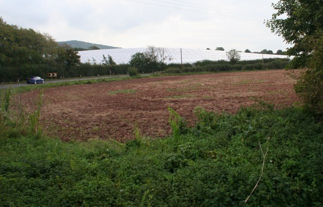
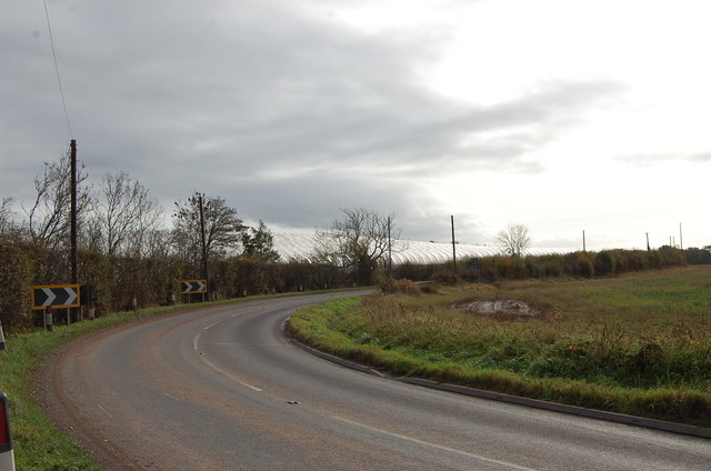
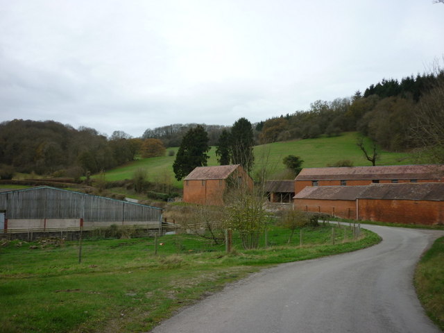
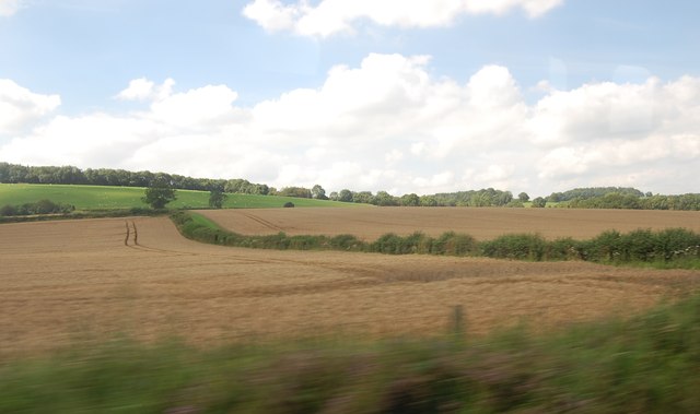
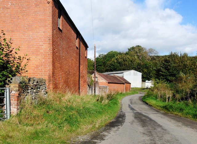
Loxter is a small village located in the county of Herefordshire, England. Situated approximately 5 miles south of the city of Hereford, Loxter is nestled in the picturesque countryside, surrounded by rolling hills and meandering rivers. The village is part of the Herefordshire Rural District and falls within the administrative district of Herefordshire Council.

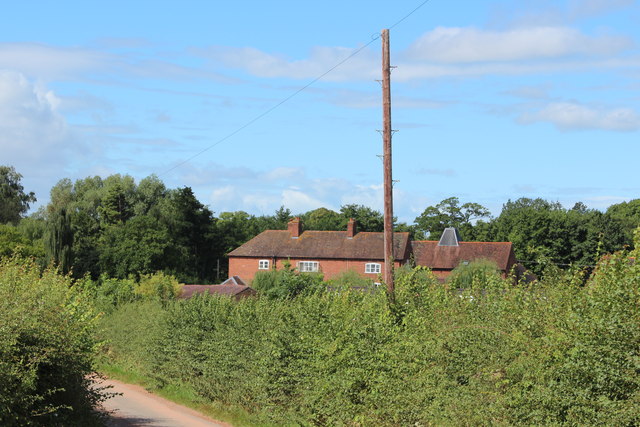
Loxter is a quaint and charming village, characterized by its traditional architecture and idyllic setting. The village is home to a close-knit community, with a population of around 300 residents. The local economy is mainly agricultural, with farming playing a significant role in the livelihoods of the villagers.

One of the notable landmarks in Loxter is St. Mary's Church, a beautiful medieval church dating back to the 12th century. The church boasts stunning architectural features, including a Norman tower and intricate stained glass windows. It serves as a place of worship for the local community and attracts visitors with its historical significance.

In terms of amenities, Loxter has a small primary school, providing education to the village's children. The nearest secondary schools and further amenities can be found in the nearby city of Hereford. The village also has a local pub, serving as a social hub for residents and visitors alike.

With its tranquil setting and friendly community, Loxter offers a peaceful retreat from the hustle and bustle of city life. Its natural beauty and rich history make it a sought-after destination for those seeking a taste of rural England.

If you have any feedback on the listing, please let us know in the comments section below.
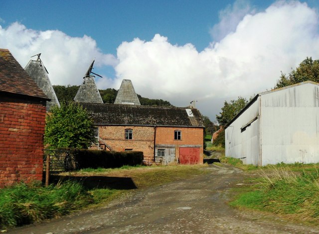
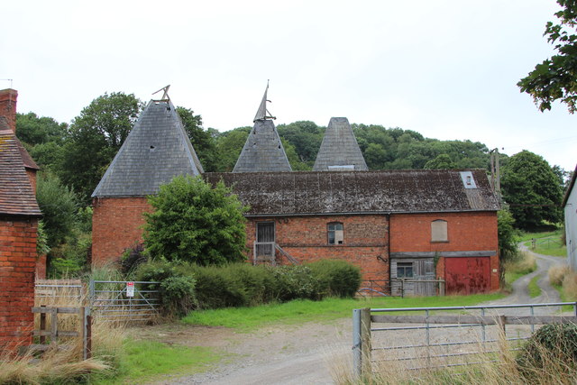
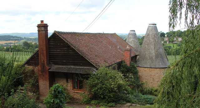
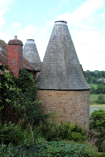
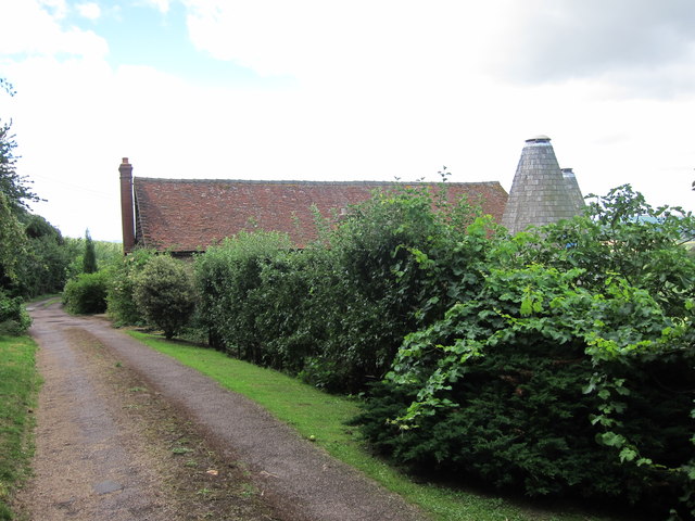
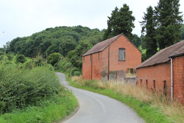
Loxter Images

Images are sourced within 2km of 52.065756/-2.4157566 or Grid Reference SO7140. Thanks to Geograph Open Source API. All images are credited.

Polytunnels,  North of Ledbury Taken from the <a href="https://www.geograph.org.uk/photo/66558">SO6940 : Bridge over the River Leadon</a>.
Polytunnels, North of Ledbury
Polytunnels near the road
Oast House at Prior's Court, Staplow Internal kiln oast house.
Oast House at Prior's Court, Staplow
Internal kiln oast house.
Kiln roof at Prior's Court Oast Internal kiln oast house.
Kiln roof at Prior's Court Oast
Internal kiln oast house.
Road junction on Bromyard Road Road junction on B4214 Bromyard Road near where the road crosses the River Leadon.
Road junction on Bromyard Road
Road junction on B4214 Bromyard Road near where the road crosses the River Leadon.
New bridge on Bromyard Road New bridge on the B4214 Bromyard Road near Staplow, north of Ledbury.  This bridge has been renewed about three years ago since it was photographed in 2017 <a href="https://www.geograph.org.uk/photo/5596868">SO6940 : Bromyard Road crossing River Leadon near Staplow</a>, I first photographed it in 2005 <a href="https://www.geograph.org.uk/photo/66558">SO6940 : Bridge over the River Leadon</a>.
New bridge on Bromyard Road
New bridge on the B4214 Bromyard Road near Staplow, north of Ledbury. This bridge has been renewed about three years ago since it was photographed in 2017 SO6940 : Bromyard Road crossing River Leadon near Staplow, I first photographed it in 2005 SO6940 : Bridge over the River Leadon.
Upper Mitchell Farm
Upper Mitchell Farm
Oast Houses at Upper Mitchell Farm
Fields near Petty France From Railway Line.
Fields near Petty France
From Railway Line.
Upper Mitchell Farm, Wellington Heath, Herefordshire The farm buildings were rundown and the buildings to the west of the road were in some decay.
Upper Mitchell Farm, Wellington Heath, Herefordshire
The farm buildings were rundown and the buildings to the west of the road were in some decay.
Frith Hill - Bradlow Knoll Parked at track entrance at SO 72088 40769. Walked SE along minor road to public footpath over whole of wooded ridge and back.  Sign states no horses.
Name: Frith Hill - Bradlow Knoll
Hill number: 5372
Height: 238m / 781ft
Area: 38B: West Gloucestershire, Hereford & Worcester
Class: Hu
Grid ref: SO 71628 39043
Summit feature: no feature
Drop: 125m
Col: 113m  SO732398
Frith Hill - Bradlow Knoll
Parked at track entrance at SO 72088 40769. Walked SE along minor road to public footpath over whole of wooded ridge and back. Sign states no horses. Name: Frith Hill - Bradlow Knoll Hill number: 5372 Height: 238m / 781ft Area: 38B: West Gloucestershire, Hereford & Worcester Class: Hu Grid ref: SO 71628 39043 Summit feature: no feature Drop: 125m Col: 113m SO732398
Upper Mitchell Farm near Wellington Heath
Unconverted Oast House at Upper Mitchell Farm
Kiln Cottage, Frith Wood Two round kiln oast house. Known as Kiln Cottage
Kiln Cottage, Frith Wood
Two round kiln oast house. Known as Kiln Cottage
Kiln Cottage, Frith Wood Two round kiln oast house. Known as Kiln Cottage
Kiln Cottage, Frith Wood
Two round kiln oast house. Known as Kiln Cottage
Kiln Cottage, Frith Wood Two round kiln oast house. Known as Kiln Cottage
Kiln Cottage, Frith Wood
Two round kiln oast house. Known as Kiln Cottage
Kiln Cottage, Frith Wood Two round kiln oast house. Known as Kiln Cottage
Kiln Cottage, Frith Wood
Two round kiln oast house. Known as Kiln Cottage
Barn at Upper Mitchell Farm
Show me another place!

Loxter is located at Grid Ref: SO7140 (Lat: 52.065756, Lng: -2.4157566)

Unitary Authority: County of Herefordshire

Police Authority: West Mercia

What 3 Words

///panting.weeks.umbrellas. Near Ledbury, Herefordshire

Related Wikis

Hope End

Hope End is an area and former estate of Herefordshire, England near the Malvern Hills, noted for its literary associations. As described by a 19th-century...

Wellington Heath

Wellington Heath is a small village and civil parish in Herefordshire, England, approximately 1.5 miles (2.4 km) north of Ledbury. The population was recorded...

Coddington, Herefordshire

Coddington is a hamlet and civil parish in eastern Herefordshire, England, about 3 miles (4.8 km) north of Ledbury. The west side of the parish covers...

Herefordshire and Gloucestershire Canal

The Herefordshire and Gloucestershire Canal (sometimes known as the Hereford and Gloucester Canal) is a canal in the west of England, which ran from Hereford...

Nearby Amenities

Located within 500m of 52.065756,-2.4157566
Bus Stop
The Swallow
Bus: yes
Naptan AtcoCode: 2090A0106134
Naptan Bearing: E
Naptan CommonName: The Swallow
Naptan Indicator: opp
Naptan NaptanCode: heratgmg
Naptan Street: Church Lane
Naptan Verified: no
Public Transport: platform
Source: naptan_import
Lat/Long: 52.0645565/-2.419055
Bus Stop
The Swallow
Bus: yes
Naptan AtcoCode: 2090A0106136
Naptan Bearing: W
Naptan BusStopType: CUS
Naptan CommonName: The Swallow
Naptan Indicator: adj
Naptan NaptanCode: heratgmj
Naptan Street: Church Lane
Naptan Verified: no
Public Transport: platform
Source: naptan_import
Lat/Long: 52.0645117/-2.4190077
Bus Stop
Loxter
Bus: yes
Naptan AtcoCode: 2090A0106148
Naptan Bearing: NE
Naptan CommonName: Loxter
Naptan Indicator: adj Raycombe Lane
Naptan NaptanCode: heratgp
Naptan Street: Church Lane
Naptan Verified: no
Public Transport: platform
Source: naptan_import
Lat/Long: 52.0658279/-2.415844
Bus Stop
Oak Tree
Bus: yes
Naptan AtcoCode: 2090A067800
Naptan Bearing: SW
Naptan BusStopType: CUS
Naptan CommonName: Oak Tree
Naptan Indicator: adj
Naptan Landmark: Old Church- Oak tree
Naptan NaptanCode: heradgjd
Naptan Street: Church Lane
Naptan Verified: no
Public Transport: platform
Source: naptan_import
Lat/Long: 52.0637252/-2.4205654
Loxter
Naptan AtcoCode: 2090A071200
Naptan Bearing: SW
Naptan BusStopType: CUS
Naptan CommonName: Loxter
Naptan Indicator: opp Raycombe Lane
Naptan NaptanCode: heradgtm
Naptan Street: Church Lane
Naptan Verified: no
Source: naptan_import
Lat/Long: 52.0656663/-2.415755
Bus Stop
Oak Tree
Bus: yes
Naptan AtcoCode: 2090A18745
Naptan Bearing: NE
Naptan BusStopType: CUS
Naptan CommonName: Oak Tree
Naptan Indicator: opp
Naptan Landmark: Old Church- Oak Tree
Naptan NaptanCode: herajdat
Naptan Street: Church Lane
Naptan Verified: no
Public Transport: platform
Source: naptan_import
Lat/Long: 52.063712/-2.4207207
Post Box
Collection Times: Mo-Fr 16:30; Sa 08:00
Description: Against wooden fence
Post Box Type: lamp
Ref: HR8 739
Lat/Long: 52.063953/-2.420833
Bench
Description: Round; Metal; Surrounds tree
Lat/Long: 52.064041/-2.4205333
Bench
Lat/Long: 52.0645203/-2.4192976
Barrier: kissing_gate
Source: survey
Lat/Long: 52.0630101/-2.4169054
Barrier: stile
Source: survey
Lat/Long: 52.0642733/-2.4179193
Barrier: stile
Source: survey
Lat/Long: 52.0644752/-2.4178342
Barrier: kissing_gate
Source: survey
Lat/Long: 52.0633165/-2.4183376
Fire Hydrant
Emergency: fire_hydrant
Fire Hydrant Type: underground
Source: survey
Lat/Long: 52.0641007/-2.4204522
Grit Bin
Source: survey
Lat/Long: 52.0640574/-2.4207647
Generator Method: photovoltaic
Generator Output Electricity: yes
Generator Source: solar
Generator Type: solar_photovoltaic_panel
Location: roof
Power: generator
Lat/Long: 52.0618663/-2.4186927
Generator Method: photovoltaic
Generator Output Electricity: yes
Generator Source: solar
Generator Type: solar_photovoltaic_panel
Location: roof
Power: generator
Lat/Long: 52.0628326/-2.4196731
Generator Method: photovoltaic
Generator Output Electricity: yes
Generator Source: solar
Generator Type: solar_photovoltaic_panel
Location: roof
Power: generator
Lat/Long: 52.0627386/-2.4196355
Loxter
Power: pole
Transformer: distribution
Voltage Primary: 11000
Lat/Long: 52.0656754/-2.414939
Power: pole
Lat/Long: 52.0652253/-2.4149711
Power: pole
Lat/Long: 52.0648254/-2.4149953
Power: pole
Lat/Long: 52.0635071/-2.4156578
Power: pole
Lat/Long: 52.0643209/-2.4130601
Hope End Farm
Location Transition: yes
Power: pole
Transformer: distribution
Voltage Primary: 11000
Lat/Long: 52.0654265/-2.4103175
Power: pole
Lat/Long: 52.0652162/-2.4108312
Power: pole
Lat/Long: 52.0651132/-2.4114923
Power: pole
Lat/Long: 52.0647521/-2.4122179
Hope End Pump
Power: pole
Transformer: distribution
Voltage Primary: 11000
Lat/Long: 52.0638736/-2.4138855
Power: pole
Lat/Long: 52.0640348/-2.4150831
Wellington Heath North
Power: pole
Transformer: distribution
Voltage Primary: 11000
Lat/Long: 52.0637548/-2.4200023
Hill Cottages West Heath
Power: pole
Transformer: distribution
Voltage Primary: 11000
Lat/Long: 52.0634329/-2.4186015
Power: pole
Lat/Long: 52.0632956/-2.4180362
Power: pole
Lat/Long: 52.0630297/-2.4169379
Power: pole
Lat/Long: 52.0628871/-2.4163183
Power: pole
Lat/Long: 52.0622349/-2.4169929
Power: pole
Lat/Long: 52.0617228/-2.4175407
The data included in this document is from www.openstreetmap.org. The data is made available under ODbL.

Have you been to Loxter?

Leave your review of Loxter below (or comments, questions and feedback).