Ducan's Marsh

Coastal Marsh, Saltings in Norfolk South Norfolk

England

Ducan's Marsh

Carleton St Peter, St Peter
Carleton St Peter, St Peter Credit: Dave Kelly

Duncan's Marsh, located in Norfolk, England, is a coastal marshland that stretches along the coast of the North Sea. Situated in the eastern part of the county, it is a significant part of the larger Norfolk Coast Area of Outstanding Natural Beauty.

The marshland is characterized by its vast expanse of saltmarshes and saltings, which are a type of coastal wetland formed by the deposition of saltwater sediments. These marshes provide a critical habitat for a wide range of plant and animal species, many of which are adapted to the unique conditions of the marsh environment.

Duncan's Marsh is particularly renowned for its diverse bird population. It serves as an important breeding ground and a stopover point for numerous species during their migratory journeys. Birdwatchers flock to this area to observe rare and protected species such as avocets, marsh harriers, and bitterns.

As a coastal marsh, Duncan's Marsh plays a crucial role in coastal protection. The dense vegetation and intricate root systems of the saltmarshes help to stabilize the coastline, reducing erosion and providing a natural defense against storm surges.

The marshland also offers opportunities for recreational activities such as walking, hiking, and wildlife photography. Several well-maintained trails wind through the marsh, allowing visitors to explore and appreciate the unique flora and fauna of the area.

Overall, Duncan's Marsh is a remarkable coastal marshland that not only supports a diverse ecosystem but also provides a valuable natural defense against coastal erosion. It is a haven for wildlife enthusiasts and a place of natural beauty for visitors to enjoy.

If you have any feedback on the listing, please let us know in the comments section below.

Ducan's Marsh Images

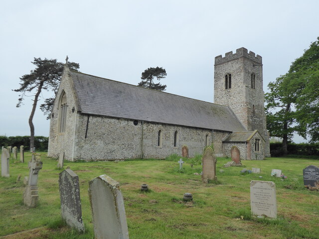
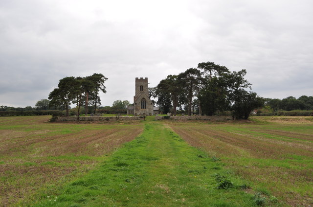
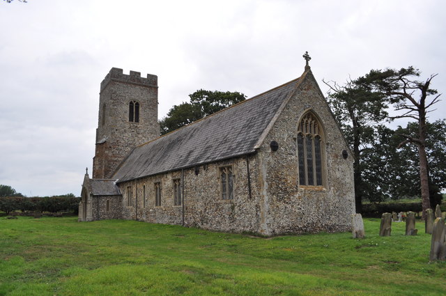
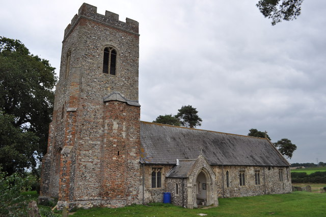
Images are sourced within 2km of 52.574553/1.4526964 or Grid Reference TG3403. Thanks to Geograph Open Source API. All images are credited.

Carleton St Peter, St Peter
The path to St Peter's church See <a href="https://www.geograph.org.uk/photo/1331932">TG3402 : The path to St Peter's church</a>
The path to St Peter's church
St Peter's church This church is mentioned in the 1086 Domesday book. The body is Norman in origin with two slit windows (north and south). The tower was extended in height in the 1600s. Now isolated in a field and kept open.
St Peter's church
This church is mentioned in the 1086 Domesday book. The body is Norman in origin with two slit windows (north and south). The tower was extended in height in the 1600s. Now isolated in a field and kept open.
St Peter's church - Norman Window A blocked up window on the southern side of the building. 
This church is mentioned in the 1086 Domesday book. The body is Norman in origin with two slit windows (north and south). The tower was extended in height in the 1600s. Now isolated in a field and kept open.

<a href="https://www.geograph.org.uk/photo/2585077">TG3302 : St Peter's church</a>
St Peter's church - Norman Window
A blocked up window on the southern side of the building. This church is mentioned in the 1086 Domesday book. The body is Norman in origin with two slit windows (north and south). The tower was extended in height in the 1600s. Now isolated in a field and kept open. TG3302 : St Peter's church
St Peter's church - Norman Window
St Peter's church See <a href="https://www.geograph.org.uk/photo/148315">TG3302 : Carleton St. Peter</a> also
St Peter's church
Buckenham Marshes Wigeon grazing by a ditch on the RSPB reserve.
Buckenham Marshes
Wigeon grazing by a ditch on the RSPB reserve.
Synchronised preening This pair of Egyptian geese were apparently at ease preening and resting just beside the Beauchamp Arms but far from other human habitation.
Synchronised preening
This pair of Egyptian geese were apparently at ease preening and resting just beside the Beauchamp Arms but far from other human habitation.
Path through Hazelmere Hole This public footpath forms a section of the Wherryman's Way long distance footpath, leading from New Road > <a title="https://www.geograph.org.uk/photo/1411099" href="https://www.geograph.org.uk/photo/1411099">Link</a> through Hazelmere Hole and from there onwards to Langley Green > <a title="https://www.geograph.org.uk/photo/1411314" href="https://www.geograph.org.uk/photo/1411314">Link</a> further to the north.

The Wherryman's Way > <a title="https://www.geograph.org.uk/photo/1340030" href="https://www.geograph.org.uk/photo/1340030">Link</a> is a 35-mile long distance footpath following the route of the Broads trading wherries between Norwich and Great Yarmouth. The route takes its name from the wherry – a large cargo-carrying barge whose black sails used to be a common sight on these waters. Ten circular village walks branch off this path along the way.
Path through Hazelmere Hole
This public footpath forms a section of the Wherryman's Way long distance footpath, leading from New Road > Link through Hazelmere Hole and from there onwards to Langley Green > Link further to the north. The Wherryman's Way > Link is a 35-mile long distance footpath following the route of the Broads trading wherries between Norwich and Great Yarmouth. The route takes its name from the wherry – a large cargo-carrying barge whose black sails used to be a common sight on these waters. Ten circular village walks branch off this path along the way.
Dry drainage ditch in Hazelmere Hole
On the edge of Hazelmere Hole
Hazelmere Hole in spring
Remains of old farm cart in Hazelmere Hole I believe this is part of the axle. For a wider view of this location see > <a title="https://www.geograph.org.uk/photo/2870757" href="https://www.geograph.org.uk/photo/2870757">Link</a>.
Remains of old farm cart in Hazelmere Hole
I believe this is part of the axle. For a wider view of this location see > Link.
Track to Langley Street This public footpath forms a section of the Wherryman's Way long distance footpath, leading from New Road > <a title="https://www.geograph.org.uk/photo/1411099" href="https://www.geograph.org.uk/photo/1411099">Link</a> through Hazelmere Hole > <a title="https://www.geograph.org.uk/photo/2870757" href="https://www.geograph.org.uk/photo/2870757">Link</a> and from there onwards to Langley Green > <a title="https://www.geograph.org.uk/photo/1411314" href="https://www.geograph.org.uk/photo/1411314">Link</a> further to the north.

The Wherryman's Way > <a title="https://www.geograph.org.uk/photo/1340030" href="https://www.geograph.org.uk/photo/1340030">Link</a> is a 35-mile long distance footpath following the route of the Broads trading wherries between Norwich and Great Yarmouth. The route takes its name from the wherry – a large cargo-carrying barge whose black sails used to be a common sight on these waters. Ten circular village walks branch off this path along the way.
Track to Langley Street
This public footpath forms a section of the Wherryman's Way long distance footpath, leading from New Road > Link through Hazelmere Hole > Link and from there onwards to Langley Green > Link further to the north. The Wherryman's Way > Link is a 35-mile long distance footpath following the route of the Broads trading wherries between Norwich and Great Yarmouth. The route takes its name from the wherry – a large cargo-carrying barge whose black sails used to be a common sight on these waters. Ten circular village walks branch off this path along the way.
Crop near Langley Green It appears to be some sort of cabbage.
Crop near Langley Green
It appears to be some sort of cabbage.
Cabbage crop near Langley Green
The Beauchamp Arms near Claxton, Norfolk I love this pub. Situated down an unmade road across the marshes from the small village of Claxton it was once the site of a ferry service across the River Yare to Buckenham.It has expansive gardens with views towards the sugar beet factory at Cantley to the West and Buckenham towards the East.
The Beauchamp Arms near Claxton, Norfolk
I love this pub. Situated down an unmade road across the marshes from the small village of Claxton it was once the site of a ferry service across the River Yare to Buckenham.It has expansive gardens with views towards the sugar beet factory at Cantley to the West and Buckenham towards the East.
Show me another place!

Ducan's Marsh is located at Grid Ref: TG3403 (Lat: 52.574553, Lng: 1.4526964)

Administrative County: Norfolk

District: South Norfolk

Police Authority: Norfolk

What 3 Words

///clashes.invent.rucksack. Near Loddon, Norfolk

Related Wikis

Ducan's Marsh

Ducan's Marsh is a 3.6-hectare (8.9-acre) biological Site of Special Scientific Interest north-east of Loddon in Norfolk. It is part of the Broadland Ramsar...

Claxton, Norfolk

Claxton is a small village 8.5 miles (13.7 km) south-east of Norwich, and south of the River Yare, between Rockland St. Mary and Loddon in South Norfolk...

Claxton Castle

Claxton Castle in the village of Claxton, Norfolk, is a ruined brick castle some 13 km southeast of Norwich. == Details == Sir William de Kerdeston and...

Carleton St Peter

Carleton St Peter is a hamlet and civil parish in South Norfolk approximately 8+1⁄2 miles (13.7 km) south-east of Norwich. There is no village centre but...

Ashby St Mary

Ashby St Mary, historically Ascebei, is a small village and civil parish in the English county of Norfolk. The civil parish has an area of 2.03 square...

Langley Abbey

Langley Abbey was an abbey of Premonstratensian Canons in Langley Green, now in the civil parish of Langley with Hardley, Norfolk, England. The monastery...

Rockland Broad

Rockland Broad is an area of open water, known as a broad, located north east of the village of Rockland St. Mary in the English county of Norfolk. The...

Thurton

Thurton is a village in South Norfolk lying 8½ miles (13½ km) south-east of Norwich on the A146 Norwich to Lowestoft road between Framingham Pigot and...

Nearby Amenities

Located within 500m of 52.574553,1.4526964
Power: tower
Ref: PPA 43
Lat/Long: 52.571328/1.449423
Power: tower
Ref: PPA 44
Lat/Long: 52.570339/1.454093
turn, W-bound
Naptan AtcoCode: 2900C081
Naptan Bearing: NW
Naptan BusStopType: CUS
Naptan CommonName: turn
Naptan Indicator: W-bound
Naptan Landmark: Ferry Road
Naptan Locality: Carleton St Peter
Naptan NaptanCode: nfoajdjm
Naptan Street: The Street
Naptan Verified: no
Source: naptan_import
Lat/Long: 52.5757307/1.4578779
turn, E-bound
Naptan AtcoCode: 2900C082
Naptan Bearing: SW
Naptan BusStopType: CUS
Naptan CommonName: turn
Naptan Indicator: E-bound
Naptan Landmark: The Street
Naptan Locality: Carleton St Peter
Naptan NaptanCode: nfoajdjp
Naptan Street: Ferry Road
Naptan Verified: no
Source: naptan_import
Lat/Long: 52.5757451/1.4586172
Green, adj
Naptan AtcoCode: 2900C171
Naptan Bearing: SE
Naptan BusStopType: CUS
Naptan CommonName: Green
Naptan Indicator: adj
Naptan Locality: Claxton
Naptan NaptanCode: nfoajgwd
Naptan Street: The Street
Naptan Verified: no
Source: naptan_import
Lat/Long: 52.5776907/1.4544857
Green, opp
Naptan AtcoCode: 2900C172
Naptan Bearing: NW
Naptan BusStopType: CUS
Naptan CommonName: Green
Naptan Indicator: opp
Naptan Locality: Claxton
Naptan NaptanCode: nfoajgwg
Naptan Street: The Street
Naptan Verified: no
Source: naptan_import
Lat/Long: 52.5776708/1.4543309
Give Way
Lat/Long: 52.5756775/1.458241
Give Way
Lat/Long: 52.5756686/1.4583949
Claxton
Man Made: village_sign
Material: wood
Note: The O in Claxton shared with the central ring from carved Olympic Rings
Start Date: 2013-02-11
Lat/Long: 52.5776621/1.4547832
Give Way
Lat/Long: 52.5777408/1.4552235
Barrier: stile
Bicycle: no
Foot: yes
Material: wood
Note: Broken step.
Stile: stepover
Lat/Long: 52.5713318/1.4540577
The data included in this document is from www.openstreetmap.org. The data is made available under ODbL.

Have you been to Ducan's Marsh?

Leave your review of Ducan's Marsh below (or comments, questions and feedback).