Carleton Broad

Lake, Pool, Pond, Freshwater Marsh in Norfolk South Norfolk

England

Carleton Broad

Carleton St Peter, St Peter
Carleton St Peter, St Peter Credit: Dave Kelly

Carleton Broad is a picturesque freshwater body located in the county of Norfolk, England. This expansive water feature is encompassed by a breathtaking landscape, offering visitors a tranquil and serene environment to explore. The broad is situated within the Norfolk Broads, a renowned national park famous for its beautiful wetland areas.

Covering an area of approximately 54 hectares, Carleton Broad is characterized by its calm and reflective waters. It is primarily a man-made lake, which was created during the medieval period through peat digging activities. The broad is surrounded by lush greenery, including reed beds and woodland, creating a diverse and vibrant ecosystem.

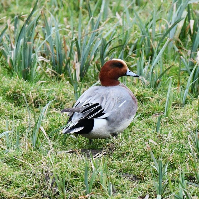
The waters of Carleton Broad are teeming with a variety of freshwater species, making it an ideal spot for angling and fishing enthusiasts. Popular fish species found in the broad include pike, roach, bream, and perch. Birdwatchers are also drawn to this area, as it serves as a haven for a plethora of bird species, including herons, swans, ducks, and geese.

For those seeking a leisurely experience on the water, Carleton Broad offers boating and canoeing opportunities. Visitors can rent boats or bring their own to explore the calm waters and admire the surrounding scenery. The broad is also an excellent spot for nature walks, providing numerous trails and paths for visitors to enjoy.

Carleton Broad is a true gem within the Norfolk Broads, offering visitors a chance to immerse themselves in the beauty of nature and enjoy a peaceful retreat in the heart of Norfolk.

If you have any feedback on the listing, please let us know in the comments section below.

Carleton Broad Images

Images are sourced within 2km of 52.577721/1.462483 or Grid Reference TG3403. Thanks to Geograph Open Source API. All images are credited.

Carleton St Peter, St Peter
War memorial by the junction of Langley Green and Staithe Road It commemorates the Fallen of WW1 and is believed to have been made from stone  sourced from the nearby Langley Abbey.
War memorial by the junction of Langley Green and Staithe Road
It commemorates the Fallen of WW1 and is believed to have been made from stone sourced from the nearby Langley Abbey.
View towards Langley Abbey
The former Wherry Inn It is now a private dwelling.  For information about this former pub see > <span class="nowrap"><a title="https://www.norfolkpubs.co.uk/norfolkl/langley/langwh.htm" rel="nofollow ugc noopener" href="https://www.norfolkpubs.co.uk/norfolkl/langley/langwh.htm">Link</a><img style="margin-left:2px;" alt="External link" title="External link - shift click to open in new window" src="https://s1.geograph.org.uk/img/external.png" width="10" height="10"/></span>
The former Wherry Inn
It is now a private dwelling. For information about this former pub see > LinkExternal link
War Memorial at Langley Green
Buckenham Marshes
Buckenham Marshes
Buckenham Marshes: Wigeon (Anas penelope) male
Buckenham Marshes: Wigeon (Anas penelope) female
Langley Abbey This is the great barn, with the sticker on it (see model) <a href="https://www.geograph.org.uk/photo/1950299">TG3602 : Langley - remains of the abbey</a>

Later in life this barn was converted into a grain processing factory. A chimney was sited behind and it was run via a peat powered steam engine. Inside was a threshing and winnowing machine as well and belts to move the grain to silos. The silos survived into 2010 before being taken out when the barn was converted into a museum. They can be seen in this photograph <a href="https://www.geograph.org.uk/photo/1342980">TG3602 : Langley - remains of the abbey</a>

Now a tourist attraction increasing in popularity.
Langley Abbey
This is the great barn, with the sticker on it (see model) TG3602 : Langley - remains of the abbey Later in life this barn was converted into a grain processing factory. A chimney was sited behind and it was run via a peat powered steam engine. Inside was a threshing and winnowing machine as well and belts to move the grain to silos. The silos survived into 2010 before being taken out when the barn was converted into a museum. They can be seen in this photograph TG3602 : Langley - remains of the abbey Now a tourist attraction increasing in popularity.
Langley Abbey - Cellarium The impressive restored Cellarium, inside are lights to highlight the room. Nothing like it would have been like but I quite liked the feel. See also <a href="https://www.geograph.org.uk/photo/1950682">TM4599 : St Olaves Priory 13th Century Undercroft</a>
 <a href="https://www.geograph.org.uk/photo/2373394">TG3602 : Langley Abbey</a>
Langley Abbey - Cellarium
The impressive restored Cellarium, inside are lights to highlight the room. Nothing like it would have been like but I quite liked the feel. See also TM4599 : St Olaves Priory 13th Century Undercroft TG3602 : Langley Abbey
Langley Abbey - Church The remains of the church at the abbey. See also <a href="https://www.geograph.org.uk/photo/1950328">TG3602 : Langley - remains of the abbey</a>
Langley Abbey - Church
The remains of the church at the abbey. See also TG3602 : Langley - remains of the abbey
Langley Abbey - Great Hall This is the great barn, with the sticker on it (see model) <a href="https://www.geograph.org.uk/photo/1950299">TG3602 : Langley - remains of the abbey</a>

Later in life this barn was converted into a grain processing factory. A chimney was sited behind and it was run via a peat powered steam engine. Inside was a threshing and winnowing machine as well and belts to move the grain to silos. The silos survived into 2010 before being taken out when the barn was converted into a museum. They can be seen in this photograph <a href="https://www.geograph.org.uk/photo/1342980">TG3602 : Langley - remains of the abbey</a>

Now a tourist attraction increasing in popularity.
Langley Abbey - Great Hall
This is the great barn, with the sticker on it (see model) TG3602 : Langley - remains of the abbey Later in life this barn was converted into a grain processing factory. A chimney was sited behind and it was run via a peat powered steam engine. Inside was a threshing and winnowing machine as well and belts to move the grain to silos. The silos survived into 2010 before being taken out when the barn was converted into a museum. They can be seen in this photograph TG3602 : Langley - remains of the abbey Now a tourist attraction increasing in popularity.
Langley Abbey Farm The farm produced Langley Longhorn beef, this is the only retailer of this beef which is hung for 30 days. Behind is the great barn of Langley Abbey.
<span class="nowrap"><a title="http://www.loddonhistory.org.uk/lang_abbey_pond.html" rel="nofollow ugc noopener" href="http://www.loddonhistory.org.uk/lang_abbey_pond.html">Link</a><img style="margin-left:2px;" alt="External link" title="External link - shift click to open in new window" src="https://s1.geograph.org.uk/img/external.png" width="10" height="10"/></span>
Langley Abbey Farm
The farm produced Langley Longhorn beef, this is the only retailer of this beef which is hung for 30 days. Behind is the great barn of Langley Abbey. LinkExternal link
Langley Abbey Langley, a Premonstratensian abbey, was founded in 1195 and dissolved in 1536. The buildings were surrounded by a wet ditch which had three entrances. Some of the buildings are still standing and are included in the present farm buildings. Excavations in 1921 revealed that the cruciform church had a tower at the West end. The presbytery was flanked by chapels extending east from the transepts, and an additional chapel to the north of the north transept. The claustral buildings were arranged to the south and included the sacristy, chapter house, parlour, dorter and its sub-vault and a warming house in the east range, the frater in the south range, and cellarium in the west range. A gatehouse adjoined the north part of the cellarium. The stable, part of the gatehouse, the cellarium with its vaulted undercroft to the north, parts of the west and north walls of the Chapter House and the south-east corner of the infirmary can all still be seen, with the stable and cellarium presently used as a museum which opened in 2010. From <a href="https://www.geograph.org.uk/photo/1342980">TG3602 : Langley - remains of the abbey</a>
Langley Abbey
Langley, a Premonstratensian abbey, was founded in 1195 and dissolved in 1536. The buildings were surrounded by a wet ditch which had three entrances. Some of the buildings are still standing and are included in the present farm buildings. Excavations in 1921 revealed that the cruciform church had a tower at the West end. The presbytery was flanked by chapels extending east from the transepts, and an additional chapel to the north of the north transept. The claustral buildings were arranged to the south and included the sacristy, chapter house, parlour, dorter and its sub-vault and a warming house in the east range, the frater in the south range, and cellarium in the west range. A gatehouse adjoined the north part of the cellarium. The stable, part of the gatehouse, the cellarium with its vaulted undercroft to the north, parts of the west and north walls of the Chapter House and the south-east corner of the infirmary can all still be seen, with the stable and cellarium presently used as a museum which opened in 2010. From TG3602 : Langley - remains of the abbey
Former Langley Abbey The site of many of the buildings.
Former Langley Abbey
The site of many of the buildings.
Show me another place!

Carleton Broad is located at Grid Ref: TG3403 (Lat: 52.577721, Lng: 1.462483)

Administrative County: Norfolk

District: South Norfolk

Police Authority: Norfolk

What 3 Words

///trickster.bookings.fingernails. Near Lingwood, Norfolk

Related Wikis

Claxton, Norfolk

Claxton is a small village 8.5 miles (13.7 km) south-east of Norwich, and south of the River Yare, between Rockland St. Mary and Loddon in South Norfolk...

Ducan's Marsh

Ducan's Marsh is a 3.6-hectare (8.9-acre) biological Site of Special Scientific Interest north-east of Loddon in Norfolk. It is part of the Broadland Ramsar...

Claxton Castle

Claxton Castle in the village of Claxton, Norfolk, is a ruined brick castle some 13 km southeast of Norwich. == Details == Sir William de Kerdeston and...
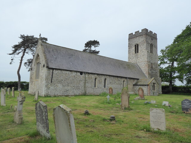
Carleton St Peter

Carleton St Peter is a hamlet and civil parish in South Norfolk approximately 8+1⁄2 miles (13.7 km) south-east of Norwich. There is no village centre but...

Nearby Amenities

Located within 500m of 52.577721,1.462483
turn, W-bound
Naptan AtcoCode: 2900C081
Naptan Bearing: NW
Naptan BusStopType: CUS
Naptan CommonName: turn
Naptan Indicator: W-bound
Naptan Landmark: Ferry Road
Naptan Locality: Carleton St Peter
Naptan NaptanCode: nfoajdjm
Naptan Street: The Street
Naptan Verified: no
Source: naptan_import
Lat/Long: 52.5757307/1.4578779
turn, E-bound
Naptan AtcoCode: 2900C082
Naptan Bearing: SW
Naptan BusStopType: CUS
Naptan CommonName: turn
Naptan Indicator: E-bound
Naptan Landmark: The Street
Naptan Locality: Carleton St Peter
Naptan NaptanCode: nfoajdjp
Naptan Street: Ferry Road
Naptan Verified: no
Source: naptan_import
Lat/Long: 52.5757451/1.4586172
Give Way
Lat/Long: 52.5756775/1.458241
Give Way
Lat/Long: 52.5756686/1.4583949
Give Way
Lat/Long: 52.5777408/1.4552235
The data included in this document is from www.openstreetmap.org. The data is made available under ODbL.

Have you been to Carleton Broad?

Leave your review of Carleton Broad below (or comments, questions and feedback).