Mundon Stone Point

Coastal Marsh, Saltings in Essex Maldon

England

Mundon Stone Point

Mid River Blackwater
Mid River Blackwater Credit: Chris Morgan

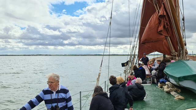
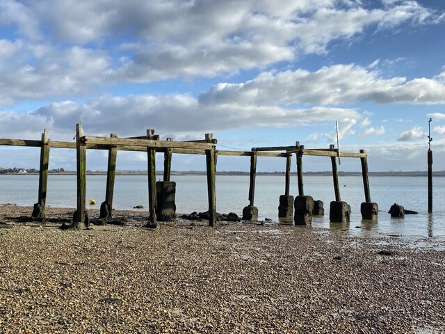
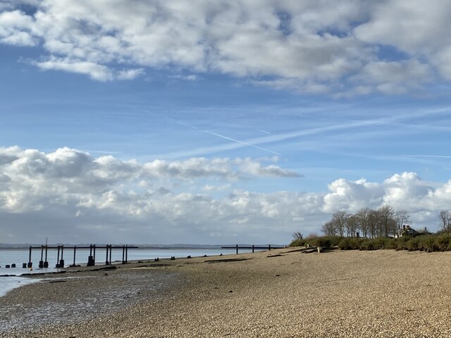
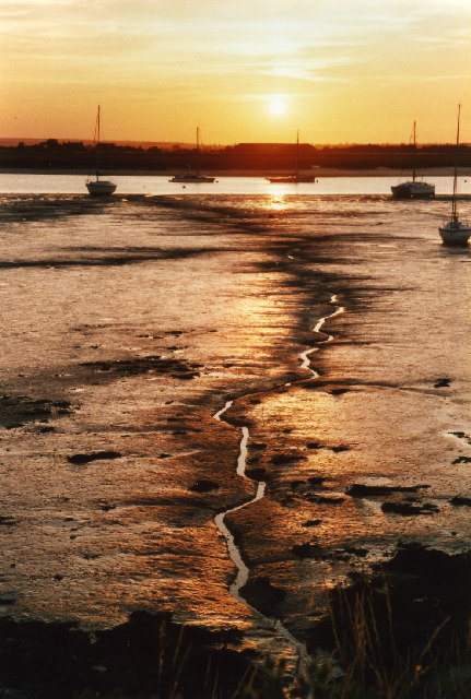
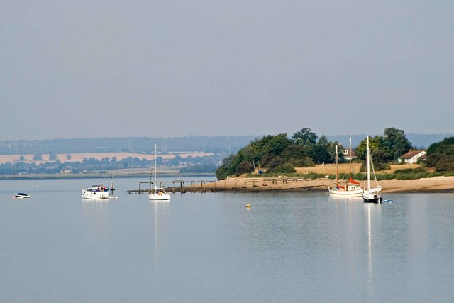
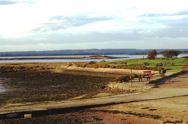
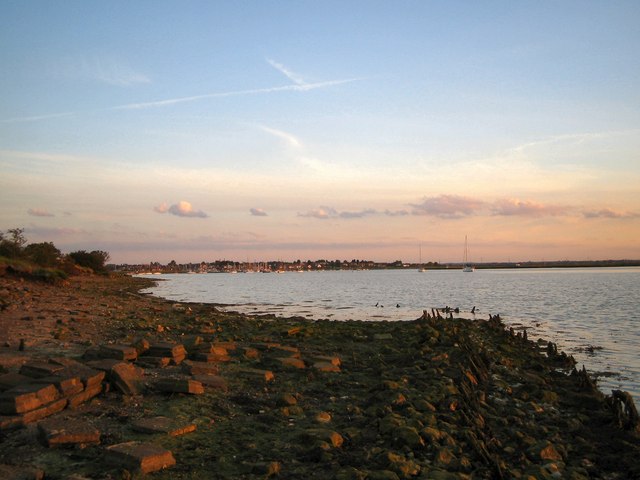
Mundon Stone Point is a scenic coastal marsh and salt marsh located in Essex, England. Situated on the eastern coast of the county, this area is renowned for its natural beauty and wildlife.

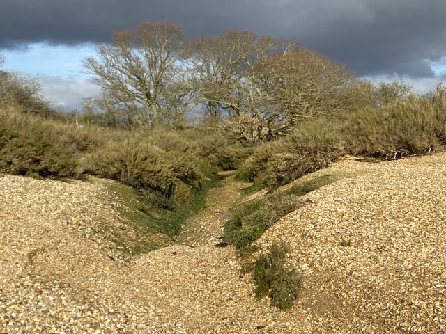
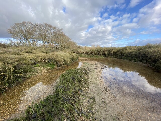
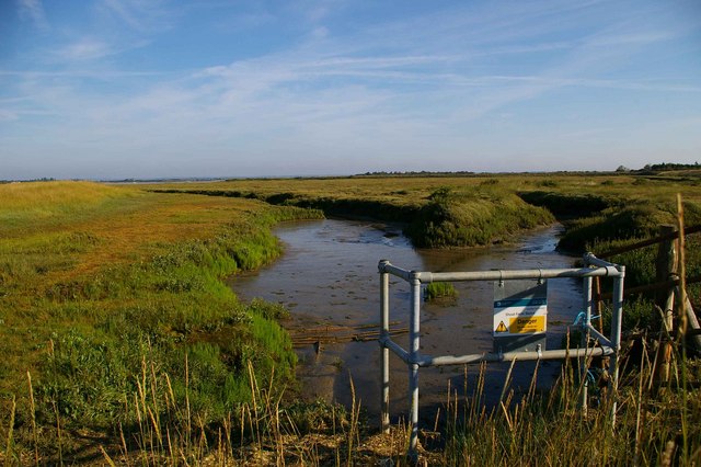
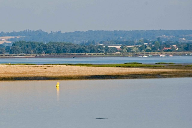
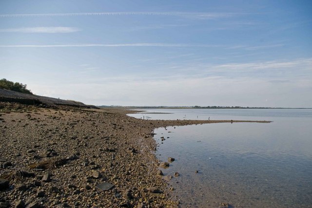
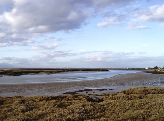
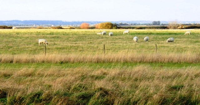
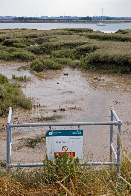
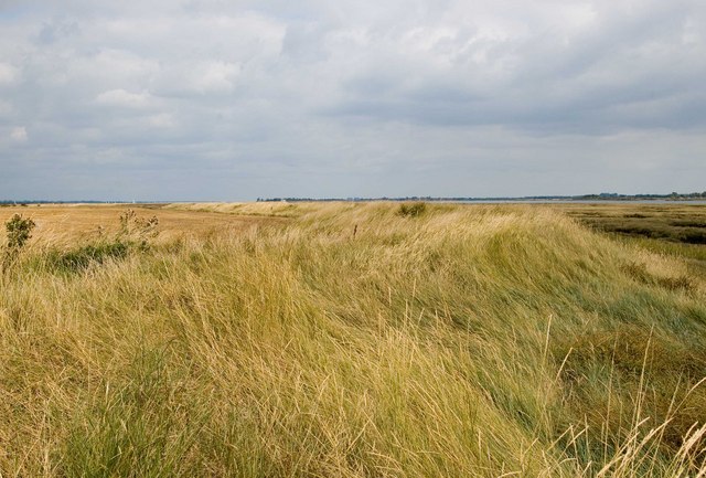
Covering an area of approximately 100 acres, Mundon Stone Point is characterized by its vast expanse of marshland and saltings. The marshes are composed of a mixture of mudflats, saltmarsh, and tidal creeks, which provide a rich and diverse habitat for numerous species of plants and animals.

The saltmarshes in Mundon Stone Point are dominated by plants such as sea lavender, samphire, and cord grass. These vegetation species are highly adapted to the saline conditions and play a crucial role in maintaining the stability of the marshes.

The area is also home to a wide variety of bird species, making it a popular destination for birdwatchers and nature enthusiasts. Common sightings include wading birds such as curlew, redshank, and avocet, as well as raptors like the marsh harrier.

Mundon Stone Point is an important site for conservation and is protected as a Site of Special Scientific Interest (SSSI). This designation ensures the preservation of the unique ecosystem and the fragile balance it supports.

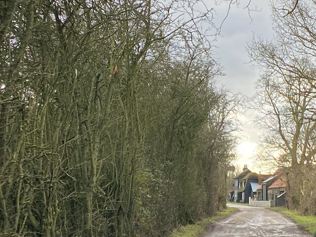
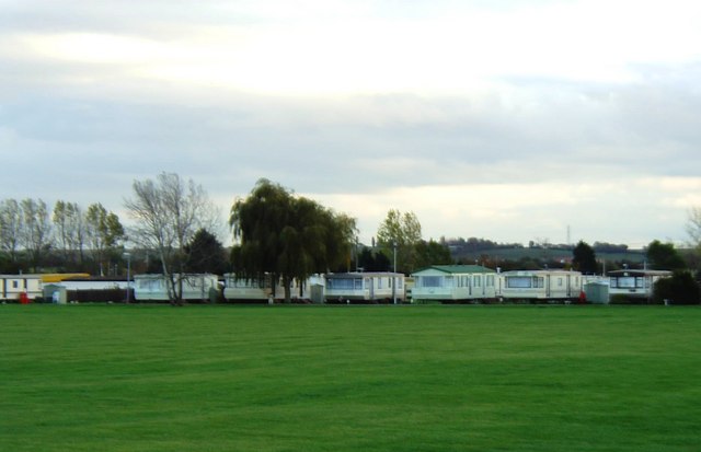
Visitors to Mundon Stone Point can enjoy picturesque walks along the coastal paths that wind through the marshes, offering stunning views of the surrounding landscape. The area is a haven for photographers, with opportunities to capture breathtaking shots of the marshes, the estuary, and the wildlife that calls this place home.

If you have any feedback on the listing, please let us know in the comments section below.

Mundon Stone Point Images

Images are sourced within 2km of 51.708165/0.76995388 or Grid Reference TL9104. Thanks to Geograph Open Source API. All images are credited.

Mid River Blackwater
Ruined landing stage, Osea Island This is near the Manor House on the southern side of the island and is on the main channel of the River Blackwater. The white building on the mainland which can just be seen through the leftmost gap in the pier, is Stansgate Abbey, the home of the  late Tony Benn. Osea Island is private and the shot was taken while staying on the island to celebrate a friend's birthday.
Ruined landing stage, Osea Island
This is near the Manor House on the southern side of the island and is on the main channel of the River Blackwater. The white building on the mainland which can just be seen through the leftmost gap in the pier, is Stansgate Abbey, the home of the late Tony Benn. Osea Island is private and the shot was taken while staying on the island to celebrate a friend's birthday.
Ruined pier/landing stage Osea Island The nomenclature varies according to which OS map you look at. See <a href="https://www.geograph.org.uk/photo/7392916">TL9105 : Ruined landing stage, Osea Island</a> for further details.
Ruined pier/landing stage Osea Island
The nomenclature varies according to which OS map you look at. See TL9105 : Ruined landing stage, Osea Island for further details.
Overgrown shingle banks near East Point, Osea Island These banks are stable (for now) being behind the island's earlier sea defences.
Osea Island is private; photo taken while staying on the island to celebrate a friend's birthday.
Overgrown shingle banks near East Point, Osea Island
These banks are stable (for now) being behind the island's earlier sea defences. Osea Island is private; photo taken while staying on the island to celebrate a friend's birthday.
On The Chase, Osea Island The Chase is the track from the causeway to the area of Osea Farm and on to the Manor House. Here I am approaching the area of farm buildings and cottages.
Osea is a private Island; the photo taken while staying on the island for a friend's birthday celebrations.
On The Chase, Osea Island
The Chase is the track from the causeway to the area of Osea Farm and on to the Manor House. Here I am approaching the area of farm buildings and cottages. Osea is a private Island; the photo taken while staying on the island for a friend's birthday celebrations.
Channel near East Point, Osea Island An interesting area of shingly saltmarsh at the eastern end of the island.
Channel near East Point, Osea Island
An interesting area of shingly saltmarsh at the eastern end of the island.
Sunset over Lawling Creek
Shoat Farm Sluice This sluice north of Steeple village looks over Steeple Creek
Shoat Farm Sluice
This sluice north of Steeple village looks over Steeple Creek
Osea Island Jetty This is the jetty on Osea Island <span class="nowrap"><a title="http://www.oseaisland.co.uk/" rel="nofollow ugc noopener" href="http://www.oseaisland.co.uk/">Link</a><img style="margin-left:2px;" alt="External link" title="External link - shift click to open in new window" src="https://s1.geograph.org.uk/img/external.png" width="10" height="10"/></span> it is a privately owned island in the River Blackwater.
Osea Island Jetty
This is the jetty on Osea Island LinkExternal link it is a privately owned island in the River Blackwater.
East of Osea This is the eastern end of Osea Island where the sandy area transforms to the saltmarsh of East Point
East of Osea
This is the eastern end of Osea Island where the sandy area transforms to the saltmarsh of East Point
Blackwater Beach This is the pebble beach on the Blackwater to the west of Stansgate Abbey Farm
Blackwater Beach
This is the pebble beach on the Blackwater to the west of Stansgate Abbey Farm
Mayland Creek Taken from the footpath on the eastern side of the creek looking north-west.
Mayland Creek
Taken from the footpath on the eastern side of the creek looking north-west.
Mundon Stone Point The water in the centre of the picture is Lawling Creek and the spit of land projecting into it is Mundon Stone Point. Taken from the northern end of Mayland Creek whose waters can just be made out in the bottom left of the picture.
Mundon Stone Point
The water in the centre of the picture is Lawling Creek and the spit of land projecting into it is Mundon Stone Point. Taken from the northern end of Mayland Creek whose waters can just be made out in the bottom left of the picture.
Steeple Bay Holiday Park, Steeple Steeple Bay is a caravan and camping site situated on the south bank of the River Blackwater.
Steeple Bay Holiday Park, Steeple
Steeple Bay is a caravan and camping site situated on the south bank of the River Blackwater.
Grazing land at Steeple Hall, near Steeple Most of the gridsquare is used as grazing land. Taken from beside an inlet of Mayland Creek.
Grazing land at Steeple Hall, near Steeple
Most of the gridsquare is used as grazing land. Taken from beside an inlet of Mayland Creek.
South-side of the Entrance to Lawling Creek, Maylandsea South-side of the entrance to Lawling Creek, with remains of old seawall in foreground, looking towards the village of Maylandsea.
South-side of the Entrance to Lawling Creek, Maylandsea
South-side of the entrance to Lawling Creek, with remains of old seawall in foreground, looking towards the village of Maylandsea.
Brick House #6 Brick House #6 sluice drains into Lawling Creek on the River Blackwater
Brick House #6
Brick House #6 sluice drains into Lawling Creek on the River Blackwater
Footpath to Maldon This is the seawall at Lawling Creek looking towards the River Blackwater. Keep on walking and you will arrive at Maldon.
Footpath to Maldon
This is the seawall at Lawling Creek looking towards the River Blackwater. Keep on walking and you will arrive at Maldon.
Show me another place!

Mundon Stone Point is located at Grid Ref: TL9104 (Lat: 51.708165, Lng: 0.76995388)

Administrative County: Essex

District: Maldon

Police Authority: Essex

What 3 Words

///senior.unionists.organist. Near Mayland, Essex

Related Wikis

Osea Island

Osea Island (Old English: Ōsgȳþes īeg, "Osyth's island"), formerly also Osey, is an inhabited island in the estuary of the River Blackwater, Essex, East...

Blackwater Estuary

The Blackwater Estuary is the estuary of the River Blackwater between Maldon and West Mersea in Essex. It is a 5,538 hectare biological Site of Special...

Maylandsea

Maylandsea, and the adjacent Mayland, are villages on the Dengie Peninsula in the English county of Essex. They are part of the Althorne ward of the Maldon...

Steeple, Essex

Steeple is a village on the Dengie Peninsula in Essex, England. It is situated just east of Maylandsea and Mayland, on the southern side of the River Blackwater...

Nearby Amenities

Located within 500m of 51.708165,0.76995388
Mundon Stone Point
Place: locality
Lat/Long: 51.7082139/0.7694454
Bench
Lat/Long: 51.7042813/0.7733613
The data included in this document is from www.openstreetmap.org. The data is made available under ODbL.

Have you been to Mundon Stone Point?

Leave your review of Mundon Stone Point below (or comments, questions and feedback).