Diggs Marshes
Coastal Marsh, Saltings in Kent Swale
England
Diggs Marshes

Diggs Marshes is a coastal marsh located in Kent, England. Covering an area of approximately 700 acres, this unique natural habitat is made up of a combination of salt marshes and saltings. The marshes are situated along the coast, providing a crucial buffer zone between the land and the sea.
The marshes are home to a diverse range of plant and animal species that have adapted to the saline conditions. Common flora found in Diggs Marshes include sea lavender, sea purslane, and samphire. These plants provide food and shelter for a variety of bird species, such as redshanks, oystercatchers, and dunlins.
In addition to its ecological importance, Diggs Marshes also plays a key role in coastal protection. The marshes act as a natural barrier against erosion and flooding, helping to maintain the stability of the coastline.
Visitors to Diggs Marshes can enjoy walking trails and birdwatching opportunities, taking in the tranquil beauty of this coastal wetland. The marshes are a designated Site of Special Scientific Interest, recognizing their significance for wildlife conservation and habitat preservation.
If you have any feedback on the listing, please let us know in the comments section below.
Diggs Marshes Images
Images are sourced within 2km of 51.424375/0.75280918 or Grid Reference TQ9173. Thanks to Geograph Open Source API. All images are credited.


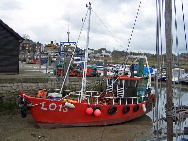
![Sheppey - Queenborough - Lampposts at harbour entrance Lampposts adorn each side of the entrance to the slipway that leads into the harbour at the historic town of Queenborough on the Isle of Sheppey. This entrance is at the western end of the High Street through the small town (popn. 3,407 [2001]) opposite The Old House at Home pub.](https://s1.geograph.org.uk/geophotos/07/39/27/7392717_11249e56.jpg)


Diggs Marshes is located at Grid Ref: TQ9173 (Lat: 51.424375, Lng: 0.75280918)
Administrative County: Kent
District: Swale
Police Authority: Kent
What 3 Words
///waving.zoos.sparrows. Near Queenborough, Kent
Nearby Locations
Related Wikis
Queenborough
Queenborough is a town on the Isle of Sheppey in the Swale borough of Kent in South East England. Queenborough is two miles (3 km) south of Sheerness....
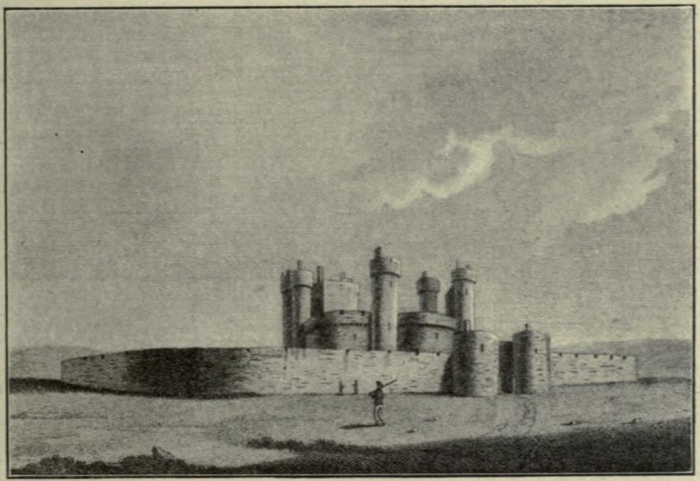
Queenborough Castle
Queenborough Castle, also known as Sheppey Castle, is a 14th-century castle, the remnants of which are in the town of Queenborough on the Isle of Sheppey...
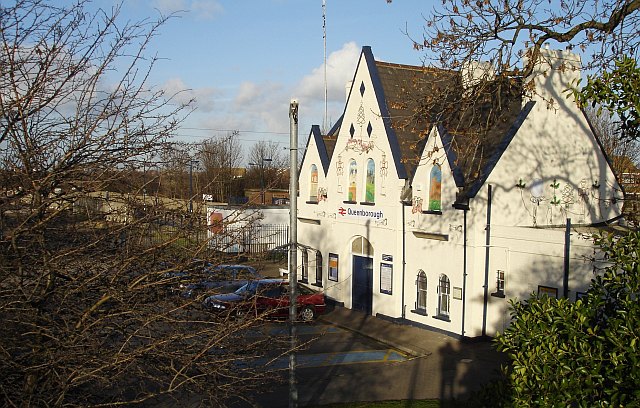
Queenborough railway station
Queenborough railway station is on the Sheerness Line, on the Isle of Sheppey in northern Kent, and serves the town of Queenborough. It is 49 miles 22...

Queenborough Guildhall
Queenborough Guildhall is a former municipal building in the High Street in Queenborough, Kent, England. The structure, which is currently used as a museum...
Nearby Amenities
Located within 500m of 51.424375,0.75280918Have you been to Diggs Marshes?
Leave your review of Diggs Marshes below (or comments, questions and feedback).