Lawling Creek

Sea, Estuary, Creek in Essex Maldon

England

Lawling Creek

Ruined landing stage, Osea Island This is near the Manor House on the southern side of the island and is on the main channel of the River Blackwater. The white building on the mainland which can just be seen through the leftmost gap in the pier, is Stansgate Abbey, the home of the  late Tony Benn. Osea Island is private and the shot was taken while staying on the island to celebrate a friend's birthday.
Ruined landing stage, Osea Island Credit: Trevor Harris

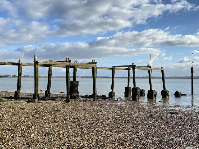
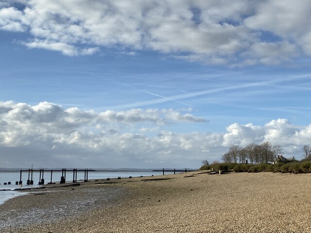
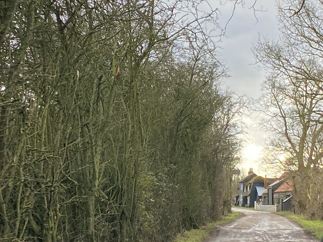
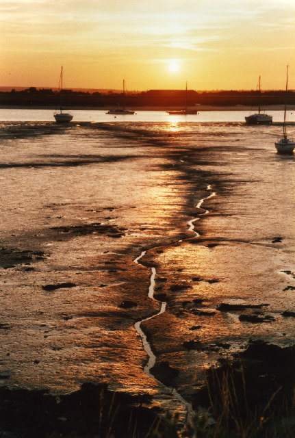
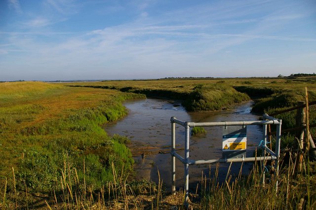
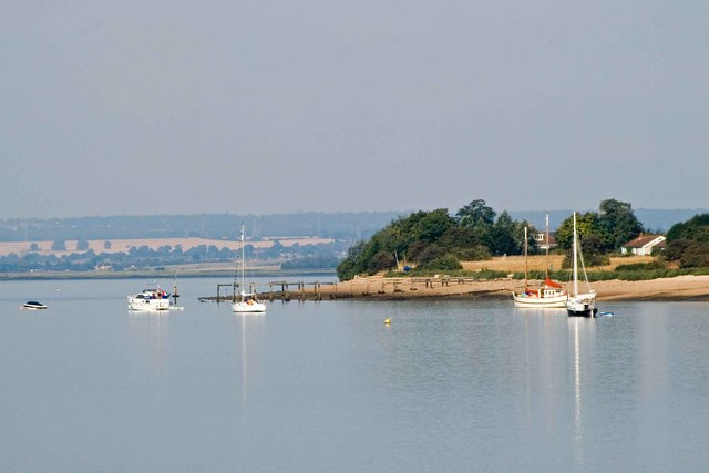
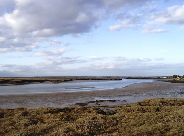
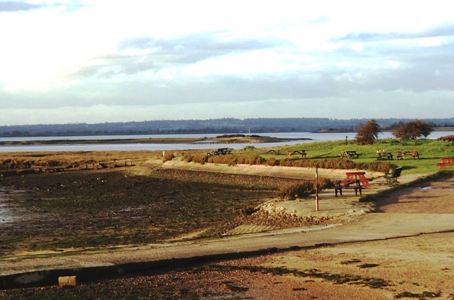
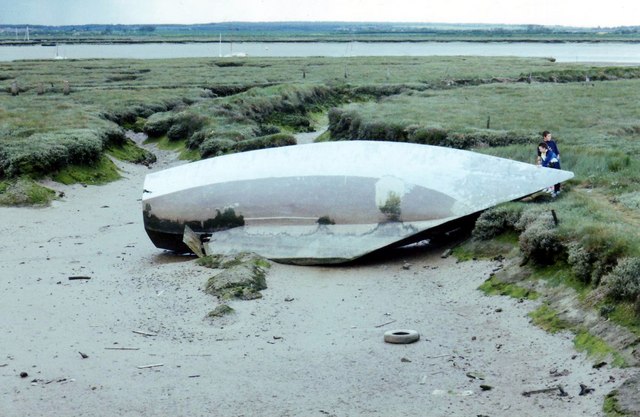
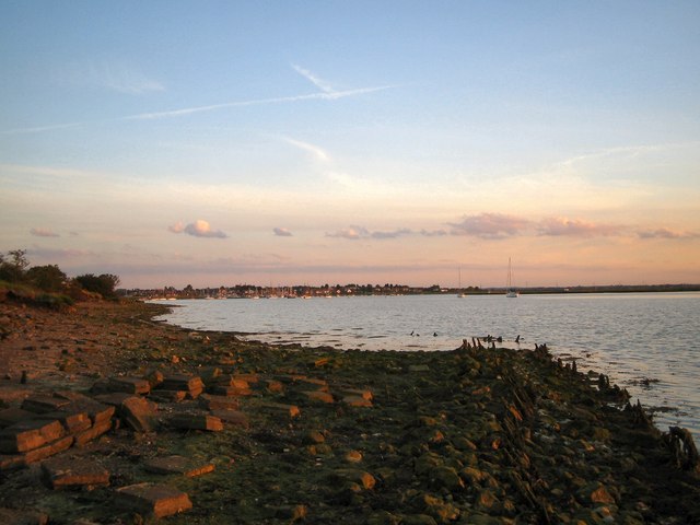
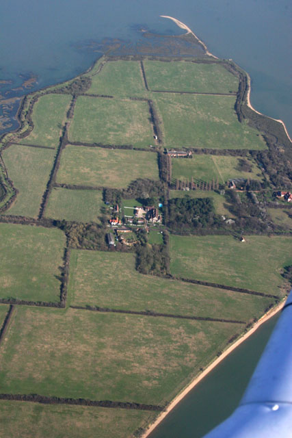
Lawling Creek is a picturesque estuary located in the county of Essex, England. Situated on the east coast, it stretches from the North Sea into the mainland, forming a narrow creek that meanders through the beautiful surrounding countryside. The creek is known for its tranquil and idyllic atmosphere, attracting visitors seeking a peaceful retreat.

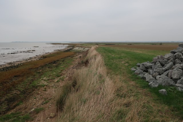
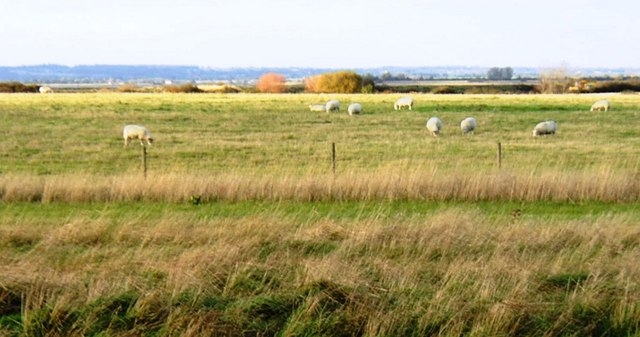
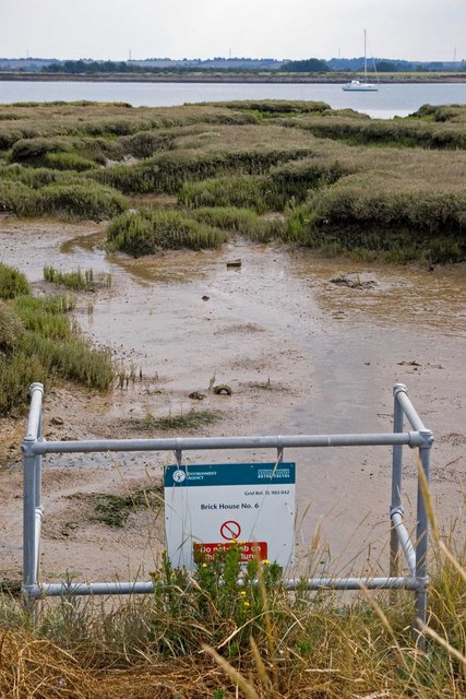
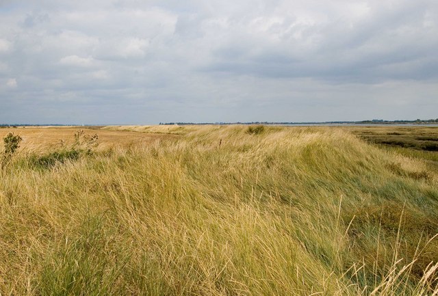
The creek is fed by several smaller streams and rivers that flow into it, resulting in a diverse ecosystem with abundant wildlife. It is a haven for a variety of bird species, including herons, egrets, and gulls, making it a popular spot for birdwatchers and nature enthusiasts. The surrounding marshlands provide a rich habitat for various plant species, creating a visually stunning landscape.

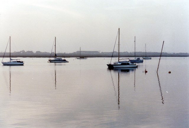
Lawling Creek is also notable for its historical significance. It has played a crucial role in the maritime trade of the region, serving as a vital transportation route for centuries. The creek was once bustling with fishing boats and cargo vessels, contributing to the local economy. While the commercial activities have diminished over time, the creek still retains its charm and significance as a cultural heritage site.

The estuary is accessible by footpaths and offers several recreational activities. Visitors can enjoy leisurely walks along the creek, appreciating the stunning views and the serenity of the surroundings. Boating and kayaking are also popular pastimes, allowing people to explore the creek's meandering channels and discover hidden gems along the way.

Lawling Creek, with its natural beauty and historical significance, offers a unique experience for those seeking a tranquil escape and a chance to connect with nature.

If you have any feedback on the listing, please let us know in the comments section below.

Lawling Creek Images

Images are sourced within 2km of 51.705968/0.76851686 or Grid Reference TL9104. Thanks to Geograph Open Source API. All images are credited.

Ruined landing stage, Osea Island This is near the Manor House on the southern side of the island and is on the main channel of the River Blackwater. The white building on the mainland which can just be seen through the leftmost gap in the pier, is Stansgate Abbey, the home of the  late Tony Benn. Osea Island is private and the shot was taken while staying on the island to celebrate a friend's birthday.
Ruined landing stage, Osea Island
This is near the Manor House on the southern side of the island and is on the main channel of the River Blackwater. The white building on the mainland which can just be seen through the leftmost gap in the pier, is Stansgate Abbey, the home of the late Tony Benn. Osea Island is private and the shot was taken while staying on the island to celebrate a friend's birthday.
Ruined pier/landing stage Osea Island The nomenclature varies according to which OS map you look at. See <a href="https://www.geograph.org.uk/photo/7392916">TL9105 : Ruined landing stage, Osea Island</a> for further details.
Ruined pier/landing stage Osea Island
The nomenclature varies according to which OS map you look at. See TL9105 : Ruined landing stage, Osea Island for further details.
On The Chase, Osea Island The Chase is the track from the causeway to the area of Osea Farm and on to the Manor House. Here I am approaching the area of farm buildings and cottages.
Osea is a private Island; the photo taken while staying on the island for a friend's birthday celebrations.
On The Chase, Osea Island
The Chase is the track from the causeway to the area of Osea Farm and on to the Manor House. Here I am approaching the area of farm buildings and cottages. Osea is a private Island; the photo taken while staying on the island for a friend's birthday celebrations.
Sea wall repairs by Southey Creek
Sunset over Lawling Creek
Shoat Farm Sluice This sluice north of Steeple village looks over Steeple Creek
Shoat Farm Sluice
This sluice north of Steeple village looks over Steeple Creek
Osea Island Jetty This is the jetty on Osea Island <span class="nowrap"><a title="http://www.oseaisland.co.uk/" rel="nofollow ugc noopener" href="http://www.oseaisland.co.uk/">Link</a><img style="margin-left:2px;" alt="External link" title="External link - shift click to open in new window" src="https://s1.geograph.org.uk/img/external.png" width="10" height="10"/></span> it is a privately owned island in the River Blackwater.
Osea Island Jetty
This is the jetty on Osea Island LinkExternal link it is a privately owned island in the River Blackwater.
Mayland Creek Taken from the footpath on the eastern side of the creek looking north-west.
Mayland Creek
Taken from the footpath on the eastern side of the creek looking north-west.
Mundon Stone Point The water in the centre of the picture is Lawling Creek and the spit of land projecting into it is Mundon Stone Point. Taken from the northern end of Mayland Creek whose waters can just be made out in the bottom left of the picture.
Mundon Stone Point
The water in the centre of the picture is Lawling Creek and the spit of land projecting into it is Mundon Stone Point. Taken from the northern end of Mayland Creek whose waters can just be made out in the bottom left of the picture.
Steeple Bay Holiday Park, Steeple Steeple Bay is a caravan and camping site situated on the south bank of the River Blackwater.
Steeple Bay Holiday Park, Steeple
Steeple Bay is a caravan and camping site situated on the south bank of the River Blackwater.
Grazing land at Steeple Hall, near Steeple Most of the gridsquare is used as grazing land. Taken from beside an inlet of Mayland Creek.
Grazing land at Steeple Hall, near Steeple
Most of the gridsquare is used as grazing land. Taken from beside an inlet of Mayland Creek.
Lighters Lighters moored in Mundon Creek opposite Maylandsea
Lighters
Lighters moored in Mundon Creek opposite Maylandsea
The calm after the storm in Mundon Creek These are the calm waters after a terrific storm in 1998. It left one boat embedded in the sea wall further along. Can you spot the one that sunk?
The calm after the storm in Mundon Creek
These are the calm waters after a terrific storm in 1998. It left one boat embedded in the sea wall further along. Can you spot the one that sunk?
Saltmarshes at Mundon Creek The hull of this boat has lain in this spot on the saltmarsh for many years. It must have been damaged before it was built. The area is used by many wading birds for feeding.
Saltmarshes at Mundon Creek
The hull of this boat has lain in this spot on the saltmarsh for many years. It must have been damaged before it was built. The area is used by many wading birds for feeding.
South-side of the Entrance to Lawling Creek, Maylandsea South-side of the entrance to Lawling Creek, with remains of old seawall in foreground, looking towards the village of Maylandsea.
South-side of the Entrance to Lawling Creek, Maylandsea
South-side of the entrance to Lawling Creek, with remains of old seawall in foreground, looking towards the village of Maylandsea.
Brick House #6 Brick House #6 sluice drains into Lawling Creek on the River Blackwater
Brick House #6
Brick House #6 sluice drains into Lawling Creek on the River Blackwater
Footpath to Maldon This is the seawall at Lawling Creek looking towards the River Blackwater. Keep on walking and you will arrive at Maldon.
Footpath to Maldon
This is the seawall at Lawling Creek looking towards the River Blackwater. Keep on walking and you will arrive at Maldon.
Osea Island Taken from a Cherokee from Southend Flying Club
Osea Island
Taken from a Cherokee from Southend Flying Club
Show me another place!

Lawling Creek is located at Grid Ref: TL9104 (Lat: 51.705968, Lng: 0.76851686)

Administrative County: Essex

District: Maldon

Police Authority: Essex

What 3 Words

///tastings.modern.snowboard. Near Mayland, Essex

Related Wikis

Osea Island

Osea Island (Old English: Ōsgȳþes īeg, "Osyth's island"), formerly also Osey, is an inhabited island in the estuary of the River Blackwater, Essex, East...
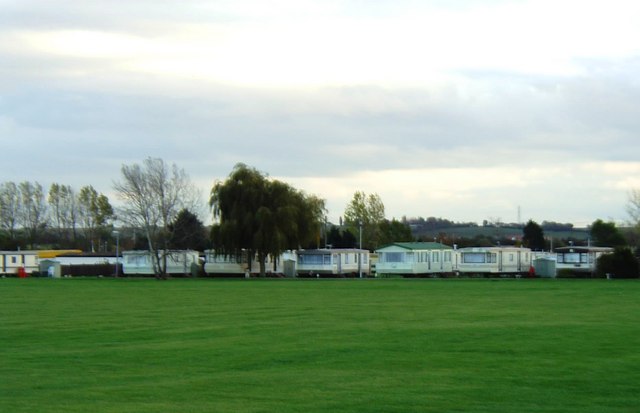
Maylandsea

Maylandsea, and the adjacent Mayland, are villages on the Dengie Peninsula in the English county of Essex. They are part of the Althorne ward of the Maldon...

Blackwater Estuary

The Blackwater Estuary is the estuary of the River Blackwater between Maldon and West Mersea in Essex. It is a 5,538 hectare biological Site of Special...

Steeple, Essex

Steeple is a village on the Dengie Peninsula in Essex, England. It is situated just east of Maylandsea and Mayland, on the southern side of the River Blackwater...

Nearby Amenities

Located within 500m of 51.705968,0.76851686
Mundon Stone Point
Place: locality
Lat/Long: 51.7082139/0.7694454
Bench
Lat/Long: 51.7042813/0.7733613
The data included in this document is from www.openstreetmap.org. The data is made available under ODbL.

Have you been to Lawling Creek?

Leave your review of Lawling Creek below (or comments, questions and feedback).