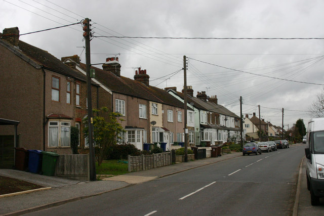
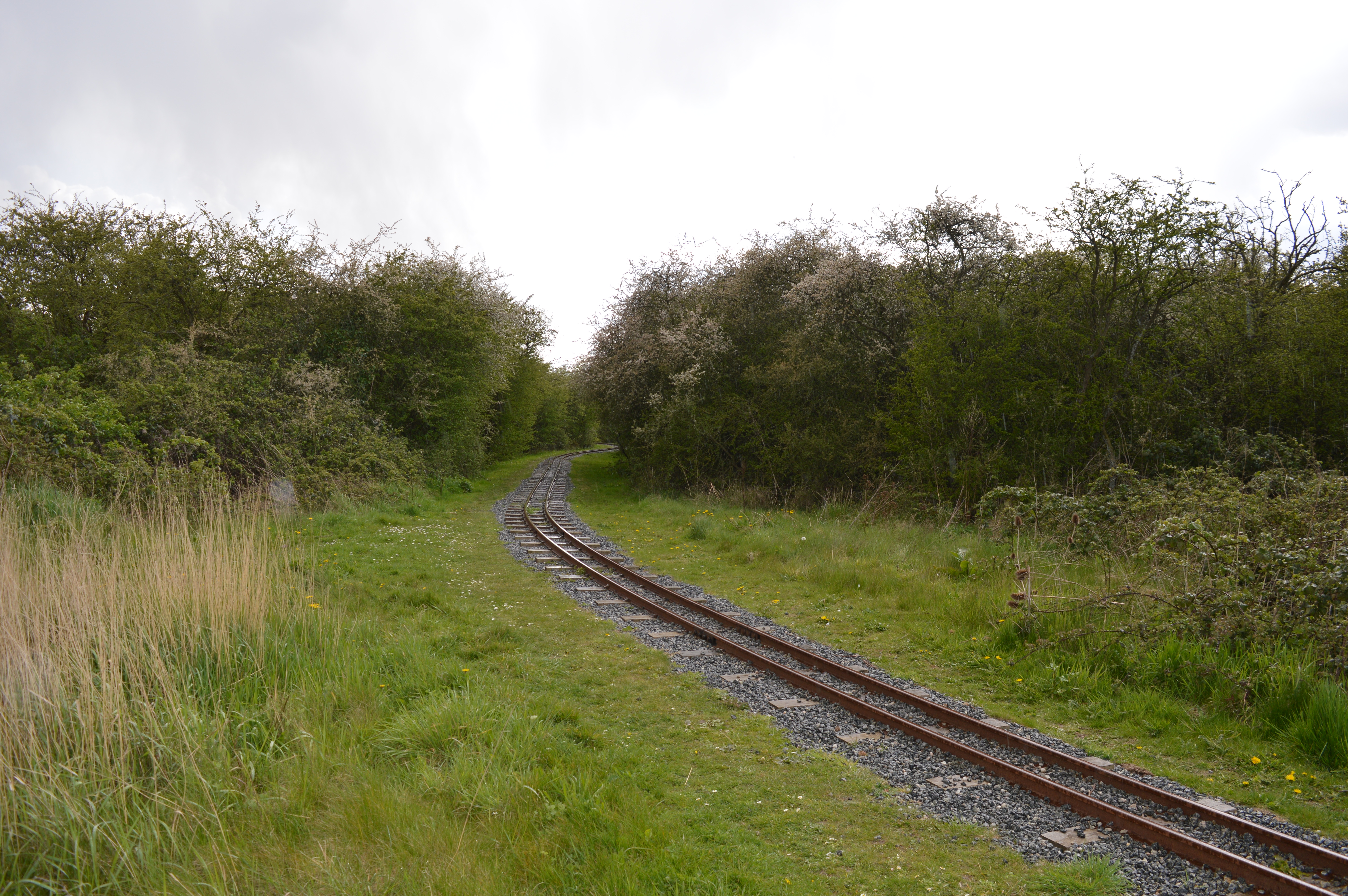
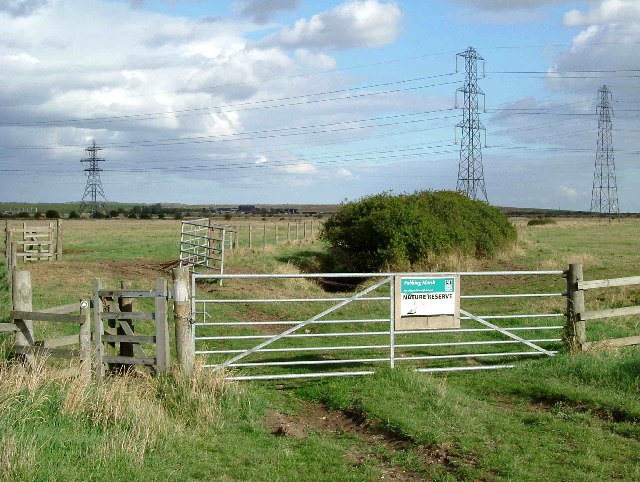
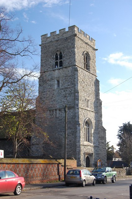
Vange Marshes

Coastal Marsh, Saltings in Essex Basildon

England

Vange Marshes

View towards Fobbing Marshes Looking towards Fobbing marshes from St Michael's churchyard in Fobbing.
View towards Fobbing Marshes Credit: Adrian Benn

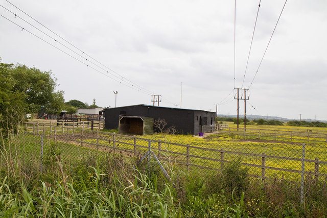
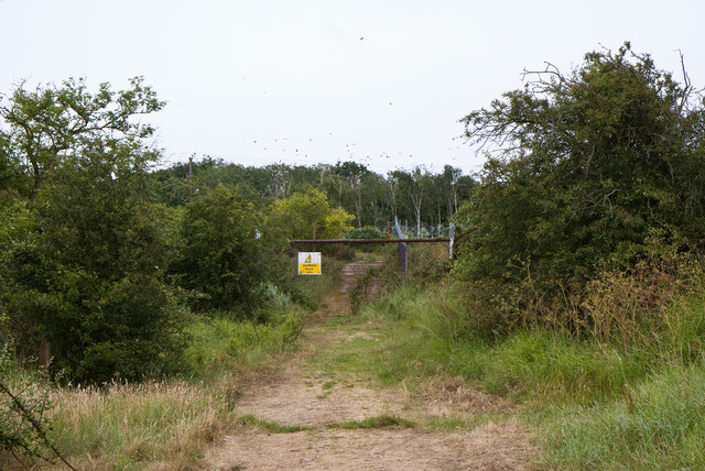
Vange Marshes is a coastal marshland located in Essex, England. Covering an area of approximately 1,500 acres, it is a significant natural reserve known for its diverse range of flora and fauna.

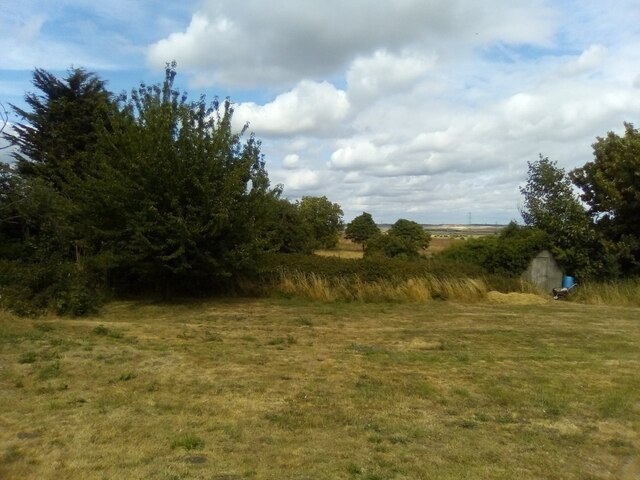
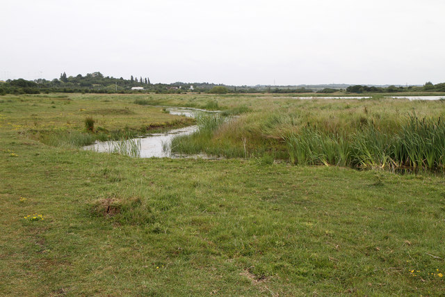
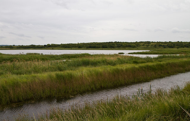
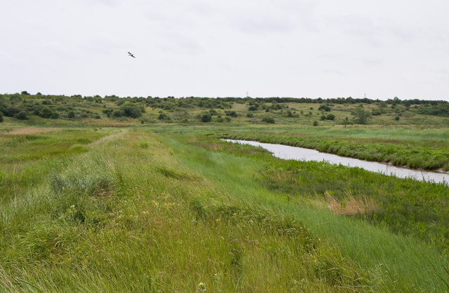
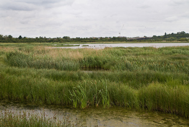
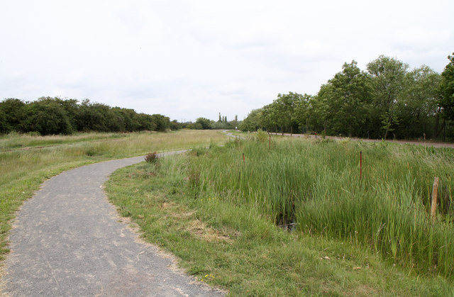
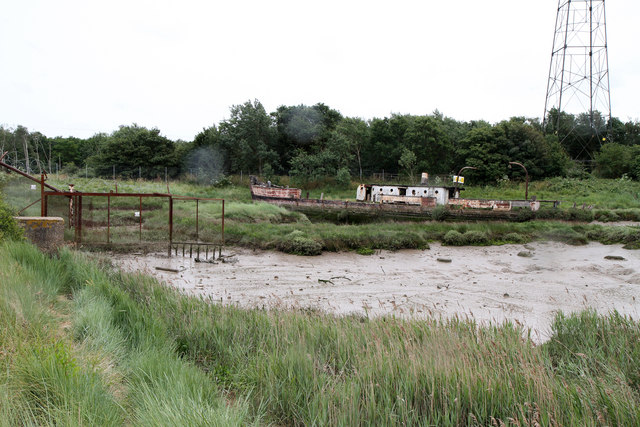
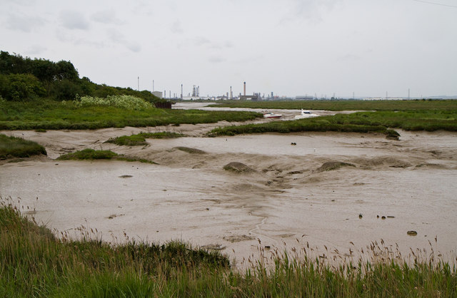
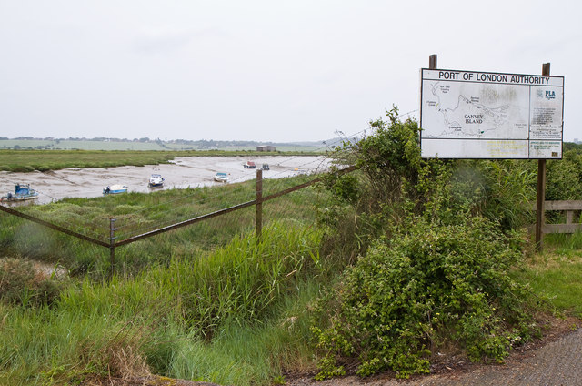
Situated near the River Thames estuary, Vange Marshes is characterized by large expanses of salt marshes and saltings. These marshes are formed by the deposition of sediment carried by tidal waters, creating a unique and ever-changing landscape. The area is predominantly flat, with a network of channels and creeks that are influenced by the tides.

The marshes are home to a rich variety of plant life, including saltmarsh grasses such as cordgrass and sea lavender. These plants have adapted to the saline conditions and play a crucial role in stabilizing the marshland and providing habitats for numerous species of birds and insects.

Vange Marshes is renowned for its importance as a breeding ground and feeding site for various bird species. It serves as a vital stopover point for migratory birds, offering them a place to rest and refuel during their long journeys. Visitors can spot a wide range of birds, including waders like avocets, redshanks, and dunlins, as well as birds of prey such as marsh harriers and peregrine falcons.

The reserve is managed by the Royal Society for the Protection of Birds (RSPB) and provides excellent opportunities for birdwatching and nature conservation. Additionally, there are several walking trails and observation points that allow visitors to explore the marshes and appreciate the unique beauty of this coastal habitat.

If you have any feedback on the listing, please let us know in the comments section below.

Vange Marshes Images

Images are sourced within 2km of 51.544146/0.49432485 or Grid Reference TQ7385. Thanks to Geograph Open Source API. All images are credited.

View towards Fobbing Marshes Looking towards Fobbing marshes from St Michael's churchyard in Fobbing.
View towards Fobbing Marshes
Looking towards Fobbing marshes from St Michael's churchyard in Fobbing.
St Chad's Church, Vange, Basildon
Pitsea Hall Lane Looking across the Tilbury Loop level crossing towards the Watt Tyler centre and South Essex Marshes Nature Reserve.  Pitsea Station car park is on the left.
Pitsea Hall Lane
Looking across the Tilbury Loop level crossing towards the Watt Tyler centre and South Essex Marshes Nature Reserve. Pitsea Station car park is on the left.
Tilbury Loop Line Seen from the foot crossing to Vange Marshes.  Looking towards Pitsea Station.
Tilbury Loop Line
Seen from the foot crossing to Vange Marshes. Looking towards Pitsea Station.
Vange Marshes Nature Reserve An RSPB reserve to the southwest of Pitsea providing precious wetland for birds and other wildlife.  Vange Marsh is a mosaic of wetland habitats with a mix of fresh and saltwater lagoons.   Amongst the more common species present on the day of our visit rarer species such as Avocet, Garganey and Spoonbill were observed.   Two mounds on the left bank of the ditch are view points provided for bird watching by the RSPB.  In the distance, on the wooded hill, the tower of the demolished Pitsea Church can be seen.
Vange Marshes Nature Reserve
An RSPB reserve to the southwest of Pitsea providing precious wetland for birds and other wildlife. Vange Marsh is a mosaic of wetland habitats with a mix of fresh and saltwater lagoons. Amongst the more common species present on the day of our visit rarer species such as Avocet, Garganey and Spoonbill were observed. Two mounds on the left bank of the ditch are view points provided for bird watching by the RSPB. In the distance, on the wooded hill, the tower of the demolished Pitsea Church can be seen.
Vange Marshes Nature Reserve An RSPB reserve to the southwest of Pitsea providing precious wetland for birds and other wildlife. Vange Marsh is a mosaic of wetland habitats with a mix of fresh and saltwater lagoons. Amongst the more common species present on the day of our visit rarer species such as Avocet, Garganey and Spoonbill were observed.
Vange Marshes Nature Reserve
An RSPB reserve to the southwest of Pitsea providing precious wetland for birds and other wildlife. Vange Marsh is a mosaic of wetland habitats with a mix of fresh and saltwater lagoons. Amongst the more common species present on the day of our visit rarer species such as Avocet, Garganey and Spoonbill were observed.
Vange Marshes Nature Reserve An RSPB reserve to the southwest of Pitsea providing precious wetland for birds and other wildlife. Vange Marsh is a mosaic of wetland habitats with a mix of fresh and saltwater lagoons. Amongst the more common species present on the day of our visit rarer species such as Avocet, Garganey and Spoonbill were observed.

This shot is taken from the southwestern limit of public access to the reserve and looks along the dyke separating the freshwater lagoons from an arm of the tidal Vange Creek (on the right).
Vange Marshes Nature Reserve
An RSPB reserve to the southwest of Pitsea providing precious wetland for birds and other wildlife. Vange Marsh is a mosaic of wetland habitats with a mix of fresh and saltwater lagoons. Amongst the more common species present on the day of our visit rarer species such as Avocet, Garganey and Spoonbill were observed. This shot is taken from the southwestern limit of public access to the reserve and looks along the dyke separating the freshwater lagoons from an arm of the tidal Vange Creek (on the right).
Vange Marshes A view across the marshes from the southwestern limit of public access.   The flyover in the distance carries the A13 over the Fenchurch Street to Shoeburyness railway line.
Vange Marshes
A view across the marshes from the southwestern limit of public access. The flyover in the distance carries the A13 over the Fenchurch Street to Shoeburyness railway line.
Stables and Powerlines A stable block of the Essex Horse and Pony Protection Society nestling between two low voltage electricity supply lines.   The society provides a rescue service for animals suffering cruelty or abuse 365 days of the year.   Details of their work can be found at <span class="nowrap"><a title="http://www.ehpps.org.uk/" rel="nofollow ugc noopener" href="http://www.ehpps.org.uk/">Link</a><img style="margin-left:2px;" alt="External link" title="External link - shift click to open in new window" src="https://s1.geograph.org.uk/img/external.png" width="10" height="10"/></span> .
Stables and Powerlines
A stable block of the Essex Horse and Pony Protection Society nestling between two low voltage electricity supply lines. The society provides a rescue service for animals suffering cruelty or abuse 365 days of the year. Details of their work can be found at LinkExternal link .
Beside Pitsea Hall Lane A view of the footpath that leads from the Wat Tyler Country Park towards the station and the town of Pitsea.   out of sight behind the trees on the left is a sewage works.   Pitsea Hall Lane is on the right.
Beside Pitsea Hall Lane
A view of the footpath that leads from the Wat Tyler Country Park towards the station and the town of Pitsea. out of sight behind the trees on the left is a sewage works. Pitsea Hall Lane is on the right.
Progression A sculpture by Michael Condron.   It was commissioned by Basildon District Council for the town square.  Dating to 2001, it was relocated to the Wat Tyler Country Park in 2005 where it stands beside Pitsea Hall Lane outside the building gthat housed the Motorboat Museum (closed in 2009).   It is constructed of electropolished stainless steel.   Unfortunately the railings distract from its appearance.
Progression
A sculpture by Michael Condron. It was commissioned by Basildon District Council for the town square. Dating to 2001, it was relocated to the Wat Tyler Country Park in 2005 where it stands beside Pitsea Hall Lane outside the building gthat housed the Motorboat Museum (closed in 2009). It is constructed of electropolished stainless steel. Unfortunately the railings distract from its appearance.
Level Crossing, Wat Tyler Country Park A 10¼ inch gauge railway operates in the park on weekends and school holidays - although it wasn't operating on this summer half-term.  The road sign on the left warns motorists of an ungated level crossing.
Level Crossing, Wat Tyler Country Park
A 10¼ inch gauge railway operates in the park on weekends and school holidays - although it wasn't operating on this summer half-term. The road sign on the left warns motorists of an ungated level crossing.
Closed Off Track This track used to connect Pitsea Wharf with other wharves , crossing between Vange Creek and Pitseahall Fleet on a dyke.   In this view, Vange creek is hidden on the right and Pitseahall Fleet on the left.   It is now fenced off to prevent access to Veolia's landfill site - some activity on which appears to have spooked the Rooks in the trees in the distance.   Veolia have set up a Pitsea Marshes Trust and have recently agreed a lease of Bowers Marsh to the RSPB as a nature reserve for 150 years at a peppercorn rent.
Closed Off Track
This track used to connect Pitsea Wharf with other wharves , crossing between Vange Creek and Pitseahall Fleet on a dyke. In this view, Vange creek is hidden on the right and Pitseahall Fleet on the left. It is now fenced off to prevent access to Veolia's landfill site - some activity on which appears to have spooked the Rooks in the trees in the distance. Veolia have set up a Pitsea Marshes Trust and have recently agreed a lease of Bowers Marsh to the RSPB as a nature reserve for 150 years at a peppercorn rent.
A Sad End Resting and rotting in Vange Creek and gradually becoming more like a mudbank than a vessel.   This is Trinity House Light Vessel LV 44, Newarp.   She was built in 1869 by C. Hill and Sons of Bristol.  Initially stationed outside Caernarvon Bay, she spent the majority of her service life at Newarp Station in the North Sea.  Decommissioned in 1945, she was sold to Erith Yacht Club where she served as a clubhouse.   She was subsequently bought by Pitsea Yacht Club.   She was grounded here on an exceptional high tide circa 1990.

Apologies for the rain-spots on the lens... it was tipping down by this stage of our stroll round the marshes.
A Sad End
Resting and rotting in Vange Creek and gradually becoming more like a mudbank than a vessel. This is Trinity House Light Vessel LV 44, Newarp. She was built in 1869 by C. Hill and Sons of Bristol. Initially stationed outside Caernarvon Bay, she spent the majority of her service life at Newarp Station in the North Sea. Decommissioned in 1945, she was sold to Erith Yacht Club where she served as a clubhouse. She was subsequently bought by Pitsea Yacht Club. She was grounded here on an exceptional high tide circa 1990. Apologies for the rain-spots on the lens... it was tipping down by this stage of our stroll round the marshes.
Vange Creek Looking across mudflats close to Pitsea Wharf.  The main creek is in the middle distance and beyond are the flarestacks and chimneys of Coryton Oil Refinery.
Vange Creek
Looking across mudflats close to Pitsea Wharf. The main creek is in the middle distance and beyond are the flarestacks and chimneys of Coryton Oil Refinery.
Vange Creek Looking upstream past the Port of London Authority sign.  The tide is out and the creek is mainly mudflats with the occasional gull and Oystercatcher braving the heavy rain to feed (notice the spots on the lens).   The map on the sign could be misleading to the casual visitor as it gives the impression that the land across the creek is Canvey Island.  In fact this is taken from Pitsea Wharf and we're looking towards Vange and Fobbing Marshes.
Vange Creek
Looking upstream past the Port of London Authority sign. The tide is out and the creek is mainly mudflats with the occasional gull and Oystercatcher braving the heavy rain to feed (notice the spots on the lens). The map on the sign could be misleading to the casual visitor as it gives the impression that the land across the creek is Canvey Island. In fact this is taken from Pitsea Wharf and we're looking towards Vange and Fobbing Marshes.
Visitor Centre The Wat Tyler Centre opened in Wat Tyler Country Park, Pitsea in July 2009.  The modern, visitor centre includes a café and facilities for business and private event hire.
Visitor Centre
The Wat Tyler Centre opened in Wat Tyler Country Park, Pitsea in July 2009. The modern, visitor centre includes a café and facilities for business and private event hire.
High Road, Fobbing Looking north with the houses on the west side.
High Road, Fobbing
Looking north with the houses on the west side.
Show me another place!

Vange Marshes is located at Grid Ref: TQ7385 (Lat: 51.544146, Lng: 0.49432485)

Administrative County: Essex

District: Basildon

Police Authority: Essex

What 3 Words

///silk.bubble.natively. Near Pitsea, Essex

Nearby Locations

Parting Gut Vange Marshes

Related Wikis

Wat Tyler Country Park

Wat Tyler Country Park is a country park located to the south of Pitsea, Essex within the area of Pitsea Marsh. The area was inhabited from the Bronze...

Fobbing Marsh

Fobbing Marsh is a 75.7-hectare (187-acre) nature reserve east of Fobbing in Essex. It is managed by the Essex Wildlife Trust.The site is mainly grazing...

South Basildon and East Thurrock (UK Parliament constituency)

South Basildon and East Thurrock is a constituency represented in the House of Commons of the UK Parliament since its 2010 creation by Stephen Metcalfe...

Pitsea waste management site

Pitsea waste management site is a large landfill site on the north side of the Thames estuary 0.7 miles (1.1 km) from Pitsea in Basildon, Essex. It is...

Pitsea Marsh

Pitsea Marsh is a 94.6-hectare (234-acre) Site of Special Scientific Interest in Pitsea in Essex. The southern half is the Wat Tyler Country Park, and...

Fobbing

Fobbing is a small village and former civil parish in Thurrock, Essex, England, and one of Thurrock's traditional (Church of England) parishes. It is between...

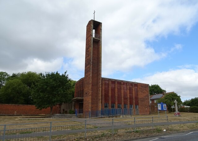
All Saints Church, Vange

All Saints Church is a redundant Anglican church in the former village of Vange, now part of the town of Basildon, Essex, England. It is recorded in the...

Vange and Fobbing Marshes

Vange and Fobbing Marshes are a 164.6-hectare (407-acre) biological Site of Special Scientific Interest in two areas south of Basildon in Essex. Vange...

Nearby Amenities

Located within 500m of 51.544146,0.49432485
The data included in this document is from www.openstreetmap.org. The data is made available under ODbL.

Have you been to Vange Marshes?

Leave your review of Vange Marshes below (or comments, questions and feedback).