Broad Marsh

Coastal Marsh, Saltings in Hampshire Havant

England

Broad Marsh

The Shipwrights Way joins the A3023 road The A3023 road crosses into Hayling Island via the Langstone Bridge. This is now the only land link onto the Island and is also used by the Shipwrights Way, which is joined by the Hayling Billy Coastal Path on the island. A 2nd bridge onto the island was the Hayling rail branch line, but that closed in 1963.
The Shipwrights Way joins the A3023 road Credit: John Lucas

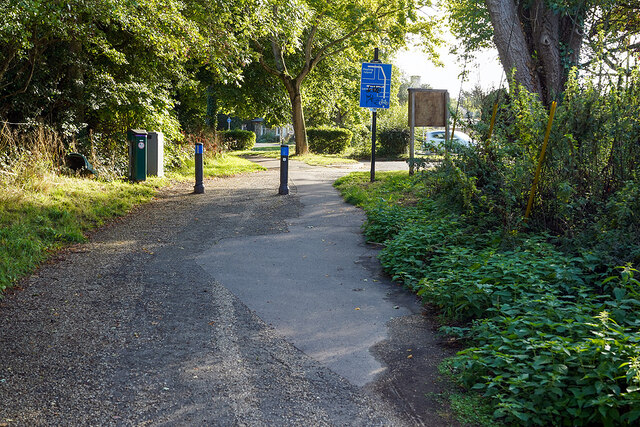
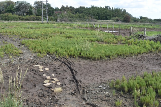
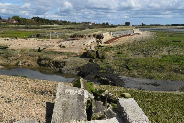
Broad Marsh is a coastal marsh located in Hampshire, England. Stretching along the coast, it is a significant natural habitat comprising marshes and saltings. The marsh is characterized by its diverse ecosystems, including mudflats, salt marshes, and tidal creeks.

The area is home to a wide range of flora and fauna, making it a haven for wildlife enthusiasts and nature lovers. The salt marshes are dominated by salt-tolerant plants such as glasswort, sea lavender, and samphire. These plants provide vital shelter and food for various bird species, including the iconic avocet, redshank, and curlew.

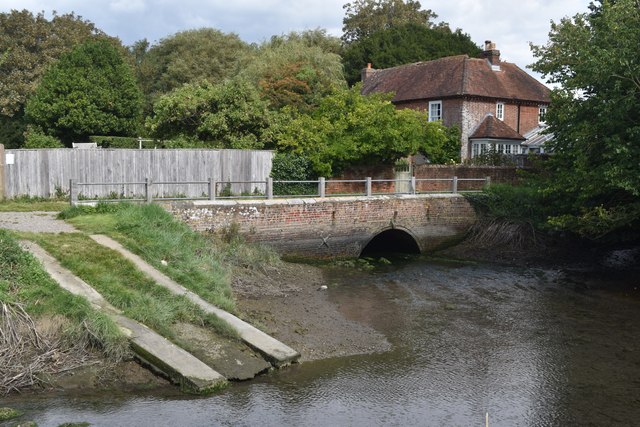
The tidal creeks that meander through the marshes are important breeding grounds for fish species, including bass and flounder. During high tide, the marshes are submerged, providing a rich feeding ground for wading birds and waterfowl.

Broad Marsh also plays a crucial role in flood prevention, acting as a buffer zone between the sea and the surrounding land. The marshes absorb excess water during high tides and storms, reducing the risk of coastal erosion and flooding in adjacent areas.

The marsh is a designated Site of Special Scientific Interest (SSSI) and is managed by conservation organizations in collaboration with local authorities. Access to the marsh is limited to designated footpaths and observation points to minimize disturbance to the delicate ecosystems.

Visitors to Broad Marsh can enjoy stunning coastal views, observe a wide variety of bird species, and experience the tranquility of this unique natural environment.

If you have any feedback on the listing, please let us know in the comments section below.

Broad Marsh Images

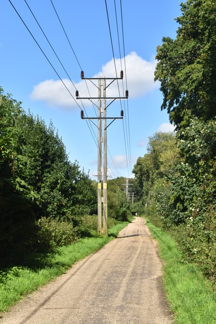
Images are sourced within 2km of 50.846376/-1.0065307 or Grid Reference SU7005. Thanks to Geograph Open Source API. All images are credited.

The Shipwrights Way joins the A3023 road The A3023 road crosses into Hayling Island via the Langstone Bridge. This is now the only land link onto the Island and is also used by the Shipwrights Way, which is joined by the Hayling Billy Coastal Path on the island. A 2nd bridge onto the island was the Hayling rail branch line, but that closed in 1963.
The Shipwrights Way joins the A3023 road
The A3023 road crosses into Hayling Island via the Langstone Bridge. This is now the only land link onto the Island and is also used by the Shipwrights Way, which is joined by the Hayling Billy Coastal Path on the island. A 2nd bridge onto the island was the Hayling rail branch line, but that closed in 1963.
Portsmouth Water - Havant OSBM Bolt (a) OSBM Bolt, Portsmouth Water board - Opposite reception offices inside site just to Left hand side of Tank Bund
Portsmouth Water - Havant OSBM Bolt (a)
OSBM Bolt, Portsmouth Water board - Opposite reception offices inside site just to Left hand side of Tank Bund
Portsmouth Water - Havant OSBM Bolt (b) OSBM Bolt, Portsmouth Water board - Opposite reception offices inside site just to Left hand side of Tank Bund
Portsmouth Water - Havant OSBM Bolt (b)
OSBM Bolt, Portsmouth Water board - Opposite reception offices inside site just to Left hand side of Tank Bund
Portsmouth Water Head Office (Havant) - Entrance Follow Green line to Reception offices - OSBM Bolt slightly past offices on opposite side of site road to left hand side of a Tank Bund
Portsmouth Water Head Office (Havant) - Entrance
Follow Green line to Reception offices - OSBM Bolt slightly past offices on opposite side of site road to left hand side of a Tank Bund
No 24 Cross Way - Havant Cut Benchmark on North face of house at No 24 Cross Way, Havant. The Cut Mark is on the North West angle of the building
Link to close up photo of benchmark below
<a href="https://www.geograph.org.uk/photo/7557716">SU7106 : Benchmark - No 24 Cross Way - Havant</a>
No 24 Cross Way - Havant
Cut Benchmark on North face of house at No 24 Cross Way, Havant. The Cut Mark is on the North West angle of the building Link to close up photo of benchmark below SU7106 : Benchmark - No 24 Cross Way - Havant
Benchmark - No 24 Cross Way - Havant Cut Benchmark on North face of house at No 24 Cross Way, Havant. The Cut Mark is on the North West angle of the building
Link to street view of property below:
<a href="https://www.geograph.org.uk/photo/7557714">SU7106 : No 24 Cross Way - Havant</a>
Benchmark - No 24 Cross Way - Havant
Cut Benchmark on North face of house at No 24 Cross Way, Havant. The Cut Mark is on the North West angle of the building Link to street view of property below: SU7106 : No 24 Cross Way - Havant
Houses in Parkside
Houses in Parkside
Junction of Mitchell Road and Newbarn Road
Shipwrights Way Long-distance footpath and cycle path on the route of the former railway branch line to Hayling Island.
Shipwrights Way
Long-distance footpath and cycle path on the route of the former railway branch line to Hayling Island.
St Faith's Church, Havant Despite its rural appearance, this churchyard is in Havant town centre.
St Faith's Church, Havant
Despite its rural appearance, this churchyard is in Havant town centre.
East Street, Havant Grand old houses in use as dental surgery and housing association office.
East Street, Havant
Grand old houses in use as dental surgery and housing association office.
Former White Hart pub, Havant One of the most prominent premises in the centre of Havant, opposite the church, but looking sadly neglected.
Former White Hart pub, Havant
One of the most prominent premises in the centre of Havant, opposite the church, but looking sadly neglected.
A3023 Langstone Road This busy road is the only vehicle route onto Hayling Island (also reachable on foot by ferry from Portsmouth).
A3023 Langstone Road
This busy road is the only vehicle route onto Hayling Island (also reachable on foot by ferry from Portsmouth).
Path across marshland, Southmoor Nature Reserve
Bridge and former West Mill, Langstone
Channel in marshland, Southmoor Nature Reserve This area is now inundated by high tides, following <a href="https://www.geograph.org.uk/photo/7592560">SU7104 : Breach in sea wall, Southmoor Nature Reserve</a>. Compare <a href="https://www.geograph.org.uk/photo/5887297">SU7104 : South Moor Langstone</a> which shows the same fence in the foreground.
Channel in marshland, Southmoor Nature Reserve
This area is now inundated by high tides, following SU7104 : Breach in sea wall, Southmoor Nature Reserve. Compare SU7104 : South Moor Langstone which shows the same fence in the foreground.
Breach in sea wall, Southmoor Nature Reserve The breach occurred in 2020 and the marshland habitat has changed dramatically, with some areas now under water at each high tide: see <a href="https://www.geograph.org.uk/photo/7592550">SU7104 : Channel in marshland, Southmoor Nature Reserve</a>. The coastal footpath is officially closed.
Breach in sea wall, Southmoor Nature Reserve
The breach occurred in 2020 and the marshland habitat has changed dramatically, with some areas now under water at each high tide: see SU7104 : Channel in marshland, Southmoor Nature Reserve. The coastal footpath is officially closed.
On the shore at Southmoor Nature Reserve The projecting sea wall is at the end of Southmoor Lane.
On the shore at Southmoor Nature Reserve
The projecting sea wall is at the end of Southmoor Lane.
Show me another place!

Broad Marsh is located at Grid Ref: SU7005 (Lat: 50.846376, Lng: -1.0065307)

Administrative County: Hampshire

District: Havant

Police Authority: Hampshire

What 3 Words

///unrealistic.left.fires. Near Havant, Hampshire

Related Wikis

The Elms (Bedhampton)

The Elms is an historic house in Old Bedhampton, near Havant, Hampshire in England. It is a Grade II* listed building The house was built in the 17th century...

Keydell House

Keydell House was situated in 45 acres (180,000 m2) of land near Lovedean Corner, in the village of Horndean, part of the ecclesiastical parish of Catherington...

Bedhampton railway station

Bedhampton railway station serves the former village of Bedhampton, now a suburb lying a mile west of the centre of Havant, in Hampshire, England. ��2...

Bedhampton

Bedhampton is a former village, and now suburb, located in the borough of Havant, Hampshire, England. It is located at the northern end of Langstone Harbour...

Nearby Amenities

Located within 500m of 50.846376,-1.0065307
Source: PGS
Lat/Long: 50.8431949/-1.002628
Source: PGS
Lat/Long: 50.8436078/-1.0022447
Source: PGS
Lat/Long: 50.8449192/-1.0008575
Source: PGS
Lat/Long: 50.8440488/-1.0007686
Source: PGS
Lat/Long: 50.8442822/-1.0005401
Motorway Junction
Broadmarsh
Lat/Long: 50.8483663/-1.0029195
Crossing
Bicycle: yes
Crossing Island: yes
Kerb: lowered
Sloped Curb: yes
Lat/Long: 50.8453672/-1.0086209
Leisure: slipway
Lat/Long: 50.8433485/-1.0026969
Crossing
Bicycle: yes
Crossing: unmarked
Kerb: lowered
Sloped Curb: yes
Lat/Long: 50.8451053/-1.0080838
Crossing
Bicycle: yes
Crossing: unmarked
Kerb: lowered
Lat/Long: 50.8451976/-1.0052007
Material: wood
Power: pole
Lat/Long: 50.8445423/-1.0089732
Material: wood
Power: pole
Lat/Long: 50.8445826/-1.0113188
Power: pole
Lat/Long: 50.8461813/-1.0021712
Material: wood
Power: pole
Lat/Long: 50.8453125/-1.0057786
Power: pole
Lat/Long: 50.8457952/-1.0037993
Material: wood
Power: pole
Lat/Long: 50.8449768/-1.0072176
Power: pole
Lat/Long: 50.8468113/-1.0000495
Crossing
Bicycle: yes
Crossing: unmarked
Kerb: lowered
Sloped Curb: yes
Lat/Long: 50.8460676/-1.0085887
Crossing
Bicycle: yes
Crossing Island: yes
Kerb: lowered
Sloped Curb: yes
Lat/Long: 50.8453551/-1.0081533
Crossing
Bicycle: yes
Crossing: unmarked
Kerb: lowered
Sloped Curb: yes
Lat/Long: 50.846012/-1.009426
Give Way
Direction: forward
Lat/Long: 50.8493375/-1.0111695
Traffic Signals
Traffic Signals Direction: forward
Lat/Long: 50.8461117/-1.0085806
Traffic Signals
Traffic Signals Direction: forward
Lat/Long: 50.8460156/-1.0088084
Post Box
Brand: Royal Mail
Brand Wikidata: Q638098
Brand Wikipedia: en:Royal Mail
Operator: Royal Mail
Operator Wikidata: Q638098
Post Box Type: pillar
Ref: PO9 161
Royal Cypher: EIIR
Royal Cypher Wikidata: Q33102113
Lat/Long: 50.8466158/-1.0004285
Material: wood
Power: pole
Lat/Long: 50.8446211/-1.011288
Bench
Lat/Long: 50.8444801/-1.0113034
Man Made: tower
Tower Type: communication
Lat/Long: 50.8479083/-1.0090846
The Emsworth Brewery
Addr Housenumber: 46, Regional Business Park
Addr Street: Harts Farm Way
Craft: brewery
Opening Hours: Th-Sa 12:00-17:00
Lat/Long: 50.8473999/-1.0008495
Barrier: height_restrictor
Lat/Long: 50.8435815/-1.0042212
The data included in this document is from www.openstreetmap.org. The data is made available under ODbL.

Have you been to Broad Marsh?

Leave your review of Broad Marsh below (or comments, questions and feedback).