Beck Side

Settlement in Lancashire South Lakeland

England

Beck Side

Ordnance Survey Cut Mark This OS cut mark can be found on the wall SE side of the road. It marks a point 6.417m above mean sea level.
Ordnance Survey Cut Mark Credit: Adrian Dust

Beck Side is a small village located in Lancashire, England. Situated in the Ribble Valley district, it lies approximately 5 miles south-east of the market town of Clitheroe. The village is surrounded by picturesque countryside, offering stunning views of the rural landscape.

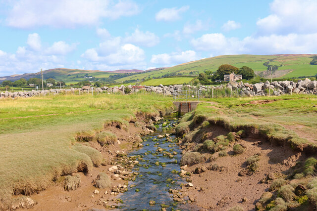
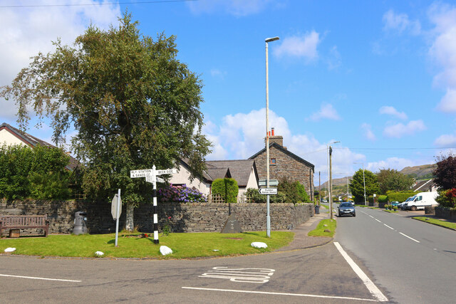
Beck Side is known for its tranquil atmosphere and close-knit community. The village consists mainly of traditional stone-built houses, which add to its charm and character. The River Ribble flows nearby, providing a peaceful setting for residents and visitors to enjoy.

Although Beck Side is a small village, it boasts a few amenities to cater to its inhabitants. A local pub can be found in the heart of the village, serving as a social hub for residents to gather and enjoy a drink or a meal. The pub often hosts community events and activities, fostering a sense of unity among the villagers.

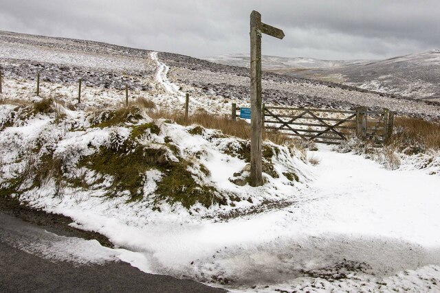
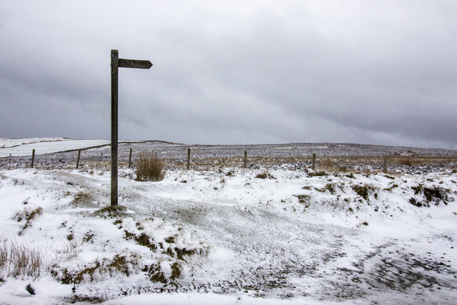
Nature lovers are drawn to Beck Side due to its proximity to the Forest of Bowland Area of Outstanding Natural Beauty. This protected area offers extensive opportunities for outdoor activities, ranging from hiking and cycling to birdwatching and wildlife spotting.

The village is well-connected to neighboring towns and cities thanks to its good transport links. The A59 road passes close by, providing easy access to Clitheroe and other nearby destinations. Public transportation options are available, including regular bus services.

In summary, Beck Side is a charming village in Lancashire, offering a peaceful rural setting, a tight-knit community, and easy access to beautiful natural surroundings.

If you have any feedback on the listing, please let us know in the comments section below.
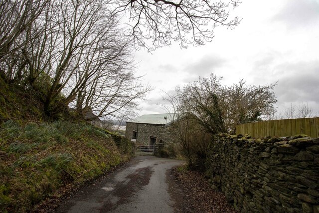
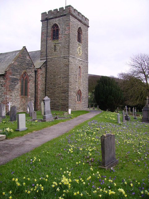
Beck Side Images

Images are sourced within 2km of 54.229633/-3.171972 or Grid Reference SD2382. Thanks to Geograph Open Source API. All images are credited.

Ordnance Survey Cut Mark This OS cut mark can be found on the wall SE side of the road. It marks a point 6.417m above mean sea level.
Ordnance Survey Cut Mark
This OS cut mark can be found on the wall SE side of the road. It marks a point 6.417m above mean sea level.
Ordnance Survey Rivet This OS rivet can be found on the south angle of the chapel. It marks a point 7.616m above mean sea level.
Ordnance Survey Rivet
This OS rivet can be found on the south angle of the chapel. It marks a point 7.616m above mean sea level.
Ordnance Survey Rivet This OS rivet can be found on the wall north side of the road. It marks a point 22.275m above mean sea level.
Ordnance Survey Rivet
This OS rivet can be found on the wall north side of the road. It marks a point 22.275m above mean sea level.
Ordnance Survey Cut Mark This OS cut mark can be found on the roadside barn at Little Croft. It marks a point 76.828m above mean sea level.
Ordnance Survey Cut Mark
This OS cut mark can be found on the roadside barn at Little Croft. It marks a point 76.828m above mean sea level.
Ordnance Survey Cut Mark This OS rivet can be found on the boulder SW side of the road. It marks a point 110.591m above mean sea level.
Ordnance Survey Cut Mark
This OS rivet can be found on the boulder SW side of the road. It marks a point 110.591m above mean sea level.
Ordnance Survey Rivet This OS rivet can be found on the wall 15m NE of the road. It marks a point 241.088m above mean sea level.
Ordnance Survey Rivet
This OS rivet can be found on the wall 15m NE of the road. It marks a point 241.088m above mean sea level.
Ordnance Survey Cut Mark This OS cut mark can be found on the boulder north side of the road. It marks a point 139.087m above mean sea level.
Ordnance Survey Cut Mark
This OS cut mark can be found on the boulder north side of the road. It marks a point 139.087m above mean sea level.
Ordnance Survey Cut Mark This OS cut mark can be found on the garden wall of the former Police Office west side of the road. It marks a point 18.246m above mean sea level.
Ordnance Survey Cut Mark
This OS cut mark can be found on the garden wall of the former Police Office west side of the road. It marks a point 18.246m above mean sea level.
Ordnance Survey Cut Mark This OS cut mark can be found on the gatepost NW side of the road. It marks a point 26.665m above mean sea level.
Ordnance Survey Cut Mark
This OS cut mark can be found on the gatepost NW side of the road. It marks a point 26.665m above mean sea level.
Ordnance Survey Cut Mark This damaged OS cut mark can be found on Waters Edge west side of the road. It marks a point 5.823m above mean sea level.
Ordnance Survey Cut Mark
This damaged OS cut mark can be found on Waters Edge west side of the road. It marks a point 5.823m above mean sea level.
Ordnance Survey Cut Mark This OS cut mark can be found on the gatepost of The Hermitage. It marks a point 29.942m above mean sea level.
Ordnance Survey Cut Mark
This OS cut mark can be found on the gatepost of The Hermitage. It marks a point 29.942m above mean sea level.
Ordnance Survey Cut Mark This hidden OS cut mark can be found on the wall SW side of the road. It marks a point 32.935m above mean sea level.
Ordnance Survey Cut Mark
This hidden OS cut mark can be found on the wall SW side of the road. It marks a point 32.935m above mean sea level.
Ordnance Survey Cut Mark This OS cut mark can be found on the NW face of the school. It marks a point 43.239m above mean sea level.
Ordnance Survey Cut Mark
This OS cut mark can be found on the NW face of the school. It marks a point 43.239m above mean sea level.
Near Soutergate Stream next to the railway line.
Near Soutergate
Stream next to the railway line.
Askew Gate Road junction at Kirkby-in-Furness.
Askew Gate
Road junction at Kirkby-in-Furness.
Gateway to moorland Footpath and gateway to moorland
Gateway to moorland
Footpath and gateway to moorland
Public footpath across moorland Public footpath signpost near Bank House Moor
Public footpath across moorland
Public footpath signpost near Bank House Moor
Bank House Farm Vernacular farm building at Bank House Farm
Bank House Farm
Vernacular farm building at Bank House Farm
Show me another place!

Beck Side is located at Grid Ref: SD2382 (Lat: 54.229633, Lng: -3.171972)

Administrative County: Cumbria

District: South Lakeland

Police Authority: Cumbria

What 3 Words

///overlaid.constants.dodging. Near Askam in Furness, Cumbria

Related Wikis

Kirkby-in-Furness

Kirkby-in-Furness, generally referred to simply as Kirkby locally, is a village that is the major part of the parish of Kirkby Ireleth in the Furness district...

Kirkby-in-Furness railway station

Kirkby-in-Furness is a railway station on the Cumbrian Coast Line, which runs between Carlisle and Barrow-in-Furness. The station, situated 9+1⁄4 miles...

Kirkby Ireleth

Kirkby Ireleth is a civil parish in the South Lakeland district of the English county of Cumbria. It includes the villages of Grizebeck and Kirkby-in...

Angerton, South Lakeland

Angerton is a civil parish in the Westmorland and Furness district of the ceremonial county of Cumbria, England, historically part of the Furness portion...

Nearby Amenities

Located within 500m of 54.229633,-3.171972
Power: tower
Lat/Long: 54.2319288/-3.1783286
Barrier: stile
Lat/Long: 54.2313457/-3.1742013
Barrier: stile
Lat/Long: 54.2307905/-3.1740501
Barrier: cattle_grid
Lat/Long: 54.227693/-3.1705928
Give Way
Direction: forward
Lat/Long: 54.2304175/-3.1741479
Grit Bin
Lat/Long: 54.2304646/-3.1729119
Grit Bin
Lat/Long: 54.2322028/-3.1661198
Give Way
Direction: forward
Lat/Long: 54.2300218/-3.1772516
Turning Circle
Lat/Long: 54.2302568/-3.1759986
Give Way
Direction: backward
Lat/Long: 54.2304399/-3.1759774
Grit Bin
Lat/Long: 54.229964/-3.1772071
Post Box
Collection Times: Mo-Fr 16:15; Sa 08:30
Drive Through: no
Post Box Type: wall
Ref: LA17 32
Lat/Long: 54.2300095/-3.1771424
Entrance: main
Lat/Long: 54.2296301/-3.1768414
Power: pole
Lat/Long: 54.2287689/-3.1743674
Power: pole
Lat/Long: 54.2290958/-3.1747941
Power: pole
Lat/Long: 54.2293609/-3.1751357
Power: pole
Lat/Long: 54.2296208/-3.1754731
Power: pole
Lat/Long: 54.2300906/-3.1760768
Power: pole
Lat/Long: 54.2305239/-3.1769793
Power: pole
Lat/Long: 54.2308454/-3.1772113
Power: pole
Lat/Long: 54.2314445/-3.1782147
Grit Bin
Lat/Long: 54.2300735/-3.1785258
Beckside
Place: village
Lat/Long: 54.2304475/-3.1753723
Grit Bin
Lat/Long: 54.2326309/-3.1664348
Waterway: weir
Lat/Long: 54.2301462/-3.1732468
Entrance: main
Lat/Long: 54.229355/-3.1762291
Barrier: cattle_grid
Lat/Long: 54.2290478/-3.1724663
Grit Bin
Lat/Long: 54.2324343/-3.1698258
Disused: yes
Man Made: watermill
Note: The watermill is disused but the water wheel still works and was refurbished a few years ago by the owner.
Lat/Long: 54.230269/-3.1740797
Power: pole
Lat/Long: 54.2324828/-3.1669606
Power: pole
Transformer: distribution
Lat/Long: 54.2321367/-3.1667871
Beck Side
Place: village
Source: npe
Lat/Long: 54.2293428/-3.1740497
Power: pole
Lat/Long: 54.2286086/-3.1729945
Power: pole
Lat/Long: 54.2284767/-3.172429
Power: pole
Lat/Long: 54.2281117/-3.1709444
The data included in this document is from www.openstreetmap.org. The data is made available under ODbL.

Have you been to Beck Side?

Leave your review of Beck Side below (or comments, questions and feedback).