Four Lane Ends

Settlement in Lancashire South Lakeland

England

Four Lane Ends

Ordnance Survey Cut Mark This OS cut mark can be found on the wall SE side of the road. It marks a point 6.417m above mean sea level.
Ordnance Survey Cut Mark Credit: Adrian Dust

Four Lane Ends is a small village located in the county of Lancashire, England. Situated in the borough of West Lancashire, it is positioned approximately 3 miles north of the market town of Ormskirk. The village is named after its unique road junction, which consists of four lanes meeting at a crossing point.

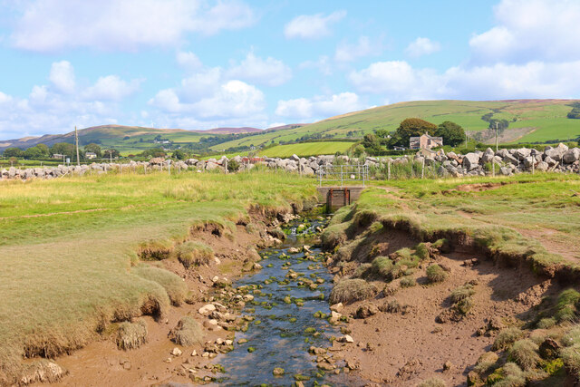
Four Lane Ends is a predominantly residential area with a population of around 500 residents. The village is characterized by its picturesque countryside surroundings, with rolling green fields and scattered farms dotting the landscape. The area is known for its tranquility and close-knit community atmosphere.

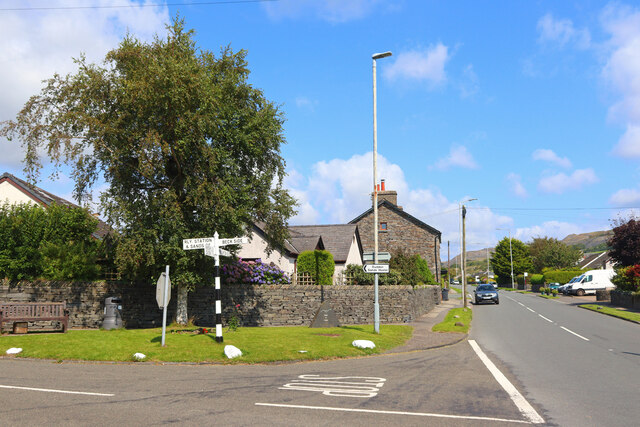
Despite its small size, Four Lane Ends offers a range of amenities to its residents. These include a local primary school, a village hall, and a small convenience store. The village is well-connected to the surrounding areas, with regular bus services providing access to nearby towns and cities.

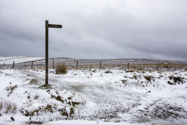
For those seeking outdoor activities, Four Lane Ends is within close proximity to several nature reserves and parks. Nearby Beacon Country Park offers beautiful walking trails and picnic spots, while Ruff Wood Nature Reserve provides opportunities for birdwatching and wildlife observation.

In summary, Four Lane Ends is a charming village nestled in the heart of Lancashire's countryside. With its peaceful surroundings and community spirit, it offers an ideal retreat for those looking for a serene rural lifestyle.

If you have any feedback on the listing, please let us know in the comments section below.

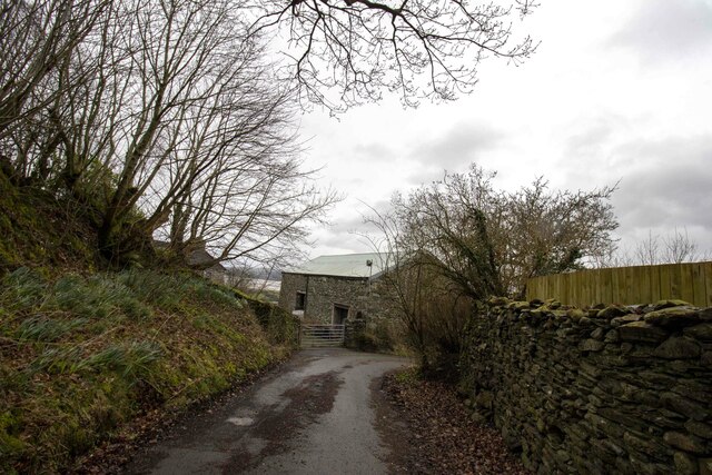
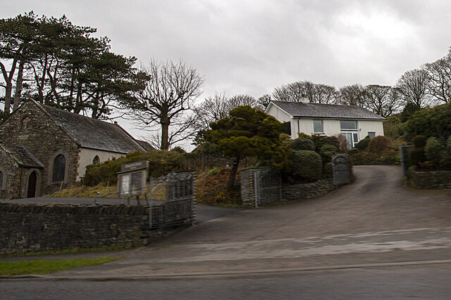
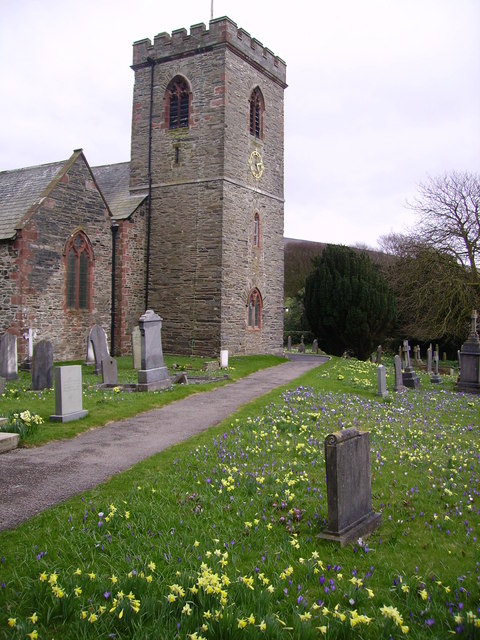
Four Lane Ends Images

Images are sourced within 2km of 54.23131/-3.1814598 or Grid Reference SD2382. Thanks to Geograph Open Source API. All images are credited.

Ordnance Survey Cut Mark This OS cut mark can be found on the wall SE side of the road. It marks a point 6.417m above mean sea level.
Ordnance Survey Cut Mark
This OS cut mark can be found on the wall SE side of the road. It marks a point 6.417m above mean sea level.
Ordnance Survey Rivet This OS rivet can be found on the south angle of the chapel. It marks a point 7.616m above mean sea level.
Ordnance Survey Rivet
This OS rivet can be found on the south angle of the chapel. It marks a point 7.616m above mean sea level.
Ordnance Survey Rivet This OS rivet can be found on the wall north side of the road. It marks a point 22.275m above mean sea level.
Ordnance Survey Rivet
This OS rivet can be found on the wall north side of the road. It marks a point 22.275m above mean sea level.
Ordnance Survey Cut Mark This OS cut mark can be found on the roadside barn at Little Croft. It marks a point 76.828m above mean sea level.
Ordnance Survey Cut Mark
This OS cut mark can be found on the roadside barn at Little Croft. It marks a point 76.828m above mean sea level.
Ordnance Survey Cut Mark This OS rivet can be found on the boulder SW side of the road. It marks a point 110.591m above mean sea level.
Ordnance Survey Cut Mark
This OS rivet can be found on the boulder SW side of the road. It marks a point 110.591m above mean sea level.
Ordnance Survey Rivet This OS rivet can be found on the wall 15m NE of the road. It marks a point 241.088m above mean sea level.
Ordnance Survey Rivet
This OS rivet can be found on the wall 15m NE of the road. It marks a point 241.088m above mean sea level.
Ordnance Survey Cut Mark This OS cut mark can be found on the boulder north side of the road. It marks a point 139.087m above mean sea level.
Ordnance Survey Cut Mark
This OS cut mark can be found on the boulder north side of the road. It marks a point 139.087m above mean sea level.
Ordnance Survey Cut Mark This OS cut mark can be found on the garden wall of the former Police Office west side of the road. It marks a point 18.246m above mean sea level.
Ordnance Survey Cut Mark
This OS cut mark can be found on the garden wall of the former Police Office west side of the road. It marks a point 18.246m above mean sea level.
Ordnance Survey Cut Mark This OS cut mark can be found on the gatepost NW side of the road. It marks a point 26.665m above mean sea level.
Ordnance Survey Cut Mark
This OS cut mark can be found on the gatepost NW side of the road. It marks a point 26.665m above mean sea level.
Ordnance Survey Cut Mark This damaged OS cut mark can be found on Waters Edge west side of the road. It marks a point 5.823m above mean sea level.
Ordnance Survey Cut Mark
This damaged OS cut mark can be found on Waters Edge west side of the road. It marks a point 5.823m above mean sea level.
Ordnance Survey Cut Mark This OS cut mark can be found on the gatepost of The Hermitage. It marks a point 29.942m above mean sea level.
Ordnance Survey Cut Mark
This OS cut mark can be found on the gatepost of The Hermitage. It marks a point 29.942m above mean sea level.
Ordnance Survey Cut Mark This hidden OS cut mark can be found on the wall SW side of the road. It marks a point 32.935m above mean sea level.
Ordnance Survey Cut Mark
This hidden OS cut mark can be found on the wall SW side of the road. It marks a point 32.935m above mean sea level.
Ordnance Survey Cut Mark This OS cut mark can be found on the NW face of the school. It marks a point 43.239m above mean sea level.
Ordnance Survey Cut Mark
This OS cut mark can be found on the NW face of the school. It marks a point 43.239m above mean sea level.
Near Soutergate Stream next to the railway line.
Near Soutergate
Stream next to the railway line.
Askew Gate Road junction at Kirkby-in-Furness.
Askew Gate
Road junction at Kirkby-in-Furness.
Public footpath across moorland Public footpath signpost near Bank House Moor
Public footpath across moorland
Public footpath signpost near Bank House Moor
Bank House Farm Vernacular farm building at Bank House Farm
Bank House Farm
Vernacular farm building at Bank House Farm
Applegarth
Applegarth
Show me another place!

Four Lane Ends is located at Grid Ref: SD2382 (Lat: 54.23131, Lng: -3.1814598)

Administrative County: Cumbria

District: South Lakeland

Police Authority: Cumbria

What 3 Words

///comb.polices.swooned. Near Askam in Furness, Cumbria

Related Wikis

Kirkby-in-Furness

Kirkby-in-Furness, generally referred to simply as Kirkby locally, is a village that is the major part of the parish of Kirkby Ireleth in the Furness district...

Kirkby-in-Furness railway station

Kirkby-in-Furness is a railway station on the Cumbrian Coast Line, which runs between Carlisle and Barrow-in-Furness. The station, situated 9+1⁄4 miles...

Kirkby Ireleth

Kirkby Ireleth is a civil parish in the South Lakeland district of the English county of Cumbria. It includes the villages of Grizebeck and Kirkby-in...

Angerton, South Lakeland

Angerton is a civil parish in the Westmorland and Furness district of the ceremonial county of Cumbria, England, historically part of the Furness portion...

Nearby Amenities

Located within 500m of 54.23131,-3.1814598
Source: PGS
Lat/Long: 54.2336533/-3.1871617
Source: PGS
Lat/Long: 54.2335571/-3.1869778
Bus Stop
Burlington Inn (N bound)
Bench: no
Bin: no
Bus: yes
Local Ref: AT
Naptan AtcoCode: 090079390601
Naptan Bearing: N
Naptan CommonName: Commercial Inn (N bound)
Naptan Indicator: at
Naptan Landmark: Pub
Naptan NaptanCode: cumdjtjp
Naptan Street: A595
Naptan Verified: no
Public Transport: platform
Shelter: no
Source: naptan_import
Lat/Long: 54.2314009/-3.1818138
Bus Stop
Burlington Inn (S bound)
Bench: no
Bin: no
Bus: yes
Local Ref: AT
Naptan AtcoCode: 090079393061
Naptan Bearing: SW
Naptan CommonName: Commercial Inn (S bound)
Naptan Indicator: at
Naptan Landmark: Post Office
Naptan NaptanCode: cumdjtmd
Naptan Street: A595
Naptan Verified: no
Public Transport: platform
Shelter: no
Source: naptan_import
Tactile Paving: no
Lat/Long: 54.2315135/-3.1815178
Bus Stop
Burlington School (N bound)
Bench: no
Bin: no
Bus: yes
Naptan AtcoCode: 090079393216
Naptan Bearing: NE
Naptan CommonName: Burlington School (N bound)
Naptan Indicator: opp
Naptan Landmark: School
Naptan NaptanCode: cumdjtmg
Naptan Street: School Road
Naptan Verified: no
Public Transport: platform
Shelter: no
Source: naptan_import
Lat/Long: 54.2342191/-3.1784881
Bus Stop
Burlington School (S bound)
Bench: no
Bin: no
Bus: yes
Naptan AtcoCode: 090079393217
Naptan Bearing: SW
Naptan CommonName: Burlington School (S bound)
Naptan Indicator: o/s
Naptan Landmark: School
Naptan NaptanCode: cumdjtmj
Naptan Street: School Road
Naptan Verified: no
Public Transport: platform
Shelter: no
Source: naptan_import
Lat/Long: 54.2342446/-3.1782824
Moorland Stores
Shop: convenience
Source: OS_OpenData_StreetView
Lat/Long: 54.231408/-3.1814322
Power: tower
Lat/Long: 54.2319288/-3.1783286
Power: tower
Lat/Long: 54.2272769/-3.1809706
Power: tower
Lat/Long: 54.2304927/-3.179718
Stop
Direction: forward
Stop: minor
Lat/Long: 54.2315414/-3.1816036
Barrier: kissing_gate
Lat/Long: 54.2324404/-3.1874615
Barrier: stile
Lat/Long: 54.2313457/-3.1742013
Barrier: stile
Lat/Long: 54.2307905/-3.1740501
Turning Circle
Lat/Long: 54.2326147/-3.1810602
Barrier: stile
Lat/Long: 54.2318515/-3.1823656
Barrier: stile
Lat/Long: 54.2322028/-3.1821494
Barrier: stile
Lat/Long: 54.2330379/-3.1824232
Barrier: stile
Lat/Long: 54.2337676/-3.18273
Barrier: stile
Lat/Long: 54.2341413/-3.1831692
Kirkby-in-Furness
Naptan AtcoCode: 9100KRKBYIF
Network: National Rail
Network Website: https://www.nationalrail.co.uk/stations/kbf/
Network Wikidata: Q26334
Operator: Northern Rail
Operator Website: https://www.northernrailway.co.uk/stations/kirkby-in-furness
Operator Wikidata: Q85789775
Public Transport: stop_position
Railway: station
Ref Crs: KBF
Request Stop: yes
Source: npe
Train: yes
Wikidata: Q4614344
Wikipedia: en:Kirkby-in-Furness railway station
Lat/Long: 54.2329033/-3.1872166
Barrier: stile
Lat/Long: 54.2304054/-3.1800501
Material: wood
Power: pole
Lat/Long: 54.22779/-3.1861498
Material: wood
Power: pole
Lat/Long: 54.2277219/-3.1853581
Material: wood
Power: pole
Lat/Long: 54.2275135/-3.1850986
Material: wood
Power: pole
Lat/Long: 54.2273846/-3.1844128
Material: wood
Power: pole
Lat/Long: 54.227238/-3.1836528
Power: pole
Lat/Long: 54.2271013/-3.1829009
Power: pole
Lat/Long: 54.2269743/-3.1821419
Power: pole
Lat/Long: 54.226859/-3.181407
Power: pole
Lat/Long: 54.2289475/-3.1866266
Power: pole
Lat/Long: 54.229606/-3.1856449
Power: pole
Lat/Long: 54.2305592/-3.1851674
Power: pole
Lat/Long: 54.2313369/-3.1847705
Source: PGS
Lat/Long: 54.233735/-3.1873222
Give Way
Direction: forward
Lat/Long: 54.2304175/-3.1741479
Stop
Direction: forward
Stop: minor
Lat/Long: 54.2313969/-3.1816429
Give Way
Direction: forward
Lat/Long: 54.2300218/-3.1772516
Turning Circle
Lat/Long: 54.2302568/-3.1759986
Give Way
Direction: backward
Lat/Long: 54.2304399/-3.1759774
Barrier: stile
Lat/Long: 54.2326828/-3.1859976
Kirkby-in-Furness
Place: village
Source: npe
Wikidata: Q2229694
Lat/Long: 54.2320301/-3.1815475
Power: pole
Lat/Long: 54.2346072/-3.1828066
Power: pole
Lat/Long: 54.2336205/-3.1834932
Give Way
Direction: backward
Lat/Long: 54.2323649/-3.1872991
Give Way
Direction: backward
Lat/Long: 54.2336581/-3.1787949
Give Way
Direction: forward
Lat/Long: 54.233169/-3.1793067
Give Way
Direction: backward
Lat/Long: 54.2327674/-3.1797607
Give Way
Direction: backward
Lat/Long: 54.2319804/-3.1809561
Grit Bin
Lat/Long: 54.2327857/-3.1796752
Post Box
Collection Times: Mo-Fr 16:15; Sa 12:00
Drive Through: no
Post Box Type: pillar
Ref: LA17 122
Royal Cypher: GVIR
Royal Cypher Wikidata: Q33102169
Source: survey
Lat/Long: 54.2314322/-3.1815241
Bench
Backrest: yes
Lat/Long: 54.2316586/-3.1816831
Waste Basket
Lat/Long: 54.231662/-3.1816434
Grit Bin
Lat/Long: 54.2321961/-3.1867626
Grit Bin
Lat/Long: 54.229964/-3.1772071
Post Box
Collection Times: Mo-Fr 16:15; Sa 08:30
Drive Through: no
Post Box Type: wall
Ref: LA17 32
Lat/Long: 54.2300095/-3.1771424
Entrance: main
Lat/Long: 54.2296301/-3.1768414
Power: pole
Lat/Long: 54.2290958/-3.1747941
Power: pole
Lat/Long: 54.2293609/-3.1751357
Power: pole
Lat/Long: 54.2296208/-3.1754731
Power: pole
Lat/Long: 54.2300906/-3.1760768
Power: pole
Lat/Long: 54.2305239/-3.1769793
Power: pole
Lat/Long: 54.2308454/-3.1772113
Power: pole
Lat/Long: 54.2314445/-3.1782147
Power: pole
Lat/Long: 54.2313633/-3.1798222
Power: pole
Lat/Long: 54.2308073/-3.1807957
Grit Bin
Lat/Long: 54.2300735/-3.1785258
Bench
Backrest: yes
Lat/Long: 54.2278847/-3.1850684
Beckside
Place: village
Lat/Long: 54.2304475/-3.1753723
Entrance: main
Lat/Long: 54.229355/-3.1762291
Grit Bin
Lat/Long: 54.2312368/-3.1814238
Grit Bin
Lat/Long: 54.2331599/-3.1772762
Crossing
Lat/Long: 54.2341909/-3.1785172
Post Box
Lat/Long: 54.232255/-3.1867882
Crossing
Lat/Long: 54.2308911/-3.1821592
Disused: yes
Man Made: watermill
Note: The watermill is disused but the water wheel still works and was refurbished a few years ago by the owner.
Lat/Long: 54.230269/-3.1740797
Power: pole
Lat/Long: 54.2326192/-3.1842169
Parking
Lat/Long: 54.2324419/-3.1858742
Entrance: yes
Lat/Long: 54.2314531/-3.1815235
Crossing
Crossing: unmarked
Tactile Paving: no
Lat/Long: 54.2319925/-3.180775
Telephone
Booth: KX100
Covered: booth
Lat/Long: 54.2317422/-3.1819019
Crossing
Lat/Long: 54.2326809/-3.1785404
Crossing
Lat/Long: 54.2326995/-3.1785112
Material: wood
Power: pole
Lat/Long: 54.2321798/-3.1844721
Railway: crossing
Lat/Long: 54.2322088/-3.187933
Railway: crossing
Lat/Long: 54.2322271/-3.1879796
Generator Method: photovoltaic
Generator Output Electricity: yes
Generator Source: solar
Generator Type: solar_photovoltaic_panel
Location: roof
Power: generator
Lat/Long: 54.2315232/-3.1879719
Generator Method: photovoltaic
Generator Output Electricity: yes
Generator Source: solar
Generator Type: solar_photovoltaic_panel
Location: roof
Power: generator
Lat/Long: 54.2321714/-3.1871807
Generator Method: photovoltaic
Generator Output Electricity: yes
Generator Source: solar
Generator Type: solar_photovoltaic_panel
Location: roof
Power: generator
Lat/Long: 54.2317262/-3.180451
Man Made: street_cabinet
Street Cabinet: telecom
Lat/Long: 54.2317491/-3.1819122
Generator Method: photovoltaic
Generator Output Electricity: yes
Generator Source: solar
Generator Type: solar_photovoltaic_panel
Power: generator
Lat/Long: 54.2351888/-3.1832615
Crossing
Crossing: unmarked
Crossing Island: yes
Tactile Paving: yes
Lat/Long: 54.2340438/-3.1785408
Power: pole
Lat/Long: 54.2332296/-3.1824211
Power: pole
Lat/Long: 54.2328529/-3.1814393
The data included in this document is from www.openstreetmap.org. The data is made available under ODbL.

Have you been to Four Lane Ends?

Leave your review of Four Lane Ends below (or comments, questions and feedback).