Old Castle Point

Coastal Marsh, Saltings in Hampshire

England

Old Castle Point

Trinity Church, Cowes Unusual to see modern housing built in close proximity to an old church.
Trinity Church, Cowes Credit: Roger Cornfoot

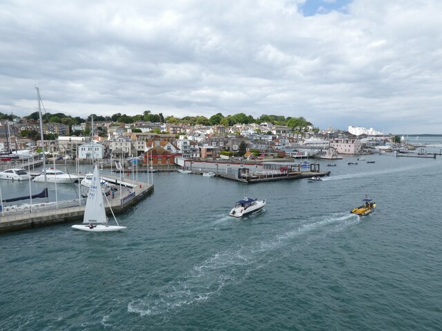
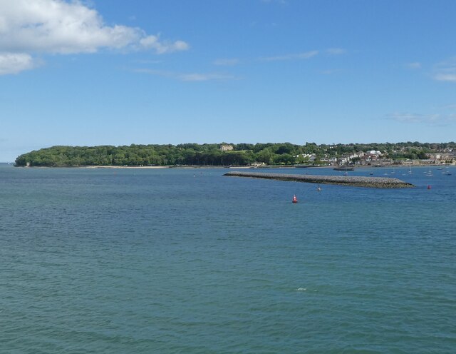
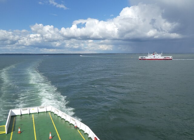
Old Castle Point is a picturesque coastal marsh located in Hampshire, England. Situated along the coast, it is a part of the broader Hampshire and Isle of Wight Coastal Marshes Special Protection Area. This area is known for its unique ecosystem and diverse wildlife.

The marshland is characterized by its vast expanse of salt marshes and saltings, which are flat areas of land that are periodically flooded by the tides. These tidal patterns create a dynamic environment, resulting in a rich biodiversity. The marshes are home to various plant species, including sea lavender, samphire, and cordgrasses, which thrive in the saline conditions.

The salt marshes also provide a sanctuary for many bird species, making it a popular destination for birdwatchers. Here, visitors can spot wading birds such as avocets, redshanks, and oystercatchers, as well as migratory birds during certain seasons.

Old Castle Point offers stunning panoramic views of the surrounding coastline. With its grassy dunes and sandy beaches, it is an idyllic spot for nature enthusiasts and beachgoers alike. The area is also intersected by numerous walking trails, allowing visitors to explore the marshes and observe the wildlife up close.

Conservation efforts are in place to preserve the delicate ecosystem of Old Castle Point. These initiatives aim to protect the salt marshes from erosion and maintain their ecological balance. Visitors are encouraged to respect the fragile environment and adhere to any guidelines provided to ensure the long-term sustainability of this beautiful coastal marsh.

If you have any feedback on the listing, please let us know in the comments section below.

Old Castle Point Images

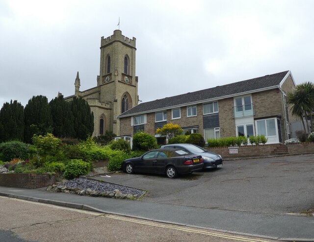
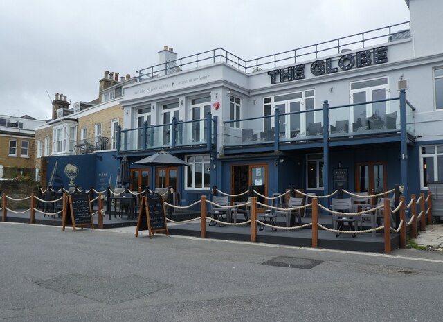
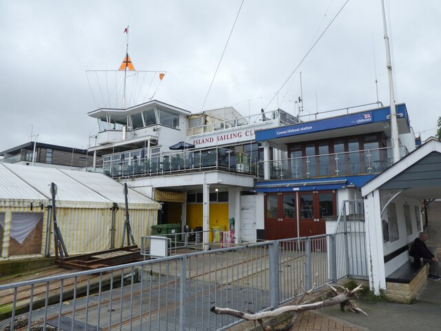
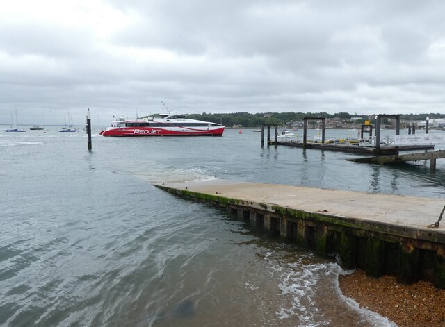
Images are sourced within 2km of 50.766422/-1.2768507 or Grid Reference SZ5196. Thanks to Geograph Open Source API. All images are credited.

Trinity Church, Cowes Unusual to see modern housing built in close proximity to an old church.
Trinity Church, Cowes
Unusual to see modern housing built in close proximity to an old church.
The Globe, Cowes
The Globe, Cowes
Island Sailing Club, Cowes
Passenger ferry arrives from Southampton
Watch House Barn
Watch House Barn
Bath Road, Cowes
Bath Road, Cowes
Cowes Baptist Church
The Duke of York, Cowes
Dockside buildings, Cowes The farthest building is a former sail loft.
Dockside buildings, Cowes
The farthest building is a former sail loft.
The harbour at Cowes
Breakwater at East Cowes
Ferries pass in the Solent
South Bramble buoy, Solent
High Street Looking along High Street.  In the background is 83 High Street (grey brick), housing the Sir Max Aitken Museum, with 84 High Street beyond.  Both date from the early 19th Century and are grade II listed - see <span class="nowrap"><a title="https://historicengland.org.uk/listing/the-list/list-entry/1222953?section=official-list-entry" rel="nofollow ugc noopener" href="https://historicengland.org.uk/listing/the-list/list-entry/1222953?section=official-list-entry">Link</a><img style="margin-left:2px;" alt="External link" title="External link - shift click to open in new window" src="https://s1.geograph.org.uk/img/external.png" width="10" height="10"/></span> and <span class="nowrap"><a title="https://historicengland.org.uk/listing/the-list/list-entry/1267523?section=official-list-entry" rel="nofollow ugc noopener" href="https://historicengland.org.uk/listing/the-list/list-entry/1267523?section=official-list-entry">Link</a><img style="margin-left:2px;" alt="External link" title="External link - shift click to open in new window" src="https://s1.geograph.org.uk/img/external.png" width="10" height="10"/></span> respectively.
High Street
Looking along High Street. In the background is 83 High Street (grey brick), housing the Sir Max Aitken Museum, with 84 High Street beyond. Both date from the early 19th Century and are grade II listed - see LinkExternal link and LinkExternal link respectively.
High Street Looking along High Street.  On the far right is Waterside House, completed in 2016 on the site of the former Waterside pub.  The bank building in the centre of the photo was formerly a branch of Lloyds Bank, converted to housing in 2000-1.
High Street
Looking along High Street. On the far right is Waterside House, completed in 2016 on the site of the former Waterside pub. The bank building in the centre of the photo was formerly a branch of Lloyds Bank, converted to housing in 2000-1.
Bath Road The northern extension of High Street, with houses dating from the early 19th Century.  From left to right are Tower House, The Turret (both blue painted, with The Turret being the narrow section on the right), Clarence House, Exmouth House and Bars Hill House.  The last four are all grade II listed - see <span class="nowrap"><a title="https://historicengland.org.uk/listing/the-list/list-entry/1267735?section=official-list-entry," rel="nofollow ugc noopener" href="https://historicengland.org.uk/listing/the-list/list-entry/1267735?section=official-list-entry,">Link</a><img style="margin-left:2px;" alt="External link" title="External link - shift click to open in new window" src="https://s1.geograph.org.uk/img/external.png" width="10" height="10"/></span> <span class="nowrap"><a title="https://historicengland.org.uk/listing/the-list/list-entry/1239820?section=official-list-entry," rel="nofollow ugc noopener" href="https://historicengland.org.uk/listing/the-list/list-entry/1239820?section=official-list-entry,">Link</a><img style="margin-left:2px;" alt="External link" title="External link - shift click to open in new window" src="https://s1.geograph.org.uk/img/external.png" width="10" height="10"/></span> <span class="nowrap"><a title="https://historicengland.org.uk/listing/the-list/list-entry/1239821?section=official-list-entry" rel="nofollow ugc noopener" href="https://historicengland.org.uk/listing/the-list/list-entry/1239821?section=official-list-entry">Link</a><img style="margin-left:2px;" alt="External link" title="External link - shift click to open in new window" src="https://s1.geograph.org.uk/img/external.png" width="10" height="10"/></span> and <span class="nowrap"><a title="https://historicengland.org.uk/listing/the-list/list-entry/1239822?section=official-list-entry" rel="nofollow ugc noopener" href="https://historicengland.org.uk/listing/the-list/list-entry/1239822?section=official-list-entry">Link</a><img style="margin-left:2px;" alt="External link" title="External link - shift click to open in new window" src="https://s1.geograph.org.uk/img/external.png" width="10" height="10"/></span> respectively.  For a wider view see <a href="https://www.geograph.org.uk/photo/7458408">SZ4996 : Bath Road</a>.
Bath Road
The northern extension of High Street, with houses dating from the early 19th Century. From left to right are Tower House, The Turret (both blue painted, with The Turret being the narrow section on the right), Clarence House, Exmouth House and Bars Hill House. The last four are all grade II listed - see LinkExternal link LinkExternal link LinkExternal link and LinkExternal link respectively. For a wider view see SZ4996 : Bath Road.
Bath Road The northern extension of High Street, with houses dating from the early 19th Century in the background.  For closer view see <a href="https://www.geograph.org.uk/photo/7458407">SZ4996 : Bath Road</a>.
Bath Road
The northern extension of High Street, with houses dating from the early 19th Century in the background. For closer view see SZ4996 : Bath Road.
High Street Looking along High Street.  In the centre of the photo is Waterside House, completed in 2016 on the site of the former Waterside pub.
High Street
Looking along High Street. In the centre of the photo is Waterside House, completed in 2016 on the site of the former Waterside pub.
Show me another place!

Old Castle Point is located at Grid Ref: SZ5196 (Lat: 50.766422, Lng: -1.2768507)

Unitary Authority: Isle of Wight

Police Authority: Hampshire

What 3 Words

///observers.whom.slightly. Near East Cowes, Isle of Wight

Related Wikis

Norris Castle

Norris Castle is located on the Isle of Wight. It was designed by James Wyatt for Lord Henry Seymour. The estate adjoins Osborne House, country home to...

East Cowes Castle

East Cowes Castle, located in East Cowes, was the home of architect John Nash between its completion and his death in 1835. Nash himself was the designer...
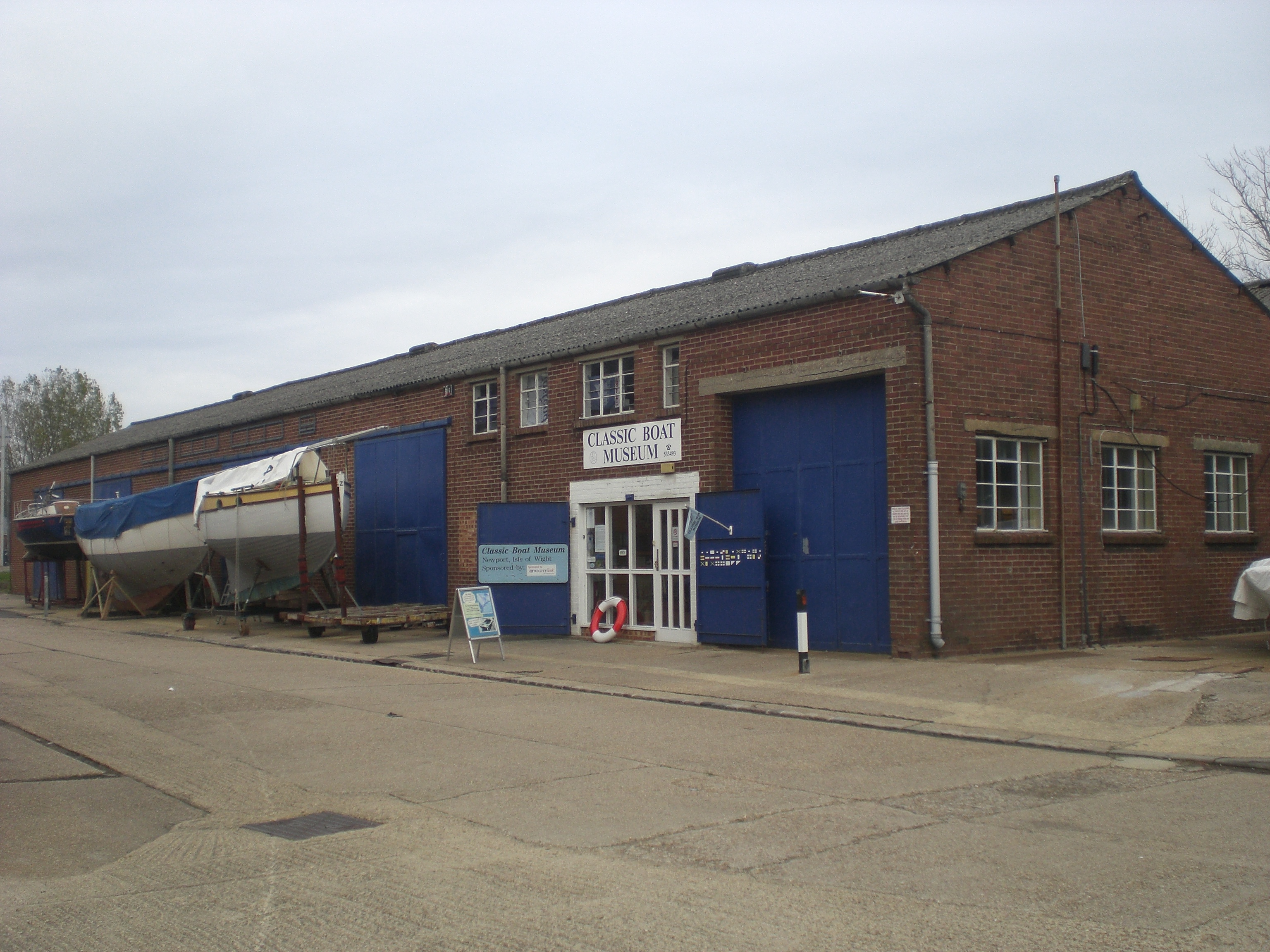
Classic Boat Museum

The Classic Boat Museum is a museum of boats and of the history of yachting and boating. It is located on the Isle of Wight at two separate sites on either...

Wight Shipyard

The Wight Shipyard is a shipbuilding company and shipyard based in East Cowes on the Isle of Wight in the UK, with their facilities occupying and including...

Nearby Amenities

Located within 500m of 50.766422,-1.2768507
Source: Bing
Lat/Long: 50.7653346/-1.2807231
Source: Bing
Lat/Long: 50.7662427/-1.2777888
Source: PGS
Lat/Long: 50.7662443/-1.2756077
Source: PGS
Lat/Long: 50.7661329/-1.2746072
Source: PGS
Lat/Long: 50.7657197/-1.2722493
Source: Bing
Lat/Long: 50.7653757/-1.2711982
Source: Bing
Lat/Long: 50.7645925/-1.282808
Source: Bing
Lat/Long: 50.7662084/-1.2777551
Source: Bing
Lat/Long: 50.7661984/-1.277316
Source: Bing
Lat/Long: 50.7663079/-1.2760769
Source: Bing
Lat/Long: 50.7661375/-1.2745936
Source: Bing
Lat/Long: 50.7658848/-1.2730112
Source: Bing
Lat/Long: 50.7650057/-1.2746659
Source: Bing
Lat/Long: 50.7650748/-1.2765198
Source: Bing
Lat/Long: 50.765058/-1.2771478
Source: Bing
Lat/Long: 50.7651832/-1.2771521
Source: Bing
Lat/Long: 50.7653328/-1.2783237
Source: Bing
Lat/Long: 50.7644406/-1.2806278
Source: Bing
Lat/Long: 50.7641401/-1.2822704
Noexit: yes
Lat/Long: 50.7662418/-1.2773658
Source: Bing
Lat/Long: 50.7662065/-1.2780413
Source: Bing
Lat/Long: 50.76615/-1.2783446
Source: Bing
Lat/Long: 50.7661233/-1.2783302
Source: Bing
Lat/Long: 50.7649157/-1.2796702
Seafarers Ale
Seamark Buoy Special Purpose Colour: yellow
Seamark Buoy Special Purpose Shape: spherical
Seamark Name: Seafarers Ale
Seamark Topmark Colour: yellow
Seamark Topmark Shape: x-shape
Seamark Type: buoy_special_purpose
Lat/Long: 50.769167/-1.2775
Seamark Beacon Lateral Category: port
Seamark Beacon Lateral Colour: red
Seamark Beacon Lateral Shape: pile
Seamark Beacon Lateral System: iala-a
Seamark Light Character: LFl
Seamark Light Colour: red
Seamark Light Height: 3
Seamark Light Period: 10
Seamark Light Range: 3
Seamark Name: Shrape Beacon
Seamark Topmark Colour: red
Seamark Topmark Shape: cylinder
Seamark Type: beacon_lateral
Lat/Long: 50.7681432/-1.2816122
Noexit: yes
Lat/Long: 50.765256/-1.2799579
Noexit: yes
Lat/Long: 50.7650995/-1.2795915
The Old Bathing House
Historic: building
Lat/Long: 50.7662523/-1.2772563
Old Castle Point
Place: locality
Lat/Long: 50.7666819/-1.2773109
Landslip 2018
Place: locality
Lat/Long: 50.7653926/-1.2798241
Landslip 2014
Place: locality
Lat/Long: 50.7655182/-1.2794083
Barrier: block
Lat/Long: 50.7651297/-1.2813263
The data included in this document is from www.openstreetmap.org. The data is made available under ODbL.

Have you been to Old Castle Point?

Leave your review of Old Castle Point below (or comments, questions and feedback).