Point of Steedie

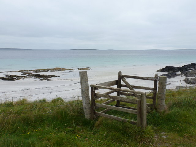
Coastal Marsh, Saltings in Orkney

Scotland

Point of Steedie

Egilsay: a view from Rousay Looking across the Rousay Sound from the isle of Rousay towards Egilsay, with the distinctive round tower of <a href="https://www.geograph.org.uk/photo/2584979">HY4630 : Egilsay: St. Magnus church</a> roughly centre of the picture.

Behind Egilsay are Muckle Green Holm and its companion Little Green Holm, with Stronsay silhouetted right across the picture beyond.
Egilsay: a view from Rousay Credit: Chris Downer

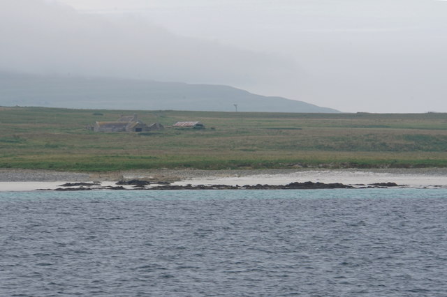
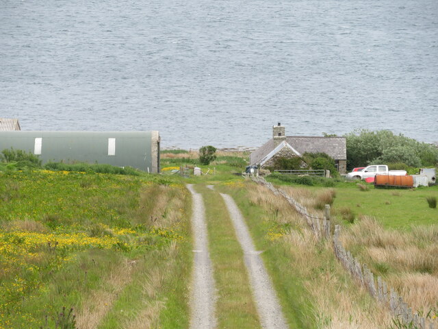
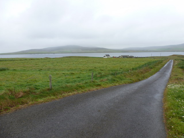
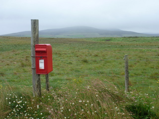
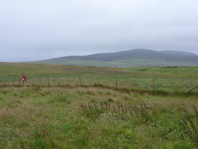
Point of Steedie, located in Orkney, Scotland, is a coastal marsh area known for its unique and diverse ecosystem. It is situated near the village of St. Margaret's Hope and is characterized by its extensive saltings, which are large areas of marshland that are regularly flooded by the tides.

The marshes at Point of Steedie are home to a wide variety of plant and animal species that have adapted to the unique conditions of the saltwater environment. The saltings provide an important habitat for numerous bird species, including wading birds such as curlews and redshanks, as well as migratory birds that visit the area during certain times of the year.

The marshland is dominated by salt-tolerant plants, such as marine grasses and samphire, which thrive in the salty conditions. These plants help to stabilize the soil and prevent erosion, creating a vital ecosystem for both terrestrial and aquatic organisms.

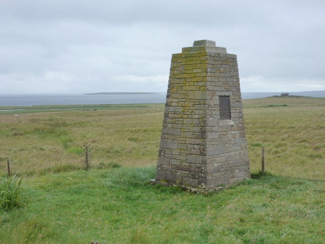
Point of Steedie is also significant from an archaeological perspective, with evidence of human activity dating back thousands of years. The area contains ancient burial sites and the remains of settlements, providing important insights into Orkney's rich history.

In addition to its ecological and historical significance, Point of Steedie offers visitors stunning views of the surrounding coastline and the opportunity to observe the diverse wildlife that calls this area home. It is a popular destination for birdwatchers, nature enthusiasts, and those interested in exploring Orkney's natural and cultural heritage.

If you have any feedback on the listing, please let us know in the comments section below.

Point of Steedie Images

Images are sourced within 2km of 59.1612/-2.9429003 or Grid Reference HY4630. Thanks to Geograph Open Source API. All images are credited.

Egilsay: a view from Rousay Looking across the Rousay Sound from the isle of Rousay towards Egilsay, with the distinctive round tower of <a href="https://www.geograph.org.uk/photo/2584979">HY4630 : Egilsay: St. Magnus church</a> roughly centre of the picture.

Behind Egilsay are Muckle Green Holm and its companion Little Green Holm, with Stronsay silhouetted right across the picture beyond.
Egilsay: a view from Rousay
Looking across the Rousay Sound from the isle of Rousay towards Egilsay, with the distinctive round tower of HY4630 : Egilsay: St. Magnus church roughly centre of the picture. Behind Egilsay are Muckle Green Holm and its companion Little Green Holm, with Stronsay silhouetted right across the picture beyond.
Mae Banks A sandy beach on the eastern side of Egilsay. Grugar Farm is a bit further inland.
Mae Banks
A sandy beach on the eastern side of Egilsay. Grugar Farm is a bit further inland.
Fishing boat passing Mae Banks A sandy stretch of coast on the eastern side of Egilsay.
Fishing boat passing Mae Banks
A sandy stretch of coast on the eastern side of Egilsay.
Beach below Maeness A view of Egilsay from a passing ferry, though the hills behind are on Rousay. St Magnus Church is far right.
Beach below Maeness
A view of Egilsay from a passing ferry, though the hills behind are on Rousay. St Magnus Church is far right.
Mae Ness A very low headland on Egilsay. St Magnus Church is in the centre, while Knitchen Hill on Rousay stands behind.
Mae Ness
A very low headland on Egilsay. St Magnus Church is in the centre, while Knitchen Hill on Rousay stands behind.
Gorehouse, Rousay Small farmstead above the shoreline on the east side of the island.
Gorehouse, Rousay
Small farmstead above the shoreline on the east side of the island.
St. Magnus Church, Egilsay
Egilsay: St. Magnus Kirk from the road Looking towards the distinctive round tower of this historic church, from the road running north-south along the island. A lump of the island of Rousay is in the background.
Egilsay: St. Magnus Kirk from the road
Looking towards the distinctive round tower of this historic church, from the road running north-south along the island. A lump of the island of Rousay is in the background.
Egilsay: southward view along the road The island crossroads is in the foreground of the picture, beyond which we look along the straight road running south. The island's postbox is on the right just beyond the junction.
Egilsay: southward view along the road
The island crossroads is in the foreground of the picture, beyond which we look along the straight road running south. The island's postbox is on the right just beyond the junction.
Egilsay: St. Magnus Kirk from the harbour Looking across the island's new jetty, on which is the road sign, towards its most famous landmark.
Egilsay: St. Magnus Kirk from the harbour
Looking across the island's new jetty, on which is the road sign, towards its most famous landmark.
Egilsay: gateway to Manse Beach A beach of white sand intermixed with outcrops of rock on the eastern side of the island.
Egilsay: gateway to Manse Beach
A beach of white sand intermixed with outcrops of rock on the eastern side of the island.
Egilsay: the road to the ferry Approaching the ferry slipway, which is hidden behind the house. The island of Rousay is in the background.
Egilsay: the road to the ferry
Approaching the ferry slipway, which is hidden behind the house. The island of Rousay is in the background.
Egilsay: the school The island's school is currently 'mothballed' because there are no children of primary school age on the island.
Egilsay: the school
The island's school is currently 'mothballed' because there are no children of primary school age on the island.
Egilsay: postbox № KW17 61 The island's postbox is attached to a large wooden pole by the crossroads and is emptied at 8:25 each morning except Sunday. The island of Rousay is in the distance.
Egilsay: postbox № KW17 61
The island's postbox is attached to a large wooden pole by the crossroads and is emptied at 8:25 each morning except Sunday. The island of Rousay is in the distance.
Egilsay: St. Magnus the Martyr monument The plaque states:

Erected by the rector and congregation of St. Magnus the Martyr by London Bridge, and the minister and congregation of St. Magnus cathedral Kirkwall, to mark the traditional spot where Earl Magnus was slain, A.D. c.1116 and to commemorate the octocentenary of St. Magnus cathedral, 1937.
Egilsay: St. Magnus the Martyr monument
The plaque states: Erected by the rector and congregation of St. Magnus the Martyr by London Bridge, and the minister and congregation of St. Magnus cathedral Kirkwall, to mark the traditional spot where Earl Magnus was slain, A.D. c.1116 and to commemorate the octocentenary of St. Magnus cathedral, 1937.
Egilsay: view past the postbox towards Rousay The island's postbox (see <a href="https://www.geograph.org.uk/photo/2584959">HY4630 : Egilsay: postbox № KW17 61</a>) provides a splash of colour on a grey, drizzly day as we look across the island towards the slopes of the neighbourning isle of Rousay.
Egilsay: view past the postbox towards Rousay
The island's postbox (see HY4630 : Egilsay: postbox № KW17 61) provides a splash of colour on a grey, drizzly day as we look across the island towards the slopes of the neighbourning isle of Rousay.
Egilsay: St. Magnus church The ruins of the 12th-century church dedicated to Earl Magnus, who was killed a short distance southeast of here in about 1116.<span class="nowrap"><a title="https://canmore.org.uk/site/2697/egilsay-st-magnuss-church" rel="nofollow ugc noopener" href="https://canmore.org.uk/site/2697/egilsay-st-magnuss-church">Link</a><img style="margin-left:2px;" alt="External link" title="External link - shift click to open in new window" src="https://s1.geograph.org.uk/img/external.png" width="10" height="10"/></span>
Egilsay: St. Magnus church
The ruins of the 12th-century church dedicated to Earl Magnus, who was killed a short distance southeast of here in about 1116.LinkExternal link
Egilsay: welcome to Onziebust Nature Reserve Looking along the road east from the crossroads. The island across the water is Eday.
Egilsay: welcome to Onziebust Nature Reserve
Looking along the road east from the crossroads. The island across the water is Eday.
Show me another place!

Point of Steedie is located at Grid Ref: HY4630 (Lat: 59.1612, Lng: -2.9429003)

Unitary Authority: Orkney Islands

Police Authority: Highlands and Islands

What 3 Words

///unit.protester.vine. Near Brinian, Orkney Islands

Related Wikis

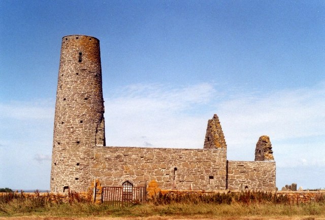
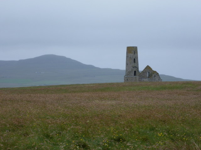
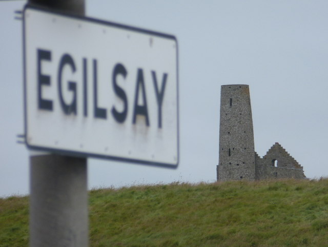
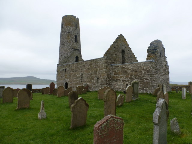
St Magnus Church, Egilsay

St Magnus's Church is a ruined medieval church located on the island of Egilsay, in Orkney, Scotland. The site is recognized as the place of execution...

Holm of Scockness

The Holm of Scockness is a small island in the Orkney Islands, between Rousay and Egilsay. It is currently used for grazing. Its name is Norse in origin...
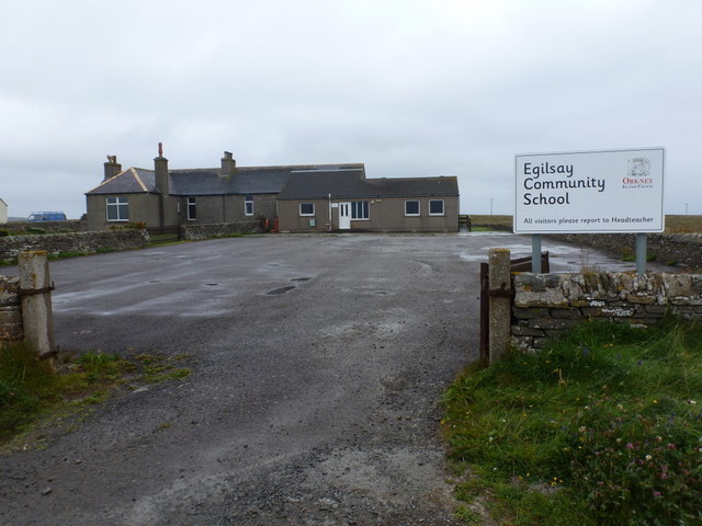
Egilsay

Egilsay (, Scots: Egilsay) is one of the Orkney Islands in Scotland, lying east of Rousay. The anglicized name of Eagleshay was used in past centuries...

Kili Holm

Kili Holm is a tidal island in the Orkney Islands, linked to Egilsay. Unusually, like its neighbour Egilsay, it may have a partly Gaelic etymology, in...

Nearby Amenities

Located within 500m of 59.1612,-2.9429003
Power: pole
Lat/Long: 59.1615809/-2.9349241
Power: pole
Lat/Long: 59.1621515/-2.9347202
Power: pole
Lat/Long: 59.16032/-2.9343112
Power: pole
Lat/Long: 59.1610295/-2.9351266
Sands of Skaill
Place: locality
Lat/Long: 59.1583381/-2.9412759
The data included in this document is from www.openstreetmap.org. The data is made available under ODbL.

Have you been to Point of Steedie?

Leave your review of Point of Steedie below (or comments, questions and feedback).