South Happ

Sea, Estuary, Creek in Orkney

Scotland

South Happ

Egilsay: a view from Rousay Looking across the Rousay Sound from the isle of Rousay towards Egilsay, with the distinctive round tower of <a href="https://www.geograph.org.uk/photo/2584979">HY4630 : Egilsay: St. Magnus church</a> roughly centre of the picture.

Behind Egilsay are Muckle Green Holm and its companion Little Green Holm, with Stronsay silhouetted right across the picture beyond.
Egilsay: a view from Rousay Credit: Chris Downer

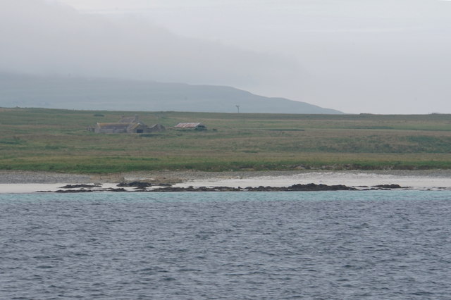
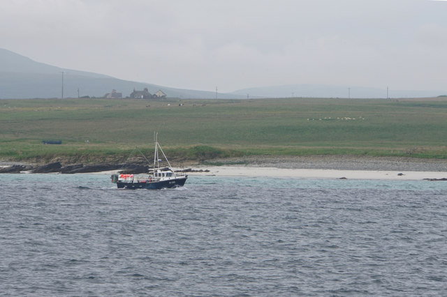
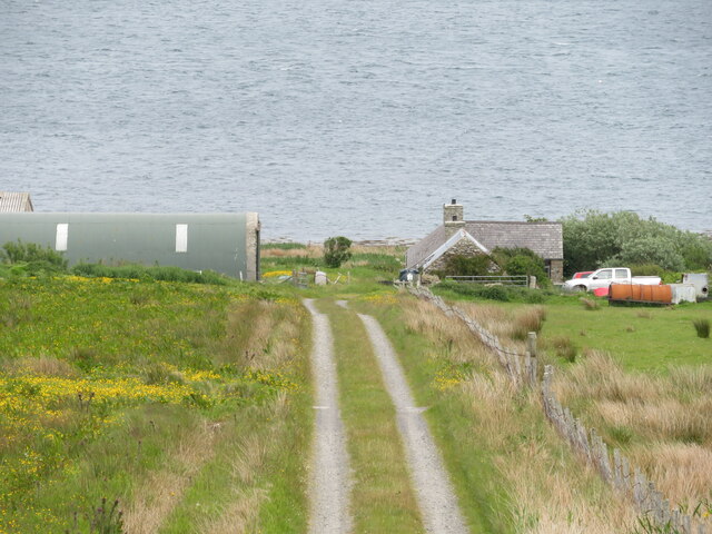
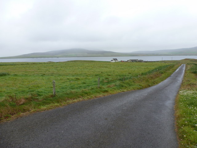
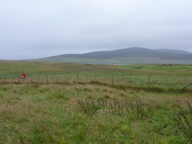
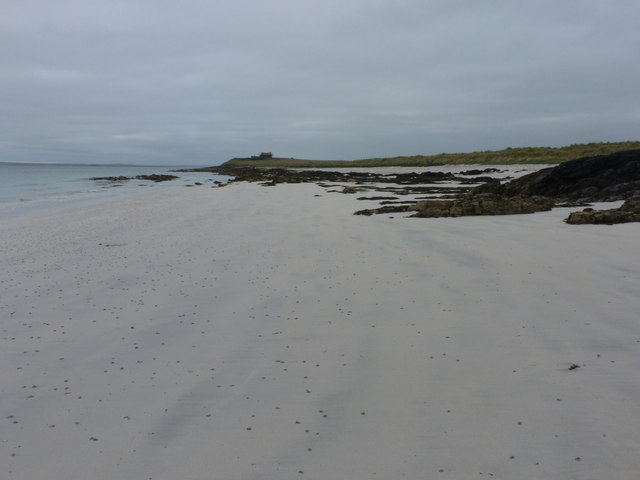
South Happ is a small coastal settlement located in the Orkney Islands, which are situated off the northeastern coast of Scotland. Nestled along the eastern shore, South Happ enjoys breathtaking views of the North Sea and is surrounded by a diverse natural landscape comprised of estuaries, creeks, and rich marine ecosystems.

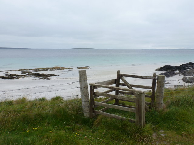
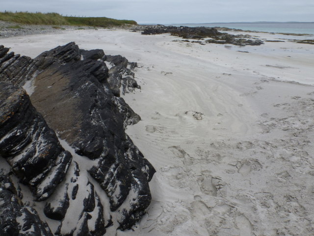
The settlement's proximity to the sea makes it an ideal destination for water enthusiasts and nature lovers alike. The North Sea offers a variety of recreational activities, including fishing, sailing, and surfing. Visitors can explore the rugged coastline, dotted with dramatic cliffs and secluded sandy beaches that provide a tranquil escape from the bustling city life.

South Happ is also blessed with the presence of several picturesque estuaries and creeks, which add to its natural charm. These estuaries act as important habitats for a wide range of bird species, making it a haven for birdwatchers and wildlife enthusiasts. Observing the diverse birdlife, including puffins, guillemots, and kittiwakes, is a popular pastime in South Happ.

The area's marine ecosystem is teeming with life, attracting marine biologists and researchers from around the world. The creeks and estuaries provide a breeding ground for various fish species, such as Atlantic salmon and sea trout. Additionally, seals and otters can often be spotted along the coastline, adding to the area's rich biodiversity.

Overall, South Happ in Orkney is a captivating destination that offers a unique blend of rugged coastal landscapes, diverse marine ecosystems, and abundant wildlife. Whether one is seeking adventure, relaxation, or an opportunity to connect with nature, South Happ is a place that truly captures the essence of the Scottish coastline.

If you have any feedback on the listing, please let us know in the comments section below.

South Happ Images

Images are sourced within 2km of 59.154872/-2.9436703 or Grid Reference HY4630. Thanks to Geograph Open Source API. All images are credited.

Egilsay: a view from Rousay Looking across the Rousay Sound from the isle of Rousay towards Egilsay, with the distinctive round tower of <a href="https://www.geograph.org.uk/photo/2584979">HY4630 : Egilsay: St. Magnus church</a> roughly centre of the picture.

Behind Egilsay are Muckle Green Holm and its companion Little Green Holm, with Stronsay silhouetted right across the picture beyond.
Egilsay: a view from Rousay
Looking across the Rousay Sound from the isle of Rousay towards Egilsay, with the distinctive round tower of HY4630 : Egilsay: St. Magnus church roughly centre of the picture. Behind Egilsay are Muckle Green Holm and its companion Little Green Holm, with Stronsay silhouetted right across the picture beyond.
Mae Banks A sandy beach on the eastern side of Egilsay. Grugar Farm is a bit further inland.
Mae Banks
A sandy beach on the eastern side of Egilsay. Grugar Farm is a bit further inland.
Fishing boat passing Mae Banks A sandy stretch of coast on the eastern side of Egilsay.
Fishing boat passing Mae Banks
A sandy stretch of coast on the eastern side of Egilsay.
Gorehouse, Rousay Small farmstead above the shoreline on the east side of the island.
Gorehouse, Rousay
Small farmstead above the shoreline on the east side of the island.
St. Magnus Church, Egilsay
Egilsay: St. Magnus Kirk from the road Looking towards the distinctive round tower of this historic church, from the road running north-south along the island. A lump of the island of Rousay is in the background.
Egilsay: St. Magnus Kirk from the road
Looking towards the distinctive round tower of this historic church, from the road running north-south along the island. A lump of the island of Rousay is in the background.
Egilsay: southward view along the road The island crossroads is in the foreground of the picture, beyond which we look along the straight road running south. The island's postbox is on the right just beyond the junction.
Egilsay: southward view along the road
The island crossroads is in the foreground of the picture, beyond which we look along the straight road running south. The island's postbox is on the right just beyond the junction.
Egilsay: St. Magnus Kirk from the harbour Looking across the island's new jetty, on which is the road sign, towards its most famous landmark.
Egilsay: St. Magnus Kirk from the harbour
Looking across the island's new jetty, on which is the road sign, towards its most famous landmark.
Egilsay: gateway to Manse Beach A beach of white sand intermixed with outcrops of rock on the eastern side of the island.
Egilsay: gateway to Manse Beach
A beach of white sand intermixed with outcrops of rock on the eastern side of the island.
Egilsay: the road to the ferry Approaching the ferry slipway, which is hidden behind the house. The island of Rousay is in the background.
Egilsay: the road to the ferry
Approaching the ferry slipway, which is hidden behind the house. The island of Rousay is in the background.
Egilsay: the school The island's school is currently 'mothballed' because there are no children of primary school age on the island.
Egilsay: the school
The island's school is currently 'mothballed' because there are no children of primary school age on the island.
Egilsay: postbox № KW17 61 The island's postbox is attached to a large wooden pole by the crossroads and is emptied at 8:25 each morning except Sunday. The island of Rousay is in the distance.
Egilsay: postbox № KW17 61
The island's postbox is attached to a large wooden pole by the crossroads and is emptied at 8:25 each morning except Sunday. The island of Rousay is in the distance.
Egilsay: St. Magnus the Martyr monument The plaque states:

Erected by the rector and congregation of St. Magnus the Martyr by London Bridge, and the minister and congregation of St. Magnus cathedral Kirkwall, to mark the traditional spot where Earl Magnus was slain, A.D. c.1116 and to commemorate the octocentenary of St. Magnus cathedral, 1937.
Egilsay: St. Magnus the Martyr monument
The plaque states: Erected by the rector and congregation of St. Magnus the Martyr by London Bridge, and the minister and congregation of St. Magnus cathedral Kirkwall, to mark the traditional spot where Earl Magnus was slain, A.D. c.1116 and to commemorate the octocentenary of St. Magnus cathedral, 1937.
Egilsay: view past the postbox towards Rousay The island's postbox (see <a href="https://www.geograph.org.uk/photo/2584959">HY4630 : Egilsay: postbox № KW17 61</a>) provides a splash of colour on a grey, drizzly day as we look across the island towards the slopes of the neighbourning isle of Rousay.
Egilsay: view past the postbox towards Rousay
The island's postbox (see HY4630 : Egilsay: postbox № KW17 61) provides a splash of colour on a grey, drizzly day as we look across the island towards the slopes of the neighbourning isle of Rousay.
Egilsay: St. Magnus church The ruins of the 12th-century church dedicated to Earl Magnus, who was killed a short distance southeast of here in about 1116.<span class="nowrap"><a title="https://canmore.org.uk/site/2697/egilsay-st-magnuss-church" rel="nofollow ugc noopener" href="https://canmore.org.uk/site/2697/egilsay-st-magnuss-church">Link</a><img style="margin-left:2px;" alt="External link" title="External link - shift click to open in new window" src="https://s1.geograph.org.uk/img/external.png" width="10" height="10"/></span>
Egilsay: St. Magnus church
The ruins of the 12th-century church dedicated to Earl Magnus, who was killed a short distance southeast of here in about 1116.LinkExternal link
Egilsay: welcome to Onziebust Nature Reserve Looking along the road east from the crossroads. The island across the water is Eday.
Egilsay: welcome to Onziebust Nature Reserve
Looking along the road east from the crossroads. The island across the water is Eday.
Egilsay: rocks at Manse Beach White sand and rocky outcrops on the east coast of the island.
Egilsay: rocks at Manse Beach
White sand and rocky outcrops on the east coast of the island.
Egilsay: Manse Beach A lovely white sandy beach on the east coast of the island.
Egilsay: Manse Beach
A lovely white sandy beach on the east coast of the island.
Show me another place!

South Happ is located at Grid Ref: HY4630 (Lat: 59.154872, Lng: -2.9436703)

Unitary Authority: Orkney Islands

Police Authority: Highlands and Islands

What 3 Words

///shredding.sheds.estimates. Near Brinian, Orkney Islands

Related Wikis

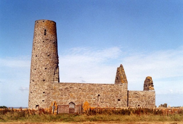
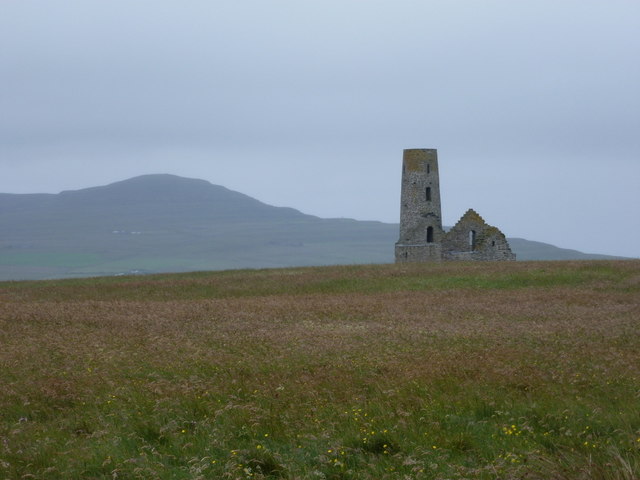
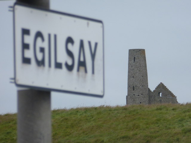
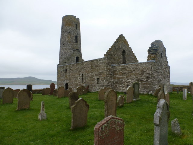
St Magnus Church, Egilsay

St Magnus's Church is a ruined medieval church located on the island of Egilsay, in Orkney, Scotland. The site is recognized as the place of execution...

Holm of Scockness

The Holm of Scockness is a small island in the Orkney Islands, between Rousay and Egilsay. It is currently used for grazing. Its name is Norse in origin...

Egilsay

Egilsay (, Scots: Egilsay) is one of the Orkney Islands in Scotland, lying east of Rousay. The island is largely farmland and is known for its corncrakes...

Kili Holm

Kili Holm is a tidal island in the Orkney Islands, linked to Egilsay. Unusually, like its neighbour Egilsay, it may have a partly Gaelic etymology, in...

Nearby Amenities

Located within 500m of 59.154872,-2.9436703
Ferry Terminal
Egilsay Ferry Terminal
Lat/Long: 59.1549457/-2.9446211
Egilsay slip
Seamark Light Character: Fl
Seamark Light Colour: green
Seamark Light Height: 4
Seamark Light Period: 3
Seamark Light Range: 4
Seamark Light Reference: A 3740
Seamark Light Sequence: 0.3+(2.7)
Seamark Type: light_minor
Source: US NGA Pub. 114. 2011-05-26.
Lat/Long: 59.1546578/-2.9449542
Power: pole
Lat/Long: 59.1512796/-2.9392397
Power: pole
Lat/Long: 59.1512493/-2.9404709
Location Transition: yes
Power: pole
Lat/Long: 59.151206/-2.9413694
Power: pole
Lat/Long: 59.1551015/-2.9410864
Power: pole
Lat/Long: 59.15514/-2.9401691
Power: pole
Lat/Long: 59.1552143/-2.9384257
Power: pole
Lat/Long: 59.1552693/-2.9367842
Power: pole
Lat/Long: 59.1553243/-2.9350488
Toilets
Lat/Long: 59.1559138/-2.9424129
Sands of Skaill
Place: locality
Lat/Long: 59.1583381/-2.9412759
The data included in this document is from www.openstreetmap.org. The data is made available under ODbL.

Have you been to South Happ?

Leave your review of South Happ below (or comments, questions and feedback).