Foulney Twist

Coastal Marsh, Saltings in Lancashire Barrow-in-Furness

England

Foulney Twist

Piel Island and Castle, Barrow-in-Furness
Piel Island and Castle, Barrow-in-Furness Credit: Simon Ledingham

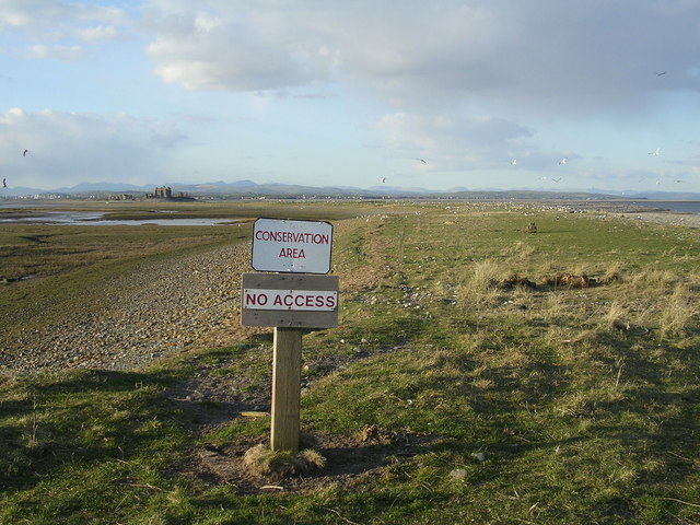
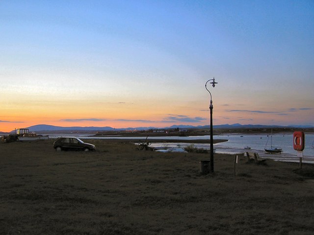
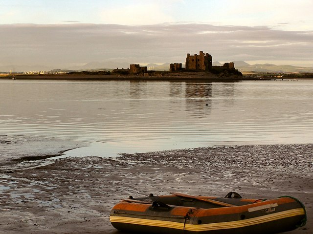
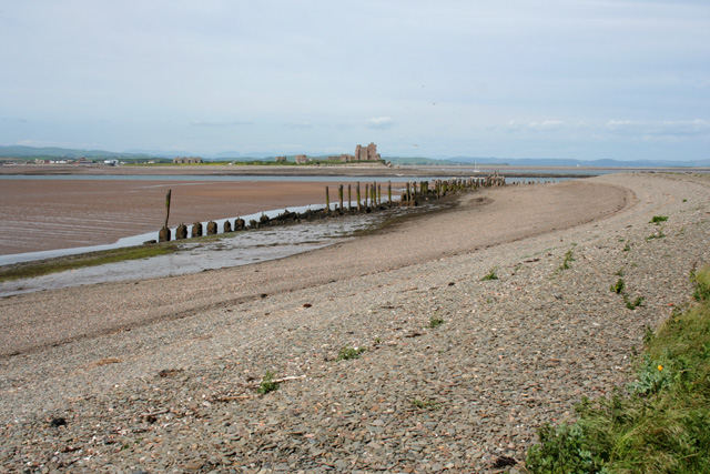
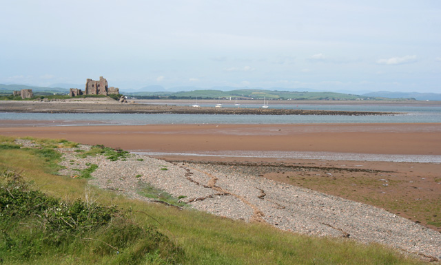
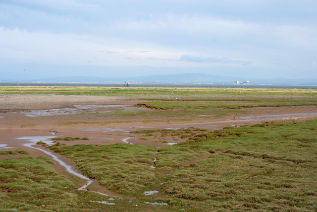
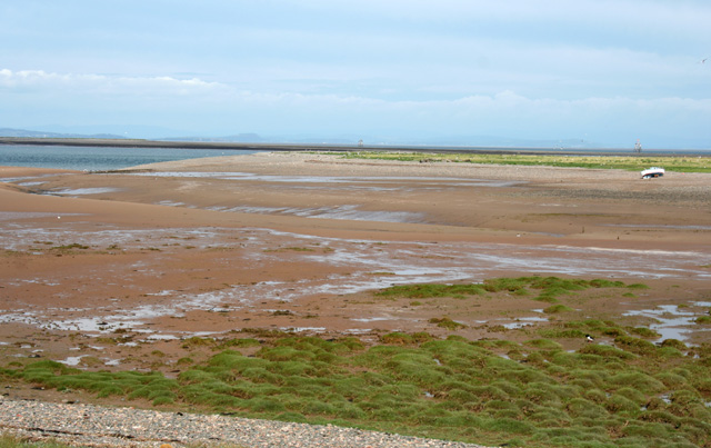
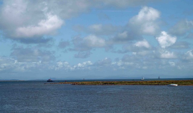
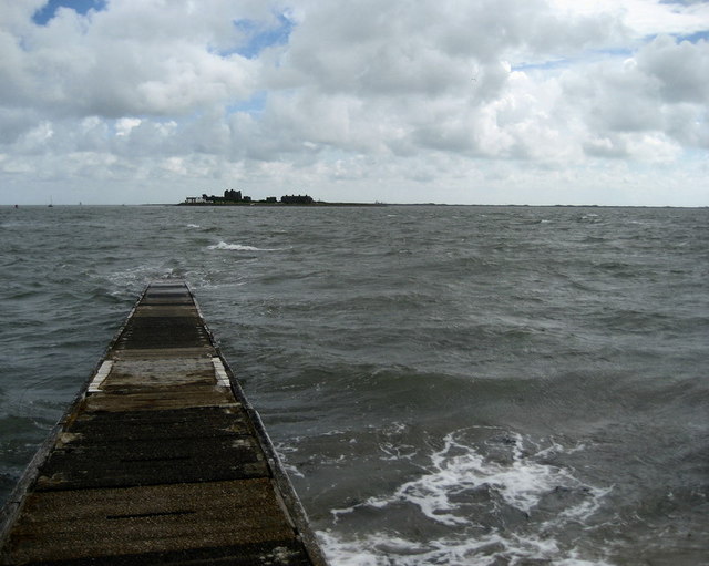
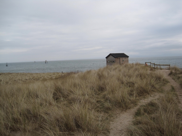
Foulney Twist is a small coastal marsh located in the county of Lancashire, England. It is situated on the southern edge of Morecambe Bay, just off the coast of the town of Barrow-in-Furness. The marsh is known for its unique landscape of saltings, which are areas of low-lying land near the coast that are regularly flooded by the tides.

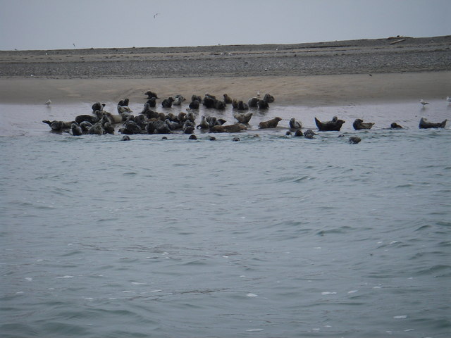
The marsh is approximately 50 acres in size and is characterized by its flat and open terrain. It is covered in a variety of salt-tolerant grasses and plants, such as sea lavender and samphire, which thrive in the brackish conditions. These plants provide important habitats and food sources for a range of bird species, including waders like redshanks and curlews, as well as ducks and geese.

Foulney Twist is also home to a number of other wildlife species, including small mammals like voles and shrews, as well as reptiles such as adders and common lizards. The marsh is considered an important site for nature conservation and has been designated as a Site of Special Scientific Interest (SSSI) due to its ecological value.

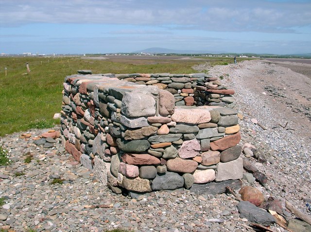
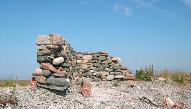
In addition to its natural significance, Foulney Twist has historical importance as well. The area has been used for salt production since medieval times, with evidence of salt pans and extraction pits still visible today.

Overall, Foulney Twist is a unique and ecologically rich coastal marsh, providing vital habitats for a range of plant and animal species.

If you have any feedback on the listing, please let us know in the comments section below.

Foulney Twist Images

Images are sourced within 2km of 54.057882/-3.150346 or Grid Reference SD2463. Thanks to Geograph Open Source API. All images are credited.

Piel Island and Castle, Barrow-in-Furness
Shelly Bars, South Walney Nature Reserve Looking north towards Piel Castle
Shelly Bars, South Walney Nature Reserve
Looking north towards Piel Castle
Piel Castle Looking East from Fouldrey Stones. A popular summer destination for visiting and local sailors. Site of spectacular sun-sets
Piel Castle
Looking East from Fouldrey Stones. A popular summer destination for visiting and local sailors. Site of spectacular sun-sets
Sunset over Barrow in Furness
Safely Ashore The head of the landing on Piel Island
Safely Ashore
The head of the landing on Piel Island
Seal colony on South Walney This colony of Grey Seals has been gradually expanding over the past few years, currently well over 70 can be seen hauled out on the sands
Seal colony on South Walney
This colony of Grey Seals has been gradually expanding over the past few years, currently well over 70 can be seen hauled out on the sands
Bass Pool There were numerous seals swimming in the water at the time of the photograph, one can be seen centre right. There is a rich source of food for marine life hereabouts, brought in on strong tides which was making at this time. Bass Pool is no longer navigable as it dries at its NW end about half tide on the ebb. It is understood that it was the main channel through to Barrow in Furness many years ago. The main channel now passes to the east of the island which has been known for many years as Piel Harbour.
Bass Pool
There were numerous seals swimming in the water at the time of the photograph, one can be seen centre right. There is a rich source of food for marine life hereabouts, brought in on strong tides which was making at this time. Bass Pool is no longer navigable as it dries at its NW end about half tide on the ebb. It is understood that it was the main channel through to Barrow in Furness many years ago. The main channel now passes to the east of the island which has been known for many years as Piel Harbour.
Disused pier on the north shore of Walney Island Shingle beach with a sand spit behind, part of Snab Sands. The disused pier at North East Point runs broadly parallel with the beach. Piel Castle on Piel Island is visible on the horizon (in <a href="https://www.geograph.org.uk/gridref/SD2363">SD2363</a>)
Disused pier on the north shore of Walney Island
Shingle beach with a sand spit behind, part of Snab Sands. The disused pier at North East Point runs broadly parallel with the beach. Piel Castle on Piel Island is visible on the horizon (in SD2363)
View to Piel Castle from North East Point View NNE from the track at the north-east corner of Walney Island towards Piel Island and Piel Castle (<a href="https://www.geograph.org.uk/gridref/SD2363">SD2363</a>). Bass Pool lies between the sands of North East Point and Piel Island, with Piel Harbour beyond
View to Piel Castle from North East Point
View NNE from the track at the north-east corner of Walney Island towards Piel Island and Piel Castle (SD2363). Bass Pool lies between the sands of North East Point and Piel Island, with Piel Harbour beyond
Shelly Bars Shelly Bars is part of the South Walney Nature Reserve, and is not accessible to the public. An extensive area of salt marsh (foreground) divides the main Walney Island from Shelly Bars. View from the hide near North East Point
Shelly Bars
Shelly Bars is part of the South Walney Nature Reserve, and is not accessible to the public. An extensive area of salt marsh (foreground) divides the main Walney Island from Shelly Bars. View from the hide near North East Point
Shelly Bars and North East Point Shelly Bars is part of the South Walney Nature Reserve, and is not accessible to the public. This view from the hide near North East Point shows the northern end of the sand bar. An oyster catcher is visible in the salt marsh (right foreground)
Shelly Bars and North East Point
Shelly Bars is part of the South Walney Nature Reserve, and is not accessible to the public. This view from the hide near North East Point shows the northern end of the sand bar. An oyster catcher is visible in the salt marsh (right foreground)
Piel Island and Castle Piel Island with ruined castle can be accessed via a ferry from Roa Island.
Piel Island and Castle
Piel Island with ruined castle can be accessed via a ferry from Roa Island.
The view from the pier head bird hide
Stone Shelter on Foulney Island Black Combe is the hill in the background
Stone Shelter on Foulney Island
Black Combe is the hill in the background
Blockhouse on Foulney Island A trail marked by posts and blue rope should be followed so as not to disturb nesting birds
Blockhouse on Foulney Island
A trail marked by posts and blue rope should be followed so as not to disturb nesting birds
Stone Shelter on Foulney Island This photo was taken 3 years after the first one in this square <a title="https://www.geograph.org.uk/photo/1920300" href="https://www.geograph.org.uk/photo/1920300">Link</a> , note half of the near side of the shelter has disappeared, probably due to erosion as the shingle it sits on is gradually washed away during high tides.
Stone Shelter on Foulney Island
This photo was taken 3 years after the first one in this square Link , note half of the near side of the shelter has disappeared, probably due to erosion as the shingle it sits on is gradually washed away during high tides.
Roa Island Landing Slipway The ferry slipway during a very high tide. A bloke called "Steve" offers a ferry service from here to Piel Island, seen in the distance, during the summer.
Roa Island Landing Slipway
The ferry slipway during a very high tide. A bloke called "Steve" offers a ferry service from here to Piel Island, seen in the distance, during the summer.
Groyne Hide, South Walney Nature Reserve
Show me another place!

Foulney Twist is located at Grid Ref: SD2463 (Lat: 54.057882, Lng: -3.150346)

Administrative County: Cumbria

District: Barrow-in-Furness

Police Authority: Cumbria

What 3 Words

///dizziness.sandpaper.sensibly. Near Barrow in Furness, Cumbria

Related Wikis

Foulney Island

Foulney Island is a low-lying grass and shingle area 1 mile (1.6 km) to the south-east of Roa Island, off the southern tip of the Furness Peninsula in...
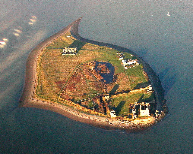
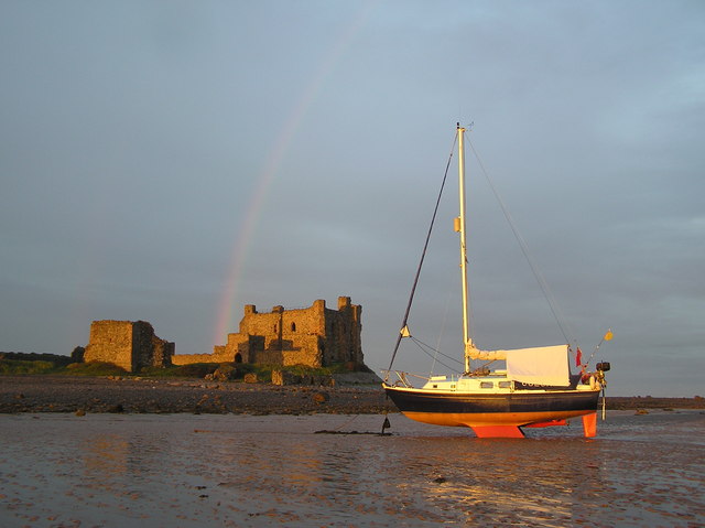
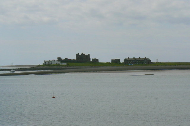
Piel Castle

Piel Castle, also known as Fouldry Castle or the Pile of Fouldray, is a castle situated on the south-eastern point of Piel Island, off the coast of the...

Piel Island

Piel Island lies in Morecambe Bay , around 1⁄2 mile (800 metres) off the southern tip of the Furness peninsula in the administrative county of Cumbria...

Walney Lighthouse

Walney Lighthouse is a functioning lighthouse located on Walney Island in Barrow-in-Furness, Cumbria, England. The current building dates to the early...

Roa Island

Roa Island lies just over half a mile (1 km) south of the village of Rampside at the southernmost point of the Furness Peninsula in Westmorland and Furness...

Piel railway station

Piel railway station was the terminus of the Furness Railway's Piel Branch in Barrow-in-Furness, England that operated between 1846 and 1936. Located on...

Rampside

Rampside is a village in Cumbria, England. Historically in Lancashire, it is located a few miles south-east of the town of Barrow-in-Furness, in the north...

Rampside Leading Light

Rampside Leading Light, also known as "The Needle", is a leading light (navigation beacon) located in the Rampside area of Barrow-in-Furness, Cumbria,...

Have you been to Foulney Twist?

Leave your review of Foulney Twist below (or comments, questions and feedback).