Bavelaw Marsh

Coastal Marsh, Saltings in Midlothian

Scotland

Bavelaw Marsh

The Pond at Red Moss Nature Reserve The Red Moss of Balerno is an SSSI, managed by the Scottish Wildlife Trust. It is an excellent example of a raised bog, and can be visited along a boardwalk.
The Pond at Red Moss Nature Reserve Credit: Oliver Dixon

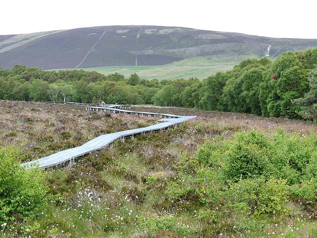
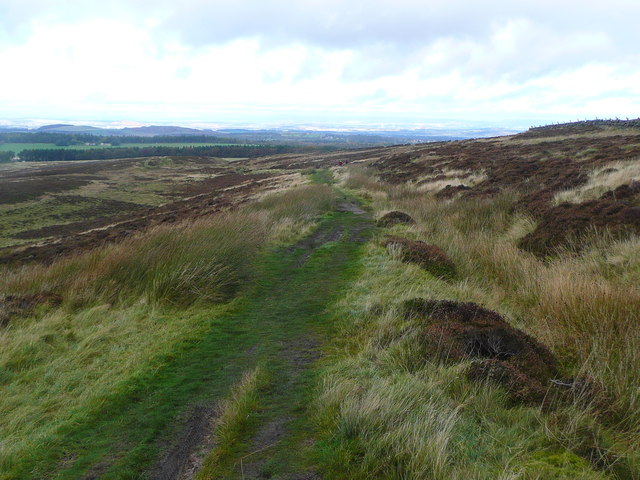
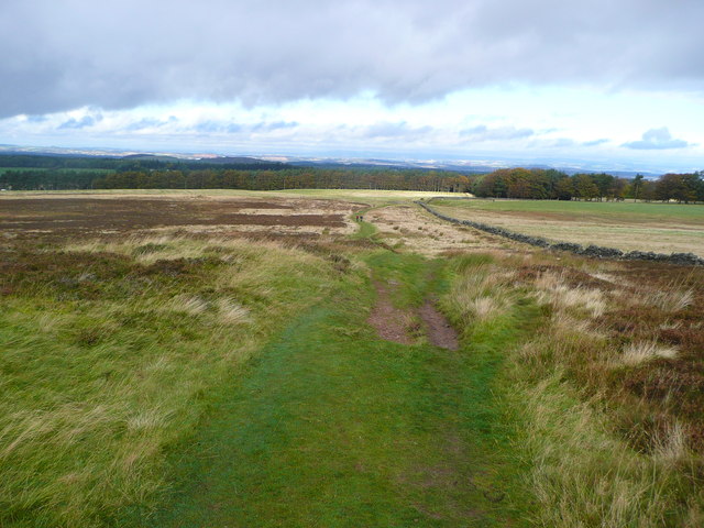
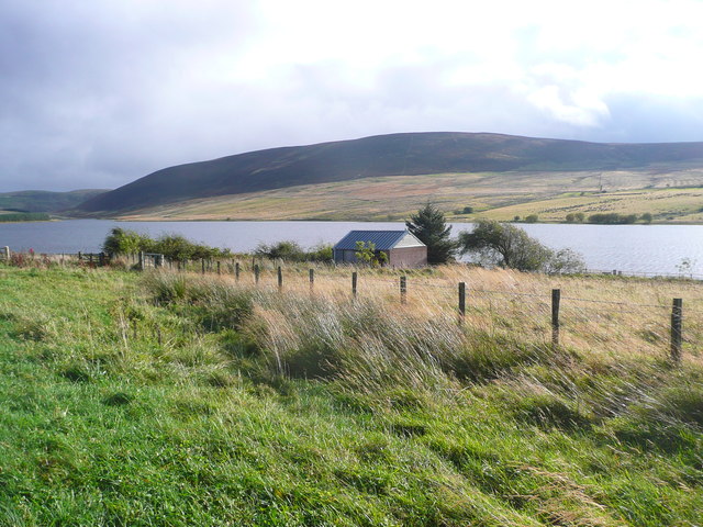
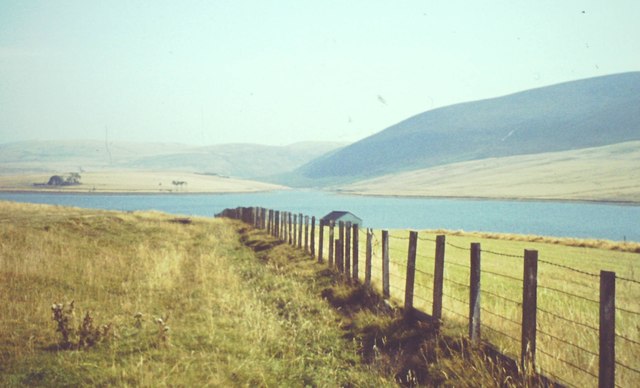
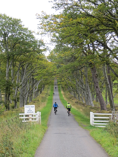
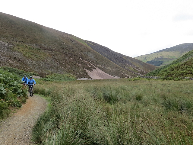
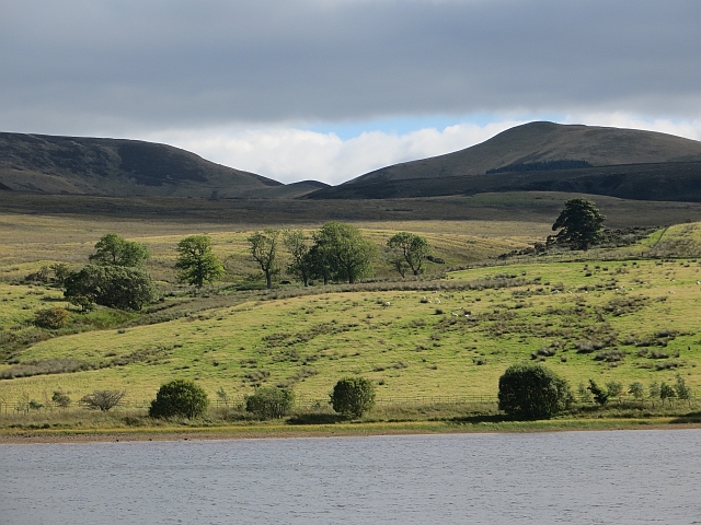
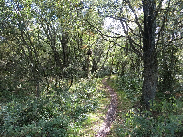
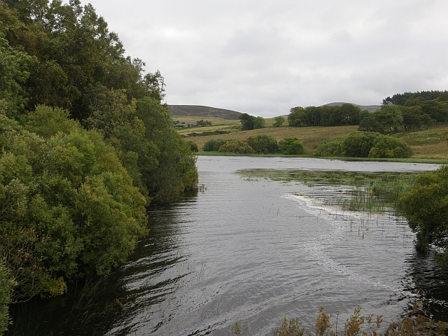
Bavelaw Marsh is a coastal marsh located in Midlothian, Scotland. It is situated on the southern shore of the Firth of Forth, approximately 12 kilometers west of Edinburgh. The marsh is part of a larger protected area known as the Bavelaw Marshes and Pentland Hills Regional Park, which covers a total area of around 10,000 hectares.

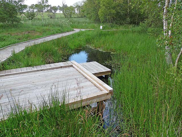
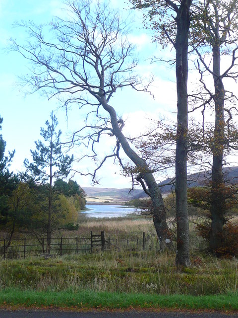
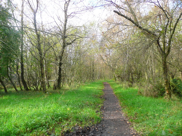
The marsh is characterized by its unique coastal ecosystem, consisting of a mix of marshland, mudflats, and saltmarshes. It is influenced by the nearby tidal movements of the Firth of Forth, resulting in a dynamic and ever-changing landscape. The marsh is home to a diverse range of flora and fauna, including various species of birds, insects, and plants.

The saltmarshes found in Bavelaw Marsh are particularly important, as they provide a habitat for many species of salt-tolerant plants. These plants, such as sea lavender and saltmarsh grass, help stabilize the marshland and provide food and shelter for a variety of wildlife.

The marsh is also a popular site for birdwatching, attracting both local bird enthusiasts and tourists. Species commonly spotted in the area include wading birds like curlews and redshanks, as well as ducks, geese, and swans. Additionally, the marsh serves as an important stopover point for migratory birds during their journeys.

Bavelaw Marsh is managed by the local authorities and conservation organizations to ensure its preservation and protection. It offers visitors an opportunity to experience the beauty and biodiversity of a coastal marsh environment, while also contributing to scientific research and conservation efforts.

If you have any feedback on the listing, please let us know in the comments section below.

Bavelaw Marsh Images

Images are sourced within 2km of 55.856494/-3.3415412 or Grid Reference NT1663. Thanks to Geograph Open Source API. All images are credited.

The Pond at Red Moss Nature Reserve The Red Moss of Balerno is an SSSI, managed by the Scottish Wildlife Trust. It is an excellent example of a raised bog, and can be visited along a boardwalk.
The Pond at Red Moss Nature Reserve
The Red Moss of Balerno is an SSSI, managed by the Scottish Wildlife Trust. It is an excellent example of a raised bog, and can be visited along a boardwalk.
The boardwalk at Red Moss Nature Reserve The Red Moss of Balerno is an SSSI, managed by the Scottish Wildlife Trust. It is an excellent example of a raised bog, and can be visited along a boardwalk. Black Hill <a href="https://www.geograph.org.uk/gridref/NT1863">NT1863</a> in the Pentlands dominates the skyline.
The boardwalk at Red Moss Nature Reserve
The Red Moss of Balerno is an SSSI, managed by the Scottish Wildlife Trust. It is an excellent example of a raised bog, and can be visited along a boardwalk. Black Hill NT1863 in the Pentlands dominates the skyline.
Boats at Threipmuir Reservoir Boats on the shore of Threipmuir Reservoir below the fishing hut. The level of water in the Reservoir is very low. Easter Bavelaw Farm can be seen on the far side of the Reservoir. Hare Hill <a href="https://www.geograph.org.uk/gridref/NT1761">NT1761</a> lies beyond the Farm, with East Kip <a href="https://www.geograph.org.uk/gridref/NT1860">NT1860</a> and West Kip <a href="https://www.geograph.org.uk/gridref/NT1760">NT1760</a> on the skyline.
Boats at Threipmuir Reservoir
Boats on the shore of Threipmuir Reservoir below the fishing hut. The level of water in the Reservoir is very low. Easter Bavelaw Farm can be seen on the far side of the Reservoir. Hare Hill NT1761 lies beyond the Farm, with East Kip NT1860 and West Kip NT1760 on the skyline.
Spillway at Threipmuir Reservoir The spillway carries surplus water from Threipmuir Reservoir down into Harlaw Reservoir, as part of a system to control flows in the Water of Leith. The level of water in the reservoir at the time of the photograph was a long way below that required to bring the spillway into operation.

Black Hill <a href="https://www.geograph.org.uk/gridref/NT1863">NT1863</a> beyond.
Spillway at Threipmuir Reservoir
The spillway carries surplus water from Threipmuir Reservoir down into Harlaw Reservoir, as part of a system to control flows in the Water of Leith. The level of water in the reservoir at the time of the photograph was a long way below that required to bring the spillway into operation. Black Hill NT1863 beyond.
The Red Road Crossing the west flank of Hare Hill.  Edinburgh and the Firth of Forth just visible in the distance.
The Red Road
Crossing the west flank of Hare Hill. Edinburgh and the Firth of Forth just visible in the distance.
The Red Road The trees of Bavelaw in the distance.
The Red Road
The trees of Bavelaw in the distance.
Bavelaw Marsh from above Redford Bridge
Path through Redford Wood
Shed by Threipmuir Reservoir Threipmuir Reservoir was completed in 1848 as a water supply for Edinburgh.  Nowadays Threipmuir, along with the smaller Harlaw reservoir, provides essential upstream flood storage to prevent flooding of the Water of Leith, but is no longer used for water supply.
Shed by Threipmuir Reservoir
Threipmuir Reservoir was completed in 1848 as a water supply for Edinburgh. Nowadays Threipmuir, along with the smaller Harlaw reservoir, provides essential upstream flood storage to prevent flooding of the Water of Leith, but is no longer used for water supply.
Spillway and bridge between Threipmuir and Harlaw Reservoirs These two reservoirs were completed in the mid-19th century as a water supply for Edinburgh. Nowadays they provides essential upstream flood storage to prevent flooding of the Water of Leith, but are no longer used for water supply.
Spillway and bridge between Threipmuir and Harlaw Reservoirs
These two reservoirs were completed in the mid-19th century as a water supply for Edinburgh. Nowadays they provides essential upstream flood storage to prevent flooding of the Water of Leith, but are no longer used for water supply.
Horseshoe Weir and Fish Pass, Threipmuir Reservoir Built as part of the Water of Leith Flood Prevention project.
Horseshoe Weir and Fish Pass, Threipmuir Reservoir
Built as part of the Water of Leith Flood Prevention project.
Fields Above Threipmuir Reservoir Grassy fields and reservoir at the foot of the Pentland Hills.
Fields Above Threipmuir Reservoir
Grassy fields and reservoir at the foot of the Pentland Hills.
Exponential Hill The driveway to Bavelaw Castle has a certain reputation. Gentle to start with, but getting steeper and steeper as you progress up the dead straight beech lined road. Plenty of rewards when you get to the top.

I was walking today, and so were they by the top of the hill.
Exponential Hill
The driveway to Bavelaw Castle has a certain reputation. Gentle to start with, but getting steeper and steeper as you progress up the dead straight beech lined road. Plenty of rewards when you get to the top. I was walking today, and so were they by the top of the hill.
Pentland Push Hub Big sponsored walk for St Columba's Hospice, Edinburgh, it was held the previous day. This is the event HQ behind Bavelaw Castle, it was being dismantled.
Pentland Push Hub
Big sponsored walk for St Columba's Hospice, Edinburgh, it was held the previous day. This is the event HQ behind Bavelaw Castle, it was being dismantled.
Green Cleugh One of the glacial meltwater channels which are a major feature of the Pentland Hills. The channel provides an obvious pass route which is very popular.
Green Cleugh
One of the glacial meltwater channels which are a major feature of the Pentland Hills. The channel provides an obvious pass route which is very popular.
Eastertown Burn The south side of Threipmuir Reservoir.
Eastertown Burn
The south side of Threipmuir Reservoir.
Path, Redford Wood Path opposite the popular Threipmuir car park.
Path, Redford Wood
Path opposite the popular Threipmuir car park.
Threipmuir Reservoir View from the bridge on the road to Bavelaw.
Threipmuir Reservoir
View from the bridge on the road to Bavelaw.
Show me another place!

Bavelaw Marsh is located at Grid Ref: NT1663 (Lat: 55.856494, Lng: -3.3415412)

Unitary Authority: City of Edinburgh

Police Authority: Edinburgh

What 3 Words

///best.reporter.interests. Near Balerno, Edinburgh

Related Wikis

Bavelaw Castle

Bavelaw Castle is a historic house in the City of Edinburgh Council area, Scotland. It is north of Hare Hill in the Pentland Hills, four miles west of...

Threipmuir Reservoir

Threipmuir Reservoir is a reservoir in the City of Edinburgh Council area, Scotland, UK. It is situated to the south of Edinburgh at the base of the Pentland...

Harlaw Reservoir

Harlaw Reservoir is a small reservoir in the City of Edinburgh Council area, Scotland, UK, situated at the base of the Pentland Hills near Currie and Balerno...

Malleny House and Garden

The Malleny House and Garden is an historic house and garden owned by the National Trust for Scotland in Balerno, 6 mi (9.7 km) southwest of Edinburgh...

Balerno

Balerno (; Scottish Gaelic: Baile Àirneach, Scottish Gaelic pronunciation: [ˈpaləˈaːrˠnəx]; Scots: Balerno or Balernie) is a village on the outskirts of...

Water of Leith Walkway

The Water of Leith Walkway is a public footpath and cycleway that runs alongside the river of the same name through Edinburgh, Scotland, from Balerno to...

Balerno Community High School

Balerno High School is a six-year secondary school located in Balerno, a suburb of Edinburgh, Scotland. The school stands on the banks of the Water of...

Loganlea Reservoir

Loganlea Reservoir is a small reservoir in the Pentland Hills, Midlothian, Scotland, UK. The Logan Burn connects the reservoir with Glencorse Reservoir...

Related Videos

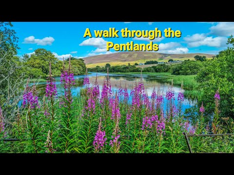
A walk through the Pentland Hills (4K)

A beautiful walk from Threipmuir Reservoir to Loganlea Reservoir, in the Pentland Hills.

Hiking Near Edinburgh - Pentland Hills Regional Park

The Pentland Hills dominate the skyline to the south of Edinburgh. The regional park is a great way to explore the Pentlands and ...

West Kip - The Pentlands

In my first video, i take a little trip to the Pentland hills at Threipmuir reservoir near Edinburgh on a cold frosty morning in February.
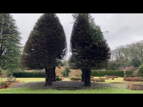
Malleny Gardens

garden #scotland #scotlandvlog #travel #solotravel The Malleny Gardens are located in the Lothians, and are in the care of the ...

Nearby Amenities

Located within 500m of 55.856494,-3.3415412
The data included in this document is from www.openstreetmap.org. The data is made available under ODbL.

Have you been to Bavelaw Marsh?

Leave your review of Bavelaw Marsh below (or comments, questions and feedback).