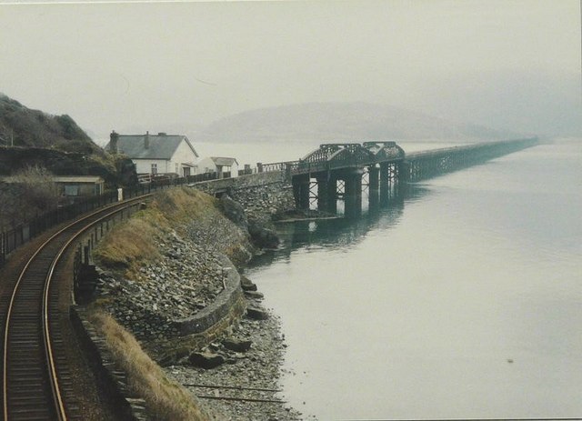
North Bank

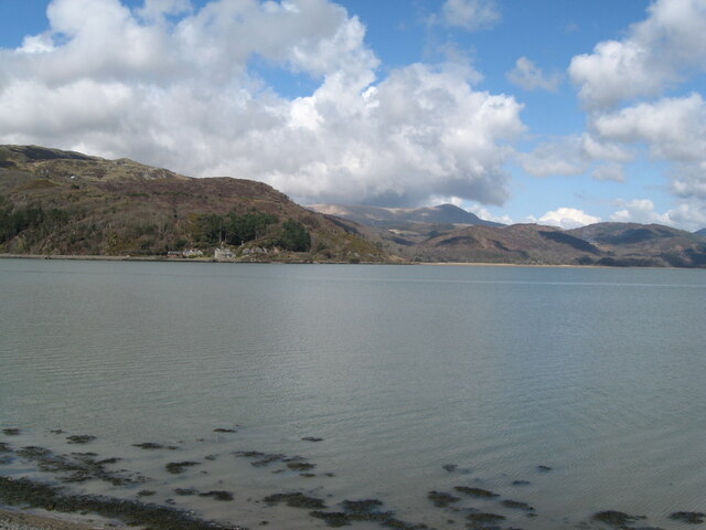
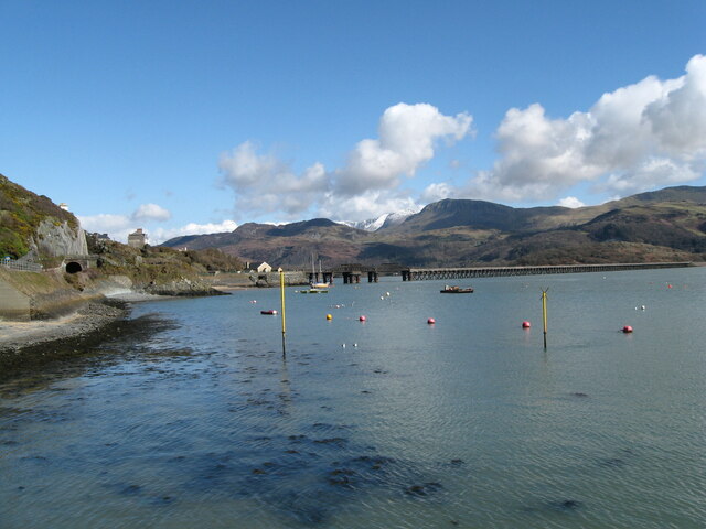
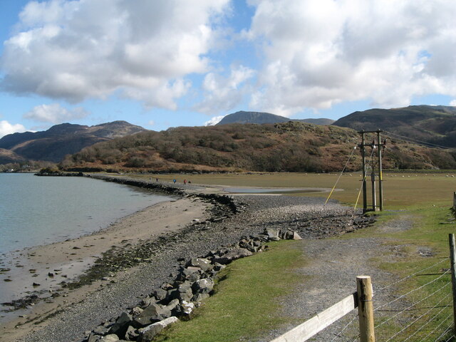
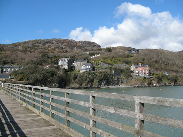
Coastal Marsh, Saltings in Merionethshire

Wales

North Bank

Coes Faen (Clock House) Hall – Barmouth, Gwynedd The earliest parts of this building date from the reign of Henry II (the Second) King of England 1154 – 1189. This Grade II listed building was built on the site of the earlier building in 1844 by the Lowe family, mill owners, with additions from 1890 – 1900. It was once used as a prison and courthouse, with two cells and a passageway at water level. It was then, at the time  of writing, an hotel and spa.  Source: Coflein. Time photo taken 2.20 pm BST (British Summer Time).

<a href="https://www.geograph.org.uk/photo/4890795">SH6215 : Eastwards view - Barmouth Bridge, Gwynedd</a>
Coes Faen (Clock House) Hall – Barmouth, Gwynedd Credit: Martin Richard Phelan

The requested URL returned error: 429 Too Many Requests

If you have any feedback on the listing, please let us know in the comments section below.

North Bank Images

Images are sourced within 2km of 52.714082/-4.0625328 or Grid Reference SH6014. Thanks to Geograph Open Source API. All images are credited.

Coes Faen (Clock House) Hall – Barmouth, Gwynedd The earliest parts of this building date from the reign of Henry II (the Second) King of England 1154 – 1189. This Grade II listed building was built on the site of the earlier building in 1844 by the Lowe family, mill owners, with additions from 1890 – 1900. It was once used as a prison and courthouse, with two cells and a passageway at water level. It was then, at the time  of writing, an hotel and spa.  Source: Coflein. Time photo taken 2.20 pm BST (British Summer Time).

<a href="https://www.geograph.org.uk/photo/4890795">SH6215 : Eastwards view - Barmouth Bridge, Gwynedd</a>
Coes Faen (Clock House) Hall – Barmouth, Gwynedd
The earliest parts of this building date from the reign of Henry II (the Second) King of England 1154 – 1189. This Grade II listed building was built on the site of the earlier building in 1844 by the Lowe family, mill owners, with additions from 1890 – 1900. It was once used as a prison and courthouse, with two cells and a passageway at water level. It was then, at the time of writing, an hotel and spa. Source: Coflein. Time photo taken 2.20 pm BST (British Summer Time). SH6215 : Eastwards view - Barmouth Bridge, Gwynedd
Estuary view 2 – Barmouth, Gwynedd Another view of Barmouth Bridge, from a different angle, this was taken from the Promenade on this sunny, warm Thursday afternoon, the last day in March 2016. On the left can be seen the railway and the entrance to the short length of tunnel which leads on over the bridge. Time taken 3.20 pm BST (British Summer Time).
Estuary view 2 – Barmouth, Gwynedd
Another view of Barmouth Bridge, from a different angle, this was taken from the Promenade on this sunny, warm Thursday afternoon, the last day in March 2016. On the left can be seen the railway and the entrance to the short length of tunnel which leads on over the bridge. Time taken 3.20 pm BST (British Summer Time).
South side stroll again – Barmouth, Gwynedd A view of the south side of the Mawddach estuary, with those walkers fading into the distance, to the south of Barmouth. Beyond is the prominence of Fegla Fawr and in the background the western end of the Cader Idris range. The structure in the foreground is the electricity supply to the town, which goes underground at this point. Barmouth is a good base for coastal walking or looking eastwards for the many attractions of the Snowdonia National Park.  Time photo taken 2.19 pm BST (British Summer Time).

<a href="https://www.geograph.org.uk/photo/5342220">SH6214 : South side stroll - Barmouth, Gwynedd</a>
South side stroll again – Barmouth, Gwynedd
A view of the south side of the Mawddach estuary, with those walkers fading into the distance, to the south of Barmouth. Beyond is the prominence of Fegla Fawr and in the background the western end of the Cader Idris range. The structure in the foreground is the electricity supply to the town, which goes underground at this point. Barmouth is a good base for coastal walking or looking eastwards for the many attractions of the Snowdonia National Park. Time photo taken 2.19 pm BST (British Summer Time). SH6214 : South side stroll - Barmouth, Gwynedd
Porth Aberamffra – Barmouth, Gwynedd The three storey house on the right of this view is on the site of the earliest settlement in Barmouth. It was active as a port in 1565, dealing in various goods and shipbuilding was also carried on here. The Barmouth Harbour Trust was set up in 1797 and activity carried on here into the 19th century. Time photo taken 2.42 pm BST (British Summer Time).
Porth Aberamffra – Barmouth, Gwynedd
The three storey house on the right of this view is on the site of the earliest settlement in Barmouth. It was active as a port in 1565, dealing in various goods and shipbuilding was also carried on here. The Barmouth Harbour Trust was set up in 1797 and activity carried on here into the 19th century. Time photo taken 2.42 pm BST (British Summer Time).
Barmouth Bridge in 1987 I walked across the bridge (which is half a mile in length) from the other side and back.
Barmouth Bridge in 1987
I walked across the bridge (which is half a mile in length) from the other side and back.
Barmouth Bridge Looking along the railway-cum-pedestrian-cum-bicycle-cum-motorcycle bridge towards Braich Ddu, the mountain in the hazy distance.
Barmouth Bridge
Looking along the railway-cum-pedestrian-cum-bicycle-cum-motorcycle bridge towards Braich Ddu, the mountain in the hazy distance.
Barmouth Bridge and Braich Ddu The near part of the bridge is designed to swing to let taller vessels through, but, according to the toll-keepers, this has not happened for decades. Braich Ddu is the mountain in the right distance.
Barmouth Bridge and Braich Ddu
The near part of the bridge is designed to swing to let taller vessels through, but, according to the toll-keepers, this has not happened for decades. Braich Ddu is the mountain in the right distance.
Barmouth Bridge at sunset Taken from the eastern end of Mawddach Crescent, near Arthog.
Barmouth Bridge at sunset
Taken from the eastern end of Mawddach Crescent, near Arthog.
Barmouth Beach With a stiff breeze blowing more sandblasting than sunbathing today
Barmouth Beach
With a stiff breeze blowing more sandblasting than sunbathing today
In Barmouth Barmouth is squeezed between the sea and the mountains. An alleyway near the market is backed by cliffs.
In Barmouth
Barmouth is squeezed between the sea and the mountains. An alleyway near the market is backed by cliffs.
Harbour at Barmouth On a cold and misty May morning
Harbour at Barmouth
On a cold and misty May morning
Barmouth Bridge/Pont Abermaw This wonderful wooden structure was opened in 1867. 
If you want to walk across the bridge, the toll is currently 90p.
Barmouth Bridge/Pont Abermaw
This wonderful wooden structure was opened in 1867. If you want to walk across the bridge, the toll is currently 90p.
Train on Barmouth Bridge The train is heading towards Morfa Mawddach station, 
the bridge goes through 3 geograph squares.
Train on Barmouth Bridge
The train is heading towards Morfa Mawddach station, the bridge goes through 3 geograph squares.
Train on Barmouth Bridge The train is heading towards Morfa Mawddach station, 
the bridge goes through 3 geograph squares.
Train on Barmouth Bridge
The train is heading towards Morfa Mawddach station, the bridge goes through 3 geograph squares.
Barmouth Harbour
Barmouth Harbour
Barmouth Bridge
Barmouth Bridge
Barmouth Beach Blue sky and White sand.  Could almost be the Bahamas!  But no,  The temperature tells you it's Barmouth.
Barmouth Beach
Blue sky and White sand. Could almost be the Bahamas! But no, The temperature tells you it's Barmouth.
The Roundhouse,  Barmouth On 21st of October 1830 the civic dignitaries of Barmouth met to discuss the problem of controlling drunken brawls in the town. A town lock-up was decided upon, Completed in 1834 it continued in use until the police station opened in 1861.   They are in great need today.  Every town should have one,  or several !
  The strange structure on the grass is a surprisingly comfortable seat.  It bears the inscription "Glyndwr 1840".  I can only assume this to be the name of an old timber framed ship from which it came.  There is a similar one nearby bearing the name "Lady Vaughan 1826"  See <a href="https://www.geograph.org.uk/photo/2438349">SH6115 : Lady Vaughan 1826.</a>
The Roundhouse, Barmouth
On 21st of October 1830 the civic dignitaries of Barmouth met to discuss the problem of controlling drunken brawls in the town. A town lock-up was decided upon, Completed in 1834 it continued in use until the police station opened in 1861. They are in great need today. Every town should have one, or several ! The strange structure on the grass is a surprisingly comfortable seat. It bears the inscription "Glyndwr 1840". I can only assume this to be the name of an old timber framed ship from which it came. There is a similar one nearby bearing the name "Lady Vaughan 1826" See SH6115 : Lady Vaughan 1826.
Show me another place!

North Bank is located at Grid Ref: SH6014 (Lat: 52.714082, Lng: -4.0625328)

Unitary Authority: Gwynedd

Police Authority: North Wales

What 3 Words

///tailwind.minder.revived. Near Barmouth, Gwynedd

Related Wikis

Fairbourne Spit

Fairbourne Spit (also known as Penrhyn Point) is a long spit of sand and shingle at the mouth of the River Mawddach where it reaches Cardigan Bay, on the...

Barmouth Lifeboat Station

Barmouth Lifeboat Station, based in Barmouth, Gwynedd, Wales, was established in the 1820s and the first lifeboat station was constructed in 1828 at a...

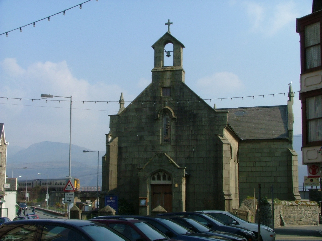
St David's Church, Barmouth

St David's Church is a Church in Wales church by the harbour of Barmouth, Gwynedd, west Wales. It is part of the Bro Ardudwy Ministry Area. == History... ==

Barmouth

Barmouth (Welsh: Abermaw (formal); Y Bermo (colloquial)) is a seaside town and community in the county of Gwynedd, north-west Wales; it lies on the estuary...

Nearby Amenities

Located within 500m of 52.714082,-4.0625328
Seamark Light Character: Q
Seamark Light Colour: red
Seamark Light Height: 4
Seamark Light Range: 5
Seamark Light Reference: A 5246
Seamark Type: light_minor
Source: US NGA Pub. 114. 2011-05-26.
Lat/Long: 52.7138333/-4.0622667
The data included in this document is from www.openstreetmap.org. The data is made available under ODbL.

Have you been to North Bank?

Leave your review of North Bank below (or comments, questions and feedback).