South Bank
Coastal Marsh, Saltings in Merionethshire
Wales
South Bank
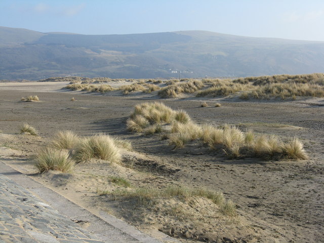
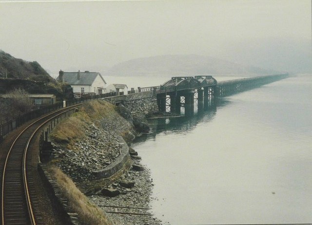
South Bank, located in Merionethshire, is a stunning coastal marsh area known for its unique and diverse ecosystem. Situated along the coast, it is characterized by its vast expanse of salt marshes and saltings, making it an important habitat for a variety of flora and fauna.
The marshes of South Bank are formed by the interaction of tidal action and freshwater from nearby rivers. This creates a brackish environment that is rich in nutrients and allows for the growth of salt-tolerant plants such as samphire, sea lavender, and cordgrass. These plants provide food and shelter to a wide array of bird species, including wading birds, waterfowl, and migratory birds.
The saltings, which are areas of salt marsh that are occasionally flooded by the tides, are home to a diverse range of marine life. The intertidal zone is teeming with small crustaceans, mollusks, and fish, which serve as a vital food source for numerous bird species and other predators.
South Bank is recognized as an important site for nature conservation, and it is protected under various national and international designations. It provides a vital stopover for migratory birds during their long journeys and supports a number of rare and endangered species.
In addition to its ecological significance, South Bank also offers fantastic opportunities for outdoor activities and wildlife observation. Visitors can enjoy walking trails that meander through the marshes, providing panoramic views of the coast and the chance to spot a variety of wildlife.
Overall, South Bank in Merionethshire is a remarkable coastal marsh area that showcases the beauty and importance of preserving our natural habitats.
If you have any feedback on the listing, please let us know in the comments section below.
South Bank Images
Images are sourced within 2km of 52.706447/-4.0641709 or Grid Reference SH6014. Thanks to Geograph Open Source API. All images are credited.
![Be warned - Twmpathau Warning of humps on the promenade at Barmouth, and the Arbour Hotel [the same name in two places, so assumed not to have lost an 'H'].](https://s2.geograph.org.uk/geophotos/02/30/16/2301682_6bcfc648.jpg)
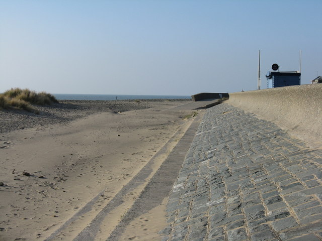
![The Promenade at Barmouth Looking south-east, towards the harbour, with the cliffs of [possibly] Craig-y-llyn on the western flanks of Cadair Idris in the distance.](https://s0.geograph.org.uk/geophotos/02/30/17/2301700_fb26c173.jpg)


South Bank is located at Grid Ref: SH6014 (Lat: 52.706447, Lng: -4.0641709)
Unitary Authority: Gwynedd
Police Authority: North Wales
What 3 Words
///habits.amaze.prompting. Near Barmouth, Gwynedd
Nearby Locations
Related Wikis

Fairbourne Spit
Fairbourne Spit (also known as Penrhyn Point) is a long spit of sand and shingle at the mouth of the River Mawddach where it reaches Cardigan Bay, on the...

Fairbourne
Fairbourne is a seaside village in Gwynedd, Wales. Located on the coast of Barmouth Bay in Arthog community, to the south of the estuary of the River Mawddach...

Barmouth Bay
Barmouth Bay (Welsh: Bae Bermo) is a bay in Gwynedd on the west coast of Wales, forming a part of the much larger Cardigan Bay. The coast fronting onto...
Fairbourne Railway
The Fairbourne Railway (Welsh: Rheilffordd y Friog) is a 12+1⁄4 in (311 mm) gauge miniature railway running for 2 miles (3.2 km) from the village of Fairbourne...

Fairbourne railway station
Fairbourne railway station serves the village of Fairbourne in Gwynedd, Wales. It is an unstaffed station on the Cambrian Coast Railway with passenger...

Barmouth Lifeboat Station
Barmouth Lifeboat Station, based in Barmouth, Gwynedd, Wales, was established in the 1820s and the first lifeboat station was constructed in 1828 at a...
St David's Church, Barmouth
St David's Church is a Church in Wales church by the harbour of Barmouth, Gwynedd, west Wales. It is part of the Bro Ardudwy Ministry Area. == History... ==

Barmouth
Barmouth (Welsh: Abermaw (formal); Y Bermo (colloquial)) is a seaside town and community in the county of Gwynedd, north-west Wales; it lies on the estuary...
Nearby Amenities
Located within 500m of 52.706447,-4.0641709Have you been to South Bank?
Leave your review of South Bank below (or comments, questions and feedback).